#maps of the ancient world
Explore tagged Tumblr posts
Text
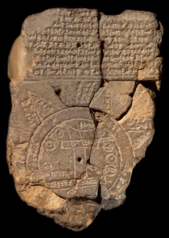
Babylonian Map of the World (6th century BC), also known as Imago Mundi, is oldest clay tablet map written in Akkadian.
The tablet describes the oldest known depiction of the known world.
It was discovered at Sippar, southern Iraq, 60 miles north of Babylon on east bank of Euphrates River.
This map not only serves as a historical record of the region's geography but also includes mythological elements, providing a comprehensive view of the ancient Babylonian worldview.
Today, the Babylonian Map of the World is housed in the British Museum, where it continues to be a valuable artifact for understanding the ancient past.
Details of the map:
1. “Mountain” (Akkadian:šá-du-ú)
2. “City” (Akkadian: uru)
3. Urartu (Armenia) (Akkadian: ú-ra-áš-tu)
4. Assyria (Akkadian: kuraš+šurki)
5. Der (Akkadian: dēr)
6. Swamp (Akkadian: ap–pa–ru)
7. Elam (Akkadian: šuša)
8. Canal (Akkadian: bit-qu)
9. Bit Yakin (Akkadian:bῑt-ia-᾿-ki-nu)
10. “City” (Akkadian: uru)
11. Habban (Akkadian: ha-ab-ban)
12. Babylon (Akkadian: tin.tirki), divided by Euphrates
13. Ocean (salt water, Akkadian:idmar-ra-tum)
#Babylonian Map of the World#Imago Mundi#clay tablet map#clay tablet#Akkadian#Sippar#Iraq#British Museum#history#mythology#map#Archaeo Histories#Ancient Babylon#Babylonia#geography#artifact
563 notes
·
View notes
Text
Some things I’d loved to have seen more often in the marauders fandom characterizations:
Ravenclaw barty ( ALL owls, enough said)
Pandora NOT being crazy/ a sear (Luna 100% got that from xeno)
Regulus not necessarily agreeing with pureblood rhetoric but seeing that his family is safer with it and also more of his relationship w Voldemort ( he didn’t become the youngest deatheater on a whim )
Sirius being a black, he was a total troubled teen and honestly probably still didn’t feel much empathy for muggleborns. Also running away didn’t erase his entire life up until that point
James being a total dick. (Hate him)
Lily getting the love she deserves instead of her entire character being watered down to nothing without her husband (I’m looking at u jegulus vs jily bitches) Lily can be her own person even if James isn’t dating her!!!
Bellatrix black. Right hand WOMAN of lord Voldemort??? Pls I need her so bad
Snape being so similar to Tom riddle and Voldemort using that to his favor ( yet making a critical error in killing Lily)
Voldemort using his charm to seduce and win favor and then as his descent into madness thickens, he relies on his magic and their fear more and more for followers
I could go ON and ON about this but I don’t want this too long 🖤 pls discuss in the comments/or replies this is my favorite topic. (This is a safe space to talk abt ur niche headcanons for characterization within the fandom)
#the marauders era#the maraunders map#the noble and most ancient house of black#the marauders#harry potter#harry potter world building#regulus black#severus snape#bellatrix black#bellatrix lestrange#sirius black#pandora lovegood#lord voldemort#barty crouch jr#barty crouch junior#jily vs jegulus people#I dislike yall#heavily#lily evans#lily potter#james potter#harry james potter#death eaters#death eater regulus#tom riddle#tom marvolo riddle
32 notes
·
View notes
Text
Wild that for every other society and country in the game their atrocities and "bad sides" are ignored or the society at large is given a pass because "they're not all that way", but one man on screen refused to ask for help in the ancient world and now the whole society is deserving of genocide per some people in the fandom.
Would you guys have been chill with all of Gridania or Ul'dah being destroyed the way Amaurot was?
#ffxiv#amaurot#hey did you know there's actually no evidence that therapy didn't exist in the ancient world?#and that there is evidence that hermes simply never asked for help#and that it's not hyth and hades (two strangers) jobs to know him well enough to know he needs therapy#they were there for a *job interview* not preventing the end of the world as far as they knew#yes it is bad how they viewed their creations but is it worse than how gridania treats duskwights?#how uldah treats refugees?#hell eulmore turned people into sin eaters and *ate them* and we didn't wipe them off the map#amaurot did not deserve complete distruction period#it's a bad take
22 notes
·
View notes
Text

#ancient egypt#ancient#giza#egyptian#egyptology#pyramids#egypt tours#egypt#ancient history#history tag#archaeology#anthropology#world history#culture#history#cartography#map#library
197 notes
·
View notes
Text
one of the things mourn watch rook has the most comments about/seems pretty knowledgeable about when they're there is the way the necropolis will just shuffle rooms around every now and then on a whim, so I'm headcanoning that rye's previous area of expertise, outside of general watcher duties, was keeping track of and rediscovering these lost or displaced areas. that, and basically acting as a sort of tour guide when need be, such as on the day they met varric.
'have we really misplaced the ashen cathedral again? *sigh* that's the third time this year, we really must strengthen the wards. oh well. someone send for ingellvar, they'll track it down in no time I'm sure. and it might keep them out of trouble for a while'
#rye's mourn watch dwarf father figure was responsible for maintaining and securing the buildings and structures of the necropolis#not quite in the top leadership of the construction side of the watchers but pretty high up there#so it makes a lot of sense to me that way too they've been to more sections of the necropolis than even most watchers go#and know the buildings and structures very well#rye would just like. set out alone for a week track down a missing mausoleum and nod in satisfaction as he updated the maps haha#this instinct for isolation and disappearing into the immense ancient silence shared only by the dead and the weight of his own grief#had no long term effects on his psychological development. of course. literally don't even worry about it he's fine :)#'I go on short hectic jaunts into the world of the living. and then I come back here and it's quiet once it becomes too much to bear#I think that's what they call work life balance or something' (it's not)#dragon age#dragon age: the veilguard#dragon age: the veilguard spoilers#dragon age spoilers#oc: Ellaryen Ingellvar
23 notes
·
View notes
Text

#martapetrova#desordre#surreal#surrealism#art#drawing#illustration#weird#fantasy#mystical#odd#gif#psychadelic#dark#digital#trippy#eerie#obscure#alternative#painting#bizarre#world#ancient ruins#ruins#map#compass
10 notes
·
View notes
Text
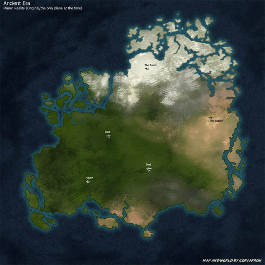
Alright guys it's now time for a very exciting worldbuilding post: SETTING MAPS!! There are several in this post so I hope you enjoy the ride and please feel free to ask me if anything catches your interest.
I will start this off by saying these are very basic, and I only marked off a couple points of interest, but I still think there is some fun stuff to talk about here. Due to the massive amount of info I am also just going to have to skip some background info. Additionally: this continent is the main setting, but there ARE at least two more. It's also huge, like comparable to at least North America in size, so please imagine there are a ton of additional features (such as rivers, lakes, additional biomes, settlements, etc) here that I just didn't mark off.
Above is the very general Ancient Era map and we are just going to get really note heavy from here. Not everything is fully named and may or may not be adjusted later. One final note before I start is there is a conlang involved. I also haven't fully translated everything but I think in this case that works in our favor, which we'll get to in a sec.
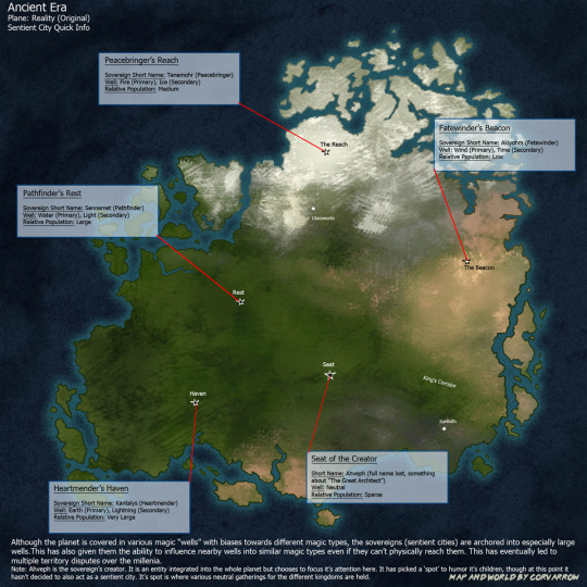
Here is the map of ancient world sentient cities and a couple pieces of information. The four* sentient cities are called Sovereigns, and they all have avatar bodies (their original sion bodies).
*Ahveph, their creator, has a "spot" but at this point it's not acting as a sentient city and it doesn't have an avatar
Their language does makes a distinction between them as a location and them as an entity when using the full name. When dealing with shorthand though the first section of the name gets used to refer to the entity and the second for the location. For example, with Fatewinder's Beacon, "Fatewinder" = entity and "The Beacon" = location. I do have the first sections translated into conlang so we'll also start using them in this post, so if you see the conlang name I'm now talking about entities and the English names are locations. By the way, Fatewinder is Akiyohm, or "(to) wind fate". His siblings are Kantalys (Kanta), Sennamet (Sen), and Tenemohr (Ten).
Worth noting here that the avatar bodies can travel, but they ARE "tethered" to their main city bodies. They can visit each other, but they can't go much farther than that, meaning they have been locked to this continent and the waters immediately around it.
What is also really important to know is that they do NOT look like normal cities. They are actually complex megastructures, though they contain all things you would expect in cities including transportation systems. These megastructures are also shaped differently from each other. The Beacon is in a desert and is mainly vertical - about 10% of it is above ground and the rest is under. The Reach is across a mountainside and is built at an angle with the most terracing of the lot. Rest is in some riverlands and is mainly horizontal. Haven is on some heavily forested karst landscape - it's also horizontal but it has less levels than Rest does because Kanta chose to stretch it out farther.
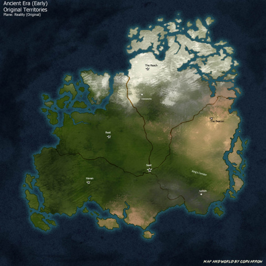
Next we have the original territory map. When they first started here, they got along fine, but eventually when they figured out they could influence other magic wells besides the ones they lived in, they had some issues with who got what well. Finally they decided to split this out into roughly equal pies and for a while they were fine with that.
Influencing the wells into certain magic types also causes the area around them to have a magic bias towards that type. For example most of Aki's wells are wind type, so his whole region tends to have wind magic and they can construct lots of windmills to take advantage of that. If they change territory lines then the wells in that area will change as well, though they won't change easily if the area is under war.
From here on out you can consider these pies to be Kingdoms, with the Sovereigns being their capitals, and the Sovereigns also being Actual sovereigns.
Ahveph's "spot" (Seat of the Creator) remains a neutral event ground for the entirety of ancient history.
Also on this map I can point out Sunbath, which is a major story location. It is a remote village that ended up on Aki's trading route. It is also where Jas happens to live.
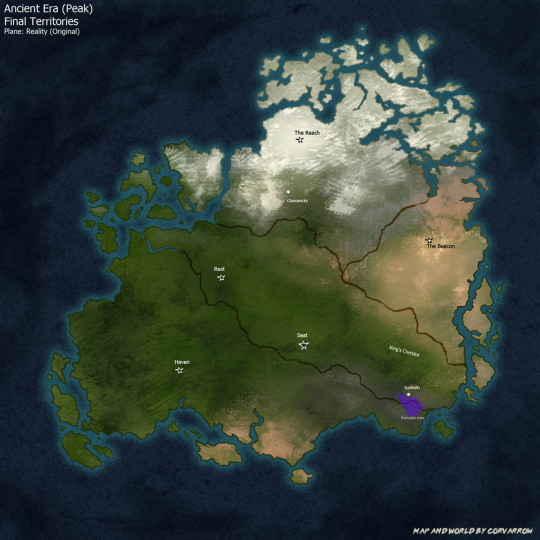
So yeah they still could not fully agree on territories which led to multiple disputes and actual wars over the millennia, until they finally ended up with this around the peak. Kanta has the largest pie by far, then Sen, Ten, and finally Aki.
At peak pre-cataclysm, this civilization had gotten quite advanced, as in "farther in the future than Earth" and "how are we feeling about the vast reaches of space everyone" kind of advanced. The major difference is that sions wield magic, so most of their advancements were heavily magic based rather than using physical science. Anl quick example of what I mean by that would be like, batteries - although they could make electrochemical batteries like we use on earth, they would more likely make them using lightning magic instead.
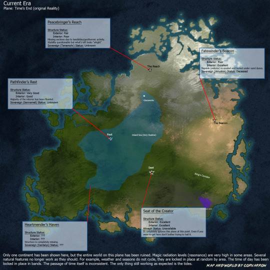
Well things couldn't stay good forever. Events led to the cataclysm and caused the plane split - literally there now three different planes are stacked on top of each other and they are not exactly the same.
First is the original Reality plane, now called Time's End. This plane has become, to put it politely, completely fucked. Although plants like it, and there are some leftover constructs like corvafex, there aren't any people or animals anymore. It is blown out with magic and very few natural processes work like they are supposed to. The time of day is locked in bands by region (see next map), time flows inconsistently, and the weather and seasons don't cycle, they are locked at random by region. This doesn't mean things are entirely in stasis though - the tides still move, which is quite clear in places such as the inland sea, and the shore near the Glassworks. At The Beacon, which had already been near a dune field, Aki's wind towers have gone without maintenance for so long that they stir up huge sandstorms every so often like clockwork.
Technically, it is still possible to reach this plane. It's most easily reached by (modern) sions because mirrors do exist here, but it is desolate. Non-sions can occasionally end up here too, but with the resonance levels and time fuckery it is not advised to stay too long.
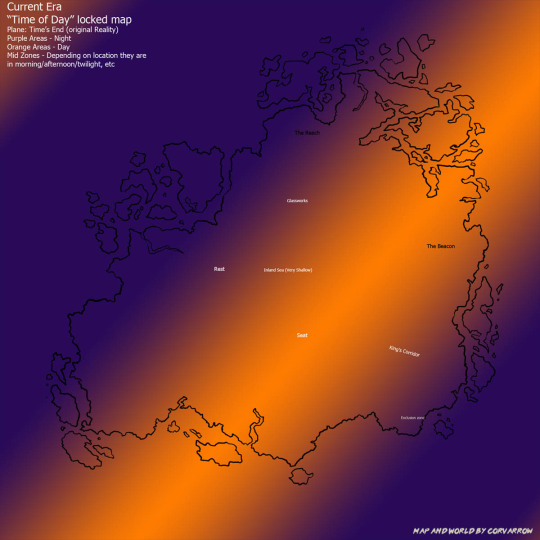
This map is just to show how the time of day is locked. So for example, the Seat of the Creator is in perpetual midday, the Beacon is stuck in the afternoon, Rest and the glassworks are still stuck in the morning, and the Reach is at night.
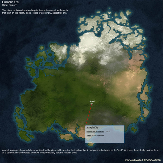
The second plane is the Memory plane. It is called this because there are copies of settlements (mostly from the new Reality) on this plane, but not actually anyone in them. The plane is actually empty, like nobody ever actually lived here, as opposed to Time's End where it is empty because everyone is dead. It still remains quite eerie to explore however. It's just tons and tons of ghost cities essentially. Most of these copies look fairly normal (if not just eerie), but not all of them as the Memory plane still contains some resonance. It's not nearly as bad as Time's End but there are some cases where you'll have like, an entire empty city permanently covered in glowing fog.
So as far as Ahveph goes - it is an entity integrated into the whole planet, and it COULD manipulate things where ever, it just chose to focus on the areas the ancient sions lived in. After the planes split it was almost completely immobilized except for this one location. It can still sorta see things but it cannot do shit unless it's here. What it has currently chosen to do is to act as a city and build modern sions to live in it. It's success at being a city like the Sovereigns is kind of debatable but to be fair it is really a different beast entirely anyway.
Named characters that actively live here are Cavi, Torch, Tower, and the Daydreamer. While it is mostly populated by sions it does sometimes allow non-sions as well, like Subore actually lives here. He is also is one of the only humans that has learned modern sionic.
This is also probably a good time to mention modern sions are fairly different from ancient sions. Ancients are all sapient automatons - they have A Process to build some more (there is in fact some "genealogy" and "genetics" involved but it gets...kind of wacky) but they are 100% new builds every time one gets made. On the other hand, Modern sions are not 100% new, they are kind of doppelgangers - specific humans/shifters from reality are identified, their essence copied, changed up a bit, and then the copies are stuffed into a new construct body and let loose in the city. A good example of this is Sy and Tower, Sy being the original guy (a "Source"), and Tower being the sion that was created.
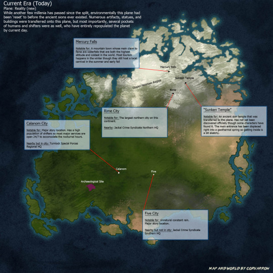
Aaand finally we have the current new Reality plane. It has been entirely repopulated by humans and shifters. The ancient sions have been largely forgotten except for whatever archaeologists dig up. Since they don't have any way to translate the relics being dug up they are just called "The Lost Race". Modern sions are basically a crypid at this point that everyone calls some variation of "mirror demon" and there is no connection that these two are actually related.
The overall technology level is similar to Earth. Maybe slightly ahead, but it is mostly based in the physical sciences with some augmentation with whatever magic relics they've figured out how to work.
Ahveph can technically manipulate things at Five since it's at the same location, but it generally does not. It has however, made a very convenient shortcut for explorers to travel back and forth between Reality and Memory.
Character locations on this plane:
Five - Sy's family had moved here from overseas when he was young. He grew up here but moved somewhere between Calanom and Five. His mom, dad, and older brother still live here though.
Calanom - Yeah so the kids (Cody, Mady, and Static/Shaun) all live here. Jack (Cavi's Source) was from here as well.
Mercury Falls - Subore and Riley (Torch's Source) are from here, though Subore didn't want to stay after Riley passed away.
#behold! my art#my art#worldbuilding#worldbuilding maps#worldbuilding map#mapmaking#world map#fantasy map#map#ancient sions#sentient cities#lost kingdoms#long post#Worldbuilding setting#Location: Time's End#Location: Memory Plane#There are so many moving parts to this you guys#lore dump#modern sions#Fun fact I also have an old SUPER ABSTRACT map of Ahveph itself along with lots of points of interest but I did not include it here#since it visually does not fit lol#The kingdoms all have different symbols that they use and things the sovereigns specialize in more than others#The Sovereigns starter roles and how they evolved over the years. As well as people's attitudes towards them.#Like there is just so much extra info that's better suited to a different post
17 notes
·
View notes
Text
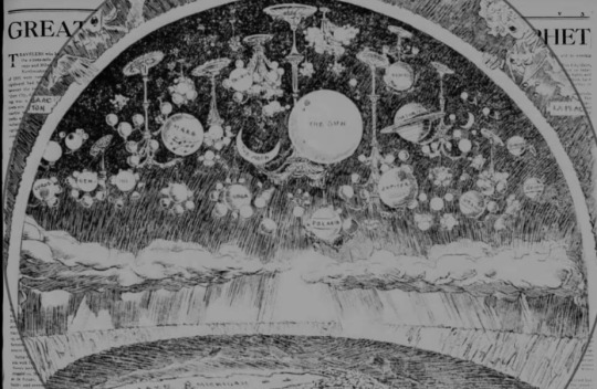
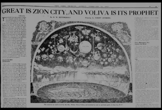
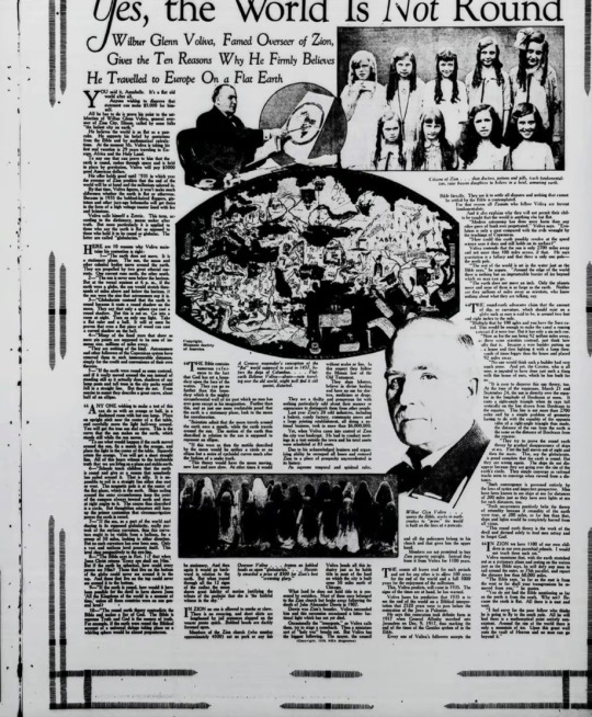
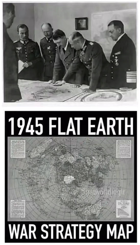
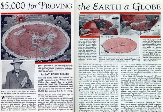
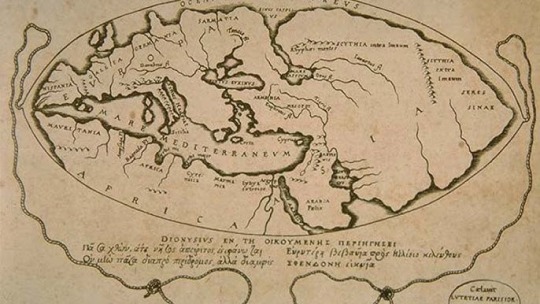
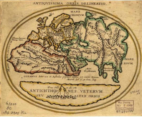
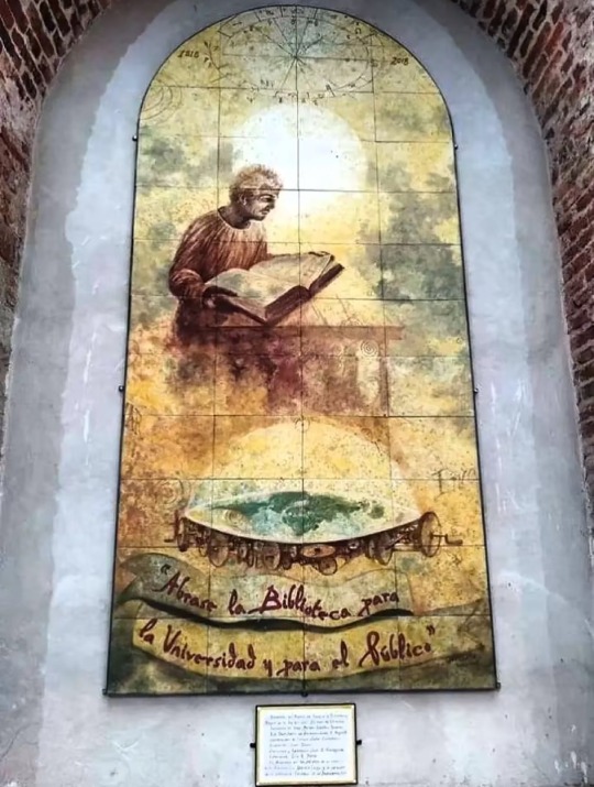
#flatearth#flat earth#flacherde#flache erde#flacheerde#esoterik#occultism#esoteric#earth#freimaurerei#drawing#chrich#kirche#okkult#Okkultismus#science#old technology#ancient#maps#map#karte#weltkarte#old world#firmament
8 notes
·
View notes
Note
I absolutely love your streetlamp city stuff and how you can just look at all your toontown characters and make a whole new world for them. It's like that one post with how au art of mlp characters eventually evolved into their own characters with separate lore and names. It's so cool
THANK YOU!! I realised that aphter a while I was having more phun doing my own thing with my own rules and world building - so I yoinked those phellas away and put them in my new place!
(Course, I still LOOOOVE toontown- but nothing theres nothing I love better than going wild with ideas and whatnot X3)
#honestly this seems to be a trend phor me#i made a WHOLE map phor an ancient chinese village/town and at least 20 characters about a demon lord phrom a long line oph demon lords and#the cycle oph death and rebirth and a nearby human mountain village phull oph cultivators who live shrouded in mist and have harnessed that#ability but in the modern times has tightened up and are more exclusive a clan#and that all started bc oph lmk#i love oc worlds i could write a billion#asks#gadget chats
22 notes
·
View notes
Note
If five pebbles was ever built for zephyr the same way he was built for moon, would he ever see her as a mentor?
i imagine that he'd!!! be more open with her than he is with Moon, because their personalities match better. Zephyr isn't really the doting, overprotective kind. She didn't have the chance to learn how to be affectionate and warm even though she wishes she could be and she needs to watch her own systems like a hawk 24/7 so she ain't got the attention to spare to nag at him even if she wanted to. they'd end up bonding over their anger at the injustice of the Iterators' fate, though
Pebs would probably take someone else as Mentor™ (she wouldn't be capable of fullfilling the expectations of that role), but he'd probably still look up to her a lot. she'd be like. a not-the-title mentor in the specific field of being angry at their situation and doing Something about it

#Spot says stuff#rain world#rw#oc tag#oc: abet zephyr#this scenario is such a headscratcher cuz like- zephyr is kept a secret from the public out of shame of the higher ups of her condition#not as a Person mind you but as a waste of resources. girl cant even Iterate because shes so broken. she cant do the One thing shes made-#-to do. oh what a shame. what a stain on our maps. the ancients never put Any effort into fixing her so making an entire Iterator right-#-next to her whos secondary goal is to Help her? unimaginable in canon. shed hate it because she thinks of herself as a lost cause#and now this poor kid has to deal with being Made for this lost cause. no matter what he does he will never be able to help her enough#it will be forever an itch and a heartbreak that cannot be mended#born directly into constant trauma just like her. instead of fixing Her they brought another life into this. she hates it so so much.#but pebbles himself shed fucking Love. hes her little perfectly self-sufficient boy and shed fucking throw hands with Suns for him#srry for the rambling these two combo'd together live rent free in me brain
116 notes
·
View notes
Text
Well, I mean the title for this article is hugely misleading, but the article itself is really interesting.
8 notes
·
View notes
Text
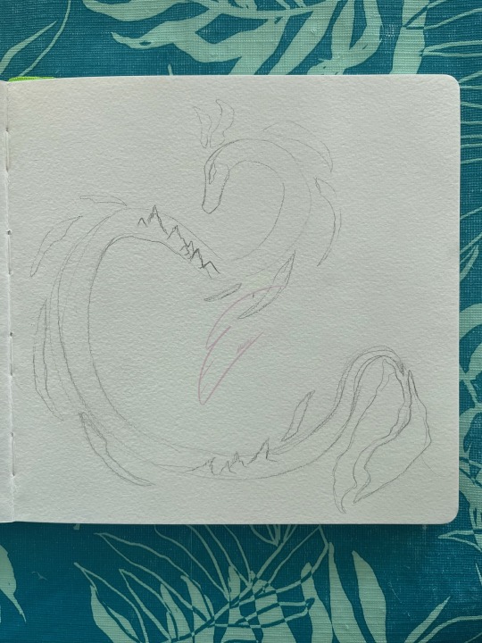
Happy WIP Wednesday! I'm considering a take on the world serpent being the actual landmass on a map. Posting my sketch this time to showcase more of my process.
#my art#cartography#my artwork#bluebird art#map#my maps#maps#map making#sketch#drawing#wip#art wip#current wip#wip wednesday#work in progress#wip art#serpent#Snake#lizard#snek#reptile#mythology#mythology and folklore#norse mythology#ancient greece#mythology art#myth#world serpent#Noai#no ai art
4 notes
·
View notes
Note
What was Medoh's life like growing up? Were things significantly different 10,000 years ago?
I have been trying to think about how to answer this one since I got it. Medoh had a very typical upbringing in the village. period typical sexism causing her to narrow down into the route of medicine woman at a relatively young age. (she’s not one to just lie down and take it, but the environment in which she was raised didn’t exactly give any other options. she lived out the projected path, if a bit adjacent.) typical parents who loved her a typical amount and were good enough at what they did that she ended up okay. she wasn’t very scrappy growing up. not one to pick fights or really make herself anyone’s problem, but not one to really enjoy the company of others. would rather be isolated and alone. Her parents died when she was a teen and she really dove further into medicine as a way to cope. becoming one of the best healers in the village. her skills were renowned and she had surprisingly good bedside manner too. She was just, very simply, a girl.
Times were very different back then. the village spilled out into the surrounding area around Lake Totori and had a booming fur, wool, & cloth trade. This is an approximation of what the area looked like at the time-

the green is representative of rito-centric settlements vs the blue being hylian-centric. (not pictured are the smaller tribes further northeast in deep Hebra or the south in the Tabathan cliffs). most of the hylian settlements focused on farming and raising alpaca/goats where as the rito acted as protectors of the area and weaving the fibre into blankets or fabrics to be sold. it’s a mutual beneficial relationship for both parties. societally things were community driven but with the air of sexism surrounding what roles people could/should participate in. whether that was the influence of the hylian settlers or simply how things came to be isn’t exactly clear. but overall the villages ran smoothly and peacefully.
#i have more thoughts but im distracted#I hope this is a satisfying answer and or it at least intruiges interest#ancient aiouu#ancient medoh#asks#vanali-of-winterfell#i LOVE talking about my world-building lore too#i spent like 40 minutes making this map because i didn’t have my old one on hand#ancient au lore
3 notes
·
View notes
Text
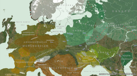
Mesolithic Map 8000 BC: although culturally and technologically continuous with Palaeolithic cultures, Mesolithic cultures quickly developed diverse local adaptations for special environments, and multiple cultures as this map reveals.
#history#historyfiles#ancient world#europe#ancient europe#map#mesolithic#mesolithic europe#palaeolithic'archaeology
4 notes
·
View notes
Text
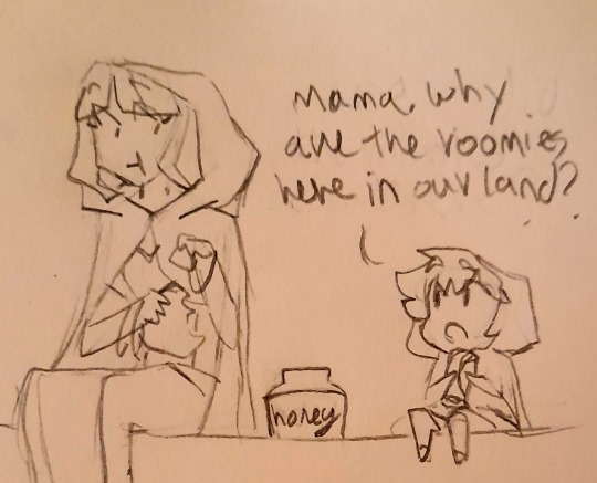
Sorry if this feels like pro Egypt propaganda she's just stuck in the past
Prev | Next
#don't factcheck my map i just drew general shapes based on memory#on the center of the world thing Egypt isn't really the centre of the world#it's just kinda the center of Africa Asia and Europe which to the ppl in the ancient times of pre americas is basically the whole world#also I'm not an expert on historical honey jars so they get a generic winny the boo honey jar#still not sure what to call this silly little fanfiction#hetalia#aph#hws#aph egypt#hws egypt#aph ancient egypt#hws ancient egypt#egytalia#blue's doodles
22 notes
·
View notes
Text
14 notes
·
View notes