#worldbuilding map
Explore tagged Tumblr posts
Text
Apocamerica Map
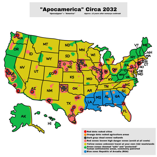
Apocamerica Masterlist
Understanding this map: Please note that I’m not a professional map maker and know absolutely nothing about cartography. This is simply a quick visual reference guide for navigating post-apocalypse America.
That being said, this map is subject to change and not wholly accurate or representative of safe/unsafe zones, as they constantly change, and there is yet to be an official database within this alternative universe. Think of this as an approximation. Also, keep in mind that this is 12 years after the initial outbreak, and things did not always look like this, nor will they continue to remain the same. Take this all with a grain of salt.
Zone breakdowns
Red, orange, & gray zones: AVOID AT ALL COSTS! Death is almost guaranteed from radiation and mutant anthrophages alike.
Blue Zone: Republic of Arcadia
Yellow zones: The yellow zones on the map are areas where human settlements still exist, and some communities are even thriving. However, these areas lack military protection and government aid, so they are considered unsafe (however subjective the word “safe” is within the context of this map). Yellow zones are also susceptible to radioactive wastelands but are often unexplored, classifying them as "unknown." Travelers in these areas risk encountering various dangers outside of anthrophages, including mutant animals, extremist groups, wasteland gangs, marauders, raiders, and other unsavory characters. Despite their predicted presence, these groups are not marked on this map as they tend to move around and are hard to keep tally of.
Green zones (power & economy): Areas designated as green zones are not entirely safe from security breaches, nemaxys outbreaks, and gang wars over territory and supply runs. These zones consist mainly of civilians striving to survive and establish a livelihood. As a result of the volatile post-outbreak landscape, the green zones are divided into constantly changing sectors. The few remaining "safe" human settlements are widely dispersed, leading the remaining Governors and congressmen to propose the formation of nation-states to exert better control over their respective areas.
However, the current de facto President, the former Speaker of the House, is determined to maintain control over sector territories and military command. They face the challenge of navigating a fragmented nation while contending with threats from the ROA and other factions attempting to seize power, testing their leadership in their efforts to restore order and unity to the ravaged remains of the US.
Despite the President’s efforts, the power vacuum in the sectors continues to expand as power-hungry politicians spare no effort to secure civilian allegiance. Some congressmen and governors have carved out their own fiefdoms within green and yellow zones, effectively becoming warlords of their respective regions.
Following the outbreak, the Hawaiian islands and Alaska are presumed to be the safest and untouched land masses. Hawaii closed its borders and halted all imports/ exports as soon as the first case of the nemaxys contagion hit the news. Meanwhile, a mass exodus of people left the continental US and headed up to Alaska, and the new capitol was relocated to a small Alaskan fishing town.
After the establishment of the Provisional Emergency Relief Agency (PERA), a federal-level build-back program was implemented in all green zones. The Bureau of Labor & Exports (BOLE) oversaw the program and regulated Chattel Services Inc. (CSI) and the remaining corporate-owned labor forces, which had a significant impact on the reconstruction efforts.
Under stringent government sanctions, an underground illicit black market has flourished, giving rise to new crime families that have ascended to power. These new syndicates replaced the previously dominant players, seizing control of the markets and territories once held by their fallen rivals.
Economic collapse rendered money worthless for a period, but eventually, the monetary system was reinstated, allowing for the revival of commerce through traditional means and ration tickets.
While crime and punishment were primarily addressed at the local level, the aftermath of the chaos led most people to abandon violence once their basic needs were met. Gainful employment provided them with a sense of purpose and belonging in society.
What about travel?
Transportation outside green zones mainly involves using trains, planes, or boats, as navigating on the ground with vehicles through a post-apocalyptic wasteland is considered too risky. However, some people still opt for ground transportation despite being viewed as dangerous and ill-advised compared to other means of travel.
#Apocamerica#Apocamerica AU#Nemaxys outbreak#whump worldbuilding#post apocalypse#post apocalyptic#apocalypse#zombie apocolypse au#zombie apocalypse#apocalypse au#whump au#worldbuilding#worldbuilding map#map making#original au
20 notes
·
View notes
Text
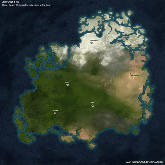
Alright guys it's now time for a very exciting worldbuilding post: SETTING MAPS!! There are several in this post so I hope you enjoy the ride and please feel free to ask me if anything catches your interest.
I will start this off by saying these are very basic, and I only marked off a couple points of interest, but I still think there is some fun stuff to talk about here. Due to the massive amount of info I am also just going to have to skip some background info. Additionally: this continent is the main setting, but there ARE at least two more. It's also huge, like comparable to at least North America in size, so please imagine there are a ton of additional features (such as rivers, lakes, additional biomes, settlements, etc) here that I just didn't mark off.
Above is the very general Ancient Era map and we are just going to get really note heavy from here. Not everything is fully named and may or may not be adjusted later. One final note before I start is there is a conlang involved. I also haven't fully translated everything but I think in this case that works in our favor, which we'll get to in a sec.
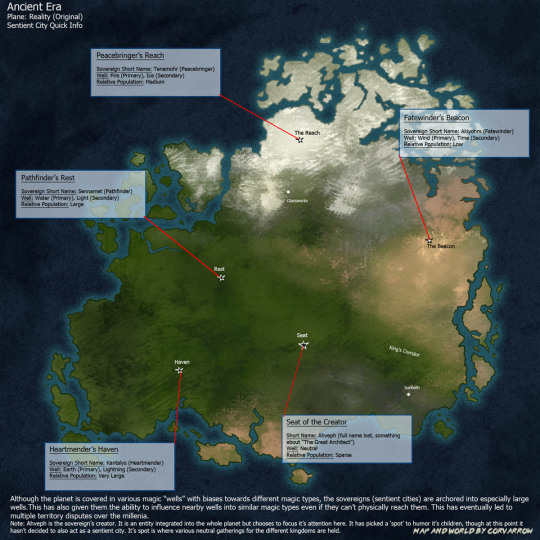
Here is the map of ancient world sentient cities and a couple pieces of information. The four* sentient cities are called Sovereigns, and they all have avatar bodies (their original sion bodies).
*Ahveph, their creator, has a "spot" but at this point it's not acting as a sentient city and it doesn't have an avatar
Their language does makes a distinction between them as a location and them as an entity when using the full name. When dealing with shorthand though the first section of the name gets used to refer to the entity and the second for the location. For example, with Fatewinder's Beacon, "Fatewinder" = entity and "The Beacon" = location. I do have the first sections translated into conlang so we'll also start using them in this post, so if you see the conlang name I'm now talking about entities and the English names are locations. By the way, Fatewinder is Akiyohm, or "(to) wind fate". His siblings are Kantalys (Kanta), Sennamet (Sen), and Tenemohr (Ten).
Worth noting here that the avatar bodies can travel, but they ARE "tethered" to their main city bodies. They can visit each other, but they can't go much farther than that, meaning they have been locked to this continent and the waters immediately around it.
What is also really important to know is that they do NOT look like normal cities. They are actually complex megastructures, though they contain all things you would expect in cities including transportation systems. These megastructures are also shaped differently from each other. The Beacon is in a desert and is mainly vertical - about 10% of it is above ground and the rest is under. The Reach is across a mountainside and is built at an angle with the most terracing of the lot. Rest is in some riverlands and is mainly horizontal. Haven is on some heavily forested karst landscape - it's also horizontal but it has less levels than Rest does because Kanta chose to stretch it out farther.
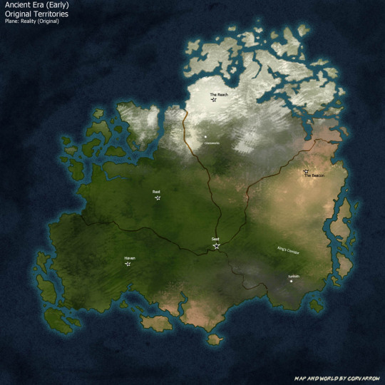
Next we have the original territory map. When they first started here, they got along fine, but eventually when they figured out they could influence other magic wells besides the ones they lived in, they had some issues with who got what well. Finally they decided to split this out into roughly equal pies and for a while they were fine with that.
Influencing the wells into certain magic types also causes the area around them to have a magic bias towards that type. For example most of Aki's wells are wind type, so his whole region tends to have wind magic and they can construct lots of windmills to take advantage of that. If they change territory lines then the wells in that area will change as well, though they won't change easily if the area is under war.
From here on out you can consider these pies to be Kingdoms, with the Sovereigns being their capitals, and the Sovereigns also being Actual sovereigns.
Ahveph's "spot" (Seat of the Creator) remains a neutral event ground for the entirety of ancient history.
Also on this map I can point out Sunbath, which is a major story location. It is a remote village that ended up on Aki's trading route. It is also where Jas happens to live.
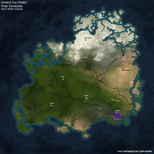
So yeah they still could not fully agree on territories which led to multiple disputes and actual wars over the millennia, until they finally ended up with this around the peak. Kanta has the largest pie by far, then Sen, Ten, and finally Aki.
At peak pre-cataclysm, this civilization had gotten quite advanced, as in "farther in the future than Earth" and "how are we feeling about the vast reaches of space everyone" kind of advanced. The major difference is that sions wield magic, so most of their advancements were heavily magic based rather than using physical science. Anl quick example of what I mean by that would be like, batteries - although they could make electrochemical batteries like we use on earth, they would more likely make them using lightning magic instead.
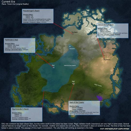
Well things couldn't stay good forever. Events led to the cataclysm and caused the plane split - literally there now three different planes are stacked on top of each other and they are not exactly the same.
First is the original Reality plane, now called Time's End. This plane has become, to put it politely, completely fucked. Although plants like it, and there are some leftover constructs like corvafex, there aren't any people or animals anymore. It is blown out with magic and very few natural processes work like they are supposed to. The time of day is locked in bands by region (see next map), time flows inconsistently, and the weather and seasons don't cycle, they are locked at random by region. This doesn't mean things are entirely in stasis though - the tides still move, which is quite clear in places such as the inland sea, and the shore near the Glassworks. At The Beacon, which had already been near a dune field, Aki's wind towers have gone without maintenance for so long that they stir up huge sandstorms every so often like clockwork.
Technically, it is still possible to reach this plane. It's most easily reached by (modern) sions because mirrors do exist here, but it is desolate. Non-sions can occasionally end up here too, but with the resonance levels and time fuckery it is not advised to stay too long.
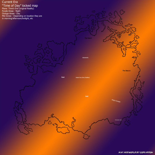
This map is just to show how the time of day is locked. So for example, the Seat of the Creator is in perpetual midday, the Beacon is stuck in the afternoon, Rest and the glassworks are still stuck in the morning, and the Reach is at night.
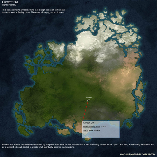
The second plane is the Memory plane. It is called this because there are copies of settlements (mostly from the new Reality) on this plane, but not actually anyone in them. The plane is actually empty, like nobody ever actually lived here, as opposed to Time's End where it is empty because everyone is dead. It still remains quite eerie to explore however. It's just tons and tons of ghost cities essentially. Most of these copies look fairly normal (if not just eerie), but not all of them as the Memory plane still contains some resonance. It's not nearly as bad as Time's End but there are some cases where you'll have like, an entire empty city permanently covered in glowing fog.
So as far as Ahveph goes - it is an entity integrated into the whole planet, and it COULD manipulate things where ever, it just chose to focus on the areas the ancient sions lived in. After the planes split it was almost completely immobilized except for this one location. It can still sorta see things but it cannot do shit unless it's here. What it has currently chosen to do is to act as a city and build modern sions to live in it. It's success at being a city like the Sovereigns is kind of debatable but to be fair it is really a different beast entirely anyway.
Named characters that actively live here are Cavi, Torch, Tower, and the Daydreamer. While it is mostly populated by sions it does sometimes allow non-sions as well, like Subore actually lives here. He is also is one of the only humans that has learned modern sionic.
This is also probably a good time to mention modern sions are fairly different from ancient sions. Ancients are all sapient automatons - they have A Process to build some more (there is in fact some "genealogy" and "genetics" involved but it gets...kind of wacky) but they are 100% new builds every time one gets made. On the other hand, Modern sions are not 100% new, they are kind of doppelgangers - specific humans/shifters from reality are identified, their essence copied, changed up a bit, and then the copies are stuffed into a new construct body and let loose in the city. A good example of this is Sy and Tower, Sy being the original guy (a "Source"), and Tower being the sion that was created.
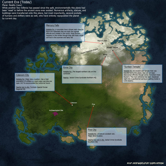
Aaand finally we have the current new Reality plane. It has been entirely repopulated by humans and shifters. The ancient sions have been largely forgotten except for whatever archaeologists dig up. Since they don't have any way to translate the relics being dug up they are just called "The Lost Race". Modern sions are basically a crypid at this point that everyone calls some variation of "mirror demon" and there is no connection that these two are actually related.
The overall technology level is similar to Earth. Maybe slightly ahead, but it is mostly based in the physical sciences with some augmentation with whatever magic relics they've figured out how to work.
Ahveph can technically manipulate things at Five since it's at the same location, but it generally does not. It has however, made a very convenient shortcut for explorers to travel back and forth between Reality and Memory.
Character locations on this plane:
Five - Sy's family had moved here from overseas when he was young. He grew up here but moved somewhere between Calanom and Five. His mom, dad, and older brother still live here though.
Calanom - Yeah so the kids (Cody, Mady, and Static/Shaun) all live here. Jack (Cavi's Source) was from here as well.
Mercury Falls - Subore and Riley (Torch's Source) are from here, though Subore didn't want to stay after Riley passed away.
#behold! my art#my art#worldbuilding#worldbuilding maps#worldbuilding map#mapmaking#world map#fantasy map#map#ancient sions#sentient cities#lost kingdoms#long post#Worldbuilding setting#Location: Time's End#Location: Memory Plane#There are so many moving parts to this you guys#lore dump#modern sions#Fun fact I also have an old SUPER ABSTRACT map of Ahveph itself along with lots of points of interest but I did not include it here#since it visually does not fit lol#The kingdoms all have different symbols that they use and things the sovereigns specialize in more than others#The Sovereigns starter roles and how they evolved over the years. As well as people's attitudes towards them.#Like there is just so much extra info that's better suited to a different post
7 notes
·
View notes
Text
Hi there my fellow tumblrs, I want to start off & say thank you so much again for all the support & love lately, you have no idea how much I appreciate the interest in my work. 💛
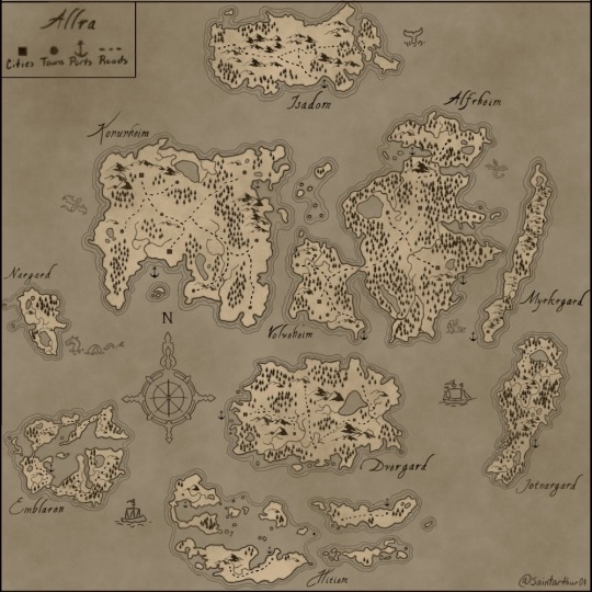
As I said in my latest post here is the world map for Allra. It only took like 33 hours. ಠ_ಠ I’m hoping in the future to update it as I continue on my WIPS & to also make some in detail close ups of each continent & even towns & cities. Also a basic history & lore dump of Allra will be coming soon ! Thank you so much again, best wishes and love y’all 💛 (artwork is mine, do not steal or use without permission ty)
#Allra world map#Chronicles of Allra#writers on tumblr#writerscommunity#writing#fantasy#writblr#fantasy map#world map#worldbuilding#worldbuilding map
21 notes
·
View notes
Text


🌊 Meanwhile in New Ahaland 🐊 Can we go there on vacation? Shown: A male zaw-afikh tossing a frisbee at a spinosaur. -- also that sorta looks like male Tial??
~ ~ ~
Bsky 🦋 | Twitter 🐦 | FurAffinity 🐾
Join me on! Discord Server 💽 | Telegram channel🎨
#marubahrt#worldbuilding#worldbuilding map#spinosaurus dinosaur#furry iguana lizard#planet roia#tial the lizard
3 notes
·
View notes
Text
15 notes
·
View notes
Photo
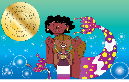
[Image description. A merman giving his mermaid daughter a necklace with rainbow beads and gold pendant with the Taino sun symbol. End description.]
Next Mermay piece! Now also for #mermayacrosstheseas . Which may be my favorite Mermay prompt simply because it's weekly. And it ties in perfectly with my Emily Windsnap fanart, plus the movie version’s worldbuilding map (click here to see it). Week 1's prompt is The Caribbean Sea, so here's Emily and Jake at their new home in the Bermuda Triangle ...
Given Jake's convenient knowledge about their secret Caribbean island, plus his black hair and brown eyes... I headcanon him being actually from the Caribbean. Some fans also suggested them being Taino (the left image is the Taino Sun symbol). Others suggested Allpoints (the Windsnap’s Caribbean home) having a Mayan look like Talokan in Wakanda Forever. Or they could be Haitian, like a certain character in the mid-credits. Also based on this sketch (click here to see it).
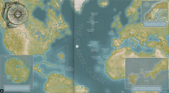
[Image description. Emily Windsnap movie worldbuilding map including the Caribbean. End description.]
#my artwork#mermay#mermay challenge#mermay 2023#mermay2023#mermaid#merman#caribbean#taino#emily windsnap#emily windsnap fanart#book#book fanart#emily windsnap movie#middle grade fiction#middle grade series#middle grade books#caribbean sea#worldbuilding map#liz kessler#mermay across the seas#mermayacrosstheseas
15 notes
·
View notes
Text
THE VOWEL WAR Ep.5
introducing Edȁrĭ... with 91 vowels
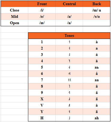
Your turn @ageblue
btw i feel like i need to elaborate on this. this was not made ad hoc for this war, i genuinely evolved Edȁrĭ as an alien language spoken by humanoid aliens (Nyadicha)...


...on planet Ùkrq́i (EXTREMELY unfinished project)

#conlangcrab#conlanging#conlang#conlangcrab talks#linguistics#worldbuilding#worldbuilding map#the vowel war
5 notes
·
View notes
Text
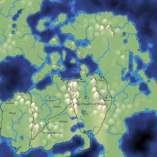
Lord of the Black Mountain: Map
I made a very rough map using mapgen4 to rough out where countries/capitols are in Lord of the Black Mountain. I haven't gotten around to making roads or anything, but I did put in locations of colonies/outposts of the Andals--those are the red xes. (Who are sea nomads engaging in some invasion/raiding/trading activities along the Sewen and Assembly of Five coastlines.)
Mapgen4 lets you do climate and water/land stuff but does not have forests. Pls assume that there are extensive forests in those mountains.
9 notes
·
View notes
Text

3 notes
·
View notes
Note
Hi! Hope I'm using this right, haven't really used this lol. Question: can you tell us about ways your world's geography has shaped it's people and politics?
M: Oh, that's a fun one to answer!
M: First, my home, the United Islands.

M: The peninsula is protected by a mountain range and a desert and the waters are hostile to those not skilled with ships. This meant the nine islands and the peninsula were left to grow relatively undisturbed, except by each other, to which there was a lot of cultural mixing and trade.
So, my homeland is essentially 10 former kingdoms united under one banner.
We're an agriculture and trade power, with a specialty in goods like wine, oil, wool, and especially salt. With some of the best sailors in the world.
M: Next, the Jungle of Flowers to the northwest.

M: They're culture developed in a lush jungle clinging to the coast, backed by a mighty inland sea.
From my understanding, certain common infections cause low birth rate, which allowed women to claim power as the ones who can give birth, thus forming a matriarchal monarchy.
Their tropical climate makes them our main source of rare fruits and woods, as well as leather and furs. They also conflict a lot with smaller kingdoms and tribes to the west for access to the coast and ports.
M: The Twin Kingdoms are also interesting.

M: They're mostly isolated to the far northwest, on a frigid island with very few large land predators. The narrow stretch of land used to mark the border between two kingdoms, the Highlands and the Lowlands. They united under one king in the last 200 years or so to be more assertive in global trade, but the tension between the two groups were… palpable when I was there.
They're predominantly herdsman and fishermen, and they mostly serve as a stop between the Jungle of Flowers and the north east
M: The Golden River is actually where my husband's family is from.

M: They live in the desert, who built their living around the mouth of what I believe the largest river in the world. They're actually a lot of smaller kingdoms who all answer to a single religious leader, who's temple sits at the mouth of the river spilling out in the ocean.
They don't actually take money like most other places I've visted, being mostly trade based, and water being the signifier of wealth. However, they sit on a seemingly endless network of gold mines that they happily trade the rest of the world for, along with beautiful glassworks.
All of the kingdoms are in conflict with each other to some degree, all trying to get more sway over water sources and to become the next leader.
M: The Volcanic Steppe was one of the strangest places I visited.

M: They're lands consist of two islands, the western one consisting of very fertile farming land, a mountain range, and a massive volcano. The eastern island has two more groups, the nomadic herders of the steppe, and the mercantile bullwork on the southern coast. The three groups seem to be in a sort of symbiotic relationship to each other, although none seem to trust the other too much.
They don't have much in terms of a centralized government, with the two sedentary societies communicating with each other mutually, and the steppe people electing a kind of king among all of the nomadic tribes' chiefs. This king communicates with the other two societies.
They seem mostly interested in selling their magnificent horses, along with animal fats, leather, and volcanic glass.
M: The Silken Delta was the last place I lived in long term before coming home.

M: They live on a smaller peninsula, consistently rich with fertile soil from the many rivers and deltas flooding and receding every year. They're a confederation of states, separated by rivers, with each state sending a representative to their central council at the tip of the peninsula.
They actually recently finished, and won, a major war with a mountain kingdom to the north, and they're enjoying the spoils. They're hungry to get back in the market, as I think they see the United Islands and economic rivals. Their cloth is something to die for, as are their spices and herbs.
M: I can go into much more detail on any of these lands if you have any follow up questions, but that's the overview.
#ask blog#send me asks#worldbuilding#ask box open#fantasy worldbuilding#digital art#my art#worldbuilding ask blog#ask answered#worldbuilding map#fantasy maps
4 notes
·
View notes
Text
->BUMP<-
A tutorial on a (bit cheating) way of creating fictional maps.
Open your editing software (RECOMMENDING Krita, since it's free and it's very good).
Step 1: Google "X country silhouette" and copy it.
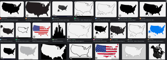
Paste it onto the canvas.
Step 2: Separate the silhouette from the background you copied with it! You can do that by using magic wand selection tool or by making a gradient map with black on 49,9% and transparent on 50% on the slider.


Step 3: Repeat several times with numerous countries and/or islands, cities, municipalities, communes, continents et cetera.
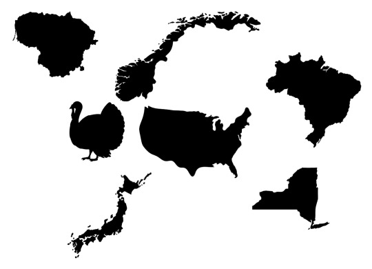
Step 4: Combine, mesh, stretch, rotate, mirror - go ham, make it work.
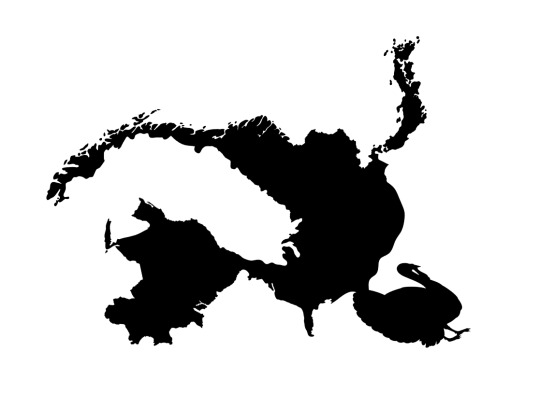
Step 5: Erase and add.
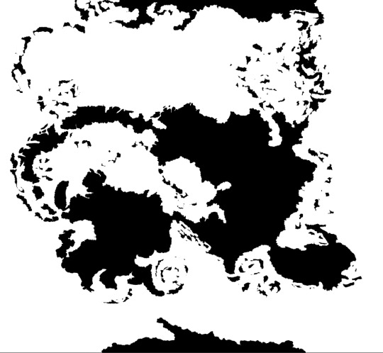
Step 6: Have your map outline ready, copy/paste it several times in the same doc on different layers and edit in different ways like biomes, kingdoms, mountains and other.
Step Mountains+: To figure out mountains, make another layer on the doc and do something like this:
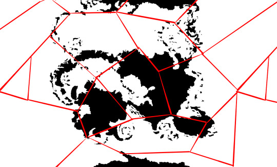
-and then in every polygon you add an arrow.
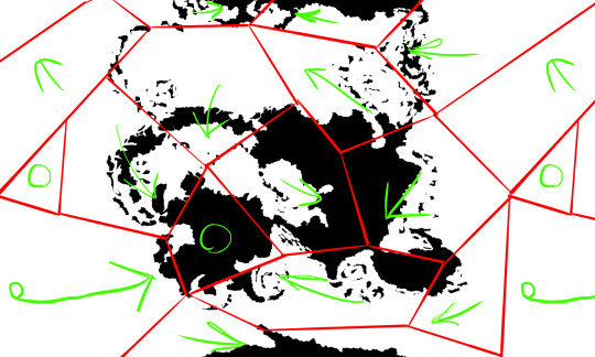
Where arrows meet or transfer onto continents, add mountains.
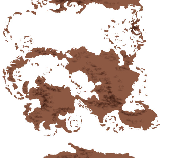
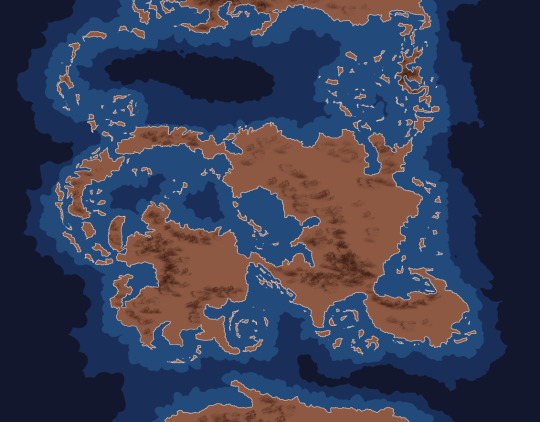
Color the sea with a couple layers of depth and you're done :D

#cartography#making maps#fantasy world#making fantasy maps#fantasy worldbuilding#worldbuilding map#map#maps
11K notes
·
View notes
Text
Some people have asked me if I can publish my mapmaking tools. So I developed a software. 🙂
Here is the result:
#tabletop#dnd#battlemap#dnd maps#rpg map#dungeons and dungeons#dungeonmaster#dungeonsanddragons#fantasymap#worldbuilding#gamedev#indiegame#drawing#gaming
27K notes
·
View notes
Text
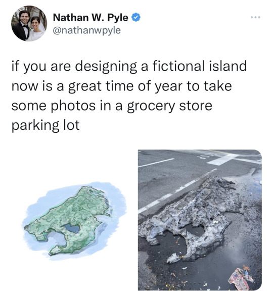
This came across my Facebook feed, felt I’d share it.
49K notes
·
View notes
Text
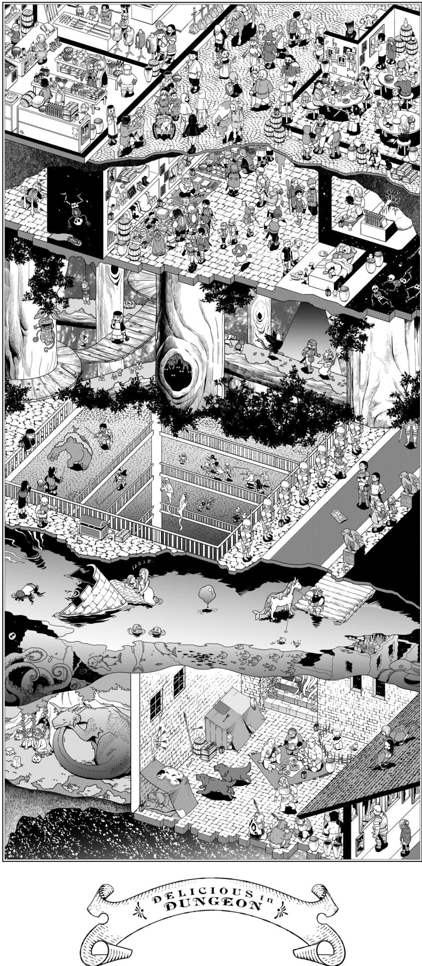
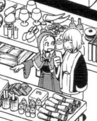
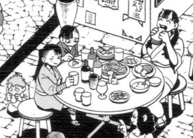
Dungeon Meshi Adventurer's Bible - Dungeon cross section
Details under the cut
Details cropped from this reddit post
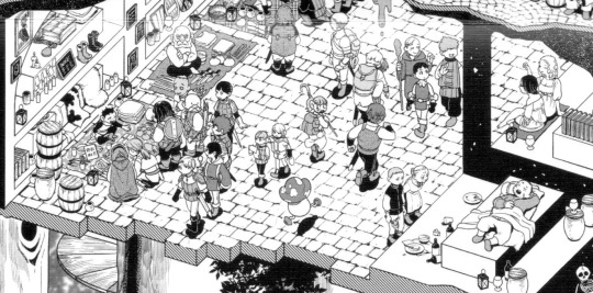
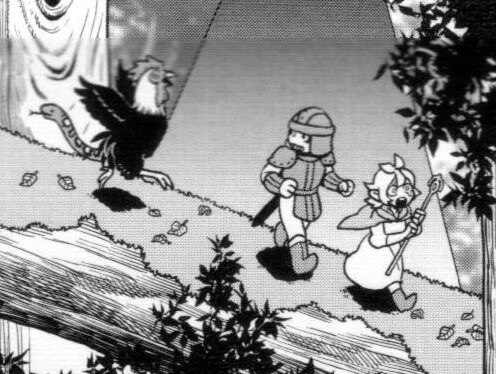
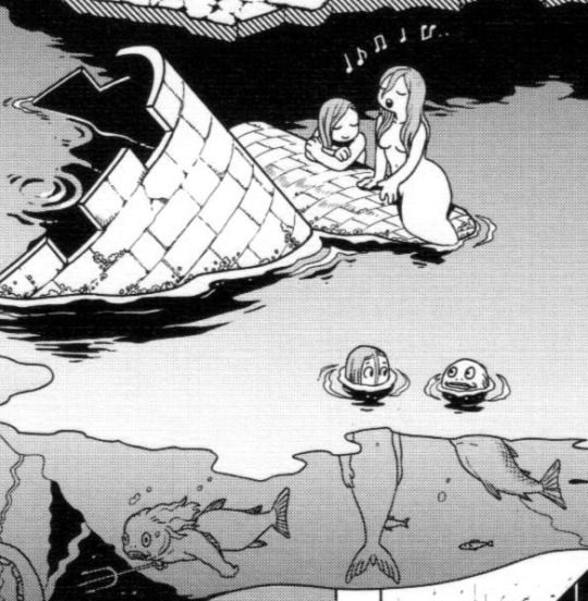
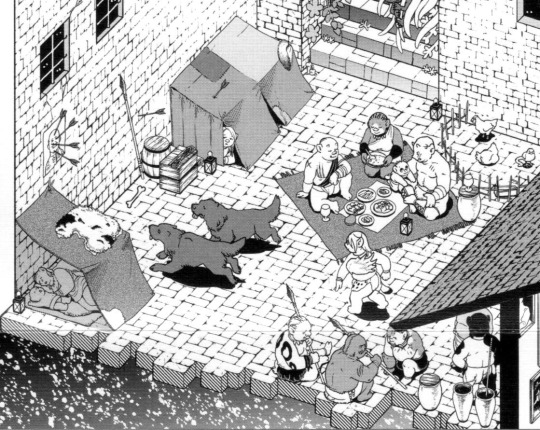
#Dungeon Meshi#adventurers bible#took me a LONG time to find a good quality full version of this#please open the full image to properly see it#tumblr mobile also ruins the quality..#Falin touden#marcille donato#chilchuck tims#leed#leed dungeon meshi#orcs#mermaid#fionil#doni#inutade#tade#hien#benichidori#is hien winking at the waitress?#worldbuilding#dungeon layout#dungeon levels#red dragon#dungeon meshi orcs#maps#for referencing
5K notes
·
View notes
Text
Map of the Solar System from Signalis

#signalis#maps#cartography#imaginary maps#mapmaking#worldbuilding#fallout#science fiction#scifi#scifiart#outer space#solar system#space
647 notes
·
View notes
Text
Wanna make a map? Check out my short booklet that'll have you coming up with a fantasy land pulled from all sorts of sources!
🧭 Find it here on itch.io, pwyw! 🧭
#worldbuilding#tabletop#ttrpg#maps#itch.io#yippie yahoo#that 3d diorama almost took as long as formatting the pdf and its only for this post#my art
262 notes
·
View notes