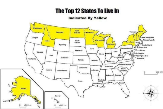
#us map
Explore tagged Tumblr posts
Text
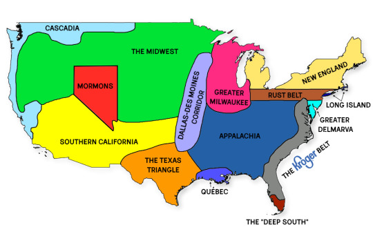
map of US social and cultural regions i made that you can use if you want to start a fight
28K notes
·
View notes
Text
When two people try to label a united states map (one lives there isnt from...one doesn't live there at all and hasn't been)

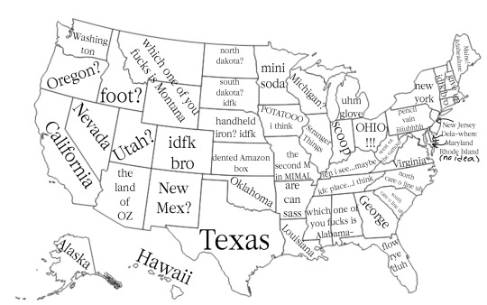
Tumblr how'd we do? Or tag yourselves...American mutuals/followers
#stbt server™#the server™#i thought i was doing so well#i was not#discord server#long distance friendship#help us#or dont#stranger things bonus track server#non american#us map
36 notes
·
View notes
Text
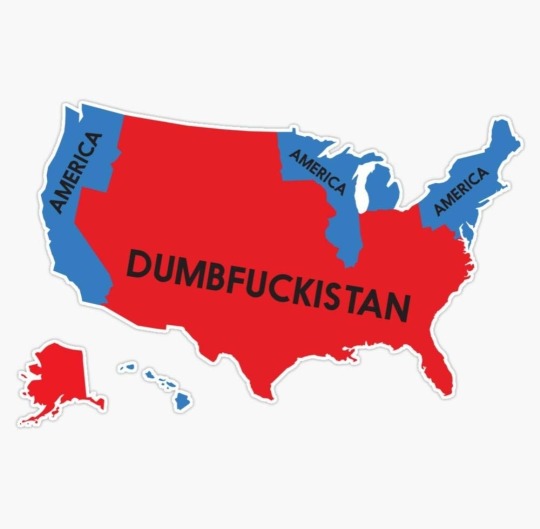
The new, updated map of the country formerly known as the United States of America.
#ETTD#FAFO#it was nice while it lasted#us map#usa map#politics#dumbfuckistan#trumpmagastan#us politics#truth#not funny#i fucking hate this#white women betrayed us
11 notes
·
View notes
Text
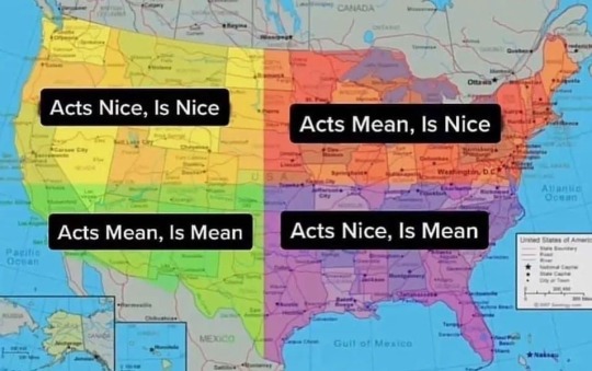
In the US, people are nice and mean
[via]
8 notes
·
View notes
Text
Inaccurate map of the United States (joke post don't take this seriously)

RIP Connecticut and Delaware
3 notes
·
View notes
Text
Idaho and Nebraska need to trade names so we can have all the I states in a line. Iowa, Illinois, and Indiana are all in a row but Idaho just had to go out west all by itself.
#i don't even know how to tage this#united states#iowa#illinois#indiana#maps#us map#organization#idaho
8 notes
·
View notes
Text
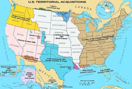
US Territorial Acquisitions over the years.
4 notes
·
View notes
Text

So @smile-at-the-stars was wondering if there was an area in the US that experienced both totality and aurora borealis caused by the solar flares earlier this week that will also experience the cicada emergence this summer, and I have nothing more interesting to do right now so I made this map that is definitely not very accurate but a good approximation nevertheless. The accuracy varies within the map because I was filling the counties one by one manually (in https://www.mapchart.net/usa-counties.html) and I had varying levels of patience during this time, so don't come for me in the notes if you spot any mistakes. I might write the code and create a better map later if I feel like it (and if anyone else wants to do so, they are more than welcome). The data for totality comes from an approximation from https://science.nasa.gov/eclipses/future-eclipses/eclipse-2024/where-when/, the aurora borealis data is an approximation from the prediction for naked eye visibility from an ABC10 image based on NWSSWPC predictions for Saturday, May 11th (https://pbs.twimg.com/media/GNTcm3EaMAAhxJy?format=jpg&name=medium is where I found it), and the cicada data is from https://www.usatoday.com/story/news/nation/2024/04/24/2024-cicada-map/73414849007/.
So as we can see, there is indeed an area where 2024 will seem like the beginning of an apocalypse.
#eclipse 2024#total solar eclipse#cicada#cicada emergence#northern lights#solar storm#solar flare#aurora borealis#space weather#eclipses#space#maps#usa#us map#making this map made me realize just how much gerrymandering there must be
6 notes
·
View notes
Text
I love how people just randomly decided to do weed when making the states
Alaska is 380 times the size of Rhode island
There's a North Dakota and a South Dakota, a North Carolina and a South Carolina, but Michigan is just Michigan
There's a Virginia, but there's also a West Virginia, which means you can be from west Virginia but not West Virginia
The past two examples mean you can be from south North Dakota, north South Dakota, south North Carolina, north South Carolina, and east West Virginia
Washington DC isn't in Washington
And finally this
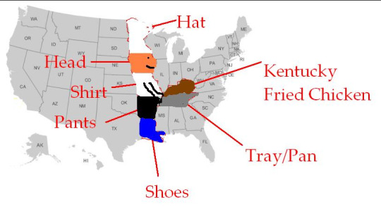
11 notes
·
View notes
Text
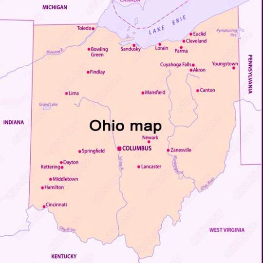
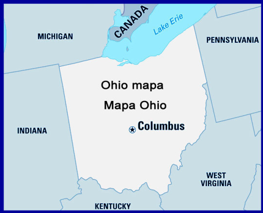
Map of Ohio These water bodies provide recreational opportunities for residents and visitors alike, as well as serving as important sources of freshwater for the surrounding communities(Ohio Lakes and Rivers Map: Waterways of the Buckeye …, ). Ohio's topography is diverse, with several distinct landscapes and natural features(Ohio Maps & Facts, )
2 notes
·
View notes
Text
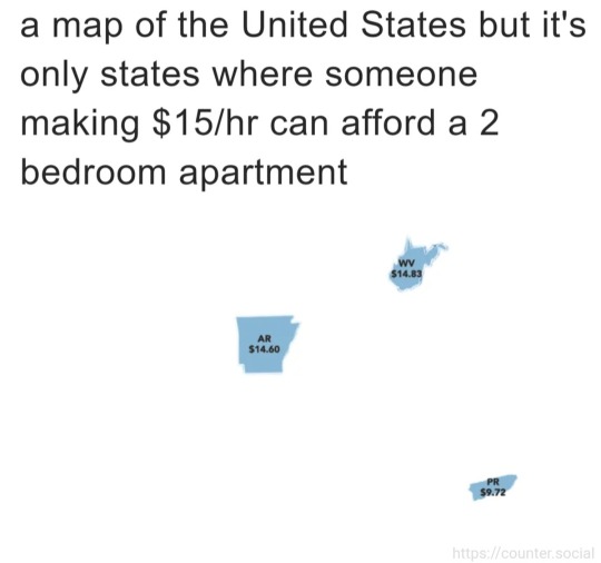
Map of the United States, but only where someone making $15 an hour can afford a two-bedroom apartment.
4 notes
·
View notes
Photo
California is missing the critical "bay area" keystone. Norcal people are SO MUCH different than anyone on the Bay or in Silicon Valley. It would actually be better to lump everything together from Marin county down the coast. Much to their chagrin.
But the inaccuracy works in the map's favor. Let's all care about California less.
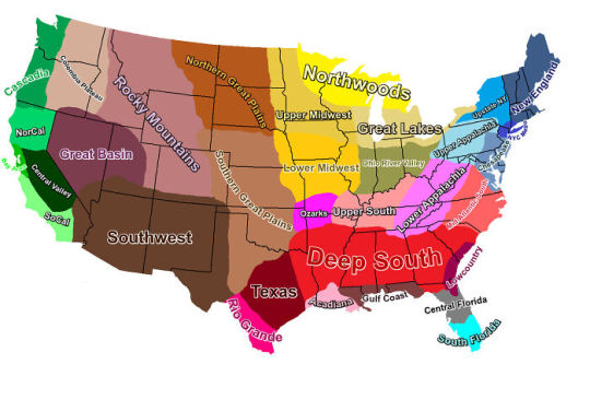
USA Cultural Regions Map
177K notes
·
View notes
Text
I have been desperately trying to find that tumblr US map with 60 states and the search engines refuse to comply because they're like "60 states is misinformation, there are 50." And now I want to strangle Google but I'm also concerned I hallucinated this hilarious map.
3 notes
·
View notes
Text
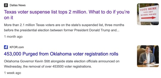
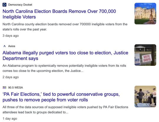
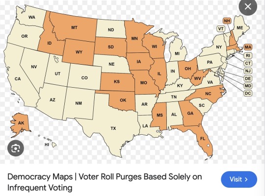
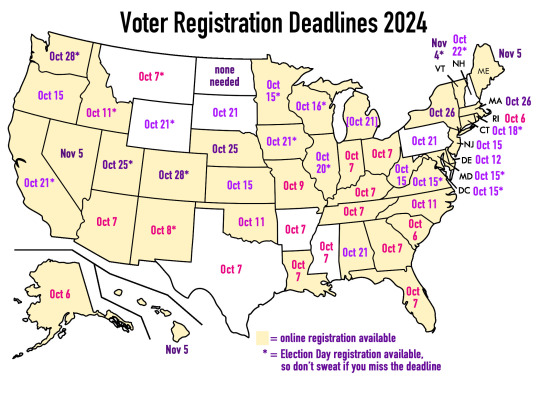
Oh look, it seems like there's a Republican-led movement to purge voter rolls in the lead-up to the election! It's almost as if your vote matters and they don't want you to vote! Anyway, I whipped up a quick map (based on this) that shows when the voter registration deadline is in each state. There are a few deadlines coming up in the next week or so.
If you live in a state that regularly purges voter rolls for infrequent voters (the orange ones in the first map), or if you moved recently, it's good to check if you're still registered to vote.
Vote.org makes it super easy to check your registration: https://www.vote.org/am-i-registered-to-vote/
Just put in your address and DOB and they'll tell you whether you're registered. (And they give you a quick link to register online if it turns out that you're not! Only the 9 states in white on my map don't have online registration, and for those they provide instructions on how to do it via mail or in person.) If you want an extra verification, find your state's election website and double-check there.
So yeah, give yourself peace of mind -- do a quick check. :)
#sorry that us election season plagues the non-usa folks on tumblr#took a break from binging more batfam fics to do this lol#i LOVE how easy vote.org makes things tho#lowkey was planning to do a gotv comic but the reg deadlines were coming up so#us election 2024#thank you past self from 2020 for already having a map in a psd file#i got my voter info booklet in the mail on friday and i'm so hype
30K notes
·
View notes
Text
#google maps#gulf of mexico#maps#map#google map#map of usa#google.maps#gulf of mexico name change#maps google#apple maps#united states map#usa map#the gulf of america#golfo de méxico#us map#golf of mexico#gulf.of america#why did trump rename the gulf of mexico#google maps gulf of america change#the gulf of mexico#gulf of america trump#gulf of mexico map#gulf#gulf.of.mexico
0 notes
