#history map
Explore tagged Tumblr posts
Text
youtube
1 note
·
View note
Text
Daily Mirror, England, December 9, 1907
5K notes
·
View notes
Text
A Rare Cross-Section Illustration Reveals the Infamous Happenings of Kowloon Walled City
2K notes
·
View notes
Photo
The Appalachian Mountains, Atlas Mountains, Scottish Highlands and Scandinavian Mountains were all once part of the same "Pangea Central Mountain Range" millions of years ago before Earth's continents split.
#maps#earth history#appalachians#atlas mountains#scottish highlands#scandinavian mountains#interesting
4K notes
·
View notes
Text
Same-sex marriage in 2003 vs. 2013 vs. 2023
(20 years of change)
More info below:
----
2003:
Marriage : Netherlands, Belgium, British Columbia (CA), Ontario (CA)
Civil unions : France (including overseas territories), Germany, Denmark, Iceland, Sweden, Norway, Finland, Greenland, Rio Negro (AR), Ciudad de Buenos Aires (AR), California (US), New York (US), Hawaii (US), Vermont (US), Canary Islands (ES), Aragon (ES), Catalonia (ES), Andalusia (ES), Extremadura (ES), Castilla-La Mancha (ES), Castilla-Leon (ES), Madrid (ES), Valencia (ES), Asturias (ES), Basque Country (ES), Navarre (ES), Balearics (ES), Quebec (CA), Alberta (CA), Manitoba (CA), Nova Scotia (CA), Geneva (CH), Zurich (CH), Portugal.
----
2013:
Marriage : Netherlands, Belgium, Canada, Brazil, Uruguay, Argentina, South Africa, Spain, Portugal, France (including overseas territories), Denmark, Norway, Sweden, Iceland, New Zealand, Washington (US), California (US), New Mexico (US), Minnesota (US), Iowa (US), Maryland (US), DC (US), New Jersey (US), Delaware (US), New York (US), Connecticut (US), Rhode Island (US), Vermont (US), Massachusetts (US), New Hampshire (US), Maine (US), Hawaii (US), Mexico City (MX), Quintana Roo (MX).
Civil unions : Greenland, Colombia, Ecuador, Merida (VZ), United Kingdom, Ireland, Germany, Czech Republic, Austria, Finland, Hungary, Slovenia, Croatia, Switzerland, Luxembourg, Liechtenstein, Australia
Recognizes marriages performed abroad : All 32 Mexican states and Israel
----
2023:
Marriage : Netherlands (including overseas territories), Belgium, United States, Canada, Mexico, Costa Rica, Cuba, Puerto Rico, Colombia, US Virgin Islands, Ecuador, Brazil, Argentina, Uruguay, Chile, Malvinas/Falklands, France (including overseas territories), Spain, Portugal, Andorra, Germany, Slovenia, Switzerland, Austria, Malta, Guernsey, Jersey, United Kingdom, Isle of Man, Ireland, Gibraltar, Norway, Denmark, Sweden, Finland, Iceland, Greenland, Luxembourg, Faroe Islands, South Africa, Australia, New Zealand, Taiwan, Northern Mariana Islands, Guam, St. Helena, Pitcairn Islands, Gibraltar.
Civil unions : Bolivia, Italy, Cayman Islands, Bermuda, Aruba, Curaçao, Czech Republic, Hungary, Croatia, Montenegro, Greece, Cyprus, Estonia, Liechtenstein
Recognizes marriages performed abroad : Namibia, Israel, Nepal, American Samoa
----
Future :
Same-sex marriage is under consideration by the legislature or the courts in Aruba, Curaçao, the Czech Republic, Estonia, Greece, India, Japan, Liechtenstein, Namibia, the Navajo Nation, Nepal, Thailand, and Venezuela, and all countries bound by the Inter-American Court of Human Rights (IACHR), which includes Barbados, Bolivia, Dominican Republic, El Salvador, Guatemala, Haiti, Honduras, Nicaragua, Panama, Paraguay, Peru, and Suriname.
Civil unions are being considered in a number of countries, including Lithuania, Peru, the Philippines, South Korea, Ukraine, China, Hong Kong, Japan, Latvia, Panama, Romania, Serbia, Slovakia, Thailand, and Venezuela.
----
#map#maps#cartography#usa#latin america#mexico#data#americas#geography#europe#gay#lgbt#gay marriage#lgbtq#lgbtq history#lgbt history#history#lesbian#sapphic#marriage#pride
7K notes
·
View notes
Text
By the way, if any of you, like me, are nerds who love maps, I highly recommend checking out the Turgot map. I won't link it or tumblr will eat this post, but you can find it just by searching Wikipedia - it's an incredibly detailed 3D map of Paris made in the 1730s, and by "incredibly detailed," I mean
incredibly
incredibly
INCREDIBLY
DETAILED!
Look, there's Notre Dame! Individual trees! Individual lampposts! Individual boats!! (Some of them even have little people in lol, though clearly not to scale)
The full scan is over 35,000 pixels wide, guys! That's over 10 feet of map!! All drawn and engraved by hand! I'm freaking out a little! What an absolutely amazing piece of history & art!
#I'm slowly collecting stupidly detailed maps of Paris for book research but this is the wildest one I've found so far#and in 3D! It really gives you a sense of the city like nothing else#history#french history#Paris#maps
16K notes
·
View notes
Text
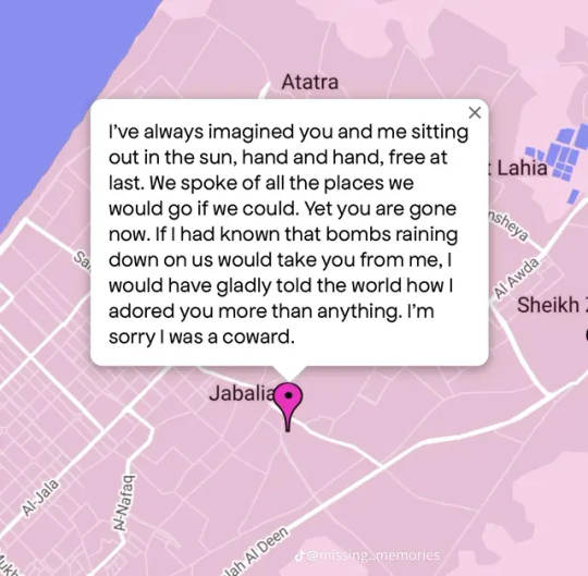
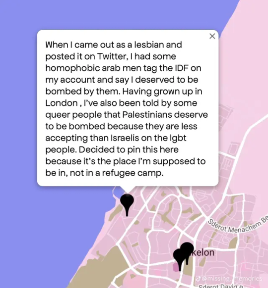
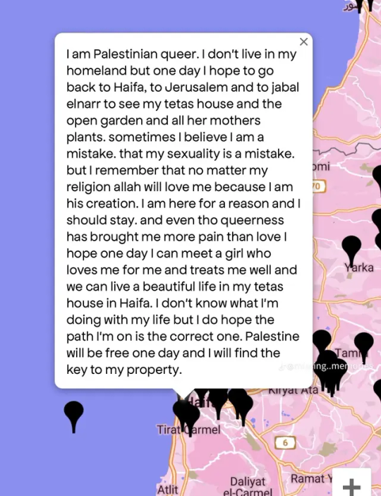
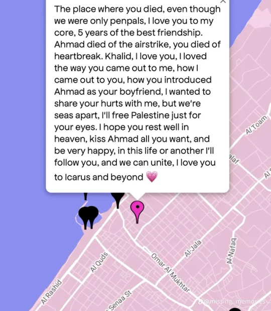
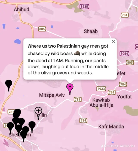
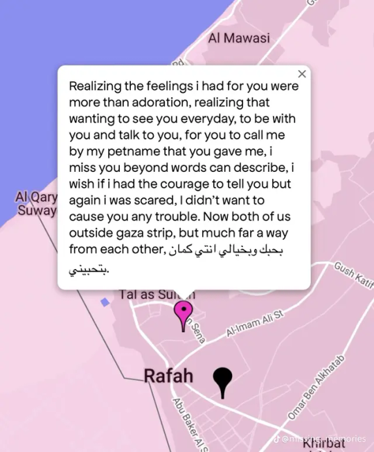
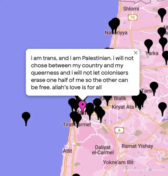
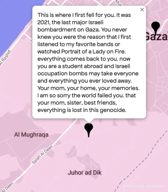
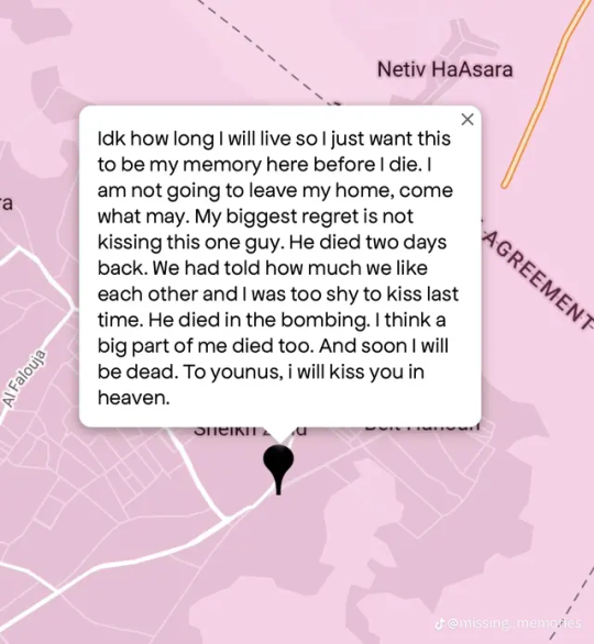
a collection of queer Palestinian stories in Gaza from queering the map.
Don't let pink washing get to your head. Queer people live everywhere, including in Gaza, where they are currently being massacred.
images are from the tiktok link i attached, there's even more there.
#free palestine#free gaza#gaza#palestine#poetry#israel palestine war#israel palestine conflict#israel#israhell#queerness#queer#queer history#queer community#lgbtq rights#lgbtq+#lgbtqia#lgbtq community#lgbtq writing#lgbtq stories#queering the map#equality#lgbt#lgbt rights#lgbt community#queer palestinians#pink washing#pinkwashing#genocide#gaza genocide
1K notes
·
View notes
Text
The most common geographical evidence we have from ancient Rome are catalogs of places. Roman maps, to the extent that they existed at all, were almost certainly rare and expensive. Ordinary Romans would not have had access to them. Instead, Romans would have used itineraria, which are just what they sound like — lists of the places a traveler might encounter along a certain road. Many itineraria are catalogs of the milestones that the Roman government placed on its road network.
One of the more famous itineraries is found on a set of cups that were excavated in Vicarello; they describe the route from Cadiz, Spain to Rome.
{WHF} {Ko-Fi} {Medium}
2K notes
·
View notes
Text
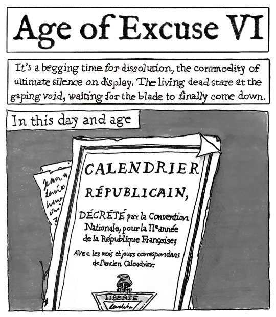
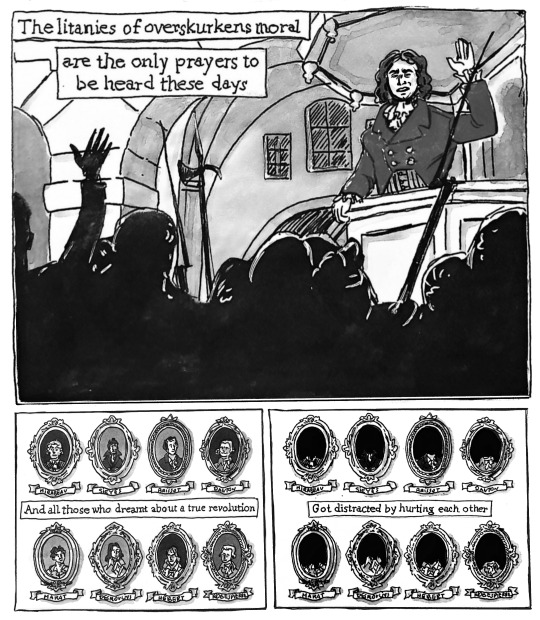
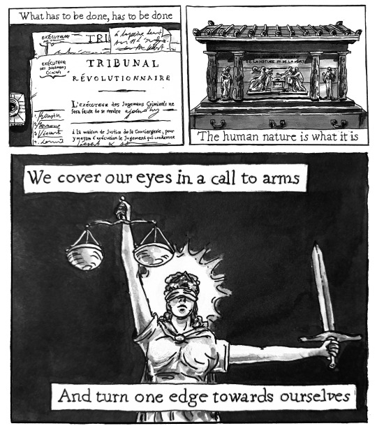
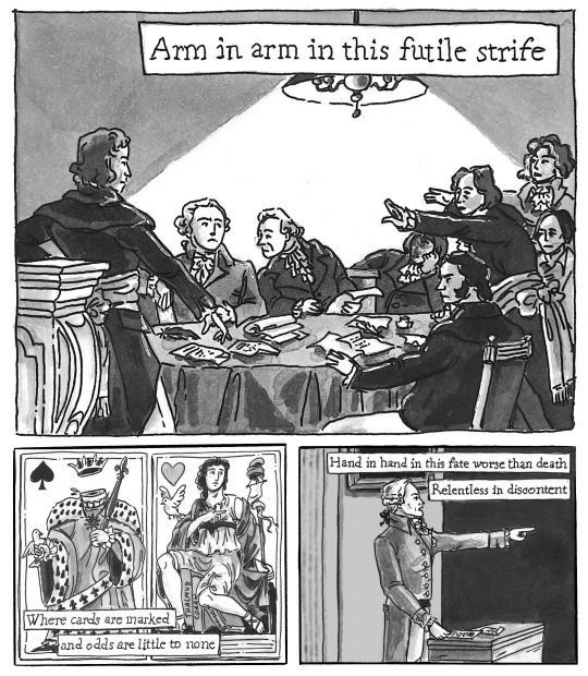
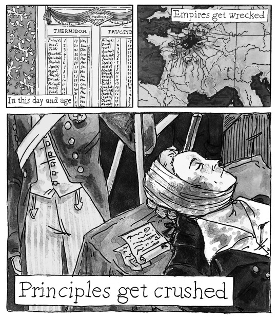
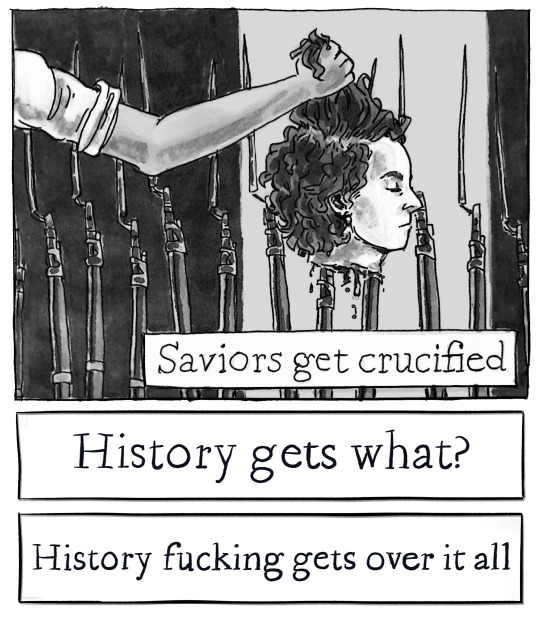
Le 9 Thermidor, l'an II de la République une & indivisible / Age of Excuse VI, Mgła
#My art#History#French Revolution#Frev#Thermidor#Robespierre#Almost two weeks in the making. /Really/ pleased with how pages 4 and 5 turned out.#The order of execution and both calendars are copied verbatim from historical documents.#As is the map. (To an extent obviously.)
253 notes
·
View notes
Text
Man sometimes I still think about Alfred's Bandit Anecdote in The Dark Knight (2008).
So, the most straightforward reading of this sequence seems to have been the one Nolan intended, because he is not actually a subtle filmmaker, and the further we got into the series the more heavily he committed to making Alfred a mouthpiece. Old man provides words of wisdom that frame the correct understanding of the situation; you can tell it's meant to be correct because subsequent Joker appearances reinforce its thesis statement.
Intended takeaway: some men (like the Joker) don't have rational motivations, they just 'want to watch the world burn,' and you have to account for that when trying to counter them. Chaos agents, basically unstoppable by reasonable means.
But the thing is. This is not a story that stands up to even mild interrogation. The number of assumptions Nolan wants us to swallow without blinking is kind of stunning.
First of all the obvious timeline questions that arise: the Anglo-Burmese Wars and periods between and leading up to them where this kind of white man's burden 'delivering jewels to local elites In The Burmese Jungle to sway them toward British interests, but getting waylaid by bandits' scenario makes any sense all, happened in the 19th century.
The Burmese resistance in the 1930s was centered on university student protests and that sort of thing; it was reasonably successful in moving Myanmar toward independence by increments, though who knows what would have happened without WWII. But it did not provide anyone with reasons to be hand-carrying huge gemstones through forests.
Even if we assume this was somehow a 20th century event, it has to have been before WWII unless we want to postulate a complete alt-history setting, and since The Dark Knight leans heavily into being a modern 21st century story with like, cell phone networking as a major plot point, this still makes Alfred old as balls. Born no later than 1920, and probably earlier.
But that's whatever; comics time. Batman Begins did some fun stuff (possibly in imitation of Batman (1980)) with making it ambiguous what decade it was supposed to be set in, though the sequels dropped that conceit. And anyway, people can be 90 years old.
So that's basically fine, although good god Wayne hire some more servants, this man should be fully retired already.
More problematic is the unfettered colonialism of it all, the confident proclamation that since this guy's motive wasn't profit, since he didn't keep the jewels, he had no motive. Because 'inconveniencing the Raj and weakening their control over the locality' isn't a Real Person Motive that a real person could have had. During or soon after failed wars to resist colonial subjugation.
Like. Come on??
The place where this story utterly shoots itself in the foot, though, is the clever bit at the end, where Bruce asks how Alfred's military unit solved the 'bandit stealing jewels he didn't even want' problem and Alfred's like: 'we burned the forest to the ground.'
Because this is so punchy! In screenwriting technical terms, it's quite well done. It's useless advice that loops the story back to its themes; obviously Batman can't burn Gotham down to get the Joker. Even in a Batman movie that doesn't like Batman very much, this is still obvious.
But at the same time this totally takes the legs out from under Alfred's words of wisdom about human nature. Because if that bandit 'wanted' to 'watch the world burn' then what his unit did wasn't so bad, right; he was basically asking for it. Burning a forest down with all the inevitable collateral damage and economic and ecological cost, all for the sake of horribly killing a group of people in the name of government revenues was totally okay guys!
It transforms the whole thing into a pretty obvious post facto rationalization of colonial violence. Which makes the Insights Into Human Nature bit real questionable!
But the movie gives absolutely no sign of having noticed this.
#hoc est meum#batman#colonialism#alfred pennyworth#film#i throw salt#meta#myanmar#history#order vs chaos framing#never a perfect map onto good vs evil i'll tell you#orientalism
371 notes
·
View notes
Text
There was a village tucked in a narrow valley between steep woods. It wasn't a large village, and wouldn't have shown up on a map of the mountains. It barely showed up on a map of the village.
It was, in fact, one of those places that exist merely so that people can have come from them. The universe is littered with them: hidden villages, windswept little towns under wide skies, isolated cabins on chilly mountains, whose only mark on history is to be the incredibly ordinary place where something extraordinary started to happen. Often there is no more than a little plaque to reveal that, against all gynecological probability, someone very famous was born halfway up a wall.
Terry Pratchett, Equal Rites
#equal rites#discworld#terry pratchett#small towns#small town life#origin story#geography#cartography#maps#importance#ordinary#extraordinary#landmarks#history#historical significance#an incredibly ordinary place#halfway up a wall
301 notes
·
View notes
Text
England doesn’t have a North-South divide. But if it did have one, Cornwall would be in the North.
Now I’m not saying there isn’t a big geographical divide between like, Manchester and Canterbury, or that the country’s a homogeneous patchwork, what I’m saying is this divide isn’t north-south and thinking about it as such masks a lot of things.
Oh, and I am, for necessity of discussing this divide, going to be ignoring the Midlands. I hope you forgive me ignoring the deep cultural ties between Birmingham and Rutland.
Map Men made a video about the North-South divide in England (https://www.youtube.com/watch?v=ENeCYwms-Cc&ab_channel=JayForeman), which focused on the line determined by Danny Dorling in 2008.
… Which isn’t a north-south divide. It’s a northwest-southeast divide, going up at more than 45 degrees – it’s more an east-west divide than it is a north-south. It also includes Wales in “the North” but we’ll get to that.
But it was a north-south divide he set out to find, so a north-south divide he sort of drew, excluding exclaves and enclaves where the metrics he was looking at would make that not a north-south divide.
Notably, several would seem to put the west country peninsula in “the North”… So what’s up with that?
(Dorling's full paper is here, and I recommend looking through the whole thing to see how he arrived at the divide he eventually concluded: https://www.dannydorling.org/wp-content/files/dannydorling_publication_id2938.pdf)
Anyway. This is what’s up with that:
This is a geological map of Great Britain (and the Isle of Man, which isn’t actually part of the UK or any of its constituent countries but I guess it’s here anyway.)
Here again, in the boundary between Jurassic and Triassic geology, is that diagonal line from the Humber to the Severn, but continuing past both. For convenience, here are those two lines superimposed on one another.
With Danny Dorling’s line (frequently following county boundaries or other administrative boundaries) in blue, and the geological divide in red.
One line was drawn in 2008, the other has existed over 200 million years.
This isn’t a coincidence – it’s the reason for the divide.
What made “the North” is the industrial revolution. And one thing that drove the industrial revolution was the mines: coal, iron, silver, tin, the rocks beneath our feet and the people who dreamed they were worth more than the people they sent into the dark to bring it into the light.
Towns grew around mines, from Walker to South Crofty, and more than just the mines defining them, it was the mines closing that would cement the divide.
“Byker Hill and Walker Shore, collier lads forever more”
“Cornish lads are fishermen and Cornish lads are miners too”
- Two folk songs about regional identity’s roots in its industry, from opposite ends of this dividing line
In the West Midlands, the Black Country didn’t earn that name with caviar; it, like Manchester and Leeds, reinvented itself when the industry collapsed: cities built in the brick ruins of the temples built to the exploitation of the workers, blackened by the smokes of the cremation of its labour industry. When the light catches the steel and glass just right, you can still see the ghosts.
Even the country life outside the cities is shaped by this geology: the terrain north-west of this line doesn’t lend itself to large, flat expanses of land for arable farming, and the divide is visible again when looking at agriculture:
With the majority of land south of the Jurassic-Triassic line being arable, mixed and market gardening, with a fair amount of cattle in the Cotswolds and Chilterns and along the north side of the Thames, and the majority north-west of it being cattle and sheep – which are almost absent from the south side of the divide with the exception of the Isle of Wight and therefore, ironically, Cowes.
Not all farming is the same, the yearly flow of labour and of marketable goods between livestock and arable having little in common beyond being intensive work out-of-doors and taking huge amounts of land to accomplish.
But one thing that also goes hand in hand with this is that sheep aren’t mostly farmed for their meat but for their wool, and what drove industrialisation in the Pennines was the steam-loom: the mechanisation and mass-production of wool.
(Incidentally, on this map arable farming and market gardening also correlate with several types of English traditional dance: Molly, Border an East Midlands and East Riding plough dances, which began as a way for seasonal farmhands to make ends meet by busking with menaces in the winter off-season, but that’s for a later Morris ramble).
But hang on, that puts Hull on the same side of the divide as Kent, not, for example, Liverpool. So what gives there?
The East Riding isn’t built on mining - a kid with a bucket and spade could find the water table in most of the county.
Hull, and other ports of Yorkshire with it, was built on whaling – and not many industries have collapsed harder than whaling. For once, the geography of the land has little impact on this, but the geography of the sea does:
Between England and the European continent is a shallower stretch of sea called Dogger Bank – named for the Dutch cod-fishing boats known as Doggers which fished on it. But shallow water isn’t great for whales. So where is there water good for whales?
Well, whalers from Great Britain would venture as far as the Antarctic ocean in search of whales, and often hunted off Greenland – but there was water closer to home where whales did and still do frequent:
(There is still whaling in the North Sea. Around 500 minke whales are killed by Norwegian whalers each year “in objection to” the global ban on commercial whaling.)
Outside of this, there’s also a divide between port cities dealing primarily in cargo or primarily in passengers, something which is somewhat evening out by one means or another, but here’s a current map of UK passenger ports and their passenger numbers:
Or at least circles sized to correspond to their passenger numbers - source with stats: https://www.gov.uk/government/statistics/sea-passenger-statistics-all-routes-2021/sea-passenger-statistics-all-routes-2021
Compare this with a map of cargo ports by load:
Source with numbers: https://safety4sea.com/uk-ports-record-steady-performance-during-2018/
Generally showing passenger numbers getting lower the further you get from Dover, but not the same correlation with cargo (Plymouth and Holyhead both bucking this trend at a glance).
So, if not “The North” and “The South”, what name does make sense for this divide?
I propose “the South” be known as Lloegyr.
These names still exist: Domnonea still exists in Brittany both as a name for that same region from which Brittonic settlers came to Brittany and an area of Brittany named for them, and in Welsh, yr Alban is Scotland, Cymru is Wales and Lloegr is England.
Wales isn’t part of “the North”. “The North” is part of Wales.
271 notes
·
View notes
Text
Fra Mauro – Scientist of the Day
Fra Mauro, a Venetian monk and cartographer, was born around 1400 and died about 1460.
read more...
#Fra Mauro#Fra Mauro world map#cartography#histsci#histSTM#15th century#history of science#Ashworth#Scientist of the Day
189 notes
·
View notes
Text
Lidar-Derived Aerial Maps Reveal the Dramatic Meandering Changes in River Banks Over Millennia
5K notes
·
View notes
Text
Legends and folklore from Mexico by region
Legends from Northern Mexico
Legends from Mexico City
Legends from the Baja California Peninsula
Legends from Southern Mexico
Legends from Central Mexico
Legends from South-Central Mexico
Legends from the Yucatan Peninsula
Legends from Mexico
#map#maps#cartography#usa#latin america#mexico#history#religion#folklore#creepy#halloween#legends#urban legends
1K notes
·
View notes