#ancient maps
Explore tagged Tumblr posts
Text

A Map of Ancient Egypt with its main Temples and Pyramids.
📷: King of Maps
62 notes
·
View notes
Text
Ancient maps, lost civilizations, and a mystery that defies history! The Piri Reis Map, created in 1513, shows incredible geographical accuracy—including the coast of Antarctica, which wasn’t officially discovered until 1820.
Where did this knowledge come from? Did ancient cartographers have access to forgotten history, or does this point to an even greater mystery?
💬 What’s your take? Could this change everything we know about the past? Comment below!
#piri reis#piri reis map#ancient maps#hidden truths#lost civilization#hidden history#forbidden knowledge#conspiracy theories
3 notes
·
View notes
Text

HOW DID THE CHINESE
K N O W A B O U T
THE A M E R I C A S
IN 1418?
Via Dr.Kek
- Spy balloons?
11 notes
·
View notes
Photo
'Never separate an Englishman from his county'

The Shires of England
#Shire map of England#10th century#English counties#UK#Middlesex#Westmoreland#Rutlandshire#Huntingdonshire#lost counties#ancient maps#nostalgia#Old England#history
942 notes
·
View notes
Text
The Viking Astronomer: A Norse Epic of Cosmic Discovery and Celestial Secrets
Eirik, a Viking warrior with a passion for the stars, embarks on a perilous journey across uncharted lands and seas after discovering ancient celestial maps. Guided by the wisdom of the Skystones and driven by an insatiable thirst for knowledge, Eirik and his crew face storms, mystical trials, and cosmic phenomena in their quest to uncover the secrets of the universe. Will they unlock the…
#Ancient Maps#Astronomy#Aurora Borealis#Celestial Secrets#Cosmic Discovery#Cosmic Gateway#Cosmic Trials#Eirik#Epic Adventure#Mystical Journey#Norse mythology#Skystones#Starry Skies#Viking Astronomer#Viking Legends#Viking Saga
0 notes
Text
1 note
·
View note
Text
ORTA ÇAĞ'DA MANYETİK KUZEY KUTBU TEORİSİ: RUPES NIGRA
Pusulaların iğnesi her zaman kuzeyi gösterir, daha çocukken öğrendiğimiz bir bilgidir bu. İyi de niye kuzeyi gösterir? Pusula iğnesi neden hareket ediyor? İcat edildiği MÖ 200’lü yıllardan modern teorinin geliştirildiği 1600’lü yıllara kadar insanlar pusulanın hareketi hakkında ne düşündü? Bu kuzeye dönme durumunu nasıl açıkladılar? Gelin videonun devamında hep beraber…

View On WordPress
#ancient maps#kuzey kutbu#kuzey kutbunda manyetik ada#manyetik kutup teorileri#orta çağ haritaları manyetizma adası#orta çağ haritaları rupes nigra#orta çağ haritalarında kuzey kutbu#orta çağ haritalarında manyetik ada#orta çağda harita#orta çağda pusula#orta çağda pusula neden kuzeyi gösteriyor#orta çağda pusula teroisi#pusula neden kuzeyi gösterir#rupes nigra
1 note
·
View note
Text
Lanky, awkward eleven year old Remus, who fully planned to spend the next seven years avoiding everyone and keeping his nose in a book.
Eleven year old Sirius, who almost faceplanted on the train because he'd never seen someone that beautiful before
Baby wolfstar 🥰
#marauders era#arcturus speaks#the marauders#marauder era#the marauders map#sirius black#remus lupin#wolfstar#remus x sirius#sirius orion black#remus loves sirius#sirius loves remus#sirius and remus#the maraunders map#marauders#the marauders era#dead gay wizards from the 70s#dead gay wizards#the noble house of black#the noble and most ancient house of black
585 notes
·
View notes
Text
The Black family will hurt their children with Crucius.
they will hurt untill they collapse, untill their screams stop and they well behave.
Crouch Sr. will manipulate his son with Imperius.
he will imperio barty for the entire summer, to make him well behave and not embarasse his figure.
The Rosier family will scare their children with Avada Kedavra.
they will kill animals / creatures infront of them , any time they disobey , and they are forced to watch.
#marauders#the maraunders map#the slytherin skittles#maraud era#dead wizards from the 70s#harry potter marauders#marauders fandom#marauders era#marauders fanfiction#the noble and most ancient house of black#black family#the black brothers#walburga black#orion black#sirius black#regulus black#rosier family#rosier siblings#rosier twins#evan rosier#pandora rosier#felix rosier#barty crouch sr#barty crouch jr#pandora lovegood#regulus arcturus black#regulus a black#sirius o black#sirius orion black#narcissa black
455 notes
·
View notes
Text
fun fact that on the marauders map it’s presented moony wormtail padfoot and prongs which reversed is the order they die in
#dead gay wizards#marauders#marauders era#regulus black#james potter#james potter x regulus black#james x regulus#jegulus#jegulus au#fun facts#marauders map#late night thoughts#all the young dudes#harry potter#marauders fandom#the noble and most ancient house of black#the marauders
180 notes
·
View notes
Text
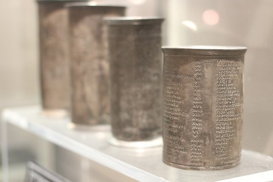
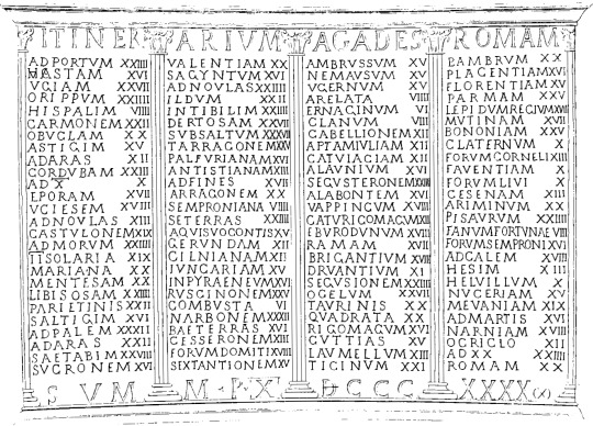
The most common geographical evidence we have from ancient Rome are catalogs of places. Roman maps, to the extent that they existed at all, were almost certainly rare and expensive. Ordinary Romans would not have had access to them. Instead, Romans would have used itineraria, which are just what they sound like — lists of the places a traveler might encounter along a certain road. Many itineraria are catalogs of the milestones that the Roman government placed on its road network.
One of the more famous itineraries is found on a set of cups that were excavated in Vicarello; they describe the route from Cadiz, Spain to Rome.


{WHF} {Ko-Fi} {Medium}
2K notes
·
View notes
Photo


Representation of the central tenet of the Orion correlation theory: the outline of the Giza pyramids superimposed over a photograph of the stars in Orion's Belt.
291 notes
·
View notes
Text

In ancient Egypt, maps were not as developed or commonly used as they are in modern times. However, the ancient Egyptians did have a basic understanding of geography and utilized certain visual representations to depict their surroundings. These representations were not as detailed or accurate as modern maps but served specific purposes.
One type of map-like representation used in ancient Egypt was called a “topographical list” or “descriptive list.” These lists documented important landmarks, cities, temples, and natural features along with their distances and directions from one another. They were often inscribed on temple walls or tomb reliefs and served as guides for religious or funerary processions.
Another form of representation was the “land register” or “estate map.” These maps depicted agricultural lands, indicating boundaries, fields, canals, and other relevant features. They were primarily used for administrative purposes, such as taxation and land management.
Ancient map of Egypt with names of towns and nomes in hieroglyphs
by Jeff Dahl
Read more
122 notes
·
View notes
Text


Honeymoon pt.5 - Shaaloani
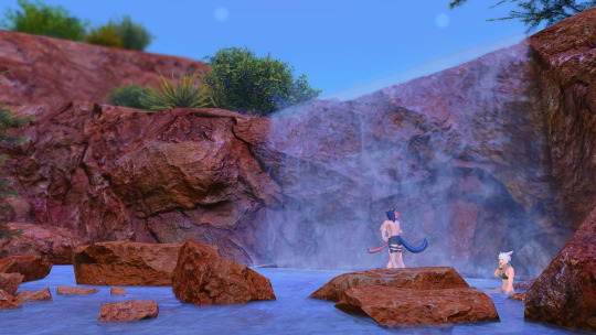
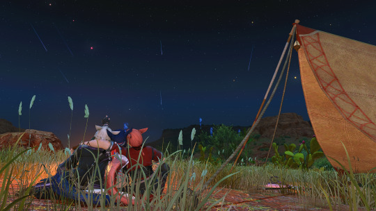
Aetherically, there are some striking differences; but in form alone the similarities to The Qitana Ravel are uncanny. That such ruins could exist both on the first and the source.... This has given me much to think about. Come, you two, let us freshen up and make camp before nightfall. Our adventures may continue tomorrow.
<<prev//next>>
#ffxiv#ffxiv gpose#wolgraha#wolshtola#y'shtola x wol#y'shtola rhul#g'raha tia#Arsay Nun#graharshtola#dawntrail#dawntrail spoilers#Tent mod is by magic mods on ko-fi#a minor canon adjustment for arsay and the gang#they get into tender valley while trying to do a treasure map lol#my idea here is that estinien and arsay bonded over doing a treasure map so he left one with the bar staff to surprise her with#when she inevitably stopped by#call it a wedding gift i suppose haha#as for the researcher - Arsay will bump into the guy at a slightly later date#the first tender valley image is a reference to my miqomarch2023 quitana ravel gpose set lol i wanted to do a fun call back#arsay just loves old ruins from ancient civilizations she thinks they are so cool!!#and yes I know shes holding her weapons like a viper but then doing a ninja attack its not important#i think making yshtola's dress took as much time as making all these gposes lol#it was worth it tho she's so cute in it#ill take some glamshots of it at some point lol
147 notes
·
View notes
Text
New update 27/09/24
The Captain of the Guard is playable!!! WOOOH! It was a big work, and currently only a very linear path is playable with the captain through Chapter 1, but I will add the rest of the choices later.
GOOD NEWS: It's the path that will definitely redeem poor Captain {instert-clever-insult} in the eyes of those who read the thief origin ❤️ So please give the captain a chance to do some good deeds to our resident little thief ✨✨✨
What the update includes:
Captain of the Theban Guard origin is playable! Lots of choices are still greyed out, but you can read through chapter 1 as the captain now.
16k words added to the demo, so that makes the total word count 185k.
I made a map! Well... I translated a map from my native language that I made ages ago for a similar book. It took me forever last week to find the English names for certain cities, and I'm not sure if some of them are correct or not but fuck it, it's good as it is. You can find the map in the Codex page in the Stats!
Did lots of bug and code fixes
Fixed some grammar and spelling errors
Next week, I'll add the missing choices in the captain route. Not sure if I'll have time to add all of them by the Friday update, but I'll try :)))
LINK TO DEMO
Hope you'll enjoy it! I'm especially interested to hear the opinion of those who've read the thief origin before 👀
❤️
#interactive fiction#weeping gods#update#ancient egypt#map#CHECK OUT THE MAP TOO!!!!#i'm super proud of it
109 notes
·
View notes
Text
i was thinking about regulus today, how he must have been a teenager, a boy. just a boy. so here’s fun facts about him

regulus wrote his door sign himself, so probably there was a day where he just decided to do this and put it up himself or get kreacher to help him, typical teenager behavior. harry thought this was something percy might do, reading harry pov always cracks me up and then the context is actually sad!!

he took pictures with his quidditch team and he was smiling with them, this shows us there was things that bought regulus joy

this is just him being a typical student hehe!!

grandeur means of high rank or of social importance and this implies his room looked like one. it also shows that sirius and regulus’ room were very different. it also says that regulus had the family motto “toujour pur” which means always pure, so someone painted that in his room when he was a child or it has always been there, intentionally placed. who made choices for his room decor? a teenager eager to please his parents or a mother who wanted to oversee the room decor, we’ll never know.

this is kreacher’s pov of how he views the situation!!

kreacher knowing regulus loved him, never doubting his love!!

what was regulus usually like? what do you think? does an 18 year old have a chance to discover all of his potential?

“his beloved regulus…”, “seeker who resembled sirius…” just kill me already!!

regulus never wanting his mother to know so she could be safe, even after how much she failed him, he loved her and wanted her safe!!

kreacher wearing the locket and fighting in the name of his beloved master!! they’re so precious :’(
#the marauders#the marauders era#marauders#regulus black#pandora lovegood#sirius black#remus x sirius#wolfstar#regulus deserved better#sirius and regulus#black brothers angst#the noble house of black#black family#noble and most ancient house of black#marauders headcanon#harry potter#harry potter and the deathly hallows#padfoot#the maraunders map#sirius orion black#walburga black#walburga's a+ parenting
74 notes
·
View notes