#Geographic Information Systems
Explore tagged Tumblr posts
Visit Tumblr Blog
Explore Tumblr blogs with no restrictions, modern design and the best experience.
Last Seen Tumblr Blogs


Fun Fact
Forty percent of Tumblr users are between the ages of 18 to 25.
Text
2 notes
·
View notes
Text
Welcome!
I don't know what to put here but I wanted to create a blog of my own.
I'll try to put something here, maybe some passion projects.
About me:
In college, Geodetic Engineering in the Philippines.
Studying to become a surveyor.
I'm a try hard graphic designer.
I'm trying to learn how to use QGIS, so I may post maps.
and maybe some graphic design i guess...
3 notes
·
View notes
Text
This video was taken by a man driving to his job during the 2018 wildfire season. 🔥😱
The relationship between humans and wildfires has evolved quite a lot throughout history, especially recently thanks to new technologies.
Indigenous peoples often used controlled burns as a land management technique, but as European settlers expanded into North America, a focus on fire suppression began to take root, especially following catastrophic events like the Great Fire of 1910, which scorched about three million acres across Idaho, Montana, and Washington.
This led to a "Smokey the Bear" approach, emphasizing the prevention of all forest fires.
In recent years, the frequency and intensity of wildfires have increased globally, with notable examples like Australia's 2019-2020 bushfire season and California's record-breaking fire seasons in 2020 and 2021.
The technology to combat wildfires has evolved rapidly since the early 20th century.
The primary tools used to be simple like shovels and axes, used to create firebreaks to halt the spread of fire.
In the 1930s, the use of aircraft for aerial reconnaissance began.
It later expanded to include dropping water and fire retardants, with the first recorded air-to-ground fire retardant drop occurring in 1955 in Los Angeles County.
In the 1960s and 1970s, the advent of more advanced communication systems, including radios, enhanced the coordination among firefighting crews.
As computing technology advanced in the late 20th and early 21st centuries, Geographic Information Systems and satellite imaging started playing an essential role in mapping fires and predicting their spread.
Most recently, drones have been employed for real-time monitoring, and machine learning algorithms are being developed to predict fire behavior more accurately.
#wildfires#Great Fire of 1910#Smokey the Bear#fire prevention#forest fires#bushfire season#air-to-ground fire retardant drop#aerial reconnaissance#Geographic Information Systems#satellite imaging#machine learning algorithms#drones#wildfire season
4 notes
·
View notes
Text
Making Maps now at makingmaps.substack.com
#Cartography#data analytics#Denis Wood#Geographic Information Systems#geospatial#information design#John Krygier#Making Maps#maps
0 notes
Text
Progression from Rough Draft in the Top Left Corner to Finished Example of Work in the Bottom Right!!!
0 notes
Text
Looking for GIS Remote Sensing Jobs? Join our dynamic team at JOBINGIS
Our goal is to find enthusiastic people who are skilled in remote sensing and geographic information systems (GIS). We are looking for someone with a sharp eye for geographical analysis, data interpretation, and problem-solving abilities. Examine fascinating chances to work on innovative initiatives, support urban planning, environmental monitoring, and other activities. With our help, expand your professional horizons. Put in your application right now to start a fulfilling career with JOBINGIS with GIS Remote Sensing Jobs.
1 note
·
View note
Text
Digital Twin in the AEC Industry – Advances and Challenges

Digital twins are dynamic, data-driven representations of real-world entities, providing a comprehensive view of their behavior, performance, and interactions. These virtual replicas are created by integrating various technologies such as Building Information Modeling (BIM), Internet of Things (IoT) sensors, Geographic Information Systems (GIS), and advanced analytics. By harnessing real-time data and simulation capabilities, digital twins enable stakeholders to visualize, analyze, and optimize assets throughout their lifecycle.
The Architecture, Engineering, and Construction (AEC) industry has long been seeking innovative solutions to streamline processes, improve efficiency, and enhance performance. In recent years, the advent of digital twins has revolutionized the way projects are conceived, designed, constructed, and managed. Digital twins, virtual replicas of physical assets, systems, or processes, offer immense potential for driving performance enhancements across the AEC industry. In this blog post, we will delve into the transformative power of digital twins and how they are reshaping the landscape of the AEC sector.
To get more insights- https://prototechsolutions.com/blog/role-of-digital-twins-in-aec-innovation/
#Architecture#Engineering#Construction#Digital Twins#Internet of Things#Geographic Information Systems#Building Information Modeling
0 notes
Text
Reading papers and stumbled upon a

#Geographic information systems (GIS) and entomological research: A review#from 2010#how many other people has it tripped up#i say things
914 notes
·
View notes
Text

63 notes
·
View notes
Note
YOU MENTIONED BOJANGLES!! IM SO PROUD THANK YOU FOR TGE REAL NC REPRESENTATION
WHY YES OF COURSE! I am always terrified of accidentally being insensitive (ocd tendencies who? where?) so I have kept NOTES from all the NC peeps sending me the lore bc I want to make it believable.
Trust that if you send me NC facts, I will keep them stashed away with my story notes bc I like to learn and also not write about stuff I don't know at all lol.
#Like even calling her grandparents meemaw and peepaw was a bit on the nose for me at first#despite it being a thing americans call their grandparents#(according to what I could find)#which they don't do at all where I'm from#like there's no cute names for them#it's just 'father's mother' ie. farmor or 'mother's mother' ie. mormor and so on#like our system is cute too but meemaw and peepaw is on another level and **mawmaw!!**#shout out to my mawmaws out there#asks and answers#sleep deprivation has reached the Free Tedtalk stage#also the Norwegian stuff for Matthias#though I feel a bit more informed with him bc Norwegians are closer to me geographically and culturally#We just name our things differently#like the cookies mentioned are 'sirup snipper' and they're pretty much brunkager but slightly to the left? I think?#Cheerwine and Bojangles I don't have the equivalent to#maybe red soda?#we have a soda here called just#red soda#it's very very red#I think it's supposed to taste like raspberry#but it just tastes red and like sugar - like you'll feel your bones vibrate levels of sugar#fun fact my friend told me; In HOO Dakota drinks Red Soda™ in the Danish translation bc we don't have Kool-Aid#I'm not actually sure I fully understand the point of Kool-Aid#I understand it's a powder#that you mix with water#to get#✨flavored water#but then you also mix in sugar...yourself?#but why didn't they include that in the packet?#like we have grenadine and ribena and stuff here
12 notes
·
View notes
Text
i work with a lot of cemetery data and names and things and sometimes ill just have to stop for a second and think to myself why, in the year of our lord 1879, did someone name their child WILLIAM WILLIAMS. like HELLO????
each stone makes me think a little about the persons life. i wonder what the guy who died Taisho 15 who was from Wakayama was like. probably a fisherman.
one time i did see a stone labeled "modern day sappho" and i think that person probably lived a decent life.
9 notes
·
View notes
Text
finally continuing to watch fantasy high because god hates me and the data i need for my GIS final is taking Forever to load
the file is so upsettingly large that it takes a minute to load anytime i try to do Anything
i'm trying to make it Smaller :(
15 notes
·
View notes
Text
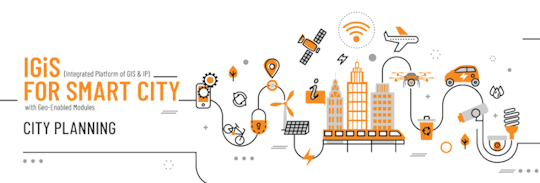
GIS In Our Daily Lives
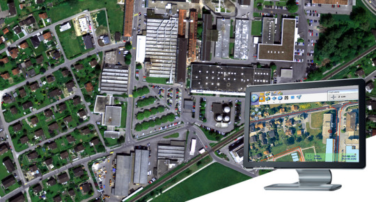
The involvement of Geographic Information Systems (GIS) in our daily lives is pervasive, influencing and enhancing various aspects across different sectors. The integration of GIS into everyday activities has become integral for decision-making, planning, and optimizing resources. GIS helps city planners and transportation experts to provide them with information like maps, satellite pictures, population statistics, and infrastructure data. GIS helps them make better decisions when designing cities and transportation systems that are sustainable and good for the environment.
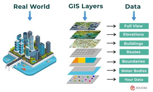
The following points elucidate the notable involvement of GIS in our daily lives:
Navigation and Location Services: GIS provides monitoring functions through the visual display of spatial data and precise geographical positioning of monitored vehicles, whereas GPS provides accurate, clear, and precise information on the position and navigation of a monitored or tracked vehicle in real-time and at the exact location.GIS is at the core of navigation applications and location-based services on smartphones. It enables accurate mapping, real-time navigation, and geolocation services, assisting individuals in finding locations, planning routes, and navigating unfamiliar areas.
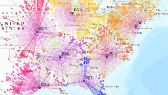
E-Commerce and Delivery Services: GIS software is a powerful tool for supply chain network planning. It helps determine the optimal location for distribution centers, warehouses, or other supply facilities. GIS is utilized in logistics and delivery services for optimizing routes, tracking shipments, and ensuring timely deliveries. E-commerce platforms leverage GIS to enhance the efficiency of their supply chain and last-mile delivery processes.
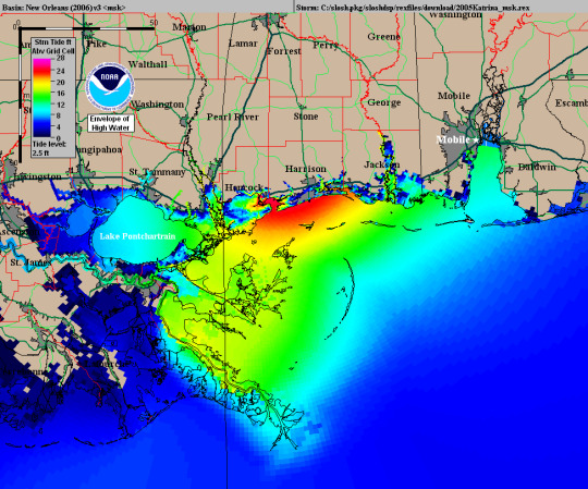
Weather Forecasting and Disaster Management: Many states are using GIS dashboard to monitor the rainfall across the state, on a real-time basis, from the data shared by rain sensors installed at various locationsGIS plays a crucial role in weather forecasting and disaster management. It assists meteorologists in analyzing spatial data, predicting weather patterns, and facilitating timely responses to natural disasters by mapping affected areas and coordinating emergency services.
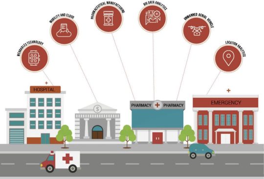
Healthcare Planning and Disease Monitoring: Geographic Information Systems enable the visualization and monitoring of infectious diseases. Additionally GIS records and displays the necessary information that health care needs of the community as well as the available resources and materials. GIS supports public health initiatives by mapping the spread of diseases, analyzing healthcare resource distribution, and assisting in the planning of vaccination campaigns. It aids in identifying high-risk areas and optimizing healthcare service delivery.
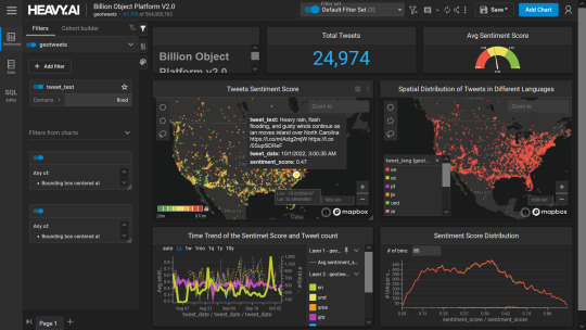
Social Media and Geo-tagging: GIS also helps in geotagging and other location related information in posts, it’s tools can map and visualize the spatial distribution of social media activity. This analysis can reveal trends, hotspots, and patterns in user engagement across different geographic areas. Many social media platforms incorporate GIS for geo-tagging, allowing users to share their location and experiences. This feature enhances social connectivity and facilitates the sharing of location-specific information.
Smart City Initiatives: The Geographic Information System (GIS) offers advanced and user-friendly capabilities for Smart City projects and allows to capture, store and manipulate, analyze and visualize spatially referenced data. It is used for spatial analysis and modeling. It is the cornerstone of smart city planning, enabling the integration of data for efficient urban management. It supports initiatives related to traffic management, waste disposal, energy consumption, and overall infrastructure development.
Education and Research: GIS is increasingly utilized in education and research for visualizing and analyzing spatial data. It enables students and researchers to explore geographic relationships, conduct field studies, and enhance their understanding of various subjects.
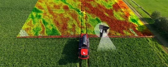
Agricultural Management and Precision Farming: Farmers leverage GIS to optimize agricultural practices by analyzing soil conditions, crop health, and weather patterns. Precision farming techniques, facilitated by GIS, contribute to increased crop yields and sustainable farming practices.
Real Estate and Property Management: In the real estate sector, GIS aids in property mapping, land valuation, and site selection. It provides real estate professionals with valuable insights into spatial relationships, market trends, and optimal development opportunities.
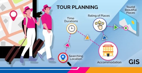
Tourism and Recreation: GIS enhances the tourism industry by providing interactive maps, route planning, and location-based information. It assists tourists in exploring destinations, finding attractions, and navigating efficiently.
The broad and varied involvement of GIS in our daily lives underscores its significance as a technology that not only facilitates geographic data analysis but also contributes to the efficiency, safety, and interconnectedness of modern society. As GIS applications continue to evolve, their impact on daily activities is expected to further expand and refine.
#gis#architectdesign#architecture#city#education#geographic information system(gis)#geographical indication
13 notes
·
View notes
Text
Today I actually got a call back from my uni!
#The course might actually happen. Need to just have a interview with the professor at the end of the month#which at least gives me a goal. It's basically a week away#dunno if quitting my job for a course in geographic information systems would be the best thing to do but I wanna do it#I might try to get 4 hour work day with this job but I doubt they'd take me up on that. I'm not that good of a worker
2 notes
·
View notes
Text


A Beautiful Mind (2001, Ron Howard)
18/06/2024
#a beautiful mind#film#2001#ron howard#mathematics#nobel prize#John Forbes Nash Jr#russell crowe#1947#princeton university#antisocial personality disorder#Formula#Doctor of Philosophy#game theory#adam smith#research#massachusetts institute of technology#Boston#cold war#the pentagon#Number#moscow#cryptography#Geographic coordinate system#united states#secret service#United States Department of Defense#classified information#russians#Suitcase nuclear device
2 notes
·
View notes
Text
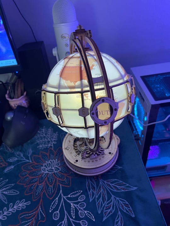
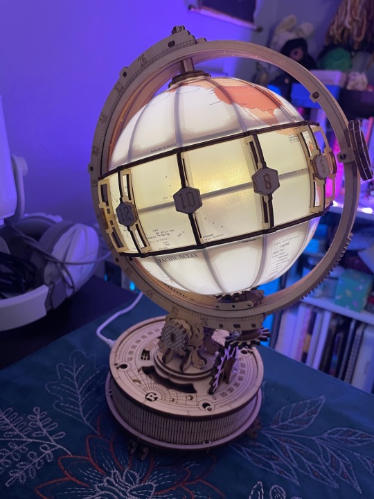
Finally got my globe model done 🥳
3 notes
·
View notes