#GIS
Explore tagged Tumblr posts
Text


RED VELVET, 10th Anniversary Under the Sun for Marie Claire Korea (July 2024), filmed by Humanofstudio
#red velvet#redvelvetinc#femaleidolsedit#femaleidol#femadolsedit#kgoddesses#ggnet#99#09#gis#*e#rv#rvedit
493 notes
·
View notes
Text


🎀☆.。.:* 🎀 ・°☆.。.:* 🎀 ・°☆.。.: 🎀 *・°☆.。 🎀 .:*・°☆🎀☆. 🎀 。.:* ☆ · ·
#⠀˚‧ ゚ 。゚ ۪ ࣪🎀🥬 ⊹︵︵︵ ⊹ ୨🎀🌈୧ ⊹ ︵︵︵ ⊹ 🎀🥬˚‧ ゚ 。゚ ۪ ࣪#˚🥞🎀 . ˚ ✦ ✿ . ˚ . ˚ ���. ˚ 🥞🎀. ˚✦ . ✿ ˚ 🥞🎀 * ˚ 🥞🎀 ✦ ˚ .#★ ₊ . ° . ⋆° .🌈🎀🥕(*・ω・)Princess⋆˚✿˖°°🧃๋࣭🍊多彩な☘️🎀#🧇🎀🌈 (🎀 ๑ ω ๑)ノ⌒*:・゚✧:*:・゚☆🍋🌺青 。・:*:・゚★黄色⭐️🌈絵の具₊˚𓇼#⭐️🎀🍊.。*゚ .*.。( ๑´꒳`๑)。.。: *🍊🎀⭐️#my gifs#gis#sanrio#sanriocore#pinkcore#jojifuku#my melody#my sweet piano#pastelcore#otakucore#aesthetic#kawaii#webcore#animecore#weebcore#neetcore#kawaiicore#gif
247 notes
·
View notes
Text
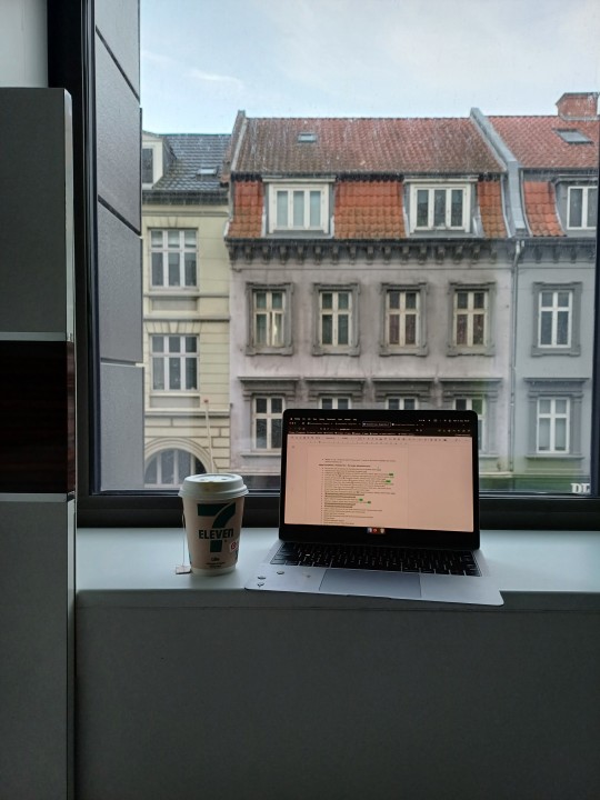

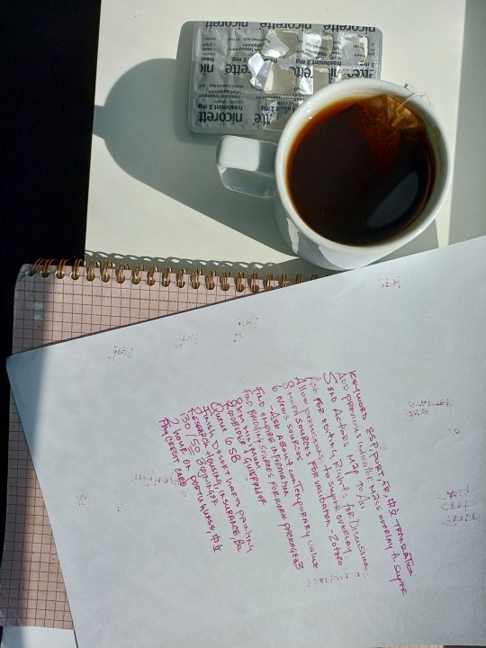
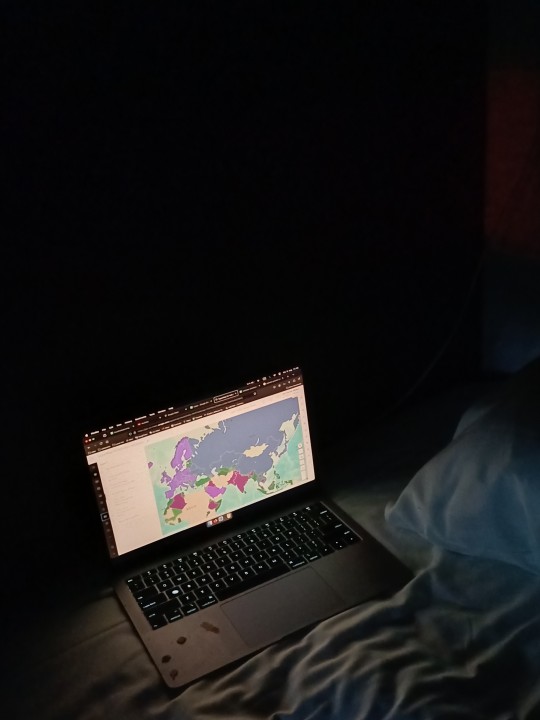
On the food poisoning diet 🥰 Super ripe bananas and white bread 🍞 😍 Aside from trying to keep my gut from killing me, I can explain a little of my research gig: right now I've been running map analyses to test the hypothesis that UNESCO heritage sites on international borders are not just products of contested territory but possibly constitutive of shared identity. They tell us all at once about land use, history, population density, conflict, eurocentrism, commerce, diversity, etc.! On an academic note, my research advisor has sent me multiple emails to apply for the 4+4 Denmark PhD scheme and I am trying to remain strong, but flattery really is persuasive 😂 And they pay so well here... spray me with a water bottle please 🙏
#gradblr#studyblr#studyspo#study motivation#researchers#cartography#GIS#geography#light academia#food
86 notes
·
View notes
Text

Italian Gruppo intevento speciale (GIS) carabinieri.
Unknown (likely state media), <2020
22 notes
·
View notes
Text
Could we be getting a GIS nerd in the second-highest office in the US?
54 notes
·
View notes
Text


WONWOO 'MAESTRO' MV Action Practice Sketch
74 notes
·
View notes
Text
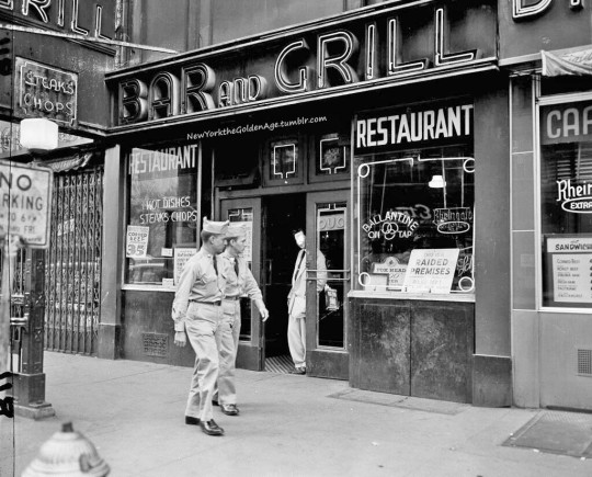
A couple of GIs pass by a restaurant and bar in Times Square with a sign in the window reading. "This is a raided premises," September 24, 1954. The police department was carrying out planned raids in this area, where servicemen mingle with other visitors.
Photo: Carl Nesensohn for the AP
#vintage New York#1950s#Carl Nesensohn#raided premises#raided bar#raided restaurant#Times Square#soldiers#1950s New York#GIs#Sept. 24#24 Sept.#police raids
44 notes
·
View notes
Text
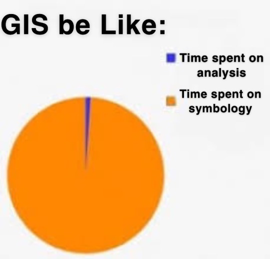
why is the default symbology the ugliest thing ive ever seen like Who want a map that looks like That
54 notes
·
View notes
Text
Are any of my mutuals scientists who are ALSO good with kids?
Last night I ran a booth with my university's geoscience club at an elementary STEM night, and the kids were... less than impressed with my setup.

I thought the fluffy cloud diorama and bigfoot sightings map would be interesting to kids, but I guess not.
The question is, how in the world do you get kids interested in the world of climate science and GIS?? How can I make my booth more fun for the next event (ideally on a budget 😬)?
#geoscience#climate science#geographic information systems#gis#stem#i feel so old. what are the kids into these days
10 notes
·
View notes
Text
i dont know if this is something anyone here needs but i just found this tutorial to get inaturalist observations into arcgis layers and it was so easy, i thought this was super advanced wizardry i wasnt ready for yet
30 notes
·
View notes
Text
Urban Renewal vs. Public Housing: Lessons from Baltimore and Pruitt-Igoe
Urban renewal and public housing have played a central role in shaping American cities, often with conflicting results. While urban renewal aims to modernize and revitalize decaying cityscapes, it frequently displaces long-standing communities, exacerbating socioeconomic inequalities. Conversely, public housing has been used to provide affordable homes for low-income populations, yet poor planning and neglect have led to segregation, poverty concentration, and failure.
This article explores these urban planning challenges through two significant case studies: Baltimore’s Inner Harbor renewal project and the Pruitt-Igoe public housing complex in St. Louis. These examples reveal the successes and failures of 20th-century urban planning, offering critical lessons for the future of equitable city development.
The Case for Urban Renewal: Baltimore’s Inner Harbor
In the mid-to-late 20th century, Baltimore launched one of the most ambitious urban renewal projects in the U.S., aimed at revitalizing its deteriorating downtown and waterfront areas. The redevelopment of Charles Center and the Inner Harbor sought to attract businesses, tourists, and high-income residents back into the urban core.
✅ Economic Growth & Tourism Boost:
The Inner Harbor was transformed into a vibrant commercial and cultural hub, with attractions like the National Aquarium and Maryland Science Center.
New retail, office spaces, and residential developments increased property values and business investments.
✅ Mixed-Use Development & Walkability:
The project embraced modern urban design principles, making the Inner Harbor a 24-hour activity zone instead of a purely business district.
The redevelopment created public spaces, waterfront promenades, and green areas, making the area more livable and attractive.
However, despite these successes, Baltimore’s renewal came with a price—one paid disproportionately by lower-income residents.
📉 Displacement & Gentrification:
The rising cost of living forced many working-class and minority residents out of the area.
Long-standing communities were pushed to the city's margins, leading to increased inequality and social tensions.
📉 Who Really Benefited?
Many of the jobs created by urban renewal did not go to local residents but rather to suburban commuters and outside investors.
The benefits were concentrated in wealthier, predominantly White areas, deepening racial and economic disparities.
Lesson: Urban renewal can drive economic growth, but without equitable policies, it risks displacing the very communities it aims to uplift. Sustainable urban planning should incorporate affordable housing, job creation, and community input to ensure benefits reach all residents.
The Failure of Public Housing: St. Louis’ Pruitt-Igoe Disaster
While Baltimore’s renewal focused on economic revitalization, St. Louis’ Pruitt-Igoe public housing complex is a cautionary tale of poorly executed housing policies. Built in the 1950s, Pruitt-Igoe was meant to be a modern, affordable housing solution for low-income residents. However, within two decades, it became one of the most infamous failures of public housing in America.
📉 Economic & Social Isolation:
As St. Louis lost manufacturing jobs and white flight accelerated suburbanization, Pruitt-Igoe’s predominantly Black residents faced growing unemployment and poverty.
Many residents struggled to afford rent, leading to funding shortages for maintenance and services.
📉 Poor Urban Design & Maintenance Neglect:
The "towers in the park" design created isolated, unsafe spaces that became hotspots for crime.
Elevator breakdowns, vandalism, and lack of maintenance made the complex nearly uninhabitable.
📉 Demolition: The End of an Era
By the late 1960s, Pruitt-Igoe had become a symbol of public housing failure.
In 1972, just two decades after its construction, the federal government demolished the entire complex—a moment often regarded as the death of high-rise public housing projects in the U.S.
Lesson: Public housing cannot succeed without long-term economic investment, proper maintenance, and integration into the broader urban fabric. Instead of isolating low-income populations in concentrated developments, policies should prioritize mixed-income housing, economic support, and community services.
Urban Planning Lessons for the Future
The contrasting stories of Baltimore and Pruitt-Igoe illustrate the complex challenges of urban development. Both cases emphasize the need for urban planning approaches that balance economic development with social equity.
✅ Urban Renewal Should Include Community-Driven Growth
Economic development should not come at the cost of displacing vulnerable communities.
Cities must include affordable housing policies, local hiring initiatives, and resident engagement in renewal projects.
✅ Public Housing Must Be Integrated, Not Isolated
Instead of large, isolated housing blocks, urban planners should invest in mixed-income, mixed-use developments that connect residents to jobs and services.
Public housing policies should prioritize maintenance and long-term sustainability rather than quick-fix solutions.
✅ Equitable Urban Planning Requires Thoughtful Policy
Planners and policymakers must address historical inequities in housing and economic access.
Transit, education, and workforce development programs should accompany any large-scale urban redevelopment effort.
Conclusion: Rethinking Urban Development for the 21st Century
Urban renewal and public housing remain central to urban development debates today. Baltimore’s Inner Harbor shows the power of economic revitalization—but also its risks of gentrification and exclusion. Pruitt-Igoe, on the other hand, serves as a lesson in the failure of isolated, underfunded public housing projects.
For cities to create sustainable, inclusive growth, planners must move beyond outdated models and embrace community-centered, equitable policies that ensure all residents benefit from urban progress.
#smart growth#pruittlgoe#public housing#community development#housing inequality#gentrification#baltimore#city development#economic development#gis#portfolio#strong towns#urban planning#sundusbhatti
13 notes
·
View notes
Text
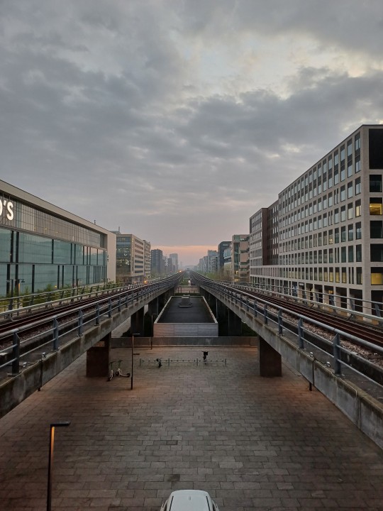

yes i have no bed frame and my rain drenched clothes on the floor but a few hours ago I found out I got a research position on a UNESCO-funded project! I'll be mapping border-split heritage sites and borderland shared practices for a less nation-bound understanding of shared culture
32 notes
·
View notes
Text

Members of the Italian Gruppo intevento speciale (GIS) carabinieri.
Unknown (likely state media), 2018
11 notes
·
View notes
Text

Happy GIS Day!
(By @ pokateo_maps on twitter)
15 notes
·
View notes
Text
Moooom, I want a map of Cyprus!
We have a map of Cyprus at home.
The map of Cyprus at home:
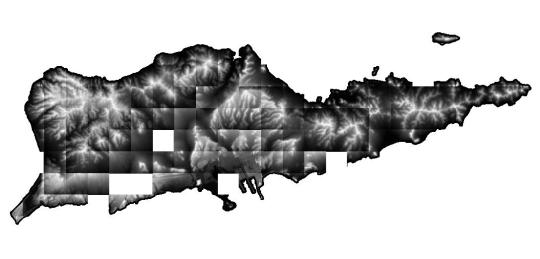
(This is actually NOT the map of Cyprus. It's not even a map yet to be honest, it's all just data at this point.)
7 notes
·
View notes