#Appennino tosco-emiliano
Explore tagged Tumblr posts
Visit Tumblr Blog
Explore Tumblr blogs with no restrictions, modern design and the best experience.
Last Seen Tumblr Blogs


Fun Fact
Users from the US are the majority of Tumblr visitors.
Text
Filmato gentilmente concesso dal cugino che abita nell' Appennino tosco-emiliano. Un bellissimo esemplare di lupo.
65 notes
·
View notes
Text
C'era la neve quel giorno di Bianca Andreina Gae - Un romanzo di amore, perdono e resistenza. Recensione di Alessandria today
Una storia di legami indissolubili e di sfide personali sullo sfondo di un dramma familiare
Una storia di legami indissolubili e di sfide personali sullo sfondo di un dramma familiare Recensione: Nel romanzo C’era la neve quel giorno, Bianca Andreina Gae ci trasporta in un’emozionante storia di resistenza e relazioni familiari. Il libro affronta la dolorosa realtà dell’usura, esplorando il rapporto complesso tra Gerardo e sua figlia Diana. Tra il negozio di ceramiche del padre e il…
#amore e perdono#Appennino Tosco-Emiliano#Bianca Andreina autrice#Bianca Andreina Gae#C&039;era la neve quel giorno#Ca’ Ansaldo#drammi familiari#legalità e giustizia#legami familiari#libri di narrativa#libro 2024#lotta contro l’usura#monte Lulla#narrativa contemporanea#narrativa di cambiamento#narrativa di crescita personale#narrativa drammatica#narrativa intensa#narrativa introspettiva#narrativa realistica#relazioni padre-figlia#resilienza#resistenza alle avversità#riflessioni sul perdono#Riflessioni sulla vita#Romanzo#Romanzo commovente#romanzo di formazione#romanzo di relazioni#romanzo di speranza
0 notes
Text
Le Strade Transappenniniche del Granducato di Toscana: ss 63 del passo del Cerreto
Massa – Aulla – Fivizzano – Passo del Cerreto – Reggio Emilia L’epoca dei Lorena nel Granducato di Toscana fu caratterizzata da una serie di importanti progetti infrastrutturali che cambiarono radicalmente il sistema delle comunicazioni della regione. Le grandi strade transappenniniche rappresentano uno degli esempi più significativi di come la viabilità fosse considerata non solo essenziale per…

View On WordPress
0 notes
Text
Passo dell'Abetone - Libro Aperto
Bellissima escursione a confine tra Emilia e Toscana. L'arrivo in crinale regala un panorama spettacolare. Partenza da Passo dell'Abetone (1388 m) e arrivo a Libro Aperto (1937 m).
Tipologia di percorso: A/R Distanza: 11,00 Km Difficoltà: Facile Ascesa: 724 m Discesa: 721 m Alt. Max: 1937 m Alt. min: 1388 m Tempo Medio: 4:45 h Si parte dal Passo dell’Abetone (1388 m) proprio in centro al paese. Una volta parcheggiata l’auto, ci dirigiamo verso le due Piramidi che anticamente segnavano il confine tra Emilia e Toscana, e imbocchiamo la strada che conduce verso…

View On WordPress
#Abetone#Appennino#appennino modenese#Appennino Tosco Emiliano#hiking#libro aperto#Passo dell&039;Abetone#rifugio la casetta di lapo#sentieri#sentieri di confine#trekking
0 notes
Text
Cascata di Premilcuore, Appennino Tosco-Emiliano.
6 notes
·
View notes
Text
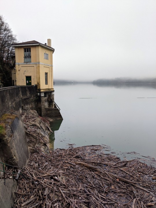
[Appennino Tosco-Emiliano]: Ponti a confronto
Antico Ponte sul Cedra (Monchio delle Corti, loc. Lugagnano) Agosto 2023 4×5″ FOMA Retropan Soft 320, Chamonix 45F2, developer Foma Retro Special stock, iso @160

View On WordPress
0 notes
Text
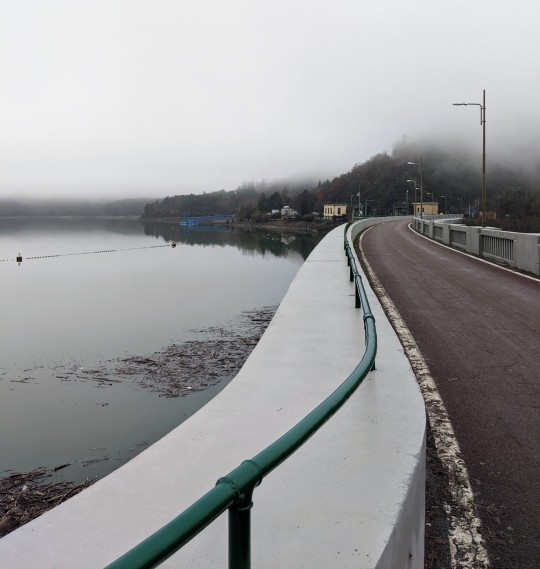
#Les revenants#By#mogwai#Plays softly in background#Lago di suviana#Appennino#Appennino Tosco Emiliano#Italia#Italy#photographers on tumblr#italian photographers#Nebbia#Fog#Foggy day
142 notes
·
View notes
Text
E al di là della notte mi aspetterà spero il sapore di un nuovo azzurro. Nazim Hikmet
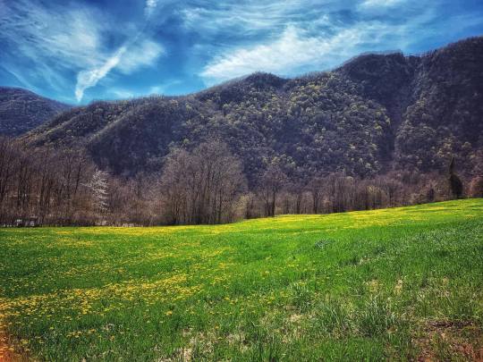
Il paesaggio lungo la valle del Secchia
2 notes
·
View notes
Photo

Dal Lago San Giovanni Gualberto (Doganaccia) alla Croce Arcana - Febbraio 2019.
0 notes
Text
Hiking in The Apennines [Part 1]
For Alex’s birthday at the beginning of September we decided the best way to celebrate was to get out of the apartment and to get as far away from buildings, cities, and people as we could reasonably do in a day trip.
Alex wanted panoramas, views and nature. So we headed to the Appenino Tosco-Emiliano National Park.
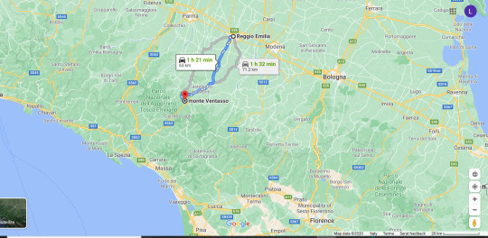
The Tuscan-Emilia Apennines are just an hour and half west of us making it an easy day trip with a friends car. Now, like all other Italian hiking trails, there is little-to-no useful information online about the hiking trails in these mountains. There is a bit more than usual if you go to the parcoappenino website they give you some information about what’s available. However, their Italian and English versions of the websites are actually completely different with different trails! And while I was looking for a short-ish, manageable hike on the Italian version I had trouble finding anything. When I switched to the English version of the site, lo-and-behold I found exactly what I was looking for...

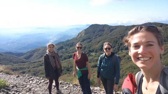
Anyway there’s a this lovely little loop from Lago Calamone up to the top of Monte Ventasso and down again only 5k should take about 3hrs! After doing a few more very specific google searches and finding a couple of blog posts I decided this was the loop for us! So we headed with our friends Alyssa and Raffaella to Lago Calamone.
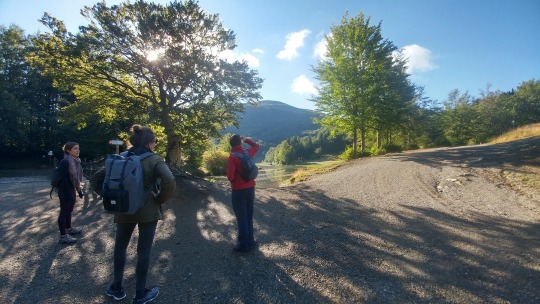
Upon arriving at the lake you’ll actually park about half a mile away in the parking lot of the hotel/restaurant. The walk to the lake is along a gravel road that’s very easy and pleasant and then you arrive at the lake itself.
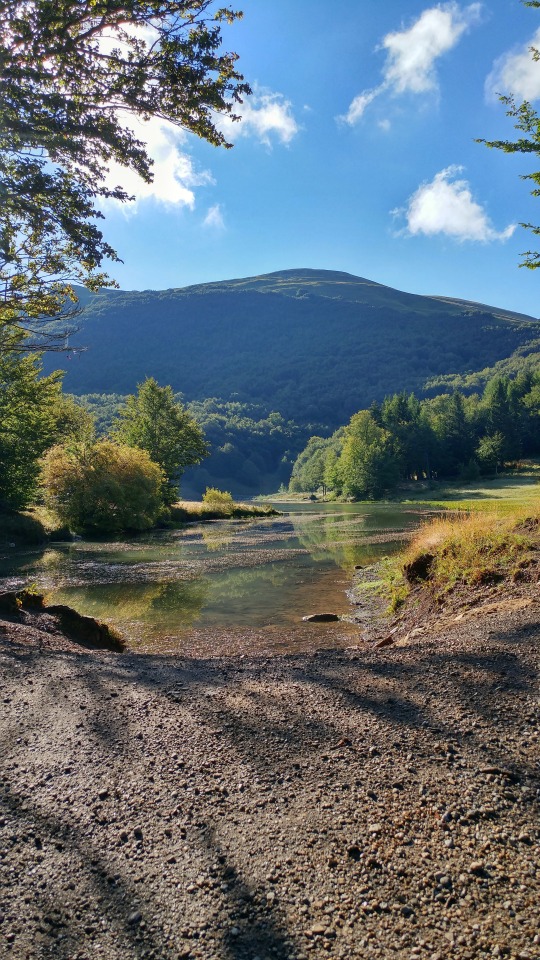
It’s an incredibly peaceful sight and immediately I knew we made the right decision. Once you reach the lake you’ll have the choice of going left or right.
Since the trail is a loop it technically doesn’t matter. But heading to the right will take you up a fairly steep path straight to the top of the mountain. Heading to the left will take you on a more windey path around the other side of the mountain. Not wanting to repeat our stair-climbing hiking adventure in Liguria we headed to the left on trail 663 towards Bivacco S. Maria Maddalena. Just as we left the lake we did have to climb quite a steep cobbled hill.
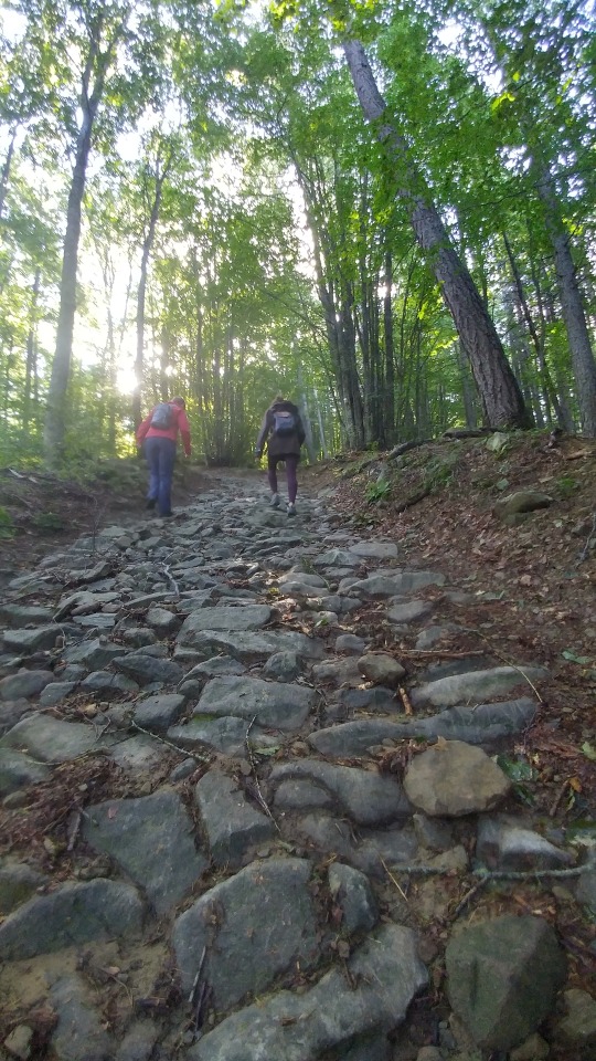
Following the signs for we entered a beautifully green, lush forest.
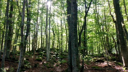
With huge trees, incredibly quiet and peaceful and no other people around it was really nourishing to walk along the soft trail.

The trail climbs a little bit and at the top of the hill you are met with a sign post. It points to the left with two names we hadn’t heard of in our research. Very helpfully someone wrote “No Bivacco S. Maria” in sharpie.

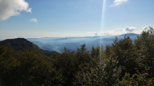
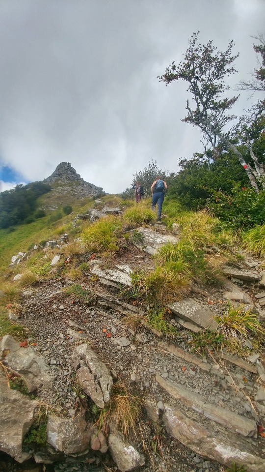
We knew we were heading to the Bivacco and so turned to go in the opposite direction. There was a sign indicating that the trail might be closed and dangerous. But the sign was posted in 2015 and the trail wasn’t blocked off in any way so we decided to proceed with caution and if it seemed dangerous we could always turn back. As we left the forest and were spat out on a steep-ish hillside we were met with spectacular views.
We also found out why the trail had been closed. There had clearly been a rockslide.But since there were four of us and the slide wasn’t very unstable or steep, we carefully made our way across.
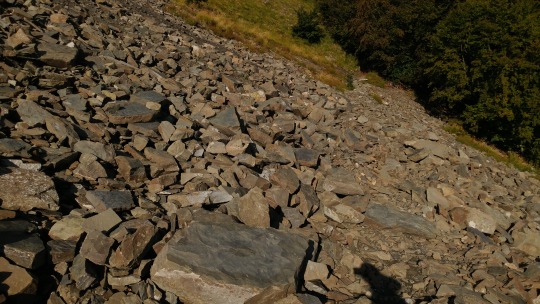
Easily reaching the other side we continued to marvel at the valley below and walk along the hill
until we finally reached Bivacco San Maria Maddalena. A refuge and church it is thought to have been the destination of an ancient woman’s pilgrimage taking place at the end of July.
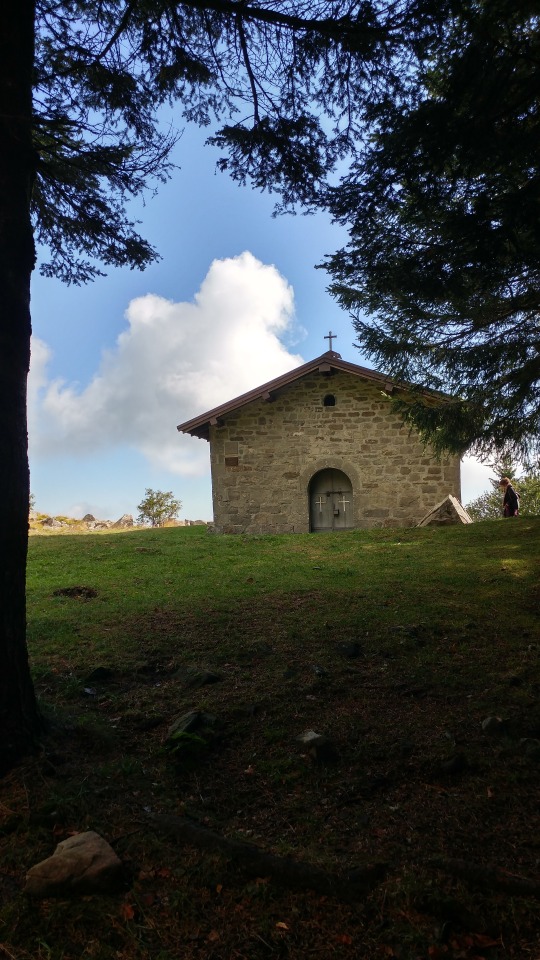
Now it is a small church overlooking the valley and hills beyond.

We paused here (2k into the trip) to admire the scenery, and drink some water before our real climb up trail 661 and to the top of Mt. Ventasso began.
#hiking#trekking#appennines#appennino#italy#italia#outdoors#nature#trails#hiking in italy#travel#travelblog#travelblogger#tblog#tuscany#emilia-romagna#reggio emilia#tosco-emiliano#mountains#lake#adventure#wanderlust#traveling italy
1 note
·
View note
Photo

Sentiero appenninico by Mattia Querci
Appennino Tosco-Emiliano National Park, Tuscany, Italy
#italy#europe#travel#nature#landscape#vertical#sunset#dusk#twilight#appennino tosco emiliano national park#tuscany#southern europe#mattia querci
6 notes
·
View notes
Text
Linea Gotica e Appennino
Torretta di Panther su una fortofocazione a Santa Lucia L’Appennino tosco emiliano e tosco romagnolo attraversano la penisola diagonalmente e separano l’Emilia e la Romagna dalla Toscana e dalle Marche; sono delimitati, a ovest dal Passo della Cisa, dove i rilievi giungono fin sulla costa tirrenica, e a est dal Passo di Bocca Trabaria, da dove degradano in crinali minori fino a raggiungere il…

View On WordPress
#Appennino tosco-emiliano e linea Gotica#Linea Gotica#Linea Gotica in Toscana#Seconda guerra mondiale
0 notes
Text
[Appennino Tosco-Emiliano]: Passo del Lagastrello
Esplorando la zona del passo del Lagastrello (MS) e il vicino lago Paduli, siamo a circa 1100 metri slm nel cuore dell’Appennino Tosco-Emiliano, mi è sembrato di entrare in una bolla sospesa, senza tempo, dove è facile instaurare una relazione con il luogo molto forte e emozionante. Girando con il banco ottico qualche visione ho desiderato fortemente registrarla. Intanto in bianco e nero un paio…

View On WordPress
0 notes
Text


#Monte Giovo#Toccata e fuga#Appennino#Appennino tosco emiliano#Italia#Italy#Montagna#mountain#Trekking#hiking#Camminare#Nature
117 notes
·
View notes
Photo

...where i am connected with everything.
Alessandro Niccolai Photographer
Website - Facebook - Tumblr
#forest#trekking#horse#art#photography#nature#photographer#alessandro niccolai#appennino#tosco emiliano#italy#italia#fotografia#fotografo#mountains#hills#montagna#natura
39 notes
·
View notes
Photo

Dal Lago San Giovanni Gualberto (Doganaccia) alla Croce Arcana - Febbraio 2019.
0 notes