#West Central Plateau
Explore tagged Tumblr posts
Video
Blue Skies for a Backdrop of a Raven in a Tree (Bryce Canyon National Park) by Mark Stevens Via Flickr: A setting looking up and to the northwest at a raven perched high on a tree branch. This was while walking the Rim Trail in Bryce Canyon National Park.
#Aquarius Plateau#Azimuth 321#Bird#Bird on Tree#Blue Skies#Blue Skies with Clouds#Bryce Amphitheater#Bryce Canyon#Bryce Canyon National Park#Central Utah Plateaus#Cloud Wisps#Clouds Wisps#Colorado Plateau#Day 4#Desert Landscape#Desert Mountain Landscape#Desert Plant Life#DxO PhotoLab 5 Edited#Eastern Edge of the Paunsaugunt Plateau#Evergreen#Evergreens#High Desert#Intermountain West#Landscape#Landscape - Scenery#Layers of Rock#Lodgepole Pine#Looking NW#Nature#Nikon D850
2 notes
·
View notes
Note
when it comes to the Isan region, does the average Thai person care whether or not they side with Laos or Thailand? due to the past wars, it seems like the people of the Korat plateau have their own identity—yet from books I read, many of the younger generations feel stuck whether claiming to be “Thai” or “Lao” and in doing so only speak central Thai.
another question is are all the Russians and Chinese people in Thailand all that bad like how the media portrays them? ex: defecating in public, pushing and shoving, public drunken fights, etc. whether you’ve personally dealt them or not, do you ever wish they either not visit all together or just be very cautious and respectful of local life? 
(I think) my final question is about westernized Thais. While many foreigners visit Thailand for either cultural reasons, religious, retiring, food, sex tourism, surgeries, etc., there are many westernized Thais who have moved/visited Thailand. do you think natives sees them as lesser than or as another foreigner? are they treated differently despite having mannerisms appearance, mindset, etc. that’s more associated with the west?
hi, thanks for the questions
I may not be the best person to ask this bc I'm a Chinese descendant who grew up in central Thailand all my life haha. I can say at least from my friends they don't really care, they are just Isan and consider themselves Thai bc they are born in Thailand (and vice versa). They speak central Thai to people from other places only bc that's the universal one (as other regions also do). I don't think they have to pick a "side" considering we're not in a conflict. idk I've never heard of that before.
I've not had bad experiences with them personally. I've heard it's bad in tourist spots but that's just typical tourist behavior (hell most of the time it's USAmerican tourists that gets in trouble). So not as much as they're portrayed but they DO do that. And yes I hope they still visit but be more respectful, not just Russians and Chinese but everyone
I have an aunt who moved to USA to be a professor for about 10 years before coming back, and I can guarantee they're not treated any differently, they'll always be Thai. If anything people praise and envies them for having the money/opportunity to move aboard haha
hope those were good enough answers ! :]
28 notes
·
View notes
Photo
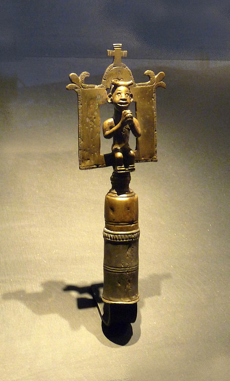
Kingdom of Kongo
The Kingdom of Kongo (14-19th century CE) was located on the western coast of central Africa in modern-day DR of Congo and Angola. Prospering on the regional trade of copper, ivory, and slaves along the Congo River, the kingdom's wealth was boosted by the arrival of Portuguese traders in the late 15th century CE who expanded even further the slave trade in the region. Kongo kings were converted to Christianity but relations with the Europeans deteriorated as each side attempted to dominate the other. Civil wars and defeats to rival neighbouring kingdoms finally saw the Kongo state collapse in the early 18th century CE. The Portuguese reinstalled the position of the Kongo monarchs, and the state limped on in name only well into the 19th century CE but the kingdom's days as the strongest power in west-central Africa were now but a distant memory.
Formation & Territory
Located on the western coast of central Africa and south of the Congo River (formerly known as the Zaire River), the kingdom arose in the late 14th century CE following the alliance of several local principalities which had been in existence since the second half of the first millennium CE. Kongo, dominated by Bantu-speaking peoples, had its capital at Mbanza Kongo - known to the Kongolese as Banza, meaning 'residence of the king' - which was located on a fertile and well-watered plateau just below the western end of the Congo River. The kingdom expanded its territory further by a gradual process of military conquest, probably motivated above all by a desire to acquire slaves. At its peak in the 15th and 16th century CE, the kingdom controlled some 240 km (150 miles) of the coast from the Congo River in the north to just short of the Cuanza River in the south, and spread some 400 km (250 miles) into the interior of central Africa up to the Kwango River.
Continue reading...
40 notes
·
View notes
Text
Dune At Home: The First Dornish War, Part 5
Thanks again to those that have followed this series; if this is your first time encountering it, check out the master post or the series on AO3 if you prefer!
This section was not originally planned, but after analyzing Orys Baratheon's march down the Boneway and the Dornish raids that take place later in the First Dornish War, I believe the Dornish Marches warrant greater attention. As result this part will come off as combination of Part 1 and 4, establishing a worldbuilding baseline for the Dornish Marches and assessing the tactics and operations utilized in the Marches during the war. Similar to the Dornish worldbuilding, I have few issues with what we are told and can infer about the Marches from George's writings; the problem again is that this worldbuilding ends up being sacrificed or ignored for the sake of the plot.
Starting with the worldbuilding of the Marches, it is helpful to note that George's inspirations for Dorne included Wales and Spain, and these areas seem to influenc the portrayal of the Marches. The maps we have of the south and of Dorne, the Reach and the Stormlands in particular situate the Marches on the northern ridges of the Red Mountains, roughly extending from Horn Hill to Stone Helm. The glimpses we get of the terrain suggest that the topography is more varied than in the Dornish parts of the Red Mountains: While Sam thinks about Horn Hill being located within heavily wooded foothills in AFFC, and one of Stannis' men remarks to Jon that he thought it was cold up in the Marches in ADWD, characters throughout the books speak of marching down on the Marches from Dorne while TWOIAF describes the Marches as "a vast expanse of grasslands, moors, and windswept plains" extending north and west beyond the hills that "rise hard and wild, pushing against the sky until they give way to the Red Mountains."
The descriptions confirm that the Dornish Marches comprise a variety of terrain from lowlands leading up to hills and mountains near the Dornish border. The Dornish border and the lands of the Stony Dornish appear to consist of the highest peaks of the Red Mountains and the ridges and hills that form its southern face, extending down to the greenbelt around Yronwood before giving way to the western desert. This helps to explain why the Stony Dornish are described in TWOIAF as having "a history as savage as that of the Mountain Clans of the Vale" despite their close proximity to the Marcher lords, as the more extreme terrain on the Dornish side of the border would have produced political and cultural fragmentation among the First Men that settled there.
The landscape of the Marches as portrayed is very comparable to that of Wales and northern Spain: Between the rainy climate and the widespread uplands and mountains, agriculture in Wales was largely confined to small areas on the periphery, with grassland and forest dominating pre-modernity; crop based agriculture was more prevalent in northern Spain but the Cantabrian and Pyrenees mountains of the far north sported a similar ecology of grass and woodlands, while the Meseta or central plateau is fairly dry and reliant on irrigation. Moreover, Sam's recollections of Horn Hill and Yandel's description of the Marches in TWOIAF as dominated by plains and grassland suggest another commonality between Wales, northern Spain and the Dornish Marches, that being an economy centered on pastoralism/animal-husbandry.
We have indications that pastoralism is widespread on the Dornish side of the border, from the infamous 'sheep wall' in the First Dornish War to the numerous references to goat paths in the Boneway, and goat paths leading into the Reach which are mentioned by F&B in the context of the First Vulture King. Forests and pastures were ubiquitous in Medieval Wales and especially High to Late Medieval Spain, where herding cattle and sheep was important to the local economies alongside goats, pigs, and especially in Spain, horses. This does not mean that crop-based agriculture would not be practiced throughout the hills and valleys of the Marches, or along the Slayne river where runoff and the river itself would aid irrigation. However, the widespread undeveloped land implied by Yandel's description does suggest that pastoralism is central to the Marcher economy, as it was for George's historical influences.
Beyond the geography and what we can infer about the Marcher economy, there are further indications from George's writing that Wales and Spain were inspirations for the Marches as much as they were for Dorne. The most obvious Welsh connection is the use and prominence of the Longbow in the Marches and the reputation of Marcher bowmen. While aboard the Cinnamon Wind in AFFC, Sam ranks "Dornish yew" bows second only to the renowned goldenheart bows of the Summer Islanders; the Tourney of the Hand in AGOT demonstrates this when the three finalists of the archery competition are Jalabhar Xho of the Summer Isles and Ser Balon Swann and Anguy from the Marches, with Anguy being the winner. Interestingly enough, the 12th century chronicler Gerald of Wales wrote of the southern Welsh being renowned for their archery and the northern Welsh for their spearmen, which calls to mind the association of the Marchers with their longbows and the Dornish with their spearmen throughout the books. Northern Wales also remained independent longer than the South, so despite the reversed geographies I believe the influence remains strong.
Another area where Wales and northern Spain may have influenced George's portrayal of the Marches is the significance of music, particularly Marcher ballads. The length of these ballads is remarked on throughout the books, in particular when Arya comes to the Brotherhood Without Banners and meets Anguy, and TWOIAF also speaks highly of them. Portugal, northern or Christian Spain, and southern France were the centers of the Medieval troubadour tradition in Europe, generating poetry and song about the deeds of knights and courtly love. Wales itself had a long tradition of music which extolled the virtues and deeds of British warriors, and were as renowned in the British isles as the troubadours of continental Europe. According to Sean Davies' War and Society in Medieval Wales, one of the privileges of membership in a prince or noble's retinue (Penteulu) was "a song from the bardd teulu whenever he requested it," bardd teulu being a member of the retinue under Welsh law who both fought and composed ballads and music for his comrades (War and Society, pg. 35, 43).
The significance of castles in the Marches, while it's to be expected given the frontier status of the region, is a further area of comparison with Wales and the Welsh Marches and northern Spain. Castle building and other fortifications were an essential part of Anglo-Norman strategy for expanding the Welsh Marches, while the county and later kingdom of Castile in northern Spain derived its name from the extensive fortifications north of the Douro river valley which were built to defend against Arab and Moorish incursions. TWOIAF speaks highly of the Marcher Lords castles but we know of numerous smaller castles and fortifications as well, as Tyrion tells Cersei that he has offered some castles on the border to Prince Doran as part of Myrcella's marriage alliance in ACOK. Even if he did not have all of these connections in mind when he was crafting the world, the information we are provided about the Marches in the books and what we can infer from that information points towards Welsh and Spanish historical influences extending outside Dorne to the Marches.
While we're still on the subject of George's inspirations for Dorne and the Marches, one inspiration that requires scrutiny is that of 'guerrilla warfare.' George was asked about Welsh influences on Dorne in 2008 during a Q&A forum chat with Asshai.com, replying that the Welsh resisted English conquest for centuries "not by defeating the English in large battles, but by melting away into their mountains and hills and waging campaigns of small scale resistance," comparing this to contemporary guerrilla warfare and terrorism, stating that the Dornish "used the same approach." Understanding how this pre-conception affects his portrayal of the First Dornish War and the fighting in the Marches requires an understanding of how these 'guerrilla' methods were utilized during and before the Middle Ages and the extent of their use.
In fairness to George, TWOIAF provides ample evidence of the Dornish waging non-guerrilla warfare: Samwell Dayne sacked Oldtown prior to the reign of Gyles I Gardener; Garth VII Goldenhand turned back an invasion by Ferris Fowler when he was young; Gyles III Gardener was defeated by the combined forces of three Dornish kings, two River Kings, the Lannisters and the Storm Kings; Dornish kings sacked Highgarden and Oldtown at the end of Garth X's reign, and Garth XI "the Painter" wreaked vengeance upon them; Argillac Durrandon also repelled a Dornish invasion when he was a young boy, and well before him Yoren Yronwood and Wylla of Wyl were defeated by Durran the Young at the Battle of Bloody Pool; Erich VIII fended off incursions by Olyvar Yronwood at the outset of the Andal invasions, Cleoden I defeated Drox the Corpse Maker near Stonehelm with the aid of three Dornish kings, and Arlan III's death was followed by Dornish incursions through the Boneway. The Dornish clearly engaged in what George would perhaps consider conventional, non-guerrilla warfare prior to Aegon's Conquest, but in truth this dichotomy of conventional and guerrilla warfare is a false one, esp. where warfare in Medieval Europe and Antiquity are concerned.
For starters, George's claim that the Welsh fought no 'large battles' to resist English conquest is simply wrong: Sean Davies identifies almost 20 engagements that can be considered large battles between 1066 and 1277, including inter-Welsh conflicts where the Anglo-Normans were involved in some way, resulting in 11 Welsh victories, 6 defeats and one draw (War and Society, pg. 135). The same period witnessed numerous skirmishes, raids, small-scale clashes, sieges, castle and fortress-building, as well as royal expeditions and major Welsh incursions that resulted in no battles, because battles were the exception, not the rule. Nor was this the result of local circumstances pertaining to Wales, as these tactics and strategies were utilized by both Christian and Muslim powers in Iberia and throughout Medieval Europe, with a pedigree extending far back into Antiquity.
The most widely read treatise on warfare in Early Medieval Europe northwest of the Alps was Vegetius' De Re Militari, which preserved military practices used by the Late Roman Army in the late 4th/early 5th Century AD, as well as reiterating advice from earlier Greek and Roman military treatises. To quote Chapter 9, Book III of De Re Militari:
"...a pitched battle is defined by a struggle lasting two or three hours, after which all hopes of the defeated party fall away. That being so, every expedient must be thought of previously, tried out in advance and implemented before matters come to this final pass. For good generals do not attack in open battle where the danger is mutual, but do it always from a hidden position, so as to kill or at least terrorize the enemy while their own men are unharmed as far as possible. ...he should deliberate whether it is expedient for the crisis to be prolonged or fought out more swiftly. For sometimes the enemy hopes that the campaign can be ended quickly, and if it becomes long-drawn out, is either reduced by hunger, or called back to his own country by his men's homesickness, or through doing nothing significant is compelled to leave in despair." (DRM, trans. N. P. Milner, pg. 83-84)
The 6th Century Strategikon by the Byzantine Emperor Maurice makes similar recommendations, drawing upon Greek and Roman treatises and his own experience in waging war against the Avars and Sassanid Persia:
"...well-timed attacks against the enemy's flanks and rear are much more effective and decisive than direct frontal charges and attacks. If the enemy force is smaller, such attacks catching them by surprise inflict greater damage, since the troops driven back will find it difficult to reach safety. If the enemy force is equal to ours or even superior, it will find itself in a serious struggle, believing that the attacking troops are numerous. Consequently, a small army should not prepare to face an organized and more numerous foe in open battle except in case of necessity. If the necessity does arise, do not mass all your troops in front, and even if the enemy is superior in numbers, direct your operations against his rear or his flanks. For it is dangerous and uncertain under all conditions and against any people to engage in purely frontal combat, even if the enemy stations a smaller number of troops up front." (Strategikon, trans. George Dennis, pg. 27) "Warfare is like hunting. Wild animals are taken by scouting, by nets, by lying in wait, by stalking, by circling around, and by other stratagems rather than by sheer force. In waging war we should proceed in the same way, whether the enemy be many or few. To try simply to overpower the enemy in the open, hand to hand and face to face, even though you might appear to win, is an enterprise which is very risky and can result in serious harm. Apart from extreme emergency, it is ridiculous to try to gain a victory which is so costly and brings only empty glory." (Strategikon, pg. 65)
Just to drive this point home, the Byzantine soldier Syrianos Magistros devotes an entire chapter of his 9th century treatise on strategy to discussing when and when not to avoid battle:
"If our army seems to be in better condition, we should move toward battle, but without underestimating the enemy. For large forces have frequently been defeated by smaller ones ... If, on the contrary, the enemy is in a better condition for combat, we should avoid battle, unless some very serious harm would result. If our territory is unprotected and great danger would result from our refusal to join battle, we must choose to fight. We ought not do this carelessly or at any chance time or place. By day we should take our stand in a narrow place, in which we will not be left open on either side or worried about a detachment of the enemy attacking us from the rear. At night, though, attack them when they are resting and sleeping. If conditions are equal on both sides and the victory could go either way, we should not advance into battle before the enemy have become inferior to us in some respect." (Dennis, Three Byzantine Military Treatises, pg. 103-105)
It must be noted that these tactics were developed and utilized over many centuries: clashes between the Anglo-Saxons and the Brythonic peoples who inhabited Wales can be dated as far back as the mid-5th century AD, and continued into the 13th century after the Norman Conquest; the Arab and Moorish states and the kingdoms of northern Spain warred with each other from the Arab invasion of 711 to the fall of Granada in 1492; and Greco-Roman military treatises drew upon a corpus of campaigns and engagements spanning more than a millennia from before the Classical Age and extending to the Byzantine Empire of the High Middle Ages.
By comparison, the Marcher Lords and the Dornish have warred with one another for more than five millennia, going by George's estimate for the timing of the Long Night. From oral and written accounts, to local customs, traditions, and institutional knowledge passed on for generations, to the material culture of how arms and equipment are made and used, the Marcher Lords and the Dornish should be well accustomed to fighting each other. None of this history and worldbuilding appears to be present north of the Dornish border during the First Dornish War; indeed the impression one has is that the Reachers, Marchers and Stormlords have never fought the Dornish before.
At the outset, Orys Baratheon leads 1000 picked knights of the Stormlands down the Boneway, but they get no farther than the Wyl river just south of the Dornish border. TWOIAF tells us the Dornish rained rocks and projectiles upon the invaders from the heights and attacked them at night, while their horses struggled on the stony slopes with some balking at the steps carved by the Dornish in the steepest passes. The entire force is killed trying to cross a bridge over the Wyl save for Orys and a dozen lords, after the Dornish shower them with arrows and trigger a rockslide to cut off their retreat. When Aegon burns the castle and holdfasts of House Wyl in 7 AC as retaliation for the maiming of Orys and his fellow captives, the Dornish retaliate by raiding Cape Wrath in 8 AC. A pirate fleet lands Dornish troops there who proceed to sack half a dozen towns and villages, allegedly burning half the Rainwood. Targaryen retaliation for this raid the following year leads to the largest engagement in the Marches during the war, when Lord Fowler attacks the Reach and Nightsong in 10 AC. Nightsong is sacked along with a dozen other villages and towns and the Caron family are taken captive before a relief force under Addam Hightower arrives. Joffrey Dayne leads a second army from Starfall and ravages Oldtown's environs for twenty leagues, evading Ser Addam's host when it returns.
Starting with Orys' ill-fated march, the question that immediately arises is what was his mission to begin with, given the small force he commanded? We know the Boneway was used as an invasion route in the past, with Daeron I personally leading part of his 50000-man army through it in his Conquest of Dorne, while Doran Martell sent 10000 Dornish troops up the Boneway to support Rhaegar during Robert's Rebellion. Nor can we blame the casualties suffered by Argillac's forces during the Conquest; while he did raise a large enough army for the Dornish and Stepstone pirates to raid the Marches and Cape Wrath in it's absence, the Stormlanders only fought two engagements with Orys and Rhaenys. Lords Errol, Fell and Buckler ambushed Orys' forces as they crossed the Wendwater and were burned out of the Kingswood by Rhaenys, while the bulk of the casualties of the Last Storm were incurred by Argillac's mounted knights and heavy horse. When Aegon's 45000-man host meets Torrhen Stark's at the Trident there are men of the Stormlands, Westerlands and Reach counted among it's ranks; excluding Aegon's 11000 Rivermen and Crownlanders, and accounting for the more than 5000 Reachers and Westermen killed and tens of thousands burned at the Field of Fire, this still allows for 4 to 14000 Stormlanders being present assuming 20 to 30000 Westermen and Reachers joined them.
If Orys' force seems too small for whatever mission was expected of it, it is also woefully unprepared for the task of navigating the Boneway. This brings me back to the issue of George's perception of warhorses that I hinted at in Part 4; the struggles of the Stormlanders horses in the Boneway are eerily similar to the horses of Stannis' men on the march to Winterfell, which we see and hear of from Theon and Asha's POVS in ADWD. While the 'small' and 'little' garrons of the Hill Clans are sure-footed and equipped with snow shoes and so better able to maintain the march, the 'big' destriers and other warhorses of Stannis' knights need more food and struggle in the snow, with some balking and refusing to move when fitted with snow shoes. This dichotomy is largely false, as we noted in Part 4 that archaeology and written sources suggest that warhorses in Antiquity and the Medieval era were 16 hands (5'3"/1.6 meters) at most with 15 hands (5'/1.5m) or smaller being more common. There would still be a height difference, but this difference would not be as significant or drastic as George seems to think.
George's inspirations are also important here, especially that of Spain given that the Iberian peninsula has a history of equestrianism that far predates the Medieval period and the Arab and Moorish invasions. Iberian and Celtiberian cavalry were renowned in the Ancient Mediterranean and saw widespread use on both sides of the Punic Wars between Rome and Carthage, with Iberia becoming an important source of auxiliary cavalry and infantry for the Roman Empire. Northern Iberia and southern France is home to many horse-breeds that are well-adapted to living and working in mountainous conditions, such as the Portuguese Garrano, Spanish Asturcón, and French Mérens. Between the economy of the Marches likely being geared more towards pastoralism and animal-husbandry as we have suggested, and the millennia which the Marcher Lords have spent warring with their Dornish neighbours, it makes no sense why Orys and his knights cannot find warhorses better suited for the terrain of the Boneway, let alone packhorses, mules and donkeys suited for carrying supplies and equipment through such places.
The ambush at the Wyl cements the image that Orys and his men were completely unprepared for their mission despite ample time to prepare and experience to draw upon. The ease with which the Dornish enfilade the column and cut-off it's retreat all but confirm the absence of a vanguard, rearguard or flank guards to provide security. A vanguard would have scouted well ahead of the column to report on the terrain and warn of ambushes while securing the bridge, flank guards would have secured high ground around the bridge and along the route to provide observation and to further guard against ambushes, and a rearguard would have protected against attacks on the column or ambushes attempted from behind. Despite these precautions being basic tactics that any army should practice while traversing treacherous terrain in enemy territory, Orys does none of these things and attempts to cross the bridge in one go, predictably ending in disaster. One might also expect him to be cautious given the terrain and his experience being ambushed at the Wendwater, but this is clearly not the case.
One subject that deserves attention here is the issue of 'goat paths' or side roads in the Red Mountains, since the use of one of these by Daeron I in his conquest is typically seen as his learning from his predecessors mistakes. In truth such paths should have been sought out and scouted well ahead of time by Aegon, Orys and the Targaryens councilors, given the time they had to prepare for this war and the task facing Orys in particular. There is no excuse for Orys to have failed to seek out individuals with knowledge of routes along the Boneway, or to have sought out local guides once he crossed the Dornish border. Medieval literature on warfare was well aware of such routes and their importance in mountain warfare:
"If they say that there are other roads, of the sort which the border guards call atrapoi, off to the right or left of the line guarding the public road, not close by but further off, these too should be seized by the infantry and tightly guarded. Otherwise, if the enemy find out the public road is securely held by a large number of troops, they will advance along one of those off to the side. If this should not be well and securely guarded, the enemy will use that to find a way through and will appear to the sides or rear of our formation, injecting confusion and fear into the Roman army. But if both sides are tightly guarded, then the enemy will either charge into battle and, with God's help, will be put to shame, or, struck with terror, they will take another road a number of days distant." (On Skirmishing, 155-157)
Note that it is taken for granted that the enemy will seek out such paths when they know the main routes are guarded; with the importance of such tracks to pastoralists on either side of the border, and the millennia of warfare between the Marchers and the Dornish, the fact that these paths were either unknown or not sought out is yet more confirmation that little to no preparation for the invasion took place, and further undermines the worldbuilding of the Marches.
The naval raid on Cape Wrath in 8 AC further highlights the absence of Westerosi naval forces from the First Dornish War, as the fleet-less Dornish end up executing the only naval action of the war. The contrast between this raid and the failed invasion of 83 AC is striking, as we're told in the latter case that spies and informants in the Dornish court and lose-lipped sailors from the pirate fleet gave Jaehaerys ample warning of the impending attack. In 8 AC however, no intel is provided despite the assassinations of Dornish lords throughout the war indicating that there were many in the country willing to support Aegon's cause for a price. The pirates also must have been lead by Euron Greyjoy, since there's not a peep about the pirate ships gathering in Dorne to execute this attack. Neither the Swanns, Estermonts or Tarth seem to have possessed any naval forces to intervene despite being located on the coast, and there is no response from any of the surrounding houses. This makes little sense given that the raiders lingered long enough to sack half a dozen villages and set fires that allegedly burned half the Rainwood, which should have allowed for ravens to reach King's Landing and call for assistance from the dragons.
Where the Marcher Lords and their worldbuilding truly becomes unhinged from the story is with the attacks on Nightsong and Oldtown in 10 AC. The first issue with the scenario is the logistics of how Lord Fowler and Ser Joffrey Dayne are able to mount their attacks. We suggested in Part 3 that the Prince's Pass is about 200 miles (c.322 km) from Skyreach to Nightsong, so the estimates we used for Aegon's army suggest that Fowler's presumably smaller force could have gone to and from Nightsong without great difficulty, since he was marching entirely within friendly territory, and the surprise he enjoys in his attack would have made foraging across the border feasible. Joffrey Dayne's army is said to have marched down from Starfall upon Oldtown, and the maps we have of Dorne and the Reach seem to indicate that the Red Mountains open up more near the mouth of the Torrentine, so it's likely he marched on Oldtown from the southeast. This would be entirely through enemy territory, requiring him to forage from the local population of the Reach to supplement the supplies he carried with him.
Distance is an issue here as we know from Samwell V of AFFC that Horn Hill is 100 leagues/300 miles (483 km) northeast of Oldtown, and the maps of Westeros we have and the distance map indicate that Starfall is a similar distance from Oldtown to the southeast. The weather also poses a further problem: we know that 3-4 AC was autumn and F&B's claim that 8 AC was very dry suggests that it was summer by that point, meaning that winter, spring and potentially another year of autumn or summer took place from 5 to 7 AC. Assuming it's still summer in 10 AC, this means that 3 of the past 8 years or almost half have been very dry with perhaps a single year of winter when rainfall would have been more substantial. This cannot have been good for Dorne or southern Westeros where food production and feeding livestock is concerned, and should have caused problems for Fowler and Dayne with feeding their armies.
Based on the speed with which Fowler attacked we might assume that his forces were mounted; Kenneth Chase estimates that with sufficient grass and water, mounted forces carrying 10 days of supplies could cover 18 to 30 miles per day (c.29 to 48 km) depending on the proximity of the enemy and the caution observed, allowing for a round trip of 180 to 300 miles (290 to 483 km) provided every man had a packhorse to carry his supplies (Chase, Firearms, 17). But without infantry or any kind of siege train, Fowler would had to have stormed Nightsong, nor does he really have the time for a siege given how he would have to build siege equipment on sight. If he did storm Nightsong then we have to wonder at this point how useful large castles actually are if they can be taken so easily. We can be almost certain that Joffrey Dayne attempted a siege, as we're told by F&B that Oldtown's walls proved too formidable and that Garmon Hightower was killed leading a sortie against Dayne.
This brings us to the most fundamental problem with the entire scenario, and that is the completely botched portrayal of how the Marchers and the rest of the Kingdom respond. For starters, despite word reaching Oldtown of the attack on Nightsong, we have nothing from the text to suggest that Highgarden or Storm's End responded, and the Targaryens and their dragons never appear to support there subjects. In fact the only ones who respond are the Hightowers, with Lord Manfred sending a host under Ser Addam to assist the Carons; according to F&B, the Dornish anticipated this and Joffrey Dayne's army attacks in response. This is simply preposterous: Oldtown is 300 miles from Horn Hill and so probably closer to 400 miles (c. 644 km) from Nightsong. There's simply no way that Dayne and Fowler anticipated the Hightowers responding over any of the other, much closer houses like Tarly, Peake, Dondarrion, Selmy, and Swann, all of whom are Marcher Lords. When one considers the time delay between Fowler's attack and word reaching Oldtown, the time needed to raise a host and take on supplies, and the time spent actually marching to Nightsong, it's completely unsurprising that Fowler was able to evade Ser Addam's forces.
The contrived nature of the response to the attacks underlines the way the Marcher Lords are divorced from their own worldbuilding by the plot. We already noted the weather and logistical concerns that should affect Fowler and Dayne's forces which could be exploited, but there are two fairly straightforward tactics that the Marcher Lords and the lords of the Reach and Stormlands in general could use to counteract Fowler and Dayne's incursions: striking at their rear and flanks, or taking the fight into Dornish territory while their armies are absent. The former is fairly self-explanatory, as given the time delays we've already discussed the chances of intercepting Fowler or Dayne's armies where they are attacking are slim; instead, the surrounding houses could use their forces to fall upon the Dornish lines of retreat, preventing them from escaping and destroying or severely mauling their armies. We know that Joffrey Dayne applied scorched earth tactics on the lands within 20 leagues of Oldtown before he withdrew, but there are numerous houses beyond this area that could threaten Dayne's lines of retreat, such as the Florents, Tarlys, Beesburys or Mullendores to name but a few. The Tarlys are particularly well situated given Horn Hill's location between the source streams of the Torrentine.
A similar approach could have been taken against Lord Fowler, with the Tarlys, Dondarrions, Selmys and other houses sending their forces through the mountains and valleys along the Prince's Pass to cut off Fowler's retreat, actions that would also give them the opportunity to rescue the Carons and Fowler's other hostages and to reclaim the loot stolen by the Dornish. In fact attacking your enemy as they withdraw is fully endorsed by Nikephoros Phokas in his treatise On Skirmishing:
"...instead of confronting the enemy as they are on their way to invade Romania, it is in many respects more advantageous and convenient to get them as they are returning to their own country. They will be worn out and much the worse for wear after having spent such a long time in the Roman lands. They are likely to be burdened with a lot of baggage, captives, and animals. The men and their horses will be so tired that they will fall apart in battle. They will also be in a hurry and anxious to get back to their own country rather quickly." (On Skirmishing, 157-159)
The other option, attacking the enemy's territory while their army is in yours, is exactly what the Daynes do when the Hightower host departs to retake Nightsong, but somehow it never occurs to the Marcher Lords or their Lords Paramount to return the favour. While an expedition against Skyreach might prove difficult, Starfall's location on an island where the Torrentine empties into the Summer Sea renders it vulnerable to attacks from the sea. The Dornish are fortunate that the Hightower and Redwyne fleets are nowhere to be seen, as it would have been easy for them to send their ships to raid Starfall while the Dayne forces were encamped outside Oldtown. Hostages could be taken to exchange with the Dornish while the raiders could obtain valuable loot and damage the local Dornish economy. Such operations were likewsise used to great effect by the Byzantine Empire in it's wars against the Arab Caliphates in modern day Syria and southeastern Turkey:
"Therefore, General, when you are at a loss about how to injure the enemy with stratagems and ambushes, because they are very cautious and guard themselves carefully, or if, on the other hand, it is because your forces are not up to facing them openly in battle, then this is what you ought to do. Either you march quickly against the lands of the enemy, leaving the most responsible of the other generals behind, with enough troops for skirmishing and for the security of the themes. Or else, if you carry out the skirmishing, then send your best general, well known and esteemed for his courage and vast experience, with a significant force of cavalry and infantry down to the country of the enemy. He should stay there a while, burning, destroying, besieging fortified towns. When the enemy hear of this, they will force their leader, even if he is unwilling, to get back to defend their own country." (On Skirmishing, 221) "You, therefore, O general, must keep an eye on them by means of trusted spies. Find out exactly what is going on with them and be prepared with a strong enough army. When they campaign by sea, you go by land and, if possible, launch an attack against their own territory. But if the spies report that it is their intention to campaign on land, then you should advise the commander of the Kibyrraiotai fleet so that, with the dromons under his command he may fall upon the Tarseote and Adanan territories that lie along the coast. For the army of the Cilician barbarians is not very numerous, since the same men are campaigning both on land and on the sea." (Taktika of Leo VI, George Dennis trans., 487-489)
In the midst of these displays of woeful ineptitude on the part of the Marcher Lords and their neighbours to the north, one final question that arises is why there has been no warning system developed to protect the Marches despite millennia of warfare with Dorne? We know the Night's Watch and the North have beacons to warn against Wildling raids, Oldtown has its Hightower, and the Shield Islands possess a beacon system for warning the Reach against Ironborn raids that may have been established under Garth VII when he gave the islands their name and still exists at the time of the main books. Considering how close Oldtown and Highgarden are to the Marches and their past sackings by the Dornish, it makes little sense for there to be no kind of system in place for the Marchers to warn one another and their overlords of an attack.
Having laid out the issues with the portrayal of the Dornish Marches during the First Dornish War, we can at last talk about 'fix-its.' One of the issues with having the Dornish succeed so effortlessly at raiding the Reach and Stormlands is that it creates something of a plot hole for the entire war; since the scenario of the War needs scaling back, and we talked about the considerable preparations needed to assemble and supply Aegon's army in Part 3, why did the Dornish not simply conduct spoiling raids? This plan would not require actually fighting the invaders on Dornish soil as our scenario from Part 3 would, and it completely avoids the problems with George's scenario that we've discussed in Parts 2 and 3. The Dornish have ample time to gather intelligence about where camps are located, where stockpiles are being kept, and which fields need to be targeted to kill or steal livestock and burn crops and grass to deny food and forage to Aegon's army locally.
Such a scenario could address the internal divisions of Dorne by having Lord or Lady Yronwood gather the other 'Stony' lords and present an ultimatum to Meria Martell: Allow the Dornish armies to take pre-emptive action against Aegon's Army, or they will aid Aegon's advance. Princess Deria is betrothed to the Yronwood heir to 'seal the deal' and planning begins, with the raids ultimately succeeding although at a heavy cost. Aegon must disperse his army for lack of supplies and the invasion is called off; the war instead becomes a series of raids and expeditions across the border by either side, alongside dragon attacks and raids by the Hightower, Redwyne, Tarth and Velaryon fleets, with the Dornish enlisting pirates and sellsails from the Stepstones and Free Cities to repay them in kind. The Marches and the Red Mountains suffer greatly from continued raiding and pillaging, with Rhaenys' death and the fruitlessness of the conflict leading to a peace agreement, ideally around 7 or 8 AC. Orys could still be taken captive in one of these raids, and the back and forth nature of the fighting would allow the Dornish and the Marchers to demonstrate their grasp of this kind of warfare.
The devastation of the Marches and Red Mountains could have interesting implications for events after the war, but I'll save that for Part 6 when we discuss the aftermath of the First Dornish War. If you've made it this far, thank you so much for braving that wall of text, I wound up having a lot more to say about the Marches than I thought I would; stay tuned, and thank you!
#asoiaf#grrm critical#fire and blood#fire and blood critical#dorne#westeros#house baratheon#orys baratheon#dornish marches#history#military history
20 notes
·
View notes
Text


Murree Man
The Marree Man, is a modern geoglyph discovered in 1998. It appears to depict an Indigenous Australian man hunting with a boomerang or stick. The figure is 2.7 km tall with a perimeter of 28 km, extending over an area of about 2.5 km squared. It lies on a plateau at Finnis Springs 60 km west of the township of Marree in central South Australia, approximately 12 km north-west of Callanna. Although it is one of the largest geoglyphs in the world, its origin remains a mystery, with no one claiming responsibility for its creation nor any eye-witness having been found.
28 notes
·
View notes
Text
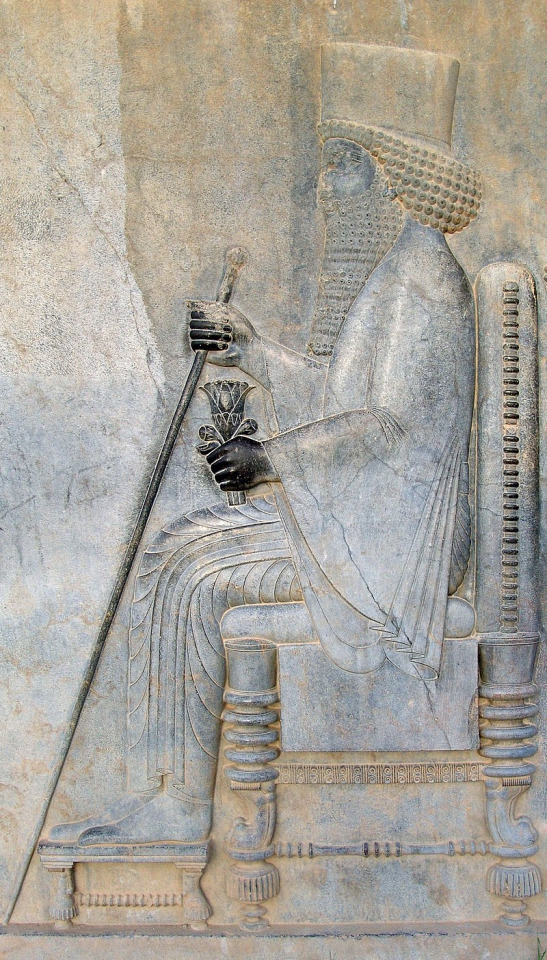
Countries that are no more: Achaemenid Empire (550BC-330BC)
It was not the first empire of Iranian peoples, but it arose as probably the greatest in terms of influence and became the measure by which all subsequent Iranian empires tended to compare themselves and its influence on culture, government & civil infrastructure would influence others beyond the span of its territory and the span of time. This is the Achaemenid Empire.
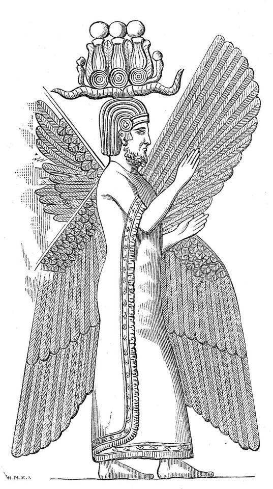
Name: In Old Persian it was known as Xšāça or the "The Kingdom or the Empire", it was named the Achaemenid Empire by later historians. Named after the ruling dynasty established by its founder Cyrus the Great who cited the name of his ancestor Haxāmaniš or Achaemenes in Greek as progenitor of the dynasty. It is sometimes also referred to as the First Persian Empire. The Greeks simply referred to it as Persia, the name which stuck for the geographic area of the Iranian plateau well into the modern era.
Language: Old Persian & Aramaic were the official languages. With Old Persian being an Iranian language that was the dynastic language of the Achaemenid ruling dynasty and the language of the Persians, an Iranian people who settled in what is now the southwestern Iranian plateau or southwest Iran circa 1,000 BC. Aramaic was a Semitic language that was the common and administrative language of the prior Neo-Assyrian & Neo-Babylonian Empires which centered in Mesopotamia or modern Iraq, Syria & Anatolian Turkey. After the Persian conquest of Babylon, the use of Aramaic remained the common tongue within the Mesopotamian regions of the empire, eventually becoming a lingua franca across the land. As the empire spread over a vast area and became increasingly multiethnic & multicultural, it absorbed many other languages among its subject peoples. These included the Semitic languages Akkadian, Phoenician & Hebrew. The Iranian language of Median among other regional Iranian languages (Sogdian, Bactrian etc). Various Anatolian languages, Elamite, Thracian & Greek among others.
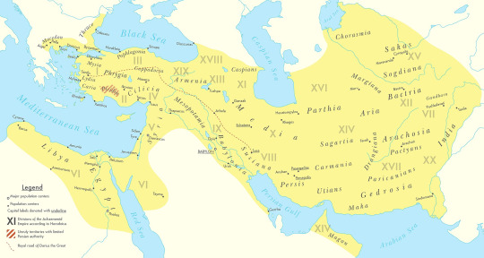
Territory: 5.5 million kilometers squared or 2.1 million square miles at its peak circa 500BC. The Achaemenid Empire spanned from southern Europe in the Balkans (Greece, Bulgaria, European Turkey) & northwest Africa (Egypt, Libya & Sudan) in the west to its eastern stretches in the Indus Valley (Pakistan) to parts of Central Asia in the northeast. It was centered firstly in the Iranian Plateau (Iran) but also held capitals in Mesopotamia (Iraq). Territory was also found in parts of the Arabian Peninsula & the Caucausus Mountains.
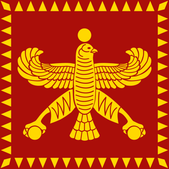
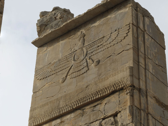
Symbols & Mottos: The Shahbaz or Derafsh Shahbaz was used as the standard of Cyrus the Great, founder of the empire. It depicts a bird of prey, typically believed to be a falcon or hawk (occasionally an eagle) sometimes rendered gold against a red backdrop and depicts the bird holding two orbs in its talons and adorned with an orb likewise above its head. The symbolism was meant to depict the bird guiding the Iranian peoples to conquest and to showcase aggression & strength coupled with dignity. The imperial family often kept falcons for the pastime of falconry.
Religion: The ancient Iranian religion of Zoroastrianism served as the official religion of the empire. It was adopted among the Persian elite & and had its unique beliefs but also helped introduce the concept of free-will among its believers, an idea to influence Judaism, Christianity & Islam in later centuries. Despite this official religion, there was a tolerance for local practices within the subject regions of the empire. The ancient Mesopotamian religion in Babylon & Assyria, Judaism, the Ancient Greek & Egyptian religions & Vedic Hinduism in India was likewise tolerated as well. The tolerance of the Achaemenids was considered a relative hallmark of their dynasty from the start. Famously, in the Old Testament of the Bible it was said that it was Cyrus the Great who freed the Jews from their Babylonian captivity and allowed them to return to their homeland of Judea in modern Israel.
Currency: Gold & silver or bimetallic use of coins became standard within the empire. The gold coins were later referred to as daric and silver as siglos. The main monetary production changes came during the rule of Darius I (522BC-486BC). Originally, they had followed the Lydian practice out of Anatolia of producing coins with gold, but the practice was simplified & refined under the Achaemenids.
Population: The estimates vary ranging from a low end of 17 million to 35 million people on the upper end circa 500BC. The official numbers are hard to determine with certainty but are generally accepted in the tens of millions with the aforementioned 17-35 million being the most reasonable range based on available sources.
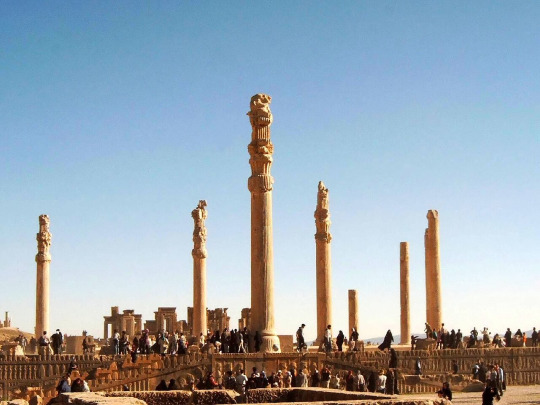
Government: The government of the Achaemenid Empire was a hereditary monarchy ruled by a king or shah or later referred to as the ShahanShah or King of Kings, this is roughly equivalent to later use of the term Emperor. Achaemenid rulers due the unprecedented size of their empire held a host of titles which varied overtime but included: King of Kings, Great King, King of Persia, King of Babylon, Pharaoh of Egypt, King of the World, King of the Universe or King of Countries. Cyrus the Great founded the dynasty with his conquest first of the Median Empire and subsequently the Neo-Babylonians and Lydians. He established four different capitals from which to rule: Pasargadae as his first in Persia (southwest central Iran), Ecbatana taken from the Medians in western Iran's Zagros Mountains. The other two capitals being Susa in southwest Iran near and Babylon in modern Iraq which was taken from the Neo-Babylonians. Later Persepolis was made a ceremonial capital too. The ShahanShah or King of Kings was also coupled with the concept of divine rule or the divinity of kings, a concept that was to prove influential in other territories for centuries to come.
While ultimate authority resided with the King of Kings and their bureaucracy could be at times fairly centralized. There was an expansive regional bureaucracy that had a degree of autonomy under the satrapy system. The satraps were the regional governors in service to the King of Kings. The Median Empire had satraps before the Persians but used local kings they conquered as client kings. The Persians did not allow this because of the divine reverence for their ShahanShah. Cyrus the Great established governors as non-royal viceroys on his behalf, though in practice they could rule like kings in all but name for their respective regions. Their administration was over their respective region which varied overtime from 26 to 36 under Darius I. Satraps collected taxes, acted as head over local leaders and bureaucracy, served as supreme judge in their region to settle disputes and criminal cases. They also had to protect the road & postal system established by the King of Kings from bandits and rebels. A council of Persians were sent to assist the satrap with administration, but locals (non-Persian) could likewise be admitted these councils. To ensure loyalty to the ShahanShah, royal secretaries & emissaries were sent as well to support & report back the condition of each satrapy. The so called "eye of the king" made annual inspections of the satrapy to ensure its good condition met the King of Kings' expectations.
Generals in chief were originally made separate to the satrap to divide the civil and military spheres of government & were responsible for military recruitment but in time if central authority from the ShahanShah waned, these could be fused into one with the satrap and general in chiefs becoming hereditary positions.
To convey messages across the widespread road system built within the empire, including the impressive 2,700 km Royal Road which spanned from Susa in Iran to Sardis in Western Anatolia, the angarium (Greek word) were an institution of royal messengers mounted on horseback to ride to the reaches of the empire conveying postage. They were exclusively loyal to the King of Kings. It is said a message could be reached to anywhere within the empire within 15 days to the empire's vast system of relay stations, passing message from rider to rider along its main roads.
Military: The military of the Achaemenids consisted of mostly land based forces: infantry & cavalry but did also eventually include a navy.
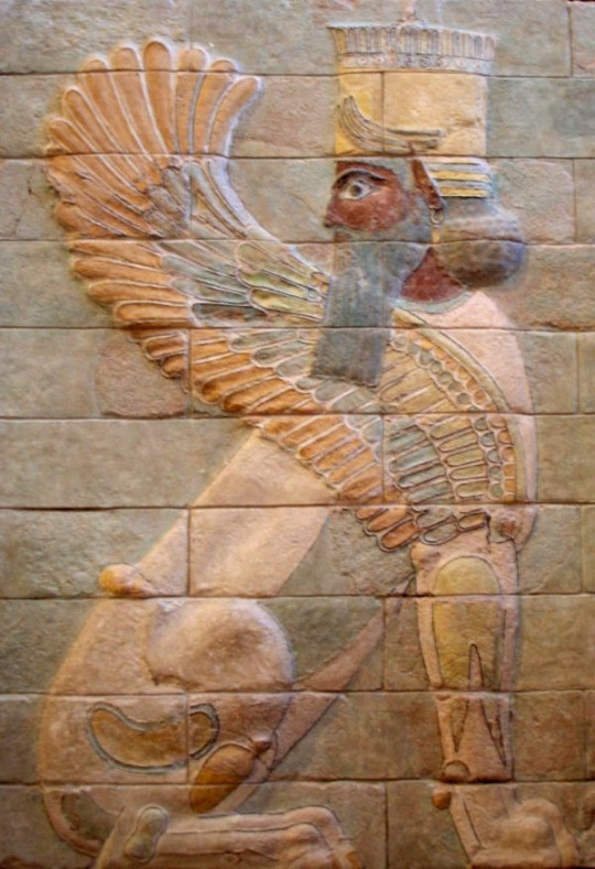
Its most famous unit was the 10,000-man strong Immortals. The Immortals were used as elite heavy infantry were ornately dressed. They were said to be constantly as 10,000 men because for any man killed, he was immediately replaced. Armed with shields, scale armor and with a variety of weapons from short spears to swords, daggers, slings, bows & arrows.
The sparabara were the first line of infantry armed with shields and spears. These served as the backbone of the army. Forming shield walls to defend the Persian archers. They were said to ably handle most opponents and could stop enemy arrows though their shields were vulnerable to enemy spears.
There was also the takabara light infantry and though is little known of them it seems they served as garrison troops and skirmishers akin to the Greek peltast of the age.
The cavalry consisted of four distinct groups: chariot driven archers used to shoot down and break up enemy formations, ideally on flat grounds. There was also the traditional horse mounted cavalry and also camel mounted cavalry, both served the traditional cavalry functions and fielded a mix of armor and weapons. Finally, there was the use of war elephants which were brought in from India on the empire's eastern reaches. These provided archers and a massive way to physically & psychologically break opposing forces.
The navy was utilized upon the empire's reaching the Mediterranean and engaged in both battles at sea and for troop transport to areas where troops needing deploying overseas, namely in Greece.
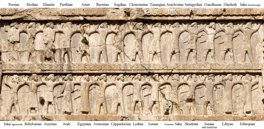
The ethnic composition of Achaemenid military was quite varied ranging from a Persian core with other Iranian peoples such as the Medians, Sogdian, Bactrians and Scythians joining at various times. Others including Anatolians, Assyrians, Babylonians, Anatolians, Indians, Arabs, Jews, Phoenicians, Thracians, Egyptians, Ethiopians, Libyans & Greeks among others.
Their opponents ranged from the various peoples they conquered starting with the Persian conquest of the Medians to the Neo-Babylonians, Lydians, Thracians, Greeks, Egyptians, Arabs & Indians and various others. A hallmark of the empire was to allow the local traditions of subjugated areas to persist so long as garrisons were maintained, taxes were collected, local forces provided levies to the military in times of war, and they did not rebel against the central authority.
Economy: Because of the efficient and extensive road system within the vast empire, trade flourished in a way not yet seen in the varied regions it encompassed. Tax districts were established with the satrapies and could be collected with relative efficiency. Commodities such as gold & jewels from India to the grains of the Nile River valley in Egypt & the dyes of the Phoenicians passed throughout the realm's reaches. Tariffs on trade & agricultural produce provided revenue for the state.
Lifespan: The empire was founded by Cyrus the Great circa 550BC with his eventual conquest of the Median & Lydian Empires. He started out as Cyrus II, King of Persia a client kingdom of the Median Empire. His reign starting in 559BC. Having overthrown and overtaken the Medians, he turned his attention Lydia and the rest of Anatolia (Asia Minor). He later attacked the Eastern Iranian peoples in Bactria, Sogdia and others. He also crossed the Hindu Kush mountains and attacked the Indus Valley getting tribute from various cities.
Cyrus then turned his attention to the west by dealing with the Neo-Babylonian Empire. Following his victory in 539BC at the Battle of Opis, the Persians conquered the Babylonia with relative quickness.
By the time of Cyrus's death his empire had the largest recorded in world history up to that point spanning from Anatolia to the Indus.
Cyrus was succeeded by his sons Cambyses II and Bardiya. Bardiya was replaced by his distant cousin Darius I also known as Darius the Great, whose lineage would constitute a number of the subsequent King of Kings.
Darius faced many rebellions which he put down in succession. His reign is marked by changes to the currency and the largest territorial expansion of the empire. An empire at its absolute zenith. He conquered large swaths of Egypt, the Indus Valley, European Scythia, Thrace & Greece. He also had exploration of the Indian Ocean from the Indus River to Suez Egypt undertaken.
The Greek kingdom of Macedon in the north reaches of the Hellenic world voluntarily became a vassal of Persia in order to avoid destruction. This would prove to be a fateful first contact with this polity that would in time unite the Greek-speaking world in the conquest of the Achaemenid Empire. However, at the time of Darius I's the reign, there were no early indications of this course of events as Macedon was considered even by other Greek states a relative backwater.
Nevertheless, the Battle of Marathon in 490BC halted the conquest of mainland Greece for a decade and showed a check on Persia's power in ways not yet seen. It is also regarded as preserving Classical Greek civilization and is celebrated to this day as an important in the annals of Western civilization more broadly given Classical Greece & in particular Athens's influence on western culture and values.
Xerxes I, son of Darius I vowed to conquer Greece and lead a subsequent invasion in 480BC-479BC. Xerxes originally saw the submission of northern Greece including Macedon but was delayed by the Greeks at the Battle of Thermopylae, most famously by Spartan King Leonidas and his small troop (the famed 300). Though the Persians won the battle it was regarded as a costly victory and one that inspired the Greeks to further resistance. Though Athens was sacked & burnt by the Persians, the subsequent victories on sea & land at Salamis & Plataea drove the Persians back from control over Greece. Though war would rage on until 449BC with the expulsion of the Persians from Europe by the Greeks.
However, the Greeks found themselves in a civil war between Athens & Sparta and Persia having resented the Athenian led coalition against their rule which had expelled them from Europe sought to indirectly weaken the Greeks by supporting Greek factions opposed to Athens through political & financial support.
Following this reversal of fortune abroad, the Achaemenid Empire not able to regain its foothold in Europe, turned inward and focused more on its cultural development. Zoroastrianism became the de-facto official religion of the empire. Additionally, architectural achievements and improvements in its many capitals were undertaken which displayed the empire's wealth. Artaxerxes II who reigned from 405BC-358BC had the longest reign of any Achaemenid ruler and it was characterized by relative peace and stability, though he contended with a number of rebellions including the Great Satraps Revolt of 366BC-360BC which took place in Anatolia and Armenia. Though he was successful in putting down the revolt. He also found himself at war with the Spartans and began to sponsor the Athenians and others against them, showcasing the ever dynamic and changing Greco-Persian relations of the time.
Partially for safety reasons, Persepolis was once again made the capital under Artaxerxes II. He helped expand the city and create many of its monuments.
Artaxerxes III feared the satraps could no longer be trusted in western Asia and ordered their armies disbanded. He faced a campaign against them which suffered some initial defeats before overcoming these rebellions, some leaders of which sought asylum in the Kingom of Macedon under its ruler Philip II (father of Alexander the Great).
Meanwhile, Egypt had effectively become independent from central Achaemenid rule and Artaxerxes III reinvaded in around 340BC-339BC. He faced stiff resistance at times but overcame the Egyptians and the last native Egyptian Pharaoh Nectanebo II was driven from power. From that time on ancient Egypt would be ruled by foreigners who held the title Pharaoh.
Artaxerxes III also faced rebellion from the Phoenicians and originally was ejected from the area of modern coastal Lebanon, Syria & Israel but came back with a large army subsequently reconquered the area including burning the Phoenician city of Sidon down which killed thousands.
Following Artaxerxes III's death his son succeeded him but a case of political intrigue & dynastic murder followed. Eventually Darius III a distant relation within the dynasty took the throne in 336BC hoping to give his reign an element of stability.
Meanwhile in Greece, due to the military reforms and innovations of Philip II, King of Macedon, the Greek speaking world was now unified under Macedon's hegemony. With Philip II holding the title of Hegemon of the Hellenic League, a relatively unified coalition of Greek kingdoms and city-states under Macedon premiership that formed to eventually invade Persia. However, Philip was murdered before his planned invasion of Asia Minor (the Achaemenid's westernmost territory) could commence. His son Alexander III (Alexander the Great) took his father's reforms and consolidated his hold over Greece before crossing over to Anatolia himself.
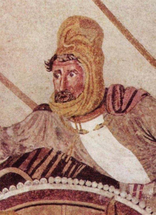
Darius III had just finished reconquering some rebelling vestiges of Egypt when Alexander army crossed over into Asia Minor circa 334BC. Over the course of 10 years Alexander's major project unfolded, the Macedonian conquest of the Persian Empire. He famously defeated Persians at Granicus, Issus and Gaugamela. The latter two battles against Darius III in person. He took the King of Kings family hostage but treated them well while Darius evacuated to the far eastern reaches of his empire to evade capture. He was subsequently killed by one of his relatives & satraps Bessus, whom Alexander eventually had killed. Bessus had declared himself King of Kings though this wasn't widely recognized and most historians regard Darius III, the last legitimate ShahanShah of Achaemenids.
Alexander had taken Babylon, Susa & Persepolis by 330BC and effectively himself was now ruler of the Persian Empire or at least its western half. In addition to being King of Macedon & Hegemon of the Hellenic League, he gained the titles King of Persia, Pharaoh of Egypt & Lord of Asia. Alexander would in time eventually subdue the eastern portions of the Achaemenid realm including parts of the Indus Valley before turning back to Persia and Babylon where he subsequently became ill and died in June 323BC at age 32. Alexander's intentions it appears were never to replace the Achaemenid government & cultural structure, in fact he planned to maintain and hybridize it with his native Greek culture. He was in fact an admirer of Cyrus the Great (even restoring his tomb after looting) & adopted many Persian customs and dress. He even allowed the Persians to practice their religion and had Persian and Greeks start to serve together in his army. Following his death and with no established successor meant the empire he established which essentially was the whole Achaemenid Empire's territory in addition to the Hellenic world fragmented into different areas run by his most trusted generals who established their own dynasties. The Asian territories from Anatolia to the Indus (including Iran and Mesopotamia) gave way to the Hellenic ruled Seleucid Empire while Egypt became the Hellenic ruled Ptolemaic Kingdom. The synthesis of Persian and Greek cultures continued in the Seleucid and Greco-Bactrian kingdoms of antiquity.
The Achaemenid Empire lasted for a little over two centuries (550BC-330BC) but it casted a long shadow over history. Its influence on Iran alone has persisted into the modern age with every subsequent Persian Empire claiming to be its rightful successor from the Parthian & Sasanian Empires of pre-Islamic Iran to the Safavids of the 16th-18th century and the usage of the title Shah until the last Shah's ejection from power in the 1979 Islamic Revolution. Even the modern Islamic Republic of Iran uses Achaemenid imagery in some military regiments and plays up its importance in tourism and museums as a source of pride to Persian (Farsi) & indeed Iranian heritage. Likewise, its form of governance and the pushing of the concept of divine rights of kings would transplant from its Greek conquerors into the rest of Europe along with various other institutions such as its road & mail system, tax collection & flourishing trade. Its mix of centralized & decentralized governance. Its religious & cultural tolerance of local regions even after their conquest would likewise serve as a template for other empires throughout history too. The Achaemenid Empire served as a template for vast international & transcontinental empires that would follow in its wake & surpass its size & scope of influence. However, it is worth studying for in its time, it was unprecedented, and its innovations so admired by the likes of Alexander the Great and others echo into the modern era.


#military history#antiquity#iran#greece#ancient greece#classical greece#ancient ruins#ancient iran#ancient persia#achaemenid#persia#zoroastrianism#alexander the great#cyrus the great#xerxes#artwork#government#history#persian empire#ancient egypt
106 notes
·
View notes
Text
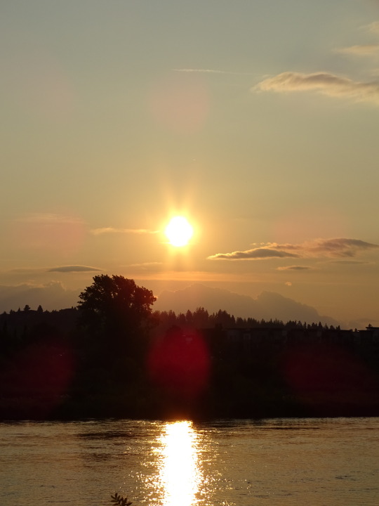
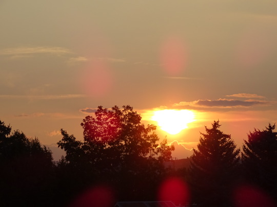

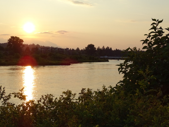
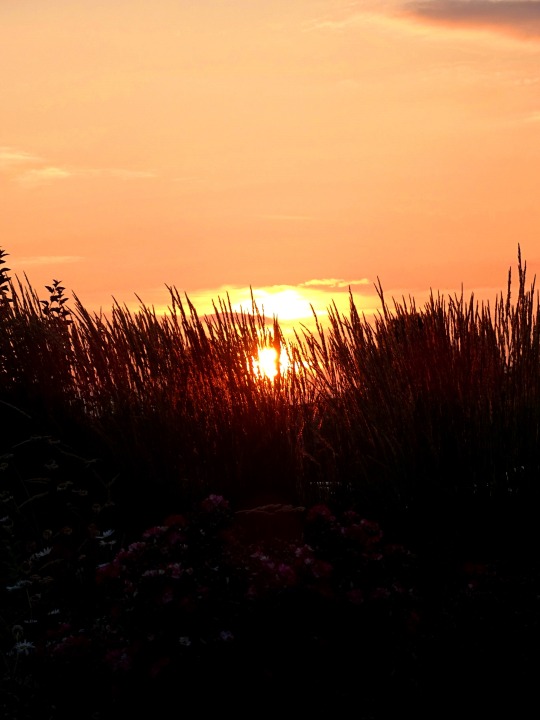
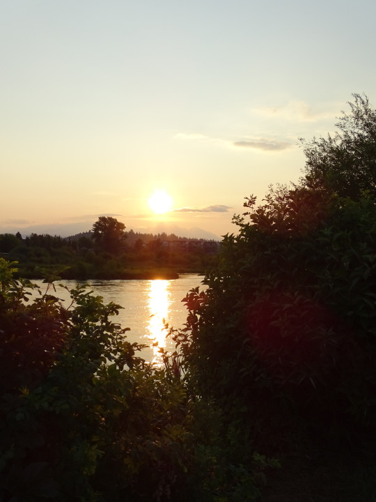
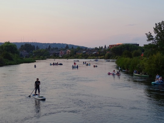
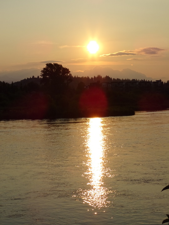
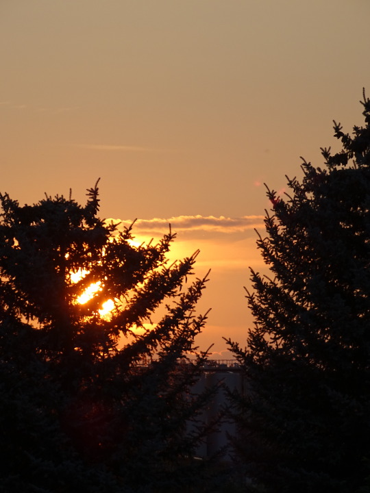
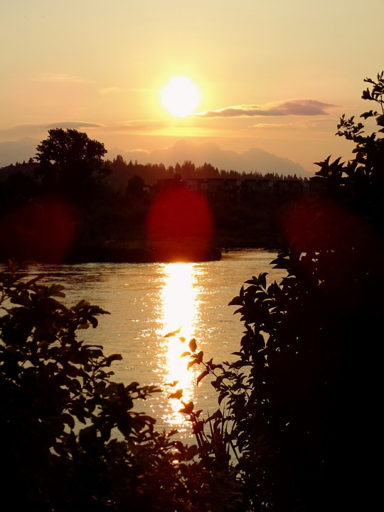
Bend, OR (No. 8)
The headwaters of the Deschutes River are at Little Lava Lake, a natural lake in the Cascade Range approximately 26 miles (42 km) northwest of the city of La Pine. The river flows south into Crane Prairie Reservoir, then into Wickiup Reservoir, from where it heads in a northeasterly direction past the resort community of Sunriver and into the city of Bend, about 170 miles (270 km) from the river mouth on the Columbia.
In central Bend, the river enters Mirror Pond, an impoundment behind Newport hydroelectric dam. The pond extends upstream to the Galveston Bridge and is a feature of Drake Park as well as Harmon, Pageant, and Brooks parks. From April through October, diversions to Central Oregon Irrigation District canals reduce the river flow between Bend and Pelton Reregulating Dam, at river mile (RM) 100 (river kilometer (RK) 160).
The river continues north from Bend, and just west of Redmond, Oregon. Here it passes by Eagle Crest Resort and Cline Falls State Scenic Viewpoint. As it heads north through the central Oregon high desert, the river carves a gorge bordered by large basalt cliffs. By the time it reaches Lake Billy Chinook, a reservoir west of Madras, the river is approximately 300 feet (91 m) below the surrounding plateau, the Little Agency Plains and Agency Plains. At Lake Billy Chinook the river is joined by the Crooked and Metolius rivers.
Beyond the dam, the river continues north in a gorge well below the surrounding countryside. It passes through the Warm Springs Indian Reservation, which includes the city of Warm Springs and the Kah-Nee-Ta resort. The river ends at its confluence with the Columbia River, 5 miles (8 km) southwest of Biggs Junction and 204 miles (328 km) from the Columbia's mouth on the Pacific Ocean.
Source: Wikipedia
#Bend#flags#Central Oregon#Deschutes County#Oregon#USA#summer 2023#Pacific Northwest#travel#original photography#vacation#tourist attraction#landscape#landmark#cityscape#architecture#Old Mill District#evening light#tree#flora#sunset#reflection
15 notes
·
View notes
Text
Submitted via Google Form:
Since a lot of the desert is not very habitable, my world has a lot of underground buildings in the desert very high tech so that the natural land isn't very important. What do I need to consider for this?
Tex: Do you have a particular desert in mind with this question? There’s a fair amount of deserts that are inhabited already by flora and fauna, if not to a hundred percent coverage, such as the Great Basin desert, Kalahari Desert, and the deserts of Australia.
Deserts that have less flora and fauna, and are of the more popular imagination, such as the Sahara, Gobi Desert, and Syrian Desert, will have pockets of inhabitation around places like wadis, where there’s enough underground pooled water for migrational animals - including humans - to travel to and from. It’s not unusual to see water, and thus inhabitation, around mountainous regions in the desert, or by the borders of a desert where climate zones shift based upon geological features.
Humans have been living in and around the desert for a very, very long time (Wikipedia). Because of this, they’ve developed methods of surviving, and while it might not necessarily be an analogue to denser human populations like New York City that’s teeming with life and a focus of travel, a life is made.
Aridity isn’t necessarily the domain of traditional deserts, either - mountains are a good example of this, as are certain popular examples of civilizations in these areas. Petra is a popular example, home to the Nabataeans and geographically within modern-day Jordan. A notable mountain peak, Tian Shan, in Central Asia, was one of many places the Yuezhi people lived, who were nomadic and lived not only in the surrounding area but also across places like the Tarim Basin and the Tibetan Plateau. There’s a lot of examples of similar situations in other parts of the globe, so this is not an isolated event in human history.
Now, what is your definition of high tech? Skyscrapers? Internet? Something else? Lighting is something humans have had for a while, in the form of candles, hearths, and lamps, and we’ve more or less had an electrical grid in some places since the late 1880s (Wikipedia).
Plumbing has existed for thousands of years in some form for both fresh and wastewater (Wikipedia 1, Wikipedia 2), as has architectural features such as bridges (Wikipedia) and other types of architectural works (Wikipedia). Multi-story buildings have also existed for a while, notable in Roman insulae and Egyptian city of Fustat.
Telecommunications has existed in some form for about as long as human civilization has existed (Wikipedia), but electronic telecommunications began at about 1830-1840 (Wikipedia). I don’t know if you consider this sufficiently old or sufficiently modern, but the information is there for your perusal. Accordingly, the predecessor to the modern internet, ARPANET, was a multi-country project that began in the 1960s and established by the US Department of Defense - and computing hardware has a before and after historical split in technological advances at about the same time (Wikipedia).
What are your goals with this setting and this technology? What are the reasons that your society is living in such an area with such a climate, and what are they using the technology for? Are the communicating with people outside of this area? Is the technology completely isolated, for archival purposes, or is it interacted with on a regular or frequent basis? How much of this is aesthetic, and how much of it is part of a plot or culture?
Utuabzu: Historically, there have been several cultures in arid environments that favoured partly or wholly underground structures, from the Ancestoral Puebloans of the American South West, who sometimes built into the sides of canyons to the Derinkuyu Underground City in south-eastern Türkiye, to the modern town of Cooper Pedy in South Australia. These sites vary significantly in form and in motivation, with the Ancestoral Puebloan canyonside structures built primarily for defense, Derinkuyu built partly for defense and partly just because the local stone was really easy to carve through and vast underground spaces made for convenient storage, and Cooper Pedy is underground to mitigate the worst of the desert heat, mostly utilising exhausted opal mines.
Any or all of these reasons could apply, and would impact your setting’s architecture and urban forms, but the biggest impact is always going to come from the reason people started living there in the first place. The Ancestoral Puebloans farmed the fertile river valleys, Derinkuyu lies in Cappadokia, a region that once gave rise to the Hittite Empire and has plenty of decent farmland and pasture, while Cooper Pedy is a major centre for opal mining.
I’d suggest considering why this culture lives in the desert in the first place, and then researching what similar locations in the real world look like. Also, decide what sort of desert you’re working with. As Tex said, there’s a lot of different kinds of desert, and they have historically produced very different cultures and architectural traditions. What makes sense in the hot sandy deserts of the Arabian Peninsula or Northern Africa does not necessarily make sense in even the relatively nearby Iranian Plateau or Thar Desert, let alone the cold deserts of Central Asia or the high altitude Atacama or Tibetan Plateau.
11 notes
·
View notes
Photo

Mountains in the Contiguous U.S. by Rise Above Surroundings / Jut
by u/Gigitoe
Jut is an indicator I developed to quantify how sharply/impressively a mountain rises above its surroundings, factoring in both height and steepness. A mountain with a jut of X rises as sharply/impressively as a vertical cliff of height X. Roughly speaking, the higher the jut, the "bigger" and more imposing a mountain appears.
Some things to note:
Jut hotspots (places with the most impressive mountains) include the Cascade Range, North Cascades, Glacier National Park, Grand Teton National Park, Yosemite National Park & Central/Southern Sierra, and Mount San Jacinto. The highest jut in the lower 48 is measured atop Mount Rainier (jut = 1312 m), a massive stratovolcano in the Cascade Range of Washington.
Even though the Colorado Rockies have a high elevation, they have a lower jut than some other mountain ranges in the West, as they rise from a high plateau. The Grand Canyon in Arizona has similar local rise as the highest peaks of the Colorado Rockies, despite having a much lower elevation.
A point with a jut of 10 – 100 m is perhaps more aptly described as a hill. Points with a jut below 10 m do not rise significantly above their surroundings, so they were not included.
Mountains in the rest of the world can have a significantly higher jut. The Matterhorn in the Swiss Alps has a jut of 1451 m. Aconcagua in the Andes of Argentina has a jut of 1827 m. Mount Everest has a jut of 2211 m. The North Peak of Denali in Alaska has a jut of 2549 m. Annapurna Fang in Nepal, the apex of the biggest mountain face on the planet, has a jut of 3395 m, the highest in the world.
This visualization was made possible with Google Earth Engine, MERIT DEM, GeoNames, and QGIS.
136 notes
·
View notes
Text
Astorvember day 5 - Village
I'm gonna use this as an excuse to post my headcanons about some of the settlement ruins in botw/aoc. Also here's the results of last year's poll
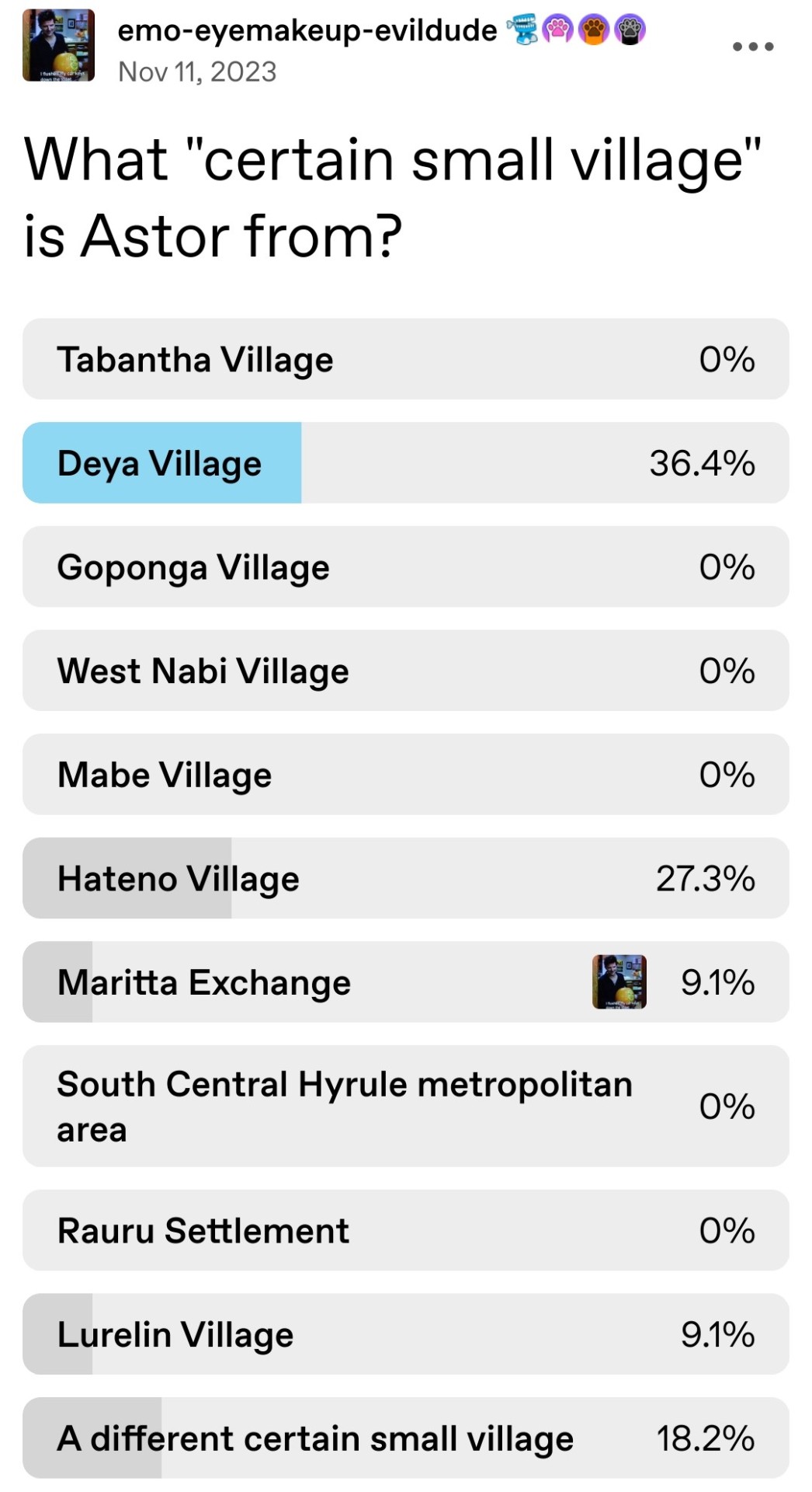
West Nabi Village: West Nabi Lake, my beloved, a small settlement on the north bank of the Squabble River in the plains east of Dueling Peaks. There's not even a village ruins marker on the map for this one, but there is a small line of houses with a series of jumps between them. There's also a stone talus nearby that's called the West Nabi Lake stone talus. My headcanon is that this is a small village that raised horses. My oc Vala from Long Road To Ruin grew up in West Nabi Village, and it will be the setting for a fic I'm currently working on. Much like other settlements close to towers like the citadel in Akkala it was subject to repeated monster attacks.
Deya Village and Goponga Village: There is more canon information on these villages but I want to include them anyway because I see people asking how they flooded all the time. Deya Village is settled in the highlands across the river from West Nabi Village. The Squabble and Hylia Rivers flow into Lake Hylia, which is very deep and surrounded by tall hills and so more than able to absorb standard floods. It is also my headcanon that Lake Hylia flows into Cora Lake and the Menoat River and eventually into the Faron Sea, albeit very slowly, but that's why that particular lake and river are so deep. Goponga Village is in the wetlands downriver from the Lanayru Great Spring, and wetlands are great at absorbing water. Unfortunately when Ganon took control of the Divine Beasts it caused Vah Ruta to flood Lanayru, which flooded the wetlands and the rivers south of them far past their usual capacity, impacting both villages. The floodwaters did not drain from Deya Village so it was not able to be rebuilt. Goponga Village fared better but re-flooded frequently, never reaching its previous equilibrium. When Vah Ruta reactivated around the time Link woke up in Breath of the Wild the Zora knew exactly the kind of impact it could have and feared that it would spread even farther since no one really knew why Vah Ruta eventually stopped producing rain, and before Link showed up there was little hope that it would stop on its own again.
Central Hyrule: All of the settlements in Hyrule Field form a metropolitan area around Castle Town. The Windvane Exchange handled matters of trade, Gatepost Town processed traffic traveling east and west through south Central Hyrule as well as to Castle Town and the Great Plateau. The Kolomo Garrison, Outpost, and East Post were villages serving the royal army outside of the knights and royal guard, who lived within Castle Town and the castle itself. Mabe Village formed around Mabe Ranch, which supplied food to the castle. The unnamed ruins east of the Great Plateau housed people who worked on the Great Plateau, which was a spiritual center hosting the Temple of Time and an abbey. Central Hyrule had other such abbeys, like the Sage Temple. All differed in their beliefs but most of them served the Goddess.
Ridgeland: The main village here is the Maritta Exchange, which processed trade largely from Rito Village, Tabantha, and Ridgeland itself. In Long Road To Ruin Astor was born and raised in one of the small homesteads that dotted the plains northeast of the Exchange and the stable. There wasn't enough traffic that way to justify a true village, but a few families settled there anyway. Fun fact, the exact house he lived in is the one at the far north end of Tanagar Canyon, just above the Forgotten Temple and the one that has Gloom in its well in Tears of the Kingdom.
Tabantha Village: This village formed around the eventually inactivated Sheikah tower during the Calamity 10,000 years before Age of Calamity. When the Sheikah tech was ordered hidden they were left only with the legacy of having been of great importance during the last Calamity. It remained a large village due to being the only other large village in Tabantha and Hebra besides Rito Village. There was more infrastructure in Hebra before the Calamity, allowing people to traverse the mountains and reach the hot springs, but when Tabantha Village fell following heavy attack by monsters and Rito Village was occupied with Vah Medoh maintenance fell by the wayside, leaving travel through Hebra very difficult.
Gerudo Desert: The entire desert was once full of settlements, but like Hebra they all fell into ruins after the Calamity. West Gerudo Village once stood in the shadow of the highlands where temperatures were a bit more stable, and wooden stalls and tents sprawled around the walls of Gerudo Town. This is where husbands would live since they weren't allowed inside Gerudo Town, where they could also enjoy ceremonies and events at the structure north of the town and sand seal races to the south. Infrastructure and frequent travel also made it easier to visit the Southern Oasis and Arbiter's Grounds, which had long since fallen into disuse. More on that in Long Road To Ruin. With Vah Naboris out of control and making passage into the desert very dangerous most visitors fled the desert and the Gerudo moved entirely within the town, leaving newlywed vai to live with their husbands outside the desert until their daughters were old enough to live within the town for several years.
Bonus: You know that set of ruins on the hill west-southwest of Outskirt Stable? I'm working on a completely different fic about a group of magicians who live in a massive, old manor house up there.
If I missed any that y'all want to hear my thoughts on, let me know!
#astorvember#astor age of calamity#breath of the wild#age of calamity#things I spend all my time thinking about: old houses in video games#also let me know if I fucking got you ( ͡° ͜ʖ ͡°)#also also if I should run the poll again just for funsies
7 notes
·
View notes
Text
24th July 1411 saw the Battle of Harlaw, near Inverurie.
Get this "biggie" out of the way first, it is also known as "Reid Harlaw" (Red Harlaw)
Is it okay to have a favourite battle? Well maybe not the event itself, it was a bloody affair by all accounts, and sadly an all Scottish affair, classified as a clan battle,part of a feud between the Clan Donald and the Stewart royal family the reason I like it is more to do with the song and the monument to those that fell.
In 1411 Lord Donald of the Isles and his army marched across the north east of Scotland. Two miles north west of Inverurie the Highlanders met a Lowland army to resolve competing claims to the Earldom of Ross. The battle was inconclusive, but the Highlanders withdrew.
The battle has become shrouded in myth and mystery and means different things to different people. From the time of the battle onwards it has cast a large shadow. Writing only a generation later, John Major recorded that school children in Aberdeen played out the battle during play time. The first ballads to record and commemorate the battle date from 1548. Ballads, songs and stories continued to be written concerning the battle over the centuries and have embellished, exaggerated and distorted the reality of Harlaw, which makes it great for those looking into as so many differing accounts have been written.
The immediate cause of the battle was a struggle for power between Donald, Lord of the Isles and the Earl of Mar, Alexander Stewart over possession of the Earldom of Ross. However, the roots of the battle are feudal and relate to an ongoing power struggle in the country at the time. On the one hand were Donald, Lord of the Isles and a number of clans. On the other hand were elements of the Stewart family, particularly those known as the Albany Stewarts.
The battle itself took place where Donald chose to camp, near Harlaw, two miles north of Inverurie. Harlaw has been described as a town, but it was more likely to be a 'fermtoun'. Typically these comprised several families and a number of houses.
Donald's forces chose a strong defensive position in this predominantly farming country they stopped on a plateau, which was surrounded by wet land to the east and west. Mar broke camp and crossed the River Urie. Mar split his men into two divisions and the vanguard was led by the sheriff of Angus and constable of Dundee leading the Angus and Mearns men.
Donald's forces were rallied by a battle song, which also shows that Donald's forces were in three divisions. Red Hector of the Battles, Hector Roy Maclean of Duart, was Donald's overall general, leading the forces on the right wing, at the head of his clan. The left wing was led by Callum Beg, chief of the MacIntoshes, whilst Donald commanded the central battle force. Mar's vanguard was lead by Scrymgeour and Sir Alexander Ogilvy, sheriff of Angus. The vanguards clashed probably near to where the present day monument stands.
The battle was probably entirely fought on foot. The wealthier lairds and knights may have worn plate armour. Chiefs on the Donald side may well have worn mail with a conical helmet and jupon, a jacket or tunic worn over or under armour. The main body of the men, on both sides, would have been armed with lances, spears, axes and swords and would not have worn armour, or anything that would have weighed them down.
Donald's forces chose a strong defensive position in this predominantly farming country they stopped on a plateau, which was surrounded by wet land to the east and west. Mar broke camp and crossed the River Urie. Mar split his men into two divisions and the vanguard was led by the sheriff of Angus and constable of Dundee leading the Angus and Mearns men.
Donald's forces were rallied by a battle song, which also shows that Donald's forces were in three divisions. Red Hector of the Battles, Hector Roy Maclean of Duart, was Donald's overall general, leading the forces on the right wing, at the head of his clan. The left wing was led by Callum Beg, chief of the MacIntoshes, whilst Donald commanded the central battle force. Mar's vanguard was lead by Scrymgeour and Sir Alexander Ogilvy, sheriff of Angus. The vanguards clashed probably near to where the present day monument stands.
The battle was probably entirely fought on foot. The wealthier lairds and knights may have worn plate armour. Chiefs on the Donald side may well have worn mail with a conical helmet and jupon, a jacket or tunic worn over or under armour. The main body of the men, on both sides, would have been armed with lances, spears, axes and swords and would not have worn armour, or anything that would have weighed them down. I don’t normally go into the apparel, but this relates to the video in the song, which will become apparent if you watch it.
In the immediate aftermath of the battle both sides claimed victory but in reality it had been a bloody and costly engagement for both sides. Nevertheless, Alexander Stewart's actions had saved Aberdeen and checked Donald of Islay's attempts to expand his influence eastwards. Alexander later went on to defeat Donald of Islay's son, also called Alexander, at the Battle of Lochaber (1429). However, two years later Alexander Stewart was defeated at the first Battle of Inverlochy in 1431.
The Battle of Harlaw is often mentioned as the biggest clan battle in Scottish history, and it demonstrated the tensions that were part of the political intrigue in the country at the time.
The Monument which stands on the approximate site of the battle was designed by Aberdeen architect William Kelly It was commissioned and paid for by the Corporation of the City of Aberdeen and built by John Smith of Inverurie at the cost of £325 and inaugurated in 1914 .
The coats of arms are a more recent addition and are those of Alexander Stewart Earl of Mar, The City of Aberdeen, Lord of the Isles, Clans, Davidson, MacLean of Duart, and Irvine of Drum.
youtube
The Battle of Harlaw by Old Blind Dogs.
As I cam in by Dunidier, And down by wetherha There were fifty thousand Heilanmem A marching to Harlaw.
… The Heilanmem William their long swords, They laid on us fu sair; And they drave back our merrymen Three acres breadth or mair.
… The first ae stroke that Forbes struck, Made the great Macdonell reel; The second stroke that Forbes struck, The great Macdonell fell.
And siccan a pilleurichie, The like ye never saw, As was amang the Heilanmen When they saw Macdonell fa.
… And sic a weary burying, The like you never saw, As there was the Sunday after that On the muirs down by Harlaw
And gin Heilan lasses speer at you, For them that gaed awa, Ye may tell them plain and plain enough They're sleeping at Harlaw!
11 notes
·
View notes
Video
My Camera Loves Joining Me on My Adventures in Nature at Bryce Canyon National Park by Mark Stevens Via Flickr: A setting looking to the south while taking in views across hoodoos and other eroded formations at Farview Point in Bryce Canyon National Park.
#Aquarius Plateau#Azimuth 175.50#Blue Skies#Bryce Canyon#Bryce Canyon National Park#Central Utah Plateaus#Colorado Plateau#Day 4#Desert Landscape#Desert Mountain Landscape#Desert Plant Life#DxO PhotoLab 5 Edited#Eastern Edge of the Paunsaugunt Plateau#Eroded Formations#Evergreen#Evergreens#Farview Point#Forest#Forest Landscape#High Desert#Hillside of Trees#Hoodoos#Horseshoe-shaped Amphitheater#Intermountain West#Landscape#Landscape - Scenery#Layers of Rock#Looking South#Nature#Nikon D850
3 notes
·
View notes
Photo

Weather: Pacific Northwest
Report generated at 2024-12-25 16:00:10.377378-08:00 using satellite imagery and alert data provided by the National Weather Service.
Winter Storm Warning
WA:
Central Chelan County
Lower Slopes of the Eastern Washington Cascades Crest
Okanogan Highlands
Okanogan Valley
Olympics
Upper Slopes of the Eastern Washington Cascades Crest
Waterville Plateau
Wenatchee Area
West Slopes North Cascades and Passes
West Slopes North Central Cascades and Passes
West Slopes South Central Cascades and Passes
Western Chelan County
Western Okanogan County
ID:
Bear River Range
Big Hole Mountains
Big Lost Highlands/Copper Basin
Blackfoot Mountains
Caribou Range
Centennial Mountains/Island Park
Franklin/Eastern Oneida Region
Marsh and Arbon Highlands
Raft River Region
Sawtooth/Stanley Basin
Southern Hills/Albion Mountains
Sun Valley Region
Teton Valley
Wood River Foothills
Winter Weather Advisory
WA:
Cascades of Lane County
Cascades of Marion and Linn Counties
North Oregon Cascades
Northeast Mountains
Northern Blue Mountains of Oregon
Northwest Blue Mountains
South Washington Cascades
Upper Columbia Basin
OR:
Baker County
Cascades of Lane County
Cascades of Marion and Linn Counties
East Slopes of the Oregon Cascades
North Central and Southeast Siskiyou County
North Oregon Cascades
Northern Blue Mountains of Oregon
Northwest Blue Mountains
Siskiyou Mountains and Southern Oregon Cascades
South Central Oregon Cascades
South Central Siskiyou County
South Washington Cascades
Upper Weiser River
Western Siskiyou County
ID:
Arco/Mud Lake Desert
Baker County
Bear Lake Valley
Beaverhead/Lemhi Highlands
Boise Mountains
Camas Prairie
Central Panhandle Mountains
Eastern Magic Valley
Frank Church Wilderness
Lost River Range
Lower Snake River Plain
Northern Clearwater Mountains
Northern Panhandle
Shoshone/Lava Beds
Southern Clearwater Mountains
Upper Snake River Plain
Upper Treasure Valley
Upper Weiser River
West Central Mountains
Western Magic Valley
CA:
Greater Lake Tahoe Area
Lassen-Eastern Plumas-Eastern Sierra Counties
Mono
North Central and Southeast Siskiyou County
Northern Trinity
Siskiyou Mountains and Southern Oregon Cascades
South Central Oregon Cascades
South Central Siskiyou County
West Slope Northern Sierra Nevada
Western Plumas County/Lassen Park
Western Siskiyou County
NV:
Greater Lake Tahoe Area
Northern Elko County
Ruby Mountains and East Humboldt Range
South Central Elko County
Southwest Elko County
Coastal Flood Warning
WA:
Central Coast
Coastal Flood Advisory
WA:
Eastern Strait of Juan de Fuca
North Coast
South Washington Coast
Western Strait of Juan De Fuca
High Surf Advisory
WA:
Central Coast
North Coast
South Washington Coast
OR:
Central Coast of Oregon
Clatsop County Coast
Tillamook County Coast
CA:
Catalina and Santa Barbara Islands
Coastal Del Norte
Coastal North Bay Including Point Reyes National Seashore
Los Angeles County Beaches
Malibu Coast
Mendocino Coast
Northern Humboldt Coast
Northern Monterey Bay
San Diego County Coastal Areas
San Francisco
San Francisco Peninsula Coast
San Luis Obispo County Beaches
Santa Barbara County Central Coast Beaches
Santa Barbara County Southeastern Coast
Santa Barbara County Southwestern Coast
Southern Monterey Bay and Big Sur Coast
Southwestern Humboldt
Ventura County Beaches
High Wind Warning
WA:
Admiralty Inlet Area
Central Coast
Clatsop County Coast
North Coast
San Juan County
South Washington Coast
Western Skagit County
Western Whatcom County
Willapa Hills
OR:
Central Coast of Oregon
Central and Eastern Lake County
Clatsop County Coast
Curry County Coast
Modoc County
Northern and Eastern Klamath County and Western Lake County
South Central Oregon Coast
South Washington Coast
Tillamook County Coast
ID:
Orofino/Grangeville Region
CA:
Central and Eastern Lake County
Coastal Del Norte
Modoc County
Northern and Eastern Klamath County and Western Lake County
Wind Advisory
WA:
Admiralty Inlet Area
Bellevue and Vicinity
Bremerton and Vicinity
Central Panhandle Mountains
Coeur d'Alene Area
East Puget Sound Lowlands
Everett and Vicinity
Foothills of the Blue Mountains of Washington
Foothills of the Northern Blue Mountains of Oregon
Hood Canal Area
Idaho Palouse
Lower Chehalis Valley Area
Lower Garfield and Asotin Counties
San Juan County
Seattle and Vicinity
Southwest Interior
Spokane Area
Tacoma Area
Upper Columbia Basin
Washington Palouse
Western Skagit County
Western Whatcom County
OR:
Central Oregon
Eastern Curry County and Josephine County
Foothills of the Blue Mountains of Washington
Foothills of the Northern Blue Mountains of Oregon
Foothills of the Southern Blue Mountains of Oregon
Grande Ronde Valley
Jackson County
North Central Oregon
ID:
Central Panhandle Mountains
Coeur d'Alene Area
Idaho Palouse
Lewis and Southern Nez Perce Counties
Spokane Area
Washington Palouse
CA:
Central Siskiyou County
Del Norte Interior
Greater Reno-Carson City-Minden Area
Interstate 5 Corridor
Northern Humboldt Coast
Northern Humboldt Interior
Northern Ventura County Mountains
Northern Washoe County
Santa Barbara County Interior Mountains
Santa Barbara County Southwestern Coast
Santa Ynez Mountains Eastern Range
Santa Ynez Mountains Western Range
Southern Humboldt Interior
Southern Ventura County Mountains
Southwestern Humboldt
Surprise Valley California
NV:
Greater Reno-Carson City-Minden Area
Northern Washoe County
Surprise Valley California
Hydrologic Outlook
WA:
Grays Harbor
Flood Watch
WA:
Clallam
Flood Warning
WA:
Mason
High Surf Warning
OR:
Curry County Coast
South Central Oregon Coast
Lake Wind Advisory
NV:
Western Nevada Basin and Range including Pyramid Lake
4 notes
·
View notes
Photo
Hausaland
Hausaland, sometimes referred to as the Hausa Kingdoms, was a group of small independent city-states in northern central Africa between the Niger River and Lake Chad which flourished from the 15th to 18th century CE. The origins of the Hausa are not known, but one hypothesis suggests they were a group of indigenous peoples joined by a common language - Hausa - while another theory explains their presence as a consequence of a migration of peoples from the southern Sahara Desert. The cities prospered thanks to local and interregional trade in such commodities as salt, precious metals, leather goods, and slaves. Islam was adopted by many of the rulers and elite of the city-states in the 14th and 15th century CE but was also one of the reasons for their loss of independence when the Muslim Fulani leader Usman dan Fodio (r. 1803-1815 CE) launched a holy war and conquered the region in the early 19th century CE.
Geography & Origins
The name Hausaland derives from the Hausa term Kasar hausa, meaning the 'country of the Hausa language', although the area also included other peoples such as the Tuareg, Fulbe, and Zabarma. The term 'Hausa' was in use only from the 16th century CE as the people called themselves according to which specific city-state or kingdom they belonged to.
Hausaland was located in the Sahel region between the Niger River and Lake Chad in north-central Africa in what is today northern Nigeria. The Sahel is the semi-arid strip of land running across Africa between the Sahara Desert in the north and the Savannah grassland to the south. Hausland, specifically, stretched from the Air mountains (north) to the Jos plateau (south) and from Borno (east) to the Niger Valley (west). This region saw the development of towns by the Hausa-speaking people from 1000 to 1300 CE.
The exact origins of the Hausa cities are not known, but theories include a migration of peoples from the southern Sahara who, abandoning their own lands following the increased desiccation of that area, established new settlements in what would become known as Hausaland. An alternative theory suggests that the Hausa people originally lived on the western shore of Lake Chad and when the lake shrank (as a consequence of the same climatic changes that affected the Sahara) they occupied this new and fertile land and then eventually spread to the immediate north and west. There is as yet, unfortunately, no archaeological evidence to support either of these two theories. As a consequence, there is a third hypothesis, which is that the Hausa had not migrated from anywhere but were indigenous to the region. Support for this theory lies in the fact that there is no tradition of migration in Hausa oral history.
There is, though, a foundation legend, known as the Bayajida or Daura legend, although this probably dates to the 16th century CE and reflects the increased influence of Islam in the region at that time. According to this tradition, Bayajida, a prince from Baghdad, arrived at the court of the ruler of the Kingdom of Kanem (or the Bornu Empire as it became by the 16th century CE). Receiving an unfavourable reception, Bayajida headed eastwards until he came upon the city of Daura. There, the queen and her kingdom were being terrorized by a great snake. Bayajida stepped in and killed the troublesome serpent and promptly married the queen. Together they had a son called Bawogari who then went on to have six sons of his own, each of which became the king of a Hausa city-state. Meanwhile, Bayajida had another son, this time with one of his concubines. This illegitimate son, called Karbogari, had seven sons, and these went on to rule seven other Hausa cities. This story neatly explains how the various cities were established but not, of course, just where Daura and its queen came from.
Continue reading...
27 notes
·
View notes
Text




aoike character guide book
places visited in yasuko aoike's works (translation under the cut by the lovely @asnowperson)
ENGLAND 1- London (Midnight Collector side story among others) 2- The National Gallery (London) (Pt.1 A Thousand Kisses) 3- British Museum (London) (Pt.1) 4- Salibury Military Base (Lieutenant Colonel Eberbach side story) 5- Heathrow Airport (No.11 Seven Days in September among others)
GERMANY 6- Plymouth (El halcón) 7- Bonn 8- NATO Bonn Office 9- Cologne 10- Thermal Spas on the Rhine River and the old castles (Eroica, among others) 11- Lilienthal Monastery (Shuudoushi Falco) 12- Berlin (No. 15 Nosferatu, among otheres) 13- Trier (No.17 Trojan Horse) 14- German Military Hospital (Intermission side story) 15- Dresden (No.16 The Panda’s Maze) 16-Hamburg (From Lawrence with Love side story) 17- Eberbach Mansion
FRANCE/ITALY/GREECE 18- Paris (No.17 Trojan Horse) 19- Louvre Museum (No.1 A Thousand Kisses) 20- Charles de Gaulle Airport (No.11 Seven Days in September) 21- Nice (No.17 Trojan Horse) 22- Avignon (Alcazar Oujo) 23- Catacombes (No.8 Veni Vidi Vici) 24- St.Peter’s Basilica (No.8 Veni Vidi Vici) 25- St.Peter’s Square (No.8 Veni Vidi Vici) 26- Parthenon Temple (No.4 Love in Greece)
SPAIN/PORTUGAL 27- Sevilla (Alcazar Oujo) 28- Sigüenza (Alcazar Oujo) 29- Toledo (Alcazar Oujo) 30- Jerez Castle (Alcazar Oujo) 31- Jerez Monastery (Alcazar Oujo) 32- Jaén (No.18 Judgment of Paris) 33- Plaza de Toros de Jaén (No.18 Judgment of Paris) 34- Córdoba (Eroica) 35- Zuera, Alcala (No.11 Seven Days in September) 36- Aragon region (Eroica) 37- Calatayud (Alcazar Oujo) 38- Granada (Alcazar Oujo) 39- Barcelona (Eroica) 40- Valencia (Alcazar Oujo) 41- Lisbon (No.3 Achilles’ Last Stand)
SWITZERLAND/AUSTRIA/LICHTENSTEIN/ROMANIA 42- Zürich (No.13 The Seventh Seal) 43- Luzern (No.12 The Laughing Cardinals) 44- Vienna State Opera (No.14 Emperor Waltz) 45- Vienna Central Cemetery (No.14 Emperor Waltz) 46- Innsbruck (No.14 Emperor Waltz) 47- Innsbruck Airport (No.14 Emperor Waltz) 48- Hofburg Palace (No.14 Emperor Waltz) 49- Tyrol region (No.14 Emperor Waltz) 50- Lichtenstein (No.13 The Seventh Seal) 51- Romania military base (No. 15 Nosferatu)
THE NETHERLANDS/BELGIUM 52- Amsterdam (Eroica, Madan no Shashu) 53- Bruxelles (No.17 Trojan Horse) 54- NATO HQ (No.19 Poseidon 2000) 55- European Commission HQ (No.13 The Seventh Seal) 56- Antwerp (No.17 Trojan Horse)
NORWAY/SWEDEN/DENMARK 57- Oslo Airport (No.11 Seven Days in September) 58- Mora (No.13 The Seventh Seal) 59- Copenhagen (No.19 Poseidon 2000) 60- Kronborg Castle (No.19 Poseidon 2000) 61- Lousiana Museum of Modern Art (No.19 Poseidon 2000)
TURKEY/SYRIA/LEBANON/ISRAEL/PALESTINE/IRAN 62- İstanbul (No.13 The Seventh Seal) 63- Rumeli Hisarı (No.11 Seven Days in September) 64- Turkish air base (No.6 Inshallah) 65- National borders of Anatolian plateau (No.6 Inshallah) 66- Historical remains of Palmyra (No.6 Inshallah) 67- Beirut (No.6 Inshallah) 68- Jerusalam (Saladin no Hi) 69- Gaza (Saladin no Hi) 70- Tehran (No.6 Inshallah)
EGYPT/TUNISIA 71- Ancient remains outside Cairo (No.6 Inshallah) 72- El Alameyn (No.6 Inshallah) 73- Giza Pyramids (No.11 Seven Days in September) 74- Alexandria (No.11 Seven Days in September) 75- Hotel Rosetta (No.11 Seven Days in September) 76- Carthage (No.17 Trojan Horse)
RUSSIA/JAPAN/USA/OTHERS 77- Moscow (No.19 Poseidon 2000) 78- St. Petersburg (No.18 Judgment of Paris) 79- Hermitage Museum (No.18 Judgment of Paris) 80- Siberia (A Tale of Alaska side story) 81- Uspensky Air Base (Eroica) 82- Tokyo Tower (Hiiro no Yuuwaku) 83- Alaska (A Tale of Alaska side story) 84- FBI Fairbanks Office (No.9 The Alaskan Front) 85- Tazlina Lake (No.9 The Alaskan Front) 86- Hawaii (No.9 The Alaskan Front) 87- West of Eden (Eve no Musukotachi) 88- Olympos (Eve no Musukotachi)
#this ones actually in order since everything is numbered#charabook#from eroica with love#sons of eve#el halcon#alcazar#etc etc#yasuko aoike#my scans#mine
24 notes
·
View notes
Text

"BELIEF IN "HAIRY GIANTS" NOT CONFINED TO INDIANS," Toronto Star. March 8, 1934. Page 5. ---- White Men Familiar With B.C. Natives Belief In "Sasquatch" ---- ONE SAW FAMILY ---- By A. D. KEAN That "Sasquatch," the legendary hairy giants of West Coast Indian fame are believed in by white men borne borne to-day when J. A. Hewat, came into The Star office to see me. Mr. Hewat is the son of Ronald Hewat one of the best known of the older police constables of British Columbia, and has been an acquaintance of mine since Childhood, having been born in the Similkameen valley near my own home.
"Sure I believe in Sasqusttch," stated the known stalwart J. A. "for I've known a great many Indians who must have seen the hairy giants. Not only among the tribes who live on the mainland but among those of the north end of Vancouver island as well. For three years I was with the Dominion geological survey, in the capacity of packer, with from 10 to 20 horses and three to five helpers in charge, and at various times I came I came in contact with Indians who told in detail of meeting the Sasquatch. The giants are thought to live in caves mostly, and have been known for ages in the districts adjacent to the Fraser delta, the western mountain passes of the coast range in and around Coquohalla - where the boundary railroad comes through from the Okanagan valley to Vancouver, and upon the high table-lands about Victoria peak on the northermost tip of Vancouver island.
More Than Legend "Sasquatch is considerably more than a legend with all those Indians," said Mr. Hewat convincingly. "I've even heard the giants described being the last living descendants of the once powerful Aztecs of Mexico and the country to the immediate south. I knew a prospector, Cariboo George by name, who told me he had seen huge barefoot tracks of the Sasquatch in the shore of William's lake (North Central B.C.) and had followed the giant's trail up into the hills nearby.
"Cariboo George related how he had hidden himself in some bushes while the Sasquatch went by. They were a monster 8-foot man and his wife and child. All were completely naked except for a thick coat of pale, brownish-colored short fur or matted hair. The giants spoke with deep rumbling, guttural voices and seemed act very happy toward one an other. Old George seemed so wholly convinced by what he described that I found myself believing likewise in the reality of the Sasquatch," admitted Hewat seriously.
"Cariboo George also claimed that a good-sized family of the giants lived in the William's lake district somewhere and that they paid visits intervals to the local waters at nightime for fishing.
Several Near Fort Langley "Near old Fort Langley, on the upper Fraser delta," went on J. A., "there are known to be several of the giants. Many Indians there whom I met and knew told me they had seen the Sasquatch. These Indians, like those farther inland, declared the giants to be rather blonde than otherwise, but that the Indians feared the Sasquatch greatly considering them in the light of evil spirits. All the Indians agree, however, that the Sasquatch are of immense stature and tremendously powerful, and that they possess the faculty of seeing clearly through the darkest night.
"No can hide from Sasquatch, one of the stock phrases of an Indian, when relating some legend of giants," said the dark-eyed Hewat.
"About the best story I heard told of the experience of an Indian trapper who lived on the northern extremity of the Mt. Victoria plateau on Vancouver island. went on J. A This Indian looked on out of his split log cabin in early one morning to find a Sasquatch stalking about dooryard.
"The giant spied the Indian just in time to prevent being shot at. According to the trapper the Sasquatch leaped behind the corner of the shack and tore the whole roof-corner off at a single sharp pull.
"This act so terrified the Indian inside that he fell into a swoon, from which he did not awaken for several hours. When that frightened trapper regained consciousness the place seemed deserted so the redman crept cautiously outside to look around.
"While following the huge footprints left by the Sasquatch the trapper came suddenly upon the giant seated calmly at the foot of a widespreading 12-font cedar tree. With horrified gaze the Indian froze In his tracks. the while the Sasquatch eyed him silently. Presently the giant spoke. He used the native dialect of the Indian though hardly used to it.
"Why Do You Follow Met" "Why do you follow me? asked the Sasquatch in a rumbling voice. I could have killed you but you were too frightened. So I came away. Now go back and tell your tribesmen what you have seen and I have done and remember, Sasquatch cautioned, ominously. 'If you so much has tell the least falsehood about me I shall bring more of my people and we will destroy you all. At which the trapper turned away and fled.
"I asked the trapper what that Sasquatch looked like and he described the giant as being of a red-brown color with a cost of thick all over the body. He said the Sasquatch showed great shiny white teeth and around the loins of the monster was a short skirt made from the pounded inner bark of cedar plaited into a strong-looking cloth.
"The Sasquatch wore no shoes or moccasins, but the bottoms of his feet appeared tough and calloused, like the pads on the feet of big bear. The giant's hands were of immense size, nearly twice as large as of a man. And the height of Sasquatch was at least eight feet. He must have weighed 400 pounds, declared the trapper.
"ONe day at home in the Similkameen valley I met an Indian who claimed to have visited the cave of Sasquatch," continued Hewat. "The place was near the head of the Tulameen river, up near the old pass used to drive cattle over to the coast when you and I were boys."
"Yes I know where you mean," I answered, but go on with the Sasquatch story."
Found Great Stools "Well this Tulameen redskin told me he walked right to the mouth of the strange cave before he realized it was there at all. Inside the darkened dwelling were great stools made of gnarled fir tree roots. There were six of these, the Indian said. In the centre of the big cave was a strong wide table. It, too, was made as though to carry several tons of weight.
"There were long logs piled at the side of the cave, near a sort of rough-looking fireplace. Farther back hung the unskinned carcass of a blacktail buck deer and there were several set chunks chunks of meat hung upon the cave, sharp racks protruding. The Indian took one fearsome look around, then darted from the cave mouth at a swift run. He never stopped, he said, until he reached the safety of his own family wig-wam.
"So you see," explained Hewat, "it's pretty hard to disbelieve the presence of the Sasquatch, in face of all the realistic stories passed on by the various tribes of Indians who live near the mountains, and who are so convinced of the existence of the giants that they scarcely dare to speak of them in more than the whispers.
"How about yourself?" I questioned J. A. "Do you believe in the Sasquatch?"
"Sure-I can't help but believe in them, after hearing almost every tribe along the lower mainland of the B.C. coast tell about the wonders of the Saskquatch," concluded Hewat.
#toronto#vancouver#similkameen#sasquatch#bigfoot#fur trapper#lower mainland#coast salish#indigenous people#first nations#pacific coast#setler colonialism in canada#great depression in canada
7 notes
·
View notes