#okavango river
Explore tagged Tumblr posts
Photo
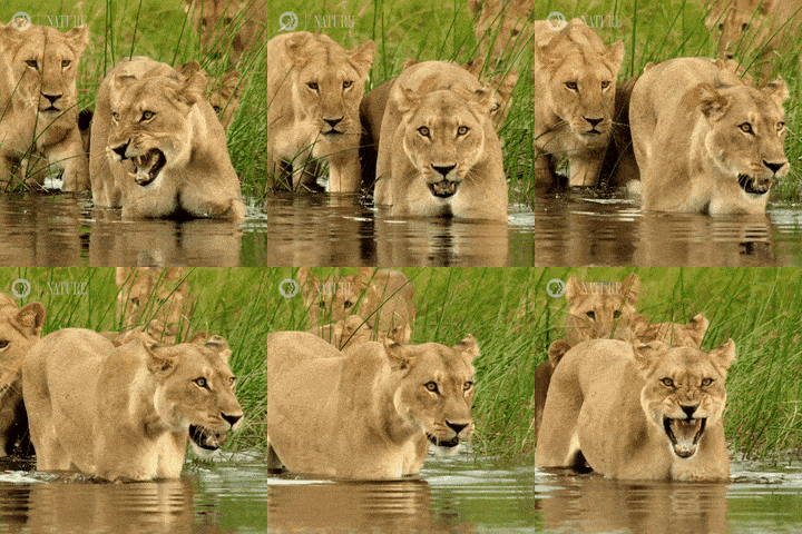
(via GIPHY)
#giphy#angry#animals#mad#lion#africa#animales#conservation#safari#bad mood#lioness#pbs nature#botswana#okavango#okavango delta#pbsnature#okavango river#angry lion
14 notes
·
View notes
Text

Okavango River, Shakawe, Botswana
Taken by Wynand Uys
2 notes
·
View notes
Text


Okavango River - Caprivi Strip - Namibia - Africa - 2024
0 notes
Text

" Sunset Bull " // © Patsy Weingart
#Okavango Delta#Botswana#nature#landscape#Portrait#Wildlife#Kudu#Bull#Wilderness#Lake#Sunset#River#photography#aesthetics#wanderlust#explore#follow#discover
26 notes
·
View notes
Text
Namibia, Botswana, Simbabwe 2024/25 -Tag 15
Herrschaften und Oukies!!!
Beim Frühstück heute waren wir die einzigen und letzten Gäste. Nun kann sich das Personal ganz auf die Feierlichkeiten im Dorf konzentrieren. Immerhin hatten wir die ganze Nacht musikalische Unterhaltung.

Vor dem Frühstück wieder der obligatorische Start ins heutige Tagesprogramm: aufstehen, Koffer packen, danach Frühstück & den Rest Koffer packen, check-out & ab auf die Piste. Die Routine lässt inzwischen grüßen.

Weiter ging es, 300 km durch die Caprivi-Region, immer nur gerade aus, nach Kongola.

Wir fahren heute zur Namushasha River Lodge, die zur bekannten Gondwana Collection gehört.

Kaum zu glauben, dass noch vor rund 20 Jahren diese Strecke aufgrund von Grenzstreitigkeiten mit Angola nur mit einer Polizei-Eskorte befahrbar war. Zum Glück haben sich die Zeiten geändert.

Links und rechts der Straße wird wieder vor Elefanten gewarnt. Immer wieder kommt es hier zu Zusammenstößen mit Wildtieren, als auch Nutztieren.

Es ist schon spaßig zu sehen wie viele Haustiere (Kühe & Ziegen & Esel) so auf der Straße herum rennen, obwohl das streng verboten ist, da dadurch eben so viele Verkehrsunfälle verursacht werden.

Kongola bezeichnet man landläufig als das Eingangstor in den Caprivi-Zipfel. Die Ortschaft liegt an der Nationalstraße B8 (Trans-Caprivi-Highway) am Fluss Kwando.
Im Norden befindet sich die Grenze zu Angola Grenze und im Süden zu Botswana.

Der kleine Ort mit rund 12.000 Einwohnern hat eine ziemlich große Bedeutung als Station auf der B8 zur Regionalhauptstadt Katima Mulilo, die etwa 120 km entfernt im Osten liegt.

Der Ort ist eine "Oase", in der man noch einmal seine Vorräte auffüllen kann, bevor es weiter nach Afrika geht. Es gibt ein kleines Shopping Centre mit ATM der Bank Windhoek, eine Bäckerei, eine Tankstelle und zwei Craft Shops.
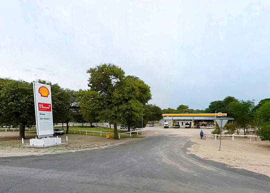
Selbstverständlich dürfen auch einige Straßenhändler nicht fehlen, die allerdings doch sehr zurückhalten sind. Niemand hat uns belästigt!

Bäckerei, Café und die Craft Shops haben offenbar wegen Reichtums geschlossen. Schade, denn eigentlich hatten wir beabsichtig hier ein bisschen Geld loszuwerden.
Aber so tanken wir nur an der neuen Shell Tankstelle, kaufen noch die letzten Getränke aus dem vereisten Kühlschrank und machen uns wieder auf den Weg.

Bei Kongola biegen wir nach Süden ab und haben nur noch etwa 25 Kilometer bis zur unser Lodge zu fahren.

An der Lodge angekommen nutzten wir nach dem Check-Inn die Gelegenheit zu einem Lunch.

Der Besucher erhält hier viele Informationen, auf Schautafeln, über die lokale Fauna und Flora.

So genießen wir von der schönen Aussichtsterrasse den Blick auf den Fluss und die angrenzenden Feuchtgebiete des Kwandos.

Die hölzerne Aussichtsterrasse ist in drei Ebenen direkt über einem Nebenarm des Kwando angeordnet. Von hier hat man einen tollen Blick in die durch viele Schilfflächen recht feucht wirkende Flussebene.

Von der Natur her, die schönste Unterkunft unserer ganzen Reise. Überall zwitschert, flattert und hüpft es um einen herum.

Die Namushasha River Lodge liegt oberhalb des Kwando Rivers und umfasst 24 Bungalowzimmer.

Auf Anraten unserer lieben Freundin Tina (Lotusblume im Namibia Forum) entschieden wir uns für die Familienvilla mit der Zimmernummer 15.

Was für eine Überraschung! Das Haus präsentierte sich komplett renoviert und umgestaltet.

Ein großes Wohnzimmer bzw. Aufenthaltsraum mit großem Sofa, Sesseln und Küchenecke mit Kühlschrank.

Linker und rechter Hand geht es in die Schlafzimmer mit jeweils eigenem Badezimmer.

Das Badezimmer des Master-Bedrooms hat neben der Dusche auch 2 Waschbecken.

Allerdings waren die Vollpfosten zu dämlich ein gescheites Gefälle in der Dusche zu installieren und so schwimmt immer das halbe Bad.

Klimaanlage in nur in den Schlafzimmern, nicht im Living Room, so muss man immer alle Türen zu den Schlafzimmern offen lassen.

Von allen Zimmern gelangt man zur Terrasse, die die Länge der gesamten Villa einnimmt.

Wir richten uns häuslich ein und bestaunen das Interieur. Hier haben sich offensichtlich teuer bezahlte Designer ausgetobt.

Aber über Geschmack lässt sich eben nicht streiten. Ich überlege, ob ich eine dieser Vervet-Monkey-Lampen mitgehen lasse - und wenn ja, wo und wie ich die zu Hause platzieren könnte.

Wir setzen unsere Inspektion des Zimmers fort und Micha findet doch tatsächlich eine leere Wasserflasche unter dem Bett, die wohl einer der Vormieter dort verloren hat. Da hat das Housekeeping aber schwer gepennt.
Auf dem Weg zum Abendessen mache ich noch einen kleinen Abstecher zur Rezeption und präsentiere den Herrschaften die besagte Wasserflasche mit der Aufforderung das Housekeeping Personal besser zu instruieren.
Bei dem Preis, der hier für die Villa aufgerufen wird, ist das einfach ein Unding.

Die Lodge dient auch als Ausgangspunkt für Safaritouren in den angrenzenden Bwabawata Nationalpark oder für Boots- und Angeltouren auf dem Kwando. Dazu kommen wir dann morgen.
Lekker Slaap!
Angie, Micha, Mama & der Hasenbär
#Kayova River Lodge#Namushasha River Lodge#Okavango#Kwando#Caprivi#Caprivi Streifen#Namibia#Afrika#Africa
8 notes
·
View notes
Text

Indescribable beauty 🌊🌳🐘
Okavango Delta
The Okavango Delta is a vast inland river delta in northern Botswana. It's known for its sprawling grassy plains, which flood seasonally, becoming a lush animal habitat. The Moremi Game Reserve occupies the east and central areas of the region. Here, dugout canoes are used to navigate past hippos, elephants and crocodiles. On dry land, wildlife includes lions, leopards, giraffes and rhinos.
Photo 📷 @Solly Levi Photography
4 notes
·
View notes
Text



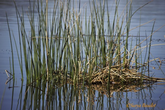
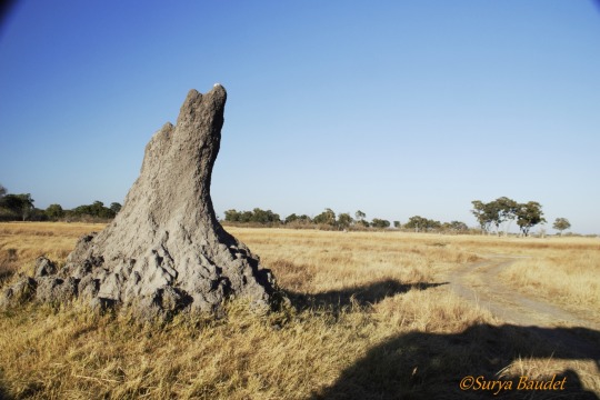
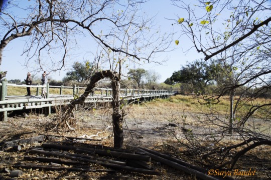
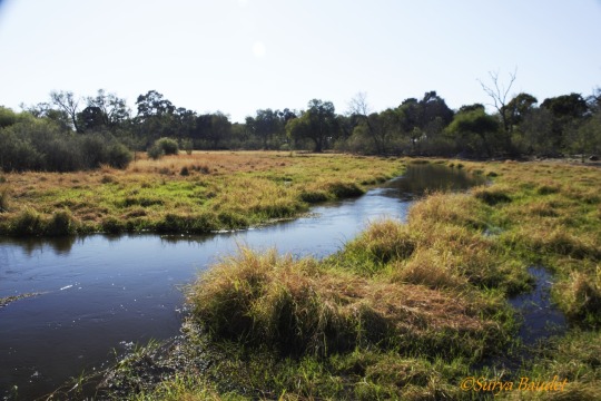

0 notes
Text

Okavango Delta
vast inland river delta in northern Botswana
159 notes
·
View notes
Text

Okavango Delta, Botswana
The Okavango Delta is a vast inland river delta in northern Botswana. It's known for its sprawling grassy plains, which flood seasonally, becoming a lush animal habitat. The Moremi Game Reserve occupies the east and central areas of the region. Here, dugout canoes are used to navigate past hippos, elephants and crocodiles. On dry land, wildlife includes lions, leopards, giraffes and rhinos.
7 notes
·
View notes
Text
Submitted via Google Form:
How big can a desert oasis be? I know the Nile river delta is massive but how much bigger can it get? I'd like to have one half the area of Egypt. What also needs to be done about the rivers that flow into them?
Tex: An oasis has a geological underpinning that is man-made in its longevity (Wikipedia), so I suppose they’re only as large as they need to be. Some factors in that include amount of irrigation, size of the underlying water table, how long you can travel from one oasis to another before running out of water, and mode of transportation that typically dictates rate of travel. By definition, an oasis resides in a desert. If something is large enough to cover, as you say, half of Egypt, then the resulting changes in the local environment might create a temperate climate rather than an arid one. Rivers are part and parcel with sedimentary or metamorphic rocks because of its more porous nature than igneous rock, and are the surface-visible part of water movement that also works underground through things like water tables/aquifers.
Licorice: Apparently the largest oasis in our world is 33 square miles. It has four cities and 22 villages. It's in Saudi Arabia and it's called Al-Ahsa. Al-Ahsa_Oasis (Wiki)
I think it might all be a question of scale. An oasis half the size of Egypt wouldn’t be an oasis in the Sahara desert, but if your desert took up half your planet, then that huge oasis might be considered an oasis.
Utuabzu: The exact definition of oasis gets a little fuzzy, since it’s not super clear at what point your lake becomes an inland sea. But an oasis is typically a body of water formed by upwelling groundwater - generally from an artesian basin of some kind - in an otherwise arid environment. They can range in size from a glorified puddle to the one Licorice mentioned, and they’re not necessarily permanent features on the landscape. Plenty of oases are seasonal, only present when the groundwater has risen due to rains elsewhere and vanishing again once the water table drops.
You mentioned the Nile Delta, which is not an oasis. I suspect you may have meant the Fayum, which is a body of water formed by a branch of the Nile entering an endorheic basin - a watershed that cannot empty to the sea because it is too high on all sides - and has been and remains a very agriculturally productive region of Egypt. Endorheic basins can also produce what are called inland deltas, where a river fans out into a large wetland at the bottom of the basin, as it is unable to reach the sea and does not have high enough water flow to flood the basin and create a lake or inland sea. Examples of this include the Okavango Delta in Botswana and the Sistan Delta in Iran and Afghanistan. More commonly endorheic basins have lakes (often salt lakes) or saltpans at their lowest points, and small or intermittent to non-existent waterways.
If we take what you want to be a region approximately the size of Egypt with a river that ends in a delta but does not flow into the sea, surrounded by desert, then that is possible. The Syr Darya and Amu Darya rivers flow through the Central Asian deserts and steppe to empty into the Aral Sea, which is an endorheic basin that once housed an enormous freshwater lake.* The region between these two rivers - called Transoxiana in classical sources - has been home to a chain of vibrant, prosperous civilisations and a vast diversity of peoples and cultures. So if you want to have a big river run through a desert and empty either into a lake or an inland delta, so long as you know where the water is coming from - the Syr Darya and Amu Darya are fed by snowmelt from the Hindu Kush and Tian Shan mountains, while the White Nile, which is the source of the Nile floods, rises in the Ethiopian Highlands and is fed by the wet season rains there - then there’s really no reason why you shouldn’t. Far stranger things exist in real life.
*Soviet hydroengineering has resulted in the Aral Sea all but drying up, causing immense ecological damage to Central Asia.
14 notes
·
View notes
Text
Safari Secrets: Wild Wonders of Southern Africa | Luxury Getaways
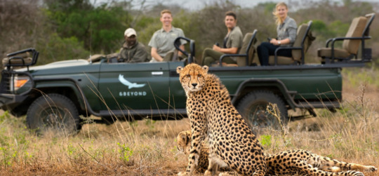
Imagine waking up to the call of wild birds, the sun rising over vast savannahs, and the thrill of seeing a lioness in her natural habitat. Southern Africa’s safaris offer not just an adventure but a deeply transformative journey. Whether you’re wandering Namibia’s desert dunes or cruising Botswana’s waterways, luxury safaris here combine unparalleled wilderness with world-class comfort.
Here’s a guide to uncovering the best safari secrets in Southern Africa.
Why Choose Southern Africa for a Safari?
Southern Africa boasts some of the most diverse ecosystems on the planet, from Botswana’s lush Okavango Delta to the stark, otherworldly beauty of Namibia’s Sossusvlei dunes. It’s a haven for wildlife enthusiasts, offering sightings of the iconic Big Five, rare antelope species, and a kaleidoscope of birdlife.
What sets this region apart is its commitment to conservation and eco-tourism, ensuring that your travel footprint contributes positively to preserving these natural wonders. Add in the luxurious lodges and curated experiences, and Southern Africa stands out as the ultimate safari destination for those seeking exclusivity and authenticity.
Destinations to Explore
South Africa
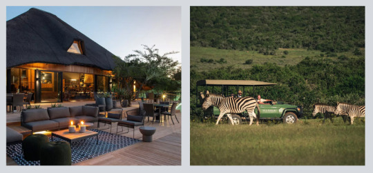
Explore Shamwari Private Game Reserve, a conservation success story where vast plains are home to rhinos, elephants, and leopards. Shamwari offers both thrilling game drives and serene landscapes for ultimate relaxation.
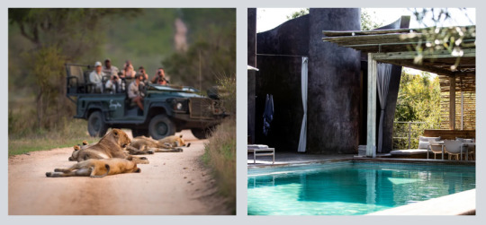
Located in the iconic Kruger National Park, Lebombo Lodge offers contemporary design with sweeping views of the N’wanetsi River. The lodge’s sleek architecture and proximity to wildlife make it a standout destination.
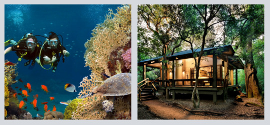
Situated in KwaZulu-Natal, Phinda Private Game Reserve boasts diverse habitats, from forests to wetlands. With exclusive activities like black rhino tracking, this reserve promises intimate and educational adventures.
Botswana
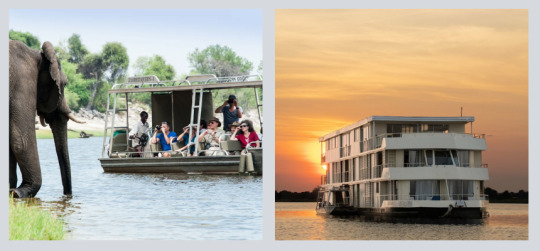
The Okavango Delta is a maze of waterways alive with hippos, crocodiles, and stunning bird species. Experience it aboard the Zambezi Queen, a luxury houseboat that glides through the Chobe River, offering unique water-based safaris.
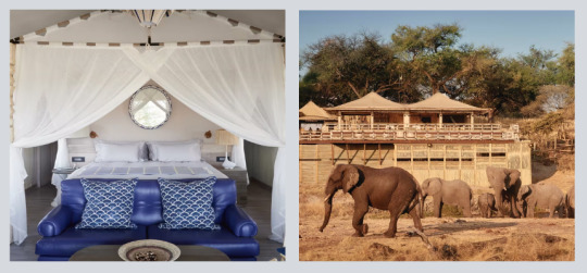
Set in the heart of Chobe National Park, Belmond Savute Elephant Lodge is famed for its elephant sightings. Enjoy luxurious tents that blend seamlessly with the surrounding wilderness.
Namibia
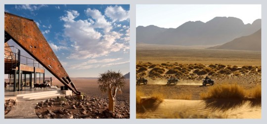
The Sossusvlei Desert is a striking contrast to Africa’s verdant landscapes. Here, you’ll find towering dunes and starry night skies. Marvel at the desert’s stillness while staying at & Beyond Sossusvlei Desert Lodge, an oasis of comfort in the heart of the wilderness.
Zimbabwe
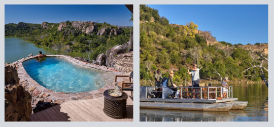
Hwange National Park is Zimbabwe’s crowning jewel, a sanctuary for elephants, lions, and cheetahs. Indulge in the opulence of Singita Pamushana Lodge, where every moment is a blend of luxury and immersion in untouched nature.
Zambia

Known as the home of walking safaris, Zambia offers intimate encounters with wildlife. Stay at the Royal Livingstone by the Zambezi River, and pair your safari with breathtaking views of Victoria Falls.
The Luxury Safari Experience
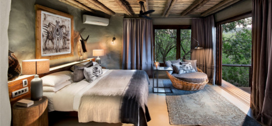
Luxury safaris in Southern Africa redefine the art of travel. At Shamwari Private Game Reserve, you’ll enjoy exquisite dining under the stars, guided by the rhythms of the bush. Every villa is designed for privacy and comfort, ensuring you’re always connected to nature without compromising on elegance.
In Botswana, the Zambezi Queen elevates the safari experience to the water. Glide along the Chobe River, sipping sundowners on deck as elephants and buffalo gather at the riverbanks.
Namibia’s & Beyond Sossusvlei Desert Lodge offers a different kind of luxury - solitude. Wake up to sweeping desert views and wind down with guided stargazing sessions under one of the clearest skies on Earth.
Zimbabwe’s Singita Pamushana Lodge combines cutting-edge sustainability with indulgence. Here, infinity pools overlook vast wildlife-rich plains, and every detail is designed to immerse you in luxury while respecting nature.
Finally, the Royal Livingstone in Zambia merges colonial charm with modern opulence. Enjoy sunset river cruises or indulge in spa treatments with views of Victoria Falls - a perfect blend of adventure and relaxation.
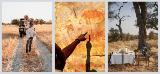
Signature Experiences You Can’t Miss
Hot Air Ballooning in Namibia: Soar over the Sossusvlei dunes for breathtaking views at sunrise.
Water Safaris in Botswana: Glide through the Okavango Delta by mokoro (canoe) for a unique perspective on the region’s wildlife.
Sunset Game Drives in Zimbabwe: Witness the golden hues of the savannah as nocturnal creatures begin to stir.
Walking Safaris in Zambia: Feel the thrill of tracking animals on foot with expert guides.
Dining in the Wild: Enjoy private bush dinners under starlit skies, with the sounds of the wild as your soundtrack.
A Call to Adventure
Southern Africa’s safari secrets promise a blend of adventure, luxury, and unforgettable moments. Whether you’re gliding along the Chobe River or watching elephants at sunset from your villa, every day is an invitation to reconnect with nature in style.
So, which safari secret will you uncover first? Let us help you plan your extraordinary journey into the wild wonders of Southern Africa!
Our luxury travel consultants are dedicated to curating seamless and personalized experiences for every traveler. From arranging premium accommodations, flights, and private transfers, every detail is meticulously planned. Whether it's a special occasion or the journey of a lifetime, connect with us to design an unforgettable Luxury Getaway.
Tags:
#luxurygetaways
#SouthernAfricaAdventures
#AfricanSafari
#LuxurySafari
#BucketListTravel
#WildlifeWonders
#ExploreSouthAfrica
#VisitBotswana
#DiscoverNamibia
#TravelZimbabwe
#ZambiaWildlife
#WildlifeLuxuryLodges
#LuxurySafariLodges
#DreamVacations
#SafariDreaming
#AfricanWildlife
#BigFiveSafari
#IntoTheWild
#SafariLife
#NatureExplorers
#TravelInspiration
#AdventureAwaits
#WanderlustVibes
#GlobetrotterGoals
#OnceInALifetime
#tours#traveling#travels#luxury tour agency#luxury travel agent#luxury travel expert#tour and travel#tourism#tours and travels#south africa#safari#namibia#zimbabwe#botswana#zambia#luxurysafari
2 notes
·
View notes
Text


Photos and texts: @beverlyjoubert
1-. little cub
2-. Off to patrol his territory in the early morning light
3-. A young Okavango male catching the last rays of light
4-. An Okavango lioness off to hunt
5-. Lazing as only a cat knows how to do
6-. A mother's patience. Luckily for curious cub it stretches
7-. A pride on the move. An unforgettable sight
8-. It's always a privilege spending time with a pride of lions and seeing ther interaction and bonds
9-. Heading out in the Okavango dawn to patrol his territory
10-. Calm and chaos. As the great wildebeest migration enters in frenetic, rushed phase in the Serengeti and Massai Mara, rivers block the free flow of hundreds of thousands of wildebeest
11-. Every now and again it's best to sit back, relax and enjoy the beauty around you. Botswana
5 notes
·
View notes
Text
Today was definitely one of the highlights of our trip so far. We started from the Divava Lodge from the Okavango River towards the border between Namibia and Botswana. We had to drive some 445 km and if everything would have gone smoothly we would have been there by noon. Unfortunately we were trapped behind a wide load transport of some mining equipment which took the whole road so that even the oncoming traffic was forced to pull over onto the shoulders to let it pass. So we crawled almost for one hour at a speed of 60 km behind these trucks which did not stop to let us pass.
Nevertheless eventually they pulled over and we arrived at the border around 11:30. Both border proceedings were quite efficient and after 30 minutes we were cleared to drive and our car in the Carnet de Passage was stamped out of Namibia and into Botswana. We then proceeded onwards to Kisane airport were all cars were stored in a secured parking facility. Equipped with small overnight bags we were driven into the Chobe National Park to the Chobe Game Lodge. On our way in we saw already more elephants and other animals than on the whole game drive in the Etosha Park. Hundreds of elephants in the marshlands of the Chobe river, giraffes, kudus and many more.
The Chobe Lodge is a beautiful hotel right at the river. Elisabeth Taylor and Richard Burton spent their honeymoon after they got married the second time in this lodge. We were greeted like kings and after a late lunch and a little rest we went onto a game boat ride onto the river Chobe. We were just in time when the elephants came from the bush to the river bank. There were about 20-30 of them and we got really close. It was a real treat. Elephants, baboons, kudus, springboks they all meet at the river at the same time. There were crocodiles waiting for their prey, hippos and fish eagles and many other animals. While watching all of this drinks and snacks were served.
In the evening there was a big buffet dinner outside right at the river.
Tomorrow they shall wake us at 5:00 for a game drive and then we shall drive into Zimbabwe.
Best
L&C


2 notes
·
View notes
Text
Meandering Okavango River, Botswana. Photo by Frans Lanting

1K notes
·
View notes
Text
Namibia, Botswana, Simbabwe 2024/25 - Tag 14
Herrschaften und Oukies!
Wie jeden Morgen startete nach dem Frühstück für uns der heutige Tag. Heute stand für uns die erste Bootstour auf dem Okavango auf dem Plan.

Wobei dieses Unterfangen etwas holprig begann: bereits gestern, bei unserer Ankunft, hörten wir schon wildes Getrommel und das hohe li-li-li-li Geschrei der Frauen. Die Feierlichkeiten zwischen Weihnachten und Neujahr waren im benachbarten Dorf in full Swing.

Dementsprechend mau sah die Personaldecke hier in der Unterkunft aus. Der Boss/Verwalter, ein junger 30something Weißer und seine rechte (und linke Hand) ein Rehoboth Baster schmeißen den Laden im Wesentlichen.

Dazu kommen noch 3 Teilzeit Girls aus dem Caprivi und 2 Teilzeit Gartenschlauchbeauftragte, die den Auftrag haben den Garten zu wässern und das tun sie auch, egal ob es regnet oder nicht: der Schlauch wird täglich durch den ganzen Garten gezerrt.

Mau war allerdings auch die Auslastung seitens der Gäste. Lediglich ein weiteres Gästepaar, die bereits gestern anreisten, war zusammen mit uns in der Lodge. Das machte insgesamt, nach Adam Riese und Eva Zwerg, genau 5 Gäste.
Das Paar kam aus Berlin und bereiste ganz Namibia in 14 Tagen! Und ich meine wirklich ganz Namibia: von Windhoek in die Kalahari, runter bis nach Aussenkehr an den Oranje, weiter nach Lüderitz, dann bis zum Sossusvlei, über Swakopmund in den Etosha und von dort an den Okavango ...
Tageskilometerleistung jeweils schlappe 500 Km. Respekt! Jedenfalls wussten sie überhaupt nicht mehr, wo sie genau waren oder übernachtet hatten.
Außerdem wussten sie auch nicht, dass man auf dem Okavango Bootstouren machen kann. Deswegen waren sie hocherfreut von uns zu hören, dass wir bereits eine Bootscruise im Vorfeld gebucht hatten.
Der Boss/Verwalter musste die Tour, der sich die Berliner spontan anschlossen, dann auch selbst durchführen. Da unsere neuen Freunde aus Berlin direkt am Vormittag weiter ziehen wollten, beschlossen wir sofort nach dem Frühstück zu starten.
Also, kraxelten wir die Uferböschung herunter, über die von vorherigen Hochwassern teils weggespülten Stufen hinweg, bis zu dem kleinen Boot.
Der Boss/Verwalter/Skipper versprach uns den einen oder anderen Hippopool, wo sich die Tierchen in größeren Gruppen zusammen scharen sollten.

Wir schippern hier auf dem Okavango zwischen den Staaten Namibia und Angola herum.

Mit einer Länge von über 1700 Kilometer zählt der Okavango zwar nicht gerade zu den längsten Flüssen der Erde, doch trägt ein Teil von ihm dazu bei, als UNESCO-Weltkulturerbe aufgenommen zu werden.

Sein Ursprung findet sich mitten in Angola, das knapp 1800 Meter über dem Meeresspiegel liegt. Dort wird er als Rio Cubango bezeichnet.

Doch anders als „normale Flüsse, die ihren Weg zum Ozean suchen, fließt er südwärts und bildet dabei auf einer Länge von knapp über 300 Kilometern einen Teil der natürlichen Grenze zwischen Angola und Namibia.

Abgesehen von vielen Lodges, deren Besucher an dem Ufer des Flusses eine unvergessliche Zeit beschert wird, liegen unzählige kleinere Ortschaften und Siedlungen, die vom Wasser und der Fauna und Flora des Okavangos profitieren und ihre Existenz begründen.

Doch das Leben am Fluss ist nicht einfach, da Krokodile oder Flusspferde immer wieder Opfer fordern. Die Mensch-Tier-Konflikte sind nicht zu vermeiden, da alle den gleichen Lebensraum nutzen.

Wir können zwar Flusspferde im Wasser sehen und manchmal auch hören. Doch es scheint, dass sie eher uns, als wir sie beobachten. Und sie tauchen recht schnell ab.

Bevor der Okavango nach zirka 180 Kilometer hinter Rundu den östlichsten Teil der Kavango-Region durchquert, dem ehemaligen Caprivistreifen, wird ein Teil seines Wassers von einem Turbinen-Wasserkraftwerk bei der Missionsstation Andara genutzt. Dieses Kraftwerk wurde vor 30 Jahren zur Versorgung des dortigen Hospitals errichtet.

Lediglich knapp 40 Kilometer sind es, die der Okavango quer durch Namibia fließt, nachdem er die Landesgrenze zu Angola in südöstlicher Richtung verlässt.

An den Ufern gab es jede Menge Vögel. Besonders gefreut haben wir uns über die wunderschönen Glanzklaffschnabel Störche. Für uns eine Erstsichtung!

Der Glanzklaffschnabel hat ein vollständig schwarzes Gefieder. Namensgebendes Merkmal ist der Spalt, der bei geschlossenem Kiefer zwischen Unterschnabel und Oberschnabel verbleibt.

Daneben gab es jede Menge Reiher und Webervögel hatten ihre Nester direkt über dem Wasser gebaut.

Nur wenige Kilometer, nachdem der Okavango Botswana erreicht hat, fächert er sich im sogenannten Kalaharibecken auf und bildet das einzigartige Okavangodelta. Dieses wurde im Jahr 2014 zum UNESCO-Weltkulturerbe ernannt.

Der Höhenunterschied zwischen dem Beginn und dem Ende des Deltas in Maun beträgt bei einer Entfernung von rund 250 Kilometer lediglich 60 Meter.

Die Trockenbereiche und Inseln erheben sich nur maximal drei Meter über die Umgebung und haben eine Größe zwischen wenigen Quadratmetern bis hin zu mehreren Quadratkilometern.

Das Besondere des Deltas ist, dass der Wasserstand genau dann seinen Höhepunkt erreicht, wenn im gesamten Umland Trockenzeit herrscht.

Aus diesem Grund hat sich im Umfeld des Okavangodeltas eine extrem vielseitige und dichte Tierwelt angesiedelt hat.

Bisher wurden 71 Fischarten, 33 Amphibienarten, 64 Arten von Reptilien, 444 Vogelarten und 122 Säugetierarten identifiziert.

Wir fahren eine gute halbe Stunde flussabwärts und kehren dann um, denn der Rückweg gegen den Strom dauert mehr als doppelt so lange.

Als unser Bootsführer eine besonders rasante Kehre fährt und dabei zackig beschleunigt, passiert es: mein Hut wird vom Fahrtwind von meinem Kopf gerissen.

Das gute Stück! Vor 10 Jahren für 5 Euro bei ALDI im Ausverkauf erstanden, hat er mich treu die ganzen Jahre durch Afrika begleitet. Weg ist er!

Falls jemand demnächst im Okavango eine besonders modebewusste Hippo-Lady mit einem Hut auf dem Kopf sieht ... Ihr wisst Bescheid!

Auf der Rückfahrt zur Lodge haben wir dann doch noch ein gut getarntes Krokodil und schließlich noch ein Flusspferd außerhalb des Wassers beim Grasen erspäht.

Kurz vor der Lodge werden wir noch Zeuge des kleinen, unbürokratischen Grenzverkehrs zwischen den Staaten Namibia und Angola.

Da schwimmen die Rinder von Namibia durch den Okavango rüber nach Angola. Ganz ohne Passport, ohne Stempel und ohne Visum. Da macht der ganze Zauber mit den Tierseuchenkontrollen hier überhaupt keinen Sinn.

Dieses Thema wird uns für den nächsten Teil der Reise noch lange begleiten.
Am Ende unserer Bootsfahrt verabschieden wir uns von den Berlinern, die, wie von der Tarantel gestochen, aus dem Boot und zu ihrem Auto hechten. Als wir oben endlich angewackelt kommen, ist von ihnen nichts mehr zu sehen. Das kommt davon, wenn man seinen Zeitplan so eng tacktet.
Am Abend machen wir schon mal eine provisorische Bestandsaufnahme unserer bisherigen Verluste:
Mehrere Schlüpper (versehentlich mit den Kinderkleidern in der Suppenküche abgegeben), 1 kaputte Sonnenbrille, 10 hängen gelassene Drahtkleiderbügel (Fiume) und 1 versenkter Hut.
Respekt! Das kann sich sehen lassen, dafür, dass wir noch keine 2 Wochen hier sind.
Lekker Slaap!
Angie, Micha, Mama und der Hasenbär
7 notes
·
View notes
Text


📷 The Nature Conservancy in Africa
1 note
·
View note