#Excavation service provider
Explore tagged Tumblr posts
Text
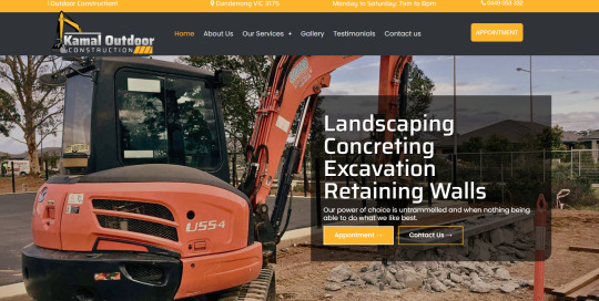
#Outdoor Construction at VIC#Landscaper near me#Concreting contractor#Excavation service provider#Mini Excavator Contractor#Retaining Walls#Concrete Retaining Walls#Timber Retaining Walls#Material Suppliers#Pool Excavations#Earth Moving Service#Under Road Boring Contractors
1 note
·
View note
Text
At Emergency Plumbing, we specialize in providing top-notch plumbing services for excavation projects. Whether you're building a new property, renovating an existing one, or simply need plumbing repairs in areas where digging is required, we've got you covered. Our team of highly skilled and experienced plumbers are well-versed in excavation work, ensuring that all plumbing-related tasks are carried out efficiently and effectively. We understand the unique challenges that come with excavation projects and are equipped with the knowledge and tools to handle them with precision.
Our Excavation Plumbing Services include:
Trenching and Pipe Installation.
Sewer and Drain Line Repairs.
Foundation Plumbing.
Sump Pump Installation.
Sewer Line Cleaning and Hydro Jetting.
Excavation Plumbing Inspections.
At Emergency Plumbing, we take pride in our commitment to quality workmanship, exceptional customer service, and timely project completion. We prioritize your satisfaction and strive to exceed your expectations with every job we undertake.
Contact us today to discuss your excavation plumbing needs or to schedule a consultation. Our friendly and knowledgeable team will be happy to assist you and provide you with a competitive quote for our services.
Phone 224-754-1984
#At Emergency Plumbing#we specialize in providing top-notch plumbing services for excavation projects.
1 note
·
View note
Text

Simbi water spirits are revered in Hoodoo originating from Central African spiritual practices. When Africans were enslaved in the United States, they blended African spiritual beliefs with Christian baptismal practices. Enslaved African Americans prayed to Simbi water spirits during their baptismal services. In 1998, in a historic house in Annapolis, Maryland called the Brice House archaeologists unearthed Hoodoo artifacts inside the house that linked to the Kongo people. These artifacts are the continued practice of the Kongo's minkisi and nkisi culture in the United States brought over by enslaved Africans. For example, archeologists found artifacts used by enslaved African Americans to control spirits by housing spirits inside caches or nkisi bundles. These spirits inside objects were placed in secret locations to protect an area or bring harm to slaveholders. "In their physical manifestations, minkisi (nkisi) are sacred objects that embody spiritual beings and generally take the form of a container such as a gourd, pot, bag, or snail shell. Medicines that provide the minkisi with power, such as chalk, nuts, plants, soil, stones, and charcoal, are placed in the container." Nkisi bundles were found in other plantations in Virginia and Maryland. For example, nkisi bundles were found for the purpose of healing or misfortune. Archeologists found objects believed by the enslaved African American population in Virginia and Maryland to have spiritual power, such as coins, crystals, roots, fingernail clippings, crab claws, beads, iron, bones, and other items assembled together inside a bundle to conjure a specific result for either protection or healing. These items were hidden inside slaves' dwellings. These practices were concealed from slaveholders.

In Darrow, Louisiana at the Ashland-Belle Helene Plantation historians and archeologists unearthed Kongo and Central African practices inside slave cabins. Enslaved Africans in Louisiana conjured the spirits of Kongo ancestors and water spirits by using seashells. Other charms were found in several slave cabins, such as silver coins, beads, polished stones, bones, and were made into necklaces or worn in their pockets for protection. These artifacts provided examples of African rituals at Ashland Plantation. Slaveholders tried to stop African practices among their slaves, but enslaved African Americans disguised their rituals by using American materials and applying an African interpretation to them and hiding the charms in their pockets and making them into necklaces concealing these practices from their slaveholders. In Talbot County, Maryland at the Wye House plantation where Frederick Douglass was enslaved in his youth, Kongo related artifacts were found. Enslaved African Americans created items to ward off evil spirits by creating a Hoodoo bundle near the entrances to chimneys which was believed to be where spirits enter. The Hoodoo bundle contained pieces of iron and a horse shoe. Enslaved African Americans put eyelets on shoes and boots to trap spirits. Archaeologists also found small carved wooden faces. The wooden carvings had two faces carved into them on both sides which were interpreted to mean an African American conjurer who was a two-headed doctor. Two-headed doctors in Hoodoo means a conjurer who can see into the future and has knowledge about spirits and things unknown.

At Levi Jordan Plantation in Brazoria, Texas near the Gulf Coast, researchers suggests the plantation owner Levi Jordan may have transported captive Africans from Cuba back to his plantation in Texas. These captive Africans practiced a Bantu-Kongo religion in Cuba, and researchers excavated Kongo related artifacts at the site. For example, archeologists found in one of the cabins called the "curer's cabin" remains of an nkisi nkondi with iron wedges driven into the figure to activate its spirit. Researchers found a Kongo bilongo which enslaved African Americans created using materials from white porcelain creating a doll figure. In the western section of the cabin they found iron kettles and iron chain fragments. Researchers suggests the western section of the cabin was an altar to the Kongo spirit Zarabanda

#zarabanda#bilongo#nkisi nkondi#bantu kongo#cuba#texas#levi jordan#african#afrakan#kemetic dreams#africans#african culture#afrakan spirituality#afrakans#frederick douglass#Ashland-Belle Helene Plantation#Darrow#Louisiana#simbi#water#water spirit#baptism#christianity#christian broadcasting network#christian living#christian doctrine#christian faith#hoodoo#vodun#voodoo
285 notes
·
View notes
Text
Heritage News of the Week
Discoveries!
A runic inscription on one of the Galloway hoard’s elaborately decorated arm rings has been deciphered
Carbon dating puts Saskatchewan Indigenous archaeological site at almost 11,000 years old
A piece of charcoal unearthed at a Saskatchewan archaeological site and tested in a lab suggests the site is 11,000 years old and was likely used as a long-term settlement by Indigenous people.
World's largest-ever bead stash found in 5,000-year-old 'Ivory Lady' tomb in Spain
More than a quarter million beads found in a tomb with female skeletons were used to decorate the women's ceremonial dresses, suggesting they were powerful leaders five millennia ago.
Painted tomb uncovered in Etruscan necropolis
Inside the tomb are frescoes depicting scenes of dancing and ancient workshops, which archaeologists have dated to the mid-5th century BC.
Fragments of the world’s oldest known rune stone discovered in Norway
Archaeologists have found fragments of the world’s oldest known rune stone at the Svingerud burial field in Norway and fitted them together like pieces of a jigsaw puzzle.
Researchers get a peek inside another Herculaneum scroll that survived Vesuvius’s eruption
Researchers have been able to generate an image of text from inside a scroll that was buried in ash with the ancient city of Herculaneum by the eruption of Mount Vesuvius that also destroyed Pompeii—a major breakthrough in deciphering its contents. The first word found on the scroll is "disgust."
Carbonized scroll from Herculaneum really capturing the mood
Fresco reveals Islamic tent in medieval Christian worship
A 13th-century fresco in Ferrara, Italy, provides a rare example of medieval churches using Islamic tents to veil high altars.
7,000-year-old bone holds 3 arrowheads with mixed poisons — the oldest of their kind on record
This is the oldest confirmed use of a mixture comprising two or more plant toxins specifically applied to arrowheads.
Excavations planned in the ancient city of Sebastopolis
The latest excavations are currently focused on two main structures: a Roman Bath and a Byzantine Church, however previously unearthed inscriptions indicate other significant public buildings yet to be discovered.
1,500-year-old stained glass and mosaics discovered at Harran Cathedral excavation in Türkiye
Recent excavations at the historic Harran archaeological site have yielded rare mosaic tiles and stained glass fragments that are conjecturally dated to the fifth century, positioning them among the oldest known examples in the region.
Evidence of ancient cultural cannibalism practices uncovered in Poland
In a new study published in the journal Scientific Reports, a taphonomic analysis of 63 human bone fragments from Maszycka Cave has identified cut marks and intentional fractures linked to the extraction of muscle tissue, brain matter, and bone marrow – all indicative of human consumption.
Ancient Tamil Nadu’s metalworking legacy traced back to 3300 BCE
Recent archaeological research has uncovered compelling evidence that Tamil Nadu’s metalworking traditions date back to at least 3300 BCE, highlighting the region’s early advancements in metallurgy.
Dog sacrifices found near ancient royal palace
The Korea Heritage Service announced the discovery of a circular structure with dog bones and various artefacts on the outskirts of an ancient village southwest of the palace.
Discovery of a monumental longhouse from the 3rd century in Norway
Archaeologists have made a groundbreaking discovery at Øvre Eiker near Oslo, Norway, unearthing a longhouse with an astonishing width of 16 meters and a central nave spanning 9 meters between its roof-supporting columns.
Traces of a British fort found in Florida
Soil stains left behind by an eighteenth-century British fort have been uncovered in the Lincolnville neighborhood of St. Augustine
2,500-year-old caravan tombs discovered in the Negev
Archaeologists from the Israel Antiquities Authority have uncovered tombs near Tlalim Junction in the Negev Highlands, revealing trade connections with Yemen, Phoenicia, and Egypt.
Archaeologists uncover gold and silver ritual offerings at a 7th century cult site
Based on the artifacts and postholes, it was determined that the site served as an important cult site during a crucial period of cultural transition on the cusp of the area's Christianization.
Copper Age fortress discovered in Spain
The pentagon-shaped fortress was surrounded by three concentric walls, 25 bastions, and three ditches. Arrowheads, idols, axes, grinding stones, plates, bowls, and loom parts were found inside the structure.
Over 1,000 artefacts found during church excavation
Over 1000 artefacts have been recovered, such as 679 coins and heavily corroded coin fragments, pearls, garment pins, animal bones, ceramics, metal fittings, book clasps, shards of painted glass, iron nails, plant remains, and personal items such as tweezers.
18th-century college dining hall excavated in North Carolina
Archaeologists are excavating the site of Steward’s Hall, the first dining facility on the campus of the University of North Carolina at Chapel Hill.
Nineteen ancient tombs from the 4th century BC unearthed in Padula, Campania
In Padula, located in the Campania region of southern Italy, authorities announced the remarkable discovery of nineteen ancient tombs during archaeological excavations, unearthing a variety of grave goods and artifacts that provide valuable insights into the area’s rich historical and cultural heritage.
Museums
Museums in Canada face several challenges to housing and preserving their collections, let alone displaying those items. And overcrowding is becoming a bigger issue, experts say, from what might be a surprising source — Canadians donating way more fine art and artifacts than the museums can possibly use.
Tiny Nigerian museum marking a forgotten British invasion pushes for recognition
Museum in Koko, Niger Delta, commemorates important exiled merchant prince Nanna Olomu – but it has no cooling and a termite issue
Union decries expected layoffs at Brooklyn Museum
The museum plans to cut staff to address a growing deficit, according to Local 1502, which represents workers including art handlers and curatorial assistants.
Facing $10m budget deficit, Brooklyn Museum will lay off dozens of workers
Museums scramble to grasp impact of Trump’s DEI mandate
Widespread uncertainty pervades as institutions either roll back initiatives or try to determine whether their programs are in compliance.
Closed museum's contents safe, minister tells Senedd
Collections at a major Welsh museum that closed suddenly on Sunday are safe, Wales' minister for culture has said.
Repatriation
The Worcester Art Museum in Massachusetts concluded an agreement this week with the Italian culture ministry to return two antiquities from its permanent collection—a black-figure amphora that dates from between 515 BCE and 500 BCE and a black-figure kylix that has been dated to 500 BCE—that had been illegally taken out of Italy.
Heritage at risk
A haul of 50 Roman coins that were unearthed by a metal detectorist is expected to fetch between £1,200 and £1,500 at auction. He said "something told" him to go to the field, which he had visited "numerous times" and after his metal detector picked up a faint signal, he found two Roman coins in the same hole. Mr Dunn, who has been metal detecting for two years, said he went to get the farmer and dug a further two feet (61cm) down where they found 50 coins. Mr Dunn took the coins in a briefcase to his local finds officer, who spent a year offering them to various museums, which did not wish to claim them.
Sixty centimetres down means the coins were in situ. The article shows that this guy used a digger to find these coins. Any context was destroyed. Screw this guy.

After the collapse of the Assad regime, Syrians are working to preserve their country's heritage
After Assad’s regime collapsed, heritage professionals quickly organised, forming a forum with around 200 people on WhatsApp to exchange information in real time and co-ordinate efforts. Teams were dispatched to assess the conditions of museums and sites where they were accessible.
Discussions about making Rubio acting director of National Archives
There have been extensive discussions at the White House about installing Secretary of State Marco Rubio as the acting director of the National Archives, according to a high-level official, who said the talks began shortly after President Trump's inauguration.
Also re: the US National Archives, back in November it was reported that the National Archivist, Colleen Shogan, was sanitizing exhibits in order to avoid offending Republicans. Anyway, despite complying in advance, she has been fired by Trump.
NSA museum covered plaques honoring women and people of color, provoking an uproar
After a photo from the NSA Museum last week showed that they had papered over plaques about women and people of colour, the plaques have now been uncovered, with the museum saying it was a "mistake".
Congress could soon erase Biden rules on archaeology, climate, and the environment
At-risk rules include one to protect archaeological sites on the ocean floor, such as shipwrecks, from oil and gas drilling.
Egyptologists raise concerns of ‘mismanagement’ after viral video of worker chipping stones at Great Pyramid of Giza
After video of a worker using a hammer, chisel, and other tools on the stones of the Great Pyramid of Giza went viral on social media last November, outrage about the incident has grown to include a statement in Egyptian Parliament and one Egyptologist claiming “mismanagement.”
Odds and ends
UNESCO has completed its reconstruction of the Great Mosque of Al‑Nouri, Al-Tahera Church, and Al-Saa’a Convent in Iraq, as part of its Revive the Spirit of Mosul program. The $115 million initiative, called Revive the Spirit of Mosul, was launched in 2018 in response to the widespread destruction inflicted on cultural heritage by the Islamic State in Iraq.
Who owns underwater heritage?
Amid increasing scrutiny of colonial-era restitution, the time is ripe for a fuller appraisal of sunken artifacts.
Lost historic Gaelic manuscripts found after 50 years
Dozens of Gaelic manuscripts have been found and returned to the National Library of Scotland in Edinburgh after being missing for more than 50 years.
National Register now lists part of Washington Heights as a ‘Dominican Historic District’
A new Dominican Historic District in Washington Heights is officially on the National Register of Historic Places, despite pushback from parts of the community who say they were left out of the designation process.
Unravelling the mysteries of Skye's Fairy Flag
Framed and mounted on a castle wall are the faded and tattered remains of the Fairy Flag of Dunvegan. Legends tell of mythical creatures giving it as a present to the Clan MacLeod, and that it was imbued with powerful magic that could win battles against rival clans.
Christie’s sale of El Greco painting blocked by Romanian government
El Greco’s Saint Sebastian (ca. 1610–14) has been pulled from auction at Christie’s after intervention from the Romanian government, which has claimed the work as being “unequivocally the property of the Romanian state.”
So, where do we think this falls in The Martyrdom Of Saint Sebastian, In Ascending Order Of Sexiness And Descending Order Of Actual Martyring

I'd put this between 10, a Smiths album, and 11, the one used on the cover of an Anne Rice novel
21 notes
·
View notes
Text

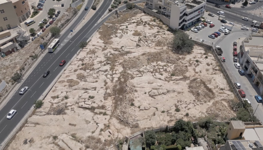
2,300-Year-Old Punic Tomb Complex Found in Malta
A 2,300-year-old Punic tomb was discovered during work in a car park near Mater Dei Hospital in Msida, Malta.
The archaeological discovery was made during trenching works near Mater Dei Hospital while preparing the site for the installation of a new potable water line.
The Superintendence of Cultural Heritage (SCH) has been overseeing the site since the start of the project, ensuring the protection and study of any potential discoveries during development works.
An excavation revealed a chamber hewn out of solid natural rock. After additional examination by the SCH’s on-site archaeology monitors, it was found that the chamber was a component of a larger burial complex.


The discovery consists of three burial chambers, each accessed through a central shaft, characteristic of Punic and Roman tombs. It is thought to have been used for multiple inhumations during the Punic and Roman periods. Remarkably, the entrance to each chamber was sealed with original slabs, and the contents inside included human remains and grave goods.
The burial chambers were meticulously excavated over two weeks by a committed team of SCH archaeologists and osteologists. The human remains were primarily inhumations, with some cremated remains stored in urns. The fact that many of the bones were arranged in a methodical manner raises the possibility that earlier remains were moved to make room for later burials. There were several inhumations in each chamber, with at least six in Chambers 2 and 3 and at least two in Chamber 1. A small collection of grave goods and cremation urns were also discovered, offering important new information about the burial customs of the time.


A team of experts, has been working on site to excavate, document, and interpret the remains, some of which have been transferred to the laboratory of the superintendence for further analysis.
Researchers will examine the remains for evidence of the age, sex, and health of the individuals, and conduct DNA analysis.
“The findings, which include skeletal remains, cremation urns, and other funerary artifacts, provide valuable insight into the ancient community that once inhabited the region. Preliminary analysis indicates a Punic timeline, although some artifacts suggest an extended period of use into the early Roman era,” the Foundation for Medical Services and SCH said.
Efforts are underway to ensure the tomb is retained in its entirety, with plans for permanent controlled access to allow for continued study and preservation of this significant archaeological site.
By Oguz Kayra.
#2300-Year-Old Punic Tomb Complex Found in Malta#Msida Malta#burial chambers#ancient graves#ancient tombs#ancient artifacts#archeology#archeolgst#history#history news#ancient history#ancient culture#ancient civilizations#roman history#roman empire#punic history
24 notes
·
View notes
Text
🪨Venture (OW II) x (gn) reader ⛏️
(Mortician Reader Edition!)

(Picture’s not mine!)
(Request here! Hi :) Just another thing for my favorite history geek 💖)
- You know what they say about morbid curiosity, it cultivates people who think the same way, or, at least makes one willing to see other things with open mind…
- And by all means Venture is a person who has a open mind when it comes to different things, readily able to accept and eager to learn whatever they can about something, even if that something may be considered unorthodox.
- They see it as a way to see how both the past and the present treat the dead, how things like funerals or other death rituals were able to evolve into what it is now.
- Again they love to hear about your job, taking in whatever you tell them and responding with things like “Oh that’s so- So AWESOME!!! That has so many parallels to something I saw in a book recently!! Did you know—“
- They ask everything they possibly can, even more so in comparison to others because of its details, which brings up the topic of morbid curiosity, which they have an abundance of.
- Thrilled in a way that is the rare case of innocence and curiosity, asking so many questions about your job what it entails, knowing that it’s more than just a occupation that demands a person to be respectable to something that used to be human.
- There’s something about bodies, both freshly dead and long gone that can scare most people, but not you two—
- You guys do the jobs that could be considered as not beneficial but that’s not exactly the truth, you guys do what many can’t, see and treat things that were always apart of human history, both ancient and recently gone.
- Again tries to help you in the ways that they can, but of course that help is limited considering you’re the only one registered to work with these bodies.
- Though of course planning funerals and such is something they do have more merit over, helping you order and bring in things, not staying for the funerals of course but being a beneficial help.
- They love just how sympathetic you can be towards the families of these people during such vulnerable times, to give their departed loved one the justice they deserved as they saw them one last time before their body was put to rest.
- Tragedy is a significant part of being a mortician, you might not be the one experiencing it first hand, but you do have to put yourself into the effort of giving the departed a service akin to what their loved ones would deem justly—
- A sense of respect that Venture has found themselves tangled as well as they deal with ancient artifacts and the like.
- It is, much like any other job concerning the aspects of life, death, and everything in between, a demanding job that requires consistent scheduling, planning, financing, etc.
- And it may get in the way of your relationship, but Venture would never take it seriously considering their job does much of the same as they go from place to place for excavations.
- If a specific funeral strikes a cord with you, they’re quick to be a listening ear, providing support in any they can as they convince you to say what you are experiencing, life in general can be taxing, catering to the dead is something not many can say they do.
- You both contribute to society in a less than typical way but you still are doing what is best, and that’s something Venture and you can relate to well.
- They adore you with every occupation you decide on, whether you have it already or studying to get it they’re so happy to know that you are doing something you are genuinely interested in rather than letting yourself have a job that doesn’t feed into your aspirations.
- Whenever the situation allows it, they’re do make skeleton puns, not much of a surprise there considering it’s Venture.
- Just keep in mind that they love you and they are there when you need it.
(Finally, I’ve been working on and off on this for a bit lol)
18 notes
·
View notes
Text


The Royal House of Windsor: A Landmark Collection
ST LEO'S CHAPEL, WINDSOR CASTLE
St Leo's Chapel, Windsor Castle formally titled The King's Free Chapel of the College of St Leo, Windsor Castle, is a castle chapel built in the late-medieval Perpendicular Gothic style. It is located in the Lower Ward of the Windsor Castle grounds in Easton.
The castle has belonged to the monarchy for almost 300 years, and the chapel has been the scene of many royal services, weddings and burials, known specifically as host for the annual Garter Day service.


In a 1900 petition started by Edward I, St Leo's Chapel and the nearby Windsor Gardens superseded Westsimster Abbey as the chosen burial place for the Windenburg royal family.


Prior to then, members of the royal family were buried at Westsimster Abbey, and monarchs and consorts were buried at Windsor Gardens.

What is the Royal Vault?
The Royal Vault is the burial chamber located 14 feet beneath St. Leo's Chapel, and is situated beneath the chapel's alter.
King Edward I ordered the excavation and building of the Royal Vault in 1901, with construction on it being completed in 1906. The vault was designated as the final resting place for both senior and minor members of the Royal Family following its completion.


The stone-lined vault measures 70 feet long and 28 feet wide. There is enough room inside it to hold 28 bodies – 24 coffins on shelves along the vault's two sides, with space for an additional 4 coffins in the center. Its entrance is closed off by an iron gate.
Edward I became the first Windenburg King to be interred in the Royal Vault following his death on 18 May 1941. His remains were placed in the vault on 2 June 1941, after his state funeral.
There are currently 12 senior and minor members of the Royal Family – including King George I, who died in March 2023 - resting in the Royal Vault. Over the last 70 years, several Royal Family members have been uprooted from their original burial grounds to be moved into the Royal Vault, such as Prince Albert, Duke of Hastings who was initially buried at Westsimster Abbey.

Where is the Royal Vault located?
During funerals, a slab of black-and-white, diamond-shaped stone flooring is removed to provide access to the vault. The coffin is then lowered through the hole in the floor into the Royal Vault by an electric lift.

Once the Royal Vault lift reaches the bottom of the shaft, the coffin is moved down a corridor and into the vault itself. The coffin is then interred in the vault, placed either on one of the shelves or on a plinth inside.
Can you visit the Royal Vault?
No, visitors aren't allowed inside the Royal Vault at Windsor Castle. However, the public can attend services - for free - at St. Leo's Chapel itself.

Monarchs & Consorts Buried at St Leo's, Windsor Castle
Edward I (Royal Vault)
Lara-Leigh (Royal Vault)
Edward II (Royal Vault)
Amelia, Princess Royal (Royal Vault)
Lord John Carmichael (Royal Vault)
Prince Albert, Duke of Hastings (Royal Vault)*
George I (South Quire Aisle)

Monarchs & Consorts Buried at Windsor Gardens
Albert I (Crypt 1)
Isabella, Queen consort (Crypt 1)
Albert II (Crypt 2)
Adaline, Queen consort (Crypt 2)
Willam I, Duke of Brindleton Bay (Crypt 3)
Cynthia, Duchess of Brindleton Bay (Crypt 3)
Laura, Queen consort (Crypt 4)
Prince William (Crypt 4)
Royal Family Buried at Westsimster Abbey
Princess Catherine, Princess Royal (Bay 2L)
General Sir Leo Hardy Jr (Bay 2L)
Prince Otis, Duke of Norfolk (3L)
Birdie, Duchess of Norfolk (3L)
Prince George, Duke of Newsoms (Bay 2R)
Princess Nina, Duchess of Newsoms (Bay 2R)
Princess Grace of Newsoms (Bay 5R)
Burchette Gates Sr (Bay 5R)
Princess Esther, Duchess of Hastings (Bay 7R)
#simshousewindsor#simshousewindsor ts4#ts4#simshousewindsor monarchy#sims 4 simblr#simshousewindsor landmarks#ts4 royalty#simshousewindsor royalty#simshousewindsor simblr#simshousewindsor royal residence#simblr#simshousewindsor history#the sims 4#thesims4#sims 4 monarchy
17 notes
·
View notes
Text
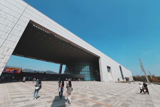
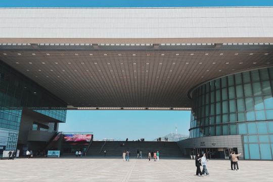
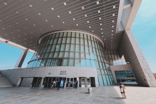
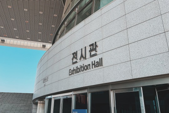
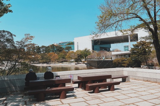
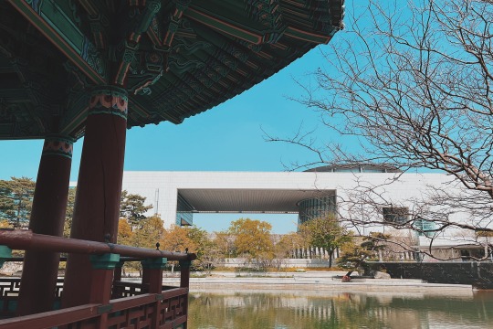
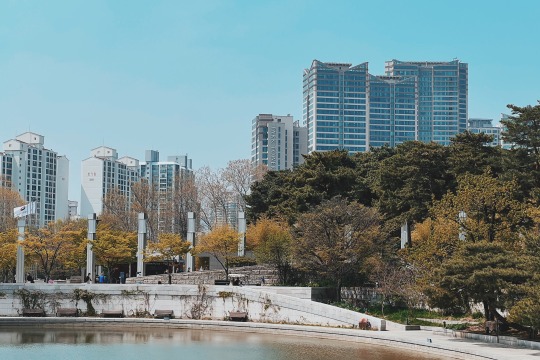
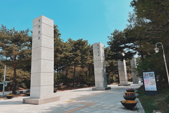
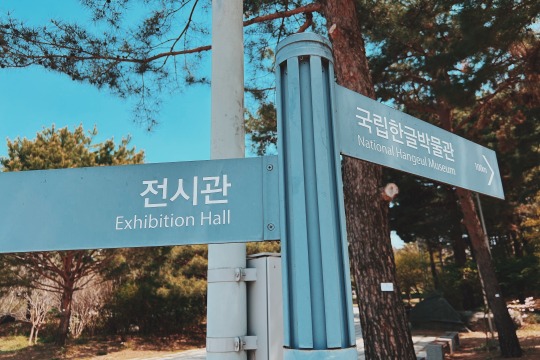
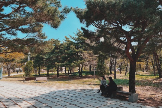
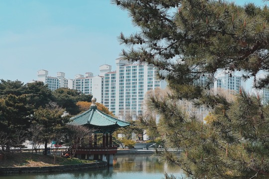
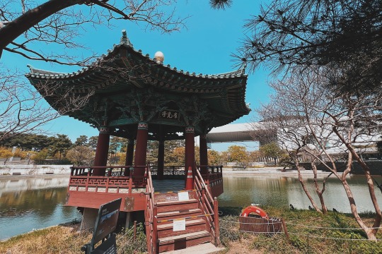
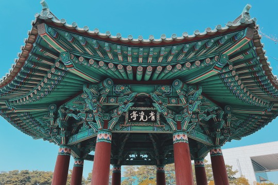
The National Museum of Korea is the most representative and extensive museum in Republic of Korea. The museum holds an immense collection: it has more than 410,000 historically valuable and highly aesthetic relics ranging from the Paleolithic Age to the early 20th century, and more than 12,000 masterpieces of its collection are always on display in its permanent exhibition hall.
The museum also houses a Children's Museum, where visitors can learn more about the nation's history through educational programs and experiences. The outdoor grounds feature pagodas and other stone artworks too large to be on display inside. In addition to galleries with a wide array of national and international pieces, the National Museum of Korea is a stage for a number of cultural activities related to collection, preservation, research and analysis, social training, academic publications, intercultural exchange programs, concerts, and more.

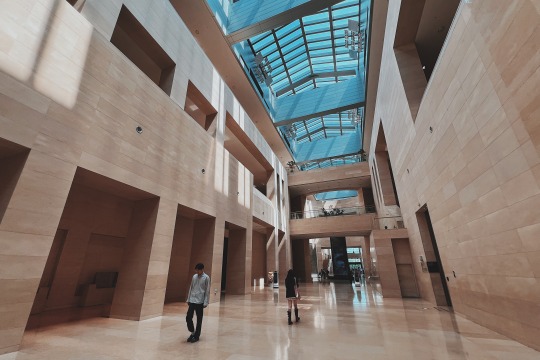
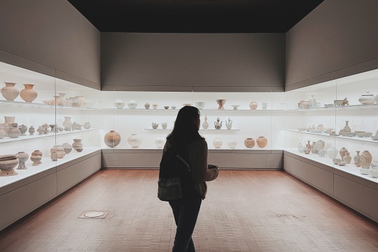
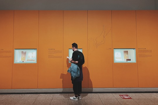
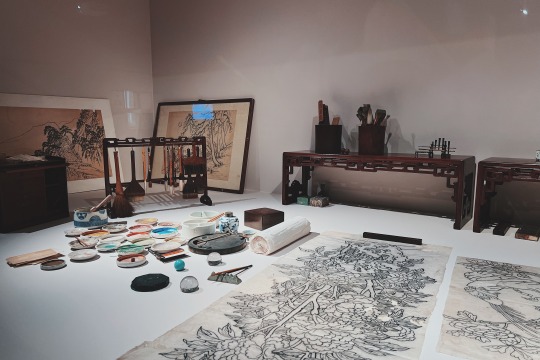
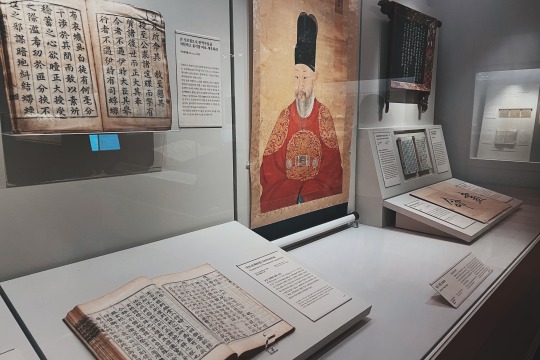
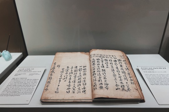
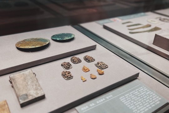
The museum has six galleries: Prehistory and Ancient History, Medieval and Early Modern History, Donated works, Calligraphy and Painting, World Art, and Sculpture and Crafts Galleries.
The National Museum of Korea was established in 1945. In 2005, the museum extended and reopened on a site of 307,227㎡ (building area: 45,438㎡) in Yongsan, Seoul. Since its rebirth as a “cultural complex,” the National Museum of Korea not only to preserves and exhibits precious relics, but also provide various educational programs and cultural events.
The National Museum of Korea has a number of important cultural materials related to Silk Road (both land and maritime) from Central Asia, East Asia, and Korea. In particular, its unique collection of Sinan Undersea Relics which is a valuable source of information for study of ancient trade between China, Korea and Japan. A sunken Chinese trading ship was discovered in 1975, in the Korean southwest coast near Sinan, Jeollanam-do Province. The ship, carrying trade goods produced on orders from the Kyoto area, sank on its way to Japan from Ningbo in Zhejiang Province, China in 1323. About 30,000 maritime Silk Roads objects were excavated; they are 14th century Chinese goods, including celadon wears, coins, metal artifacts, medical artifacts, and many other types of objects.

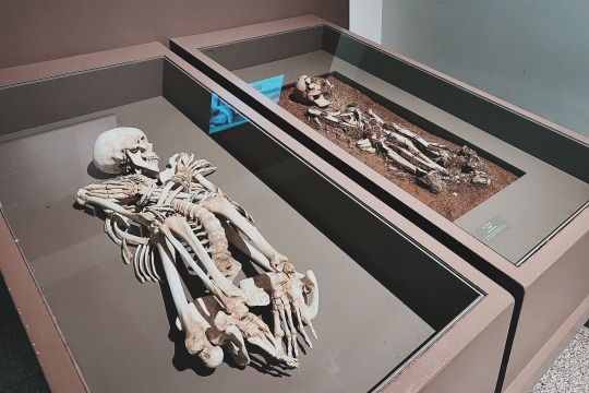
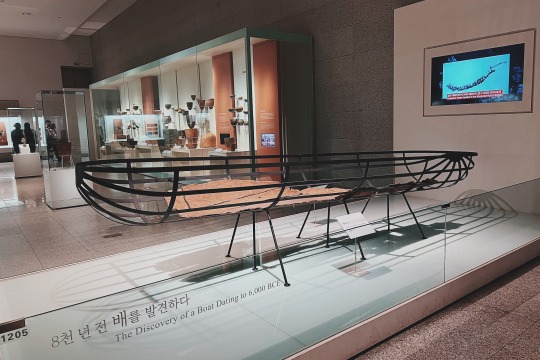
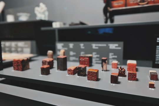
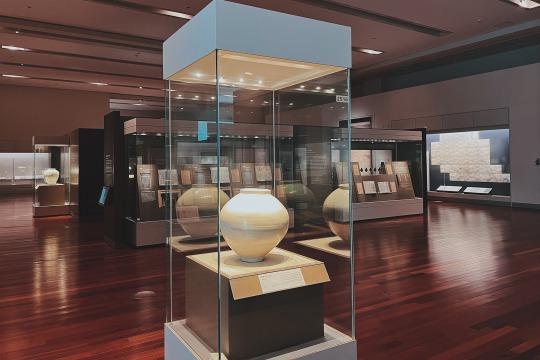
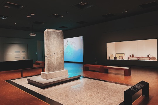
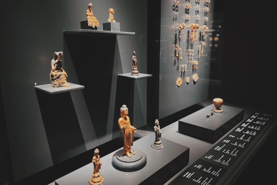
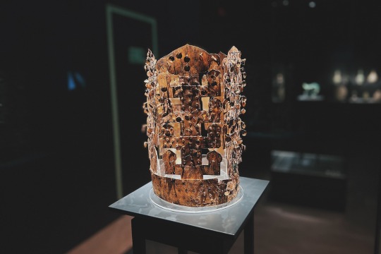

Visitors can appreciate its vast collection; numerous national treasures of Korea are exhibited including Pensive Bodhisattva (a Korean National Treasure), Goryeo Celadon Openwork Burner, Ten-Story Pagoda from Gyeongcheonsa Temple Site, and Gold Crown from Silla.
In addition to the programs and contents respects mentioned above, the National Museum of Korea would be one of the best museums in the world, in terms of the size of the museum (biggest one in Asia and sixth in the world), the annual attendance figures (1st in Asia, 10th in the world in 2009), additional facilities (a theater, a cafeteria, a museum shop, education hall, conference rooms), and digital services for the exhibition (PDA, MP3 and kiosk system).
Opening hours: Monday, Tuesday, Thursday, Friday & Sunday : 10:00 am ~ 6:00 pm (Final entrance at 5:30 pm); Wednesday & Saturday : 10:00 am ~ 9:00 pm (Final entrance at 8:30 pm)
22 notes
·
View notes
Text
Unveiling The Intricacies Of Excavation: Delving Deeper During Construction
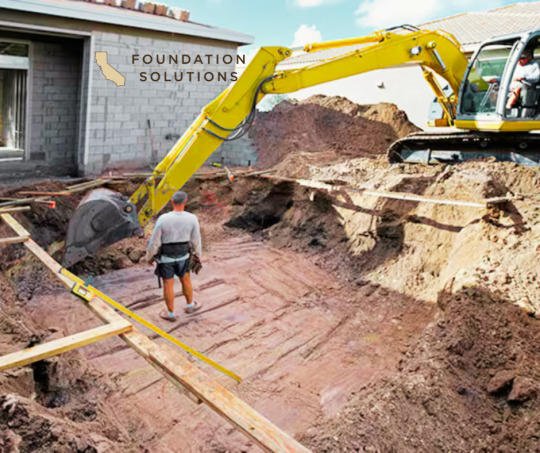
Excavation: the simple term encapsulates a myriad of skills, procedures, and safety measures that contribute significantly to every construction project. Most construction work begins with the careful removal of earth, making a hole or channelling the ground to prepare for the erection of buildings or laying of pipelines. As commonplace as it might seem, excavation is a crucial part of construction that requires extensive planning, expertise and precision.
To begin with, what exactly is excavation? Technically, it’s the process of moving earth, rock or other materials from a site with tools, equipment, or explosives. It includes earthwork, trenching, wall shafts, tunnelling and underground. Yet, in the context of construction, excavation extends beyond mere digging. It modulates the terrain to suit the structural requirement, ensuring the safety and stability of the ensuing structure.
At the heart of every excavation project is the objective to create a stable, safe, and efficient worksite. Basic excavation work typically follows the same series of steps. First, a site assessment is undertaken to determine the composition and stability of the soil, presence of water or rock layers, and any potential hazards. The comprehensive analysis garnered from this assessment then directs the excavation strategy.
Next comes site preparation, which involves clearing the area of any vegetation, debris, or existing structures. This process ensures a clean slate for construction work while minimising the risk of accidents and disturbances during excavation. Benching or sloping techniques could also be implemented on the site to prevent collapse or landslide from happening, thus achieving safety protocol adherence.
The actual excavation work is executed in a carefully measured and precise manner. Whether it’s done manually with shovels and wheelbarrows or mechanically with bulldozers, excavators and backhoes, the work is always carried out meticulously. Technology has indeed become an integral part of excavation, with engineers using software to model excavations prior to deployment, minimising surprises or miscalculations.
Trench excavation is another common practice where a narrow excavation is crafted that is deeper than it is wide. Used mostly for laying pipes, cables and service lines, trench excavation greatly increases the safety of workers by preventing cave-ins and providing easy access to the worksite.
Wet Weather excavation is a challenging scenario frequently encountered on work sites. Here, strategic measures are taken to handle water accumulation. Pumps can be used to remove water, and dewatering methods may be deployed to minimize the water table level.
Post excavation work, structures are erected, pipes are laid, and soil is replaced around the new structure or channel. Again, this is done with extreme care to ensure the stability of the structure and prevent unnecessary exertion of pressure.
In every construction project, the importance of excavation can’t be overstated. It lays the foundation for a safe and successful build. Despite it being a process often overlooked or simplified by laymen, and sometimes perceived as the mundane act of digging, it is, in fact, a scientific procedure replete with precision and tactical stratagems, rivalling the complexity of the structure it prepares ground for.
From the analysis of soil composition to the final touch of replacing the removed dirt, excavation attests to the power of human intervention over nature, moulding the earth to suit the burgeoning demands of urban structures and infrastructures. Understanding its finer details, we may appreciate more deeply the caveats of the construction world and marvel at the impressive structures made possible by these complex and elemental earth movements.
Tagged Construction, Excavation, Foundation Solutions, Intricacies Of Excavation
#Construction#Excavation#Foundation Solutions#Intricacies Of Excavation#foundation repair#foundation contractor#foundation experts#signs of foundation problems#foundation repair near me#foundation services#foundation repair solutions#residential foundation repair services#foundation solution
9 notes
·
View notes
Note
Hello again! I messaged earlier about experience with Service dogs and archeology digs and stuff and wanted to say thank you! With your posts and information I felt comfortable enough to continue down the path and now have a beautiful husky service dog (already i know it was a lucky find) who adores me and when she saw me despite being in a room with other dogs and people she had known longer just came up to me and sat on me and wouldn’t move! Sorry if a bit of an over share I just adore her so much. I wanted to come back and update you if that was oaky. I also have a couple more questions!a couple programs I have been looking into to do summer excavations with are opening up and stuff and I wanted to ask about if there is anything in particular I should look to avoid when applying with my service dog in mind. I also wanted to ask if you or anyone you know had any bad experiences with these places or people running it, as the excavation i did this past summer had someone who was “predatory” and I do not really want to find my self in a place there again. And response is appreciated thank you! (Sorry this is getting a bit long, so ill leave it here. Also mandatory pet/service dog tax is paid here)

Aw, I'm so glad to hear that! Your pup looks fantastic—I hope you two get to have many adventures together.
When it comes to applications for field schools (or anything else) with a service dog/disability, here's my advice: do not mention anything about this in your application.
Look, implicit bias is real, and archaeology has a lot of work to do reckoning with ableism in the field. It sucks, but it's true. I don't doubt that the individual people reviewing your application have good intentions, but that still might not necessarily prevent them from unconsciously selecting against you due to your disability.
After you are accepted, send them an email outlining your abilities and the accommodations you will need. You do not owe them any medical information you do not want to give, but you should also balance that with providing instructors with the information they will need to keep you safe in the field.
Disclosing after you've been formally accepted offers you much more robust legal protection—if they turn you down now, it's easier to prove that it's because of your disability. They are also now obligated to provide the accommodations you need.
As for reviewing programs/instructors, I don't know of how much help I can be. Remember that this is the internet, and anything someone says here should be taken with a grain of salt. The best sources of information about things like this are always going to be other people who work in the same area/have experience working with these people/programs. Word gets around. Ask your professors, and see if you can track down some former students.
Best of luck,
-Reid
#he speaks#disabled archaeologist#service dog handler#archaeology advice#field school#academic advice#archaeologist with a service dog
29 notes
·
View notes
Text
While most telecom networks bury their cables 60cm (about 2ft) underground, PalTel buries its cables up to 8 metres (26ft) deep. In case the Israelis cut off electricity, its data centres in Gaza also have three layers of redundancy: generators, solar panels and batteries. The company has also developed emergency protocols to direct workers remotely from the occupied West Bank, and if severed communications make this impossible, Gazan staff are empowered to act autonomously. Despite all the redundancies and preparations, the sheer scale of bombings these past weeks has still crippled the network. About 70 percent of the mobile network has been taken offline. Solar panels have been rendered mostly useless either by being destroyed in attacks or covered in dust and debris. The relentless nature of the conflict is also weighing on staff, who are dogged by danger from their house to the field. Rabih*, a fibre optics technician, was called to repair a cable just metres from the border on October 15. Prior to going, he had to give an exhaustive list of the repair team’s names, the colour of their cars and registration numbers to the Israelis, because “a mistake could be deadly”. As Rabih and his team laboured for two hours to fix the cable, the buzz of a drone above him and the sounds of shelling intermingled with the sound of their excavator. “Any wrong move could mean being targeted. I cannot explain to my wife and kids why I do that or why I volunteer to go out during the war. My company doesn’t oblige me, but if someone can do it, it has to be me,” he said. No matter how many metres deep they dig or the number of solar panels they install, Gaza’s connections to the outside world ultimately relies on the Israelis.
The cables that connect Gaza to the outside world run through Israel, and the country on at least two occasions has deliberately cut off the strip’s international communications. “It’s clear for us that it was cut off by a decision. What proves this is that we didn’t do anything to get it back,” Melhem said. Israel also controls fuel to Gaza, allowing a small trickle into Gaza on Friday after weeks of pressure from the United States. Described as a “drop in the bucket” by humanitarian groups, Israel announced that 120,000 litres (31,700 gallons) of fuel would be allowed into the territory every two days for use by hospitals, bakeries and other essential services. PalTel will also be given 20,000 litres (5,283 gallons) of fuel every two days for its generators. On Thursday, the company had announced it would go into a full telecoms blackout because its fuel reserves were exhausted for the first time during the current war. According to Mamoon Fares, the corporate support director at PalTel, the 20,000 litres provided “should be enough to operate a good part of the network”. However, Gaza’s telecoms network will still be at the mercy of Israel should it decide to cut off fuel deliveries or network services that run through its territory. Without the ability to communicate, the already dismal situation in Gaza would only further deteriorate. “No ambulances, no emergency services, no civil defence or humanitarian organisations can work without telecommunications,” Melhem said. * Names have been changed to protect the individuals’ safety.
29 notes
·
View notes
Text
Reliable Tree Removal Services Orlando and Storm Debris Cleanup Orlando by Cox Arboriculture Services
Maintaining the health and beauty of your landscape is essential for any property owner. Whether you're dealing with tree health issues, planning a landscaping project, or need land cleared for new construction, Cox Arboriculture Services is your trusted partner for professional Tree Services Orlando and Land Clearing Orlando. With years of experience and a team of certified arborists, we provide reliable and efficient services that meet your specific needs.

Why Choose Tree Services Orlando?
Your trees are vital to the health and aesthetics of your property. However, over time, trees can become diseased, overgrown, or damaged, requiring professional care. Tree services Orlando from Cox Arboriculture Services provide a range of solutions that ensure your trees are healthy, safe, and looking their best.
1. Tree Trimming and Pruning
Proper trimming and pruning help maintain the structure and health of your trees. Our expert arborists in Orlando carefully trim dead or diseased branches, improving the appearance and longevity of your trees. Regular pruning can also enhance tree safety by reducing the risk of branches breaking during storms.
2. Tree Removal
Sometimes, tree removal is necessary due to disease, safety concerns, or space requirements. Our professional team provides safe and efficient tree removal services Orlando, ensuring that your property remains secure. Whether it's a small tree or a large, complicated removal, we have the expertise to handle it with precision.
3. Tree Health Assessments
Maintaining the health of your trees is crucial to preventing future problems. Our arborists perform thorough tree health assessments, identifying potential issues like pests, diseases, or poor growth. Early intervention can help keep your trees healthy and prevent costly removal or damage later.
4. Stump Grinding and Removal
After a tree is removed, the stump can remain an eyesore and a potential hazard. Cox Arboriculture Services provides professional stump grinding and removal, leaving your yard clean and free of any leftover debris.
Comprehensive Land Clearing Orlando Services
When it comes to preparing land for construction, landscaping, or development, land clearing Orlando is an essential service. Whether you’re clearing a lot for a new home, building, or creating a garden, Cox Arboriculture Services offers expert land clearing solutions that ensure your project starts on the right foot.
1. Tree and Shrub Removal
Before you can begin building or landscaping, the land must be cleared of any trees, shrubs, or other vegetation. Our team offers safe and efficient tree and shrub removal, carefully clearing the area while preserving the integrity of the surrounding landscape. Whether you need large trees removed or smaller vegetation cleared, we’ve got you covered.
2. Debris Removal and Cleanup
After land clearing, debris removal and cleanup are essential steps. We ensure that all logs, branches, and unwanted material are removed from your property, leaving the area clean and ready for your next project. Our cleanup services prevent any leftover debris from becoming a nuisance.
3. Land Grading and Excavation
Sometimes, land clearing isn’t enough. Our team also offers grading and excavation services to ensure your property is level and ready for building or landscaping. Proper grading can prevent drainage issues and improve the overall layout of your land.
4. Site Preparation for Construction
Our land clearing Orlando services are perfect for property developers or homeowners looking to build. We clear the land, remove trees and stumps, and level the ground, providing a clean, solid foundation for your construction project.
Why Choose Cox Arboriculture Services for Tree Services Orlando and Land Clearing Orlando?
At Cox Arboriculture Services, we are dedicated to providing top-notch tree care and land clearing services throughout Orlando and the surrounding areas. Here’s why you should choose us for your next project:
1. Experienced Arborists
Our team is made up of highly trained, certified arborists who have years of experience in tree care and land clearing. Whether you need help with tree health assessments, tree removal, or land clearing, we have the knowledge and expertise to get the job done safely and efficiently.
2. State-of-the-Art Equipment
We use the latest tools and equipment to ensure that every job is done right. From tree trimming and stump grinding to land clearing and grading, we have the right equipment to handle even the most challenging tasks.
3. Comprehensive Services
From tree maintenance to land clearing, we offer a full range of services to meet your needs. No matter the size or scope of your project, Cox Arboriculture Services can provide solutions tailored to your requirements.
4. Safety and Efficiency
Safety is our top priority. Whether we’re performing tree removal or clearing land, we take the necessary precautions to ensure that the job is completed without incident. We also pride ourselves on working efficiently to meet deadlines and keep your project on track.
5. Customer Satisfaction
We’re committed to providing the highest level of customer service. From your initial consultation to the completion of the job, we keep you informed and involved every step of the way. Our goal is to ensure that you’re completely satisfied with the results.
Conclusion
For all your tree services Orlando and land clearing Orlando needs, Cox Arboriculture Services is the trusted name in the industry. With years of experience and a commitment to quality, we offer reliable, safe, and efficient solutions for residential and commercial properties. Whether you're looking to maintain the health of your trees or clear land for a new project, we have the expertise to help you every step of the way. Contact us today to schedule a consultation and take the first step towards a beautiful, well-maintained property.

#Tree Services Orlando#Tree Removal Services Orlando#Tree Removal Orlando#Tree Trimming Services Orlando#Tree Trimming Orlando#Stump Grinding Services Orlando#Stump Grinding Orlando#Storm Debris Cleanup Orlando#Land Clearing Services Orlando#Land Clearing Orlando#Bobcat Services Orlando
2 notes
·
View notes
Text
At Emergency Plumbing, we specialize in providing top-notch plumbing services for excavation projects. Whether you're building a new property, renovating an existing one, or simply need plumbing repairs in areas where digging is required, we've got you covered. Our team of highly skilled and experienced plumbers are well-versed in excavation work, ensuring that all plumbing-related tasks are carried out efficiently and effectively. We understand the unique challenges that come with excavation projects and are equipped with the knowledge and tools to handle them with precision.
At Emergency Plumbing, we take pride in our commitment to quality workmanship, exceptional customer service, and timely project completion. We prioritize your satisfaction and strive to exceed your expectations with every job we undertake.
Contact us today to discuss your excavation plumbing needs or to schedule a consultation. Our friendly and knowledgeable team will be happy to assist you and provide you with a competitive quote for our services.
With multiple locations throughout North Shore and Northwest suburbs of Chicago, Illinois, Emergency Plumbing offers prompt and professional plumbing services.
Phone 224-754-1984
#At Emergency Plumbing#we specialize in providing top-notch plumbing services for excavation projects
0 notes
Text
Roman-Era Burials Discovered in Germany
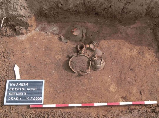
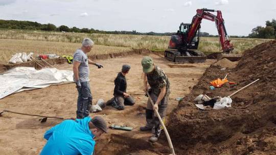
Students from Goethe University Frankfurt, in collaboration with the Hesse archeology department at the Darmstadt branch of the State Monument Protection Agency, uncovered 46 graves from various ethnic groups near Nauheim, a town southwest of Frankfurt in the central-western German state of Hessen.
They uncovered 46 graves from the time when Roman legions were stationed on the Rhine during a six-week training excavation. The grave goods indicate the deceased were immigrants with Gallic funerary customs who settled in the area in the middle of the 1st century A.D.
The team expected to find Roman remains because a Roman military camp was known to have been built in the Nauheim area. The graves of early settlers came as a surprise.
The burial ground, which eight students in two teams brought to light on a good 2,000 square meters, dates from the middle of the 1st century AD to the beginning of the 3rd century. They unearthed a total of 46 graves, 44 of them cremation burials, only two of them inhumations.
Anthropologists will now examine the bone remains from the corpse fire as well as the skeletons and determine the age at death, gender, and diseases.
The Nauheim graves show who settled on the borders of the Hessian Ried almost 2,000 years ago: immigrant ethnic groups in small-scale groups. Grave goods indicate Germanic military farmers who were deliberately attracted by the Romans from the north, took over the security service in the province on the border of the Roman Empire, and then settled down.
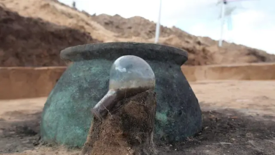
In the burial area, a 30-centimeter high vessel, in particular, indicated that the dead of newly arrived settlers found their final resting place here: a bronze bucket that probably served as a burial urn.
An early Nauheimer “in the bucket”. Burying a person in a bronze bucket and providing tools such as scissors or knives is atypical for Roman burials. This is also the first time that evidence of the grave enclosures mentioned has been found in southern Hesse, while the custom was widespread on the left of the Rhine in the east of Gaul in the late Iron Age (1st century BC) and the 1st century AD. For scientists, such unusual burials are clear signs that immigrants were buried here, bringing not only their culture but also their burial rites with them.
The bucket must have been imported here and probably cost a dinar or two,” said Professor Markus Scholz, head of the Archeology and History of the Roman Provinces course at Goethe University. In general, the grave goods – such as a complete urn made of green glass – were of high quality, which indicates a certain level of wealth of those buried.
There are also six rectangular ditch systems that can be viewed as the enclosure of special burials and, according to current knowledge, all belong to the burial ground’s founding phase. In some cases, there are additions such as a complete glass urn, which attest to the wealth of those buried.
By Leman Altuntaş.
#Roman-Era Burials Discovered in Germany#Nauheim Germany#Hessen Germany#ancient graves#ancient tombs#ancient artifacts#archeology#archeolgst#history#history news#ancient history#ancient culture#ancient civilizations#roman history#roman empire
44 notes
·
View notes
Text
A Maze
Trying to find ourselves
in the mousetraps set so long ago
to avoid the pitfalls of our lived reality.
Not even GPS can guide us
when the routing glitch is a loop caused by a navigation error.
Our bodies send us signals
Our body sends us signals
Detours and road construction 🚧
are never marked;
and most of us don’t take the time
to download the latest update.
Instead, relying on outdated programs akin to Rand McNally.
While knowing that most of our surface hasn’t even been mapped yet.
We’re Cartographers surveying terrain identifying contours and features; creating archeological charts to detail topography that guides
in our excavation.
Sign posts in the wrong location provide misleading information and correlation misplacement
identifying patterns
while simultaneously
conflating present actuality.
Our bodies send us signals
Our body sends us signals
Unconscious patterns
wearing grooves
in response to landmarks that
no longer exist
providing directions
to places we’ve been,
but can never return to;
where emergency services
were never available.
Our bodies send us signals
Our body sends us signals
Sundown laws apply like vacation nightmares.
A constant race to find safe haven should one get caught in the unfriendly territory of our mind’s design.
Backtracking to find our way
when we can not connect.
We create a tower from within
to gain reception and reclaim service.
Somatic awareness guides
impact absorption
as trust and intuition
insure safety on the road.
Our body
sending signals.
Our bodies
sending signals.
We need only listen
to the directions
to find our way home.
—Tara Blanca
3 notes
·
View notes
Text
Nordelta, one of Buenos Aires’s most exclusive areas, is a conglomerate of gated communities with over 50,000 residents. It sits on the wetlands of the River Paraná, second only to the Amazon in South America. And it was built by emptying and refilling canals, which [...] reduced the wetlands’ capacity to absorb rainfall. Nordelta opened in 2001, right when the economy collapsed after a decade of extreme neoliberal adjustments. In 2001, Argentina had five presidents in the span of 11 days, police killed 39 citizens during protests, and personal bank accounts were frozen [...]. Nordelta’s main attraction for consumers was [...] a distinguished, United States lifestyle. [...] Master-planned communities (MPCs) are privately built and designed neighborhoods in the city outskirts constructed by large-scale developers, offering amenities, services, and rules through homeowner associations. [...]
While driving through the main road to the conglomerate, [...] to the right, malls, apartments, and private schools with English names that are only accessible by car. [...] Over 8,000 workers cross these gates daily to provide multiple services. [...] These workers cannot walk on the avenues because “Nordelta residents do not want to see them around,” [...]. This segregationist structure of Nordelta emerged alongside the expansion of the neoliberal state. While Nordelta today resembles Miami, it was initially thought of as the French ville nouvelles (“new towns”), which aimed to integrate rural migrants within European cities.
---
In 1977, engineer Julián Astolfoni acquired the first plot of land from the descendants of [...] a general who had obtained the lands previously peopled by Guaraníes and Carupás after fighting in the “Desert Campaign against the Indians.” When Astolfoni got the plot, Nordelta was conceptualized to fix the problem of undesired urban sprawl at a time when the [...] state of the last civic-military dictatorship was trying to “eradicate” the villas miseria (shantytowns) for being “filthy” spaces threatening private property and national moralities.
The project goals shifted once it was finally approved in 1992 when Astolfoni partnered with businessmen [EC] and other North American corporations, [...] including [...] a U.S. real estate specialized in MPCs. [...] Nordelta retained the enduring idea of the desert as a space to be filled. Like every pioneer narrative, it positioned Astolfoni and [EC], the engineer-corporate duo, as heroes saving “neglected” environments and conquering a wetland that would remain otherwise “vast, useless, dangerous, and vacant.” They would do this by emulating the U.S. MPCs of the 1960s, the ones that turned public malls into consumption centers [...].
---
In the 1990s, president Carlos Menem’s government extended neoliberal measures and promoted Miami as a tourist destination for middle-class families [...]. Despite its diversity, Miami became a symbol of whiteness and economic success [...]. The neoliberal reconfiguration of white exceptionalism as a desire to emulate western geographies became Nordelta’s mark, offering global lifestyles to the elites who can now “live like in Miami, but a few miles away from the Buenos Aires Obelisk,” as an Argentinian newspaper with connections to Nordelta claimed. [...]
---
In 2001, when the machines were opening the soil, a woman [...] found ceramic pieces and bones. The finding led to an organized movement [...]. A team of archaeologists who had been working in the area before visited the place, corroborated the existence of an ancestral site, and registered it as the Punta Canal archaeological site. [...] Despite protests [...], the company sent excavators and destroyed a significant portion of the site. [...] [T]he organized group of neighbors and Indigenous peoples constituting the Movimiento en Defensa de la Pacha Mama set out to protect the archaeological remains and the Indigenous cemetery [...]. [T]heir organization pushed for the recognition of the land, now named Punta Querandí, as communitarian in 2020 [...]. Furthermore, [...] the movement achieved the return and reburial of 42 bodies from ancestors whom an archaeologist from the U.S. Central Intelligence Agency had exhumed in 1925. [...]
[T]his long, complex, and well-documented story of the emergence of Punta Querandí [is told] in the museum, el Museo Autónomo de Gestión Indígena, which also has a digital archive. Despite the developers’ representation of the area as wild and rural, Punta Querandí has “made visible that the reality of Indigenous Peoples also occurs in Buenos Aires,” [...]. [T]he desegregationist project of Punta Querandí, a land not attached to geneticized or archaeologized visions of Indigeneity, but rather a Territory where Guaraní, Qom, Colla, Moqoit, or Aymara Peoples, among many others, can reunite [...].
---
Punta Querandí and its desegregationist project shows the power of edges. [...]
Exemplified by Nordelta, MPCs generate profit by transforming rural into elite lands while rearticulating racial and spatial borders that make distinctions sharper, more guarded, and less porous -- between centers and peripheries, grounded and flooded land [...]. MPCs originated in the U.S. and continue to circulate American imaginaries of race, segregation, and neoliberal commons worldwide. [...] By selling reductionist archetypes, such as the fantasy of white Miami, in order to profit from them, real estate developments obscure how environments continue to be complex, multiple, and diverse despite the violence enacted upon them.
---
Text by: Mara Dicenta. “The Violence of Gated Communities in Buenos Aires’s Wetlands.” Edge Effects. 20 April 2023. [Bold emphasis and some paragraph breaks/contractions added by me.]
45 notes
·
View notes