#Crowfoot Glacier
Explore tagged Tumblr posts
Video
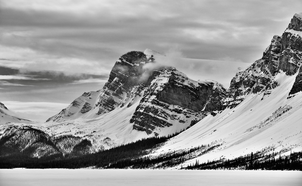
Being Alive and Smelling That Sweet Mountain Air (Banff National Park) by Mark Stevens Via Flickr: At the Crowfoot Glacier Viewpoint along the Icefields Parkway with a view looking to the southeast to Crowfoot Glacier, Bowcrow Peak, and Crowfoot Mountain. This is in Banff National Park.
#Alberta Highway 93#Alberta and Glacier National Park#Azimuth 153#Banff National Park#Blue Skies#Bow Lake#Bowcrow Peak#Canadian Rockies#Central Main Ranges#Crowfoot Glacier#Crowfoot Glacier Viewpoint#Crowfoot Mountain#Day 2#DxO PhotoLab 6 Edited#Evergreen Trees#Evergreens#Forest#Forest Landscape#Highway 93#Hillside of Trees#Icefields Parkway#Lake#Landscape#Landscape - Scenery#Looking SE#Mountain Peak#Mountains#Mountains in Distance#Mountains off in Distance#Mountainside
3 notes
·
View notes
Text


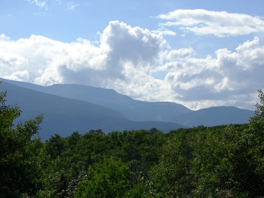


Labyrinth Park, Grande Cache (No. 4)
Some of the best ski resorts of the Rockies are located in this region, and are important tourist destinations. They include Fortress Mountain Resort, Lake Louise, Marmot Basin, Mount Norquay, Nakiska and Sunshine Village. Other tourist attractions include the glaciers of the Columbia, Wapta and Waputik Icefields such as the Athabasca, Bow, Crowfoot, Hector, Peyto, Saskatchewan and Vulture Glaciers.
Glacial lakes line the Icefields Parkway and dot the surrounding valleys. Some of the more spectacular are Bow, Hector, Louise, Maligne, Moraine, Peyto, Pyramid and Vermilion lakes.
Source: Wikipedia
#Grande Mountain#Labyrinth Park#Grande Cache#Alberta#Municipal District of Greenview No. 16#Upper Peace#Rocky Mountains#Northern Rockies#Alberta's Rockies#First Nations#travel#original photography#vacation#tourist attraction#landmark#cityscape#landscape#summer 2023#Canada#small town#Native Americans
2 notes
·
View notes
Photo

Greenery at Crowfoot Glacier, Alberta, Canada [OC][5368x3579]
13 notes
·
View notes
Text
22nd May 2024
Today we left for Jasper via the Icefields Parkway. It is claimed as the most scenic drive in the world and was amazing. We did have sun, rain, snow and low cloud, but we still managed to stop at 10 spots. Before we even got to the Parkway, Jane spotted cars stopped on the side and saw a bear. She was so excited for her first bear in the wild. Luckily it was behind the fencing, so it was safe to get out of the car. It was also nice seeing the animal crossing points that have been built over the highway.


We then stopped at Hector Lake, Crowfoot Glacier Viewpoint, Bow Lake (which was frozen and lovely), Waterfowl Lakes Viewpoint, Bridal Veil Falls, Columbia Ice Field (very busy and terrible weather so didn't stay long), Tangle Creek Falls, Goats & Glacier Lookout, A nice stop with no name at the river, and Athabasca Falls which were great, the falls had taken different routes over time and we could walk through the old channels. Michael also found good use of the brush/scraper stick that was in the back of the hire car.


We made it to Jasper and our accommodation at Pyramid Lodge overlooking Pyramid Lake. We purchased bear spray in case we met any bears a few days ago but Michael has just been carrying it around. We hiked to Pyramid Island (not far) and had a look around. Still no bears. The one on the highway didn't really count as it was behind a fence.


We headed into Jasper for dinner and Bella spotted a beautiful Snow Rainbow.


0 notes
Text
Alberta Rockies (3): 2nd visit to Banff & Jasper
When I had been in Banff earlier in the trip, I learned about the Cave and Basin national historic site, whose thermal springs had been the kick-off of the creation of national parks in Canada. People can no longer use the hot springs, as they found a unique snail living solely in the hot waters on this mountain (!) but the exhibits provide an interesting history of how national park policies have changed over the years from resources to conservation management, whilst also balancing human use for tourism... exactly what I want to do in Chile!😍💖

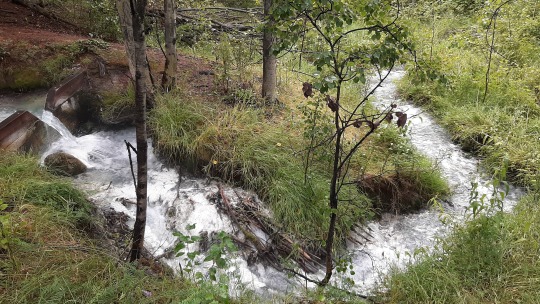
There's also a little boardwalk out to the marsh which provides a warm habitat year-round because of the steaming hot water runoff from the springs, so after a massive rain shower had passed, I went to check out the white algae that grow in the streams and look for fish & birds. Turns out that this is the only place in the Rockies where garter snakes live as it keeps the soil from freezing in winter, but luckily none came my way ... I had already noticed that I hadn't seen any snakes in a while, now I know why! 😄
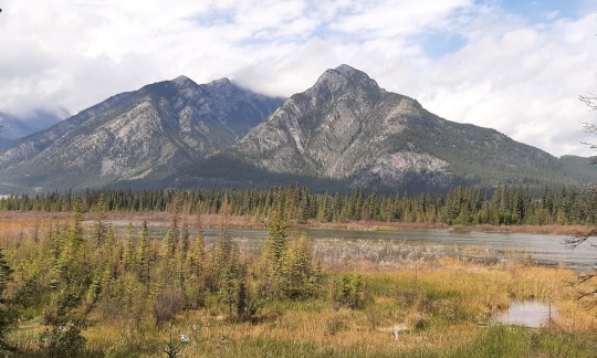
Most national parks aim to build reconciliation and collaboration with local Indigenous communities, recognizing that the creation of those parks resulted in the loss of traditional hunting, gathering and spiritual places (newer parks now often have an agreement for continued traditional use). In this case, Banff asked Indigenous artists to create large stand-alone, cubic murals, which I thought were very powerful.

Dodging the rain once more, I drove to Bow Falls close where I just sat on a bench for several hours looking at the river and doing some internet (as Kootenay Park had zero reception). Had a quick dinner downtown but despite its prettiness, I felt it was heaving with tourists so couldn't wait to get back to my quiet campsite! 😁
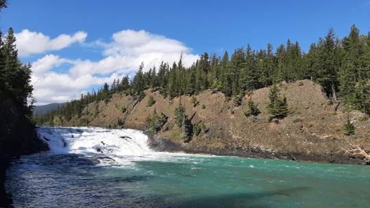
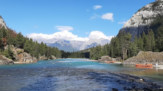
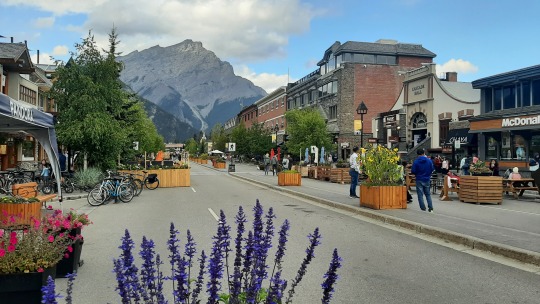
After another night & morning of rain (this is the only time so far in 3 months that it rained so much during camping so I'm not really allowed to complain), I was hoping that Jasper would give me some sun and warmth, but unfortunately it stayed gloomy and cold (12C) all day. 😢
My first stop was at the Crowfoot Glacier and Bow Lake, which despite the clouds were in-your-face impressive. I had initially not planned to drive the Icefield Parkway as I spent two days here in 2010, literally stopping at every viewpoint of which there are tons, but the mountains and lakes were mind-blowing as ever so I'm glad I came back after all. 😊 Similar to the sea, mountains are magnetizing regardless of whether it's sunny or gloomy, so how could you ever say no?! 😍
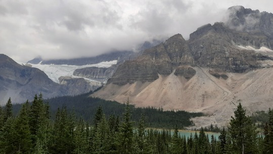
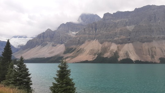
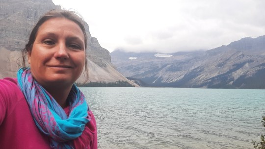
The walk to the Peyto Lake viewpoint is a steep hill up, but the scenery is mesmerizing. 😍 It (& every stop) was of course super crowded but somehow I didn't find it overbearing and still managed to get people-free pics!

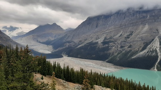
Speaking about bears, after another view of the glorious mountains, there was a suddenly a massive pile of cars and... a grizzly bear walking on the hill with 2 cubs! 🤩🤩🤩 I was so taken looking at them that I forgot to take a pic until they were much further away, but they're the 3 black dots if you zoom in 😂. For a moment it looked as if they were returning back to where I was (they were first next to my car when I stopped!) but alas they got fed up with all the people gawking and left into the woods. It was really cute to see the characteristic shoulder hump also on the little ones... made my day! 🥰
Two-minutes drive around the bend was a parking lot for a popular hike, where people were completely unaware of the grizzlies, so that reiterated my resolve of not going for solo hikes in the Rockies! 😅
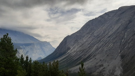

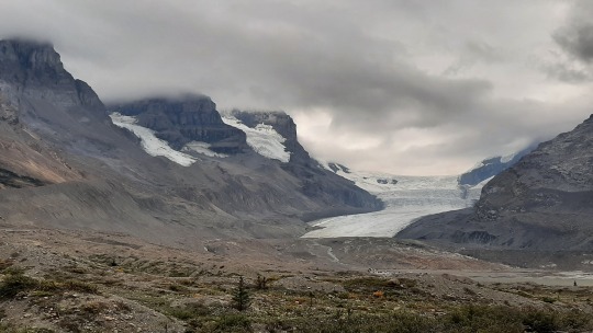
Finally, I spent some time at the Columbia Icefield Centre, looking at the exhibits and eating fries overlooking the glacier. 😋 There was one exhibit showing the ice's retreat that has happened since 2017, so I'm curious whether I can see it on my own pics from 2010 that I must have taken when we were here... once I got the time to retrieve those photos, I'll post them to do my own citizen science! 😄
As it was another 100km to the town of Jasper & I was tired, I skipped all other stops (including undoubtedly two pretty waterfalls), and drove straight to the campground where to my astonishment I did not have a firepit (didn't even occur to me to check when I booked it) so got no fire to keep me warm. 😣
It dropped to 4 degrees that night 😨 and although I was ok warm in my mummie sleeping bag, it was not comfortable so when the sun came in the morning, I just sat for hours with a cup of tea and a book, embracing every ray! 🌞 I felt a bit guilty to stay on the campsite whereas I was supposed to take in all the beauty of the park, but this was exactly what the doctor had ordered to get my mood lifted! 🥰


After only leaving the site at 1pm I wasn't really up to do much driving and facing crowds at the waterfalls, Mount Edith Cavell etc, so instead I checked out Patricia and Pyramid lakes which are close to town. With calm water & no wind it was a perfect day for a paddle, so I pumped up my SUP for the first time using the repaired hose... it was very slow in building pressure while leaking some air, so as I wasn't sure it was correctly reading and would possibly blow up, I stopped at 7psi instead of the usual 15psi... I told the warden who came over to talk about invasive aquatic species that I would likely sink 🤣, but I just managed to stay afloat! 🤗 Good news is that the pressure gauge is correct so that I can continue to use the pump until I have a replacement (which after a hunt at multiple stores in Golden, Jasper and Edmonton has proven to be impossible except for buying online which I can't do until I'm back in TO 😕, the downside of modern shopping!)
I ended up having a beautiful paddle around the lake with views of mountains and glaciers, that I couldn't capture as in the commotion I had forgotten to bring my phone 😅. As a bonus, on the way out, I saw a black bear alongside the road so this was a happy day!

Before heading back to town, I hiked a small portion of the Maligne Canyon, which had impressive potholes from (previously) swirling water, as well as a huge logjam under which the water continued to flow. The waterfalls & gorge were pretty too but not newsworthy compared to the prettier Marble Canyon... I believe I've canyoned out for this trip 😛, a downside of traveling for so long!


Although the town of Jasper is less pretty than Banff, it has much less tourists and therefore is far more relaxed in terms of vibe; a cool mountain town! On my way to the canyon, I had hopped into a bakery for a delicious rhubarb pastry, and now on my way back I had some appetizers & local beer on a rooftop patio watching the sunset. 🤗
The sky was cloud-free and although I was too tired to stay up all night for the milky way to come, the treeline against the darkening sky was magical and I managed to photograph the Big Dipper and Arcturus at its tail (shout out to Byron 😉)! At the front end, I also could see the North Star and the beginnings of the Little Dipper but they were still very faint.


Went happily to sleep but that night, it got again freaking cold so less charmed in the morning 😫... if this weather continues, it would mean the end of my camping as I'm really not prepared for close-to-freezing temps!
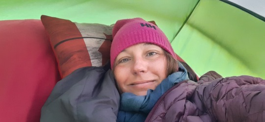
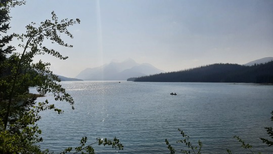
Even without an extensive sun-warming session, it took me a couple of hours to pack up the tent, eat & get dressed - I guess not working & having deadlines has made me slow 🙃 but the beauty of traveling solo is that I don't answer to anyone 😀 - and get on my way to Maligne Lake. I believe it's famous because of the row of mountains at the back end of the lake, but the smoke had returned so there was really not much to see.... too much wind to go for a paddle, too few people hiking to make me comfortable on the trails, meant that I drank my cup of tea at the lookout and then left.... no magic for me here today, c'est la vie! 😜


Leaving Jasper Park eastward towards Hinton, the mountains changed; they became less high and more white-grey in colour, still pretty though.
Big disappointment; I had planned for the afternoon to soak at the Miette hot springs, which are supposedly to be surrounded by beautiful nature, but I had not checked the website so wasn't aware that they are closed since June due to a landslide! 😵
This was the end of my time in the Rockies, now back through (more) northern Alberta, excited to explore Edmonton!

Wildlife: 1 grizzly bear with 2 cubs ♥ and 1 black bear at Jasper
SUPs: one at Jasper
Hikes: one at Banff, two at Jasper
1 note
·
View note
Photo
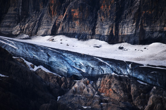
banff national park, alberta, canada
#photographers on tumblr#original photography#glacier#ice#nature#mountains#crowfoot glacier#banff national park#national park#canada#rocky mountains
6 notes
·
View notes
Video
youtube
Crowfoot Glacier
0 notes
Video
From the archives Via Flickr: Crowfoot Glacier in Banff National Park
0 notes
Video
instagram
rainbowdiablo #nofilter....#BowLakewith backdrops of 2 Glaciers #BowGlacier seen first, then panning to #CrowfootGlacier. The #BowGlacier feeds this lake and the gorgeous Bow River that winds all the way through Calgary. This is a place I could stay ALL day or even a week. Wish I could put a cabin up right here.
#Alberta#Canada#Banff#National park#Bow lake#geology#bow glacier#crowfoot glacier#nature#landscape#Bow river#travel#video#instagram#nofilter#wanderlust#parkscanada#the earth story
244 notes
·
View notes
Video
An Iced Over Bow Lake and a Backdrop to BowCrow Peak and Crowfoot Mountain (Black & White, Banff National Park) by Mark Stevens Via Flickr: A view across Bow Lake while walking around the Simpson's Num-Ti-Jah Lodge area. One day I'll stay a night over at this lodge. Today though was a chance to take in the wintry look of the nearby Waputik Mountains and Crowfoot Glacier off in the distance.
#Banff National Park#Black & White#Bow Lake#BowCrow Peak#Canadian Rockies#Central Main Ranges#Crowfoot Glacier#Crowfoot Mountain#Day 4#Evergreen#Evergreen Trees#Frozen Over#Glacier#Highway 93#Hillside of Trees#Icefields Parkway#Lake#Looking SE#Looking to Continental Divide#Looking to Mountains of the Continental Divide#Mountains#Mountains in Distance#Mountains off in Distance#Nature#Nikon D800E#Overcast#Portfolio#Project365#Silver Efex Pro 2#Snowcapped
2 notes
·
View notes
Photo

Icy hues at the south end of Bow Lake. In the background is what remains of the Crowfoot Glacier. Formerly, the glacier had 3 toes. Only two are now left, with the remainder of the ice likely gone within a few decades. 30-second exposure with a polarizer, f/16, ISO 100. — view on Instagram https://ift.tt/3huBUcv
244 notes
·
View notes
Photo


Crowfoot Glacier
19 notes
·
View notes
Text
Yorath House Artist Residency Blog 2: The River’s Edge
Words by Adriana A. Davies, Jan 6-9, 2022 Artwork by Marlena Wyman Jan 17-21, 2022 Artists-in-Residence at Yorath House

Origin of Rivers
Great rivers begin as trickles As the ice pack melts, Over time.
In the Rocky Mountains, Crowfoot Glacier, After the passage of 100 years, Becomes unrecognizable: Only a couple of stumps.
The water roars down Sluices and tunnels Going underground And pooling in expanses Of milky aquamarine lakes— Teeth-chatteringly cold.
From North to South The rivers are named— Peace and Athabasca, North and South Saskatchewan, Bow, Elbow and Milk.
They have carved deep channels In the glacial sediment, And given the land its final shape.
With exploration And settlement, We named things.
But they already had Age-old names, Some of which remain In words exotic and sibilant Like Saskatchewan, Sipiwiyiniwak And Amiskwaciy.
But this other land, Where great herds of buffalo roamed, And Indigenous People had dominion, Is gone.
Remembered only through historic markers Such as at Tail Creek— Commemorating the last buffalo kill Ending the nomadic life Of Indigenous People And Métis hunters.
They rode across The Great Plains Unrestricted by provincial And state boundaries.
Still -24 Celsius temperatures but today the sun finally comes out and outlines the slopes and indentations in the snow like in works of the Group of Seven, who not only painted in Eastern Canada but also some of whom taught at the Banff School of Fine Arts and rendered Alberta landscapes. Today I contemplate the geology and physical geography of the surrounding land.
You cannot see the North Saskatchewan River to the south of the house, nor can you hear it in winter. The escarpment on the south bank is much higher than on the north bank (the Yorath House side) and, from the back of the house, the only view is of a cross-section of sedimentary rock and soil with plants and shrubs (albeit dead ones in winter) clinging to it. Behind the trees at the top of the ridge is Saskatchewan Drive and the Belgravia neighbourhood.

Prominent towards the top of the river bank are cement pillars that served as the retaining wall of the old Keillor Road that clung to the river bank and which was used by drivers for quick access to and from the University of Alberta via Fox Drive and the Whitemud Freeway. I have a guilty confession: I was one of those drivers who used the shortcut and on my morning and evening commutes enjoyed the “wildness” of the road as I rounded curves and bends, and also admired the horses in the Equine Centre. This was in the 1980s when I worked on Hurtig’s Canadian Encyclopedia project and, subsequently, for the Local Government Studies and Public Administration programs located in Ring House 2 on the U of A campus.
A landslide in 2002 took out the road and some of the trails and it was decided that the road would be closed permanently. These “ruins” became known unofficially as “The End of the World” and attracted many “daredevils” and courting couples. The City tried to deter this through signage indicating danger and also at times ticketing sightseers. Since it was already used as a viewing point, in 2015, after public consultations, the City decided to make this accidental attraction into the real thing. The design phase including assessment of environmental impacts took place from 2016 to 2018 and construction of a formal viewing platform with railings occurred in 2019.
Erosion
The play of wind and water Has shaped these landforms. Wide river channels Snake across the flat plain, The ravines they've scooped out, Wooded with willow, Poplar and birch.
At river level, There is only stillness Punctuated by bird song, And it is easy to imagine Canoes gliding along, Stopping off at traditional meeting places, Today's cities and towns.
The river has cut a steep channel. And the banks form wooded escarpments. Standing on the promontory of one, I play queen of the castle, The wind whipping past me, Making me feel truly alive.
The site, now officially known as Keillor Point, provides stunning views of Laurier and Buena Vista Parks and the River. It is a fitting tribute to Dr. Frederick Keillor, the First World War medical officer, who purchased 61 acres in 1918 from pioneer John Walter, whose extensive businesses were destroyed as a result of the 1915 flood. Keillor built a rock and log cabin and farmed the land next to Fox Drive. By the late 1920s, this parcel of land was valued for its recreational potential, and a road was built to provide access to a ski club that had located nearby and the River valley. By the 1940s, Keillor had many offers from developers but his dream was that the City would purchase his farm, and keep development to a minimum and only for recreational uses. In the 1950s, he leased the land to some horsemen who created a stable and arena. In the 1970s, the land was purchased by the City and the equine use continued and today comprises the Whitemud Equine Centre. Dr. Keillor is commemorated through a plaque including a photo that is located at the bottom of the wooden stairs that take visitors down the slope to the River.i

Adriana A. Davies & Marlena Wyman outside Yorath House. Photo by David Johnston.
Unlike other parts of Edmonton’s extensive River Valley where you can easily reach the river bottom and walk along gravelled and sandy areas and skim rocks across the water, the Yorath lands do not have this type of frontage. The land sits above the River but not at a great height. I imagine that Bette Yorath warned the children about going down to the River not that they needed to. There was and is a large field that lends itself to picnics and games of baseball and other child’s play such as hide-and-seek. That is what makes it and Laurier and Buena Vista Parks such popular off-leash areas. In this extreme winter weather, one only sees hardy breeds of large dogs romping through the snow and dragging bundled-up owners behind them.
I cannot help but think of the River as not only a geographic feature but also as a conduit backwards and forwards through time. The word Sipiwiyiniwak means “People of the River” in Cree. Some 2,500 members of the Enoch Cree Nation live just west of the City of Edmonton ward that is named in their honour. Yorath House and the North Saskatchewan River lots on which it is located are found on Treaty 6 lands. The people of the region that became Edmonton are “people of the river” using its resources for nourishment. They have lived and gathered there since time immemorial, through the eras of the Treaties to the present.
The inter-relationship between the flowing river and the passage of time is a universal symbol. The North Saskatchewan River has carved a deep channel from its glacial origins in the Eastern slopes of the Rocky Mountains as it meanders through the three prairie steps to Hudson’s Bay.
The historic Yorath House is an entry point into that journey in geological and human time.

Winter Promise
The air is heavy with the weight of unfallen snow. The quiet almost disconcerting, In this house in tamed woodland. No faint barks of hardy dogs leaping over snowbanks Dragging their owners behind them In this off-leash area of the city. Their tracks can be seen in yesterday’s snow. Winter has this way of quietly erasing signs of human activity Leaving the landscape still and unpopulated As it once was.
How can I not reflect on time’s passage When the Covid-19 clock With its giant hands Sweeps away human lives Like the Great Reaper of Medieval fables.
While in my heart I struggle to hope That we will get through this, As we have in the past With wars, famines, plagues and pandemics, My mind is agitated.
I know that I must embrace the outer stillness of Nature And cultivate a Zen-like state, Or Christian resignation. As I sit separated from the cold by thick panes of glass, A pale light illuminates the winter landscape And somehow I begin to breathe more easily.
___________________________
1 Information about Keillor, his farm and the equine centre established on it is provided in Tania Millen, “A Public Treasure Called Whitemud,” Horse Journals, April 27, 2018, URL: https://www.horsejournals.com/popular/history-heritage/horses-everyone-edmonton
___________________________
0 notes
Video
Merging Of Two Hearts (Explored) by Renee Via Flickr: Explored December 4, 2021 www.flickr.com/explore/2021/12/04 Early morning at 4:50am, arrived at Moraine Lake, planned to take sunrise photo at Moraine Lake, then hike to the Larch Valley. But parking lot was full… Had to change the whole day’s plan – headed to Bow Lake - One of my favorite lakes at Rocky Mountains, visited several times at different weather conditions during this trip... Bow Lake is one of the lakes that locates in the Icefields Parkway between Banff National Park and Jasper National Park, fed by melt water from the Bow Glacier, the lake lies at the base of Bow Summit, which is perfectly reflected in its aquamarine waters on a calm day. Few people around in the early morning, spending some time walking around the lake. The light changing from blue hour to golden hour, the water changing from breeze ripples to calm, ripples again, waited for calm… the scenery of Canadian Rockies was out of this world. Here was the capture of the sunrise light up Crowfoot Mountain from the shore. _______________________ Huge thanks all for the visiting, faves and kind comments! 🙏💕 I appreciated all your stopping by. Stay healthy and take care my dear Flickr friends! 🙏
#Bow#Lake#Sunrise#Rocky#Mountains#Icefields#Parkway#Banff#National#Park#Glacier#Summit#Reflections#Aquamarine#Waters#Light#Clouds#Sky#Nature#Travel#Trees#Fall#Canon#CanonR5#Landscape
1 note
·
View note
Photo

Crowfoot Glacier Aberta Canada [OC] (4000x3000) via /r/EarthPorn https://ift.tt/2K8p1cU
0 notes


