#digital maps
Explore tagged Tumblr posts
Photo
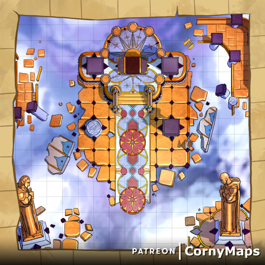
Even in the great halls of Elysium there are troubles. This map is available to my $5 tier patrons! Signing up gets you access to 20 high res maps! http://patreon.com/CornyMaps
#dnd#maps#5e#pathfinder#battle maps#heaven#celestia#elysium#ttrpg#digital maps#roll20#wargaming#dungeon#dungeons and dragons#ruins#sky#clouds
3 notes
·
View notes
Text
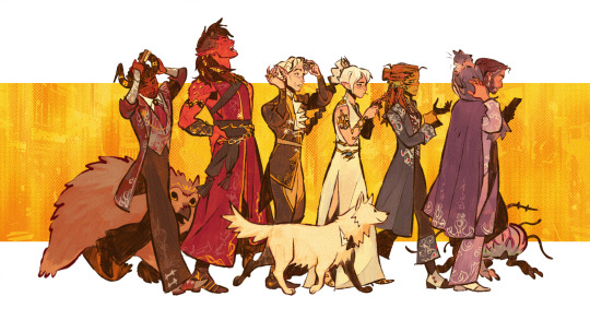
happy late birthday to bg3!!! here's the tadpookies (and their Little Guys) in their red carpet bests!
#baldurs gate 3#bg3#character design#character art#digital illustration#character designer#laezel#shadowheart#astarion#karlach#gale dekarios#wyll ravengard#because ofc i snuck in shadowzel#shadowzel#gale is google mapping bc theyre late
21K notes
·
View notes
Text
Transforming Memories into Custom City and Star Map Portraits | Tasweer PK
Tasweer combines over a decade of printing understanding with an ardor for digital artwork, developing personalized city and famous person map pics. We rework your unique reminiscences into lovely, custom-designed artwork, shooting the essence of your most meaningful reviews. Whether it is a memorable location or a vast moment in the stars, our digital maps and snapshots are crafted to mirror the unique memories that rely most on you. Let Tasweer convey your reminiscences to lifestyles with lovely, one-of-a-kind portions that mix art and emotion.
1 note
·
View note
Text
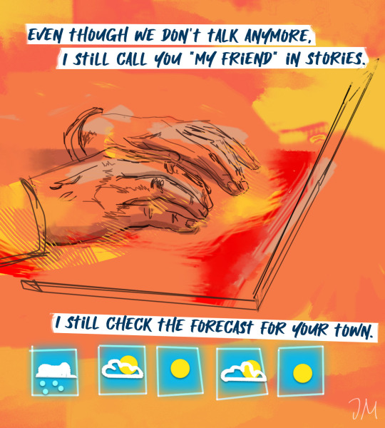
take a jacket just in case
#it's true i use a world meteorological map to see if my ex is in a heat wave lol out of love#ive had this idea in my head forever#my art#digital artists#artists on tumblr#queer art#all my love alright all of it!
45K notes
·
View notes
Text
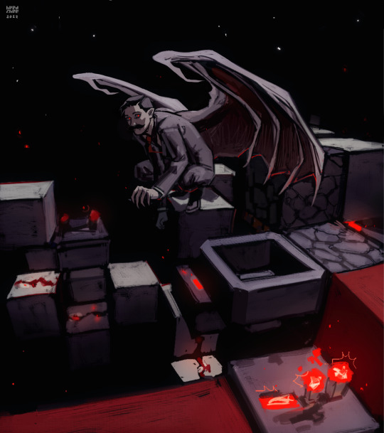
nice redstone gremlin
#vampire mumbo#mumbo jumbo#I actually downloaded one of his redstone maps and used it as reference for this composition lol#this machine doesn't do anything#like in that lemon demon song#fanart#digital art#hc mumbo#hermitcraft art#hermitcraft#hermitblr#minecraft art#artists on tumblr#art#digital painting#hermitcraft fanart#арткозацтво#украртпідтримка#укр тумбочка#украрт#укртумбочка#український tumblr#vampire#vampire art#mcyt art#mcyt fanart#mumbo kills a lot jumbo#mumbo k jumbo
7K notes
·
View notes
Text
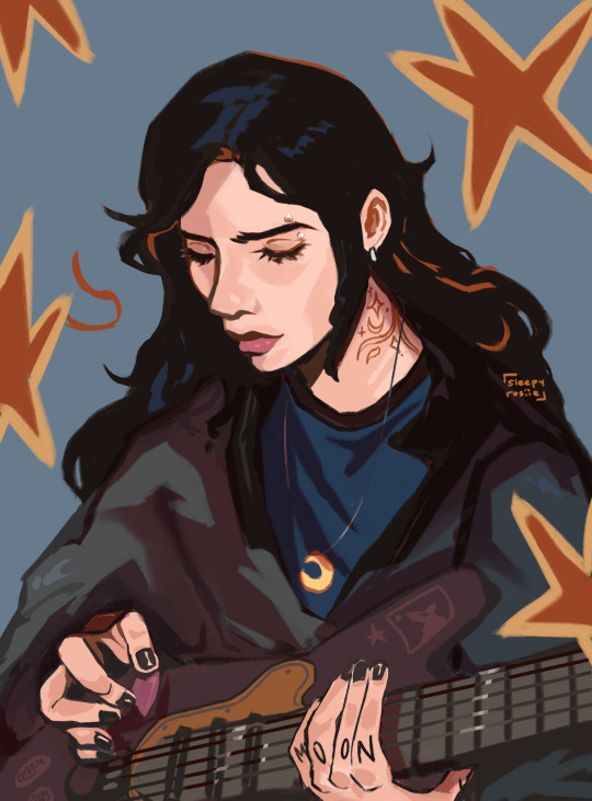
Sirius Black guitarist AU
#atyd marauders#marauders#the maraunders map#remus x sirius#sirius black#sirius orion black#atyd remus#atyd sirius#atyd fandom#all the young dudes#harry potter fanart#harry potter fandom#art#digital painting#illustration#fanart#james potter
1K notes
·
View notes
Text
[RAIN WORLD SPOILERS] Here's my contribution to the Rain World MAP "Plastic Beach"
And here's the making of:
youtube
#mebi's art#digital art#fanart#animation#krita#opentoonz#plastic beach MAP#rw#rain world#rw animation#rain world animation#rw spoilers#rain world spoilers#rw iterator#rw pebbles#rw 5p#rw fp#rw five pebbles#rain world five pebbles#rain world 5p#rain world fp#rw monk#rain world monk#rw the monk#5 pebbles#rw fanart#five pebbles#five pebbles fanart#rain world fanart#Youtube
1K notes
·
View notes
Text
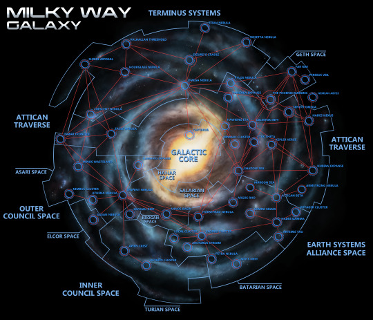
Mass Effect galaxy map - repainted and plotted with all known Mass Relay connections from the main series games.
I have made one addition with the Luminous Expanse, to represent the location of the Hanar homeworld. I also made some educated guesses as to the placement of locations such as Tartarus and the Nemean Abyss.
1K notes
·
View notes
Text
They tried to skip class.

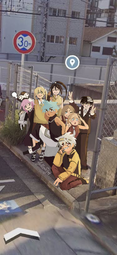
At least they left something memorable
#fanart#digital art#anime#soul eater#death the kid#artists on tumblr#liz and patty#dtk#thompson sisters#maka albarn#crona gorgon#soul eater black star#black star#tsubaki nakatsukasa#sid barrett#google maps meme#soul eater evans#soul eater fanart
2K notes
·
View notes
Text
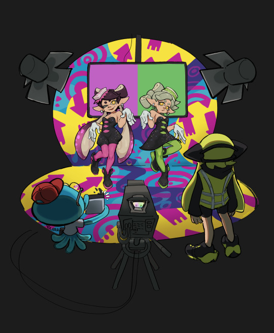
Aaand that's a wrap! Keep staying fresh.
#i found out about wii u servers closing very last minute akjdgh but i was able to play several battles before the servers closed thankfully#god splat 1 was so good the weapons and maps were so fun i might try to play it through...other means#also BRING BACK SALTSPRAY RIG ;__; it wasn't in rotation when i played rip#truly end of an era o7#goodbye splatoon 1#rip squid jump too#digital art#fanart#splatoon#squid sisters#callie and marie#callie splatoon#marie splatoon#agent 3#i realized the missed opportunity to add capn cuttlefish...#art
3K notes
·
View notes
Text


Speaking in the third person... AM -- which is I -- AM is satisfied with the sacrifice. He -- that is to say, I -- will spare the village his -- that is to say, my -- wrath for today. I have -- as I said before -- spoken.
(black and white version under the cut)

#my art#art#azza txt#ihnmaims#i have no mouth and i must scream#i have no mouth and i must scream AM#AM#allied mastercomputer#ihnmaims am#am ihnmaims#digital art#this took me so long aaaaaAAAAAAA#the wires alone#my god#i totally did not want to color this either lmaokk#gradient map win#anyway fuck this computer guy am i right or am i right?#hehe#nah fuck him#get a glass a water n dump it on his ass#i also wanted to make his logo funky#because i can who cares#his boring ass needs to update his logo anyway#that shit old
3K notes
·
View notes
Text

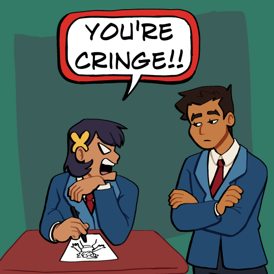


DC I'm begging please bring back Damian's friends PLEASE
Commission Info / Kofi
#batman#batman dc#batman comics#batfam#the batfam#the batfamily#batfamily#dc comics#dc#dcu#damian wayne#damian wayne al ghul#damian al ghul#damian al ghul wayne#mia mizoguchi#maps mizoguchi#mia maps mizoguchi#robin sona#batman fan art#batman fan comic#art#digital art#digital illustration#illustration
3K notes
·
View notes
Text
They’re lost I think
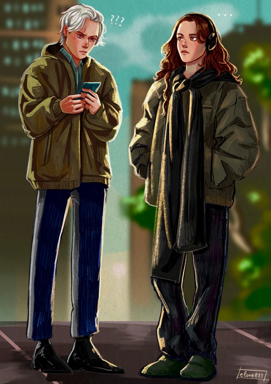
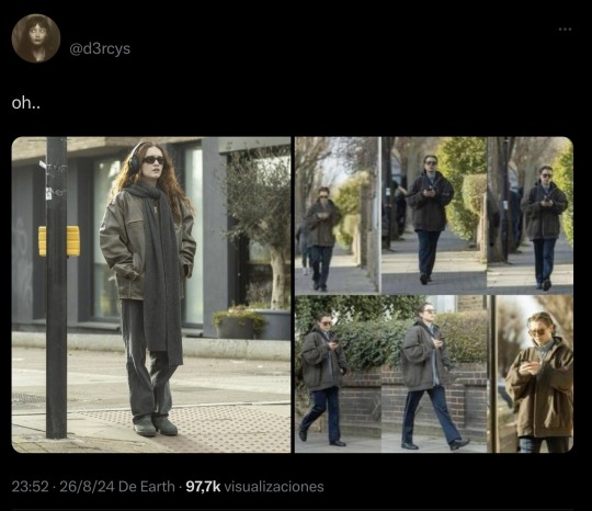
#they’re so lost guys they have no idea of how a map works#rhaenicent#rhaenyra targaryen#alicent hightower#house of the dragon#emma d'arcy#olivia cooke#hotd#street style#art#fanart#drawing#myart#digital art#artwork#drawn
2K notes
·
View notes
Text
"does anyone else feel like theyre being watched?"
the surreptitious ghostface:
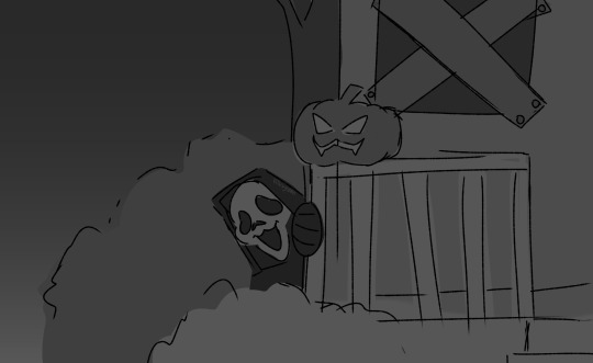
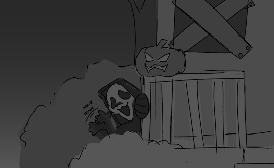
#I have a feeling hed do that#also I love how I simplified him here his mask looks so spoinky bouncy friendly which is what I wanted#art#I drew the haddonfield map from memory btw so if it looks familiar but off thats why#dead by daylight#dbd#slashers#digital art#danny johnson#ghostface#danny jed olsen johnson#dbd art#dbd fanart#dbd ghostface#dbd killer#ghostface dbd
1K notes
·
View notes
Text
There is nothing quite like a big paper map.
You can put a finger on one spot and look around at other stuff nearby and then easily return to where your finger is.
They can also be incredibly beautiful.
On the other hand, a paper map can’t read you directions or alert you to speed traps.
So there are pros and cons either way, really.
0 notes
Photo
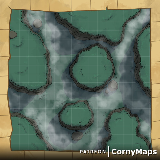
The mist rolls in what's hiding between the canyons. This is available to my $10 patrons! http://Patreon.com/Cornymaps
#dnd#dungeons and dragons#pathfinder#battlemaps#maps#map#battle maps#battle map#digital maps#nature#wilderness#witcher#ttrpg#chams#wargames#random encounter#osr#roll20#fantasy grounds#travel#spooky#grass
0 notes