#THE MOUNTAIN IS 5KM TALL??????
Explore tagged Tumblr posts
Text
COMPLETELY forgot that blackbeard was the one that attacked drum??? Omg

So if everything usopp lies about ends up becoming true.... He is dying dying

Zoro reacting like this after his best hunting contest with sanji.... Yeah... (Zoro not trusting Luffy is defeated and Luffy thinking Zoro is trouble if he gets captured... Yeah)

I don't think Zoro posing to become a cool statue has the right to say anything about being a brainless idiot....

She did NOT take igarams advice because still in arabasta Luffy had to punch her to make her understand ajshajsni the sacrificing others at least (also Vivi asking zoro to cut her off too..... Insane as always)

Luffy coming thru once again.... Zero hesitation....

This page is so,,... It goes stupidly hard... Once again being kind and having a pure heart pays off

Wait a second,,,, kuro WHAT.... I think sanji hasn't called Zoro Marino yet.... Inspo...


Express round: sanji is dying soon, chopper is cute and why is full body blushing with jango's glasses on his hand???
#also its so funny how the sketches are always background actions and lines and then nami's face completely drawn and nearly rendered akdhaka#oda has his favourites#funky bar comes from the mirror ball island of jango's dance adventures.... i see#oda criticizing the privatization of medical care so true#talking tag#reading one piece#luffy climbing a mountain for HOURS cold and hurt for nami and sanji ahdjahdjsjaiajsksjakaakakaoka#THE MOUNTAIN IS 5KM TALL??????#nami asking chopper to join them.... vicecaptain.... yeah.....#chopper is so cute in here... big belly chopper i miss you....#skinny wapol looks like brulee.... sorry girl#sanji asking nami if she is alright and he isnt even on the panel akdhaka she doesnt give af!!!#chopper is so cute in this arc.... also we need to get back to chopper and luffys relationship we got fuck all now....#like that is his friend and that means something to chopper like damn.....#nami and sanji hiding from kureha... they are so good when sanji is being normal....#thinking about it this was his first taste of physical female domination... you can see how he ended up where he is now.... also older woma#AAAAAAAHHHHH ACEEEEEEEE#looking for blackbeard already i am going to kill myself. and they didnt tell luffy about him......#kureha knew about the d in gold roger??? hello??? the will of d already.... oof#augh..... arc over....
0 notes
Note
So I just unlock a new area of arguments.
I was taking to my friend and she mentioned that sy only punish disciple by running laps around the mountains.
This got me intrigued, so I head to Google to find out what the average circumstances of a mountain.
Sadly I could not find any informative on it. As it depends on many actors.
But I do remember that sy said that CQM mountain was so tall that it reaches the sky. Or something along that height. So it is a very big/large mountain.
So I was thinking along the lines of mount everst.
But for the sake of arguments, I would say that the circumference of it will be around 5km.
So when sy order disciples to run 5 to 30 laps around the mountain.
He is basically ordering them to di around 1 to 2 cross country marathon.
Keep in mind that a cross country is around 12km.
This is also not including the time it took to walk down the mountain
.
26 notes
·
View notes
Text
Curiosity Rover postcard from Mars' Marker Band Valley
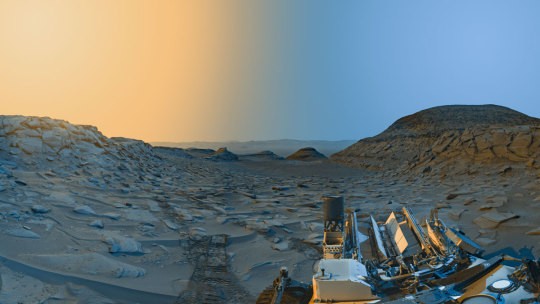
NASA’s Curiosity Mars rover used its navigation cameras to capture panoramas at two times of day on April 8, 2023, at 9:20 AM and 3:40 PM local Mars time, then merged the two images together. Blue represents the morning panorama and yellow the afternoon.
Each of these new panoramas took about 7-1/2 minutes to capture and include five individual images stitched together. By capturing the panoramas at two different times of day, the scene shows dramatic shadows similar to stage lighting coming in from the left and right of center stage. Because it was winter (when dust is at its lowest in the Martian atmosphere) at the time, shadows are sharper and deeper.
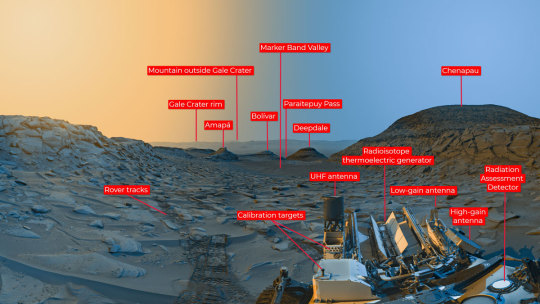
(Some annotated details from the scene.)
Curiosity is ascending the foothills of Mount Sharp, a 3-mile-tall (5km) mountain found within Gale Crater. The crater rim is visible roughly 25 miles (40 km) away. And because skies were so clear, you can see a mountain beyond the crater rim, even though it’s 54 miles (87 kilometers) outside of Gale.
NASA source page: X
11 notes
·
View notes
Text

A rough approximation of what Sentral State looks like.
A very rough explosion of human development, cut slightly from the north and south by the mountains of Langkasuka, with plenty of forestry around as to not seem too desolate.
Sentral City itself is 10km tall and 5km wide, the whole state approximately 40km squared.
The city sits in the middle of the valley separating the two mountain ranges where the River Bangga flows across the land all the way to the ocean. The mouth of the Bangga called Sentral Bay and the final rusting site of the HMFF (Her Majesty's Flying Fortress) Her Most Sacred Blessing (The Blessing for short).
9 notes
·
View notes
Text
Submitted via Google Form:
Hi, I'm trying to create super tall skyscrapers (mostly 3-5km highest would be 7km) for my story but I have no idea how much existing technology can help with that because there's nothing even close to the heights I want. I also might need details of some inner workings (plot-related setting). Any help please? Also would it make sense that when the 5km tall skyscraper is the highest and the next record setter would suddenly jump to 7km? Or maybe that might be possible due to completely different climates or different design? I guess I'm going to need a bit of help with that I suppose? I should say my story is set in a subtropical coastal climate and doesn't get many earthquakes.
Feral: The skyscraper that I am personally familiar with the mechanical and operational components of that I will be using as a reference to answer this is 240m above ground, which is 48 above ground floors; it then extends below for six underground engineering levels. The foundation itself is about 30 meters deep, which is an eighth the height of the building itself. The building is designed to be able to be 100% self-sufficient for three continuous days of its highest function level during cataclysmic municipal system failure. So the engineering levels provide space for servers, generators, mechanical (HVAC), a rainwater purification system, and reserves of hundreds of thousands of gallons of water (potable and non-potable) and diesel fuel.
The depth of the foundation for a skyscraper depends primarily on two factors. The first is essentially the pressure of the building on the ground. So, the more pyramidal the shape, the less depth is necessary. The second is the depth of the bedrock. The weight of the skyscraper is such that you pretty much want to get to bedrock to anchor the building. You can do this with a full excavation if the bedrock is close enough to the surface or use caissons (in the case of extreme water table flooding) or piles to get to bedrock beneath a more moderate excavation.
The Burj Khalifa is over ten times the height of the building I’m personally familiar with, but its foundation is only 50-ish meters deep. This is in part because of how it is designed to disperse the relative pressure the building is exerting on the ground. In other words, it has a very wide base and it gets narrower as it extends upwards in a very particular cadence.
A couple resources for you:
So from this information, hopefully you can extrapolate what you need to for the actual construction of the skyscraper from here because frankly it's hurting my brain.
But it's not how deep the foundations must go that is ultimately going to prevent the building of a 7km skyscraper without incredible leaps in engineering, it’s the habitability of those upper levels. At 7km above sea level (assuming your building is at sea level), I would expect the temperature to be -30 degrees celsius. And dropping down 5km is just really not going to be much warmer.

From https://www.pdas.com/atmosTable2SI.html
Another consideration is the ability of the inhabitants to breathe. You are technically under the “Death Zone” at 7km, but altitude sickness can start setting in at around 2.5km - and those numbers are based on people who have a) acclimated to the low oxygen levels at altitude and b) are extremely fit mountain climbers.
There’s also, of course, catastrophe to consider. Skyscrapers are already very, very bad places to be in the event of true calamity. Of course, fire suppression systems are usually pretty good, but there’s no such thing as a perfect system. And since the only way to get around the temperature and oxygen issue is with a pressurization system, you’ll have to consider how people move between the floors and get in and out of the building. Also what happens when there’s explosive decompression or if people do have to evacuate? No one is going to appreciate getting the bends when it turns out to be a false alarm.
This is not meant to be a list of insurmountable problems. This is meant to be a list of just some of the problems your universe’s engineers will have to surmount.
And one last thing - the difference between the 5km skyscrapers and the 7km skyscraper? That’s probably going to end up having way more to do with money than with technology.
34 notes
·
View notes
Text
An idea for semi-realistic monsters
I’m probably not the first person to think of something like this, but here is my take on a Cockatrice and Wyvern like creatures that evolved from raptors.
Cockatrice and Wyverns
Overview
An odd evolutionary offshoot of the Dromaeosauridae (raptor) family, The Wyvern and Cockatrice are unusual ambush predators, that can produce and spit venom for hunting. Like most other Dromaeosauridae, the Cockatrice and Wyvren have three fingers on each hand, the first and second finger on each hand is surprisingly dexterous and used by the creature to help it climb, the third finger on each hand is elongated, and properly part of the creature's wing structure. Cockatrice and Wyvren are also digitigrade bipeds with a large sickle shaped claw on each foot that can be used to slash or anchor them to larger prey items. At first glance, Cockatrice and Wyvrens do not look that different from modern reconstructions of raptor type dinosaurs, including a large plume/fan of feathers at the tip of the tail. Unlike other raptors, Cockatrice and Wyvrens do not have normal toothy mouths, instead they have heavy beaks, similar in structure to, but not as robust as, the beaks of the Phorusrhacidae (terror birds), a large bright red wattle-like venom sac immediately behind their lower jaws, and a double row of serrated ridges running down either side of the tail starting half way down the tail's length and terminating just ahead of the fan. Because of the rigid nature of their tails, a Cockatrice or Wyvren can employ their tail ridges in combat, but only to a limited degree, employing them as a defense against pursuing enemies, or occasionally, to injure larger prey in hit and run attacks. Cockatrice and Wyvren are not true fliers, but, they glide quite well, with most studies estimating that both species possess a 6 to 1 glide ratio.
Cockatrice and Wyverns mostly live in temperate to sub-tropical regions, Cockatrice prefer to live in forested foothill regions, while Wyvrens live in more mountainous regions or wide open plains. Both species prefer to nest in caves or structures such as barns and basements were they have ready access to food.
History
The origin of the Cockatrice and Wyvern is not yet completely understood, some researchers have assigned them the speculative genus expuens accipiter, (spitting hawk in Latin) within the family Dromaeosauridae to the creatures and assigned them the species names Africanus (Wyvern) and Pacifica (Cockatrice). These names and placing are not accepted by all researchers, with some arguing the creatures simply stem from the same common ancestor as Dromaeosauridae and modern avians. Fragmentary fossil evidence suggests that the oldest ancestors of the modern species evolved in Cretaceous south-west Asia some 78mya. It is still not clear to researchers how the creature's survived the KT extinction event. Researchers are confident however that the two modern lineages, first diverged at the start of the Pleistocene glaciation beginning 2.58mya, with the ancestors of the ea. Africanus (Wyvern), being confined to Africa, while ea. Pacifica (Cockatrice) were confined to the islands of the South Pacific, with their modern forms moving into the Eurasia as the glaciers receded.
In recent times researchers have proposed the existence of three additional species the North American ea. Leedsdiablos (the Jersey Devil), the semi aqutic ea. Amazonas (the Brazillian Boiúna serpent) of South America, and the ea. Oceanis (the Poukai bird of Maori folklore) said to be native to New Zealand and Australia. These claims are however, dismissed out of hand by most researchers, with alleged sightings put down to hoaxes, miss-identification or illegally imported specimens.
Cockatrice
Physical traits
Cockatrice are the smaller, and more social, of the two species. A typical Cockatrices 91-122cm (3-4ft) long from beak tip to tail tip, stands 56-61cm (22-24in) tall at the shoulder, with a tip-to-tip wingspan of 3-3.1meters (roughly 10ft), and weigh 20-28kg (45-60lb), like birds, female Cockatrice are larger than males. Cockatrice have predominately off-white, yellow, or brown feathers, males have dark green, red or blue feathers on their heads and tails for mating display, both male and female cockatrice have brightly colored red, green and blue feathers concealed within their breast and wing feathers for threat displays. Cockatrice produce a potent neurotoxin that can paralyze their prey, that the cockatrice can project upto 4 to 5 meters (approximately 15feet), or inject it directly into the target through a pair of hypodermic fangs near the tip of the creature's beak. A Cockatrice's neurotoxin is designed to cause a victim's joints to seize up, a creature that has been effected by Cockatrice venom will be unable to move for upto, 144 hours (six days). The venom will not absorb through normal epidermal tissue, as such, a Cockatrice will aim for a creature's face, attempting to contaminate the soft tissue of the creature's eyes, mouth or nostrils. The common hunting strategy for a Cockatrice is to climb on to an elevated position, such as a small ledge or particularly thick tree branch to attack its intended prey, first by spitting on it and secondly by leaping onto the target, leading with its heavy foot talons. Cockatrice have powerful legs it can sprint at upto 75kph (55mph) for three minutes, and can leap 7-8meters (roughly 25ft) from a standing start at ground level. A Cockatrice will reach full maturity in three years and can survive upto 20 years in captivity, but, most live only 10 to 15 years in the wild.
Society and Child rearing
While not true pack hunters, as many as 15 mated pairs of Cockatrice can be found living in a single cave or building. Cockatrice mate for life and eggs are lain in clutches of 4 to 6. Breeding season lasts from late spring to early summer and fertilized eggs take 8 weeks to hatch. During this time, the mother will stay with the nest while the father hunts for food to bring back, and will continue to hunt while the mother guards the young for the first 4 weeks after they hatch. At a round 7 weeks old, Cockatrices chicks will begin to accompany their parents on hunting trips. A Cockatrice couple will chase away a current clutch of young when the mother begins to brood again, typically one year after their hatching. While they are unnervingly quiet when hunting, Cockatrice are boisterous creatures when at rest or threatened, with a wide range of calls, similar to sounds made by both predatory and non-predatory birds.
Diet
Cockatrice are obligate carnivores, while they mostly stick to animals they can quickly dispatch and consume whole, such as small rodents, lizards or birds, they can, thanks to their neurotoxin, bring down prey considerably larger than themselves, while their mate is tending to their young, males will frequently pursue goats, beaver and other similar sized animals to bring back to the nest. While single and mated pairs of Cockatrice will usually attempt to drive away other Cockatrice that come to close to their kills, a strange behavior can be observed when a single or mated pair brings down a particularly large prey item such as a cow or elk. When this happens, the successful Cockatrice will begin making a peculiar high pitched wailing, this wail can be heard out to a range of 4-5km (roughly 3 miles) and will draw in other Cockatrice, which will be allowed to share the catch with them. When consuming large prey, Cockatrice have a “puncture and pull” feeding method, and can not crack bone, though, they can digest the bones of smaller animals when consumed whole. To maintain ideal health, a Cockatrice must consume at least its own body weight each week.
Wyvern
Physical Traits
Wyvern are larger and much less social than their smaller cousins. A typical specimen stands 1.8-2 meters (6 to 7 feet) tall at the shoulder, measure 4.5-6.1 meters (15-20feet) long from beak to tail tip, a tip to tip wingspan of 9-10 meters (roughly 30ft) and a weight of 272-296 kg (600-650lb). Like most varieties of bird, female Wyverns are larger than their male counterparts. Wyvern feathers are a mixture of dark gray, rust red, and dull brown, giving the creatures a surprising degree of camouflage in their preferred habitat. Unlike the Cockatrice, Wyvern do not have fangs and do not produce neurotoxin, instead, they produce a potent molecular acid that can cause serious damage to any organic matter it comes into contact with, including sedimentary rock, and is capable of scouring flesh down to the bone on unprotected humans or similar creatures and can even inflicting third degree burns to animals like hippopotamus and rhinoceros, or humans wearing thick winter clothing. When stored in the venom sac, and when initially projected from the Wyvern's mouth, the acid is coated in mucus that prevents it from injuring the Wyvern producing it, the mucus will quickly dissolve once exposed to the air, once this happens the Wyvern is just as vulnerable to the acid as any other creature. The venom sac of a typical adult Wyvern can produce enough venom to cover a 45 to 50 cm² (17-20 in²) area, an adult Wyvren can project acid upto 10-11 meters (roughly 30 to 35 feet). Once a Wyvern has “spit” acid, it takes roughly 85-90 seconds for it to produce enough acid to do so again. Wyvren acid is however virtually ineffective against most refined metals and modern ceramics such as ones used in the production of bullet proof armors. A Wyvern is fast, capable of running upto 68kph (45mph) for upto 3 minutes and can cover a distance of 10 meters (30ft) when jumping from a standing start at ground level. When hunting a Wyvern will spit acid to cripple prey before leaping on to the prey to disembowel it with their talons. A Wyvren reaches full maturity at six years old and can survive for upto 50 years.
Society and Child rearing
Wyvern are mostly solitary creatures, though they do mate for life and will occasionally tolerate Cockatrice or other small predatory animals sharing their hunting ranges. Wyvern breeding season usually begins in late winter and lasts till early spring. After mating a female Wyvern will lay one or two eggs and incubate them for the next twelve weeks. During the entire incubation process and for the first three months after the Wyvern chicks hatch, the mother remains at the nesting site while the father hunts. At two years old, the chick(s) will begin accompanying their parents on hunts. For the first four years after the chick(s) have hatched, the mother Wyvern's body will produce hormones to suppress her reproductive cycle, however, after this period, hormone production ends and the mother will begin brooding again at the start of the next breeding season, at which point she will chase away her adolescent child(ren) as a potential threat to her future chick(s).
Diet
Wyvern are obligate carnivores, when tending chicks that are to young to leave the nest, Wyverns will content themselves with small game that can easily be carried to the den, like goats, gazelle, sheep or young deer. When not tending to young or when the young are old enough to accompany their parents on hunts, Wyvern hunt large game, like cattle, adult deer, and in some cases, even giraffe or hippopotamus, while a Wyvern's beak and jaw muscles are not quite strong enough to bite through bone, they are strong enough to severe the cartilage, allowing them to bite off arms and legs to swallow whole. Wyvern living near rural communities are especially found of domesticated pigs and donkeys. To maintain proper health, a Wyvern must consume roughly twice its body weight each week.
The Boiúna serpent (Speculative)
While still regarded as a hoax or miss-identification of an existing animal by most researchers, a great deal of eyewitness testimony has been gathered on the hypothetical ea. Amazonas has been collected and presented here.
Physical traits
In most regards a Boiúna serpent is reported in one of two ways, either being similar in size to its Cockatrice cousins or to Wyverns, however, their wingspan is described as only 1.5 to 2.2 meters (4-7.5ft) from tip to tip when reported as being Cockatrice sized or 5-6 meters (16-20ft) when reported as Wyvren sized, however, its wing feathers are much longer and seemingly employed to create shade for attracting fish. The legs of a Boiúna are usually described as longer and thinner than either of its two recognized cousins, with less pronounced cutting claws. The beak of a Boiúna serpent is described as being more like the beak of a Cormorant, long and thin with a sharp hook at the end for catching and holding fish. The feathers covering most of a Boiúna serpent are said to be mostly blue-black or purple-black, with a smaller tuft pale gray feathers on their chest and necks, the beak and leg scales are usually a dark brown color. On the matter of their venom, accounts seem to be largely split between two camps. While all accounts say that the Boiúna serpent lacks teeth, and therefore can not inject venom, roughly half of all reported encounters claim that they possess a weakened version of the neurotoxin produced by a Cockatrice, with the effects wearing off in a matter of hours or after only a day or two, while other sources claim that the Boiúna serpent produces not venom, but, a strong natural adhesive that can pin potential threats in place allowing them to escape or bring down the target, Boiúna serpent venom is believed to have the same range as Cockatrice venom when “spit”. It is not known for certain, but, most researchers that believe in the Boiúna serpent, think it is slower than other relate species estimating their top speed at around 59-60kph (40mph).
Society and Child Rearing
Boiúna, do not seem to be sociable creatures, traveling alone or mated pairs. As most researchers believe young have never been observed, arguing that the Boiúna may experience indeterminate growth, it is believed that they are kept sheltered for much longer than with other species of expuens accipiter. However, in recent years, an alternate theory has emerged, suggesting that reports of smaller Boiúna are actually of young/immature members of the species and that the larger adults actually practice significantly less parental care than their cousins.
Diet
Unsurprisingly, the primary diet of the Boiúna serpent is believed to be fish and small reptiles. Boiúna serpents are also speculated to raid the nests of other birds as well as caiman and other reptiles. Some witnesses report seeing Boiúna serpent kick snakes to death in a manner similar to Sagittarius serpentarius (Secretary birds). Others have claimed to witness them feeding on large animals such a Tapir and Pudu deer. If the latter stories are true, it is not known if they actively brought down the animal in question, or merely used threat displays to chase off the animal that actually brought it down.
3 notes
·
View notes
Photo

An Sgurr
Some 58 million years ago the area we now know as the Hebrides (a group of Islands off Scotland) were a place of fire and smoke rather than the present windy sea lashed locale of the present era. The North Atlantic Ocean was opening, completing the bustup of Pangaea. This sundering of the European and North American plates was accompanied by huge outpourings of lava over a wide region, whose remnants still dot the landscape from Greenland to Ireland, Canada to Scandinavia.
This 5km long ridge on the isle of Eigg is what remains of a huge pyroclastic flow from a large eruption, whose main vent was located at the present isle of Rum. An Sgurr is also a textbook example of what geomorphologists (those who study the surface shape of the Earth and how it came to be) call inverted topography, a process whereby what were once lowlands turns into highlands due to an interaction between the constraints imposed by the underlying geology and the forces of erosion.
When the silica rich rhyodacitic lava erupted, the hot molten ash and rock flowed from the vent down a river valley, filling it to a height well above the 400 metres of the uneroded remnants that we see today. The rock is dark (unlike most silica rich volcanic rocks) because it is a quick cooled variety known as pitchstone with a high glass content, but coarser and with more crystallinity than the more familiar obsidian. It looks like a glassy matrix, filled with angular crystals. Our ridge is the largest exposure of such rock in the UK, and it displays typical lava cooling features (such as columnar jointing similar to the Giant's Causeway).
Pitchstone also happens to be very resistant to erosion, the result of its peculiar part glass part crystal structure, and over the aeons since it was emplaced, the basaltic rocks (also from the growing continental rift) around it have melted away under the assault of wind, frost and wave, leaving the fossilised impression of a whole Palaeocene river bed standing proud as a tall ridge, complete with its rounded boulders and tree fossils at the base. Solitary mountains like An Sgurr (the notch) are known as inselbergs, but they form by a variety of processes, and most are not inverted.
Loz
Image credit: James Gray
http://www.geograph.org.uk/snippet/11009
#an sgurr#geology#inverted topography#channel#igneous#lava#pyroclastic#volcanic#rock#the earth story#science#pitchst
126 notes
·
View notes
Text
8 days Lemosho route Trekking Kilimanjaro
This route is considered as the most scenic trail on Kilimanjaro, granting panoramic vistas on various sides of the mountain. As one of the newer routes, Lemosho is a superb choice for your climb. Due to its ideal balance of low crowds Lemosho Is preferred as the best route, beautiful scenery and a high summit success, Africa Natural Tours specializes in guiding on the Lemosho route. Most of our clients climb Kilimanjaro using this route and they consistently report that they loved it. Thus, Lemosho is highly recommended. 8 days Lemosho kilimanjaro
The Lemosho route approaches Mount Kilimanjaro from the west, beginning with a long drive from Moshi to Londorossi Gate. From there, the first two days are spent trekking through the rain forest to Shira Ridge. The Lemosho route crosses the entire Shira Plateau from west to east in a pleasant, relatively flat hike. Crowds are low until the route joins the Machame route near Lava Tower. Then the route travers’s underneath Kilimanjaro's Southern Ice Field on a path known as the Southern Circuit before summiting from Barafu. Descent is made via the Mweka route. 8 days Lemosho Kilimanjaro
Day 1: Londorossi Gate to Forest Camp
Elevation (ft): 7,800ft to 9,500ft
Distance: 6 km
Hiking Time:3-4 hours
Habitat: Rain Forest
Full board at Forest camp Know as {Big tree Camp}.
We depart from Moshi for Londorossi Gate, which takes about 4 hours, where you will complete entry formalities. Then drive to the Lemosho trailhead (another hour to reach the trailhead). Upon arrival at trailhead, we eat lunch, and then commence through undisturbed forest which winds to the first camp site which is Forest camp Know as {Big tree Camp}.
Day 2: Forest Camp to Shira One Camp
Elevation (ft): 9,500ft to 11,500ft
Distance: 8 km
Hiking Time 5-6 hours
Habitat: Moorland
Full Board at Shira One Camp
We continue on the trail leading out of the forest and into a savannah of tall grasses, heather, and volcanic rock draped with lichen beards. As we ascend through the lush rolling hills and cross several streams, we reach the Shira Ridge before dropping gently down to Shira 1 camp. The view of Kibo from across the plateau is amazing.
Day 3: Shira Camp 1 to Shira 2 to Moir Camp
Elevation (ft): 11,500ft to 13,800 ft
Distance: 14 km
Hiking Time: 5-7 hours
Habitat: Moorland
Full Board at Shira 2 camp
We explore the Shira plateau for a full day. It is a gentle walk east toward Kibo’s glaciered peak, across the plateau which leads to Shira 2 camp on moorland meadows by a stream. Then we Stay at shira 2 camp or continue to Moir Hut, a little used site on the base of Lent Hills. A variety of walks are available on Lent Hills making this an excellent acclimatization opportunity. Shira is one of the highest plateaus on earth.
Day 4: Moir Hut to Lava Tower to Barranco Camp or Shira 2 Camp to Lava Tower to Barranco.
Elevation (ft): 13,800ft to 13,000ft
Distance: 7 km
Hiking Time: 4-6 hours
Habitat: Semi Desert
Full Board at Shira 2 or Moir Hut camp
From the Shira Plateau, we continue to the east up a ridge, passing the junction towards the peak of Kibo. As we continue, our direction changes to the South East towards the Lava Tower, called the “Shark’s Tooth.” Shortly after the tower, we come to the second junction which brings us up to the Arrow Glacier at an altitude of 16,000ft. We now continue down to the Barranco Hut at an altitude of 13,000ft. Here we rest, enjoy dinner, and overnight. Although you end the day at the same elevation as when you started, this day is very important for acclimatization and will help your body prepare for summit day.
Day 5: Barranco Camp to Karanga Camp
Elevation (ft): 13,000ft to 13,100ft
Distance: 5km
Hiking Time: 4-5 hours
Habitat: Alpine Desert
Full Board at Karanga Camp.
After breakfast, we leave Barranco and continue on a steep ridge passing the Barranco Wall, to the Karanga Valley campsite. This is a short day meant for acclimatization.
Day 6: Karanga Camp to Barafu Camp
Elevation (ft): 13,100ft to 15,300ft
Distance: 4 km
Hiking Time: 4-5 hours
Habitat: Alpine Desert
Full Board at Barafu Hut Camp.
After breakfast, we leave Karanga and hit the junction which connects with the Mweka Trail. We continue up to the Barafu Hut. At this point, you have completed the South Circuit, which offers views of the summit from many different angles. Here we make camp, rest, enjoy dinner, and prepare for the summit day. The two peaks of Mawenzi and Kibo are to be seen from this position.
Day 7: Barafu Camp to Summit to Mweka Hut
Elevation (ft): 15,300ft to 19,345ft (and down to 10,000ft)
Distance: 5 km ascent / 12 km descent
Hiking Time: 7-8 hours ascent / 4-6 hours descent
Habitat: Arctic
Full Board at Mweka hut Camp.
Very early in the morning (midnight to 2am), we continue our way to the summit between the Rebmann and Ratzel glaciers. You head in a northwesterly direction and ascend through heavy scree towards Stella Point on the crater rim. This is the most mentally and physically challenging portion of the trek.
At Stella Point (18,600 ft), you will stop for a short rest and will be rewarded with the most magnificent sunrise you are ever likely to see (weather permitting). From Stella Point, you may encounter snow all the way on your 1-hour ascent to the summit. At Uhuru Peak, you have reached the highest point on Mount Kilimanjaro and the continent of Africa. Faster hikers will see the sunrise from the summit.
From the summit, we now make our descent continuing straight down to the Mweka Hut camp site, stopping at Barafu for lunch. You will need gaiters and trekking poles for the loose gravel going down. Mweka Camp is situated in the upper forest and mist or rain can be expected in the late afternoon. Later in the evening, we enjoy our last dinner on the mountain and a well-earned sleep.
Day 8: Mweka Camp to Moshi
Elevation (ft): 10,000ft to 5,400ft
Distance: 10 km
Hiking Time: 3-4 hours
Habitat: Rain Forest
Half Board
After breakfast we continue the descent down to the Mweka Park Gate to receive your summit certificates. At lower elevations, it can be wet and muddy. Gaiters and trekking poles will help. Shorts and t-shirts will probably be plenty to wear (keep rain gear and warmer clothing handy).
Zoom Tours vehicle will be waiting for you at Mweka gate to drive you back to your hotel in Moshi.
Included
Park fees,
Camp fees
Rescue fees
Transportation to & from the mountain gate
Professional mountain guides, cooks and porters
3 meals daily while on the mountain
Not Included
Both National and International flights
Medical insurance
Tips to mountain crew
Items of a personal nature
0 notes
Text
Top 5 Places to Visit in Argentina

Whether you are on a solo trip or backpacking the South American destinations, Argentina cannot go off radar from your bucket list. This elongated South American country can hypnotize you with its impressive tango moves, soccer, gaucho culture, and undoubtedly the majestic snow-clad peaks of the Andes. Stretching from the tropic of Capricorn towards the Antarctic, Argentina encompasses a very diverse terrain. Hence, book cheap flights to Argentina right away and explore the country’s varying landscapes.
What to Explore in Argentina
Argentina is bustling with adventure for those who seek thrill. But the country is full of diversity, which makes it a perfect holiday getaway for everyone. From buzzing capital city Buenos Aires’ creative coffee culture to staggeringly massive Iguazu Falls, the rolling vineyards of Mendoza, and stunning Perito Moreno glacier, Argentina is indeed a land worth a visit.
Argentina’s Best Attractions
1. Buenos Aires

Argentina’s capital city is often considered as ‘Paris of South America’. The city is draped with Belle Epoque architecture, popular coffee culture, grand boulevards, and incredible drinking and dining scene, which make it one of the best places to visit in Argentina. However, more than its dazzling nightlife and dynamic food scene, the steamy moves of tango can be hypnotic too.
In addition, the city lets you shop in San Telmo’s boutiques, or you can meander through the ornate Recoleta cemetery, or visit the National Museum of Fine Arts. But whatever you do, the only thing which you are going to cherish forever is to take a romantic stroll around the city’s grand boulevard and sipping espresso from the city’s cozy cafes.
2. Iguazu Falls
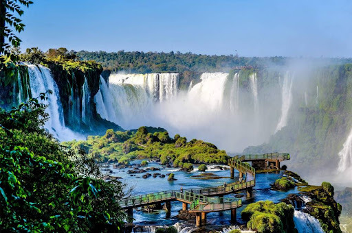
Nestled against a backdrop of a dense rainforest, and straddling between Argentina and Brazil, Iguazu Falls is a sight to behold. This 269-ft tall is a chain of hundreds of thundering cascades, nearly 1.85 miles in extension. A visit to the Iguazu Falls makes for a great escape from urban chaos, as tourists can also admire the rich flora and fauna of the nearby national park.
This UNESCO World Heritage Site is three times the size of Niagara Falls. Furthermore, if you are planning for just a day trip here, then let me tell you, there are plenty of things to keep you hooked for two days. Discover the jungle trails, admire nature in its wildest form, explore the surrounding attractions, and buy local handicrafts from nearby Puerto Iguazu market.
3. Perito Moreno Glacier
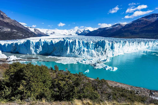
Another UNESCO world heritage site and top-most Argentina attraction, is Perito Moreno Glacier in Argentine Patagonia. It is one of the planet’s most accessible ice fields, which measures 30km long, 5km wide, and 60m high. The glacier is named after a 19th-century explorer, and offers adventurous excursion opportunities to visitors.
Adventure-junkies, who want to climb the glacier, can take ice trekking tours that range from an hour to five hours walk over the ice formation. Apart from this once-in-a-lifetime experience, visitors are greeted with Monte Fitz Roy, which many believe is harder to climb than Mt. Everest.
4. Ushuaia
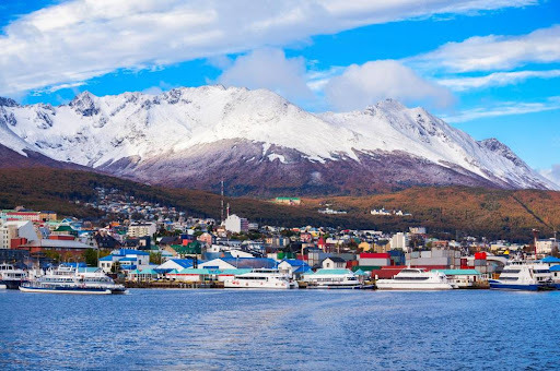
Perched on the Tierra del Fuego archipelago, Ushuaia is surrounded by the Martian mountains, and the Beagle Channel. This resort town has been nicknamed as ‘End of the World’, as it marks the end of the American continent at its southern end. Furthermore, this busy and adventurous port was established as a penal colony in the 20th-century. However, today, it has become a jumping off point for tourists who are on their way to explore Antarctica.
This historically important sea passage makes for a convenient base for exploring the rugged beauty of the region. But despite being a base, Ushuaia has its own charm. It is in Ushuaia, where Andes meets the Beagle Channel in a sharp skid. Being one of the popular Argentina tourist attractions, it has plenty of sites worthy of a visit.
5. Mendoza
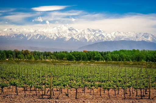
Often considered as the ‘Napa Valley’ of Argentina, the bustling Mendoza is blessed with more than 1500 wineries. Located within Maipu, Lujan de Cuyo and the Uco Valley, the bustling Mendoza boasts numerous high-tech and modern wineries of Argentina. This impressive desert oasis is also known as ‘the land of sunshine and fine wine’.
Despite being a cosmopolitan city of Argentina that brags wide, leafy avenues, atmospheric plazas, and cafeterias, tourists come here for amazing food, wineries, and incredible natural vistas.
Takeaway
Argentina is one such country in South America, which is blessed with both urban sprawl and breathtaking natural vistas. Whether you want to take a romantic stroll around the grand boulevards of Buenos Aires or sipping the finest wine from one of Mendoza’s vineyards, and admiring the magnificence of Iguazu Falls, Argentina has it all. So, what are you waiting for? Book cheap flights to Argentina, and explore the best of the region.
Meta: Planning a vacation in Argentina? Get cheap flights to Argentina and explore the best natural and urban attractions. Try good food and fine wine of Mendoza.
0 notes
Text
SHIMLA MANALI – THE READY GUIDE TO A FANTASTIC HOLIDAY THIS YEAR
Suppose there's a place that is like it was in the colonial period, that's Shimla. The capital city of Himachal Pradesh sits at 2200m high and is surrounded by stunning mountains with stunning valleys and enchanting forests. It is among the top places for solo travelers as well as couples and families. Shimla has been drawing thousands in the last 50 years and even more.
As the summer capital of the British, this beautiful town preserves its charming façade with stunning architecture, gorgeous churches, and temples even in the present. Also, don't forget the pedestrian-friendly Mall street where you can take a stroll through the town's center. If you've not visited Shimla already, you should plan a trip very soon. If you plan a trip with your family or go by yourself or make it a girls-only getaway, Shimla has plenty to keep you entertained and engaged. Kesari Tours Kesari Tours thought you would want to know all sorts of details before choosing the Shimla tour package you want to take on your next trip.
The best timing to go, Shimla
Shimla is a year-round tourist destination. The ideal time to go to Shimla to enjoy a wonderful vacation is during the summer months from March through June, if you like an ideal climate in the daytime. It's one of the most effective ways to beat the heat of summer in other regions of India. On the other hand, if you're looking to go on a holiday with snow from November through February, they are the ideal time to travel.
Shimla is famous for its breathtaking Victorian architecture, sparkling lakes, and natural beauty that leaves you staring at it with awe. It is referred to as Shimla is the Queen of Hill Stations in the north; it is possible to make a weekend trip to Shimla or take your time to enjoy the amazing climate.
Visits to places to go
We know you'd like to discover the town and its sights quickly, especially if you're in a hurry. But, you should take the time to take your time and take in the stunning landscapes and enjoying the snow if you're traveling during winter. Check out the must-see places on your tour of Shimla.
It is the Shimla Ridge: To soak in the beauty of nature, take Instagram-worthy pictures and shop until you're satisfied, go to Shimla Ridge. Shimla Ridge. In the city's center, the Ridge provides one of the most stunning views of the majestic Himalayas. A vast open space that runs along Mall Road. Mall Road is equally popular in Shimla The Ridge connects you with the Scandal Point too. It is a great place to shop, eat and shop at local eateries, go to the magnificent Christ Church, explore the Tudor library, and relish the stunning views over the town. The museum is open daily between 8 am and 6 pm.
Christ Church: If you are a fan of architecture, then a wonderful model of Neo-Gothic architecture can be found in Christ Church. Christ Church sited on the Ridge. It was built in 1857. The church is a vital component of Shimla. The beautiful stained-glass windows, the inside murals, as well as the towering clock make this church a must to visit. It houses one of the biggest pipe organs in India and has been part of many well-known Bollywood films such as 3 Idiots and Black. It is accessible every day and is an excellent location to study the past, architectural styles and click pictures.
Summer Hill: On the fringes of Shimla is a charming town known as Summer Hill, where potters collected clay to make their pottery. Also known as Potter's Hill is 1283m above sea level, offering breathtaking panoramas of a lush valley with lush vegetation around. It's located about 5km from the Ridge and is one of seven hills that create Shimla. Make sure to look out over the sunrise as the sun reveals stunning mountains in shades of purple and orange. It is possible to spend the day exploring the beautiful town. Make sure to visit the beautiful Chadwick Falls and a ride on the train Kalka-Shimla.
Annandale: Aren't you wondering what Annandale is? It is the place in which the British played polo, cricket or raced horse. It was named Annadale. The place is now home to an undeveloped golf course, Helipad, and an Army museum. The museum admission is free, and it's open from 10 am to 2 pm between 3 pm and 5 pm Tuesday through Sunday. It's about 4 kilometers far from Annandale Ridge and is known for its trails to hike. It is possible to plan an excursion up to Glen as well as the top point in Annandale. Enjoy nature and the peace and tranquility of the beautiful gardens close by. There is a Cactus museum located nearby.
Manali trip, where snow-capped mountains beckon you
It's not like a Shimla trip is truly complete without a visit to Manali as well. It is nestled between the snow-covered mountains in the Pir Panjal, and Dhauladhar Ranges Manali is one of the most popular hills in India. It is a stunning place with breathtaking views, green forests, vast landscapes dotted with blooms, a plethora of blue tributaries, and a constant fairytale-like mist scented by pine that lingers throughout the night; Manali is home to breathtaking picturesque beauty. From charming tiny hippie hamlets to lively high-end streets, museums, temples as well as river-based adventures and trek tracks, Manali has several reasons it's a popular tourist destination all season. Make sure to check out Manali-Shimla tours.
The best time to go to Manali
One of the most enjoyable seasons to go to Manali is during winter and you can contact them to capture a trip for the Manali Tour Package. It runs from October through February. For those who like snowfall, Jan is the best month to experience fresh snowfall. Make sure you have warm clothing in case temperatures drop below 0 degrees C. If it's an ideal climate you're looking for, then the summer period from March to June is the ideal time.
Manali is renowned for its clean streets, the tall eucalyptus tree and charming eateries, quaint markets, and charming cafés that serve delicious local cuisine at a reasonable price. If you're looking for an idyllic and peaceful spot in which you can listen to the birds tweeting while an eerie Kullu River roars in the background If so, Old Manali is the place to be. Manali package is also known for its adventure sports like paragliding, skiing, rafting and mountaineering, and the famous Mall Road.
0 notes
Text
Science and Prophecy

CHINA APOCALYPSE: SIGNS OF THE TIMES (5/5)
"Do not despise prophetic utterances. Test everything; retain what is good." 1 Thess. 5:20-21
Extreme weather events. Unusual celestial signs and sounds. National epidemic which has spread around the world. Locust plague. Extensive drought. Mega-flooding with more than 400 million Chinese people at risk. Earthquakes in diverse places. Imminent volcanic eruptions. Food shortages. Famine. Economic depression. Civil unrest. Massive migration …
The current calamitous situation in China was predicted by a Buddhist monk in the Forbidden City, named Gentleman Zigong, who warned about it a hundred years ago and converted it into a very short text (see image).
The plague has already arrived in China, and with the plague the invasion of locusts (which has already begun in 2 provinces and 2 autonomous regions). In the Second Act, the plague from China has spread to the whole world. In the Third Act, earthquakes have become more frequent beginning July of 2020, as China awaits the coming of volcanic eruptions (smoke and fire from under the ground), after which the Fourth Act – the Great Flood – will come.
Referenced below is evidence for the fulfillment of Gentleman Zigong’s oracle for the calamities to befall China beginning 2020 …
200 TRILLIONS LOCUSTS ARE COMING TO CHINA
China’s total arable land of 135 million hectares at risk. Locusts have already infested more than 3.9 million hectares farm land in Hainan and Shandong provinces and Xinjiang Uygur and Inner Mongolia Autonomous Regions.
https://youtu.be/64gNYgh38NQ
CHINESE PLATEAU PROVINCE SEES WORST DROUGHT IN 10 YEARS
The plateau province of Yunnan in southwest China has encountered its worst drought in 10 years. As of April 2020, 1.48 million people and 417,300 large domestic animals faced drinking water shortage, and 306,667 hectares of crops were damaged, according to the provincial water conservancy department. Some 100 rivers in the province were cut off, 180 reservoirs dried up, and 140 irrigation wells had an insufficient water supply.
https://news.cgtn.com/news/2020-04-18/Chinese-plateau-province-sees-worst-drought-in-10-years-PMGdSN543e/index.html
LARGEST FLOODS IN CHINESE HISTORY WIPES OUT THE COUNTRY’S FOOD & GRAIN SUPPLY
400-year flooding in China’s history, inundating most of its wheat, corn and rice-producing areas. Multiple landslides along Yangtze river.Torrential rains to last at least two more months. China to start from zero to feed its 1.5 billion people. Massive migration of Chinese people coming.
https://youtu.be/erONP33MBlA
ROTTEN FOOD RESERVES
Massive corruption in Sinograin, China's largest corporate grain reserve, has put into doubt both the quantity and quality of its reserves.
https://youtu.be/Dk8DFq_fT9g
VOLCANO IN NORTHEAST CHINA MAY BE ‘RECHARGING’ FOR ERUPTION
A volcano in northeast China could be “recharging” for an eruption, with a vast amount of magma believed to be rising up underneath it, according to a team of geophysicists.
The researchers say they discovered two huge magma chambers under Wei Mountain in the Wudalianchi volcanic field in Heilongjiang, near the border with Russia and North Korea. Their modelling suggests the chambers dwarf the volcano, which is 100 metres (328 feet) tall and 5km (3.1 miles) wide.
It was a surprise discovery, since the volcano last erupted more than 500,000 years ago and was considered extinct. Geologists have been more focused on Changbai, or Paektu Mountain, to the south, whose eruption in 946AD was one of the most powerful volcanic events ever recorded, its fallout zone spanning from Japan to Greenland.
https://www.scmp.com/news/china/science/article/3089327/volcano-northeast-china-may-be-recharging-eruption-study-finds
CHINA'S DAMS: A TICKING TIME BOMB?
94,000 unreinforced earthen dams built in the 1950s and 1960s at risk of breaching. Yellow and Huaihe rivers overflowing and beginning to flood Eastern China.
https://youtu.be/uMe9Lk2eu_Q
THREE GORGES DAM RAISES MORE CONCERN
Massive flooding in Central and, now, Eastern China. Imminent collapse of Three Gorges Dam due to epic flooding of Yangtze River. Collapse to severely impact more than 400 million Chinese, possibly killing millions. Unusual weather turns day into night in Harbin city …
https://youtu.be/7cZtJUTH2RU
Please pray for the Chinese people!
#catholic#prophecy#apocalypse#china#locusts#locust plague#floods#three gorges dam#zigong#gentleman zigong
0 notes
Text
Peru part 3. Return to Cusco
Way too long coming I know, but oh well, I’ve been busy and lazy and the whole thing should be done within a week or so. Peru part 3 (Cuzco part 2), here goes.
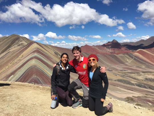
I’d done my Machu Picchu expedition over the space of 3 days, which meant that upon returning to Cuzco I had no intention of trekking the very next day. This intention was far from fulfilled, as that evening I met Jaina and Kelsey, both travelling together from the US. They had very limited time in Cuzco with a flight to Lima on the Friday. Given they wanted to do Rainbow Mountain I decided it was better to do a bit tired with friends, than refreshed alone. We booked it that evening and took an early night, given the 430am meet time.
We reconvened in the dark, bleary eyed and hoping to get some sleep on the four hour trip to the mountain. We were told the first two hours of the ride, which took us to breakfast, were on ‘good tarmac roads’. Of course everything is relative, and it was still far too bumpy for me to get any kind of sleep. All the tours offer the exact same package, the only variables seem to be price and the quality of breakfast. We went with our hostel’s deal, which is definitely not always the best option. Breakfast however was excellent, certainly in comparison to some horror stories I’ve heard, of some stale/mouldy bread with a juice carton. We had Spanish omelette, frankfurters, toast, jam and coffee. I scoffed down as much as wouldn’t seem rude. There was then another two hours on a more treacherous road which Kelsey and Jaina enjoyed to a lesser extent. The drop to the right side was sheer, and plunged approximately 100ft by my reckoning. Eventually we arrived at the mountain which to little surprise, had been found by a few other tour groups before us.
I’ve learnt on the trip not to let this put me off. It usually means there are stunning views, and enough space to still get an Instagram where it looks like you’re the only person there.
It’s about 5km as I remember to the summit, and takes about two hours. It was the first time the altitude had really hit me, we were now at 17,000ft, with Cuzco being at 11,000ft. This made the hike pretty challenging, I drunk two and a half litres of water easily on the way up. The walk is made more frustrating by the fact you can pay about £15 to ride a horse up. The horses are for the most part dragged up the mountain by 5 foot tall Peruvian women. Neither the horses or their owners look like they ever get days off, and I really felt for some of the animals in particular who looked so worn down, every step was a struggle. The situation wasn’t helped by the fact most of the horses were ridden by overweight westerners. The other riders were a good few Asian tourists filming the entire ride on go pros. I’m sure a riveting watch for all the family when they return home. They don’t have a separate path, so you are constantly being made to give way to a plodding horse on its as it climbs up, or ducking out the way of a horse that is being made to canter down the hill riderless, to pick up its next rider. Saying all this the view from the top of the mountain is absolutely stunning. You can see for miles, and you have the entirely unique scene of the painted mountains. The last climb is the hardest, meaning it isn’t quite as busy at the very top, this bit is too steep for even the most alive of horses. We managed to walk down to a quieter spot to take a plethora of photos. Luckily we were one of the first of our group of around 20 to reach the summit, and so had a great amount of time to take it all in. Casually residing on the other side of the canyon to the rainbow mountains is Peru’s 4th or 5th highest mountain. Higher than any in the UK of course, it stood as an intimidating presence, and apparently has never been climbed.
I found the route down more challenging than that up. Although the path did undulate, I think this was more due to the pure accumulation of time spent so high up. By the time we finally reached the minibus all three of us were struggling with pounding headaches and lack of breath. More sleep was managed on the way back to the hostel where we pulled in at about 7.


We were all starving and so headed to a place called ‘Green Point’. It is Cusco’s only totally vegan restaurant. We mainly went because Kelsey’s vegan, they had been the day before. I was a little apprehensive, and they spent much time apologising in advance in case I didn’t like it. I couldn’t have been more wrong, it was some of the best food of my entire trip. I had the quinoa burger with sweet potato fries. It came with three different dips and was incredibly filling. We somewhat waddled back to our hostel after. We’d at one point spoke of going out that evening, but by this point none of us could move. I said my goodbye’s to Kelsey and Jaina, who had a flight at 7am the next day.
The next day was relaxed and very enjoyable, and really helped to validate the fact I had chosen to spend 11 days in the city. Myself and Alison found a bijou but delicious coffee place for breakfast with one of the prettiest menus I have ever seen.

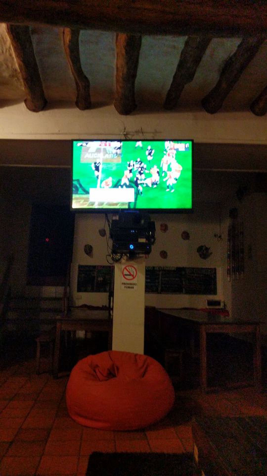
I then spent the rest of the day chilling in the hostel, and I think writing the Chile blog. When it came to the evening, Liz, Alison and I went on somewhat of a bar/hostel crawl. We started at the Irish owned Wild Rover, which is way up on a hill, and would be horrific to walk back to late. I had considered staying at Cusco’s self proclaimed ‘best party hostel’, and this visit made me so glad I had stayed at the wonderful Ecopackers for my entire time instead. Wild rover involved lots of dancing on the bar, but I think the fact they chose to project scenes of people having a much better time at a festival, on a big screen, told you that it was incredibly forced. After little more than an hour there we moved downhill to Loki. Loki is also a ‘party hostel’ but is older and felt more genuine than Wild Rover. I also approved of the water gun that was capable of firing shots into the gaping mouths of revellers. It was fun and I think we met a few Americans there but they may have been Canadian, that then accompanied us to Cusco’s only true club, Changos. Changos was surprisingly good. It had a big space, a well organised but reasonably priced bar, and hadn’t completely sold itself out to the backpacker market, with a good percentage of locals in attendance. It was therefore somewhat frustrating that I had to leave Changos at 230am, to watch the final British and Irish Lions test. I say frustrating, but I’d been overwhelmed with excitement ever since the end of the second test, a week previous. Finding that my hostel had ESPN 2 South America earlier in the day, was one of the single greatest moments of elation I’ve ever experienced. I grabbed a kebab and jogged back to the hostel common room. It was pitch black with everyone either in bed, or out. I switched on the television, and to my relief it burst into life with the haka, albeit with Spanish commentary. I then plugged my phone in and made a WhatsApp call to dad, watching it at 8:30am at home. I made him pause and play his stream so that our game clocks were synced up, and he gave me the commentary down the phone. It was an incredibly cagey game, and when the Spanish adverts rolled on at half time I did fall asleep while still on the call. (Alcohol consumption + comfy sofa + 3:15am). At this point dad must have panicked, wondering if he’d be able to awake me from my slumber before the start of the second half. I think I woke up about the 47 minute mark, and only missed one penalty. The series ended in the most bizarre of fashions. A controversial tv ref decision saving the Lions, and committing the match to a tie. Both teams looked around not knowing whether to celebrate or fall to the ground in despair. The sides both had big opportunities to win the game within the last 20 minutes that weren’t taken. I dragged myself to bed, still overjoyed that I’d managed to watch the game live, 3 weeks after seeing the team in Rotorua, a town that couldn’t possibly seem further away. Three weeks felt like three months, in the best of ways.
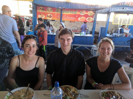
The next day was fairly uneventful. Liz, Marieka and myself did some shopping, and got food at the market. I did find out that Marieka who is dutch, plays hockey to a pretty high level, and her dad is an ICC umpire. This provided a huge amount of conversation, to the point that to our fault, we almost forgot about Liz walking with us, and had to apologise profusely. A few others had got back from a hike that day, so I was glad to introduce more people to Green Point. There were so many items on the menu I was desperate to try, I really did not need an excuse. I had the stir fry this time which was fantastic, while others sampled vegan sushi, lasagne and a few Peruvian delicacies.
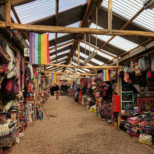
On Sunday I did a jam packed tour of the sacred valley with Liz, Alison and Marieka. Jam packed because we managed to find a version that basically fitted a day and a half’s tour into one. It meant a lot of jumping on and off the bus with little time to stop, but was what we wanted really. I don’t feel guilty in saying some of the ruins were far more impressive than others. I expect the ones I was least captured by, are the most fascinating for archaeologists. I loved the salt mines, and ruins at Ollantaytambo. The agricultural farming circles less so. The guinea pig farm at the start of the tour was also pretty cool. We left at around 530am I think, and the day was pretty tiring. When I got back to the hostel I ate there, and then met Luke (who featured in Santiago and Buenos Aires), and has one more appearance to come… He was staying with his dad in Cusco. There was a pretty impressive district wide power cut, which resulted in us all huddling round the fire. I also met Eliza, a law student from Brussels who had some pretty passionate views on the UK’s incompetence re Brexit, which was amusing and terrifying at the same time.

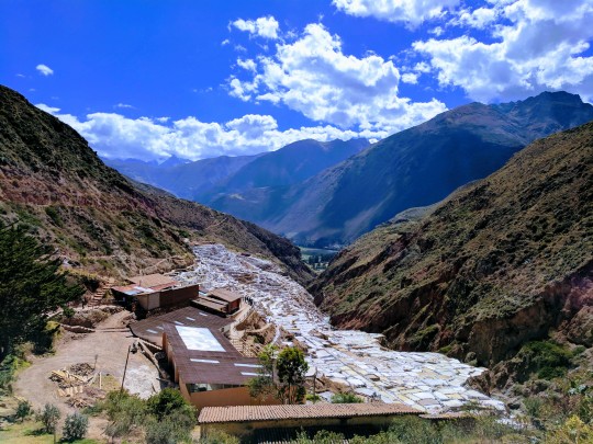
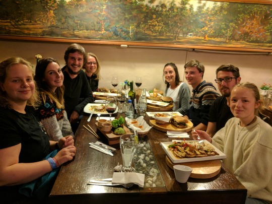
My final day in Cusco involved my best empanadas of the trip, and a visit to what wasn’t the monkey temple… An Irish guy who’s name I’ve forgotten was set on visiting this temple, however I’m pretty sure it’s a nickname and he definitely didn’t know it’s Spanish name. After a couple of taxi drivers looked back at us with blank expressions, one claimed he knew where to go and we piled in. He didn’t. He also only managed to take us halfway up the hill he was intending to, so we got out and enjoyed the view from what was still a decent set of ruins. That evening about 10 of us got dinner at, well, obviously, green point. I hadn’t had the Lentil burger yet! I won’t name everyone but there was a group of about 8 of us, all of which have multiple mentions in the Peru blogs who had dipped in and out of the hostel on tours, but who had generally stuck together. I loved having 11 days in a place with a great group of people. The dinner was a great way to finish my time in Peru, which I did love, and would love to return to. The next day I boarded a flight to Lima, and then onto Mexico City, but that’s for the next one.
1 note
·
View note
Text
Almaty - Bishkek - Osh
29/04/2017 K9595 Train from Urumqi South to Almaty 2 at 23.14 Duration 33 hours Hard Sleeper - £150
The train started screeching to a halt as we approached the Kazakh border only a few hours after leaving Urumqi. Before we could get out of bed and look half decent, Chinese border guards were on board, wanting to rummage around in our luggage and scrolling through photos on our camera. I think they just want to make sure you have not taken any photos that could harm the stability of the peoples republic. It was all quite friendly in the end, our guard started sharing with us similar tourist snaps from his phone from his weekend in Xi'an with the mrs.
Mohammed, our Chechen friend on his way back to Grozny from a business trip in Urumqi, explained the Kazakh side would be much smoother, which turned out to be the case. The guard assigned to our cabin was eager to practice his English and hear about our trip and then spoke at length in Russian with Mohammed. After 6 hours spent travelling about 2 miles we pulled into the ghost town border station where we got off to stretch our legs as the train had it’s wheels changed to match the different Russian gauge width. Mo knows this station cafe and the staff well, and insists on buying us lunch. He is a big fan of UFC fighting and with great pride he plays us youtube videos from his phone of several Chechen fighters in action whilst we tuck into our beef noodles.
Some Kazak border guards approach our little private section of the cafe, shocked to see some tourists at ‘their table’. They suddenly see Mo, give him a nod of the head, and we continue to sip on tea as we are shown more videos, this time of Chechen rebel leader, Akhmed Zakayev, being interviewed at his excilled home in London. This then begins to make me wonder, why is Mo travelling this route? 33 hours on a train to Almaty, 4 hour drive to Bishkek airport in Kyrgyzstan, before a 4 hour flight to Grozny? Is a photo with this guy a wise move? Is it gonna land me in serious trouble with the russian border police in a few weeks time?
Almaty is very quiet on the May day bank holiday. After the crowds and noise of Urumqi we are pleased to have the city to ourselves as we get a big goodbye hug from Mo, and make our way to our hostel at sunrise. The view from the hostel rooftop has to be one of the best city backdrops in the world, with the snow covered Tien Shan mountain range surrounding the entire south side of the city.
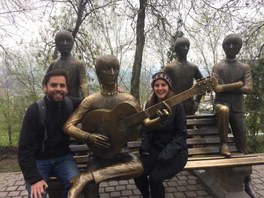
The air feels so much cleaner here as we head towards the mountains and take the bus up to 'kok tobe’ a favourite weekend hang out for local families wanting snaps with the city view behind them and next to the only Beatles statue in the world with all the fab 4 together (apparently)?
Back down in the city, we visit the Grand central mosque. We are not certain if Lo could come in so I Left her outside went in and had a look around briefly. It seems a nice quiet space, but not much praying going on. Lots of men just sitting in corner texting on their phones.
Food is getting welcomingly less soup and noodles and more cornish pasty like sincle leaving China. The staple Kazakh snack food is a fried bread filled with potato and is sold on stalls every few meters it seems. Some have mutton in if you get lucky. The fast food soviet era cafeterias dotted all over town provide cheap school dinner like meals, you take a tray, point at what you want and a dinner lady shovels a load on your plate. Sausage and mash, mutton stew and rice, bit of cake for afters… just good simple stodge that fills you up and doesn’t cause problems the next day.
Which is important when you have a long day of hiking planned. Determined not to spend any money on cable cars and ski resort entrance fees, we took the bus up to the impressive looking Medeu outdoor ice rink and followed a hiking trail up into the mountains. We passed an old stripped out soviet tank which was fun to play around in for a bit, pretending we were en route to Afghanistan to destroy the Taliban. The fun and games were all over when we realised the snow was getting seriously deep along the trail we were following, which was no longer really visible. We were the only people up there and couldn’t work out a way back down till we spotted a big Russian geezer trekking in just speedos and boots with walking poles. Happy looking chap, and a lovely tan he had on him, but we were worried we would be disturbing his peaceful time alone up in the mountains, but he was very helpful and pointed us to a safe way down. 'Plov’ (rice with chopped up mutton and veg in it) for dinner was just reward for our hiking efforts.
4/5/2017 Almaty to Bishkek Marshrutka (minibus) 5 hours
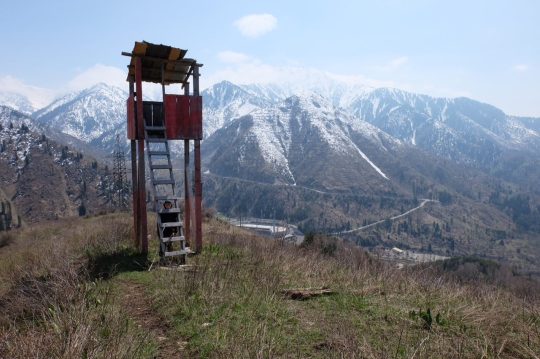
Credence clearwater revival, 'put a spell on you’ played us out of Almaty, our 'marshrutka’ (public minibus) driver obviously had great taste in Music. Dylan, Cohen, Eagles, all made for a great head bobbing, palm tapping on thigh, journey along the dusty A2 highway to the Kyrgyzstan border. It felt good to be on the road, the Tien Shan mountains, a natural border zone, were always in view outside the left hand windows. No more railway journeys now till we depart from Tashkent for Moscow on 3rd June, just long hours in less comfortable 'Marshrutkas’ but with some amazing scenery along the way.
The border crossing into Kyrgyzstan is smooth and without too much delay. No bag searches, no questions asked. This was expected to be the easiest of the 3 central asian border crossings we were to encounter, the former soviet state border police having a pretty bad reputation for hassling foreigners for bribes, we were relieved with the friendly Kyrgyz welcome.
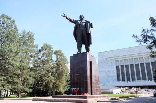
On arriving in Bishkek we were dropped off close to the huge Lenin statue that still stands tall here. Some flowers had even be laid below his feet, probably to mark 100 years since the revolution. Our host in Bishkek was Liza, a proud Kyrgyz lady of Russian heritage. She made us feel extremely welcome at our little homestay, an old 1960’s soviet era house, one entrance, 3 different little homes around a courtyard. We had our own little bedsit and an outside toilet and shower all for just $10 a night. Back in Dalston it would be rented out for £1700 a month, bills not included.
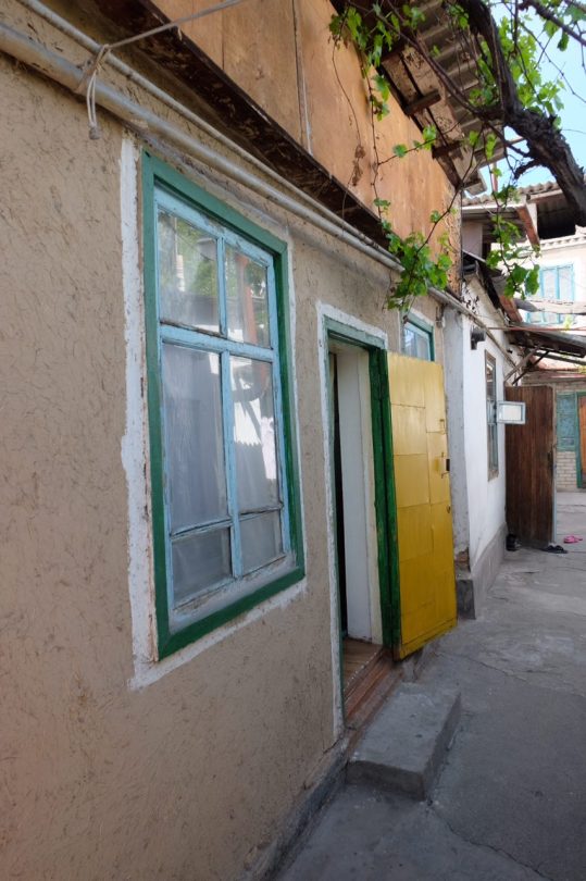

Liza seems to be a face around Bishkek. As she walks us to the bus station the next morning lots of people stop to talk, eager to see where her new guests are from. She tells us of the history of the different populations that have settled in the city over the last century and the glory days of the Soviet Union when life was much simpler, people were free to travel the whole of the central asian region without the ethnic tensions of more recent times. “Then people got greedy!” she bemoans.
Liza sees us safely on to our Marshrutka for a day trip to beautiful Lake Izzy Kol, the second largest alpine lake in the world. 30 mins in and the Marushkta has a tyre blow out. No safety triangle on a fast moving highway, I stand 50 metres up the road and act as a human safety triangle waving my arms at bemused drivers urging them to slow down as they pass our driver and some younger passengers helping to change the outside wheel. I think Louisa is really embarrassed to be associated with me at this point. “The safety of your passengers is the number one priority as a bus driver!” Steve Sparkle, at the arriva london training school, drummed it into me on my first day 7 years ago. We’re never off duty!
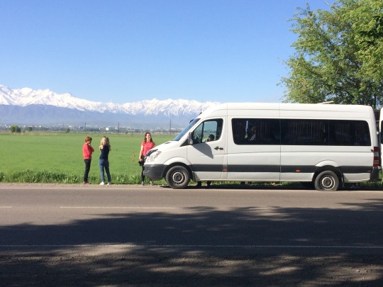
The place along the lake we are dropped of at is a little underwhelming. Stunning scenery overlooking the lake, but all the beachfront appears to be sectioned off for rich russian holiday homes, and being out of season the place is a bit dead. We managed to find a little bit of public beach, got our swimming costumes on and tried to go for a dip. 15 seconds in the water and your limbs start to go numb with the cold so we didn’t stick about for long, especially after being joined on our little beach by an angry looking herd of cows.
6/5/2017 Bishkek to Osh Marshrutka - 13 hours
Again Liza insists on walking us to the chaotic Bishkek bus station to make sure we get on the right Marshrutka, this time a 13 hour journey to Osh in the south of the country awaits us. The driver, Safiq, a cheeky chappy with the common Kyrgyz gold toothed smile, another good friend of Liza’s, is excited to hear that I’m a bus driver in London and insists me and 'your guest’ are allowed up front next to him. Result!
After Saffiq, stops off at a few mates houses on the road out of Bishkek, to pick up some parcels, we finally start to make some progress. The views out the window for the whole drive are pretty special, as the Marshrutka struggles up the several mountain passes en route. We start passing a few brave cyclists along the way, this route, all the way down to the Pamir highway, being a bit of a mecca for Eurasian crossing lycra warriors from around the world. I’m slightly envious of the challenge they are undertaking, then read in the guidebook that a 5km mountain pass tunnel we pass through “was the scene of a tragic carbon monoxide disaster” a few years ago.
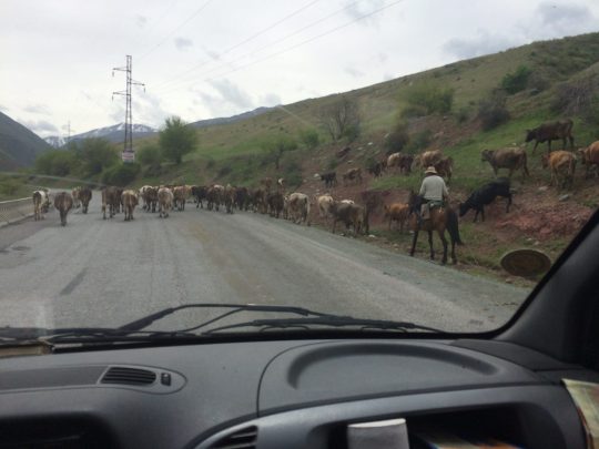
Despite only brief toilet stops for 12 hours, just an hour from Osh, Driver Saffiq decides it’s time for a sit down meal at a shashlik (kebab) house he knows. It’s nearly midnight and we are struggling to keep our eyes open, but as the guests of honour at Saffiq’s table, we are treated to a pot of tea and after prayers some meat on a stick and bread. I show Saffiq a photo of me with a London bus, much to the amusement of his mates around the table who start mocking him about my bus being bigger than his bus. Great banter.
In coming to Osh we are now back on the route of the ancient silk road after a slight Northern detour. Only a 4 hour drive from the Chinese border, this city claims to be over 3000 years old, “older than Rome!” they say. There is not much in the way of historical ruins here, the old famous bazaar is a ram shackle mix of metal shipping containers stacked on top of each other with shop windows cut of the front. It’s a lively place though and lots of cheap fruit and veg is available, perfect for us, as we try and give our immune systems a boost before we head south to the remote Pamir Highway. Also plenty of scenic hikes about an hour drive out of town, into the Alay Valley. On Victory Day bank holiday we are joined along the rapid flowing river banks by lots of Kyrgyz families enjoying the day off work in the sun and celebrating the soviet unions most important holiday of course.

The Osh Guesthouse hostel is the place to stay for people looking for 4x4 ride shares into Tajikistan. A big whiteboard is updated every hour wth requests for people to help spilt the costs, of what can be an expensive drive at very high altitudes. We get lucky on our second day when Fergus, from County Westmeath, Ireland and Antonio from Barcelona arrive and are looking at a similar 10 day itinerary to us.
We will start with a stop close to the Tajik border at the town of Sary Mogul, famous for it’s views of towering Peak Lenin (7,100 meters). Then into Tajikistan, all the way down to the Wakhan Valley, hugging the Afghan border at Khorog before returning to civilisation in the Tajik capital Dushanbe. Not much electricity en route, let alone Wifi, so you won’t be hearing from us for a while.
County Westmeath, Antrim and Down all represented on this road trip! Should be plenty of GA football chat to help pass the time.
1 note
·
View note
Video
vimeo
Original caption:
Short Movie about Incredible journey through Son Doong — largest cave on Earth.
For all questions and proposals - [email protected]
More info — cameraptor.com/sondong
instagram.com/georgyegor/ [email protected]
Camera: Sony a7s2 and mavic Drone: DJI Mavic
At over 5km long, with sections reaching up to 200m tall and 150m wide, Hang Son Doong is large enough to house an entire New York City block, complete with 40 story skyscrapers. With a total measured volume of 38.5 million cubic metres, this comfortably surpasses Deer Cave in Malaysia, which was considered to be the previous record holder. Stalagmites up to 80m high have also been surveyed, the tallest ever encountered.
Less people have seen the inside of Hang Son Doong than have stood on the summit of Mount Everest.
MUSIC: River by ZACHARY DAVID Hovard Shoe - Song of the Lonely Mountain
DIRECTOR — Georgy Tarasov PRODUCER — VOOGIE.pro COLORIST — Regie VFX ARTIST — Sergey Mykhailov VOICEOVER — Ernest Rudyak SOUND EDITOR — Nikita Bochkov MOTION DESIGNER — Alexey Fedorov EXECUTIVE PRODUCTION MANAGER — Ilya Buzanov
STARRING:
Andrew Ilitchev Artem Yunusov Ernest Rudyak Dmitry Dyldin
#hang son doong#son doong cave#geology#limestone#karst#nature#travel#landscape#video#vimeo#wanderlust#the earth story#cave#underground#drone#vietnam
93 notes
·
View notes
Video
vimeo
Short Movie about Incredible journey through Son Doong — largest cave on Earth. CAMERAPTOR (More info — http://bit.ly/2zImY6t ) At over 5km long, with sections reaching up to 200m tall and 150m wide, Hang Son Doong is large enough to house an entire New York City block, complete with 40 story skyscrapers. With a total measured volume of 38.5 million cubic metres, this comfortably surpasses Deer Cave in Malaysia, which was considered to be the previous record holder. Stalagmites up to 80m high have also been surveyed, the tallest ever encountered. Less people have seen the inside of Hang Son Doong than have stood on the summit of Mount Everest. MUSIC: River by ZACHARY DAVID Hovard Shoe - Song of the Lonely Mountain DIRECTOR — Georgy Tarasov PRODUCER — VOOGIE.pro COLORIST — Regie VFX ARTIST — Sergey Mykhailov VOICEOVER — Ernest Rudyak SOUND EDITOR — Nikita Bochkov MOTION DESIGNER — Alexey Fedorov EXECUTIVE PRODUCTION MANAGER — Ilya Buzanov STARRING: Andrew Ilitchev Artem Yunusov Ernest Rudyak Dmitry Dyldin
0 notes
Text
Tales from Tajikistan
Crossing over the border to Tajikistan was super easy. And on the other side I was able to easily take out cash from the first ATM, unlike the fucking slot machines in Uzbekistan.
The first few Ks were scenic, but afterwards it went through a very populated river valley. It was late afternoon and all of the children were out in full force. People make a point to be exceptionally friendly in Tajikistan, but sometimes you can have too much of a good thing. I had dozens of adults offer me watermelon and gave out an almost unhealthy amount of high fives. Once, some kids grabbed onto the back of my bags and tried running with and slowing me down. I all of a sudden got flashbacks of Ethiopia and had to uncling them from the bike. It was all a bit overbearing.
It had felt like hours until I was finally far away from it all to find a spot to camp.Anyways, I pitched the tent on a hillside and watched the sun go down and the lights flicker on in homes off in the distance. The milky-way came out later and man, did it look delicious. The next morning I woke up to the sound of children nearby. You’ve gotta be fucking joking me. It was only 6am and I could see them watching me from behind a rock about 150m away. I pretended not to notice them while I got ready- I wasn’t quite energetic enough for yet another game of show and tell while I pack my tent up.
On the road, I had a two kilometer vertical ascent to a pass. At the top was the famed Aznob Tunnel, colloquially referred to as the “Tunnel of Death.” It’s 5km long, unlit and unventilated. If the blind traffic inside doesn’t kill you, breathing in the high-altitude unventilated diesel fumes and coal debris eventually will.
I chatted with the military officers up top. They were funny. The chief insisted I must be tall from drinking too much tit-milk as a child. I watched them take bribes from the truckers. They asked nothing of me but, after an hour or so of chatting, they eventually found an mostly empty flatbed for me to slap my bike on. I rode with three other guys back there as we launched through a wormhole in time. It was black with vehicle lights shooting by. There was certainly turbulence. And the black soot stung the eyes and made it quite difficult to breathe.
Finally after a very long 10 minutes, (who knows with a wormhole?) we popped out the other end. I was relieved to be able to breathe again, and certainly grateful for not having to ride it. There were a total of 14 tunnels on the other side down to Dushanbe, but not nearly as long. I was able to hold my breath and cruise through most of them.
Before the capital I stopped for lunch. I decided I’d been eating way too much meat lately. I ordered the restaurant’s signature salad, the cabbage (not beef) soup, and the waiter was confused and inevitably talked me into a half portion of chicken. It was half a chicken, the “cabbage” soup had a whole beef knuckle in it, and the salad was mostly bacon and mayonnaise. Well done on my part!
In Dushanbe I ate something bad. Something my guts did not like. I’m not religious, but there was something fitting about being in a Muslim country and sitting to pray five times a day between sunrise to sunset.
I’ll be honest, I’ve never in all my travels bore witness to the frequency of sick travelers I encountered in Tajikistan. Mind you, I’m currently writing this from India... and I must say things are relatively tame in comparison even here. Tajikistan was a fucking battleground. It’s combatants, Giardia, E. Coli, and god know what else. Almost no one was spared.
Out of Dushanbe I rode with Nabeel, a fella from Pakistan that had been living in the UK for several years. He was great company. People loved treating him especially well because he was Muslim and he certainly loved taking advantage of it as well. Though sometimes, just to fuck with people he would tell them he’s Jewish. He would opt not to to pray with locals when invited to do so, but claimed he only did so seldomly and in private. In fact, he was interesting in that he was no stranger to vices, but did everything in seemingly balanced moderation. He drank sometimes and had tried drugs. He had been unfaithful to his wife, but only on multi-month trips. He had cigarettes, but I would watch him smoke two, maybe three a day.
We had lunch one day at a cafe run by an older couple. The man told us about life back in the day and how he speaks Russian because Stalin required three yrs of studying it back in the day. In fact, linguistically, Central Asia was quite different. If there is a language barrier in a foreign country, a traveler usually gravitates towards younger people who either may understand English or put up with you shitty local language easier. Since english is a fallacy in most of Central Asia and Russian hasn’t been taught much for the past 30 years it typically is much easier to approach older folks, just as long as you’re sure to speak loudly and be prepared for what may well be a life’s story in response.
One afternoon I pulled over to mack on some biscuits on a dirt road. An older woman walked past and upon hearing my Russian stopped to talk to me. It became clear after a bit that this 50+ yr old woman was interested in more than just conversation and invited me to her place, not before asking for my number. This was a far cry from the three woman that turned their backs to me. But still I had to decline, after all... I had some K’s to make.
Though, he’d been on the road a few months, this was still Nabeel’s first trip. He picked up on some of the oddities of how I live my life. This got me wondering if maybe I might have some residual cyclist habits upon returning home and living with roommates or a girlfriend. I’d suddenly have to justify why I’m doing dishes with laundry detergent, or washing my clothes in the shower, or cutting my toothbrush in half, supergluing my clothes back together, etc...
These are the things I think about all day... Also, for about three days I rode along the border of Afghanistan. The Afghan side was definitely more beautiful. It was much less developed and much, much greener. It was an almost vertical maze of tracks sprinkled with mud/straw hats with waterfalls cutting through it all. The mountains above shot up above the snow into the sky.
It was quite fascinating. I got to observe life on the other side of the Panj, sometimes just a football pitch away. I watched some of the traffic on the dirt road, mostly donkeys, but sometimes 2-3 people on a motorbike, or the occasional vehicle. Kids would sometimes go for a swim and women would wash clothes, dressed in full black burkas. I got plenty of waves and shouts and Selam Alecum’s. One day I considered tossing my frisbee over to some kids on the other side but in the end, decided it was slightly too far to reach the other side. And I certainly didn’t wanna be responsible for a kid drowning, especially given we’ve probably already done enough damage there.
In Rushon I spent a day off the bike but invariably ended up going hiking with a backpacking couple. They had come here after touring west Africa and Thomas had been to some 155 countries and counting. He told me a good bit about the history of the division between the Tajik and Afghan border and how the people were of the same families, language, and culture but divided by yet another geopolitical line and a river with currently almost no bridges. He also told me about the number of people that get eaten by wolves in the winter here.
By the way... Whoever claims plastic doesn’t degrade has been seriously misled. Due to the dry cycles of desert, the freezing temps, the endless sun, and some washing and stretching, everything I own of plastic has lost almost all of its structural integrity. Clothing grows holes and becomes impossibly fragile. Panniers and bags fall apart. And no zipper I’ve started with has survived the onslaught. It all disintegrates slowly into a thin fabric or shell of what it once was.
Leaving Rushon I decided to embark on a lesser traveled, off-road bikepacking route through the Bartang valley. The Pamir Highway was scenic, but there was more traffic, cafes, and people than I’d expected. Since it was mountainous adventure I was after, I set off for the Bartang.
I was accompanied by two French fellas on a two week bikepacking holiday. They were well experienced and well equipped. But since their gear was all new, I had some premonitions about what was loose and where they might fall. Most of these didn’t go unfounded. We didn’t always ride together, but they were great company.
Though the Bartang rises over 2 vertical kilometer in the 4-5 days, it meant nothing given how strong of a tailwind we had. The first two days we were hardly pedaling during the afternoon and it was almost painful to stop because of the pelting dust. I pitied anyone cycling in the other direction. There were also plenty of river crossings that kept things exciting. There are rumors of people losing panniers and even bicycles to the rivers. This time of year was not bad, but they did swell a bit in the afternoon and one day I finally designated as shoe-washing day as they were too long and too numerous.
One evening we glamped with two Belgian guys headed the other way. We had a river shower and a bonfire. One of them had decided to buy a hybrid bike in Bishkek and slap his backpack on top. His bike was struggling. The other was experiencing some dramatic digestive occurrences. “It’s like he’s shitting around every corner” Peter exclaimed! “I swear he must be doing it on purpose!”
Although I must say, in the Bartang I was finally able to stop the onslaught on my bowels. After Dushanbe I had lost the only hand sanitizer I had struggled to find there, probably on the side of the road. I swear to you, I almost cried. But here there were no more children’s high fives, I cooked all my food, and there were no public toilets. And perhaps most importantly, there was an abundance of natural springs were water ran clear straight out of the rock, with the glaciers visible high above.
On our last full day in the Bartang we ascended a pass and it opened up to a huge high altitude valley at about 4,000m with tons of surrounding peaks. It was spectacularly remote and desolate landscape and so I decided to celebrate 40,075km (the worlds circumference) which I’m confident I had recently covered. We popped a bottle of champagne. I poured some on my face, and I lost my mileage sign (which was also my visa) to the wind and had to chase after it. Afterwards we would have a magnificent campsite-one of the best of the trip and gallantly ride onto the border pass of Kyrgystan. Physically I was tired and worn, but mentally I was elated-I’d just bicycled around the goddamn planet!
0 notes