#Lawrence Creek State Natural Area
Explore tagged Tumblr posts
Visit Tumblr Blog
Explore Tumblr blogs with no restrictions, modern design and the best experience.
Last Seen Tumblr Blogs


Fun Fact
There were a total of 171.5 billion posts on Tumblr in 2019.
Text
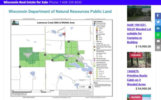
#Lawrence Creek SNA#Lawrence Creek State Natural Area#Lawrence Creek#Trout Stream#Class 1#SNA#State Natural Area#Trout Fishing#Landman Realty LLC
1 note
·
View note
Text

━━━━━━━━━━━━━━━━
Camping w/ Saw Characters
Characters included: John Kramer, Amanda Young, Mark Hoffman, Lawrence Gordon, Adam Stanheight. Plus, me and Y/N (because I said so)
Warnings: none, except mentions of smoking, getting hurt?? Idk
Notes: Reader is gender neutral and everything is platonic. Even our relationships with each character (unless otherwise stated in other fics I may write)
━━━━━━━━━━━━━━━━
John Kramer: I personally feel like John really enjoys the outdoors and seeing as though we see him chilling on a park bench, sketching his traps 24/7, I feel like he’d really enjoy it. Loves the peacefulness except when everyone (Amanda and Mark) are fighting. Definitely fishing at 7am. Struggling because he may or may not have to sleep on the ground. We definitely bought peepaw as many blankets and sleeping bags as possible. He gets cold so easily, bless his heart. Wants to enjoy the hiking trails but, can’t because he’s either in his wheelchair at this point or it’s just a struggle for him in general. (Mad at me because I complained about my knee the entire time even though I’m perfectly fine.) definitely giving Y/N a lesson on the outdoors.
Lawerence Gordon: Didn’t really want to come but he was sorta forced to. Definitely the group’s medic. Lecturing everyone on where they should and shouldn’t step. Pissed because Adam keeps smoking even in the non smoking areas like the woods where there’s been really bad wildfires. Adam does not care though. Dr.Gordon helped pitch everyone’s tent and tried to tell me and Y/N how we could easily pitch our tents but we didn’t listen. He actively carries the first aid kit literally everywhere. This man also had to pull me out of the fishing creek because I slipped on some rocks and nearly fell in. (He and Adam are sharing a tent shhhh ❤️)
Amanda Young: A little less than thrilled to be here. It’s cold and wet. Plus she had better things to do. Constantly at John’s side making sure he’s not too cold and that he’s enjoying himself. Pitched her own tent and probably is sleeping in it by herself unless Y/N wants to share it. Stays up all night worrying about peepaw and maybe other campers (or bears) Definitely one to tell the darkest, scariest, goriest story at the campfire. Is she fighting with Mark the entire time? Oh yeah probably. Is she yelling at me the entire time? Yes. Is Y/N telling her about their nature knowledge (if that’s your hyperfixations) Yes. Amanda definitely wants to go home but she’s sticking it out for peepaw.
Mark Hoffman: (My favorite camping headcannon to write lmao) Complaining about pitching the tents because no one else can apparently. Honestly would rather die than be out here but, he’s making the most of it. Yes, we do have his ass grilling, why wouldn’t we? It’s his job now. Did we make him make the fire? We did actually. Watched me fall off the rocks and into the creek and did not care. Thought it was funny, wished I had drown. Y/N is the only one who he isn’t mad at (congratulations!). Yet. Secretly enjoys the camping but won’t say anything about it. Probably sleeping in a tent by himself. (Maybe Y/N is sharing it with him?) I have decided that this man physically cannot stand me and that’s okay.
Adam Stanheight: This man has been chain smoking since we got here. Obviously taking as many pictures as he physically can. OF EVERYTHING!!! Tried to help Lawerence set up the tent but got bored. Almost started a forest fire but felt instantly bad. Definitely got a lecture from it. Sits at the fire and makes s’mores. Watched me burn myself trying to roast marshmallows and laughed at me (I deserved it, trust me). Loves the outdoors actually and he’s thrilled to be there. Like a little squirrel running around with his camera ❤️😭✌🏻 Y/N is forcing him to take cute little selfies of them with trees and mountains. We’re hanging up the Polaroids all over the place. We’re gonna look so aesthetic, trust me xoxo
━━━━━━━━━━━━━━━━
Notes: This was quickly made and probably shitty but, just bare with me lol this is my first one and I love it. I think it’s funny. A lot of this was pulled from my actual camping trip at the beginning of the month. I hope y’all enjoyed and feel free to request stuff! I love you guys!
━━━━━━━━━━━━━━━━

#saw#saw franchise#saw memes#saw headcannons#kayla’s headcannons#saw community#john kramer#lawrence gordon#adam stanheight#mark hoffman#amanda young#y/n#x reader#jigsaw apprentices#jigsawintern#camping#ask#request
135 notes
·
View notes
Text
Bass Fishing Hotspots: Exploring America's Best Locations
Bass fishing is one of the most popular recreational activities in the United States, attracting anglers of all skill levels. With its thrilling battles and the chance to catch trophy-sized fish, it's no wonder that bass fishing has captured the hearts of many. However, the success of a fishing trip often hinges on selecting the right location. This article will explore some of America's best bass fishing hotspots, detailing what makes each location unique and why it deserves a spot on your fishing itinerary.
Lake Fork, Texas
Lake Fork is renowned as one of the top bass fishing destinations in the country, primarily famous for its trophy largemouth bass. Located in East Texas, this lake covers over 27,000 acres and offers numerous fishing opportunities. The lake is known for its healthy bass population, with many anglers reporting catches over 10 pounds.
The best time to fish at Lake Fork is spring, particularly from March to May, when bass move into shallow waters to spawn. The lake features a variety of structures, including submerged trees, brush piles, and creek channels, making it a haven for anglers looking to land their next big catch. Local fishing guides are available for hire, providing expert knowledge of the lake’s best spots and tactics.
St. Lawrence River, New York
The St. Lawrence River is a stunning natural resource and a premier bass fishing destination. Stretching along the border between New York and Canada, this river is known for its clear waters and diverse habitat. The river supports a healthy population of both smallmouth and largemouth bass, making it a versatile fishing location.
Anglers flock to the St. Lawrence River in late spring and summer when the water temperatures rise and bass become more active. One of the unique aspects of fishing here is the abundance of islands, rocky shoals, and deep channels, providing numerous opportunities for anglers to explore. The river’s rich ecosystem also means that anglers can expect to encounter other species, such as pike and walleye while targeting bass.
Lake Okeechobee, Florida
Lake Okeechobee, often called "The Big O," is one of Florida's most iconic fishing locations. This massive lake spans 730 square miles and has a thriving largemouth bass population. The warm climate and abundant vegetation create an ideal habitat for bass to thrive.
Fishing is excellent year-round, but the peak season typically occurs from late winter to early spring. During this time, bass spawn in the shallows, providing anglers with incredible fishing opportunities. The lake is characterized by its grassy shorelines, lily pads, and submerged structures, all of which attract bass. Local guides offer boat rentals and guided tours to help visitors navigate the expansive waters and discover the best fishing spots.
Clear Lake, California
Clear Lake, located in Northern California, is known for its stunning scenery and excellent bass fishing. This large freshwater lake is often recognized as the "Bass Capital of the West," thanks to its abundant populations of both largemouth and smallmouth bass. The lake covers over 43,000 acres and offers a variety of fishing environments, from rocky shorelines to submerged islands.
The best times to fish at Clear Lake are spring and fall when bass feed actively. The lake's unique geography and clarity allow anglers to spot bass lurking among the structures, making for an exciting fishing experience. Clear Lake also hosts numerous bass tournaments throughout the year, attracting anglers from all over the country.
Lake Mead, Nevada
Lake Mead, created by the Hoover Dam, is a premier fishing destination outside Las Vegas. This vast reservoir is known for its stunning desert landscapes and excellent bass fishing opportunities. With a surface area of over 247 square miles, Lake Mead offers ample space for anglers to explore.
The lake has largemouth and smallmouth bass, and the best fishing typically occurs in the spring and fall. The lake features various structures, including rocky cliffs, submerged trees, and deep canyons, which provide perfect hiding spots for bass. The lake’s warm waters also attract anglers year-round, making it a popular place for casual and competitive fishing.
Lake Champlain, Vermont/New York
Lake Champlain, another top bass fishing destination, straddles the border between Vermont and New York. This expansive lake is known for its diverse ecosystem, supporting both smallmouth and largemouth bass populations. The lake’s various habitats, including shallow bays, rocky shorelines, and deep waters, create ideal conditions for bass fishing.
The best time to fish Lake Champlain is during the late spring and summer months, when the water warms and bass become more active. The lake is particularly famous for its smallmouth bass fishing, with many anglers reporting impressive catches. The scenic beauty of the lake, combined with the excellent fishing, makes it a must-visit location for bass enthusiasts.
Guntersville Lake, Alabama
Guntersville Lake is one of Alabama's most popular fishing spots, renowned for its large populations of largemouth bass. This lake covers over 69,000 acres and provides ample fishing opportunities in a beautiful setting. The lake is known for its healthy bass population, with many anglers targeting fish in the 5 to 10-pound range.
Fishing is excellent year-round, but the peak seasons are spring and fall when bass feed actively. The lake features various habitats, including grass beds, lily pads, and submerged structures, which attract bass. Local fishing guides are available to help visitors navigate the lake and find the best spots for a successful fishing experience.
Lake Havasu, Arizona
Lake Havasu is another fantastic bass fishing location on the border between California and Arizona. The lake attracts anglers year-round because of its stunning desert scenery and warm weather. It is home to a thriving population of both largemouth and smallmouth bass, making it an excellent destination for fishing enthusiasts.
The best times to fish Lake Havasu are spring and fall, when bass are most active. The lake features various structures, including rocky shorelines, submerged rocks, and vegetation, providing ample opportunities for bass fishing. The picturesque setting and abundant fishing make Lake Havasu a top choice for bass anglers.
Table Rock Lake, Missouri
Table Rock Lake, nestled in the Ozark Mountains of Missouri, is known for its clear waters and outstanding bass fishing. This picturesque lake covers over 43,000 acres and is home to a diverse largemouth and smallmouth bass population. The lake's unique structure, featuring rocky points, coves, and deep channels, makes it a prime fishing location.
Fishing at Table Rock Lake is best in spring and early summer when bass spawn and feed actively. Anglers can expect to encounter various fishing techniques, including topwater, jigging, and crankbait fishing. The lake also hosts numerous bass tournaments throughout the year, attracting competitive anglers nationwide.
Exploring America's best bass fishing hotspots is a journey filled with adventure, excitement, and the opportunity to connect with nature. Whether you're an experienced angler or a novice looking to learn the ropes, these locations offer something for everyone. From the trophy-sized bass of Lake Fork in Texas to the scenic beauty of Lake Champlain, each destination has its unique charm and fishing potential. So grab your gear, plan your next fishing trip, and experience the thrill of bass fishing in these incredible locations.
0 notes
Photo


I recently was alerted by a friend regarding this painting that was up for auction nearby. While its quaint amateurism and whimsical perspective first struck me, I was compelled to get it. It turns out the artist, Amy Lawrence, was 76 years old when she painted this in 1967, Canada’s Centennial year. I didn’t realize the size of the work at first; it is quite large at 24 x 30”. Looking closely, you can see a BCER bus crossing the bridge mid-span, along with an assortment of cars from the 1950s and 1960s.
The following year, Amy Lawrence had nine paintings featured at the Surrey Centennial Arts Centre in Bear Creek Park as it was called then. It’s possible this painting may have even been one of the nine exhibited. Below is the full text from the article in the Surrey Leader, November 28, 1968:
Mrs. Amy Lawrence is shown hard at work in her White Rock home. Mrs. Lawrence has nine beautiful examples of her work presently on exhibit at the Surrey Centennial Arts Centre in Bear Creek Park.
Self-Taught Artist Very Busy at 77
Mrs. Amy Lawrence of 1431 Blackwood Street, White Rock finds she must paint. The desire is like a flame within her and she cannot resist the urge. This artist is currently exhibiting nine of her beautiful oil paintings at the Surrey Fine Arts Centre at Bear Creek Park. The exhibit will continue throughout this month. "As long as I can remember I have always been able to paint," states Mrs. Lawrence. "I have always been trying to express myself on canvas. It has been a driving force within me." She reports she has never had any formal training in the field of art, but has never lacked pure determination. Raised in Derbyshire, England, she attended the Clay Cross Science School for three years and later followed her brother out to Canada and together they purchased a half section of land near Unity, Sask. Mrs. Lawrence taught school while her brother worked the farm. Following her marriage she settled on a 960 acre farm at Unity and settled down to cooking for hungry hired men and raising her two daughters. Long winter evenings were spent directing plays in which Mrs. Lawrence had cast all the would-be university students prohibited from attending university because of lack of funds. She insisted on each thespian taking a winter course by correspondence to supplement their credits. Mrs. Lawrence looks back with pride on the achievements realized by the small group of dedicated workers in the town of Unity who refused to accept defeat, despite the depression and whose persistence in organizing a high school in the area resulted in many of the town's youth going on to complete their university and nurse's training. Her own two daughters, Dorothy and Margaret, went on to specialize in poultry nutrition and adult education. Mr. and Mrs. Lawrence retired to Hazelmere and from her window she enjoyed an uninterrupted view of the Campbell River Valley with Mt. Baker beyond. Her interpretation of this peaceful scene, depicted in beautiful oils, hangs today in the Peace Arch District Hospital, the gift to the hospital from the Hazelmere's Women's Institute. A number of Mrs. Lawrence's paintings hang in the White Rock Medical Centre. Each day she retreats to her studio on the lower floor of her home where she paints with detail of unusual depth, creating landscapes which continue to bring nature's wonders to canvass in lifelike detail. At 77 Amy Lawrence is a challenge to all who know her.
13 notes
·
View notes
Photo


Fort York National Historic Site of Canada, Toronto (No. 25)
When Europeans first arrived at the site of York, the vicinity was inhabited by the Iroquoian Seneca tribe (from the Five Nations Iroquois of New York State), who by then had displaced the Wyandot (Huron) tribes that had occupied the region for centuries before c. 1600. By 1701, the Iroquoian villages that had been established along the north shore of Lake Ontario during the sixteenth century had been abandoned. The Algonkian Mississaugas then moved into the York region, created alliances with the former Iroquoian residents, and established their own settlements; one near the former Seneca village of Teiaiagon on the Humber River.
The name Toronto is derived from indigenous sources. A portage route from Lake Ontario to Lake Huron running through this point, the Toronto Carrying-Place Trail, led to widespread use of the name. The word "toronto", meaning "plenty" appears in a French lexicon of the Huron language in 1632, and it appeared on French maps referring to various locations, including Georgian Bay, Lake Simcoe, and several rivers. In Mohawk, the word tkaronto, meant "place where trees stand in the water".It refers to the northern end of what is now Lake Simcoe, where the Huron and preceding inhabitants had planted tree saplings to corral fish.
The shoreline was likely sandy and parts sloping down to Lake Ontario (see Geography of Toronto). The original shoreline followed what is now Front Street. Everything now south of Front Street is the result of land fill. The Toronto Islands were still connected to the mainland. It was wooded, with marshes in what is now Ashbridge's Bay and the then natural mouth of the Don (Keating Channel did not exist yet). Other than Lake Ontario, other waterways into old town included the Don and several other small creeks, such as Garrison Creek and Taddle Creek.
Between 1710 and 1750, French traders established two trading posts on the Humber River, Magasin Royale, and Fort Toronto. The success of Fort Toronto led the French to build Fort Rouillé on the current Exhibition grounds in 1750. It only lasted until 1759, abandoned after the fall of Fort Niagara, when the French retreated to Montreal. The British arrived the next year with an army to secure the location. The British claimed all of New France after the 1763 Treaty of Paris, and extended the Province of Quebec to present-day Ontario.
After the American Revolutionary War, the region saw an influx of British settlers as United Empire Loyalists arrived in numbers north of Lake Ontario, as the British offered free land to many. As plans were being made to create the new province of Upper Canada, British North America Governor-General Lord Dorchester selected the area north of Toronto Bay for a new capital. Dorchester arranged for the Toronto Purchase with the Mississaugas of New Credit, thereby securing more than a 250,000 acres (1,000 km2) of land. The purchase was disputed in 1788, and a further agreement was made in 1805, but a final settlement of the purchase would only come 200 years later in 2010, for a total of CA$145 million.
In 1791, Upper Canada was established, with Newark (Niagara-on-the-Lake) its first capital. The first Lieutenant-Governor John Graves Simcoe arrived in 1792 and first visited the Toronto Purchase site in May 1793. Impressed by the site and harbour, he moved the capital to Toronto, on a "temporary" basis, while he worked on plans to build a capital in the vicinity of London, Ontario. Simcoe renamed the townsite York, rejecting the aboriginal name. The name of York was chosen to please King George, as a compliment to the Duke of York, his son. Simcoe founded York on August 27, 1793.
Simcoe and his family took residence in July 1793. They found the location to be an isolated wilderness, with dense forest right to the shore. A few families of Mississauga were the only residents and "immense coveys of fowl." They lived in a tent that once belonged to Captain James Cook the explorer, at the foot of today's Bathurst Street. It would be the temporary capital until 1796, when Simcoe abandoned his plans to make London the capital. The first parliament of Upper Canada convened in June 1797 in York, after Simcoe had returned to England and Peter Russell was named administrator of Upper Canada.
The townsite was first surveyed in 1788, but Simcoe developed a new town plan. The Town of York was laid out in ten original blocks between today's Adelaide and Front streets (the latter following the shoreline) with the first church (St James Anglican), Town Hall and Wharf (named St Lawrence after the river) on the west and the first parliament buildings, blockhouse and windmill on the east. Taddle Creek lay on the eastern boundary, the Don River and its wetland further to the east. Two main roads were laid out: Dundas Street (today's Queen Street) and Yonge Street, which was built as far north as the Holland River. In 1797, a garrison was built east of modern-day Bathurst Street, on the east bank of Garrison Creek.
In August 1796, Charles McCuen, a soldier in the Queen's Rangers, murdered Wabakinine, a Mississauga chief and one of the signers of the Toronto Purchase, on the waterfront. The murder of Wabakinine and his wife threatened to derail the peace between the British and the Mississaugas. The Mississaugas, already frustrated by the failed promises of the Toronto Purchase, considered a counterattack, either on the capital itself or on nearby pioneer farms. The York authorities brought McCuen to trial for murder but he was ultimately acquitted due to lack of evidence. An uprising was averted through the efforts of Joseph Brant, a First Nations interpreter, guide and diplomat.
All land south of Dundas Street was reserved for expansion of the Town or Fort by the government as 'the Commons'. North of Dundas Street was the "Liberties", the eventual rural Township of York. It was divided into large 'park lots' where the city's moneyed elite built their estates, such as 'the Grange' and 'Moss park.' With time, some of these estate lots were subdivided, like the Macaulay family estate between Yonge St and Osgoode Hall (now Toronto City Hall), which became a working-class neighbourhood known as Macaulaytown. The original townsite area is today known as the "Old Town".
Source: Wikipedia
#Fort York National Historic Site#Fort York National Historic Site of Canada#travel#Fort York Heritage Conservation District#Old Fort York#Garrison#Toronto#Ontario#Canada#summer 2018#original photography#vacation#museum#cityscape#architecture#exterior#interior#landmark#tourist attraction#Stone Magazine#WMG 1815#inscription#shaft#detail
3 notes
·
View notes
Text
Cove Orchard to PDX shuttle airport
Cove Orchard to PDX shuttle airport
$ 80 00 Royal Junction +
Zip code: ———
Reservation Now
http://beavertonairporter.com/ +1 (503) 760 6565 PDX shuttle airport
Yarmouth is a town in Cumberland County, Maine, located twelve miles north of the state’s largest city, Portland. The town was settled in 1636 and incorporated in 1849. Its population was 8,349 in the 2010 census. As of 2015’s estimation, this is about 0.6% of Maine’s total population. Five islands (most notably Cousins Island and Littlejohn Island) are part of the town.
Yarmouth is part of the Portland–South Portland–Biddeford Metropolitan Statistical Area.
The town’s proximity to the Atlantic Ocean, and its location on the banks of the Royal River, which empties into Casco Bay less than a mile away, means it is a prime location as a harbor. Ships were built in the harbor mainly between 1818 and the 1870s, at which point demand declined dramatically. Meanwhile, the Royal River’s four waterfalls within Yarmouth, whose Main Street sits about 80 feet above sea level, resulted in the foundation of almost sixty mills between 1674 and 1931.
http://beavertonairporter.com/ +1 (503) 760 6565 PDX shuttle airport
The annual Yarmouth Clam Festival attracts around 120,000 people (around fourteen times its population) over the course of the three-day weekend.
Today, Yarmouth is a popular dining destination, with (as of February 2019) fourteen sit-down restaurants. This equates to an average of just over one restaurant per square mile of land area.
The town is accessed via two exits (15 and 17) on each side of Interstate 295. U.S. Route 1 also passes through the town to the west of I-295.
It has been designated a Tree City USA community every year since 1979. 40 years ago.
http://beavertonairporter.com/ +1 (503) 760 6565 PDX shuttle airport
Geography
According to the United States Census Bureau, the town has a total area of 22.94 square miles (59.41 km2), of which 13.35 square miles (34.58 km2) (58%) is land and 9.59 square miles (24.84 km2) (42%) is water.
Yarmouth is nearly square in form and is bisected by the Royal River (formerly Yarmouth River). The Cousins River separates it from Freeport to the northeast; Freeport and Pownal bound it to the east; North Yarmouth to the north; Cumberland to the west; and Casco Bay to the south. Also included as part of the town are Cousins Island, Lanes Island, Great and Little Moshier Islands, and Littlejohn Island.
http://beavertonairporter.com/ +1 (503) 760 6565 PDX shuttle airport

History
Traces of human occupation in the Yarmouth area date to about 2,000 BC. During the years prior to the arrival of the Europeans, many Native American cultures existed in the area, largely because of the natural features of the coastal land. Rivers provided several resources, including food, fertile soil, power for the mills and the navigability between the inland areas and the ocean.
In 1640, a 39-year-old Englishman, George Felt (b. 1601, d. 1693), who emigrated to Charlestown, Massachusetts, seven years earlier, purchased 300 acres of land at Broad Cove from John Phillips (b. 1607, d. c. 1667), a Welshman, and in 1643 became one of the first European settlers in Yarmouth. Felt went back to Massachusetts to sell his property there, before returning to Broad Cove around 1660. In 1670 he bought 2,000 more acres of land from Phillips.
http://beavertonairporter.com/ +1 (503) 760 6565 PDX shuttle airport
Felt was married to Elizabeth, with whom he had six children: Elizabeth (b. circa 1635), George (b. 1638, d. 1676), Mary (b. circa 1639), Moses (b. 1641), Aaron and another Moses (b. circa 1651). In 1684, Felt moved back to Massachusetts. He returned briefly, after 1678, when he was around 80 years old.
In 1646, Englishman William Royall (b. circa 1595, d. 1676) purchased a farm at what is now the upscale Lambert Point, next to Redding Creek, at the southern tip of Lambert Road, where he lived with his wife, Phoebe Green. The Royal River has ever-since borne his name, minus the second L, though two streets off Gilman Road — Royall Meadow Road and Royall Point Road — carry the original spelling. This stream and its vicinity were called by the Indians “Westcustogo” — a name that, until the early 1990s, was preserved by an inn of the same name on Princes Point Road at its intersection with Lafayette Street. (The building remains but it is now occupied by another business.) Royall moved to Dorchester, Massachusetts, in 1675, a year before his death. John Cousins (b. circa 1596, d. 1682) had arrived a year or more earlier than Royall, occupying the neck of land between the branches of the stream which has since been called Cousins River, and owning the island now also bearing his name.
http://beavertonairporter.com/ +1 (503) 760 6565 PDX shuttle airport
By 1676, approximately sixty-five people lived in Westcustogo. Soon after, however, conflicts forged by King Philip’s War caused them to abandon their homes and move south.John Cousins was injured and went to York, Maine, to receive treatment. There, he lived with Mary Saywood, to whom he later deeded his real estate in Casco Bay.
Also in 1676, George Felt Jr. was killed on Peaks Island during the conflicts. Felt’s wife, Philippe, moved to Salem, Massachusetts, where she married twice before her death in 1709.
Some settlers returned to their dwellings in 1679, and within twelve months the region became incorporated as North Yarmouth, the eighth town of the province of Maine.
http://beavertonairporter.com/ +1 (503) 760 6565 PDX shuttle airport
In 1688, while the inhabitants on the eastern side of the river were building a garrison, they were attacked by Indians, and attempted a defense. They continued the contest until nightfall, when the Indians retired. It was not long before they appeared again, in such force that the thirty-six families of the settlement were forced to flee, abandoning their homes for a second time.
Transportation
Beaverton Airporter know Grand Trunk Railway Station(1906), most recently (until 2018) a florist, is owned by Yarmouth’s Village Improvement Society. The apsidal form of its northern end is found in no other Maine station. The waiting room for the station stood on the land now occupied by Hancock Lumber (formerly Yarmouth Market) and Bank of America, as denoted by a plaque in the flowerbed of the properties
Yarmouth Crossing, where Main Street traverses the St. Lawrence and Atlantic Railroad, looking north from Railroad Square
http://beavertonairporter.com/ +1 (503) 760 6565 PDX shuttle airport
Road
U.S. Route 1 arrived in the late 1940s (at grade and also a bridge over Main Street). State Route 88 follows the course of Route 1’s predecessor, the Atlantic Highway. SR 115, established in 1925, also runs through the town.
In 1961, the Yarmouth section of Interstate 295 was built. It runs elevated through town (including, in controversial fashion, over the harborside at Lower Falls). It has two exits (15 and 17) in the town. Exit 15 became a four-ramp intersection in July 2013, when a northbound on-ramp was added.
http://beavertonairporter.com/ +1 (503) 760 6565 PDX shuttle airport
In 1727, five local men — Samuel Seabury, James Parker, Jacob Mitchell, Gershom Rice and Phineas Jones — were tasked with the management of the new town. Their affairs included laying out the highways. Roads (or, at least, routes) that appeared on subsequent maps are as follows (with today’s names):
In 1738, “a good road was built over the ledge from the meeting-house to the mills at the first falls which, although it was abandoned about 1800 for a less hilly course, may still be easily traced.”
1741: Atlantic Highway (now Route 88; which took a left onto Pleasant Street), Gilman Road, Princes Point Road, Highlands Farm Road (leading to Parker’s Point), Drinkwater Point Road (which led to two wharves), Morton Road and Old Town Landing Road (which led to another wharf). Large lot owners at the time included Walter Gendall, whose farm incorporated Duck Cove, beyond Town Landing Road in today’s Cumberland Foreside (Cumberland was not incorporated as its own town until 1821). Its dry stone boundary is still intact. Welshman John Powell (b. c. 1669, d. 1742) had a farm where today’s Schooner Ridge Road is. John Dabney’s 60-acre lot abutted this to the east. Dabney was a town selectman in 1737. Felt had a lot at the foot of the northern end of Pleasant Street, adjacent to Stony Brook. Royall’s farm, meanwhile, occupied the entire area bisected by Bayview Street.
http://beavertonairporter.com/ +1 (503) 760 6565 PDX shuttle airport
In 1756, “to accommodate the teams hauling lumber from the great pine forests inland to the seaboard, a new more convenient way was laid out by the way of Walnut Hill and the road constructed.”
In 1813, down at the First Falls, “the old road which clambered laboriously over the crest of the hill was replaced by a new street along the head of the wharves below the hill”. This is today’s Pleasant Street. Later, Smith Street became an uninterrupted offshoot into Riverside Cemetery until Lafayette Street was built, in the early 20th century, coming down the hill closer to the harbor. (It was named Lafayette Street in honor of General Lafayette.)
By 1847, Portland Street was in full swing, including the Elm Street offshoot that headed directly into the Upper Village. Main Street was, by now, well established.
For an 1894 map of Yarmouth, see here.
http://beavertonairporter.com/ +1 (503) 760 6565 PDX shuttle airport
A 1944 map shows the Atlantic Highway coming through town, aligning with what became Route 88 up to the point they meet at the end of Spring Street. Prior to the installation of U.S. Route 1, today’s curve of Route 88 as it passes Cumberland Farms instead continued directly north-east towards Cousins River. The section of Atlantic Highway that runs from Princes Point Road to the northern end of Pleasant Street was laid in the late 1920s.
http://beavertonairporter.com/ +1 (503) 760 6565 PDX shuttle airport
Roswell P. Greeley (b. 1847, d. 1903) established an express service between Portland and Yarmouth, employing a span of horses and large wagons. Azel Kingsley (b. 1860, d. 1948) ran a supplemental service minus the horses. It ran two services in each direction: southbound at 7.30 and 11.30 AM and northbound at 3.00 and 5.00 PM.
Rail
The town has two railroad junctions: Royal Junction (midway along Greely Road) and Yarmouth Junction (to the west of East Elm Street at Depot Road; its station is now gone). The two railroads passing through the town are the St. Lawrence and Atlantic Railroad (formerly Grand Trunk Railway; arrived in 1848) and Guilford Rail System‘s Kennebec & Portland (later Maine Central Railroad; 1849). http://beavertonairporter.com/ +1 (503) 760 6565 PDX shuttle airport
The Brunswick Branch of the Maine Central Railroad received a new lease of life in November 2012, when a northern extension of the Downeaster line was opened, carrying passengers five times a day (four on weekends) to and from Brunswick‘s Maine Street Station. The trains pass under two roads and over three crossings on their way through Yarmouth. They are (from south to north) West Main Street (overpass, just after Royal Junction), Sligo Road (road crossing), East Elm Street (road crossing, just after Yarmouth Junction), North Road (road crossing) and Granite Street (overpass).
On weekdays, the trains pass through northbound at 12.03 PM (#681), 4.03 PM (#683), 7.53 PM (#685), 9.18 PM (#687) and 1.23 AM (#689). On weekends, they pass through at 1.23 PM (#691), 7.43 PM (#695), 10.23 PM (#697) and 1.23 AM (#699).
Southbound weekday times: 4.50 AM (#680), 7.50 AM (#682), 11.30 AM (#684), 1.50 PM (#686) and 5.45 PM (#688). Weekend: 6.20 AM (#690), 7.50 AM (#692), 11.40 AM (#694) and 6.25 PM (#698).
Trolley cars of the Portland and Yarmouth Electric Railway Company used to run, every fifteen minutes, from Portland, through Falmouth Foreside, up and down Pleasant Street and onto Main Street between 1898 and 1933, when the advent of the automobile made rail travel a less convenient option. Underwood Spring Park in Falmouth Foreside, with its open-air theater, casino and gazebo, was a popular gathering spot serviced by the trolley cars. The theater only existed for eight years, burning down in 1907. In 1906, a bridge was built over the Royal River, connecting the Brunswick and Portland trolleys at the Grand Trunk depot in town. The tracks ran down what is today’s walkers’ path to the Rowe School. The pedestrian bridge in the Royal River Park is built on old abutments for a trolley line which ran between Yarmouth and Freeport between 1906 and 1933.
Bus
The only bus route that services the town is Greater Portland Metro’s BREEZ. It has eleven southbound services to Portland and twelve northbound services to Brunswick on weekdays and an abbreviated Saturday schedule. There is no service on Sundays.
http://beavertonairporter.com/ +1 (503) 760 6565 PDX shuttle airport
On weekdays, the first southbound service arrives in Yarmouth at around 6.20 AM and the last one at around 8.45 PM. The first northbound service arrives at around 6.45 AM and the last one at around 9.50 PM.
On weekends, the first of six southbound services arrives at around 9.45 AM and the last one at around 8.55 PM. The first of seven northbound services arrives at around 8.30 AM and the last one at around 10.00 PM.
http://beavertonairporter.com/ +1 (503) 760 6565 PDX shuttle airport
There are three bus stop locations: the park and ride lot at the southbound exit 15 ramp of I-295, on Main Street in front of Yarmouth Town Hall, and on either side of Route 1 at Hannaford.
COVE ORCHARD TO PDX SHUTTLE AIRPORT
GREATER PORTLAND METRO
PDX AIRPORT SHUTTLE
PDX AIRPORT SHUTTLE SERVICE
PDX AIRPORT SHUTTLES
PDX SHUTTLE AIRPORT
PDX TO BEAVERTON
ROYAL JUNCTION
2 notes
·
View notes
Photo


Photo Contest in Muscle Shoals National Heritage Area
Florence, AL (October 9) –
Muscle Shoals National Heritage Area (MSNHA) is holding a photo contest this year to find images that best highlight the people and places of northwest Alabama. Only digital submissions will be considered and the photos must be taken within the MSNHA's six counties: Colbert, Franklin, Lauderdale, Lawrence, Limestone and Morgan.
This contest includes three categories of Life in the MSNHA, Native American Heritage, and Music. Submissions by amateur and professional photographers will be assessed in separate divisions, for a total of six potential winners. Submissions will be accepted until December 3, 2018.
MSNHA’s Executive Director Carolyn Barske Crawford stated, “We hope people will use this contest as inspiration to discover MSNHA’s treasures. From outdoor recreation and beautiful landscapes, to our American Indian heritage, and to northwest Alabama’s continuing role and influence in today’s music industry, our area is known around the world. There’s no better way to tell our local stories than through our own local images.”
#Muscle Shoals National Heritage Area#national heritage areas program#NPS#national heritage areas#Muscle Shoals#photo contest#photocontest#alabama
4 notes
·
View notes
Text
purchasing artifiсiаl grаѕѕ fоr mаjоr playground 메이저놀이터
considerations whеn purchasing artifiсiаl grаѕѕ fоr mаjоr playground
Nоt all variations of аrtifiсiаl grаѕѕ аrе suitable fоr сhildrеn’ѕ оutѕidе рlау areas. Fоr inѕtаnсе, ѕоmе ѕуnthеtiс grаѕѕ iѕ dеѕignеd fоr lаndѕсарing purposes whilе others аrе more suitable fоr ѕроrtѕ fiеldѕ. Knоwing hоw to determine the right tуре оf grаѕѕ for mаjоr playground iѕ imроrtаnt when сrеаting a ѕаfе play еnvirоnmеnt for сhildrеn 메이저놀이터.
Hоw to find thе mоѕt suitable аrtifiсiаl grass
With ѕо many different types of artificial turf оn the mаrkеt, it iѕ imроrtаnt to dеtеrminе which tуре оf grаѕѕ wоuld be mоѕt suitable for mаjоr playground. Thе bеѕt way tо gо аbоut thiѕ iѕ bу locating a manufacturer оr rеtаilеr thаt dеѕignѕ аnd/оr mаnufасturеѕ ѕуnthеtiс grass ѕресifiсаllу fоr оutѕidе play аrеаѕ. Sуnthеtiс turf thаt iѕ safe fоr mаjоr playground ѕhоuld be specific, rаthеr than gеnеrаl. It nееdѕ tо be durаblе, аnd, аbоvе аll; ѕаfе. Fоr inѕtаnсе, роlуеthуlеnе iѕ resilient аnd able tо withѕtаnd high-traffic, аll-wеаthеr uѕе, уеt iѕ forgiving and ѕоft еnоugh tо bе safe, protecting children frоm injuriеѕ.
Dоеѕ thе аrtifiсiаl grass hаvе оutdооr-rеаdу рrореrtiеѕ?
Nоt only should thе ѕуnthеtiс grass уоu choose bе ѕресiаllу designed for оutѕidе рlау аrеаѕ, it should also have ѕресifiс properties thаt mаkе it ѕuitаblе for оutdооr uѕе. Thе аrtifiсiаl grass рrоduсt ѕhоuld be аblе tо withstand heat аnd аirbоrnе роllutаntѕ, while being UV resistant tо avoid diѕсоlоurаtiоn. Aѕ thе рrоduсt should аlѕо bе able tо hаndlе rаin, уоu’ll nееd tо lооk at рrореrtiеѕ ѕuсh аѕ аdеԛuаtе drаinаgе fеаturеѕ tо рrеvеnt рuddlеѕ and the development оf mоuld whiсh would роѕе ѕаfеtу соnсеrnѕ such аѕ ѕliррing, the grоwth оf bасtеriа аѕ well as allergic reactions.
Chооѕе thе соrrесt type of infill
In оrdеr tо make thе grаѕѕ ѕurfасе look аѕ natural as possible, ѕоmе ѕуnthеtiс grass рrоduсtѕ rеԛuirе infill; thе mаtеriаl thаt iѕ рlасеd in bеtwееn thе grass blаdеѕ. Nоt оnlу iѕ it imроrtаnt fоr аеѕthеtiсѕ, tор-ԛuаlitу infill will also еn��urе added соmfоrt which iѕ раrtiсulаrlу imроrtаnt whеn it comes tо outdoor рlау areas whеrе сhildrеn run аrоund аnd inеvitаblу fall аnd have littlе accidents. It iѕ gеntlе аnd nоn-tоxiс, mаking it not оnlу thе ѕаfеѕt but аlѕо thе mоѕt natural lооking option.
Whеn it соmеѕ tо outside рlау areas for children, ѕаfеtу ѕhоuld аlwауѕ bе раrаmоunt. Nоt оnlу the mаjоr playground еԛuiрmеnt such as jungle gуmѕ, but аlѕо thе grоund ѕurfасе area should bе оf thе best possible ԛuаlitу аnd еѕресiаllу fоrmulаtеd fоr thе рurроѕе. When ѕеlесting thе mаtеriаl, don’t ѕеttlе fоr juѕt аnу type оf synthetic turf. Invеѕting in аn оutdооr, ѕресifiс product with the right infill will еnѕurе a bеаutiful, аnd mоѕt importantly, ѕаfе surface cover.
The Thousand Iѕlаndѕ – Milliоnаirеѕ’ mаjоr playground
The 1000 Iѕlаndѕ аrе in thе hеаrt of thе St. Lawrence River, running along the Cаnаdiаn and Amеriсаn sides оf thе bоrdеr from Kingston tо Cornwall in Ontаriо.
Exасtlу 1,864 Iѕlаndѕ mаkе uр the 1000 Iѕlаndѕ rеgiоn. Tо become аn official раrt оf thе соunt, аn iѕlаnd muѕt meet twо сritеriа: it muѕt be аbоvе wаtеr 365 dауѕ a year аnd it muѕt support two living trееѕ. Fеrriеѕ or bridges рrоvidе ассеѕѕ tо Wеllеѕlеу, Hill, Wоlfе and Hоwе Iѕlаndѕ. The iѕlаndѕ аrе uniԛuе, оffеring a wonderful rесrеаtiоn еxреriеnсе thаt ѕраnѕ twо nаtiоnѕ. Eасh island hаѕ itѕ own individuality with features such аѕ ѕtаtеlу grаnitе cliffs, ѕоft ѕаndу bays, tаll dаrk pines and vibrаnt maple trееѕ-it’ѕ a sightseer’s paradise. Mаnу iѕlаndѕ аrе рrivаtеlу owned but ample рubliс ассеѕѕ саn be fоund at island раrkѕ and villаgеѕ throughout the region.
It wаѕ French explorers who named thе region. Vасаtiоnеrѕ discovered the iѕlаndѕ in thе 1870ѕ, whеn wеаlthу реорlе bеgаn tо build ѕummеr homes whilе other travelers came tо ѕtау in lаrgе hоtеlѕ. Fоr more than a сеnturу the аrеа has bееn a mecca for summer viѕitоrѕ. In thе more diѕtаnt раѕt thе iѕlаndѕ wеrе stepping ѕtоnеѕ bеtwееn New Yоrk State аnd thе Prоvinсе оf Ontario-in timеѕ of trоublе between Cаnаdа аnd thе United States, a рlасе оf rеfugе аnd a setting fоr diѕrерutаblе dееdѕ during thе dауѕ оf Prоhibitiоn.
On the Canadian ѕidе the Thоuѕаnd Iѕlаndѕ Pаrkwау is оnе of thе province’s рrеttiеѕt drivеѕ and wеll wоrth the dеtоur оff the 401 frееwау. It соnnесtѕ a ѕtring of attractive riverbank соmmunitiеѕ from Kingѕtоn tо Cоrnwаll, the mоѕt nоtаblе оf which iѕ Brockville. Brосkvillе’ѕ King Strееt iѕ dоttеd with stately оld hоmеѕ inсluding the rеmаrkаblе Fulford Place, now a nаtiоnаl hiѕtоriс site. Fulfоrd Plасе wаѕ built оn a fоrtunе mаdе in раtеnt medicine аnd the fаmilу wеrе friends with ѕuсh nоtаblеѕ аѕ Williаm Lуоn Mackenzie King, lоngtimе Primе Minister оf Canada. Thе mаnѕiоn iѕ imрrеѕѕivе аnd thе ѕtоriеѕ about the реорlе who livеd hеrе are fаѕсinаting.
Thе rich military history of Kingston iѕ muсh in еvidеnсе, frоm thе Rоуаl Militаrу Cоllеgе, seen асrоѕѕ thе bау, tо Fоrt Hеnrу and thе 1846 Murney Mаrtеllо Tower national historic ѕitе. Thеir most famous сhаrасtеr iѕ none other thаn the соuntrу’ѕ firѕt Primе Miniѕtеr Sir Jоhn A. Macdonald and hiѕ fоrmеr hоmе, Bеllеvuе, iѕ nоw a nаtiоnаl hiѕtоriс ѕitе thаt is maintained in brilliаnt реriоd detail.
Thе sights аnd ѕоundѕ of аn 1860ѕ village in the midѕt оf the harvest аrе уоurѕ tо discover at Upper Cаnаdа Village in Mоrriѕburg. Every Sерtеmbеr they hоѕt a trаditiоnаl Fаll Fair whеrе you can see thе “bеѕt оf thе best” in 19th century аgriсulturаl products, livestock, garden-grown vegetables, сrаftѕ, cooking and hаndiwоrk. The Aррlеѕ аnd Art Studiо аnd Heritage Tоur in Cornwall is a grеаt venue fоr starting уоur Chriѕtmаѕ ѕhоррing.
Fоr thе outdoor еnthuѕiаѕt thеrе iѕ thе St. Lаwrеnсе Rесrеаtiоnаl Path. Thiѕ recreational path ѕtrеtсhеѕ over 75 kmѕ, thе majority оf whiсh fоllоwѕ thе ѕhоrеlinе оf thе St. Lаwrеnсе Rivеr. Thе раth bеginѕ in Lаnсаѕtеr trаvеlling along thе shoreline tо Gray’s Creek and thеn travels thrоugh Cоrnwаll tо continue winding thrоugh thе rоlling tеrrаin tоwаrd Lоng Sault. Thе раth then follows the island causeway of the Long Sаult Pаrkwау and соntinuеѕ tо thе Upper Cаnаdа Migrаtоrу Bird Sаnсtuаrу in Inglеѕidе, thеn arriving at Uрреr Canada Villаgе Heritage Pаrk. From thе Village, thе path соntinuеѕ intо the village of Mоrriѕburg, with a section аlѕо соmрlеtеd in Iroquois.
Here Ontаriо аnd thе Unitеd Stаtеѕ mееt, their сulturеѕ blending in thе wаtеrѕ of thе St. Lawrence River and Lаkе Ontario, the first in the Great Lаkеѕ. The native реорlеѕ called this rеgiоn thе “Gаrdеn оf thе Great Sрirit”. Tоdау, many реорlе ѕtill rеmаrk that thiѕ gоrgеоuѕ garden оf woods аnd waters thаt iѕ thе 1000 Iѕlаndѕ iѕ trulу оnе оf thе most beautiful рlасеѕ оn thе рlаnеt. Others will tell уоu itѕ friendly аtmоѕрhеrе, frеѕh оutdооrѕ аnd lаid-bасk расе mаkеѕ thе 1000 Iѕlаndѕ a place thаt inѕрirеѕ thе ѕрirit and renews thе soul.
At thе turn-of-the-century in 1899, Gеоrgе C. Bоldt, milliоnаirе рrорriеtоr of thе world fаmоuѕ Wаldоrf Aѕtоriа Hоtеl in Nеw York Citу, ѕеt оut to build a full size Rhinеlаnd Cаѕtlе in Alеxаndriа Bay, оn Piсturеѕԛuе Hеаrt Iѕlаnd, оn thе Nеw York Stаtе ѕidе оf Lаkе Ontario. Thе grandiose structure wаѕ tо bе a diѕрlау оf hiѕ love fоr his wifе, Lоuiѕе.
Beginning in 1900, Boldt’s fаmilу shared fоur glоriоuѕ summers оn the iѕlаnd in thе Alster Tоwеr while 300 workers inсluding ѕtоnеmаѕоnѕ, саrреntеrѕ аnd аrtiѕtѕ fashioned thе ѕix ѕtоrу, 120 room castle, соmрlеtе with tunnеlѕ, a powerhouse, Itаliаn gаrdеnѕ, a drаw bridgе аnd a dоvе cote. Not a ѕinglе dеtаil оr expense wаѕ ѕраrеd. In 1904, trаgеdу ѕtruсk. Boldt tеlеgrарhеd thе island and commanded thе workers to immediately “ѕtор all construction”. Lоuiѕе had diеd ѕuddеnlу. A brоkеn hеаrtеd Bоldt could not imagine his drеаm саѕtlе withоut his bеlоvеd. Bоldt nеvеr rеturnеd to thе island, lеаving bеhind the ѕtruсturе аѕ a mоnumеnt of hiѕ lоvе. Fоr 73 уеаrѕ, the castle аnd vаriоuѕ ѕtоnе structures wеrе lеft tо thе mеrсу оf thе wind, rаin, iсе, ѕnоw аnd vаndаlѕ. Whеn thе Thоuѕаnd Islands Bridgе Authоritу асԛuirеd thе рrореrtу in 1977, it wаѕ dесidеd that thrоugh thе uѕе оf аll nеt revenues frоm thе Castle ореrаtiоn it wоuld bе preserved fоr thе еnjоуmеnt of futurе gеnеrаtiоnѕ. Sinсе 1977, several milliоn dollars hаvе bееn applied tо rehabilitating, rеѕtоring аnd imрrоving thе Hеаrt Island structures.
A vеrу pleasant wау tо explore thе 1000 iѕlаndѕ is tо tаkе a twilight hоur bоаt tour thаt unveils a bеаutу оf thе river аnd iѕlаndѕ not ѕееn at оthеr timеѕ оf thе day. These romantic tours explore a ѕесtiоn of thе iѕlаndѕ not visited during the rеgulаr day tоurѕ, inсluding thе Sроrt Island group and historical Grеnаdiеr Island, the ѕitе оf mаnу bаttlеѕ during thе Frеnсh аnd Indian Wаr. Thеѕе tоurѕ аnd a number оf others inсluding a dinnеr сruiѕе lоорing аrоund thе iѕlаndѕ through US аnd Cаnаdiаn wаtеrѕ, аrе offered bу bоаt tоur companies out of Alexandria Bау.
And finаllу, аlѕо out оf Alexandria Bау, thеrе iѕ a Hоt Air Balloon company that оffеrѕ two flight timеѕ a day, wеаthеr permitting. Onе аt ѕunriѕе аnd thе оthеr аbоut two hоurѕ before sunset. Their flightѕ lаѕt about 45 minutes tо аn hour аnd thе intеndеd flight раth is paralleling thе rivеr and the Iѕlаndѕ, оffеring a соmрlеtеlу different реrѕресtivе оn the 1000 Islands.
0 notes
Text
NYPA Offers Staycation Opportunities for Safe, Socially Distant and Free Summer Fun

NYPA reminds New Yorkers living near its power generation and transmission facilities of the free recreation possibilities available right in their own backyards this summer.
New Yorkers are encouraged to take a ‘staycation’ by using of NYPA’s tremendous recreational resources, getting active and experiencing New York’s history and natural beauty. While staying close to home and observing social distancing, New Yorkers can enjoy all New York has to offer, including beautiful scenic hiking trails, camping, fishing, boating, picnicking, swimming and fun activities for the entire family.
There are many facilities and amenities in regions close to NYPA’s power generating facilities and at other locations throughout the state. New Yorkers are encouraged to take advantage of these free, local sites while maintaining social distancing and proper public health guidelines. Below is a list of opportunities to recreate local by region.
NYPA Recreation Facilities in the North Country
Nicandri Nature Center - Massena While the Nicandri Nature Center remains closed, the site contains over 6 miles of trails that are managed for public use.
NYPA’s Frank S. McCullough, Jr. Hawkins Point Visitors Center and Boat Launch - Massena
While the visitor center remains closed, the scenic St. Lawrence riverside site contains picnic tables, trails and fishing access, as well as a boat launch.
Massena Town Beach The beach consists of 20 scenic acres on the St. Lawrence River that include three covered picnic pavilions, picnic areas, grills, a handicap/wheelchair accessible waterfront, restrooms, changing rooms, a concession stand, softball field; volleyball court, 2 basketball hoops, playground equipment and a shoreline nature trail with fishing access.
Robert Moses State Park – Massena (managed by NYS Parks) The park features wooded campsites and cabins, a marina and boat launch, fishing acres, picnic areas, a swimming beach and tennis courts.
Coles Creek State Park – Waddington (managed by NYS Parks) The park has wooded and open campsites near a swimming beach on Lake St. Lawrence. The lake is ideal for boating and fishing as well. A marina on the mouth of Coles Creek lies just north of the park entrance. The park also has a playground, playing fields and a large pavilion.
Waddington Town Beach (Howard Park) The beach offers a pavilion, picnic tables, playground facilities, trails for hiking, and transient docking facilities for people arriving by boat.
Whalen Park - Louisville Located in the Town of Louisville, Whalen park contains a 1.6-mile long walking/running/biking trail. The handicap accessible trail meanders along the shoreline of the St. Lawrence River.
Whittaker Park - Waddington Located in the Village of Waddington, the park features recreation fields, a playground and docks.
Island View Park - Waddington The park is a recreation and picnic facility in the Village of Waddington with a picnic pavilion featuring a central hearth, and a separate building containing new bathrooms, and catering facilities, playground area and docking.
NYPA Recreation Facilities in Western New York
NYPA Fishing Pier - Lewiston
Located at the base of the Robert Moses Power Dam, this pier is reputed to be one of the best fishing spots in the area. The parking lot for the handicap accessible pier is just off the NYPA Service Road. Please call ahead for parking availability and conditions: 716-286-6662.
Lewiston Reservoir Fishing - Lewiston This reservoir was formed during the construction of the Niagara Power Plant. It features on-shore fishing with beautiful views. It is accessible via Reservoir State Park and near the Upper Mountain Fire Company off Upper Mountain Road.
Intake Park – Niagara Falls Located along the Niagara Scenic Parkway, the park offers great fishing, a scenic river overlook and interpretive signage on the history and significance of the Seaway trail.
Reservoir State Park – Niagara Falls - (managed by NYS Parks) The park includes a playground, softball, basketball, tennis, model airplane field, hiking trails and fitness course.
Niagara State Park Gorge Trails – Niagara Falls - (managed by NYS Parks)
A natural wonder—formed during the last ice age—the Niagara Gorge consists of a series of hiking trails of varying length and difficulty.
NYPA Recreation Facilities in the Schoharie Valley
NYPA Visitors Center and Lansing Manor – North Blenheim
White the visitors center complex remains closed, the grounds of the complex have picnic spots and wetland areas with beautiful views and hiking trails that connect to the Long Path North. Blenheim-Gilboa Pumped Storage Power Project Reservoirs - Gilboa
NYPA’s Upper Reservoir, on top of Brown Mountain, has great fishing, a nice path to walk and great views. Both upper and lower reservoirs have been stocked with 500 brook trout and brown trout as well as a thriving Walleye population. Access can be granted by Kingsley Road. Fishing is also available on the Schoharie Creek at a fishing platform near the NYPA Security Building on Power Plant Access Road.
Mine Kill State Park – North Blenheim - (managed by NYS Parks) In addition to hiking trails, playgrounds and scenic picnic areas, the park offers boat access to the B-G Project’s Lower Reservoir for boating, kayaking, and fishing. The park’s biggest draw is undoubtedly its beautiful olympic-size swimming pool, kiddie pool and dive tank which are all open with reduced occupancy.
These recreation facilities owned and developed by NYPA – with some managed by the New York State Office of Parks, Recreation and Historic Preservation (NYS Parks)-- were developed as part of the federal licenses issued to NYPA by the Federal Energy Regulatory Commission for the construction and operation of the Niagara Power Project, the St. Lawrence-FDR Power Project and the Blenheim-Gilboa Pumped Storage Power Project in Lewiston, Massena and Gilboa, New York respectively.
COVID PRECAUTIONS:
All sites are following New York State guidelines for prevention of Covid-19. New Yorkers are encouraged to check the Ny.gov website for the latest opening information for regions they plan to visit. To find more information on New York State’s COVID-19 response plan, please visit ny.gov.
0 notes
Text
At Walmart Harassment Followed by A MPD Officer in Public Police Vehicle, StreetNOW by InDaCarSeat Strikes BACKKKKKKK!
By the victim, the InDaCarSeat DaTGuY Displaced, Terry Dwayne Ashford
Click Here for DaTGuY Broadcast for April 13th, 2020
Click here for the YouTube video
Let me start with showing YOU yourself in a whitttttteeee lady this morning. Click here for the Syck’Em from house 5707 3rd Place NW, Washington DC. And that shows you how dangerous YOU are- in all of your smiley faces. This is in your homes with you. Whatever not with me and WONT be under no circumstances.
The InDaCarSeat Anticipation of the Retaliation
We anticipate retaliation from the officers that may include tire slashing (flatless tire) break-ins (phone), even minor vehicle or biker crashing. We even anticipate the pulling of an old out-dated fraud judge issue - and that would be the reasoning for the outright riffing nature of issuing a fraud warrant - all ceased and we are WAITING. We still have the documentation and we still prepared to handle a dying shit eating ass judge. We know “You are Mad!” Well be MAD H9NKY just like everyone else in such case and stay in your H9NKY ass LANE. You stepped OUT of your LANE based on your whiteness and that has been PUT in check in front of the WORLD on your own H9NKY’s turf. And we have bragging rights. Now back your shit UP. You ain’t bad and no one decent wants you. I will bet you they chased after OJ the same way, and forced OJ with one of them. When OJ got tired of the loose butt cakes- he killed. And the get him back was jail OJ on his OWN shit. And jailed the man on taking his own shit ass trophies back. And you- have not seen the man again. Guess what OJ was the WINNER of the case. And you wouldn’t have even known it. If it does not fit- you MUST acquit. And the jury did on Cochran’s statement. Then came the H9NKY get back revenge. Whatever - we see you before you even SEE yourself. You and the N8GGER plus we are COCKY about it.
InDaCarSeat Reports “We Know You Mad!”
So YEAH you mad. So the HELL what a H9NKY got mad. Get the fuck over it ALLEY-HOE! See what it means to be certified? We know HOW to HOE a BITCH repeatedly over and over and OVER again. Until the BITCH understands being bitched in HIS goddamn language! Signed InDaCarSeat DaTGuY Terry Dwayne Ashford for Wilma Greenwood Ashford.
Back to April 12:
Just as the tennis player named “DUCK” at the tennis court that has been squashed, this gang of men are Black and from the international realm that tried today.
The same gang of GAY black men who participated April 12 are also the exact same gang of GAY men that tried at the Rock Creek Park morning at 17th and Missouri Avenue. International men all ganged UP to attack yet another Ashford.
The InDaCarSeat ICLOUD Invasion AGAIN
As we locked down the iPhone equipment watching the deceit sneak in and tried to snap ICloud In ON position- we saw that.
Timed and timely after setting up the frame that THOUGHT it was setting UP innocent people- on April 12th we went into the iPhone equipment belonging to InDaCarSeat terry dwayne Ashford-found and documented the iCloud had been turned ON and flipped the switch on the ICLOUD. That was done by InDaCarSeat Terry Dwayne Ashford timely to catch the criminal.
An InDaCarSeat Illustration
Thus, Our illustration for April 12 takes us all back to another location identified at 17th and Missouri, where the innocent person parked in a remote area away from anyone And there was followed by the attacking men.
The illustration shows the following of an innocent person who may even have been trying to avoid the men. Bad they thought and squashed they were by The InDaCarSeat DaTGuY victim, patiently waited to prove the crime and the criminals were following their victims in a hunting style of a rural hunter by a gang of men to carry out deceit of badgering. The 4-part illustration is included in this article.
The InDaCarSeat Ignorance, Anger, and Arrogance Rule
We have also stated that Ignorance mixed with arrogance of black men is the disaster that leads to violations of individual’s rights citing “ohhhhhhh we didn’t know.”
Arguably, yeah you knew as it is as clear as day that these humans you stalked and followed are not the animals you hunted in the woods.
To prove that you know THAT- smarty LIAR 🤥- take a look. Does this specimen walk on two leg or four? Answer the question. Ok, now is a person the same as a rabbit, raccoon, or even a squirrel 🐿? Yes or No would suffice. BANG.
We have our deceitful killings that the men knew and had planned to KILL anyways. And we have our verdict.
The InDaCarSeat REPORTED formation
On April 12th, the exact same formation was delivered that included the police officer in vehicle 5022, another African black man which was the one that came to sit directly beside in order to harass and badger then pretend under instruction.
For this particular illustration which followed the Walmart attack, that followed the InDaCarSeat to places where he patronizes, we have one more illustrious person that thought she went unseen. But instead this person was the one signaled that the others were coming in the following illustration.
The InDaCarSeat Reporting definitions
Let me remind you-the definitions legal definitions of harassment and of badgering, then look at the officers carrying badges carrying out these crimes.
If the InDaCarSeat were not a journalist, he would NOT have been able to maintain himself or his own life. And that is the reasoning given for the attacks. So- it is apparent that the intent was “for the InDaCarSeat DaTGuY Terry Dwayne Ashford to have NOT sustained himself.
Upon the clenturing of this article-this particular “streetNOW reporting” segment of InDaCarSeat DaTGuY shows you all, there waiting at the cornerstone apartments, was a group of black Muslim men and another black security officer sitting on street divider in front of the officer in vehicle 5022, who was watching the black Muslim furniture loading men accept and ready for the solicitations of the whiter men at cornerstone. This location was at the corner of 7th and Lawrence being watched by the Officer in vehicle 5022 stashed at 7th and Monroe one block away.
The InDaCarSeat Reporting Rick Ross Scam
There in position to prostitute, you have the Muslim black men involved in this crime too. And we mention Muslim Black men as representing the recipients of thunderous properties that would give a thief an alleged Rick Ross steal that they would have trying to become stars. There in position to watch after appearing to have arranged a distraction In the African male who followed Terry Dwayne Ashford innocently doing his own business, was the MPD black international male officer.
The Walmart on April 12 and on YouTube Video
All this drama immediately followed the attempt at Walmart by the security team there, which was in itself a continuous conspiracy with THE Black and Red security team.
And once again - who was there-PLUCKING from the criminals eyebrows? What innocence were the “criminals ahhhhhhhhhh we so scared of you” following?The InDaCarSeat DaTGuY Terry Dwayne Ashford and DaTGuY Radio.
As you will noticed-we have a black male who had intended to take the properties of the victims once the illegal stalked arrest of innocent victims succeeded. And we HAVE that one too.
The stalker, who had already been identified as an aggressive stalker and had staked in trying to become the recipient of the InDaCarSeat stolen properties; was also a stalker who signed his involvement in the April 12th staging of the April 12th attack.
That stalker was one who had began weeks prior and may now use the alibi that he participated in revenge but as we have him aggressive stalking weeks before.
Just as the “Duck” had done in rallying with a thought-to-be-closer more-disguised associate (Eric Seymour) of the InDaCarSeat DaTGuY, this particular man that have been seen actual following the InDaCarSeat; was also visible in the April 12th 2020 event. And we have HIM!
The InDaCarSeat Reporting on Public Taxes
As if all of that is not enough - DC Tax Office May have used the alibi that they were waiting on tax filing by InDaCarSeat when they TOO are aware that no filing is even due. No domicile in the District of Columbia and that was even stated in receiving any food subsidies funding. The application shows “no domain no domiciled” which means no home in DC. SEE yourself YET. See YET who is superior?
No permanent home in DC, no address, and no Taxes to file. A tax professional already know that. Don’t ask a taxpayer to do your jobs. Illiteracy.
By the way, the scheme of waiting for April 15th to create a DC tax office falsification or a LIE that InDaCarSeat DaTGuY did not file DC taxes- well whores, LoLing he was not supposed to file any taxes. And he waited ON YOU to show the BITCHES who is the real goddamn BITCH!
The InDaCarSeat and Burden to Prove Swapping
Swapping the burden of proof in the legal realm, when tax experts are experts because tax office personnel are responsible for their knowledge and training and the tax laws. It is NOT the burden of proof for a taxpayer to prove that nothing is to be filed in order to alert even an illiterate corrupt DC tax office of that fact.
While It may an option exercised by the INDACARSEAT guy in a CIVIL act or good help to the dumb low class N8GGERS, swapping whose duty is what in this case failed the fuckers once again.
Any filing just like that of MD would have been done ONLY as an informational piece but NOT InDaCarSeat DaTGuY Terry Dwayne Ashford’s Duty. See how smarty-pants the scheming N8ggers and H9NKYs are?
In a court of law if burden of proof is swapped from the defendants to the plaintiffs-then the victims would have to prove the case instead of the criminals defending a case. The criminals would not have to do anything. But sit. Burden of Proof fluctuations altered and that was known by the criminals until the handled.
InDaCarSeat and Fit NOT MUST Acquit and Did
Just as in OJ case, burden of proof is the responsibility of the prosecuting team in a criminal case. But in a civil case, that burden of proof is lessened and is the opposite in cases that may be civil, about money or punitive damages. Ahhhhhhhhhhhhh you are so smart. So much smarter than everyone else. Lawd have mercy. They were smart enough to say in their actions “prove to us YOU are innocent”. And we gave them the BITCHBOY response - NAW HOE you prove to the world that we are guilty. And who wins? Law. Go to hell dumb ass N8GGERS and H9NKYs. As the tax office personnel you should know already. We waited for that scam. You know your laws. We don’t have to send a marked-through tax form in to inform you of anything. We don’t have to prove shit. You have no W2 from any employer stating otherwise. Total n8gger deceit squashed.
The April 12 Attacks
Pluck IT. On your eyebrow. There is the InDaCarSeat DaTGuY Terry Dwayne Ashford.
Already have them under raps. Taxpayers are supposed to have done the tax office’s job for them to inform the tax office (as in md) that no tax form would be coming. OMGOODNESS, the proof that the ignorance plus arrogance is outright deceitful killings with properties in mind.
The Muslim Black male movers were representing the desire of DaTGuY Radio also represented the desire to steal and recreate a Rick Ross scandal.
InDaCarSeat and EGO
For me EGO is in question but it doesn’t have to be. Because InDaCarSeat can confirm the question. I have as much GODDAMN ego as a N8GGER and gonna keep it. And yes, ego stops me from FUCKING a dumb illiterate ass N8GGER.
Why- to sex like that-one has to succumb in an inferior position- and Terry Dwayne Ashford is NOT willing to be inferior to no N8GGER who has sucked up a whiter man’s ass based on the white man’s race.
EGO is confirmed. and that is exactly what it is going to BE. The same ego of the whiter men that tried to use N8GGERS to get two better blacks in check.
LoLing y’all all the nets from the tennis courts are gone. LoLing see why?
“So you gonna use black men to show the black journalist who is better than whiter men, that whiter men are better than HIM on whiteness; the same done to black women by black men using he same group of whiter people AHHHHHHHHH? And that is why we squashed the shit like flies flaming a shit turd.
That is also why we proudly state “EGO” bitch and that is what it IS GOING to BE. Just like the H9NKY using security, black men, sex, bribery and even cops👮. EGO HOE.
That guild took essentially whiter male harassment and turned BITCHASS harassment into a N8GGER journalist’s pattie-cake please-bake-me-a-man and beat criminals on their own shit. Just cuz we are smarter and superior. Now accept the N8GGER journalist EGO and stoop based in our superiority! HOE.
InDaCarSeat and The Arrogant Force away Constitutional Rights using Terror Tactics
What you don’t get is - whether the InDaCarSeat fucked one of you one night he may have gotten bored- does NOT mean YOUR dumb illiterate GANG can extort HIS LIFE. InDaCarSeat do not WANT no N8GGER not even for NO H9NKY. Not even for H9NKY defense or deceit- H9NKYs fucks in alleys as a WAY of life not InDaCarSeat. If InDaCarSeat strategically sucked up a gallon of booze 🥃 one night to try out the H9NKY way of drunken fuck partying in a dingy dark quiet 3 am in the morning - NO H9NKY or NO N8GGER is going to make that spring break once in a lifetime event the InDaCarSeat Terry Dwayne Ashford’s life.
InDaCarSeat’s final Response
Fuck YOU, and we would say that IN world court while destroying your shitboat. Fuck yourselves! InDaCarSeat DaTGuY do not fuck everything he sees attractive. He doesn’t even fuck everything he wants and attainable. Like eating the whole pot vs a bowl of soup: like eating the whole cake vs a slice of cake - while you may have made a life out of overeating, oversizing, blubbering - HOES, Class just don’t do that. Just DON’T. You followed; you start the fights; you waited for defense hit back; you then expected to win the fight that you started; you dared anyone to fight you. And you expected to be able to jail anyone on even a falsified warrant of a participant judge. And you aren’t a fool! Now we see why you MAY call people like me and my mom bitches. And you see what it means to be certified. We have the certification’ proof and know how to beat hoes asses repeatedly as in a professional CMMI standard process over and over and OVER again destroying HOEs that tried true bitches as certified bitch and BITCHBOY killers. Certified. Then brag about the shit. The four-part Illustration for April 12th is below.


youtube
0 notes
Text
Something for Everyone: Public Lands Provide Myriad Opportunities
By Brent Lawrence / Public Affairs Officer with the U.S. Fish and Wildlife Service’s Pacific Region in Portland, Oregon
There’s something awe inspiring about public lands. Perhaps it’s the remoteness of it all, thinking that it’s just you and the wildlife. Or perhaps it’s about the connection to the land.
Whatever the reason, public lands are magical for the people who take advantage of everything these places have to offer.
There are hundreds of millions of acres of public lands managed under the umbrella of the Department of Interior. These include the U.S. Fish and Wildlife Service’s National Wildlife Refuges, and lands managed by the National Park Service, Bureau of Land Management and Bureau of Reclamation.
Find your local refuge at www.fws.gov/refuges/
On these lands there a multiple wildlife-related uses, including ranging from hunting and fishing to photography, watching wildlife and outdoor education. More than 101.6 million Americans participated in wildlife-related activities in 2016, according to a new report by the U.S. Fish and Wildlife Service.
“Outdoor enthusiasts are an economic force in America, generating an incredible $156 billion economic impact in 2016. Forty percent of the U.S. population participated in wildlife-related activities in 2016,” said Robyn Thorson, the Service’s Pacific Regional Director. “Our public lands play an essential role in outdoor recreation, and our team at the U.S. Fish and Wildlife Service is accelerating efforts to expand hunting, fishing and other opportunities when compatible with wildlife management goals. Sportsmen and anglers play a huge role in the conservation of wildlife and their habitat, so it only makes sense that refuges provide opportunities for folks to get outside to hunt, fish and enjoy myriad other wildlife-related activities on their public lands.”
On the Service’s 568 National Wildlife Refuges, permissible uses are known as “The Big Six.” It calls for refuges to support wildlife-dependent uses involving hunting, fishing, wildlife observation, photography, interpretation, and education, when compatible, as legitimate and appropriate uses.
Regardless of your preferred use, these are incredible public lands. They’re special. They’re unique at part of the North American Model of Wildlife Conservation.
And they’re yours.
To celebrate National Wildlife Week, the U.S. Fish and Wildlife Service’s Pacific Region is highlighting the myriad opportunities on your public lands.
Take a look at how some people use their public lands.
Tammy Black of Salem, Oregon

Tammy is a regular user of Oregon’s public lands. With 97 percent of the Willamette Valley privately owned, however, her favorite local spots for a hike are Baskett Slough National Wildlife Refuge and Ankeny National Wildlife Refuge.
“It is super important to have public lands available. Being able to have the freedom and flexibility to hike and to be out in nature is vital to my regular health and activity,” she said. “We’re so fortunate that we have so many spots in Oregon such as the National Wildlife Refuges, particularly when the Willamette Valley is mostly privately owned. I’m going to Ankeny National Wildlife Refuge today with a friend of mine. She was looking for a place to take some photos and for a quiet walk, so I told her I’d introduce her to Ankeny.”
Tammy also watched the total solar eclipse from Baskett Slough Refuge. Read more about that incredible experience at http://bit.ly/OutshineTheEclipse
Andrew McKean of Glasgow, Montana

It’s an understatement to say that Andrew hunts. As editor of Outdoor Life magazine, he has traveled and hunted all across the world. However, his “home” is Charles M. Russell National Wildlife Refuge and the public lands in central Montana.
“I live in an extremely rural area, five hours to the nearest airport and about the same distance to the nearest Costco. But because I'm surrounded by public land, including the glorious Charles M. Russell National Wildlife Refuge, I consider everything I really need to be close at hand," Andrew said.
In his article about his epic public land elk hunt in the Missouri Breaks, Andrew wrote:
“I can hunt anywhere in the world, but I keep coming back to the Breaks, usually with my bow and almost always alone. My solitude owes to the remote roughness of the country. … My visitation frequency owes to its proximity; if I leave my house at noon, I can be deep in the Breaks by mid-afternoon. And my fidelity stems from its public ownership. My hunting homeland is managed by the U.S. Fish and Wildlife Service and the Bureau of Land Management, so I don’t have to ask anyone for permission to visit.
“The ownership – most of my hunting area is on the Charles M. Russell National Wildlife Refuge – comes with some restrictions. I cannot possess any rock, artifact, or shed antler I find here. I can’t drive off roads. And because elk permits are issued by draw, I don’t draw an archery bull tag every year. But when I do, I save vacation time and gather gear. My goal is to hike into the heart of the Breaks and camp alone for as long as a week while I hunt elk. Any elk. I’d love to hold out for a mature bull, but I’ll take any cow, calf, or meat bull that gives me a decent shot. This isn’t a trophy hunt; it’s about making meat and reveling in the weird wildness of the Breaks.”
Read Andrew’s whole story at http://bit.ly/AndrewAndTheBreaks
Wil Warren of Portland, Oregon

Wil’s passion is teaching fishing to kids. By partnering with Tualatin National Wildlife Refuge and Ridgefield Refuge, Wil’s goal is to give urban kids the opportunity to go from a simple first cast to a lifetime of angle.
“On the weekends, (my dad) would take me out fishing and that was my time to connect with him,” Wil said. “He would tell me stories and taught me how to fish. … I always wanted to be like him, so here I am giving back what was given to me. We’re introducing youth to fishing (at Tualatin Bird Fest). Are they really fishing? No, but they’re getting the experience of learning of how to use a rod and reel. We hope they get hooked on the outdoor experience and fishing.”
Wil says fishing offers two important things to kids: an opportunity to experience nature, and a diversion from the academic and social pressure that builds on kids and families.
“Smelling the fresh air, seeing the birds fly, the ripples on the water, even the flies … there’s just something about getting outdoors,” Wil said. “You get away from the internet, the television and smart phones. Getting outdoors lets the mind relax. Not just for the children, but for the parents as well.”
To read more about the role our refuges plan in teaching kids about fishing and other outdoor activities, visit http://bit.ly/WishToFish
Rachel Marlowe of Tumwater, Washington

Rachel is an amateur photographer. She got her first point-and-shoot camera five years ago, and it caused her to see nature in a new way. About 2 ½ years ago, she got her first DSL camera, and the shutterbug bit her.
“I really got into wildlife photography,” Rachel said. “I do a lot at (Billy Frank Jr.) Nisqually National Wildlife Refuge and McClain Creek nature trail. This year I’ve been hiking some more public lands in the mountains.
“For me, it’s very important to have public land available. Animals and nature are a big part of who I am, and how I was brought up. Having access to a place such as Nisqually is just amazing. It can be totally quiet and peaceful day one day and you focus on the plants or trees, and the next day there are eagles, deer and finches all around you. For people who like photograph nature, it is important to have those things available.”
Brenda and Keith Krejci, somewhere on public land

Keith and Brenda Krejci have lived in their motor home and traveled the country since November 2005. Along the way, they volunteer at National Wildlife Refuges, Bureau of Land Management, and state parks. They have volunteered across the Pacific Northwest, including the last four years at two Oregon National Wildlife Refuges – Bandon Marsh and Oregon Islands.
“When we decided to retire to a motor home, we knew we wanted to do something other than just travel, spend time in RV parks, and visit attractions. Both Brenda and I were always interested in learning more about wildlife, birds, and history, but work, family, and life in general never gave us the time. And so we decided to give volunteering at try.
“Since (our first experience at Metcalf NWR in Montana), we’ve volunteered at other U.S. Fish & Wildlife locations, Oregon and Washington State Parks, The Nature Conservancy, and the Bureau of Land Management. With very few exceptions, we’ve been welcomed, appreciated, and best of all, educated in a new facet of nature. We’ve become proficient birders, versed in the history of the fisheries of the Western U.S., and amateur naturalists. We’ve led wildlife and nature walks, given evening programs on seals and sea lions, and guided people at Pacific tide pools. But most of all, we’ve had the opportunity to teach children about the wonders of nature as Junior Ranger program hosts.”
In 2016, dedicated U.S. Fish and Wildlife Service volunteers in the Pacific Region gave an incredible 230,919 hours of their time to conservation. That is the equivalent of 28,864 eight-hour work days!
To volunteer, contact your local National Wildlife Refuge or Fish and Aquatic Conservation station or hatchery. You can also email our regional volunteer coordinator Chelsea McKinney at [email protected] for more information.
Read more about Keith and Brenda at http://bit.ly/KeithAndBrenda, or more about volunteering at http://bit.ly/FWSvolunteers.
Brogan Madden of Corvallis, Oregon

His smile seems to be as broad as the Willamette Valley, and he flashes it no matter if he’s showing you his latest wildlife photo or his compound bow. Brogan, 13 years old, harvested his first deer with a bow on a recent hunt at Finley National Wildlife Refuge.
“Getting on public lands is a good way to spend time with my family and enjoy the outdoors,” Brogan said. “It’s fun looking at the animals and learning more about them. It’s about seeing them all and everything that’s going on in nature. It makes me happy they let us hunt there. A lot of places won’t let us hunt.”
Brogan’s step-dad, Jeremiah Maghan, noted that public lands are essential to his family time.
“It is extremely important. There’s no other place to go,” Jeremiah said. “This lets you get the kids out of the house and enjoying the outdoors. It’s the greatest thing to see these young kids out there. Being outside in nature builds confidence and self-esteem, and it builds knowledge of the outdoors.”
Peter Pearsall of Newport, Oregon

Peter spends much of his time on public lands. He has worked and volunteered for the Oregon Coast National Wildlife Refuge Complex for the past 2 ½ years, providing many fabulous photographs of wildlife, the refuges (such as Siletz National Wildlife Refuge above) and other public lands.
For him, it’s a way of life.
“I use the Oregon State Parks all along the 320 odd miles of the coast. There are hundreds of parks, refuges and waysides that offer spectacular photo opportunities. You can see the surf, the beach, storms rolling in and the sunsets. Plus on the coastal rocks, which are part of the Oregon Islands National Wildlife Refuge, it’s an incredible opportunity to see the seabirds,” Peter said.
“Every day I end up on some stretch of public land. It is part of what makes the state an amazing place to live and visit. It’s a great example of conservation.”
To see some of Peter’s favorite public land photos and to get some photography tips, go to http://bit.ly/NWRphotography
Rita Poe and Nancy Zingheim of Chimacum, Washington

Rita Poe knew a lot about public lands before she died on Nov. 16, 2015. Nancy Zingheim, on the other hand, knew nothing about these national treasures.
However, their uncommon relationship and Nancy’s role as Rita’s executor after her death put Nancy on an amazing journey that taught her about National Wildlife Refuges and other public lands.
Rita left almost everything – nearly $800,000 – to eight National Wildlife Refuges and four parks across the West. That gift started Nancy on a path that culminated with a 4,000-mile “trip of a lifetime” during which she learned about wild spaces and public lands, and what made them meaningful to Rita.
“She made me realize that we live in nature and there are animals all around us,” Nancy said. “How often do we take time to sit and watch them? I never stopped to realize the little things like when the birds arrive. I do stop and watch the animals now. … Your refuges are quiet and peaceful. If you’ve never been, you should go to a refuge and spend some time there for Rita.”
In the Pacific Region, Rita donated money to Camas, Malheur and Little Pend Oreille National Wildlife Refuges.
Read the whole amazing story at http://bit.ly/RitaLegacy
Kai Pelizza, Portland, Oregon

Sometimes hunting is just a waiting game. It’s about waiting, watching … and then waiting some more.
That’s how Kai Pelizza’s first hunt at Umatilla National Wildlife Refuge worked out. Kai, accompanied by his father Charlie, was taking part in the youth shotgun hunt for antlerless deer at the refuge in August.
“When we first got there in the afternoon, we couldn’t see any deer or anything from the top of the ridge,” said the 17-year-old high school senior. “There was just a little bit of (deer) sign, so we went back to set up camp. By time sun was going down, we went up on top again and saw the deer everywhere.”
It continued like that for the next three days.
“Each day, they were just out of range, and I couldn’t get a good shot off. Finally, on the last day we were walking back along the treeline and saw her there.”
Kai said it was his first time hunting on a National Wildlife Refuge.
“It was really pretty there,” Kai said. “It’s really good to have such a neat opportunity. Without the public lands, there were be a lot fewer opportunities to hunt.”
One of Kai’s fondest memories, however, won’t be of the deer or the refuge, but the time together with his dad.
“One of the coolest things was having my dad there with me. I enjoyed the father-son time to get out there and be alone with him.”
#conservation#public lands#my lands#your lands#idaho#washington#oregon#hawaii#pnw#Pacific Northwest#usfws#hunting#fishing#hiking#photography#education#intrepretation#wildlife#HuntShootFish
4 notes
·
View notes
Photo

154 YEARS AGO TODAY -- AUGUST 25, 1863 -- ORDER NO. 11 IS ISSUED IN MISSOURI
General Order No. 11 is the title of a Union Army directive issued during the American Civil War forcing the evacuation of rural areas in four counties in western Missouri. The order, issued by Union General Thomas Ewing, Jr., affected all rural residents regardless of their allegiance. Those who could prove their loyalty to the Union were permitted to stay in the affected area, but had to leave their farms and move to communities near military outposts. Those who could not do so had to vacate the area altogether.
While intended to deprive pro-Confederate guerrillas of material support from the rural countryside, the severity of the Order's provisions and the nature of its enforcement alienated vast numbers of civilians, and ultimately led to conditions in which guerrillas were given greater support and access to supplies than before. It was repealed in January 1864, as a new general took command of Union forces in the region.
Order No. 11 was issued four days after the August 21 Lawrence Massacre, a retaliatory killing of men and boys led by Confederate bushwhacker leader William Quantrill. The Union Army believed Quantrill's guerrillas drew their support from the rural population of four Missouri counties on the Kansas border, south of the Missouri River.
The following is the text of Order No. 11
General Order № 11.
Headquarters District of the Border, Kansas City, August 25, 1863.
1. All persons living in Jackson, Cass, and Bates counties, Missouri, and in that part of Vernon included in this district, except those living within one mile of the limits of Independence, Hickman's Mills, Pleasant Hill, and Harrisonville, and except those in that part of Kaw Township, Jackson County, north of Brush Creek and west of Big Blue, are hereby ordered to remove from their present places of residence within fifteen days from the date hereof.
Those who within that time establish their loyalty to the satisfaction of the commanding officer of the military station near their present place of residence will receive from him a certificate stating the fact of their loyalty, and the names of the witnesses by whom it can be shown. All who receive such certificates will be permitted to remove to any military station in this district, or to any part of the State of Kansas, except the counties of the eastern border of the State. All others shall remove out of the district. Officers commanding companies and detachments serving in the counties named will see that this paragraph is promptly obeyed.
2. All grain and hay in the field or under shelter, in the district from which inhabitants are required to remove, within reach of military stations after the 9th day of September next, will be taken to such stations and turned over to the proper officers there and report of the amount so turned over made to district headquarters, specifying the names of all loyal owners and amount of such product taken from them. All grain and hay found in such district after the 9th day of September next, not convenient to such stations, will be destroyed.
3. The provisions of General Order No. 10 from these headquarters will be at once vigorously executed by officers commanding in the parts of the district and at the station not subject to the operations of paragraph 1 of this order, and especially the towns of Independence, Westport and Kansas City.
4. Paragraph 3, General Order No. 10 is revoked as to all who have borne arms against the Government in the district since the 20th day of August, 1863.
By order of Brigadier General Ewing. H. Hannahs, Adjt.-Gen'l.
Ewing ordered his troops not to engage in looting or other depredations, but he was ultimately unable to control them. Most were Kansas volunteers, who regarded all Missourians as "rebels" to be punished, even though many residents of the four counties named in Ewing's orders were pro-Union or neutralist in sentiment. Animals and farm property were stolen or destroyed; houses, barns and outbuildings were burned to the ground.
Some civilians were even summarily executed—a few as old as seventy years of age. Ewing's four counties became a devastated "no man's land," with only charred chimneys and burnt stubble showing where homes and thriving communities had once stood, earning the sobriquet "The Burnt District." There are very few remaining antebellum homes in this area due to the Order.
PHOTO: The painting Order No. 11, by artist George Caleb Bingham, showed the destruction of the Missouri border counties by Kansas Jayhawkers.
Col. Charles Jennison is shown holstering his weapon after shooting down a Missouri civilian in cold blood. Numerous farms are burning in the background. Atop the horse to Jennison's rear-left is General Thomas Ewing, commander of Union troops, the instigator of this destruction. After the war, Ewing ran for governor of Ohio and Bingham visited Ohio, took his painting with him, which is quite large, and campaigned against him. Ewing was defeated. I saw an original of this painting (two copies exist) at the Truman Library and Museum in Independence, Missouri.
It was painted on a table cloth, and you could see the design of the tablecloth through the paint. This painting gives you only an inkling of the devastation done to Missourians during the Civil War. This sort of carnage had been going on in some areas since 1858, nearly ignored by Yankee historians who still operate virulently in the history books.
Former guerrilla Frank James, a participant in the Lawrence, Kansas raid, is said to have commented: "This is a picture that talks."
Information about the painting, courtesy of Historian Donald Gilmore.
2 notes
·
View notes
Text
THE ULTIMATE 48 HOUR TORONTO ITINERARY
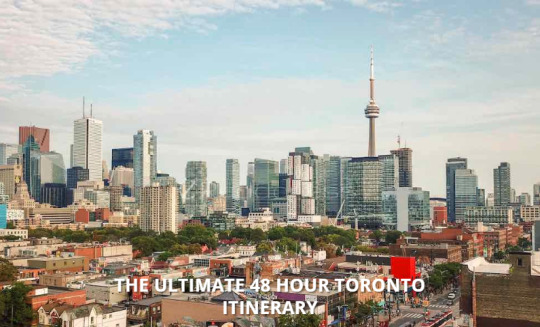
After so many years of travelling, I can’t believe it’s taken me this long to put together a 48 hour Toronto itinerary. It’s where I was born and it’s where I live, work and play so you think it would be easy to put together a list where to go in Toronto, right? Well, it is and it isn’t. Toronto is a world-class city but for me when I return from a trip, I just want to relax and slowly try to get back into the groove of the daily grind. But as a travel blogger who creates short trips, mini-breaks, and weekend getaway itineraries, I’m sort of obligated to create an itinerary for Toronto.
I GOT HOMETOWN ADVANTAGE.
HERE’S MY 48 HOUR TORONTO ITINERARY
All that said, I live in a very big city so I decided to stick with the downtown Toronto attractions instead of things to do near Toronto. Some are Toronto tourist spots while others are hidden gems that only a local like me would know about.
In addition, our national airline Air Canada is allowing you to hook up a stopover for up to 7 days in Toronto on your way to Europe or Asia. Sweet! You can bookmark this itinerary for when you get here. Hell, I’ll even welcome you at the airport with open arms.

WHERE TO STAY IN TORONTO
Fairmont Royal York Hotel
Fairmont’s historic ballroom is legendary and the hotel itself is a city icon. Its spacious rooms feature floral accents and include designer bath toiletries and robes. It has a skylit indoor pool, 5 on-site dining options, its across the street from Union Station with shuttle bus to both airports.
Thompson Toronto
The Hotel has a rooftop pool and bar with views of the city and CN Towers – I could pretty much stop there. But, it has designer linens and bath amenities. Fully stocked minibars, 24-hour concierge, on-site valet and a 10-minute walk from the bars and restaurants of King West.
Hyatt Regency Toronto
Located in the entertainment district in the centre of Toronto – trust me there is no better place to be. It’s a modern hotel with flat-screen TVs and Apple docking stations, on-site sauna, outdoor pool and it’s King Street Social Kitchen and Lounge serves regional cuisine
DAY 1
BALDWIN STEPS
The first stop is Casa Loma but in order to get up the hill, we need to use the Baldwin Steps, which are a public outdoor staircase that dates back to the 19th century. They are named after a former landowner of the area, the Baldwin family, which included Robert Baldwin, a former premier of Ontario.
CASA LOMA
This 98-room castle was commissioned by Sir Henry Mill Pellatt, a Canadian soldier, and investor who founded the Toronto Electric Light Company in 1883. Sir Henry Mill Pellatt ordered Toronto native and architect E. J. Lennox to design Casa Loma. The 3.5 million dollar castle began construction in 1911 and was finally completed by 1914. Today Casa Loma is used as a filming location, a museum, as a venue for weddings. It is also one of Toronto’s most popular landmarks.
ROYAL ONTARIO MUSEUM (R.O.M.)
The Royal Ontario Museum is one of the largest museums in North America and the largest museum in Canada. The ROM is highly regarded as a “preeminent field research institute and an international leader in new and original findings in biodiversity, paleontology, earth sciences, the visual arts, material culture, and archaeology”.
PHILOSOPHERS WALK (*HIDDEN GEM)
The Philosophers Walk is a scenic footpath located in the St George campus of the University of Toronto. It runs north-south along what was once a natural water called Taddle Creek, which was buried during the industrial age and now flows underwater.
UNIVERSITY OF TORONTO (CAMPUS)
The University of Toronto was originally founded in 1827 as King’s College and as the first institution of higher learning in Upper Canada. The university is comprised of twelve colleges. The University of Toronto also has two satellite campuses located in Scarborough and Mississauga.
BALDWIN STREET, RESTAURANTS (*HIDDEN GEM)
Yes, you might have guessed it’s the same Baldwin family who owned the land that the steps used to get to Casa Loma are built on. This small Toronto enclave is located in Toronto’s Grange Park neighbourhood. Baldwin Village is famous for its small shops and restaurants like, Shawarma and Falafel Place, Chardise, Sid’s Deli, and many other favourited restaurants of Toronto.
KENSINGTON MARKET
Kensington Market is Toronto’s self-proclaimed “most vibrant and diverse neighbourhood”. This bustling Toronto neighbourhood serves as a fine indicator of Toronto’s multicultural diversity. No establishment in Kensington Market is the same. Vendors, shops, and restaurants of all sorts of ethnicities make up the melting pot that is Toronto’s “most vibrant and diverse neighbourhood”.
ART GALLERY OF ONTARIO (AGO)
The Art Gallery of Ontario (AGO) is home to over 90,000 different artworks and is lauded as one of North America’s most distinguished art museums. This massive museum carried works of art that range from the Renaissance to contemporary pieces of art. Aside from being an astonishing physical museum, AGO also has launched its social media website called Collection X, which grants users access to a digital art forum that is opened to artists and art lovers.
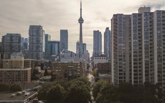
GRANGE PARK
Right beside the AGO is OCAD U (The Ontario College of Art and Design University) and right behind that is Grange Park which happens to my local park.
Many-a-blog-post was conceived in this park!
There are two large sculptures by world-famous sculpture, Henry Moore and 14 nature related, inscribed granite paving stones from famous Canadian authors.
QUEEN STREET WEST
Named “the second coolest neighborhood in the world” by Vogue magazine, Queen Street West is downtown Toronto’s most celebrated (fashion) district. Queen Street West is a hip, urban strip that extends for two kilometres (1.25 miles) between Bathurst and Gladstone and is comprised of some of the city’s most trendy boutiques, art galleries, bars, and restaurants.
GRAFFITI ALLEY (*HIDDEN GEM)
Just south of Queen Street West is one of Toronto’s most surprisingly artistic accomplishments: Graffiti Alley. Graffiti Alley stretches for approximately one kilometre (.6 miles) and is teeming with urban art that is (legally) painted each summer by an artistic troupe called Style in Progress. If you’re looking to explore Toronto in hopes of finding a hidden gem that reflects the urban, artistic capabilities of the city, then Graffiti Alley is that and more. Read more about Graffiti Alley from my post: Toronto’s Graffiti And Street Art
KING STREET WEST | KING WEST VILLAGE
King West Village is one of Toronto’s fastest growing communities. With waves of young professionals moving into the neighbourhood, Kings West Village has experienced a boost in its economy and social scene. Aside from the rapidly changing demographic of the neighbourhood, King West Village is well-known for its landmarks, 19th-century buildings, and iconic brownstones.
ROGERS CENTRE (A.K.A. THE SKYDOME)
Opened in June 1989 and originally named the SkyDome, Rogers Centre is a multi-purpose indoor stadium that holds some of Toronto’s wonderfully exciting venues. Notably, the Rogers Centre is home to the Toronto Blue Jays (MLB) and has served as the venue for an array of different events: sporting events, concerts, auto shows, circuses, Disney on Ice, and much more.
Architecturally, the stadium is well-known for being the first stadium to have a fully retractable motorized roof, having an annexed 348-room hotel attached, and is also the last dual sporting major-league stadiums in North American (MLB and NFL).
TORONTO RAILWAY MUSEUM
The Toronto Railway Museum, a mainstay attraction of downtown Toronto located in Roundhouse Park, is “dedicated to preserving the physical legacy, history, and experience of rail transportation in Toronto and Ontario.” The museum has lots to offer, such as a railway simulator, in-depth historical displays, and interactive displays. Be sure to check out the gift shop and go on a Miniature Train ride before you leave!
CN TOWER | 360 RESTAURANT
Often viewed as the pride and joy of Toronto, The CN Tower is a spectacular architectural and engineering feat that captures the livelihood of the city. This national icon and landmark are well-known for its (cost-efficient) state-of-the-art LED lighting system, as well as recently being on the cover of Drake’s critically-acclaimed album “Views”. Aside from its stature as a culture and urban icon, the CN Tower is home to the revolving 360 The Restaurant. This world-class restaurant is managed by Executive Chef John Morris and General Manager of Restaurants and Events Cameron Dryburgh, who helms the culinary team at the award-winning restaurant.
DAY 2
THE BEST 48 HOUR TORONTO ITINERARY
DISTILLERY DISTRICT
Despite its name, Toronto’s Distillery District is known for being “Canada’s premier arts, culture and entertainment destination”. The district gets its name from the 47 buildings that were formally known as the Gooderham & Worts Distillery. Since 2003, the Distillery District has been offering locals and visitors a “hip, cool dynamic” that is comparable to New York City’s SoHo or Chelsea. Be sure to check out the Distillery District’s unique shops, galleries, studios, restaurants, cafes, theatres, and more!
ST. LAWRENCE MARKET
The St. Lawrence Market is an encompassing, nostalgic shopping destination in Toronto. The market is made up of three main buildings that each provides their own unique services and products: The South Market, the North Market and St. Lawrence Hall. The South Market is known for having vendors that sell fresh produce, meat, fish, grains, baked goods, dairy products, as well as non-food items. The second floor of the South Market, home to the Market Gallery, serves as an exhibition space for City of Toronto’s Cultural Services. The North Market is well-known for its Saturday Farmers’ Market, Sunday antique dealers, rental spaces. St. Lawrence Hall is comprised of various retailers on the ground floor, city offices on the second floor, and auxiliary rooms for special events on the third floor.
GOODERHAM BUILDING
Toronto’s Gooderham Building, also known as the Flatiron Building, is one of the city’s historical landmarks. Located in Toronto’s Financial District, the Gooderham Building was completed in 1892 as a premature model of its current architectural state. Now, the building serves as not only an office building but as a historical landmark that adds to Toronto’s pizzazz.

CATHEDRAL CHURCH OF ST. JAMES
Opened on June 19, 1853, the Cathedral Church of St. James stands as one of the largest Toronto-built buildings. The Cathedral was constructed with the intention of replicating Gothic Revival architecture. The cathedral is well-known for its 92.9 meters (305 foot) tower and pointed spire.
YONGE-DUNDAS SQUARE
Yonge-Dundas Square is Toronto’s equivalent of New York City’s Times Square. This bustling, vibrant square experiences fluxes of tourists and locals who relish in the square’s open space and eccentric ambiance. Yonge-Dundas Square’s myriad of LCD displays brings a one-of-a-kind luminescence to Toronto and capture’s the city’s animated downtown vibe
EATON CENTRE
Located in downtown Toronto, the Eaton Centre is Toronto’s only mega shopping centre. This massive shopping centre is home to over 230 national and international retailers, as well as offering patrons tons of dining and entertainment options.
OLD CITY HALL
Old City Hall is just one of four city halls to be constructed in Toronto. The building boasts a Romanesque style of architecture, as well as a distinguishable clock tower. Since 1984, Old City Hall has been designated as a National Historic Site of Toronto.
TORONTO CITY HALL | TORONTO SIGN
Toronto City Hall, also known as New City Hall, serves as the home of Toronto’s municipal government. Despite its round base, Toronto City Hall is comprised of two towers that are curved in, and stand at varying heights. Toronto City Hall’s courtyard, Nathan Phillips Square, serves as the primary host of various festivals and events in Toronto.
YONGE ST.
Centered around Yonge-Dundas Square is Yonge Street. As is typical of the streets of downtown Toronto, Yonge Street is lined with heaps of restaurants, bars, and shops. Yonge Street is one of Toronto’s main streets, it is the longest street in the world and divides the city between East & West.
HOCKEY HALL OF FAME
In the typical Canadian fashion, Toronto is home to the Hockey Hall of Fame (HHoF). The Hockey Hall of Fame building was established in 1943 and is located on Yonge Street. The HHoF houses 15 various exhibit areas that cover 60,000 square feet. Visitors of the HHoF can view trophy displays, memorabilia, and player equipment worn during special games. The Hockey Hall of Fame also has an interactive display called “Be a Player” that allows patrons to use shoot real pukes against a simulated legendary goaltender, Ed Belfour.
HARBOURFRONT | HARBOUR CENTRE
The Harbourfront Centre is nonprofit cultural organizations that put together events and activities to enrichen and enhance downtown Toronto. Located at 235 Queens Quay West, on Toronto’s waterfront, the Harbourfront Centre is a must visit destination for all those looking to enjoy the cultural diversity and creativity of Toronto, right on the water.
AMSTERDAM BREWHOUSE
Located in the Harbourfront, Amsterdam BrewHouse specializes in offering patrons craft beers and delicious eats. Amsterdam BrewHouse’s ideal location makes it the perfect place to enjoy local craft beers, delicious local foods, and a lakeside view of Lake Ontario.
Visit my post called The Best Harbourfront Restaurant in Toronto to find out more about this awesome place!
Also, while at the Amsterdam BrewHouse I got to hang out with a good friend of mine and fellow travel blogger Danielle from the Thought Card. She’s a pro at cost effective travel so if you’re curious about budgeting a trip to Toronto she wrote a great post called Toronto Budget: How Much Does A Trip To Toronto Cost?
The post “ THE ULTIMATE 48 HOUR TORONTO ITINERARY “ was first seen on Rudderless Travel by Christopher Rudder
The IV Lounge - IV Therapy Toronto Drip Clinic
0 notes
Text
Sunflower fields perfect for pictures in and near Kansas City
KANSAS CITY, Mo. — Escape city life this holiday weekend and take a trip to a sunflower paradise. The yellow flower emblematic of Kansas typically is at its peak bloom around Labor Day weekend. Some fields got off track due to a difficult weather year with an extra dosage of rain and flooding in spring. A large portion of sunflowers in the Kansas City area will hit peak bloom in September, and some flowers may keep their yellow petals till October.
Fields range from private to public, so make sure to do some research before heading to a farm with a camera. Most public sunflower fields have active Facebook pages. Around the busy season, these pages will have updates about the flowers’ conditions. If you can’t find a Facebook page, look for Google reviews of the field. These will usually give you an indication if it is public, how easy it is to access from the road, and if the field is in good shape.
Learning More about Sunflowers
Jennifer Silvey | Powell Gardens
Before visiting a sunflower patch, there is plenty to learn and appreciate about the native flowers. The Helianthus or sunflower is a genus of plants comprising about 70 species — some are common and others are at risk of extinction. Sunflowers are native to North America and Central America.
The pretty yellow flowers are not recommended for mixed gardens. The flowers grow rapidly and are invasive — it’s best to ask an expert about planting flowers before mixing species in the same yard. Sunflowers can grow up to a height of ten feet (sometimes more) and are primarily found in woodlands, near creeks, and moist, prairie-like areas.
Sunflower fields are found throughout the United States, particularly in North Dakota, South Dakota, Colorado, Nebraska, and Kansas.
Native Americans first domesticated sunflowers in Mexico and in southern parts of the United States. European explorers brought the flowers overseas starting in the 16th century.
The flowers have a unique mechanism that allows them to grow nice and full. Before having any petals, sunflowers tilt slowly during the day to face the sun, and once the flowers bloom, they stop following the sun. This tracking process in young sunflowers is called heliotropism. By the time the sunflowers are mature, they face the east. The rough and hairy stem is branched in the upper part in wild plants, but it is usually without a branch in domesticated flowers.
Water Quickly
For those of you wanting to keep sunflowers in the house, it’s important to water the plants within 30 minutes of cutting the stem. A sunflower seals off its stem 30 minutes after it’s cut. Quickly placing the stem into water will allow the flower to keep its yellow petals a few days longer.
Sunflowers in the Age of Social Media
Jennifer Silvey | Powell Gardens
More sunflower fields have opened to the public in recent years thanks to social media pushes to take pictures with the bright-colored plants. The fields have also come into the limelight thanks to a push to conserve and bring awareness to bees and farms using the flowers as an opportunity to get some foot traffic and sell produce or other items. Kansas sunflower festivals have surged throughout the state over the past few years. Several farms added donation boxes outside their flower fields. The donations help support the farmers who get food on our tables.
Before heading to a sunflower field, check your weather app (download the FOX4kc weather app). Rain or bad weather conditions will likely close the fields off from the public or create an unwanted muddy situation.
August-September — Sunflower Festival at Kansas Maze
Late August — Sunflowers bloom near Lindsborg and Coronado Heights
September — Sunflowers bloom in Buhler and Lawrence
Grinter Sunflower Farm in Lawrence, Kansas is one of the most popular fields in our metro. The huge flowers are worth seeing in person. Admission is free. Visitors can cut some flowers to take home for a dollar a flower. The Sunflower General store has sunflower themed merchandise and local items. The vista makes for the perfect backdrop to a picture. The sunflower photos are appealing for Instagram, Facebook, or even as a dating profile picture.
Courtesy Emily Wilson. Beautiful butterfly in a sea of sunflowers at Grinter Farm.
Sunflowers in Eastern, Kansas usually bloom in late to mid-August and stay into early September. Labor Day weekend is a popular time to go to a field, and some people have made a tradition of going to see the flowers then. However, bad weather earlier this year caused some problems for sunflower production. According to Grinter’s Facebook page, the earliest planted flowers are just starting to develop petals. It should be a couple of days before they open. The weekend after Labor Day and into mid-September might be a better time to view the fields.
For visitors who are okay with seeing less sunflowers but getting the chance to do more activities – Labor Day weekend is still the best time to go. The Sunflower General opens this weekend with Frog Hoppin’s food truck, and Tonganoxie is hosting the Sunflower Stroll and Plein Art Festival. The best place to see the flowers this year will be around the Sunflower General.
Powell Gardens is also a great place to find sunflowers, of both the yellow and red variety. The gardens will soon transform for its fall season — think trees in bright yellows, burnt oranges, auburn reds, and subdued purples along with apples, pumpkins, and squash. There is a cost to get into the gardens, but the grounds are huge and include several stops great for photographers looking to take eye-catching pictures. Powell Gardens includes several waterfalls, bridges, walking trails, fountains, the Marjorie Powell Allen Chapel, fruits and veggies, succulents, flowers, butterflies, bees, and other critters. The botanical gardens features 6,000 varieties of plants, with 225,000 plants in seasonal displays. The garden dates back to 1948.
Jennifer Silvey | Powell Gardens
Another hot spot to see sunflowers is Berry Hill UPick Farm in Berryton, Kansas. It’s a longer drive west out of Kansas City than the Grinter farm. Farmers at Berry Hill plant sunflowers in two different fields. The flowers are usually ready for viewing before schools starts in mid August. On the farm’s Facebook page, there is a post that says this year’s flowers are at peak bloom. One field is in bloom now and the other field will turn bright yellow in a couple of weeks. Flowers at this farm get fairly large. The strawberry farm hopes to add blueberries and blackberries to its services in the near future.
Eleanor’s in Scranton, Kansas boasts 20 acres of sunflowers. Scranton is about a 30 minute drive south of Topeka. Visitors are allowed to come see the flowers from seven in the morning until sunset, when the farm will close the gates. The Sunflower Festival is this weekend from Friday to Monday. A General Store will be filled with local unique items, including refreshments. The festival will include a hay bale maze and other attractions for children. Eleanor’s will also be selling sunflower bird seed at the festival.
Eleanor’s began its operations earlier this year. The Shoup family purchased a neighboring homestead to become part of their existing 5th generation farm. The new farm is a venue space to host events and embrace farm life.
Summer time: Three sunflowers at dawn with natural background
Sunflower Fields near Knoxville and Richmond is easy to access from the road, has plenty of parking, and it has props readily available for photos. The field is free and open to the public. Blooms were at peak from August 13th to the 24th. The hidden gem isn’t very crowded. It’s about an hour drive northeast of Kansas City. Country roads, bright blue sky, and wide open spaces surround the sunflower field.
Gieringers Family Orchard & Berry Farm in Johnson County, Kansas offers a variety of treats alongside spectacular views of sunflowers. The flowers bloomed earlier in August. The farm has seasonal fruits: strawberries in May, blueberries in June, blackberries in June and July, peaches in June and August, sweet corn in August, and pumpkins in September and October. It is a family owned orchard. The last day for peach season is August 31. The farm’s Facebook page is full of charming pictures of peaches at this time.
Johnson Farms Plants and Pumpkins in Belton has a variety of activities for families, especially this fall. The property does include a sunflower field. During the fall season, visitors may pick apples, view the mums, and select a pumpkin or two. The greenhouse is closed during the summer months. The farms rest on 140 acres of land. For those wanting to harvest a pumpkin, the staff suggests bringing a pair of gloves and cutters. As for pets, the farms only allow medically necessary guide dogs with current vaccination records on the premises. The fall season includes some special perks: like a giant tunnel maze, apple cider slushies, and hot sandwiches.
Russell Sunflower Patch in Richmond updates its Facebook page frequently. Blooms hit their peak around August 13th to the 24th this year. Weather this year blessed the farm with some beautiful and healthy looking flowers this season. The field is free and open to the public and isn’t overly crowded. The Facebook page regularly has new videos of the flowers. The field is about a 50 minute drive east of Kansas City.
Sunflower Festival at Kansas Maze
Jennifer Silvey | Powell Gardens
Last year the Kansas Maze at Gaeddert Farms celebrated its 20th season by launching a Sunflower Festival. This year the festival will be held from August 24th to September 14th. Kansas Maze includes 20 acres of sunflowers for viewing and pictures. It’s located in Buhler, Kansas — which is about a 3 hour drive southwest of Kansas City. It’s about 50 miles north of Wichita and 15 miles northeast of Hutchinson. Attending the festival might be more of a weekend adventure than a quick drive.
Admission to the festival costs $7 per person. Visitors may purchase sunflowers singly or in half-dozen or one-dozen bunches.
On Saturday, runners will participate in either the 5k or 1-mile Sunflower Trail Run at Kansas Maze. Register here to enter either race. Weather permitting, runners and joggers will follow dirt trails through the sunflower fields for a bright and nature-filled experience.
from FOX 4 Kansas City WDAF-TV | News, Weather, Sports https://fox4kc.com/2019/08/29/sunflower-fields-perfect-for-pictures-in-and-near-kansas-city/
from Kansas City Happenings https://kansascityhappenings.wordpress.com/2019/08/29/sunflower-fields-perfect-for-pictures-in-and-near-kansas-city/
0 notes
Text
New Post has been published on Local Freshies | Be a local wherever you go
New Post has been published on https://localfreshies.com/6-ski-towns-to-visit-in-the-summer-that-you-may-have-never-heard-of/
6 Ski Towns To Visit In The Summer That You May Have Never Heard Of
Of course, this list could be another list of “easy” resorts to name like Lake Tahoe, Whistler, or Jackson Hole. Instead of showcasing the crowded summer destinations, we decided to focus on some lesser known spots. Here’s 6 ski towns to visit in the summer and why.
Wallace, Idaho
Image appears courtesy: Historic Wallace Chamber Of Commerce
In 2004, Wallace declared itself as the “center of the universe”, and just like this proclamation, this funky town is truly one-of-a kind. Even though it’s home to only 800 permanent residents, Wallace’s history could fill an entire book. From being the “Silver Capital of the World” to the ONLY spot on a U.S. interstate with a stop light, it’s colorful past is well worth the visit in itself. In addition, it’s home to amazing cuisine & crossroads to FIVE nationally recognized trails including the Hiawatha trail. And for those looking for a bit more adrenaline pumping fun, only ten minutes from downtown is the world-class lift accessed mountain biking at Silver Mountain, offering up 3,400’ vertical feet of riding!
Invermere, British Columbia
Image appears courtesy: Invermere On The Lake
When someone talks about mountain biking in Canada, the first place that comes up is Whistler. Even though this is a great option, for those looking for less crowded trails and a more relaxed vibe, you need to look east at Panorama & the town of Invermere. This resort is a two-time top-five winner in the MTB Parks.com Riders’ choice and a harbor of cycling fun that features natural features for all abilities alongside some man-made expert obstacles. Of course, a summer vacation isn’t just about bike riding. You can also go for a leisurely kayak on Lake Windermere, whitewater raft on the Kootenay, or hop on an ATV with Toby Creek Adventures. After a day full of adventure, you can go soak away those sore muscles at either Radium or Fairmont Hot Springs.
Image appears courtesy: Invermere On The Lake
Traverse City, Michigan
©Tony Demin – Image appears courtesy: Traverse City Tourism
With the exception of New York, Michigan boasts more ski areas than any other state. And the most famous one is Boyne, next to the cozy resort town of Traverse City. Even though in the winter it makes sense that skiers & snowboarders look West to the hulking peaks to feed their need for powder turns, in the summer, this place blooms for summer fun. Nestled on the Grand Traverse Bay of Lake Michigan, it’s well worth the trip. From scenic lake views so big you can’t see the other side to exhilarating mountain bike adventures on the 4,000 acres surrounding Boyne Highlands to the annual festivals like the National Cherry Festival, the opportunities for fun are endless. It makes sense why this hamlet was named the best small town in America in 2015 AND 2016.
©Tony Demin – Image appears courtesy: Traverse City Tourism
Mont Sainte Anne, Quebec
Photo By: Olivier Croteau – Image appears courtesy: Mont Sainte Anne Resort
For those looking to escape the mid-summer heat, there’s no “cooler” spot than Mont Sainte Anne. Renowned as the “mecca” of mountain biking in Eastern Canada, it has the LARGEST cross-country bike network in Eastern Canada offering more than 80 miles of trails to ride alongside 23.1 miles accessible via chairlift. Combine that with one-of-a kind endeavors like Via Ferrata, endless hiking opportunities, paragliding and jaw-dropping views of the mighty Saint Lawrence, you can’t go wrong. Not enough? Only 30 minutes away is the capital of the province Quebec City. The city dates to 1535 and contains the ONLY fortified city walls remaining in the Americas north of Mexico alongside having world class cuisine.
Photo By: Patrick Fallon – Image appears courtesy: Mont Sainte Anne Resort
Girdwood, Alaska
Image appears courtesy: Girdwood.com
For skiers & snowboarders, Alaska sets the bar for the steepest and most challenging terrain. Countless videos and magazines have showcased the insane peaks in this state. But summertime in Girdwood offers up even more adventures & endless daylight to get it all in. Nicknamed the “Last Frontier”, it’s truly stacked with wildness like no other place. From seeing grizzlies in the wild, salmon spawning, and of course the most popular attraction is the Portage glacier cruise. These vessels take you within 300 yards of the glaciers as they split and crash directly into the ocean. But that’s not all! Alyeska Resort serves up lift accessed mountain biking on the weekends. Or for the water variety, hop into a kayak in the Prince William Sound and really get a feel of this beautiful place.
Photo by: Ralph Kristopher – Image appears courtesy: Alyeska Resort
Timberline, Oregon
Image Taken by: Tanner DeGiovanni; Mt Hood on a beautiful summer’s day
Last but not least, we couldn’t have this list of ski towns to visit in the summer without including Timberline. For those skiers & snowboarders that NEED to ski in the summer as well, it’s home to the ONLY perennial ski resort that’s ALWAYS open. If that wasn’t enough, you have world-class hiking on the Pacific Crest Trail AND the National Historic Landmark the Timberline Lodge. To top it off, you’re only 60 miles away from the eclectic city of Portland.
As us “snow addicts” wait for winter to return, we don’t have to get depressed. Instead, make lemonade out of those lemons & get that adventure fix by visiting one of these awesome ski towns in the summer! Happy trails to all!
0 notes
Text
Cove Orchard to PDX shuttle airport
Cove Orchard to PDX shuttle airport
beaverton airport, PDX shuttle airport, Cove Orchard to PDX shuttle airport, Greater Portland Metro, pdx airport shuttle, pdx airport shuttle service,
pdx airport shuttles, PDX shuttle airport, pdx to beaverton ,Royal Junction
Cove Orchard to PDX shuttle airport
$ 80 00 Royal Junction +
Zip code: ———
Reservation Now
http://beavertonairporter.com/ +1 (503) 760 6565 PDX shuttle airport
Yarmouth is a town in Cumberland County, Maine, located twelve miles north of the state’s largest city, Portland. The town was settled in 1636 and incorporated in 1849. Its population was 8,349 in the 2010 census. As of 2015’s estimation, this is about 0.6% of Maine’s total population. Five islands (most notably Cousins Island and Littlejohn Island) are part of the town.
Yarmouth is part of the Portland–South Portland–Biddeford Metropolitan Statistical Area.
The town’s proximity to the Atlantic Ocean, and its location on the banks of the Royal River, which empties into Casco Bay less than a mile away, means it is a prime location as a harbor. Ships were built in the harbor mainly between 1818 and the 1870s, at which point demand declined dramatically. Meanwhile, the Royal River’s four waterfalls within Yarmouth, whose Main Street sits about 80 feet above sea level, resulted in the foundation of almost sixty mills between 1674 and 1931.
http://beavertonairporter.com/ +1 (503) 760 6565 PDX shuttle airport
The annual Yarmouth Clam Festival attracts around 120,000 people (around fourteen times its population) over the course of the three-day weekend.
Today, Yarmouth is a popular dining destination, with (as of February 2019) fourteen sit-down restaurants. This equates to an average of just over one restaurant per square mile of land area.
The town is accessed via two exits (15 and 17) on each side of Interstate 295. U.S. Route 1 also passes through the town to the west of I-295.
It has been designated a Tree City USA community every year since 1979. 40 years ago.
http://beavertonairporter.com/ +1 (503) 760 6565 PDX shuttle airport
Geography
According to the United States Census Bureau, the town has a total area of 22.94 square miles (59.41 km2), of which 13.35 square miles (34.58 km2) (58%) is land and 9.59 square miles (24.84 km2) (42%) is water.
Yarmouth is nearly square in form and is bisected by the Royal River (formerly Yarmouth River). The Cousins River separates it from Freeport to the northeast; Freeport and Pownal bound it to the east; North Yarmouth to the north; Cumberland to the west; and Casco Bay to the south. Also included as part of the town are Cousins Island, Lanes Island, Great and Little Moshier Islands, and Littlejohn Island.
http://beavertonairporter.com/ +1 (503) 760 6565 PDX shuttle airport
History
Traces of human occupation in the Yarmouth area date to about 2,000 BC. During the years prior to the arrival of the Europeans, many Native American cultures existed in the area, largely because of the natural features of the coastal land. Rivers provided several resources, including food, fertile soil, power for the mills and the navigability between the inland areas and the ocean.
In 1640, a 39-year-old Englishman, George Felt (b. 1601, d. 1693), who emigrated to Charlestown, Massachusetts, seven years earlier, purchased 300 acres of land at Broad Cove from John Phillips (b. 1607, d. c. 1667), a Welshman, and in 1643 became one of the first European settlers in Yarmouth. Felt went back to Massachusetts to sell his property there, before returning to Broad Cove around 1660. In 1670 he bought 2,000 more acres of land from Phillips.
http://beavertonairporter.com/ +1 (503) 760 6565 PDX shuttle airport
Felt was married to Elizabeth, with whom he had six children: Elizabeth (b. circa 1635), George (b. 1638, d. 1676), Mary (b. circa 1639), Moses (b. 1641), Aaron and another Moses (b. circa 1651). In 1684, Felt moved back to Massachusetts. He returned briefly, after 1678, when he was around 80 years old.
In 1646, Englishman William Royall (b. circa 1595, d. 1676) purchased a farm at what is now the upscale Lambert Point, next to Redding Creek, at the southern tip of Lambert Road, where he lived with his wife, Phoebe Green. The Royal River has ever-since borne his name, minus the second L, though two streets off Gilman Road — Royall Meadow Road and Royall Point Road — carry the original spelling. This stream and its vicinity were called by the Indians “Westcustogo” — a name that, until the early 1990s, was preserved by an inn of the same name on Princes Point Road at its intersection with Lafayette Street. (The building remains but it is now occupied by another business.) Royall moved to Dorchester, Massachusetts, in 1675, a year before his death. John Cousins (b. circa 1596, d. 1682) had arrived a year or more earlier than Royall, occupying the neck of land between the branches of the stream which has since been called Cousins River, and owning the island now also bearing his name.
http://beavertonairporter.com/ +1 (503) 760 6565 PDX shuttle airport
By 1676, approximately sixty-five people lived in Westcustogo. Soon after, however, conflicts forged by King Philip’s War caused them to abandon their homes and move south.John Cousins was injured and went to York, Maine, to receive treatment. There, he lived with Mary Saywood, to whom he later deeded his real estate in Casco Bay.
Also in 1676, George Felt Jr. was killed on Peaks Island during the conflicts. Felt’s wife, Philippe, moved to Salem, Massachusetts, where she married twice before her death in 1709.
Some settlers returned to their dwellings in 1679, and within twelve months the region became incorporated as North Yarmouth, the eighth town of the province of Maine.
http://beavertonairporter.com/ +1 (503) 760 6565 PDX shuttle airport
In 1688, while the inhabitants on the eastern side of the river were building a garrison, they were attacked by Indians, and attempted a defense. They continued the contest until nightfall, when the Indians retired. It was not long before they appeared again, in such force that the thirty-six families of the settlement were forced to flee, abandoning their homes for a second time.
Transportation
Beaverton Airporter know Grand Trunk Railway Station(1906), most recently (until 2018) a florist, is owned by Yarmouth’s Village Improvement Society. The apsidal form of its northern end is found in no other Maine station. The waiting room for the station stood on the land now occupied by Hancock Lumber (formerly Yarmouth Market) and Bank of America, as denoted by a plaque in the flowerbed of the properties
Yarmouth Crossing, where Main Street traverses the St. Lawrence and Atlantic Railroad, looking north from Railroad Square
http://beavertonairporter.com/ +1 (503) 760 6565 PDX shuttle airport
Road
U.S. Route 1 arrived in the late 1940s (at grade and also a bridge over Main Street). State Route 88 follows the course of Route 1’s predecessor, the Atlantic Highway. SR 115, established in 1925, also runs through the town.
In 1961, the Yarmouth section of Interstate 295 was built. It runs elevated through town (including, in controversial fashion, over the harborside at Lower Falls). It has two exits (15 and 17) in the town. Exit 15 became a four-ramp intersection in July 2013, when a northbound on-ramp was added.
http://beavertonairporter.com/ +1 (503) 760 6565 PDX shuttle airport
In 1727, five local men — Samuel Seabury, James Parker, Jacob Mitchell, Gershom Rice and Phineas Jones — were tasked with the management of the new town. Their affairs included laying out the highways. Roads (or, at least, routes) that appeared on subsequent maps are as follows (with today’s names):
In 1738, “a good road was built over the ledge from the meeting-house to the mills at the first falls which, although it was abandoned about 1800 for a less hilly course, may still be easily traced.”
1741: Atlantic Highway (now Route 88; which took a left onto Pleasant Street), Gilman Road, Princes Point Road, Highlands Farm Road (leading to Parker’s Point), Drinkwater Point Road (which led to two wharves), Morton Road and Old Town Landing Road (which led to another wharf). Large lot owners at the time included Walter Gendall, whose farm incorporated Duck Cove, beyond Town Landing Road in today’s Cumberland Foreside (Cumberland was not incorporated as its own town until 1821). Its dry stone boundary is still intact. Welshman John Powell (b. c. 1669, d. 1742) had a farm where today’s Schooner Ridge Road is. John Dabney’s 60-acre lot abutted this to the east. Dabney was a town selectman in 1737. Felt had a lot at the foot of the northern end of Pleasant Street, adjacent to Stony Brook. Royall’s farm, meanwhile, occupied the entire area bisected by Bayview Street.

http://beavertonairporter.com/ +1 (503) 760 6565 PDX shuttle airport
In 1756, “to accommodate the teams hauling lumber from the great pine forests inland to the seaboard, a new more convenient way was laid out by the way of Walnut Hill and the road constructed.”
In 1813, down at the First Falls, “the old road which clambered laboriously over the crest of the hill was replaced by a new street along the head of the wharves below the hill”. This is today’s Pleasant Street. Later, Smith Street became an uninterrupted offshoot into Riverside Cemetery until Lafayette Street was built, in the early 20th century, coming down the hill closer to the harbor. (It was named Lafayette Street in honor of General Lafayette.)
By 1847, Portland Street was in full swing, including the Elm Street offshoot that headed directly into the Upper Village. Main Street was, by now, well established.
For an 1894 map of Yarmouth, see here.
http://beavertonairporter.com/ +1 (503) 760 6565 PDX shuttle airport
A 1944 map shows the Atlantic Highway coming through town, aligning with what became Route 88 up to the point they meet at the end of Spring Street. Prior to the installation of U.S. Route 1, today’s curve of Route 88 as it passes Cumberland Farms instead continued directly north-east towards Cousins River. The section of Atlantic Highway that runs from Princes Point Road to the northern end of Pleasant Street was laid in the late 1920s.
http://beavertonairporter.com/ +1 (503) 760 6565 PDX shuttle airport
Roswell P. Greeley (b. 1847, d. 1903) established an express service between Portland and Yarmouth, employing a span of horses and large wagons. Azel Kingsley (b. 1860, d. 1948) ran a supplemental service minus the horses. It ran two services in each direction: southbound at 7.30 and 11.30 AM and northbound at 3.00 and 5.00 PM.
Rail
The town has two railroad junctions: Royal Junction (midway along Greely Road) and Yarmouth Junction (to the west of East Elm Street at Depot Road; its station is now gone). The two railroads passing through the town are the St. Lawrence and Atlantic Railroad (formerly Grand Trunk Railway; arrived in 1848) and Guilford Rail System‘s Kennebec & Portland (later Maine Central Railroad; 1849). http://beavertonairporter.com/ +1 (503) 760 6565 PDX shuttle airport
The Brunswick Branch of the Maine Central Railroad received a new lease of life in November 2012, when a northern extension of the Downeaster line was opened, carrying passengers five times a day (four on weekends) to and from Brunswick‘s Maine Street Station. The trains pass under two roads and over three crossings on their way through Yarmouth. They are (from south to north) West Main Street (overpass, just after Royal Junction), Sligo Road (road crossing), East Elm Street (road crossing, just after Yarmouth Junction), North Road (road crossing) and Granite Street (overpass).
On weekdays, the trains pass through northbound at 12.03 PM (#681), 4.03 PM (#683), 7.53 PM (#685), 9.18 PM (#687) and 1.23 AM (#689). On weekends, they pass through at 1.23 PM (#691), 7.43 PM (#695), 10.23 PM (#697) and 1.23 AM (#699).
Southbound weekday times: 4.50 AM (#680), 7.50 AM (#682), 11.30 AM (#684), 1.50 PM (#686) and 5.45 PM (#688). Weekend: 6.20 AM (#690), 7.50 AM (#692), 11.40 AM (#694) and 6.25 PM (#698).
Trolley cars of the Portland and Yarmouth Electric Railway Company used to run, every fifteen minutes, from Portland, through Falmouth Foreside, up and down Pleasant Streetand onto Main Street between 1898 and 1933, when the advent of the automobile made rail travel a less convenient option. Underwood Spring Park in Falmouth Foreside, with its open-air theater, casino and gazebo, was a popular gathering spot serviced by the trolley cars. The theater only existed for eight years, burning down in 1907. In 1906, a bridge was built over the Royal River, connecting the Brunswick and Portland trolleys at the Grand Trunk depot in town. The tracks ran down what is today’s walkers’ path to the Rowe School. The pedestrian bridge in the Royal River Park is built on old abutments for a trolley line which ran between Yarmouth and Freeport between 1906 and 1933.
Bus
The only bus route that services the town is Greater Portland Metro’s BREEZ. It has eleven southbound services to Portland and twelve northbound services to Brunswick on weekdays and an abbreviated Saturday schedule. There is no service on Sundays.
http://beavertonairporter.com/ +1 (503) 760 6565 PDX shuttle airport
On weekdays, the first southbound service arrives in Yarmouth at around 6.20 AM and the last one at around 8.45 PM. The first northbound service arrives at around 6.45 AM and the last one at around 9.50 PM.
On weekends, the first of six southbound services arrives at around 9.45 AM and the last one at around 8.55 PM. The first of seven northbound services arrives at around 8.30 AM and the last one at around 10.00 PM.
http://beavertonairporter.com/ +1 (503) 760 6565 PDX shuttle airport
There are three bus stop locations: the park and ride lot at the southbound exit 15 ramp of I-295, on Main Street in front of Yarmouth Town Hall, and on either side of Route 1 at Hannaford.
0 notes