#Col Agnel
Explore tagged Tumblr posts
Text
Provincia di Cuneo (I, Piemont): Colle della Maddalena / Col de Larche, Col de la Lombarde, Col Agnel / Colle dell'Agnello
In the west of the Provincia di Cuneo, the Colle della Maddalena / Col de Larche (I: SS21 / F: D900, 1,991 m) leads from the Maritime Alps (Val d'Oronaye) to Argentera. The “real” hairpin bends are on the Italian side. On the narrow SP255, heading south, you reach the Col de la Lombarde (2,350 m), and then cross the border back into France. The actual pass road itself is a fascinating route, although you shouldn't suffer too much from altitude sickness in some places. The narrow M97 (new designation; the “M” stands for mountain road, “Montagne”) takes you along the French side axis Isola 2000 / Isola into the corresponding valley. If you turn south from there, the M2205, M6102 and M6202 will take you to the sea in Nice.
Another fascinating route in the northwest of the province leads over the Col Agnel / Colle dell'Agnello (2,744m, up to 11% gradient) from Molines-en-Queyras (F, D205T) to Pontechianale (I, SP251 / SP105) to the Lago di Castello / Lago di Pontechianale. It is the third highest (continuously asphalted) Alpine pass and the highest border pass. Today it is less frequented due to the corresponding highway routes. In Sampeyre, you can turn west (SP 8, Strada Borgata Fiandrini) and cross the Colle di Sampeyre (2,284 m, asphalted throughout - but very poorly in places). On the southern ramp (SP 335) you can take a detour (!) to the village of San Martino Superiore, which is spectacularly situated on a rocky ridge with a rewarding view. Then descend through the Vallone d'Elva through the Valle Maira (SP 422). Here, the road has been blasted out of the rock, is very narrow, has few safety barriers and leads through several rock tunnels - so be careful! You end up in Ponte Marmora; the SP 113 takes you to Demonte (SS 21). If you keep to the west, you will reach the Colle della Maddalena / Col de Larche (north) or the Col de la Lombarde (south) which lead to the French border, see above.
(Without guarantee)
(Translated with DeepL)

#Provincia di Cueno#Colle della Maddalena#Col de Larche#Colle dell'Agnello#Col de la Lombarde#motorbike#motorcycle#motorrad#moto#Col Agnel
10 notes
·
View notes
Text
“ Eravamo nell'atrio, tutto rivestito di capelvenere. Dinnanzi m'era lo scenario che godevo da un mese e che mi sembrava di vedere ogni giorno per la prima volta. Il declivio verde di aranci, costellato di frutti d'oro, poi l'azzurro del mare, l'azzurro del cielo; e su quell'orizzonte a tre smalti diversi, i piú divini modelli che l'arte dorica abbia, col Partenone, tramandato sino a noi. Il Tempio della Concordia, e vicino il Tempio d'Era con la sua fuga di venti colonne erette e di venti colonne abbattute, e, piú oltre, il Tempio d'Ercole, ossario spaventoso della barbarie cartaginese, meraviglia ciclopica tale che la nostra fantasia si domanda non come sia stato costrutto, ma come sia stato abbattuto; e oltre ancora il Tempio di Giove Olimpico, il Tempio di Castore e Polluce: tutte le sacre rúine che Agrigento spiega a sfida tra l'azzurro del cielo e del mare, ecatombe di graniti e di marmi che sembra dover ricoprire tutta la terra di colonne mozze o giacenti, di capitelli, di cubi, di lastre, di frantumi divini. Ma dinnanzi a noi era quello che Miss Eleanor chiamava «il mio tempio», il tempio di Demetra, eretto ancora sulle sue cinquantaquattro colonne, l'unico intatto fra dieci altri abbattuti, l'unico sopravvissuto, per uno strano privilegio, al furore fenicio e cartaginese, al fanatismo cristiano e saraceno. — No, amico mio. Dobbiamo ai cristiani e ai saraceni se il tempio è giunto intatto fino a noi.
Fu San Rinaldo, nel IV secolo, che lo scelse fra «i monumenti infernali dell'idolatria» per convertirlo in una chiesa dedicata a San Giovanni Evangelista, chiesa che fu trasformata in moschea al tempo dell'invasione saracena. E l'edificio divino fu salvo, mascherato e protetto come un fossile nella sua custodia di pietra e di cemento. Quale grazia del caso! Pensate allo scempio che fu fatto degli altri! Pubblicherò un manoscritto di mio padre dedicato tutto allo studio di queste distruzioni nefande. Pensate a quel colossale Tempio d'Ercole che forni materiale per tutti i porti nel Medio Evo! Tutto fu abbattuto e spezzato. Abbattute le colonne ciclopiche, ogni scannellatura delle quali poteva contenere un uomo, come in una nicchia, abbattuti i giganti e le sibille alte dodici metri che reggevano l'architrave, meraviglia di mole titanica e di scultura perfetta. Pensate le teste, le braccia, le spalle divine, i capitelli intorno ai quali si gettavano gomene colossali, tese, tirate da schiere di buoi fustigati, mentre le seghe tagliavano, le vanghe scalzavano i capolari alle basi. E le moli precipitavano in frantumi spaventosi, con un rombo che faceva tremare le terra. Ora sulle nudità divine, tra le pieghe dei pepli, nidificano le attinie e i polipi di Porto d'Empedocle. — Cose da invocare un secondo toro di Falaride per i cristianissimi demolitori. — Il gregge! Il gregge dell'Abazia! — Miss Eleanor si interruppe ad un tratto, ebbe uno di quei suoi moti fanciulleschi di bimba sopravvissuta, — il gregge dell'Abazia! Guardate che incanto! Dall'interno del Tempio, sul grigio delle colonne immani, biancheggiarono d'improvviso due, trecento agnelle color di neve. Uscivano dal riposo meridiano, dalla fresca penombra, correvano lungo il pronao, balzavano sui plinti, scendevano con grandi belati e tinnir di campani. Tre pastori s'affaccendavano con i cani per adunare le disperse e le ritardatarie. Alcune, le piccoline, non s'attentavano a balzare dagli alti cubi di granito, correvano disperate lungo il pronao, protendevano il collo invocando soccorso, con un belato lamentevole. I pastori le prendevano tra le braccia, passandole dall'uno all'altro, tra l'abbaiare dei cani. “
---------
Brano tratto dal racconto di Guido Gozzano Alcina, pubblicato per la prima volta sulla rivista culturale milanese L’illustrazione italiana il 26 dicembre 1913.
#Guido Gozzano#Alcina#racconti brevi#leggere#classicità#L’illustrazione italiana#poeti#anima#meditazione#spirito#scrittori italiani del '900#narrativa del '900#spiritualità#libri#intellettuali italiani del XX secolo#intimismo#Sicilia#teosofia#letteratura europea#amore#positivismo#età liberale#arte#narrativa italiana del XX secolo#età giolittiana#crepuscolarismo#Agrigento#valle dei templi#amicizia#amici
7 notes
·
View notes
Text
Day 9: Embracing the French Alps
The morning discerned an opportunity - A sliver of manageable climate was snaking its way through the Alpine terrain, creating a window between the French and Italian alps. Although a couple of the passes I'd originally earmarked, the Agnel and Col du Madeline, were inaccessible due to a fatal accident and snow respectively, other spectacular routes awaited.
First up was the Col du Vars, followed by the Col d'Izoard. Rising to an altitude of around 2400m, the Col d'Izoard is a legend among the southern French Alpine passes, and I was thrilled to be finally navigating its winding roads. Despite the biting cold, the ride was nothing short of exhilarating - open roads, unimpeded visibility, and ever-changing scenery from gurgling rivers and roadside waterfalls to climbs by snowy peaks.
Every component seemed to be in sync on this route. The frosty, yet sunny weather was perfect for the Guzzi, which backfired and spluttered acoustically. My riding too was confident and fluid, evidenced by a christened hero blob below my right foot peg and a scratched up side stand on the left. It all converged into a truly memorable ride down an iconic alpine road.
Descending from Col d'Izoard into Briançon, the pleasure was somewhat overshadowed by an emergency vehicle and a helicopter retuning back up the pass. Despite my concern for the people involved in what must have been an accident behind me, I continued my journey, aiming next for Col de Montgenèvre and Susa.
But, the allure of Col de Lautaret and the mighty Col du Galibier, rising to 2600m, was irresistible. I was conscious that tackling these routes would mean bracing for sub-zero temperatures, leading me to a pit-stop at Decathlon for additional thermal gear.
Climbing into Col du Galibier, the landscape became an icy white spectacle. The road was surrounded by towering walls of ice, spiralling up towards the peak. I paused at the summit, taking in the sight of Mont Blanc in the distance. Celebrating my achievement with a cup of camp stove-brewed coffee from melted snow, I toasted the French Alps, readying myself for the next chapter of my journey in Italy.
As I entered Susa, a bustling Italian town, the contrast was stark. I had been enveloped by the tranquil grandeur of the Pyrenees and the Alps, and now, the urban clamor jarred me. That's when clarity struck me - I was not on this journey for cities, which I could always visit by plane. I was traveling for the chance to embrace nature and mountainscapes, something I may never get the chance to see again. This moment prompted a quick turnaround; arrivedeci, Italy. Let’s see what the Swiss alps have to offer instead.
My route took me via the D1006, traversing next to Mont Cenis. This journey offered sweeping views of the Lac du Mont-Cenis and towering mountains. The scale of everything, reminiscent of what my brother described about Canadian roads, was jaw-dropping. It was on this road, winding down from Mont Cenis to val Cenis, that I realise I’m perfectly set up for an ambitious challenge: the Col de l'Iseran.
Col de l'Iseran, the highest and arguably most demanding road in the Swiss Alps, standing at a vertigo-inducing 2,764m, was no joke. For both my rattling Guzzi and me, it’s a big ask.
Herein lay my predicament. While essential, a second night in a hotel was an expense I hadn't budgeted for and honestly, couldn’t really justify. Particularly after forking out €90 on thermal clobber.
In the end, necessity birthed resilience. I took on an unexpected role as a haggler, knocking on hotel doors, awkwardly negotiating with receptionists, until finally striking a deal at the Alpazur hotel for just a quarter of the listed price.
Settling in, I’m eating sweaty leftover sausages from the previous day and prepared for an early night. Big day tomorrow.
0 notes
Photo


The Scenic Route, Pt 3
1 note
·
View note
Text

"Ready to paint"
KTM Superduke 1290 R en souvenir du Col d'Agnel
#ktm#ktmsuperduke#ktmsuperduke1290r#moto life#moto#motard#bike#biker#bikerstyle#painting#alpesfrancaises#alpes#col#agnel#readytorace
0 notes
Text
Parola di Dante 147/365
instagram
"L'oltracotata schiatta che s'indraca
dietro a chi fugge, e a chi mostra 'l dente
o ver la borsa, com' agnel si placa [...]"
Neologismo dantesco usato, nella forma latineggiante "indracare" (lat. "draco"), col senso di ‘farsi feroce come un drago’, a indicare il comportamento crudele e aggressivo assunto dalla famiglia Adimari. Il verbo è rimasto circoscritto all’uso letterario e ha trovato successivi riscontri in autori come Pulci, Sannazzaro e, fra i moderni, Alfieri, Leopardi e Carducci.
#alighieri#dante#dante alighieri#anno dantesco#la parola di dante#parola di dante#dante 700#dante700#Instagram
1 note
·
View note
Text

Vue depuis le Sommet Bucher sur Molines (derrière le millet des oiseaux à gauche), la vallée du Col Agnel (derrière les deux mélèzes) et celle de Saint-Véran (derrière la plus grande centaurée scabieuse)
1 note
·
View note
Photo


samedi 14 septembre
randonnée depuis St Véran, en fait depuis le parking de l’ancienne carrière de marbre, située 1 km plus bas que la chapelle de Clausis, afin d’éviter 3 heures AR de marche sur la piste, l’expérience de la veille a servi...
photos, de haut en bas: ° reflets au lac de la Blanche (2500 m), situé en contrebas du refuge du même nom, ° le col de St Véran (2848 m), frontalier avec l’Italie, comme suggéré par le panneau, où les vététistes montent, avec le vélo sur le dos dans les passages les plus pentus. La joyeuse bande que j’ai rencontrée était partie le matin de Château-Queyras, allait monter jusqu’au col de Chamoussière, à peine plus élevé que celui de St Véran, pour redescendre de 1500 m, sur une quinzaine de km, jusqu’à Ristolas ° du col de Saint Véran, l'Italie avec le Monte Viso (3841 m) et au loin, Maddalena et le lac de Pontechianale (1587 m) au pied du col Agnel ° le monte Viso en gros plan ° depuis le sentier allant au col Blanchet, lui aussi frontalier, photo prise à la côte 2950, les lacs Blanchet Inférieur (2748 m) et Supérieur (2829 m) et sur le chemin du retour, ° 2 marmottes parmi les innombrables que j’ai vues, souvent assez proches de leur terrier. Beaucoup plus rare, l’une, qui devait être aussi assoiffée que moi, se désaltérait dans le torrent.
1 note
·
View note
Text
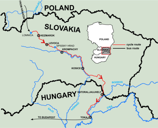
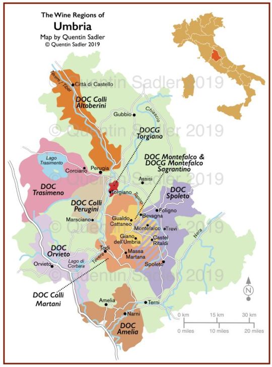
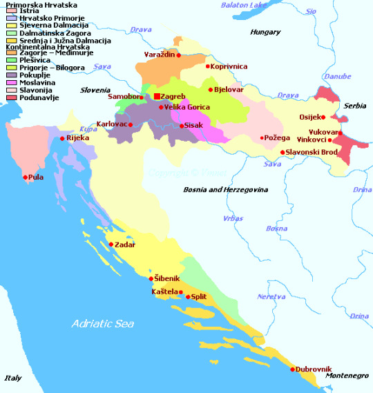
Central european wine maps
DOWNLOAD NOW Central european wine maps

The notable avian species that are found here include the Golden eagle, peregrine falcon, black grouse, black woodpecker, etc. The European lynx ( Lynx lynx) and the marmot ( Marmota marmota) have been successfully reintroduced in the Swiss Alps. Some of the important mammal species that are found in the Alpine region are the ibex ( Capra ibex), Alpine hare ( Lepus timidus), red deer ( Cervus elaphus), etc. Many plants like crocus, primulas, rhododendron, and edelweiss also thrive well in the Alpine habitats. Mixed mountain forests including oak, beech, pine, poplar, chestnut, and birch trees thrive well in the lower mountain slopes, whereas coniferous forests are found in the higher altitudes. Several vegetation zones are found in the Alpine mountains. Bernard Pass, Gotthard, Semmering Pass, etc. Some of the major passes in the Alpine mountains are the Brenner Pass, the Col de I’lseran, Col Agnel, Mont-Cenis, Great St. This collision generated huge pressure resulting in the upliftment of the sedimentary rocks thereby creating the characteristic Alps mountain folds. The Alps Mountain range was formed millions of years ago during collisions between the Eurasian and the African tectonic plates. Several lakes are also found here including Lake Annecy, Lake Constance, Lake Garda, Lake Geneva, etc. Some of the notable rivers that flow in the Alpine Mountain region include the Inn, Po, Rhine, and Rhône rivers. Some of the other notable mountain peaks include the Matterhorn, Dufourspitze, Finsteraarhorn, Weisshorn, Grossglockner, Zugspitze, and Triglav. Located on the boundary between Switzerland and Italy is Monte Rosa, which rises to an elevation of 4,634 m and is the second-highest peak in the Alps. Mont Blanc sits on the border of France and Italy and rises to an elevation of 4,808 m, making it the highest peak in the Alps Mountain Range. It comprises of the Cottian, Ligurian and the Graian Alps, as well as the Mont Blanc massif and Valle d’Aosta.

The Western Alps extends from the Maritime Alps near the Mediterranean coast to the Great St Bernard Pass, straddling the borders of France, Italy and Switzerland. The Central Alps occupy the area between the Great St Bernard and Brenner passes and comprises the Bernese and Glarus Alps on the northern side and the Lepontine, Ötztal, Pennine, and the Rhaetian Alps in the southern part. Located mainly in Austria but also Germany, Italy and Slovenia, the Eastern Alps also comprise the Bavarian Alps, the Carnic Alps, the Dinaric Alps, the Dolomite Alps, and the Julian Alps. The Alps mountain range can be divided into three broad sections: the Eastern, Central, and Western Alps. The 22.6 km-long Aletsch Glacier located in the Valais canton of Switzerland is the largest glacier in the Alps. The Alps is a discontinuous mountain range and comprises numerous peaks and valleys that are of varying heights and depths. The Alps cover a total area of about 207,000 km 2 and have a maximum width of about 250 km at its widest point that is situated between Verona in Italy and the Garmisch-Partenkirchen in southern Germany. The Alps mountain range ends in Albania on the rugged Adriatic Sea coastline. The mountain range then continues downwards through the countries of Slovenia, Croatia, Bosnia and Herzegovina, Serbia, and Montenegro. The Alps mountain range stretches from the north of the Mediterranean Sea near Monaco in southern France into Switzerland, then through northern Italy into southern Germany, and towards Vienna in Austria.

Where Are The Alps? Map of Europe showing the elevation of the Alps. These mountain ranges extend for about 1,200 km in a crescent shape across eight Alpine countries, namely Austria, France, Germany, Italy, Liechtenstein, Monaco, Slovenia, and Switzerland. The Alps are an extensive mountain system that is located in south-central Europe.
DOWNLOAD NOW Central european wine maps
0 notes
Text

23 juillet, 12h15.
Après avoir passé le col, nous nous installons pour la pause déjeuner. Vue sur le Pain de Sucre côté français (à gauche), le Mont Viso côté italien (à droite) et le Col Agnel entre les 2.

0 notes
Photo

la Taillante/Queyras
technique : aquarelle
illustration réalisée dans le cadre du sentier de déambulation du col Agnel/Parc naturel régional du Queyras
2 notes
·
View notes
Photo

Canon EOS 250D | 50mm | 1/640s | f/14 | ISO 100 Taken on 31/01/2021. Everyone likes National and International Days to the extent that they allow us to discover and rediscover some of the most beautiful places in the entire globe. Not that there is a need for a scheduled day; however, it is one more chance for us to appreciate the world we live in. And so today is it is on the occasion of the 'Giornata Nazionale del Paesaggio' (National Landscape Day) that was inserted into the calendar by the Italian Ministry for 14th March with the aim of promoting landscape culture and raising awareness among Italian – or at least reminding them – of just how lucky they are to live in 'il Belpaese' (the Beautiful Country). Nothing gets more beautiful than snow-capped mountains in the Alps on a sunny winter's day. In this shot I wanted to place particular emphasis on the sheer height and might of the mountain peaks in stark contrast to the tiny hamlet of Chianale, the last village of the Varaita Valley before the Col Agnel mountain pass that winds up the Cottian Alps and leads into France. 𝗛𝗼𝘄 𝘁𝗼 𝗴𝗲𝘁 𝘁𝗵𝗲𝗿𝗲: Take a bus from Saluzzo (line 106) with 'BusCompany'. The bus only stops at Chianale from mid-July to the start of September, though the town before it, called Pontechianale, is no more than 5km away. ______________________________________ #Chianale #ValleVaraita #Ig_Cuneo #Ig_Piemonte #RoadToPiemonte #SiViaggiare_Piemonte #Italia #Italy #PaesaggioItaliano #Italia_BestPhoto #Super_Italia_Channel #MadeInItaly #Map_Of_Italy #TravelDiaries #Italia_In_Grande #BellaItalia #Italia_Dev #Italia_Mania #Italia_Da_Scoprire #Piemonte_Illife #Canon #Raw_Italy #NoFilter #YallersPiemonte #VivoItalia #LonelyPlanetItalia #ScattoPiemonte #RoughGuides #Alps #MountainScenery (at Chianale) https://www.instagram.com/p/CMaooULF47-/?igshid=10zpsn6wokfmv
#chianale#vallevaraita#ig_cuneo#ig_piemonte#roadtopiemonte#siviaggiare_piemonte#italia#italy#paesaggioitaliano#italia_bestphoto#super_italia_channel#madeinitaly#map_of_italy#traveldiaries#italia_in_grande#bellaitalia#italia_dev#italia_mania#italia_da_scoprire#piemonte_illife#canon#raw_italy#nofilter#yallerspiemonte#vivoitalia#lonelyplanetitalia#scattopiemonte#roughguides#alps#mountainscenery
0 notes
Photo

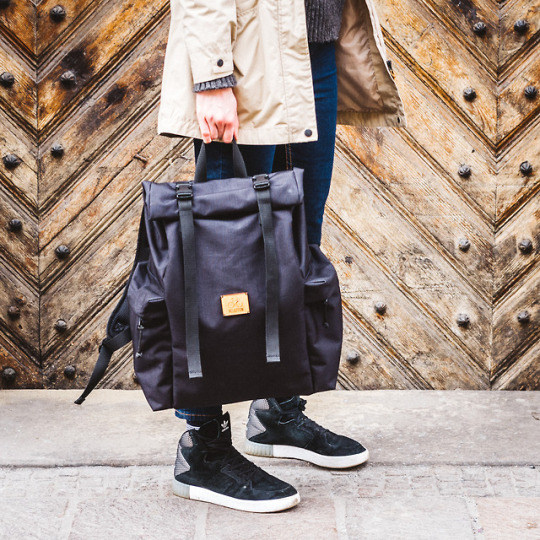
Meet our new roll top backpack Agnel, inspired by Col Agnel in the Alps.
#rucksack#backpack#sac a dos#velotton#roll top bag#roll top backpack#rolltop backpack#rolltop bag#black backpack#womens backpack#mens backpack#unisex backpack#hipster backpack#laptop backpack#travel backpack#city backpack#commuter#commuter backpack#travel#city#street style#street fashion#street photography#outdoor#door
2 notes
·
View notes
Photo

#mountain #atvride #amazing #beautifulview #instadaily #pontechianale #top #bestphoto #iphonesia #iphoneography #iphoneonly #beautifuldestinations #amazingday #amazingplace #lasciatemiqui #😎 (presso Col Agnel)
#amazingplace#iphonesia#amazingday#atvride#instadaily#top#iphoneography#beautifulview#pontechianale#amazing#iphoneonly#bestphoto#😎#beautifuldestinations#mountain#lasciatemiqui
1 note
·
View note
Photo

Col Agnel N°2
1 note
·
View note
Video
instagram
à Col Agnel
1 note
·
View note