#topographic map
Explore tagged Tumblr posts
Visit Tumblr Blog
Explore Tumblr blogs with no restrictions, modern design and the best experience.
Last Seen Tumblr Blogs


Fun Fact
Tumblr is available in 18 languages.
Text
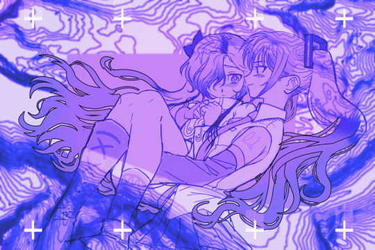
miku x sekai (my brainworms)
#vocaloid#illustration#fanart#vocal synth#hatsune miku#cevio sekai#my art#trying out quicker processes to keep my presence alive....#also I would like to see more of this pairing :3c#topographic map
122 notes
·
View notes
Text
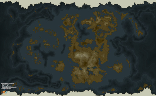
Getting closer to the quality I want! I just have to remeber to recolour the ice next time I import it to blender lol
#map illustration#fantasy map#topographic map#maps#thaorin’s gate#drowsys art#thaorin's gate#the prime nexus#blender
11 notes
·
View notes
Text

A Topographic map for my world! I'm pretty happy with it, but definitely open to constructive criticism.
43 notes
·
View notes
Text
Gus!
For a school assignment where I have to steal someone’s artstyle and make my own thing with it. I still have to add the background, lettering, etc, but the hard part is (hopefully) done :)


#Gus#screenprinting#screen printing#poster#digital art#topographic map#dog#American Bulldog#good boy#digital illustration#digital artwork
8 notes
·
View notes
Photo

17 notes
·
View notes
Text

Composite of French IGN, Swiss Swisstopo and Italian IGM topo maps at FR-CH-IT tripoint.
From Skitourenguru. Currently they can only use the Swiss one though, because the French license is just too cryptic and the Italians don't answer their open data request (even though EU law basically requires them to grant permission...).
#the italian igm map!!!#just 😍😍😍😍😍#i've never seen them before!#i knew italian maps are basically the most beautiful#see tci/tabacco maps#but still... wow#i mean ign/swisstopo is nice but just super basic in comparison to this <3#map#topo map#topographic map#swisstopo#ign#igm#mountains ♥
2 notes
·
View notes
Text
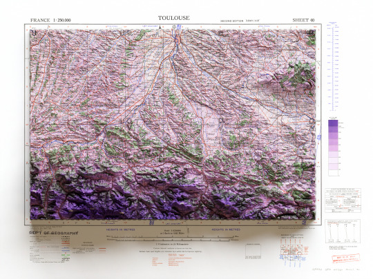

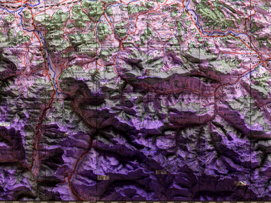
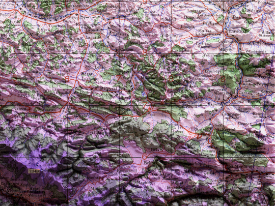
🗺️ 𝗠𝗔𝗣 𝗜𝗡𝗙𝗢 Toulouse. GSGS (Series); 2738. 2nd ed.,Great Britain. War Office. General Staff. Geographical Section. 1943. Source: Mapster
If you like our work, want to see our daily updates (or want to say hello to our studio), consider to follow our Instagram or Twitter account. Otherwise if are interested in our prints or have a custom request check our shop.
#france#toulouse#shaded relief map#3d map#print art#gis#cartographyart#cartography#topographic map#maps#geography#world history
4 notes
·
View notes
Text
He Will Be Hard-Pressed to Catch Up With the Leaders
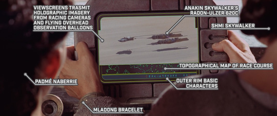
STAR WARS EPISODE I: The Phantom Menace 01:00:41
The view screen shown here is the same one that Shmi was carrying in previous shots, only held in landscape mode with the horn handles just offscreen. It’s the same as the ones used by the crowd, just with the handles. (Krayt dragon teeth? Some other creature’s horns?)

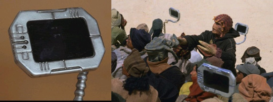
#Star Wars#Episode I#The Phantom Menace#Tatooine#Mos Espa#Mos Espa Grand Arena#Boonta Eve Classic#podrace#viewscreen#holographic imagery#racing camera#observation balloon#Anakin Skywalker's podracer#Radon-Ulzer 620C#Shmi Skywalker#Padmé Naberrie#mladong bracelet#Outer Rim Basic#topographic map
3 notes
·
View notes
Text
The Oldest Three-dimensional Map

Source: https://phys.org/news/2011-11-genographic-humans-migrated-africa-arabia.html
Water was far more important a consideration when traveling before more modern methods of traveling, so knowing how and where water traveled and pooled was extremely important to our ancestors in the distant past. Before paper or writing, there needed to be other ways of relaying information to others, some of which likely continued through to today in sketched maps into sand. More permanent maps were included in paintings on cave walls or etched into rocks or tusks.

Source: https://cosmosmagazine.com/history/archaeology/3d-map-in-palaeolithic-cave/
In December of 2024, a paper was released detailing the study of a sandstone cave near Paris, France called Ségognole 3. The cave was rediscovered in the 1980s and was known for 'sexual figuration' and the representation of horses. More recently, as detailed in the 2024 paper, it was noticed that the floor of the cave had been deliberately etched so that it represents the landscape, especially the watersheds, of the area around the cave. This is thought to have happened about 13,000 years ago and is likely the oldest map of this type that we know of. This places it in the Paleolithic, or Old Stone Age, which was from about 3.3 million to 12,000 years ago.

Source: https://www.researchgate.net/figure/Segognole-3-is-one-of-4-engraved-grottoes-numbered-Segognole-2-through-5-in-an_fig2_267939409
The map as some features that don't appear to be natural as well as representations of the natural world around the cave. It is thought that some of these represent efforts by early humans to alter the world around them, or possibly good shelters, though it is possible these markings have a deeper meaning, especially in relation to the other carvings in the cave.
This cave also demonstrates that people were able to control water in such a way that it carved the waterways into the cave floor. It wasn't known prior to this that early humans had such a deep understanding and control over the hydrological processes and their effects on sandstone to get the results desired.
5 notes
·
View notes
Text
Topographic Survey Software
AutoPlotter Advanced delivers an affordable solution for everyday land surveying needs. Built on the powerful DTM engine of its Pro counterpart, it seamlessly processes data from total stations, GPS, or similar instruments. Generate professional topographic and contour maps, perform traverse adjustments, and coordinate conversion. Its built-in CAD tools let you create complete drawings, while features like instant map creation and 3D terrain views accelerate your workflow. Easy to learn and use, AutoPlotter Advanced is ideal for surveyors seeking productivity and affordability.
https://infycons.com/autoplotter/advanced/

#civil engineering and civil software#topographical survey#land survey#civil technology#cross section generation#topographic map#topographic survey#quantity calculation#software solutions
0 notes

Text


Chanthaburi maps
0 notes
Text

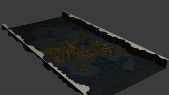
It is done. After months. Time to sleep for an aeon.
#thaorin’s gate#drowsys art#thaorin's gate#the prime nexus#world building#map illustration#topographic map#fantasy map
21 notes
·
View notes
Text
Practice taking photos on the bus. Totally worth it. Lol 😂
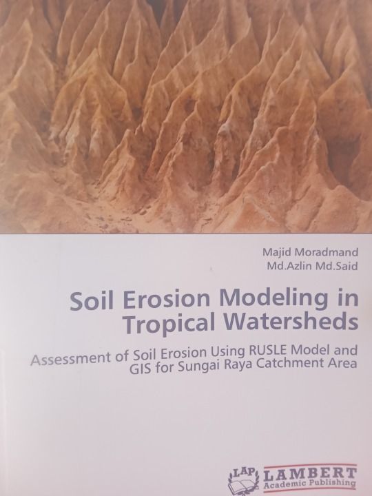


This research is quite useful in my remote sensing study.(But I don't have RUSLE model.....er...nevermind.)
#My camera#books#soil erosion modeling in tropical watersheds#Malaysia#Camera#Tropical#watersheds#remote sensing#Topographic map
0 notes
Photo

topo map.png :)
#pattern#topographic map#digital art#krita#my art#not yours#this is my laptop background#background#wallpaper
0 notes
Photo

10 notes
·
View notes