#pacific crest trail blog
Explore tagged Tumblr posts
Text
Expand Your Horizons: The Ultimate Guide to Travel Books and E-Books
Embarking on a journey to distant lands doesn’t always require a passport. With the turn of a page or the tap of a screen, you can explore the world through the vivid imagery and captivating narratives found in travel books, e-books, and audiobooks. Whether you’re seeking inspiration for your next adventure or looking to immerse yourself in the cultures and landscapes of far-off destinations,…

View On WordPress
#"Eat#"In Patagonia" by Bruce Chatwin:#"Into the Wild" by Jon Krakauer:#"The Alchemist" by Paulo Coelho:#"Wild: From Lost to Found on the Pacific Crest Trail" by Cheryl Strayed:#adventure#africa#destinations#e-books#europe#kenya#Love" by Elizabeth Gilbert:#norway#Pray#safari#technology#the best travel book#top 10 travel books#top 5 travel books#travel#travel blog#travel books to read 2024#travel e-books#vacation
0 notes
Text
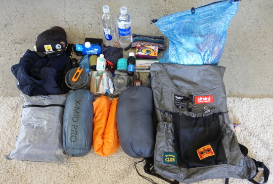
Hey folks! My name is Dan and I used to work for Tumblr. I quit my job about 10 days ago to prepare and commit myself to a long distance thru hike. Welcome to my hiking Tumblr 🎉🎉🎉
Here we go! It's T minus 4 days until the beginning of my Pacific Crest Trail thru hike. I will be blogging and documenting my journey on the trail. I suppose I will try to publish my posts every time I go into a trail town.
Gear List
Let's break down the gear I will be starting with!
Big 3 (pack, shelter, sleeping bag)
Durston Kakwa 40 - I will be carrying a 40L backpack this time. I've added some patches with fabric glue to personalize it a little bit (◕‿◕✿)
Enlightened Equiptment Enigma 20F Quilt
Durston Gears X-Mid Pro 1 - best lightweight trekking pole tents imo
Sleeping Pad - Klymit Insulated V UL SL
Water Filtration
Smart Water Bottle 1L x 4
Sawyer Squeeze <3
Kitchen
Jetboil Stash
Fuel Cannister
Utensils
Bic lighter
Toiletries
Nail Clipper
Wet Wipes
Toothbrush/Toothpaste
Sunscreen
Chafing Balm
Trowel
Lip Balm
First Aid Kit/Duct Tape/Meds
Clothing
Smart Wool Socks x 2
Arcteryx Synthetic
Arcteryx Atom Shell
Patagonia Wind Pants
Leggings
Baseball Cap
Underwear x 2
Hiking Shorts
Patagonia Sun Hoodie
T-shirt x 2
STUFF
Apple EarPods
iPhone 11 Pro
Garmin Inreach Mini 2 - satellite transmitter
Nitecore UL Headlamp
Nitecore UL 10000 mAh Powerbank x 2
Sony ZV-1 & UL tripod
Journal & Pen
UL Sea2Summit Pillow
Bug Net
Microspikes
There may be a few I'm leaving out of this list but ^ gives you a general sense of what I will be carrying. Here's also a link to my lighter pack
Base weight is currently just under 14 lbs! As reference, I am 5'7 130 lbs
Section 1: Southern California
The Southern Californian portion of the trail is dominated by desert landscapes with a few mountain passes. Socal saw record snow fall this year so I hope water resupply in this section won't be as big of an issue!
The following are all the trail towns I will be visiting in this section. For the sake of simplicity, all trail towns up to Kennedy Meadows South or KMS will be part of socal.

My friends back in NYC will be sending me resupply packages as I go. Currently, I'm reading Pacific Crest Trials which I am finding to be very interesting in terms of mental preparation for the thru hike.
My friend Kevin will be driving me down to Campo, the southern terminus of the trail on the 29th!
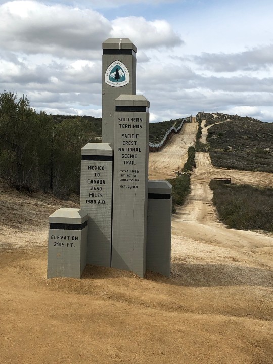
I'm feeling pretty good about this and as prepared as I can be!!! I also reached out to a manufacturer to make pins I could give out to fellow hikers on the trail. I've learned from music festivals that pins are a great way to make friends :3
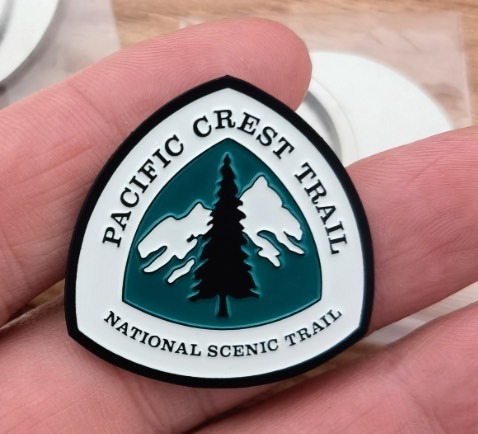
It's just a simple design of the PCT trail marker but it came out looking very nice!
Intentions & Goals
I read this book called 'Start With Why' with one of my previous coworker and I thought defining my "why"s for the trail will help tremendously. I know I will have really tough days and days when I want to just quit and go back to the comforts of society. Here is my unpolished "why" for the PCT that I memoed on my phone:
I am doing this for to remind myself that I can do anything I put my mind to. This year, my friend passed away and I was reminded that life is fleeting and I need to live pursuing what I want more vigorously. Postponing happiness until retirement is a flawed life approach! I've always wanted to this and I would like to take this time to figure out what I really want to do in this life and where I want to end up. I am trying to live with more intentionality and I'm working towards a real goal I've set for myself and doing this out of my own joy.
I am hiking the PCT because:
I need time to evaluate what I want to do with my life and career
The PCT has always been a larger than life adventure that I wanted to do
Life is short and I should take every chance I get to pursue what I want to do in life
I have the rest of my life to excel in my career
I want to experience true freedom and self sufficiency
I want to prove to myself I can do anything I set my mind to
Well here we go and I will try to post updates on my epic as I go :D
Happy Earth month! Go plant a tree 🌲
50 notes
·
View notes
Text
The Interesting Weird Division
Mac who writes a frequent blog about his adventures hiking, biking, and so many other outdoorsy activities recently posted an essay entitled, 'The Interesting Weird Divide'. In that post Mac describes the reaction of friends, family, and others to your decision to do some (seemingly sounding) epic adventure like hike the PCT. His view is once you do such a thing your friends, family, and others will display a great deal of interest initially and especially once you return. You may get a party, some cake, and lots of kudos. Then before you know it you have been invited to join in on, or determined on your own, some new/next adventure/challenge. This leaves some scratching their heads while still others are patting you on the back.
To get more of Mac's description of this phenomena go to his website, https://www.halfwayanywhere.com and read his post.
Mac got me to thinking about my own experience. I along with two best friends have hiked the PCT. Mostly we have done this in the company of each other. Our overall experience was a bit different from the typical thru hiker. We hiked the PCT in sections over time. Technically you would refer to us as we refer to ourselves as 'section hikers'.
When we started our intent was to get to Rainy Pass from the Columbia River in the thirty days we had to do it. By today's standard that may sound meager but however you view it, our view was and still is, we embarked on an epic journey. Our friends and family were impressed with our ambitious plan. Many were excited for us. Since we all lived in Washington at the time this hike seemed the most logical and practical place to experience the PCT.

Two of us on the Washington PCT
Upon our return we were greeted with excitement, admiration, and questions. "How was it?" "How far did you go each day?" And the ubiquitous question, "...see any bears?". At that point we were mostly done with PCT short of returning two years later to finish the last section and get to Canada. We had officially hiked all of Washington.
Upon achieving that goal the PCT lay dormant in each of our lives for about ten years. In the intervening time we became separated by significant geographical distances, settled down (some), got married and had children. Then like any dormancy a desire woke up in all three of us and we were planning another PCT hike. Because of our personal and career obligations we could not take thirty days this time but a bit less and no less meaningful or important to all three of us.
This is where that "interesting weird division" started happening to us. We were now officially bitten by the PCT 'bug'. Our friends and family still had questions and mostly supportive comments then and each time after that. However we were crossing a line. A point of no return. With each trip we officially crossed that interesting-weird divide. Eventually, like Mac says, "You will return as the “weird friend/relative” who does outdoor things for extended periods.' That is who we became. The farther south on the PCT we went the less familiar friends and family were with what we were doing. That lack of familiarity may add to the overall weirdness of our adventures. Please don't read 'weird' as being a bad or negative thing. Rather it is a demarcation, an identifier that speaks to being unusual or different.
None of this deterred us. With each trip we became more resolved than ever to keep biting off pieces/sections of the PCT. By crossing the divide we had established an identification as serious hikers dedicated to the Pacific Crest Trail and everything it offered. Maybe we were seen as a bit weird or unusual for continuing to go back to the PCT. Our extended hikes remained epics for us and are still thought of in those ways. Since our PCT hikes we have gone on to attempt parts of the Long Trail and the Colorado Trail. Yes, we do like these extended hikes and most of all we like being together. There is nothing weird or unusual about that.

In our case the division we have created by our hiking choices are more multipliers. Every time we have gotten out together it has been a set of experiences multiplied by joy, excitement, humor, pain, exhilaration, and friendship. I will cross over that division every time.
4 notes
·
View notes
Note
I've been meaning to ask you about your Big Long Walk since i first saw you mention it in a tag! If you're willing to tell the story i'd be interested to hear it?
tl;dr i solo-hiked the Pacific Crest Trail (PCT) in 6 months of 2020. idk if you've heard of this trail. it goes from the US-Mexico border to the US-Canada border. it's kinda neat.
Big Long Walk: filed on this blog under sparse text posts of "#backpacking 2020."
(people are always like 'wow that's so impressive' and i'm always like (privately) 'tbh backpacking 20+ miles in a day is easier than doing 1 full cycle of laundry whilst battling Problems Disorder')
imho if you are lucky enough to possess the rare quintfecta of spare A) cash B) time C) health D) desire E) foolishness to decide to do it and then commit and not give up, it's pretty doable. it's just walking 1 mile. and another. rinse and repeat for 2,651 miles.
fun fact! the Continental Divide Trail (CDT) thru-hikers call the PCT the "Piece of Cake Trail."
but why did i do it? idk. why not. there's some additional context to my life here that's kinda personal so i won't get into it. mainly i wanted to escape emails and gender and i wanted to see some cool nature. mission accomplished! i did it for fun & You Only Live Once.
it's endlessly funny though. cuz I somehow did not realize when i Embarked, that backpacking a couple thousand miles would irrevocably Affect me. the way i see the World is fundamentally affected. the way i Exist is affected. i'm more Me. i didn't set out to Find Myself but i sure did become myself anyway.
a little slice of tangible in-this-real-live-world transcendence in the form of self-inflicted sore feet, sunrise in the desert, and a thousand more miles to go.
#cyborg lifeblogging#much like homestuck i would not actually recommend it to anyone who isn't Into it tho#even tho i of course think it's amazing blah blah#ways the PCT is like homestuck:#1. long#2. don't like don't read#3. altered my brain chemistry#4. you have to be a certain kind of foolish to do the whole thing#5. frog breeding
24 notes
·
View notes
Text
15 Toughest Treks in the World for Hiking Enthusiasts
Are you an adventurer at heart, always seeking the next thrilling journey? If the whisper of the wind through the pines, the allure of the untamed wilderness, and the exhilaration of ascending to new heights stir your soul, then this is the blog for you.
Welcome to our curated list of the 15 toughest treks in the world. These aren’t your average hikes; they’re thrilling adventures that push you to your limits, challenge your resilience, and reward you with breathtaking views and unforgettable experiences.
From the harsh arctic landscapes of Greenland to the towering peaks of the Nepalese Himalayas, each of these treks offers a unique journey that will test your endurance and ignite your adventurous spirit.
So, lace up your boots, pack your gear, and join us as we explore the thrilling world of extreme trekking. The mountains are calling – are you ready to answer?
Table Of Contents
1. Everest Base Camp Trek, Nepal 2. The Snowman Trek, Bhutan 3. The Pacific Crest Trail, USA 4. The Mount Kilimanjaro Trek, Tanzania 5. The Inca Trail to Machu Picchu, Peru 6. Mount Elbrus Trek, Russia 7. The Great Himalaya Trail, Nepal 8. Appalachian Trail, USA 9. Overland Track, Australia 10. GR20, Corsica 11. The Polar Route, Greenland 12. Routeburn Track, New Zealand 13. Larapinta Trail, Australia 14. The Long Range Traverse, Canada 15. Dientes Circuit, Chile Conclusion
1. Everest Base Camp Trek, Nepal
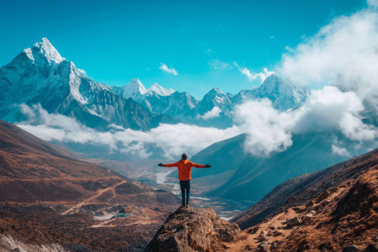
Embark on a journey to the foot of the highest peak in the world. The Everest Base Camp trek is not just a trek but a journey through the heart of the majestic Himalayas. This trek takes you through diverse landscapes, from lush valleys, glacial moraines, and terraced fields to pine forests and Sherpa villages. Along the way, you’ll encounter suspension bridges, ancient monasteries, and, of course, breathtaking views of some of the world’s tallest mountains. It’s a true test of endurance and acclimatization, but the reward is a firsthand view of Everest’s grandeur.
Altitude: 5,545 meters (18,192 ft)
Best Time to Go: March to May and September to November
Difficulty Level: Challenging
2. The Snowman Trek, Bhutan
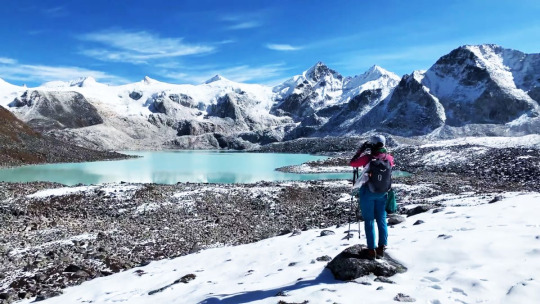
Touted as one of the most difficult treks in the world, the Snowman Trek traverses through eleven high-altitude passes, each over 4,500 meters. The journey unfolds across the remote Lunana region, offering a deep dive into Bhutan’s rich cultural heritage and lush, untouched landscapes. Expect to encounter serene mountain lakes, majestic peaks, isolated villages, and diverse wildlife. This trek is as mentally demanding as it is physically due to its length and the isolation of the terrain.
Altitude: 5,320 meters (17,454 ft)
Best Time to Go: September to October
Difficulty Level: Very Challenging
3. The Pacific Crest Trail, USA
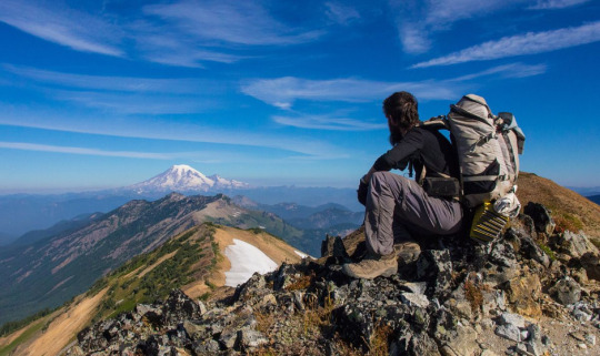
Spanning from the Mexican to the Canadian border, the Pacific Crest Trail offers an immersive journey through the diverse ecosystems of the American West. The trek takes hikers through scorching deserts, glaciated expanses of the Sierra Nevada, and the dense forests of Oregon and Washington. The length and varied terrain of the trek make it one of the toughest but also one of the most rewarding.
Altitude: 4,009 meters (13,153 ft)
Best Time to Go: May to November
Difficulty Level: Very Challenging
4. The Mount Kilimanjaro Trek, Tanzania
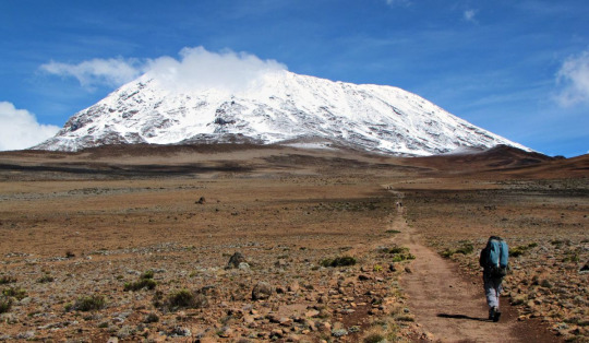
The highest peak in Africa, Mount Kilimanjaro, offers multiple routes for trekkers. Each route presents its unique set of challenges, including altitude sickness, steep inclines, and varying weather conditions. The journey unfolds through five different ecosystems, from lush rainforests and alpine deserts to the icy summit of Uhuru Peak. Despite the challenges, reaching the “Roof of Africa” is an unforgettable experience.
Altitude: 5,895 meters (19,341 ft)
Best Time to Go: January to March and June to October
Difficulty Level: Challenging
5. The Inca Trail to Machu Picchu, Peru
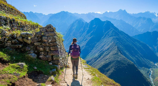
The Inca Trail is a rich journey through a variety of microclimates, across high mountain passes, and into lush subtropical vegetation. This trek provides glimpses into the past, with Incan paving stones, ruins, and tunnels scattered along the route. Despite the physical challenge of the high altitude and the steep ascents and descents, this trek offers an unrivaled reward: the sight of the ancient city of Machu Picchu at sunrise. The combination of natural beauty, fascinating history, and the physical challenge make this one of the most famous treks in the world.
Altitude: 4,200 meters (13,780 ft)
Best Time to Go: May to September
Difficulty Level: Moderate to Challenging
6. Mount Elbrus Trek, Russia
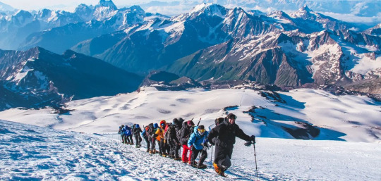
Mount Elbrus, nestled in the heart of the Caucasus Mountains, is the highest peak in Europe. The trek to its summit involves navigating through precarious glaciers and steep inclines. Despite the challenges, it offers panoramic views of the Caucasus and a unique sense of accomplishment. The trek’s difficulty is compounded by the unpredictable weather and the need for proper acclimatization, making it a must for experienced climbers.
Altitude: 5,642 meters (18,510 ft)
Best Time to Go: July to August
Difficulty Level: Very Challenging
7. The Great Himalaya Trail, Nepal
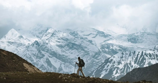
As one of the longest and highest walking trails in the world, the Great Himalaya Trail traverses the full length of the Nepalese Himalayas. This route takes trekkers through some of the wildest and most remote mountain environments on earth. The terrain is challenging and the route is remote, but the breathtaking views of high peaks, passes, and valleys make the trek an unforgettable journey. The trail is a testament to the beauty, diversity, and grandeur of the Himalayan range.
Altitude: 6,146 meters (20,160 ft)
Best Time to Go: March to May and October to November
Difficulty Level: Very Challenging
8. Appalachian Trail, USA
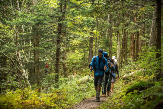
Spanning fourteen U.S. states, the Appalachian Trail is one of the longest continuously marked footpaths in the world. This journey takes hikers through wild landscapes, dense forests, and over numerous mountain peaks. Each section of the trail presents its unique set of challenges, from harsh weather conditions to physically demanding terrain. Still, the trail’s stunning beauty and the sense of accomplishment from completing sections, or the entire trail, draw hikers from around the world.
Altitude: 2,024 meters (6,643 ft)
Best Time to Go: March to September
Difficulty Level: Challenging
9. Overland Track, Australia
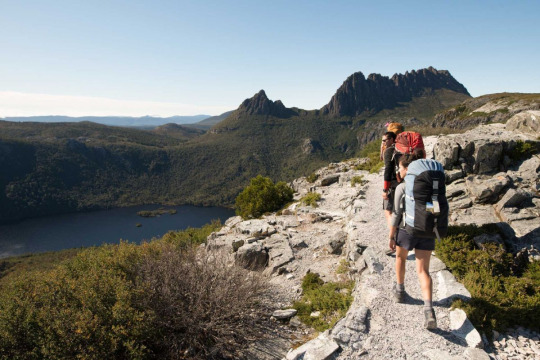
The Overland Track, Australia’s premier alpine walk, takes trekkers through the heart of the Cradle Mountain-Lake St Clair National Park. As part of the Tasmanian Wilderness World Heritage Area, this 65-km trail is a journey of discovery through diverse landscapes. From ancient rainforests and alpine meadows to rugged mountains and sparkling lakes, the track offers breathtaking views at every turn. The challenge of the Overland Track lies in its length and the unpredictable Tasmanian weather, but its stunning scenery and rich biodiversity make it worth the effort.
Altitude: 1,545 meters (5,069 ft)
Best Time to Go: October to May
Difficulty Level: Moderate to Challenging
10. GR20, Corsica
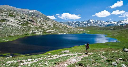
Considered the most challenging long-distance trail in Europe, the GR20 in Corsica stretches from the north to the south across the mountainous heart of the island. This stunning trek takes hikers through rugged peaks, beautiful glacial lakes, and dense forests. The trail’s beauty is matched by its difficulty, with steep ascents, rocky terrain, and often unpredictable weather conditions. The GR20 is a grueling trek but offers a rewarding experience that’s hard to match.
Altitude: 2,706 meters (8,878 ft)
Best Time to Go: June to September
Difficulty Level: Very Challenging
11. The Polar Route, Greenland
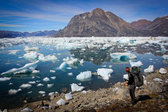
An arctic adventure like no other, the Polar Route in Greenland is a journey through ice fields, fjords, and remote arctic tundra. This challenging expedition tests the endurance of even the most experienced hikers, but the reward is a stunning, untouched wilderness, the chance to witness the Northern Lights, and the possibility of encountering arctic wildlife. The trek’s isolation and the harsh arctic climate add to the difficulty, making it a trek suited for the truly adventurous.
Altitude: Varies, up to 2,000 meters (6,562 ft)
Best Time to Go: April to June
Difficulty Level: Very Challenging
12. Routeburn Track, New Zealand
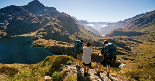
The Routeburn Track, located in New Zealand’s South Island, offers an incredible journey across the Southern Alps. The track winds through vast valleys, pristine alpine lakes, and verdant forests, showcasing the best of New Zealand’s diverse natural beauty. The trail is well-maintained, but the fluctuating weather conditions and the physical demands of the mountainous terrain make it a challenging trek. Regardless, the breathtaking views and the chance to explore the unique landscapes of New Zealand make the Routeburn Track a must-do for any hiking enthusiast.
Altitude: 1,255 meters (4,117 ft)
Best Time to Go: October to April
Difficulty Level: Moderate to Challenging
13. Larapinta Trail, Australia
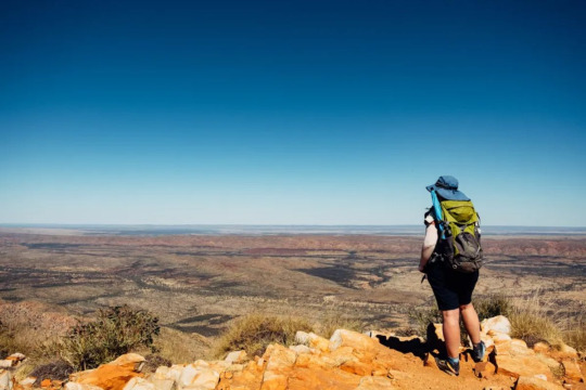
Situated in the heart of Central Australia, the Larapinta Trail extends over 223 kilometers along the spine of the West MacDonnell Ranges. This trail brings you up close to the ancient landscape of the Northern Territory, offering stunning views of jagged ridges, weathered peaks, and the rich, red soil of the Australian Outback. Hikers will encounter a wide variety of wildlife, rare plants, and a stark, captivating beauty that’s unique to this part of the world. The route’s length, combined with the harsh, arid climate, make it a challenging trek.
Altitude: 1,380 meters (4,528 ft)
Best Time to Go: April to September
Difficulty Level: Challenging
14. The Long Range Traverse, Canada
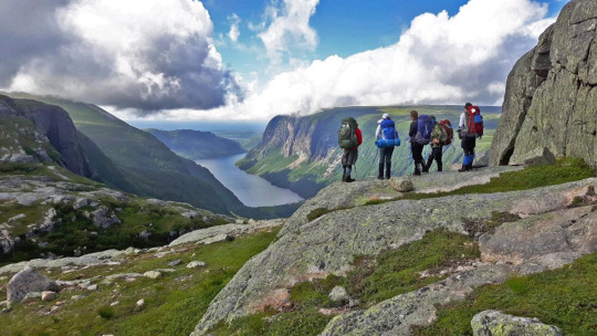
The Long Range Traverse is an unmarked and rugged backcountry route through some of the best wilderness in Canada’s Gros Morne National Park. This challenging trek requires navigation skills as you make your way through dense forest, across bogs, and up steep scree slopes. However, the breathtaking views of fjords, glacial valleys, and the raw, untamed beauty of the Newfoundland wilderness make it worth the effort.
Altitude: 806 meters (2,644 ft)
Best Time to Go: June to September
Difficulty Level: Challenging
15. Dientes Circuit, Chile
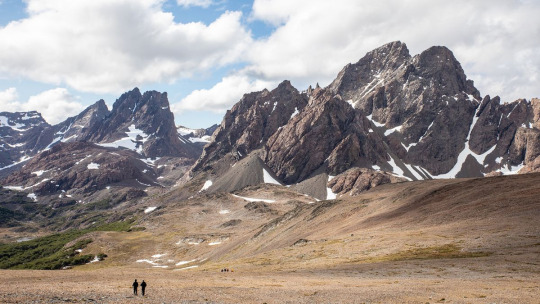
Found on the isolated Isla Navarino in the extreme south of Chile, the Dientes Circuit is a trek like no other. This remote, rugged trail will test your trekking skills as you navigate through untouched Magellanic forests, peat bogs, and steep mountain passes. The views from the trail are unparalleled, with the jagged peaks of the Dientes de Navarino range on one side and the Beagle Channel, Cape Horn, and the snowy mountains of Tierra del Fuego on the other. This trek is not for the faint-hearted, but the stunning, end-of-the-world scenery makes it a must-do for experienced hikers.
Altitude: 800 meters (2,624 ft)
Best Time to Go: December to March
Difficulty Level: Challenging
Conclusion
Tackling these treks isn’t merely about testing your physical stamina. It’s about pushing your boundaries, exploring the unexplored, and discovering your own resilience in the face of adversity. It’s about standing on top of a peak, looking out at the panoramic vistas, and realizing that the world is as vast as it is beautiful – and you’re a part of it.
So, whether you’re a seasoned hiker or an adventurous spirit looking for your next challenge, we hope this list has ignited a spark of wanderlust. Remember, every journey begins with a single step. And who knows? Perhaps your next step will lead you on one of the toughest treks in the world.
After all, as the famous mountaineer, Sir Edmund Hillary once said, “It’s not the mountain we conquer, but ourselves.” So here’s to the treks that await us, the summits yet to be conquered, and the adventures that lie ahead. Happy trekking!
2 notes
·
View notes
Text
Camino 2023?
It’s time to start thinking about another walk. Having completed the Camino Frances, Camino Portuguese, and Finisterre, I’d like to hike from Le Puy en Velay to St-Jean-Pied-de-Port in France (chemin du Puy / via Podiensis) but that’s not in the cards this year, for numerous reasons. I looked at the Bruce Trail in Ontario, Canada as an option but it requires tent camping to travel end-to-end, and my back doesn’t want to do it. So, I am looking at an alternative. Instead of walking, I think that I will bicycle a portion of the Trans Canada Trail (TCT) since the distances are sometimes significant between towns and villages. The TCT is made up of a considerable number of converted rail lines, making it suitable for a long distant gravel ride.
The TCT extends over 28,000 across Canada and it is the world’s largest trail network. By way of comparison, the Pacific Crest Trail stretches 4,400 km (2,700 miles), the Continental Divide Trail extends 5,000 km (3,100 miles), and the Appalachian Trail is 3,500 km (2,200 miles).

It's fair to say that the TCT is massive and hiking over 8,000 km along the trail, from east coast to west coast, is not in my sweet spot. I am looking for a segment of about 1,000 km that I can bicycle but finding one has not been easy. The trail is relatively young (created in 1992) and the trail is managed by many local groups. As a result, there are limited resources to help with planning, e.g. very few blogs (Come Walk With Us on the TCT is an excellent one for hikers) and no clear destination(s) (like Santiago). The Trans Canada Trail website is helpful but requires you to contact each of the local trail groups (dozens of them) to get information on food, and accommodations, and points of interest. Lots to look into.

2 notes
·
View notes
Text
Kristin Thue: Thru-Hiker and Human Rights Activist from Norway, Sharing Adventures on Her Blog 'Let’s Trek It' to Inspire Others to Undertake Their Own Wilderness Journeys.
Kristin is a thru-hiker, climber, and human rights activist from Norway currently living in London. Despite her outdoorsy upbringing in snowy Norway, it was only in her 20s that she discovered her own adventure journey.
After going through a very tough time at university, Kristin decided to hike the Te Araroa across New Zealand’s South Island as an existential journey to shed her depression when she was 22.
Her thru-hiking journey has taken her across the world on trails such as the John Muir Trail, the GR11 Spain, the GR20 Corsica, and The Haute Route in Switzerland.
She founded her blog, Let’s Trek It, to share her adventures, tips, and inspire others to undertake their own wilderness journeys.
***
Don't miss the latest episodes of the Tough Girl Podcast, released every Tuesday and Thursday at 7 AM UK time!
Be sure to hit the subscribe button to stay updated on the incredible journeys and stories of strong women.
This episode of the Tough Girl Podcast is proudly sponsored by INOV8, pioneers in cutting-edge sportswear.
Use code TOUGHGIRL15 to get your 15% discount. Click Here
***
Show notes
Who is Kristin
Originally from Norway but living in London now
Being a thru-hiker for the past 9 years
Growing up in Norway and spending a lot of time outdoors in the mountains
Discovering thru hiking
The struggles during her undergrad years
Dealing with bullying and feeling of being loneliness
Struggling with depression
Searching for purpose
Being inspired by the book: Wild - By Cheryl Strayed
Cheryl Strayed - Tough Girl Podcast May 2, 2017
Knowing that the Te Araroa Trail was the key to making her life better
Deciding to start with a smaller trail - The West Highland Way - for her first thru0hike
The kindness of strangers on the trails
Being 22 and ready to go
The reasons for deciding to hike in New Zealand
Concerns before thru-hiking
Expecting thru-hiking to make everything better
Walking into her life
Why it’s the journey and not the destination
Favourite sections on the South Island, New Zealand
The Nelson Lakes and the Two Thumb Range
Feeling so happy while being on the trail
The challenging days on a thru-hike
Struggling with a lack of sleep
Thunderstorms on the GR20 (Corsica)
Dealing with challenging situation on a thru-hike
Balancing her love of hiking with her London lifestyle
Post trail/adventure blues and dealing with them
Filling your life with fun things
Hiking the GR11(walking across the Pyrenees, on the Spanish side)
Future walks/thruhikes
Heading to America to section hike part of the Pacific Crest Trail (PCT)
Trail name - “white blaze”
How to connect with Kristin
Believing in the power of inspiration
Final words of advice and wisdom for you - “ Dare to act on an idea because there is no reason why it can’t be you”
Social Media
Website: www.letstrekit.com
Instagram: @lets.trek.it
Facebook: @letstrekit
Check out this episode!
#podcast#women#sports#health#motivation#challenges#change#adventure#active#wellness#explore#grow#support#encourage#running#swimming#triathlon#exercise#weights
0 notes
Text
Desert Adventures: Exploring Extreme Hiking Trails in Arid Landscapes with Richard Eitzel
Venturing into the desert wilderness offers thrill-seekers and nature enthusiasts the opportunity to embark on extreme hiking trails that traverse rugged terrain and showcase the raw beauty of arid landscapes. From towering sand dunes to deep canyons and ancient rock formations, desert hiking trails present a unique set of challenges and rewards for intrepid explorers. In this blog, we delve into the world of extreme hiking in desert environments with the help of expert hikers such as Richard Eitzel, highlighting some of the most exhilarating trails and offering tips for those seeking to embark on their own desert adventure.
The Allure of Desert Hiking
The allure of desert hiking lies in the stark contrast between the harsh, unforgiving environment and the breathtaking beauty that unfolds before your eyes. As you traverse vast expanses of sandy terrain and rocky outcrops, you'll encounter a mesmerizing array of natural wonders, from towering mesas and towering rock formations to hidden oases and winding canyons. Each step brings new discoveries and challenges, as you navigate rugged terrain and adapt to the ever-changing conditions of the desert landscape.
Moreover, desert hiking offers a sense of solitude and connection with nature that is unmatched in more densely populated areas. Far removed from the hustle and bustle of urban life, desert trails provide an opportunity to escape the stresses of everyday life and immerse yourself in the serenity of the wilderness. Whether you're seeking a solo adventure or embarking on a guided trek with fellow enthusiasts, the desert offers a unique and unforgettable hiking experience that will leave you with a renewed appreciation for the beauty and resilience of the natural world.
Challenges of Desert Hiking
While desert hiking can be a rewarding and exhilarating experience, it also comes with its own set of challenges and hazards that must be navigated with caution and preparation. One of the most significant challenges of desert hiking is the extreme temperatures, which can fluctuate dramatically between scorching daytime heat and freezing nighttime cold. Dehydration and heat exhaustion are serious risks in desert environments, requiring hikers to carry an ample supply of water and to plan their hikes during the cooler hours of the day.
Additionally, desert terrain can be rugged and unforgiving, with steep ascents, loose sand, and rocky outcrops presenting obstacles to even the most experienced hikers. Navigating narrow canyons and negotiating steep cliffs requires careful footwork and a keen sense of balance, as well as the ability to assess and mitigate risks effectively. Moreover, desert wildlife such as snakes, scorpions, and insects can pose potential threats to hikers, requiring vigilance and awareness of one's surroundings at all times.
Iconic Desert Hiking Trails
From the towering peaks of the American Southwest to the vast expanses of the Sahara Desert, there are countless iconic hiking trails that beckon adventurers to explore the beauty and grandeur of desert landscapes. One such trail is the Grand Canyon Rim-to-Rim hike, a challenging trek that takes experienced hikers like Richard Eitzel on a journey through one of the world's most awe-inspiring natural wonders. Spanning approximately 21 miles and descending nearly 10,000 feet into the depths of the canyon, this epic hike offers breathtaking panoramic views and a true test of endurance.
Another iconic desert hiking trail is the Pacific Crest Trail (PCT), which stretches over 2,650 miles from the border of Mexico to the border of Canada, traversing diverse landscapes including deserts, mountains, and forests along the way. The desert section of the PCT, known as the Southern California Desert, presents hikers with the opportunity to experience the solitude and beauty of the desert wilderness while tackling challenging terrain and extreme temperatures. With its stunning vistas and rugged beauty, the PCT is a bucket-list destination for outdoor enthusiasts seeking adventure and exploration in the desert.
Essential Gear and Preparation
Preparing for a desert hiking adventure requires careful planning and consideration of essential gear and supplies to ensure a safe and enjoyable experience. Key items to pack include plenty of water (at least one gallon per person per day), high-energy snacks, sunscreen, a wide-brimmed hat, lightweight clothing layers, sturdy hiking boots, a map and compass or GPS device, a first aid kit, and emergency signaling devices such as a whistle or mirror. Additionally, expert hikers such as Richard Eitzel inform a trusted friend or family member of their itinerary and expected return time, and carry a fully charged cell phone for emergencies.
Moreover, it's essential to research the specific trail you plan to hike and familiarize yourself with its terrain, difficulty level, and potential hazards. Checking weather forecasts and trail conditions before setting out can help you prepare accordingly and make informed decisions about when and where to hike. Additionally, knowing how to recognize and respond to signs of dehydration, heat exhaustion, and other medical emergencies is essential for staying safe in the desert wilderness. By taking these precautions and being properly equipped, hikers can enjoy their desert adventure with confidence and peace of mind.
Environmental Conservation and Leave No Trace Principles
As stewards of the natural environment, desert hikers have a responsibility to minimize their impact on fragile ecosystems and preserve the beauty and integrity of the wilderness for future generations. Adopting Leave No Trace principles, such as packing out all trash, staying on designated trails, and avoiding damage to vegetation and wildlife habitat, is essential for minimizing the environmental footprint of hiking activities. Additionally, practicing responsible fire safety and respecting wildlife by observing from a distance and refraining from feeding or disturbing animals helps protect the delicate balance of desert ecosystems.
Furthermore, supporting local conservation efforts and participating in volunteer initiatives such as trail maintenance and cleanup efforts can make a positive contribution to preserving desert wilderness areas and promoting sustainable outdoor recreation practices. By cultivating a culture of environmental stewardship and mindfulness among hikers as emphasized by experienced hikers including Richard Eitzel, we can ensure that these pristine landscapes remain accessible and intact for future generations to enjoy.
Embracing the Adventure of Desert Hiking
Exploring extreme hiking trails in desert landscapes offers adventurers the opportunity to embark on thrilling adventures and connect with the raw beauty of the natural world. Despite the challenges and hazards that come with desert hiking, the rewards are plentiful, from awe-inspiring vistas and unique geological formations to the sense of accomplishment and self-discovery that comes from overcoming obstacles and pushing personal limits.
By preparing carefully, respecting the environment, and embracing the spirit of adventure, expert hikers such as Richard Eitzel embark on unforgettable journeys through the desert wilderness, forging memories that will last a lifetime. So lace up your boots, pack your water bottles, and set out to explore the wonders of desert hiking today!
0 notes
Text
Title: The Transformative Power of Long Distance Hiking on Mind and Body
Introduction:
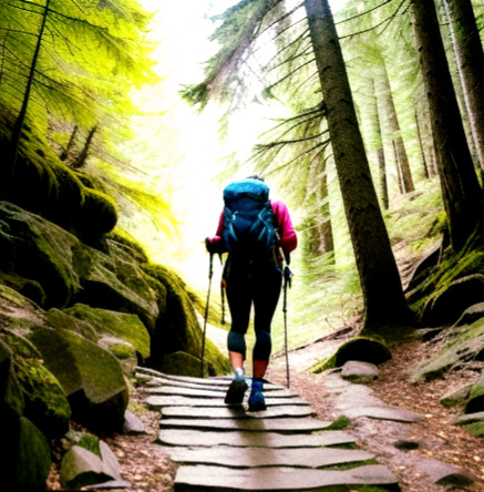
Long distance hiking has emerged as a popular activity for individuals seeking physical and mental rejuvenation. The effects of extended hikes on both physiology and mental clarity are truly remarkable. In this blog, we will explore the profound impact that long distance hiking can have on an individual's overall well-being, with a particular focus on its potential to alleviate mental health issues such as anxiety.
Physiological Effects:
Engaging in long distance hiking offers numerous physiological benefits. Firstly, it improves cardiovascular health by challenging the heart and increasing blood flow throughout the body. The sustained physical exertion involved in hiking for extended periods strengthens the heart muscle, leading to improved endurance and overall fitness levels.
Additionally, long distance hiking promotes muscular strength and tone. The repetitive movements required during hikes engage various muscle groups, resulting in increased strength and flexibility. Over time, hikers experience enhanced muscle definition and improved overall physical performance.
Mental Clarity:
One of the most remarkable aspects of long distance hiking is its ability to provide mental clarity and focus. When immersed in nature and disconnected from the distractions of everyday life, hikers often find themselves experiencing a heightened sense of awareness and tranquility. The rhythmic motion of walking, combined with the soothing sounds of nature, creates an environment conducive to deep introspection and reflection.
As hikers traverse through breathtaking landscapes, they are able to detach from the stresses and worries of their daily lives. This detachment allows them to gain a fresh perspective on their challenges and concerns. Many hikers report feeling a sense of peace and serenity while on the trail, which can lead to reduced stress levels and improved overall mental well-being.
Cognitive Growth:
The benefits of long distance hiking extend beyond physical and mental rejuvenation. Scientific research suggests that engaging in activities like hiking stimulates neurogenesis, the process by which new brain cells are formed. This phenomenon has been linked to improved cognitive function, memory retention, and problem-solving skills.
When individuals embark on long distance hikes, they are exposed to new environments, challenges, and stimuli. This exposure prompts the brain to adapt and form new neural connections, ultimately enhancing cognitive abilities. Hikers often find that their creativity and critical thinking skills are sharpened as a result of these experiences.
Case Studies:
Numerous case studies have highlighted the positive impact of long distance hiking on individuals struggling with mental health issues, particularly anxiety. For example, Sarah, a 35-year-old woman diagnosed with generalized anxiety disorder, embarked on a month-long hike along the Pacific Crest Trail. Throughout her journey, she noticed a significant reduction in her anxiety symptoms. Sarah attributed this improvement to the combination of physical activity, immersion in nature, and the opportunity for self-reflection that the hike provided.
Scientific Proof:
Scientific evidence supports the notion that spending time in nature, such as during a long distance hike, can significantly reduce levels of cortisol, the stress hormone, in the body. A study published in the Journal of Environmental Psychology found that individuals who engaged in nature-based activities experienced lower cortisol levels compared to those who did not. This suggests that immersing oneself in nature can have a calming effect on the mind and body, reducing stress and anxiety.
Conclusion:
In conclusion, the amazing effects of long distance hiking on both physiology and mental clarity cannot be understated. From improved cardiovascular health and muscular strength to enhanced cognitive function and mental well-being, the benefits of embarking on a long hike are numerous. For individuals grappling with mental health issues, such as anxiety, the transformative power of nature can provide a much-needed respite and pave the way for long-term healing and growth. So, lace up your hiking boots, embrace the wonders of the great outdoors, and embark on a journey that will not only challenge your body but also nourish your mind and soul.
#self impowerment#self importance#self improvement#mental health#self identity#stress#self introspection#self care#resilience#self confidence#anxiety#cognition
0 notes
Text
🥾 The Long Way Home
Titouan Le Roux, a 25-year-old French filmmaker, solo hiked the Pacific Crest Trail (PCT) — 4,270 kilometers in 165 days.
I’ve watched a lot of hiking videos over the last few year and this one stands out from the rest. The cinematography is stunning, especially knowing he filmed this completely by himself. While I didn’t care so much for the poetic narration, the visuals are stunning. 😍
youtube
Checkout his instagram stories and his 19-part blog too. He’ll be hiking the Continental Divide Trail (4,873 km) next, looking forward to the sequel!
It made me re-watch “Wild” this weekend, the memoir of Cheryl Strayed hiking on the PCT, directed by Jean-Marc Vallée. It resonated more deeply this time, with Reese Witherspoon and Laura Dern delivering powerful performances.
The book and film’s release coincided with a surge in PCT permit applications, jumping from 1,879 in 2013 to 7,852 in 2022. Hope it doesn’t get ruined by popularity. 😕
Harmen Hoek also released another video, this time he hiked the John Muir Trail, which is mostly part of the PCT, in 21 days. Makes me dream of doing a thru-hike someday.
0 notes
Text
Exploring Nature's Wonders: Hiking Adventures in El Dorado County
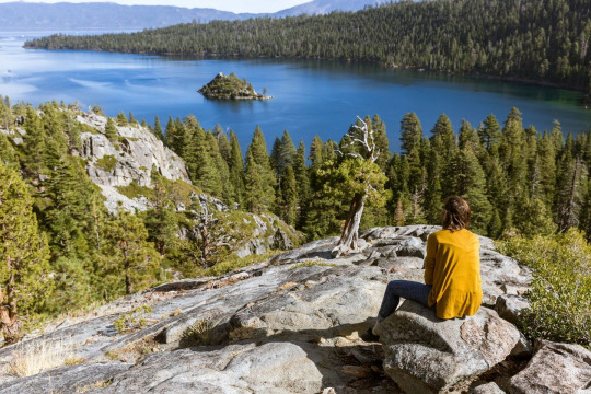
Nestled in the heart of California, El Dorado County is a haven for hiking enthusiasts seeking to immerse themselves in the breathtaking beauty of nature. With its diverse landscapes, ranging from dense forests to rolling hills and majestic lakes, El Dorado County offers an array of hiking adventures that cater to every level of outdoor enthusiast. This blog aims to be your guide to the unparalleled hiking experiences awaiting you in El Dorado County.
Diverse Trails for Every Explorer:
El Dorado County boasts a diverse network of trails, ensuring that hikers of all skill levels can find their perfect path. Whether you're a seasoned trekker looking for a challenging ascent or a casual walker seeking a peaceful nature stroll, El Dorado County has a trail to suit your preferences. From the renowned Pacific Crest Trail to hidden gems like the Desolation Wilderness trails, each step unveils a new dimension of natural wonders.
Scenic Beauty Along the Way:
As you traverse the hiking trails of El Dorado County, be prepared to be captivated by the sheer scenic beauty that surrounds you. Towering pine trees provide shade on warm summer days, while wildflowers carpet the meadows in a riot of colors. Lakeshores offer serene vistas, and mountain peaks present panoramic views that make the effort entirely worthwhile. This blog will highlight some of the most picturesque spots along the hiking routes, encouraging you to pause, take a breath, and soak in the stunning landscapes.
Wildlife Encounters:
El Dorado County's trails are not only pathways through spectacular scenery but also windows into the natural habitats of diverse wildlife. From deer grazing in meadows to the elusive glimpses of eagles soaring overhead, hikers often have the chance to witness the wonders of the region's fauna. The blog will delve into the potential wildlife encounters, adding an extra layer of excitement to your hiking adventures.
Planning Your Hike:
To make the most of your hiking experience in El Dorado County, proper planning is key. The blog will provide insights into trailhead locations, difficulty levels, and any permits or considerations necessary for certain routes. Additionally, tips on what to pack, the best seasons for specific trails, and safety precautions will ensure that your hiking adventure is not only enjoyable but also well-prepared.
Community and Trail Conservation:
El Dorado County takes pride in its hiking community and places a strong emphasis on trail conservation. This section of the blog will shed light on local organizations and initiatives dedicated to preserving the natural beauty of the trails. It will also encourage responsible hiking practices, such as Leave No Trace principles, to ensure that future generations can continue to enjoy these pristine landscapes.
Conclusion:
Embarking on hiking adventures in El Dorado County is a journey into nature's wonders, a chance to reconnect with the great outdoors. Whether you seek solitude among ancient trees or panoramic views that take your breath away, El Dorado County's trails offer an array of experiences for every hiker. Lace up your boots, grab your backpack, and let the exploration begin in this enchanting corner of California's natural paradise.
0 notes
Text
This is my first pop-it post, lol. I’m almost 50 and just discovering Tumblr. I’m going to be hiking the PCT Pacific Crest Trail this year. I will try to blog about that at a later time.
1 note
·
View note
Text
Outdoor Escapes: The Best Hiking Trails in the World

Summer is the perfect time to embrace adventure and reconnect with nature. And what better way to do so than by hitting the trails and exploring the great outdoors? Hiking trails offer a unique opportunity to unleash your adventurous spirit, challenge yourself physically and mentally, and discover the breathtaking beauty of the natural world. Whether you're a seasoned hiker or new to the world of hiking, there is a trail out there that will ignite your passion for exploration. In this blog, we will delve into the joys of summer hiking trails, highlighting some of the most spectacular destinations around the world. We have hiked some parts of these trails. Not the whole trail but it they are still wonderful. The Appalachian Trail is close to our cabin in North Carolina and the Inca Trail is wonderful in Peru. So, get ready to lace up your boots, pack your backpack, and embark on an unforgettable journey into the heart of nature.
The Appalachian Trail: East Coast Beauty
Stretching over 2,100 miles along the eastern coast of the United States, the Appalachian Trail is a hiker's paradise. Starting from Springer Mountain in Georgia and ending at Mount Katahdin in Maine, this iconic trail passes through 14 states, offering an incredible variety of landscapes and experiences. Whether you choose to hike a section or challenge yourself to thru-hike the entire trail, the Appalachian Trail will reward you with breathtaking views, tranquil forests, and encounters with wildlife. Don't miss the chance to conquer peaks like Mount Washington, experience the beauty of the Great Smoky Mountains, and embrace the Appalachian culture along the way.
The Inca Trail: Ancient Wonders
For those seeking a blend of adventure and history, the Inca Trail in Peru is a must-do hiking experience. Following the footsteps of the ancient Incas, this trail takes you through the mesmerizing Andes Mountains, lush cloud forests, and finally, leads to the legendary Machu Picchu. The journey is not only physically rewarding but also culturally enriching as you pass by ancient ruins, stone pathways, and breathtaking landscapes. Immerse yourself in the mystique of the Inca civilization and marvel at the awe-inspiring beauty of this UNESCO World Heritage Site. It is important to note that permits are required to hike the Inca Trail, and they should be secured well in advance due to the trail's popularity.
The Tour du Mont Blanc: Alpine Splendor
If you dream of hiking through picturesque alpine meadows, crossing glistening glaciers, and being surrounded by majestic peaks, the Tour du Mont Blanc is the trail for you. This iconic circuit trail spans approximately 110 miles, passing through France, Italy, and Switzerland, and offers an unforgettable journey through some of the most stunning landscapes in Europe. As you hike along the trail, you'll be rewarded with breathtaking views of Mont Blanc, charming mountain villages, and alpine lakes. Each day brings a new adventure, and each night offers the warmth and hospitality of alpine huts and cosy lodges. Be prepared for varying weather conditions and challenging terrain, but rest assured that the beauty of the Mont Blanc massif will make every step worthwhile.
The Pacific Crest Trail: West Coast Wonder
The Pacific Crest Trail (PCT) stretches over 2,650 miles from the southern border of California to the northern border of Washington, traversing some of the most diverse and awe-inspiring landscapes in the United States. From the arid deserts of Southern California to the towering peaks of the Sierra Nevada and the lush forests of the Pacific Northwest, the PCT offers a truly epic adventure. Whether you choose to tackle a section or embark on a thru-hike, this trail will test your endurance, expose you to the raw beauty of the West Coast, and allow you to forge lifelong friendships with fellow hikers. Prepare yourself for the stunning beauty of places like the Mojave Desert, the High Sierra, and the Cascade Range. It is important to plan and prepare thoroughly, as the PCT presents various challenges such as water scarcity, extreme temperatures, and demanding terrain. But the rewards of witnessing unforgettable sunsets, encountering wildlife, and experiencing the profound solitude of nature make it all worthwhile.
The Camino de Santiago: Spiritual Journey
For those seeking a hiking trail with a unique spiritual dimension, the Camino de Santiago in Spain is an incredible pilgrimage route that spans hundreds of miles. The most popular route, the Camino Francés, starts in the French town of Saint-Jean-Pied-de-Port and ends in the city of Santiago de Compostela. Along the way, you'll walk through the picturesque Spanish countryside, ancient villages, and historic towns, all while encountering fellow pilgrims from around the world. The Camino de Santiago offers a chance for self-reflection, personal growth, and a deep connection with centuries of history and tradition. Whether you undertake the entire route or choose a shorter section, the Camino de Santiago promises a transformative journey that will leave you with cherished memories and a sense of spiritual fulfilment.
Our Final Word
Hiking trails provide an incredible opportunity to unleash your adventurous spirit and forge a deeper connection with the natural world. Whether you choose to explore the majestic beauty of the Appalachian Trail, immerse yourself in the ancient wonders of the Inca Trail, traverse the alpine splendour of the Tour du Mont Blanc, or challenge yourself on the epic Pacific Crest Trail, each journey will be a transformative experience. These hiking trails not only offer stunning landscapes but also teach valuable lessons of resilience, self-discovery, and appreciation for the beauty of the Earth. As you hike through diverse terrains, breathe in the crisp mountain air, and witness nature's grandeur, you'll find a renewed sense of wonder and a deeper understanding of your own capabilities. So, pack your backpack, lace up your hiking boots, and set out on an adventure that will leave an indelible mark on your soul. Unleash your adventurous spirit, embrace the challenges, and let the summer hiking trails be your gateway to exhilaration, self-discovery, and lifelong memories. The great outdoors awaits, ready to reward you with its boundless wonders.
Related Posts
Read the full article
0 notes
Text
My Top Three Hardest Days on the Trail
Kathleen ‘Token’ Neves was one of the PCTA’s P3 hikers in 2018. Kathleen tells me that the 3 ‘p’s stand for PROTECT, PRESERVE, and PROMOTE. “As a P3 Hiker, I acted as an ambassador for the trail along my thru-hike and helped represent the PCTA,” Kathleen continued.
In her other life, she has been an avid yoga teacher in the Seattle area for many years. “It was through yoga where I discovered my real passion for hiking. It started with my first Rim to Rim hike in the Grand Canyon. Next thing I know, on the plane ride home, I decided I wanted to hike the PCT,” Kathleen continued. You can see her entire blog at http://www.kathleenlovesyoga.com/
Kathleen has a piece included in Crossing Paths: A Pacific Crest Trailside Reader.
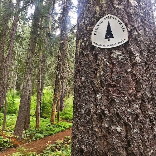
I’ve had numerous amazing experiences out here and I’ve had some not-so-amazing experiences. As with off-trail life, you have your good days and your bad days. On social media, it’s common for people to only talk about the good stuff they experience on the PCT – beautiful sunrises/sunsets, epic tentsites, the incredible views, other cool hikers, tasty food on trail/in town or trail magic along the way. But what about the not so good stuff?
When you hike 15-20+ miles a day for over four months, bad days are inevitable. When sharing my PCT thru-hiking experience, I think it’s important to talk about it all – the good, the bad and the really tough days. Since starting my PCT thru-hike back in April, three really tough days stand out as my absolute hardest out here so far.
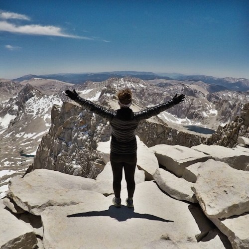
When most PCT thru-hikers take the alternate 17 mile route to Mount Whitney, they camp the night before at either the Crabtree Meadow Ranger Station or Guitar Lake and slack pack up to Whitney, bringing only water and snacks with them to the top and leave the rest of their belongings at camp. After hiking up to Whitney, they come back down, breakdown camp and head back to the PCT.
My trail family didn’t do that. Instead, we brought all of our stuff up with us to the junction of Whitney and the Whitney Portal. We left our packs at the junction, hiked up the 1.9 miles to Whitney and then came back to the junction to retrieve our packs. Then instead of going back down the way we came like most other PCT hikers, we went up, over and down the Whitney Portal towards Lone Pine.
Coming down the Whitney Portal was brutal. There was ice to cross over multiple times – I was the only one in the group who had microspikes. There were 99 switchbacks to navigate down. It was the longest 8 miles I’ve ever had to hike. Since we had such a long day, we didn’t take many breaks and hardly ate any food. Hiking up Whitney was hard enough, but coming down was even harder. I had two breakdowns – one when I reached the top of Whitney and one coming down the portal after I realized we still had another five miles to go.
The silver lining in the day was knowing there was a McDonalds in Lone Pine we could have dinner at. Once I meal planned in my head what I’d eat when we got there, I was able to stop crying and focus on getting myself down those last five miles. Seriously, it was McDonalds that saved the day and got me off that mountain. Now whenever I think of Mount Whitney, the first thing that comes to mind is, “Never Again!”
Tough Day #2: Day 63 – Bear Ridge Trail to VVR (in the dark)
My second hardest day on trail was on my sixth day of being in the High Sierra all alone. I ended up hiking 25.8 miles on this day, making it the most physically challenging day in the Sierra section so far.
Mentally, it was hard because quite frankly, I was tired, dirty and lonely. I had spent the last week all by myself hiking up and down multiple passes, having to cross snowfields on most of them. I hadn’t had a shower in six days, ran out of clean clothes, had run out of DEET and was being eaten alive by mosquitoes, had to ford multiple creeks and rivers all by myself, was lonely from having to camp by myself each night and hadn’t had cell service so couldn’t let my friends and family know of my whereabouts. On top of it all, I knew I still had one more pass to make it over and one more big river to ford before heading off trail for a Zero Day.
Even though I had seen some of the most amazingly beautiful landscapes I’ve ever seen in my life, I was ready to get off trail for a day, talk to other people and eat food that didn’t require boiling water to cook.

I hit the junction for the Bear Ridge Trail at around 7pm. The sun was starting to go down, but I decided to take my chances and keep going. I figured if it got too dark, I’d meet up with the other hikers and camp with them.
It got dark quickly, especially in the forested areas on the trail. I picked up my hiking pace, got my headlamp out, turned it on and made a deal with myself – I’d stop at the first tent I saw on trail and camp for the night.
As soon as I turned on my headlamp and started hiking again, I slipped on a rock, fell to my chest and snapped one of my trekking poles in half. I was sad about my trekking pole, but realized the trekking pole had stopped me from sliding face first into a tree. I got up, dusted myself off and kept going down the trail.
I never did see anyone camped along the trail as I hiked down. I don’t know what was more scary – hiking in the dark by myself or realizing I was the only person hiking the trail, in the dark! I made it down to the trailhead well after dark.
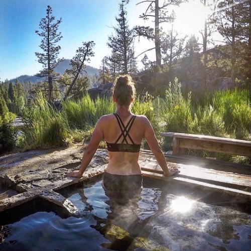
Down the 2.5 mile road walk in the pitch dark black I went. I was so creeped out, I started playing music outloud on my phone, in hopes of scaring any animals away. I kept thinking something was behind me, but it was only the full moon shining on everything in its path.
After hiking over 25 miles for the day, at around 10:30, I walked into VVR. I was immediately greeted by a group of other hikers gathered around a campfire. They introduced themselves, showed me where the flushed toilets were, where I could set up my tent and let me know when and where breakfast would be in the morning. I was so relieved this day was finally over, I cried at the campfire in front of the other hikers. I was so exhausted, I didn’t even care. The tough day was now behind me.
Tough Day #3: Day 127 – Goat Rocks to White Pass Reroute
Goat Rocks was a section of the PCT I had been looking forward to doing. I’d seen countless pictures of other PCT hikers on this section and was excited to see the views with my own eyes.
The day before doing the Goat Rocks section, it had been overcast and the clouds above looked like they might bring rain. Grit and I made a collective decision to camp down low in a forested area so we’d have some protection, just in case it rained. Our decision was a good one because it was cold and rained all night. In the morning, there was still plenty of fog, but the sun was peeping out in spots. We took our chances, packed up camp and headed up the mountain.
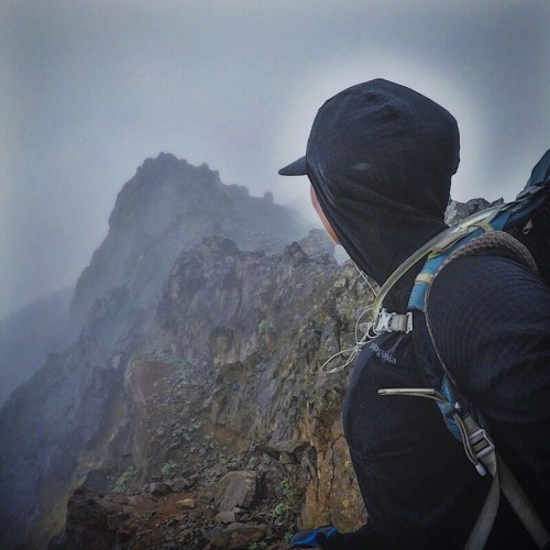
As I climbed closer to the top, I had two pretty decently sized snowfields to cross. Even though the fog was thick all around me, I could still manage to see the pretty steep drop off below me. One slip, one fall and it would be a slick and steep ride down.
After the snowfields, I had to make a decision – stay on the PCT (the stock route) or take the Old Snowy route where I’d have to scramble my way to the top to see the epic views along the knife edge portion of the mountain. Since I was surrounded by fog, I stayed on the PCT. Turns out the PCT was quite challenging. The rocks were slick and it was still a long way down if I were to slip.
I’m not afraid of heights, but hiking Goat Rocks made me feel like I was. Sometimes the fog would open up just to let enough sunlight in and show me how high I was and how steep of a drop it was on the way down. This entire section of the trail was covered in loose rocks and had numerous steep ups and steep downs. It was incredibly cold and windy up there. I had to keep moving in order to keep my body temperature up and the shivers at bay. Half way through this section, about two miles in, I was ready for my hiking for the day to be over.
At the bottom of Goat Rocks, the PCT was closed due to multiple wildfires in the area. We were then rerouted on another series of trails coming down from Goat Rocks and into White Pass. Since it was a reroute on multiple trails, no one seemed to know exactly how long the reroute was or what the elevation gain/loss might be. A couple SoBos had told us the night before that the reroute would mainly be all down for us heading north. They were wrong. Very wrong.
For the first mile, the reroute did head down. After we passed the first campsite on the trail, we started to climb. The first climb was steep and long. Parts of the trail were crumbly with loose rock and most of this section was exposed in the hot sun. Once I made my way to the top, caught my breath and said a few choice words, I could see the two wildfires burning nearby. I could also see back to Goat Rocks. The fog had lifted completely. It was now clear blue, sunny skies over the entire section. I was so bummed. I’d been robbed of the views I’d been looking forward to seeing. I had to keep moving north if I wanted to get into town that night.
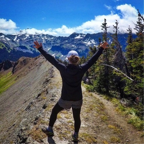
A couple hours into the reroute, I became hellbent on making it into town that evening. I was tired, dirty, thirsty and hungry. I didn’t want to spend another night on trail, especially this hellacious reroute. So I kicked it in high gear and went as fast as I could, not stopping for breaks or to filter/refill my water. Since I had no idea how long the reroute was to town, it felt like the trail was never going to end. I’d climb up to the top of something and then down the other side, through several densely forested areas, having to climb up and down and up again.
At one point, I could start to hear a nearby highway. I got excited because I knew I must have been getting close to the end. At this time, it was also starting to get dark out. Soon I’d have to get my headlamp out to see and if I got to the highway too late, no one would stop to pick me up and give me a ride into town.
I saw a forest boundary line, getting even more excited about how close I must be getting to the end until I saw the fast moving creek right after the sign. My heart sank. It was like the Universe was testing me to see how bad I wanted to go into town that evening. There was no bridge going over the creek. It was starting to get pretty dark and the wind had picked up. There was a sketchy log that went halfway across the creek, but I didn’t feel comfortable enough crossing over the log and jumping off to the other side with my pack on. Desperate to get into town, I sat down on the rocks, took my shoes off, pulled my leggings up to my knees and walked my ass across the creek. Since it was getting dark, it was hard to see just how deep the creek was where I was crossing it. Halfway across, I fell into the creek up to my thighs, getting my leggings soaked in the cold water.
As soon I got across to the other side and out of the water, I didn’t have time to wipe my feet off. I stuffed my wet feet into my dry socks and shoes and moved my soaked leggings all the way down my legs. I got my headlamp out and scrambled my way on down the trail towards the highway. Only the trail didn’t go down. It was a steep half-mile climb up towards the road.
By the time I got to the highway, I was shivering, out of breath and the sun had set, making it dark out. I watched as the occasional car sped up and down the mountain highway. It would be a three mile road walk up into town. There wasn’t a big enough shoulder to walk along the highway safely in the dark. The chances of someone seeing me hitching on the highway or picking me up for that matter were slim to none. Feeling defeated, I could feel the tears form in my eyes as I slowly walked back down the trail.
My only option at this point was to pitch my tent somewhere along the trail so I could get back up to the highway first thing in the morning and hopefully get a hitch into town. Since the trail was such a steep incline, there wasn’t a flat spot to camp at close to the highway. The flattest spot available would be literally right on trail.
As I started to take my tent out of my pack, I saw a set of headlights from the highway. A car had pulled over to the side of the road! Desperate, I left my pack and tent and ran up to the highway with my headlamp still on. When I reached the highway, I saw the car on the side of the road, but was too scared to approach it. Instead, I turned my back to the car and pretended to read the fire closure notices at the trailhead.
“Are you hiking the PCT?” asked the male voice coming from the car. I smiled, turned around and screamed, “Yes!”
“Do you want a ride into town?”
“I’d LOVE a ride! Let me go grab my stuff.”
I ran down the trail, stuffed my tent back into my pack, threw my pack on my back and ran towards the car. In normal situations, I’d be more cautious by getting a good look at the driver before hopping in for a hitch, but I figured nothing could be worse than having to sleep on a slope, in the middle of the trail, in my tent, on a cold night with wet leggings. Town was only three miles away!
Luckily for me, the hitch turned out to be harmless. He was getting ready to start his section hike from White Pass to Trout Lake – and he was from Seattle. What are the odds?
As we drove up the highway, I gave him detailed scoop about the reroute, in-between thanking him repeatedly for giving me a ride into town.
He dropped me off at the Kracker Barrel, the town’s local convenience store/gas station where I thanked him one more time and said goodbye. Kracker Barrel was closed for the evening so I walked behind the building, ready to set up my tent at the first safe place I could find. As I looked at the back of the building, to my right I could see the lit up sign on the building next door that said, “Lodging” After the day I had, I would have paid anything for a room for the night.
I immediately walked next door and rented a room for the evening. In this magical and well-earned room, I would take a warm shower, soak my feet in Epsom salt, heat up one of my hiker trash meals in the room’s microwave and eat candy in a warm, clean bed while I watched “Purple Rain” on TV until 2:30 in the morning. A perfect ending to an incredibly tough day.
Tags: Bear Ridge VVR Vermillion Valley Resort Mt. Whitney Whitney Portal Goat Rocks White Pass
4 notes
·
View notes
Text
Chris Hikes the PCT- part 2
“The mountains are calling and I must go”, John Muir wrote in a letter to his sister in 1873, and after being in the Sierra Nevada mountains for the last few weeks, I can understand how he felt. Although some of the toughest hiking, the Sierra Nevadas are also some of the most scenic By mid-June, Chris and his hiking bubble had completed 25% of the trail, ending the “desert” portion of the…

View On WordPress
#backpacking#budget travel#California#Donner Pass#hwy 395#Lake Tahoe#Pacific Crest Trail#PCT#Sierra Nevadas#travel blog
1 note
·
View note
Text
|| Good Times ||
Pretty self-explanatory.
It doesn't get much better for me.
#video#hiking#outdoors#the hikers eye#opt outside#no people#landscape#nature#go outside and play#the mountains are calling#pacific crest trail#pct#videography#video blog#vlog#serenity#tranquility#tranquil
4 notes
·
View notes