#esri
Explore tagged Tumblr posts
Text
if you've wanted to learn ArcGIS but don't have access to a license they're offering a free Cartography class right now that gives you 6 weeks access to ArcGIS Pro. It seems like a pretty beginner friendly class but if nothing else just take advantage of it to get the license and then make your own course!! Personally I think GIS is so fun if this is the kind of thing that interests you and you're looking for a new challenge (link is to the course page it just formatted weird)(also it's not working in firefox for me today just fyi)
9 notes
·
View notes
Text
That feeling you get when ArcPro just starts ‘thinking’ and you can’t decide whether you should close it or just wait…
4 notes
·
View notes
Text
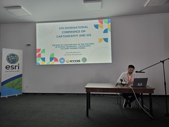
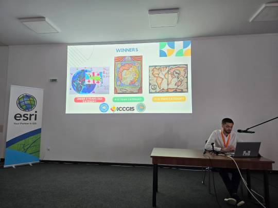
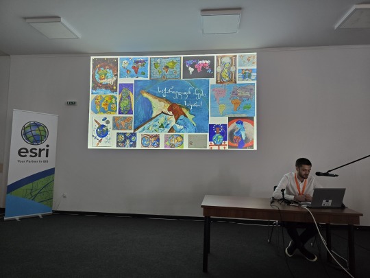
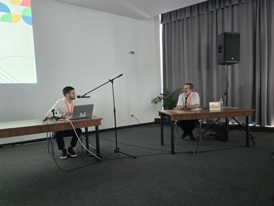
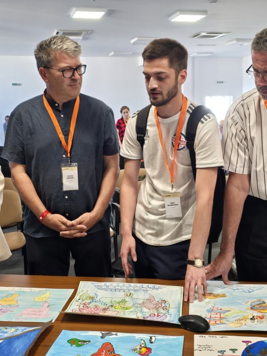
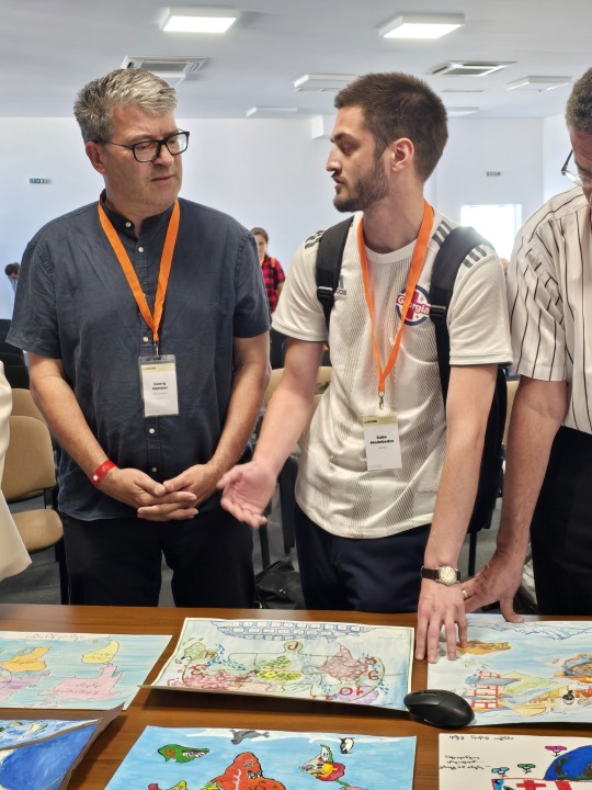
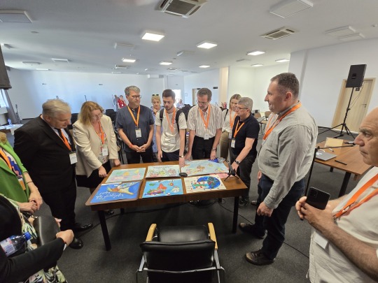
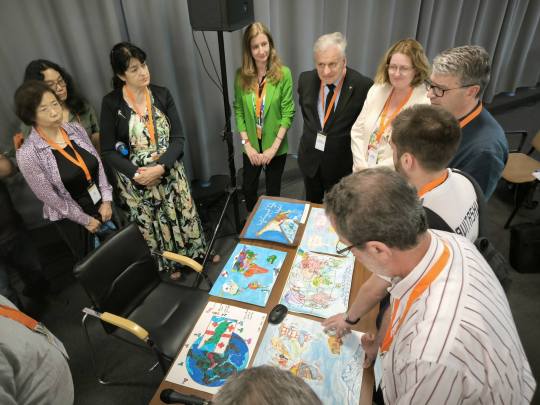
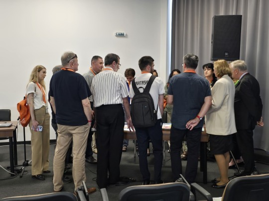
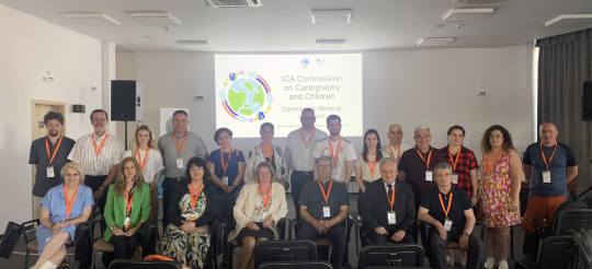
მე-9 საერთაშორისო კონფერენცია კარტოგრაფიისა და GIS-ის შესახებ
9th INTERNATIONAL CONFERENCE ON CARTOGRAPHY & GIS
ცალკე გამოყოფის ღირსია ახალგაზრდა ნიჭიერი მეცნიერ-კარტოგრაფის, დოქტორანტ საბა მოდებაძის (თსუ) მოხსენება, რომელიც სასკოლო კარტოგრაფიას ეძღვნებოდა. კონფერენციას წინ უძღოდა საბა მოდებაძის მიერ თსუ-ში ჩატარებული კონკურსი სასკოლო ასაკის ბავშვებისათვის “ჩემი თვალით დანახული სამყარო“, რომელშიც, სხვადასხვა ასაკობრივი ჯგუფის, 159-მა მოსწავლემ მიიღო მონაწილეობა. ეს იყო მოსწავლეთა მიერ შესრულებული ე.წ. “მენტალური” (აზრისეული) კარტოგრაფიული ნაწარმოებები, თუ როგორ წარმოუდგენიათ მათ სამყარო. საბა მოდებაძემ ამ კონკურსის ორგანიზებას წარმატებით გაართვა თავი და ბულგარეთის საერთაშორისო კონფერენციაზე გააკეთა ამ კონკურსის რჩეული ნამუშევრების დემონსტრირება. მისმა პრეზენტაციამ დიდი მოწონება და აზრთა გაცვლა-გამოცვლა გამოიწვია. საბას კანდიდატურა განიხილება საერთაშორისო კარტოგრაფიული ასოციაციის ერთ-ერთი კომისიის “საბავშვო კარტოგრაფიის” წევრად, რომელსაც, ბულგარელი პროფესორი და ამ კონფერენციის ერთ-ერთი ორგანიზატორი, პროფესორი სილვია მარინოვა ხელმძვანელობს.
A separate mention should be given to the presentation by young, talented cartographer doctoral student Saba Modebadze (TSU), dedicated to school cartography. Prior to the conference, Saba Modebadze organized a competition at TSU for school-age children called "The World Seen Through My Eyes," in which 159 students of various age groups participated. These were "mental" (conceptual) cartographic works showing how they imagine the world. Saba Modebadze successfully organized this competition and presented selected works at the international conference in Bulgaria. His presentation was met with great appreciation and sparked a lively exchange of ideas. Saba's candidacy is being considered for membership in the "Children's Cartography" commission of the International Cartographic Association, chaired by a Bulgarian professor and one of the conference organizers, Professor Silvia Marinova.
#tumblr#like#follow#photo#conference#cartography#GIS#Nessebar#Bulgaria#Georgia#georgian#delegation#ICCGIS#ESRI#ICA
2 notes
·
View notes
Text
tfw you're a gis analyst working with arcmap and arcsde and you click "save edits" 37 times before the sde reconciles and lets you save.
#gis#i hate it here#all my homies hate esri#esri#arcgis#yes my company still uses arcmap in the year of our lord 2023
3 notes
·
View notes
Text
Seri Bluff: Menguasai QGIS Desktop 3.34.x LTR.
Dapatkan harga Video Tutorial "Seri Bluff: Menguasai QGIS Desktop 3.34.x LTR" hanya Rp. 99.000,- ( Harga asli Rp. 279.000). Hanya berlaku 5 hari sampai 21/02/2025
#attribute query#select by attribute#feature info#opensource#gis operator#geodatabase#spatial query#select by location#location allocation#location intelligence#location based services#gis#geoserver#arcgis#esri#openlayers#wms#wfs#web mapping#leaflet#shapefile#qgis#geonode#freelancer#gis analyst#gis jobs#webgis#development#gis professional#project management
0 notes
Text
Data survey lapangan dalam UTM dapat di kelola dengan baik menggunakan QGIS.
Data tabular survey lapangan yang di lengkapi dengan titik koordinat UTM zone 47 N dapat di plot ke atas aplikasi QGIS dimana sebaran data ini akan tampil dan memudahkan dalam analisis spasial, pemodelan spasial dan pengambilan keputusan. Dapatkan video tutorialnya disini:
#attribute query#select by attribute#feature info#opensource#gis operator#geodatabase#spatial query#select by location#location allocation#location intelligence#location based services#gis#geoserver#arcgis#esri#openlayers#wms#wfs#web mapping#leaflet#shapefile#qgis#geonode#freelancer#gis analyst#gis jobs#webgis#development#gis professional#project management
0 notes
Text
ArcGis Pro ModelBuilder will be the death of me. I don't unsterstand what I'm doing 😭😭😭
0 notes
Text
ESRI: Mapping the Future of Biodiversity
"Nature doesn’t need us to survive, we need it. 🌿🦋 See @khayhoe ’s discussion with @EsriUK and Oxygen Conservation on using ArcGIS to support #BiodiversityNetGain, which aims to increase biodiversity with every development"
youtube
0 notes
Text
Discover Innovation at the Esri European DevSummit 2024

🌍 Join the European DevSummit 2024 in Berlin! 🌍 From November 12-14, immerse yourself in hands-on sessions, explore cutting-edge ArcGIS tools, and connect with GIS professionals from around the world. Don’t miss expert insights, live demos, and networking opportunities that will elevate your skills and help you stay ahead in GIS technology. Read the full article
0 notes
Text

Source: National Geographic Education
Maps are powerful devices that allow us to find our way, analyze and visualize complex datasets, solve problems and tell stories.
Through National Geographic MapMaker, a Geographic Information System (GIS) tool for the classroom built in partnership with Esri, this resource collection showcases information and data related to Planetary Health, one of six focus areas of National Geographic Explorers. Discover more about these projects that explore the relationships and interdependencies between human health and the environment: http://on.natgeo.org/6185WEMbR

1 note
·
View note
Text
Esri User Conference 2024: The world’s largest GIS conference (July 15–19, 2024 | San Diego, California).
iSpatial Techno Solutions (IST) will be exhibiting at the Esri User Conference 2024 in San Diego, CA. This event gives an opportunity for IST as we showcase our cutting-edge GIS and AI solutions that are shaping the future of sustainability and energy.

Sustainable Innovation

At IST, our commitment to sustainability drives our innovation. We are leveraging Esri's powerful GIS technology to develop solutions that help communities and organizations achieve their sustainability goals. Our advanced tools enable precise environmental monitoring, helping local and city governments to make informed decisions that promote ecological balance and resource conservation.
Leading Grid Modernization

The utility and energy sectors are evolving, and IST is at the forefront with Esri's Utility Network solution. Our expertise enhances operational efficiency, service reliability, and infrastructure management. We help utility providers optimize networks, reduce outages, and meet the demand for clean energy.
Advancing with Geo AI and Generative AI

They have a pioneering approach integrates Geo AI and Generative AI to convert data into actionable intelligence. These technologies offer local and city governments unparalleled insights, enabling them to tackle complex urban challenges effectively. From predictive analytics to real-time data visualization, our AI-driven solutions provide the essential tools for proactive decision-making and strategic planning.
Visit IST at Esri UC 2024
Join IST at Booth 1113 at Esri UC 2024 to discover how IST's solutions are making an impact. Engage with our experts to learn about our projects, experience live demonstrations of our technologies, and explore collaboration opportunities to drive sustainability and innovation in your organization.
Stay connected with IST on social media live updates, exclusive content, and behind-the-scenes insights from the conference.
If you want to work together to shape a sustainable and intelligent future. For more information, visit our website or contact us directly at [email protected].
We look forward to meeting you at Esri UC 2024!
#esri uc 2024#Esri user conference#Esri user conference 2024#esri uc#ArcGIS Utility Network#GIS#GEOAI#Geo analytics#Location Intelligence#ArcGIS enterprise#Esri#Geospatial#ArcFM#Asset Management#Geodatabase#ArcMap#Geometric#ArcGIS Pro#Web App Builder
1 note
·
View note
Text
Highlight of my day: sitting, watching ArcPro load
2 notes
·
View notes
Text
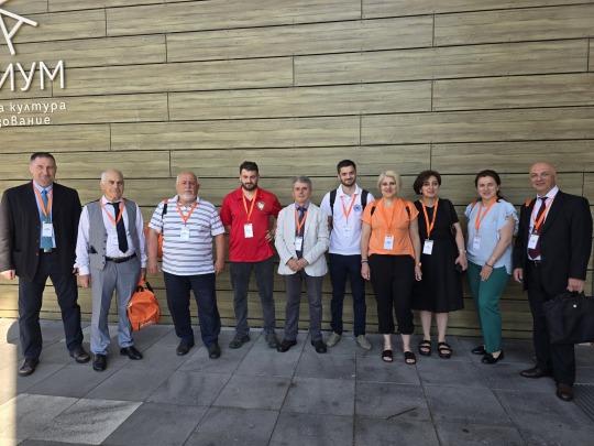
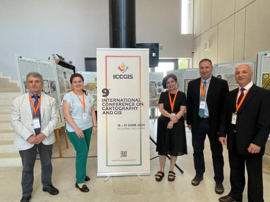
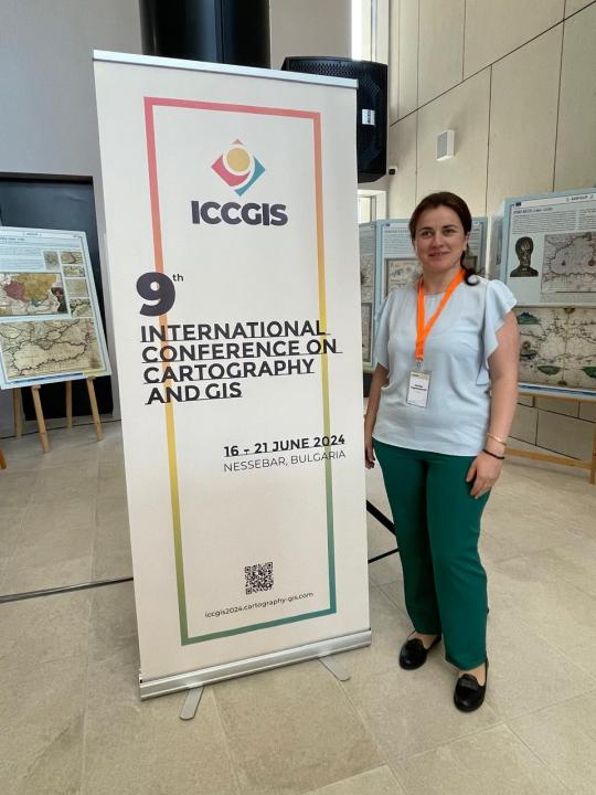
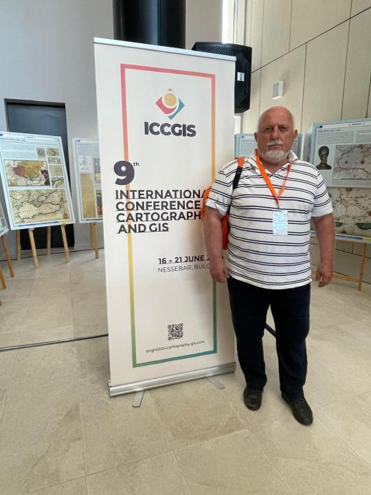
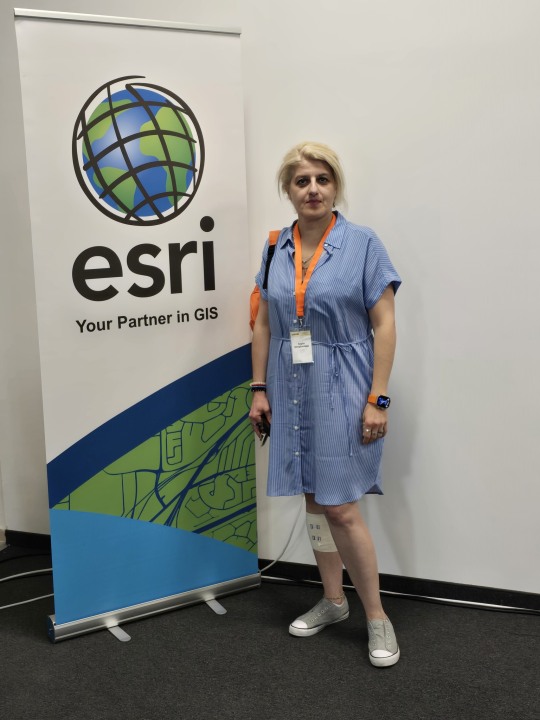
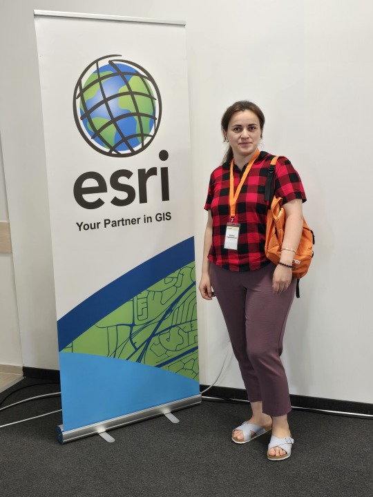
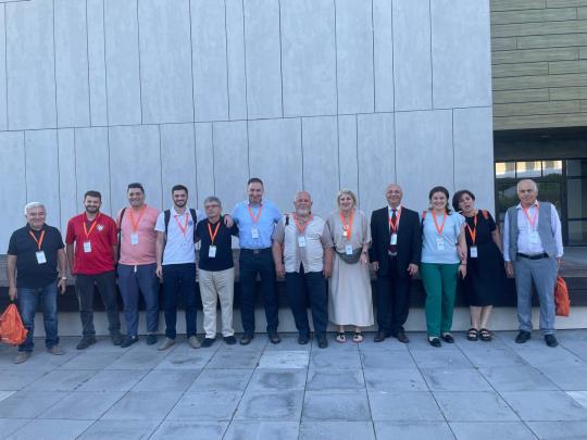
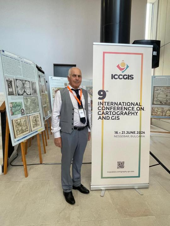
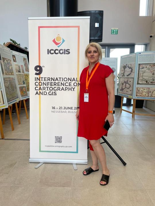
მე-9 საერთაშორისო კონფერენცია კარტოგრაფიისა და GIS-ის შესახებ
9th INTERNATIONAL CONFERENCE ON CARTOGRAPHY & GIS
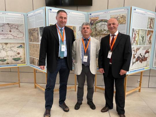
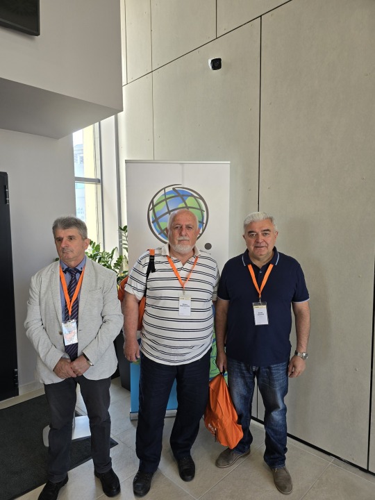
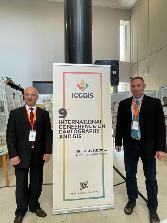
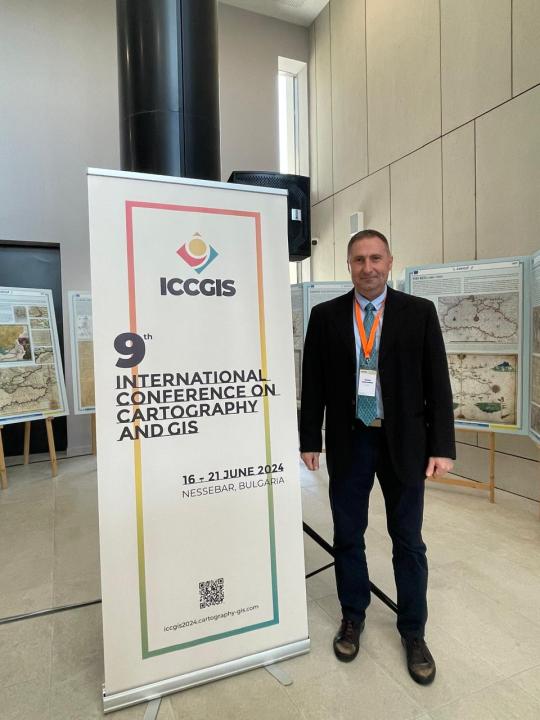
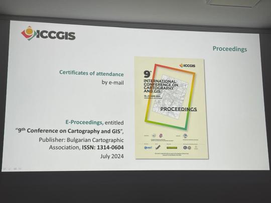
კონფერენციის მუშაობაში მონაწილეობა მიიღო ქართველ მეცნიერთა 12 წევრიანმა ჯგუფმა. ჯგუფში შედიოდნენ ალექსანდრე ასლანიკაშვილის სახელობის საქართველოს კარტოგრაფთა ასოციაციის წევრები (ასოციაციის პრეზიდენტი, თენგიზ გორდეზიანი, ვიცე პრეზიდენტები: ზურაბ ლაოშვილი, თედო გორგოძე და გოჩა გუძუაძე, გენერალური მდივანი საბა მოდებაძე და სწავლული მდივანი მარიამ გაგოშაშვილი). კონფერენციაზე მოხსენებები წარმოადგინეს: თენგიზ გორდეზიანმა, საბა მოდებაძემ, გოჩა გუძუაძემ (2 მოხსენება), რობერტ მაღლაკელიძემ, ნიკოლოზ კაპანაძემ, მარიამ გაგოშაშვილმა (ივანე ჯავახიშვილის სახელობის თბილისის სახელმწიფო უნივერსიტეტი), სოფიო გორგიჯანიძემ (2 მოხსენება, ჰიდრომეტეოროლოგიის ინსტიტუტი), რევაზ თოლორდავამ (სოხუმის სახელმწიფო უნივერსიტეტი), ზურაბ ლაოშვილმა (საქართველოს ტექნიკური უნივერსიტეტი), ნატო მაის��რაძემ (საქართველოს გარემოს დაცვისა და სოფლის მეურნეობის სამინისტრო). ქართველ მეცნიერთა მოხსენებებმა მოიცვა შემდეგი სფეროები: თეორიული კარტოგრაფია, თემატური კარტოგრაფია, საკადასტრო კარტოგრაფია, გეოინფორმაციული სისტემები პრაქტიკაში, სასკოლო კარტოგრაფია, სამხედრო კარტოგრაფია, თანამედროვე გეოდინამიური პროცესების კარტოგრაფირება, გეოეკოლოგიური კარტოგრაფირება. ქართველ მეცნიერთა პრეზენტაციებმა დიდი მოწონება დაიმსახურა. კონფერენციის მასალები გამოქვეყნდება კრებულის ფორმატში, რომელიც ინდექსირებული იქნება საერთაშორისო ბაზაში Web of Science-ში. კონფერენციის მუშაობაში მონაწილე ქვეყნებს შორის საქართველოს დელეგაცია რაოდენობრივად მხოლოდ კონფერენციის ორგანიზატორ ბულგარეთის დელეგაციას და ჩეხეთის რესპუბლიკის დელეგაციას ჩამორჩებოდა.
The conference was attended by a 12-member group of Georgian scientists. The group included members of the Alexander Aslanikashvili Georgian Cartographers Association (Association President Tengiz Gordeziani, Vice Presidents Zurab Laoshvili, Tedo Gorgodze, and Gocha Gudzuadze, General Secretary Saba Modebadze, and Scientific Secretary Mariam Gagoshashvili). Presentations were made by Tengiz Gordeziani, Saba Modebadze, Gocha Gudzuadze (2 presentations), Robert Maghlakelidze, Nikoloz Kapanadze, Mariam Gagoshashvili (Ivane Javakhishvili Tbilisi State University), Sofio Gorgijanidze (2 presentations, Institute of Hydrometeorology), Revaz Tolordava (Sokhumi State University), Zurab Laoshvili (Georgian Technical University), and Nato Maisuradze (Ministry of Environmental Protection and Agriculture of Georgia). The presentations covered areas such as theoretical cartography, thematic cartography, cadastral cartography, GIS practice, school cartography, military cartography, the cartography of modern geodynamic processes, and geoecological cartography. The presentations by the Georgian scientists were well-received. The conference materials will be published in a collection indexed in the international database Web of Science. Among the countries participating in the conference, the Georgian delegation was quantitatively behind only the delegations of Bulgaria, the conference organizer, and the Czech Republic.
#tumblr#like#follow#photo#conference#cartography#GIS#Nessebar#Bulgaria#Georgia#georgian#delegation#ICCGIS#ESRI#ICA
0 notes
Text

At Chetu, our experts utilize AI techniques to unlock the full potential of digital twin technology. Through our strategic partnership with Esri, we provide cutting-edge AI and ML solutions that tackle spatial challenges. Our innovative solutions reveal hidden patterns, advance predictive modeling, and give companies a competitive advantage. To learn more, click here: https://tinyurl.com/vht52afj.
0 notes
Text
Seri Bluff: Menguasai ArcGIS Desktop 10.8.2.
Dapatkan harga Video Tutorial "Seri Bluff: Menguasai ArcGIS Desktop 10.8.2" hanya Rp. 99.000,- ( Harga asli Rp. 279.000). Hanya berlaku 5 hari sampai 21/02/2025.
#attribute query#select by attribute#feature info#opensource#gis operator#geodatabase#spatial query#select by location#location allocation#location intelligence#location based services#gis#geoserver#arcgis#esri#openlayers#wms#wfs#web mapping#leaflet#shapefile#qgis#geonode#freelancer#gis analyst#gis jobs#webgis#development#gis professional#project management
0 notes