#Yolla Bolly Mountains
Explore tagged Tumblr posts
Visit Tumblr Blog
Explore Tumblr blogs with no restrictions, modern design and the best experience.
Last Seen Tumblr Blogs


Fun Fact
In Q3 of 2020, 31% of US users access the Tumblr app daily.
Video

flickr
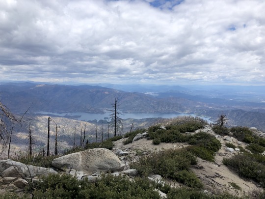
Ridges and Peaks of the Yolla Bolly Area by Mark Stevens Via Flickr: A view looking across a grassy field with scattered volcanic rock debris. This is from a roadside pull off along California State Route 36 looking to the southwest. I was able to identify North Yolla Bolly Mountain and Tomhead Mountain using the PeakVisor app on my iPhone.
#Along Roadside#Azimuth 242#Blue Skies#Boulders#CA-36#California Cascades#California State Route 36#Cascade Range#Day 1#DxO PhotoLab 8 Edited#Forest#Forest Landscape#Grassy Area#Grassy Field#Landscape#Landscape - Scenery#Large Rocks#Lassen Peak Area#Lassen Volcanic Shasta Napa#Looking SW#Mount Linn#Mountain Peak#Mountains#Mountains in Distance#Mountains off in Distance#Mountainside#Nature#Nikon Z8#No People#North Yolla Bolly Mountain
1 note
·
View note
Text
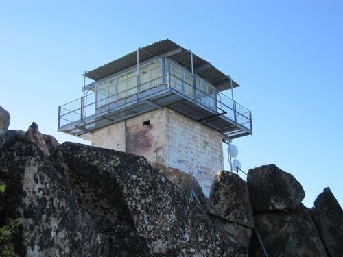
Sierra Buttes Fire Lookout: A Worthy Side Trip
By Rees Hughes
Perched on the very top of Sierra Buttes, nearly 8,600 feet high and well above any surrounding topography, the decommissioned fire lookout offers an amazing 360-degree view. On a clear day, the view extends west across the Sacramento Valley to the Yolla Bollys and Sutter Buttes, south across the Yuba drainage and far into the High Sierra, and north and east are equally stunning. It is a couple mile side trip from the PCT and well worth the detour. I’ve gone a couple of times now including a visit in early August.
In 1975 the National Geographic Society published a comprehensive 196-page book on the nascent Pacific Crest Trail. The book chronicled the thru-hike of author Will Gray and photographer Sam Abell. This was well before trail names, trail angels, and even completion of the trail. A friend of mine recently gave me a copy he had purchased at a library sale. It truly captures the era when external frame Kelty packs, wool, and heavy leather boots reigned supreme. It is well worth a read.
This short excerpt begins at Sierra Buttes, just north of Sierra City. I have included a few photos of the lookout from my walk through the area:
“Lightning makes an incredible whipping and crackling sound just before it hits. Then there’s a loud buzzing like radio static as the thunderclap shakes the whole building. Sometimes there’s a blue glow around the roof overhang, and I’ve even seen electricity arc back and forth between the beams. The first time I saw that, man, I was scared!”
Bill Thomason sat with his feet on a desk inside the fire lookout station that perches – at 8,587 feet – atop the highest of the Sierra Buttes. The thumb-like spires of volcanic rock provide a vantage high above the rolling ridges of the northern Sierra, and I could trace, far below, the Pacific Crest Trail near Sardine Lakes. A side trail ended at the base of the 178 metal steps that climbed the rocks to our steel-and-glass cage.

Bill, a college student who works summers as a fire guard for the U.S. Forest Service, continued to describe the awesome display of a thunderstorm and I was glad that the sky was bright blue and cloudless. “One of the first things I learned,” Bill said, “was not to touch metal during electrical storms. But I’ve gotten so used to them now that I can usually sleep right through.”
What were his duties? “Basically, I just look for smoke, I take a compass reading and check my card file to see if it’s coming from a sawmill, say, or a campground. If not, I radio headquarters to have it checked out. Fortunately, this area’s not too vulnerable; there are relatively few fires each year.”
I asked Bill whether the isolation of sitting alone high on a remote mountain ever bothered him. “Usually it’s not all that lonely,” he answered. “Besides the hiking path, there’s a jeep trail, so I get a few visitors almost every day. Sometimes more than a few – over the Fourth of July weekend, at least 150 people trooped through. And there’s always communication through the radio. But I have gone as long as four days without seeing anyone. I guess I’ve learned to appreciate both company and loneliness. The time of day I most like to be alone is at sunset. It’s so peaceful up here then.”
Fire lookouts are fast going the way of the typewriter, Kodachrome and the handwritten letter. According to author Philip Connors, 90 percent of American lookout towers have been decommissioned with only a few hundred remaining, mostly in the West and Alaska.
A dozen miles north of Sierra Buttes, the trail skirts placid Gold Lake, named in acknowledgment of one of the biggest hoaxes of the gold rush days. In 1849 vague rumors of a lake with banks strewn with gold spread through the mining camps. In the early summer of 1850, an English miner named J.R. Stoddard appeared in Nevada City with a poke of nuggets and a dramatic tale. While on a hunting trip, he said, he had stumbled on the fabled lake of gold, and was astounded by its abundance of riches. As he scooped up handfuls of nuggets, he was suddenly attacked by Indians, and was wounded in the leg by an arrow while escaping.
He offered – for a price – to lead an expedition back to the lake; dozens of gold-hungry prospectors responded and paid the fee. When the party left Nevada City, a throng of perhaps a thousand other men followed along.
For days the horde vainly tramped the mountains. Stoddard became increasingly vague about his bearings, until at last the miners rebelled and gave him an ultimatum: He had 24 hours to find the lake or he would be strung from the nearest tree.
That night the wily Stoddard stole out of camp and disappeared. In the morning the miners, thoroughly chagrined, headed back to their old claims or sought new ones in the Gold Lake country.
Sam rejoined me on the trail north of Gold Lake and together we walked the dry, hot ridges of the northern Sierra. Late one afternoon, as we followed a dusty road toward a bluff overlooking the North Fork of the Feather River, the aroma of cooking drew us toward a small prefabricated house alive with young men.
It was a crew of the California Ecology Corps, sponsored by the California Division of Forestry. Under contract with the U.S. Forest Service, the men were building a six-mile section of Pacific Crest Trail from the ridgetop down into the Feather River Canyon near the town of Belden. After we had demolished a supper of roast beef and corn on the cob, I sat sipping coffee and talking to Dick Hansen, project foreman and a 20-year veteran of the Division of Forestry, and Rick Lawrence, the 22-year-old crew leader.
“We’ve been up here for just under three weeks, and we’ve already got more than half a mile of trail built,” Dick said with pride. “The whole project should take no more than four or five months, we hope.”
“We’re averaging about 250 feet of finished trail per day,” Rick added, “and that’s through manzanita, which is hard to dig out. We have to follow strict specifications of trail width and drainage, of course, and we’re anxious to do a good job; we’re hoping that this one will lead to more contracts.”
In the late mountain twilight the corpsmen returned from swimming, fishing, or rock climbing and crawled into the sleeping bags scattered around the prefab building. A few minutes after five o'clock the next morning I was served a tasty cheese and mushroom omelet by camp cook Jim Atha. Breakfast over, we crowded into a truck and bumped along the dirt road leading to the new trail site.
Following the newly constructed section, I rounded a well-engineered switchback and faced a tangle of brush. Ahead of me a proficient team of two strong corpsmen worked with lopping shears to cut out the tough branches and trunks and form a rough corridor. A couple of dozen yards behind them, another team wielding picks and shovels grubbed out rocks and roots and widened the initial path. Other teams graded, cleared, and trimmed, until finally a permanent section of Pacific Crest Trail had been completed.
“We rotate the men every day so they don’t get burned out on any one job,” Rick told me. “As we work, we’re careful to preserve the natural lay of the land as much as possible. We only take out boulders or trees where they would be a serious hindrance to hikers.”
From the top of the canyon wall, Rick looked down at his crew and said, “This is the kind of work you can appreciate doing. You feel like you’re leaving your mark, that you can come back in 20 years and be proud of what you’ve accomplished.”
Bob Birkby wrote a wonderful piece that is included in the Oregon/Washington volume of The Pacific Crest Trailside Reader, “The Art of the Trail: An Aesthetic Appreciation of What’s Underfoot”. It captures the work of art that results from good trail building … and reminds us not to take for granted the work of Dick Hansen, Rick Lawrence, and their team and countless similar teams that built the PCT.
13 notes
·
View notes
Text
Ducket Peak, South Fork Mountain & Little Bally from Coggins Park, Whiskeytown National Recreation Area
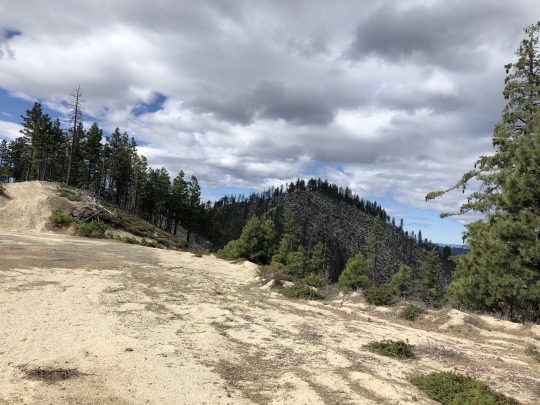
I wanted to climb a cluster of peaks with little fame west of Redding. Standing at 6,975 ft, Bully Choop is the tallest and most prominent peak in the general area. The interesting name comes from the Wintun people of Northern California. Bully translates to spirit, while the translation for Choop is unclear. When I first saw the mountain, the conical peak was impressively covered with snow. I felt a distant energy emanating from the peak, so perhaps there is a certain spirit within this mountain. While this peak was definitely on my to-do list, it wasn’t what incentivized me to finally visit the area. A patch of peaks on the California Coastal list which includes Buckhorn Bally, Little Bally, South Fork Mountain, Ducket Peak and Shoemaker Bally were begging to be climbed. I saw it as an opportunity to “bag” several peaks in one outing, so I devised a thorough plan over two days that would hopefully allow me to climb all of these and more. I reached out to Daryn, who I knew was also interested in these peaks, and I set off north on a Friday. On my drive-in day, I hoped to bag three peaks towards the later half of the afternoon; Buckhorn Bally, Bully Choop and Paradise Peak. All are essentially drive ups, and I hoped to exert little energy in climbing the trio. From Redding, I followed Highway 299 West, then turned left on East County Line Road. I parked near the highest point of the road no more than a tenth of a mile on the northeastern side of Buckhorn Bally.

I walked through the forest for about 5 minutes until I reached the top.

There were a few rocks laying about, so I climbed several of them just to make sure I stood on the highest one.
I found a register containing familiar names. I was surprised that such a nondescript peak contained a register at all.

I spotted Shasta Bally through a gap in the trees.
I retraced my steps through the forest, hopped back in my Jeep, then continued downhill towards my next saddle. I stopped for a picture once I got my first view of Bully Choop.
The road took longer to drive than I budgeted for. At least I was able to drive all the way to the top. A recently reported snow patch had receded, and while it was rocky for the last mile, my Jeep handled it like a champ.

I climbed the lookout. A chilly breeze blew through me. The forecast was slightly unstable, but I viewed this as a positive thing since I expected the following day’s hike to be warm. Off to the northeast were Shasta Bally, Shoemaker Bally, Little Bally, South Fork Mountain, Ducket Peak and Paradise Peak.
To the south was North Yolla Bolly Mountain.

Shasta Trinity National Forest was shrouded with clouds.
To the northwest were the Trinity Alps, obscured by the late afternoon glare.

I still wanted to climb Paradise Peak and even Shoemaker Bally while I had daylight. I hurriedly drove back down the road.

I could have driven almost all the way to the top of Paradise Peak by approaching from the north, but I didn’t research this peak at all. Instead I approached from the west. I realized my error during my walk, but whatever, I was there to hike anyways. I noted a building on my way, which spooked me out a little. I was concerned that I was unknowingly trespassing, but after some post hike research, I think this is nothing more than a storage building for the lookout. I hiked up a short but steep and sandy trail to the summit where I found a structure and several rocky pinnacles.

I climbed one that was class 3, but was discouraged to find an even higher rock that looked rather technical. I walked to the base and knew immediately that I wouldn’t be able to climb it.

It reminded me of the summit block on Thunderbolt Peak, except with less holds. I think at minimum it is 5.10a. I was a little pissed off because several people have logged successful summits of the peak, but I know for a fact that they didn’t climb it. Now I have to come back with a lasso.
Strike 1. Defeated, I sulked back towards the car. I turned on the radio and listened to the Warriors vs Grizzlies basketball game. They were playing for the 8th seed and the final spot in the NBA playoffs. This was a nice distraction as I drove down the lonely forest roads alone. I felt I could still partially salvage the day with a summit of Shoemaker Bally. I reached the turnoff which climbs up to the saddle just north of the peak, but found the gate closed. This was also the road which led to our planned starting point for the next day’s hike. I considered running up the dirt road, but doing so would add an extra three miles and a thousand feet of gain. I simply didn’t have enough time that evening for a lengthened approach of Shoemaker Bally. In addition, the following day’s effort would now be significantly harder. Strike 2. I decided to sleep in my car at a big flat area next to the gate. Daryn showed up while I was cooking dinner. and listening to the end of the game. It was back and forth, but the Warriors collapsed in the last minute, losing both the game and their chance at the playoffs. Strike 3.

I woke up the next morning ready to bounce back. The day’s itinerary was to climb Little Bally, Ducket Peak and South Fork Mountain. If I had enough “juice”, I hoped to tack on Shoemaker Bally at the end of the day to recoup from my previous day’s loss. I had originally planned on starting from the saddle north of Shoemaker Bally, but the road closure would add mileage and elevation gain to an already difficult day. My brain raced around and after studying the map for a bit, I noticed a road leading towards the general direction of Little Bally from Coggins Park. This route option was out of the question before due to extremely thick brush, but with the Carr Fire of 2018 burning most of the area, I hoped to find a way through. We found another closed gate at Coggins Park, but figured starting here would be good enough.
Even if the gate was open, we would not have been able to drive much further since a small creek washed out the road. The road was very gradual and we followed it for 1.5 miles. Staying on the road would eventually take us up Shasta Bally, so we took an unmarked spur road underneath the northern face of Peak 5493. I had expected to run into the impenetrable brush by this point, but much to my delight, the Carr Fire had cleared out most of it. The road petered out, but it was no longer needed, and we strode east towards the ridgeline above.

Daryn passed the time working on his limerick that incorporated the word Ducket. I swear he could pass for a poet. Shasta Bally was an impressive sight to our north.
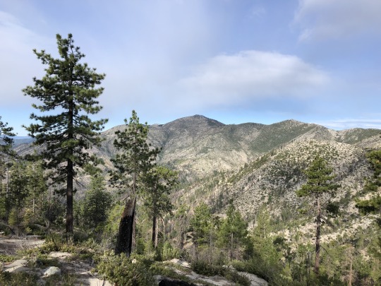
Once atop the ridge, South Fork Mountain, Little Bally and Ducket Peak came into view. Climbing all three would be a challenge.

Off to the northwest stood the Trinity Alps.

We continued along the top of the ridge. There were several reference markers along the ridge marking the boundary of Whiskeytown National Recreation Area.

- Shasta Bally

The Carr fire burned a shocking 97% of the entire Whiskeytown National Recreation Area, and all the nasty bushwhacking that previous parties had reported was eliminated. Our three peaks of interest stood ahead of us; first we would climb Ducket Peak on the right, then we would climb South Fork Mountain on the left, and lastly we would climb Little Bally in the middle. With any bit of luck, we could avoid climbing over Little Bally multiple times by sidehilling along its barren flanks.
As we continued along the ridge towards Little Bally, it began to snow. I actually welcomed this, recognizing that I probably wouldn’t find any water throughout the day. The colder the better.
I looked back at Shoemaker Bally and Bully Choop.

- Colorado Four O'clock
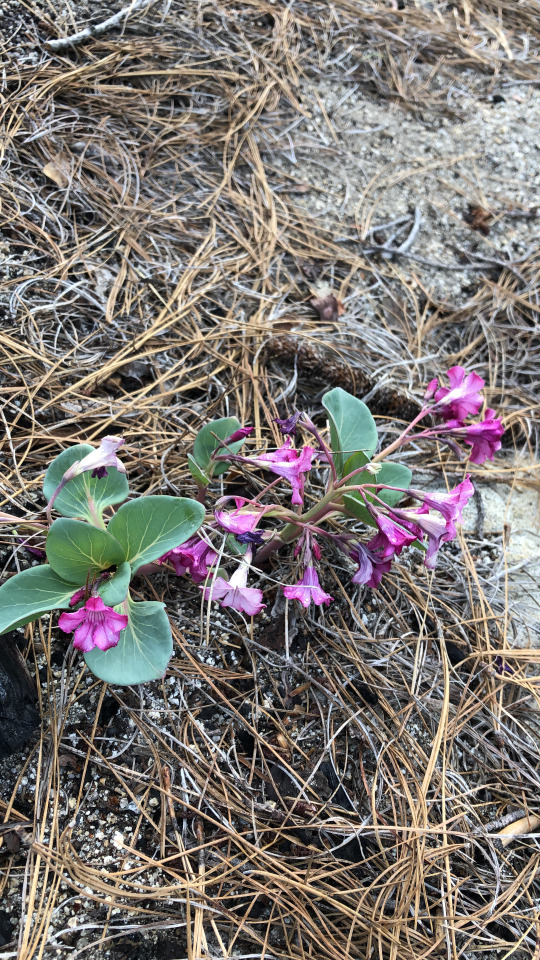
- Rainbow Iris

What ensued was an unavoidable one thousand foot drop to the saddle just west of Little Bally. The temperature at the saddle was noticeably warmer. Here stood a small patch of pines that survived the fire. Pine needles covered the already soft sandy ground. This was likely to be the most pleasant area of the hike, but we were looking to climb peaks, not find shelter. We continued along the ridge up the western slope of Little Bally through gaps in the brush which were plentiful and easy to find.

- Shoemaker Bally
The climb went quicker than I expected. There was a false summit in front of us which I was able to sidehill beneath. I’m not sure if this saved any physical effort, but mentally it might have helped me. I looked at Ducket Peak as I approached the saddle between the false summit and the true summit. It looked incredibly clear and pretty straightforward to angle directly towards this peak, so we decided to climb Ducket Peak first.

We took a rest under some shade at the mini saddle. I stashed some water here, knowing I would need some reserves for my return.

We then began our traverse towards Ducket Peak.

Travel was again easier than I expected. I led the way here, finding a route that ran parallel to the contour lines on my topo map. I maintained my elevation across the open swaths along the mountainside, and when my progress became interrupted by new growth, I allowed myself to drop down slightly in elevation to avoid the obstacles. This effective strategy was made easier by the soft sand underneath our feet, and we progressed around the mountain quickly. Once on the southeast side of the peak, we dropped down quickly to the ridgeline leading towards Ducket Peak below.
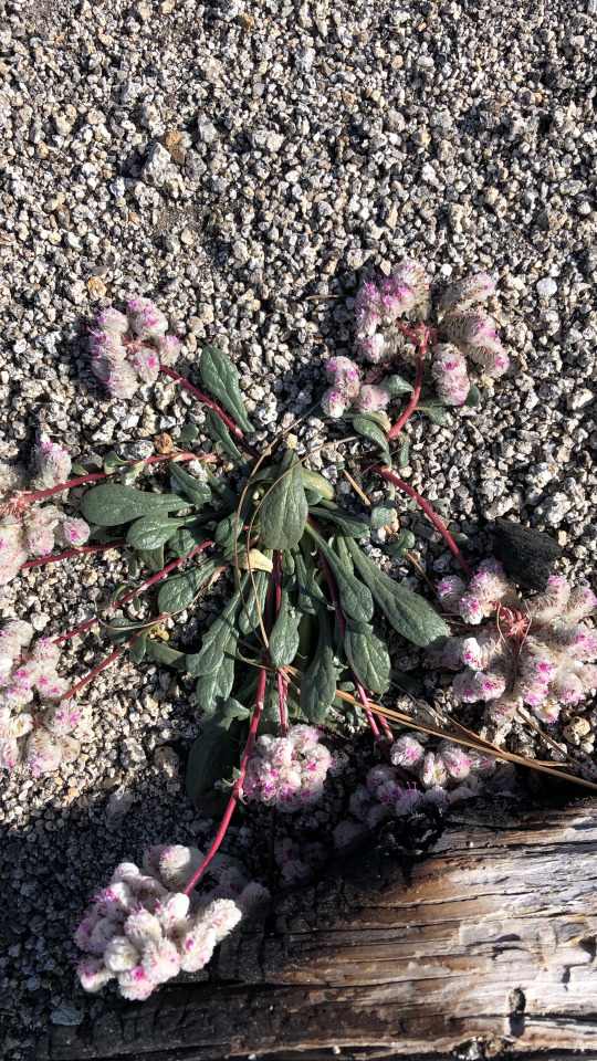
- One-seeded Pussypaws
I believe we crossed into private property at some point, however I did not see any signage indicating as such. I assume that the area was part of a logging interest, but after the big fire, not many trees remain. We connected with an old road once on the ridge. It hadn’t been driven in years, which eased my concerns. I didn’t want to get turned back by a landowner after all the hiking we had just done. We crossed an intersection with a very nicely graded road that appeared heavily used. The peak was close, but if we were to see anyone, this would be the place.
We crossed the road unperturbed, then continued along the ridgeline. The last section was very steep and sandy. We found a forested summit area. There were two summit contenders. We had to break some branches to sit atop the first rock, but this was the least interesting of the two.

We turned our focus to the boulder problem a few meters away. I studied it quickly, but the best I could think of was to stand on a friction slab then heave my body awkwardly up on top. It wasn’t pretty, but it worked. I found Bob’s register underneath a cairn on top then I simply jumped off. It was a bit high, but there was a soft cushion of pine needles underneath my feet. Then I watched Daryn solve the boulder problem.

I would rate it at V0.

Daryn was able to get up alright, but he had troubled getting off. While I had the advantage of young knees, Daryn needed to be more cautious. I stood with my back facing the rock while Daryn placed his feet on my shoulders. I then lowered down into a squat until we both collapsed onto the ground. Success! We ate lunch and found a benchmark located on a lower rock nearby.

After all that work, we had summited only our first peak, but it was probably the hardest of them all. We backtracked along the ridge towards Little Bally, but our next objective was South Fork Mountain.
Rather than climb up and over Little Bally, we sidehilled underneath Little Bally diagonally towards the saddle between Little Bally and South Fork Mountain. This was unpleasant, but short lived.


We crossed too high in the drainage to get any water from Eagle Creek. Once atop the ridge we had easier terrain as we made our way east towards South Fork Mountain. We found a random bear box on the way. We guessed that this was placed for the fire crews since it looked somewhat new.

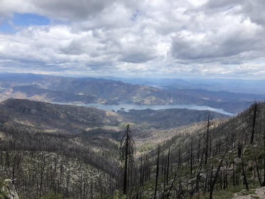
My other theory was that there once was a trail along this ridge, and the bear box was placed for recreational purposes. There were a few sections along the ridge that looked like an old trail. While no trail is marked here on the topo map, there is an old road on the east side of South Fork Mountain, so to me it seems plausible that one existed at some point. Below us to our north was Whiskeytown Lake.
The ridge dragged on and on and on. There were more ups and downs than I had expected, as these minor bumps were not significant enough to be represented on the topo map. I started to tire, but all things come to an end.

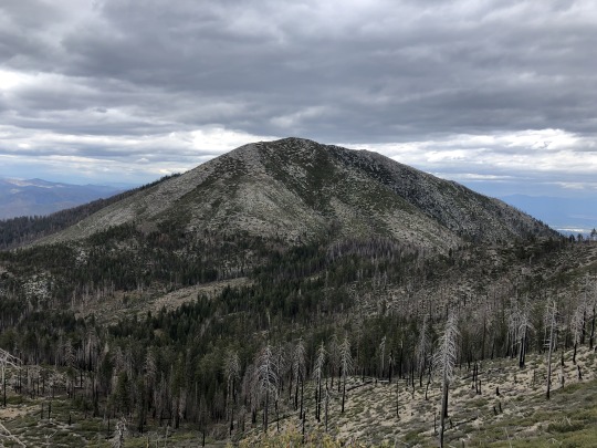
We were thankful to finally reach the summit. To the southwest was Ducket Peak.
To the west were Bully Choop and Little Bally.

To the northwest was Shasta Bally.

To the north was Whiskeytown Lake.
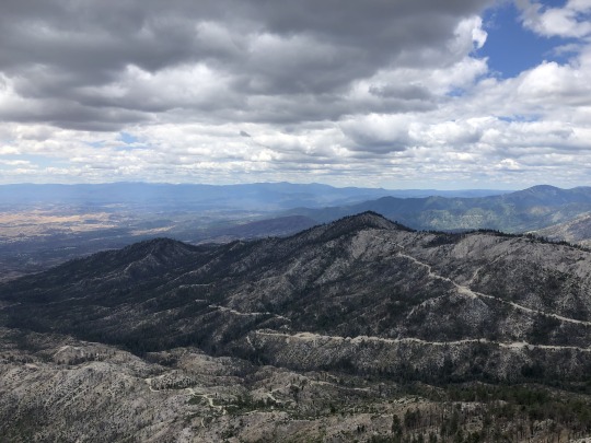
To the east was Sacramento Valley. On a clearer day Mt Lassen would be visible.

We couldn’t find the register at first. I looked around the bushes underneath the summit rock and found it wide open. The pencil was missing but the book was still in tact. Perhaps some rodents had gotten to it. The register container had rusted so we decided to replace it. We added a new pencil and signed ourselves in.

We were as far out as we would be that day, so all we needed to do was head back. I am thankful for the burn because without it, I don’t know if our trip would have been possible. The area kind of reminded me of Ventana Wilderness.
We continued west along the ridge, passing a little garter snake on the way. This time we actually climbed Little Bally, which was the highest of the three named peaks. To the east was South Fork Mountain.
To the northwest was Shasta Bally.
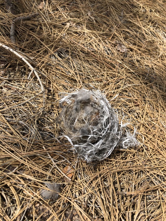
We didn’t spend much time on the summit of Little Bally since we still had a lot of hiking ahead of us. I picked up my water stash and replenished myself. We then dropped back into the deep saddle to our west. I found a bird nest on the ground.
The climb back out of the saddle was a slog, but we were prepared for it. Daryn and I both wanted to climb Peak 5493 as a bonus peak. We skipped this on the way in, and it would only be a short detour to reach it. We continued along the ridge to the high point of our hike, struggling through a short section of manzanita on the way. Looking back to the east were South Fork Mountain, Little Bally and Ducket Peak.

To the north was Shasta Bally.
To the southwest were Shoemaker Bally and Bully Choop. Daryn had already climbed Shoemaker Bally, but I still needed it and I really wanted to get it today, however I was pretty tired. Continuing along the ridgeline looked tough, so I decided to bail with Daryn and head back to the car.

We continued along the ridgeline towards Shoemaker Bally for another half mile, and then we dropped down back to the old road which we used on our approach. Once back on the road, it was an easy walk to the car. I figured that I need to come back for Paradise Peak anyways, so I would be able to combine that with Shoemaker Bally. In the end, it was an 18.5 mile day, and getting Ducket Peak was my main goal, so I was satisfied. I drove back home that night excited to spend the following day with my family.
1 note
·
View note
Text
The Incredible Foxtail Pine

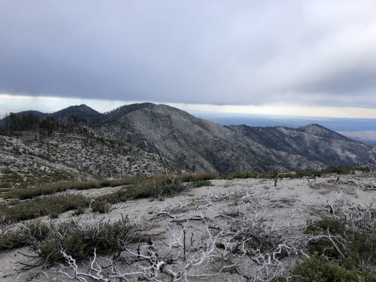
I remember the exact moment that foxtail pines imprinted themselves permanently in my memory. After descending from 13,153-foot Forester Pass, the John Muir Trail crosses Tyndall Creek and almost immediately climbs toward the Bighorn Plateau, a barren moonscape populated by marmots and surrounded by jagged peaks. If there are trees in this area they are stunted by the proximity to the treeline except for the ruddy-barked foxtail pine, with its broad trunk and windswept foliage standing stalwart against the harshest of elements. It seemed even more amazing that foxtails could seemingly thrive when even modest ground cover had retreated to more salubrious habitats. The forest floor was virtually barren.
This population of foxtail pines is some 500 miles from the foxtail pines in the Klamath Knot on California’s North Coast (where I live), where I live, and has been separated since the mid-Pleistocene (some million years). Both retain the bottlebrush needle arrangement that gives foxtail pines their distinctive appearance and name. But there are differences. Over the millennia, these subspecies have diverged in foliage, crown form, and bark color. The southern subspecies can live more than twice as long as its northern relatives (1,000 years), although neither contest the longevity of the foxtail’s cousin, the bristlecone pine (which touch 5,000 years). Some botanists have attributed the larger size of the southern subspecies to its longer life.
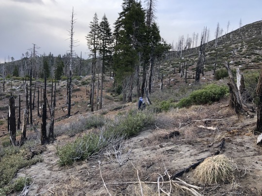
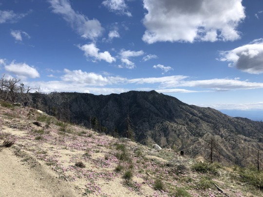
In the Klamath Knot, the foxtail does well in nutrient-deficient soils and is often found along high, dry ridgelines. Conifer guru Michael Kauffmann calls these isolated environments ‘sky islands’. These sky islands do not tend to be accessible in any other way than by a challenging, often arduous walk. That was exactly where I found a stand of foxtails below North Yolla Bolly Peak (7,868’). These trees seem to do best in the harshest of conditions often bent at the base from the weight of winter snow and dead at the top from relentless ridge top winds. The foxtail is the symbol of determination and resilience. Perhaps they too appreciate the magnificent views.
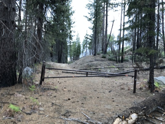
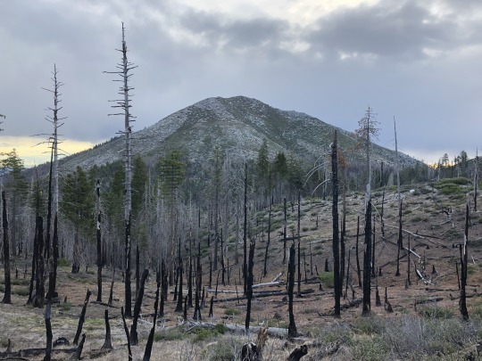
It was to be our fifth day of trail work along the Bigfoot Trail. Much of our effort had focused on removing downed trees and cutting back the brush that encroached on the trail. We had pushed as far as eight miles from our base camp which necessitated long exhausting walks in addition to the trail work. There was general interest in a break. While some spent the day bird watching and others ‘botanizing’, four of us found the abandoned fire lookout on Black Rock Mountain irresistible. This tired sentinel of a tower, made obsolete by technology, still watches over the northern Yolla Bollys. Had it been staffed, the lookout could well have called in the small fire that smoldered a ridgeline to the south sending skyward a modest plume of white smoke. It turned out that lightning had sparked the East Fire five days before our arrival and, gratefully, it never did amount to much. The Forest Service assigned two fire fighters to stay with our trail work group just in case the fire’s temperament changed and an evacuation was necessary. After the tragic fires of the past couple of years, all of California remains a bit on edge.

As we climbed we emerged from the incense cedar forest that surrounded our camp passing through patches of Shasta fir that dot the otherwise exposed expanse of Pettijohn Meadow. The route sent us below North Yolly Bolly to a broad saddle that separated the two peaks. Even in late June, substantial fields of snow blanketed the north face of this high ridge with the peaks – North Yolla Bolly and Black Rock – at opposite ends. It was an ample reminder that winter lasts much of the year at this elevation.
Intermingled with the Shasta fir were the foxtail, and then it was only foxtail grabbing onto the rocky, exposed ridge. David Rains Wallace says that these mountains seem old, marked by “the wrinkles and leanness of great age.” There are elements of flora and fauna here, he continues, that reach “farther into the past than any place west of the Mississippi River.” Perhaps it is only fitting that fossil records for the foxtail pine extend back more than 40 million years. It is a pretty amazing tree.
#Foxtail pine#Bristlecone pine#Yolla Bolly Mountains#Bighorn Plateau#David Rains Wallace#Klamath Knot
3 notes
·
View notes
Text

Photo taken at mile 468.2 just off the trail on the Leona Divide Fire Road (Lonesome Valley is the valley below)
I got to know Brad Marston a number of years ago when we worked together on a Bigfoot trail crew in California's Yolla Bolly Mountains. We have since worked regularly on more trail crews and Brad and his daughter, Anna, contributed a story to Crossing Paths on the subject of climate change.
Brad was to join the Trail Gorillas for a 4-day trail work trip but plans were derailed by weather and the trail work was cancelled. Brad managed to get at least one very nice day in Section E (north of Tehachapi) before the predicted storm rolled in. This is a section that gets less attention than many others so it is nice to be able to post some photos.


3 notes
·
View notes
Text
An Appreciation for What is Underfoot
I just returned from a week of trail work in the Yolla Bolly Mountains west of the Sacramento River Valley along a stretch of the Bigfoot Trail (see earlier posts about the 360-mile long Bigfoot Trail) with a team of 11 volunteers. The trails in this area are not heavily used and have been poorly maintained for many years. I was reminded how it just does not take that long for nature to overwhelm a once active, well-maintained trail system. It takes regular and consistent effort to sustain a trail . . . a fact most of us take for granted.
This year, with the heavy snow pack and above average precipitation in most of California’s high country, has exacted a heavy toll on trails including the PCT. The most recent edition of the PCTA’s digital newsletter ‘Trail Dirt’ featured an article about efforts to restore the PCT in the Whitewater and Mission Creek drainages of Southern California. Here is an excerpt of that story written by Eleonore Anderson:
Upon reaching Mission Creek Canyon, it was obvious that the area had experienced catastrophic flooding since the previous year. In many areas, the canyon and trail were dramatically different, and the trail had disappeared at almost every creek crossing. Despite having spent time there before, I had trouble finding where the trail had been on numerous occasions. If I did find the PCT, I was a bit heartbroken to find that all the work that had been done in previous years (or decades!) was nowhere to be found.
But that is the nature of trail work. While Mother Nature is constantly changing our topography, we get to learn from the past and try, try again.

So what is the solution in Mission Creek?
The Pacific Crest Trail was, obviously, not built all at once. The trail is a connecting path made up of old logging roads, animal paths, cattle trails and everything in between. The U.S. Forest Service, National Park Service, Bureau of Land Management, California State Parks, the PCTA and countless volunteers have worked tirelessly to build and repair the PCT to create a lasting, sustainable trail that future generations can enjoy.
Sustainable trail design almost always dictates that a trail should not be built in a creek bed, but on the side of a slope where water can drain quickly. This method serves not only the longevity of the trail itself, but the natural hydrology of the surrounding environment. Of course, this isn’t always possible. .
So, it certainly would have been better if the trail originally had been built on the slopes above the creek. It would have been more sustainable, less prone to the forces of fast-moving water, and better for the aquatic environment.
Mission Creek is home to endangered species Bell’s Vireo (a small olive-grey colored songbird), as well as the endangered Southwestern Willow Flycatcher. Bear, mountain lion, deer and Bighorn Sheep also call this canyon home.
And remember the law that only hand tools are allowed in Congressionally-designated wilderness.
So, it’s easy to see why relocating the existing trail would be no easy task. It would require costly and time-consuming scientific study just to find the optimal route, not to mention the back-breaking work of building miles and miles of new tread.
For all those reasons, the trail corridor, despite its obvious downsides, needs to stay put.
In Fall 2019, I will be returning to Mission Creek/Whitewater with an ACE trail crew to make the convoluted bits of the PCT a little more obvious. However, one week of work there is not enough. We will have to be a bit more inventive with our camp location as the trail is no longer passable for stock animals.
Nevertheless, in the spirit of grit-fueled trail work and resource conservation, no job is too big. We just might have to get a little creative and sweat a little more.
I would recommend reading or re-reading Bob Birkby’s “The Art of the Trail: An Aesthetic Appreciation of What’s Underfoot” in The Pacific Crest Trailside Reader: Oregon and Washington.
1 note
·
View note
Photo


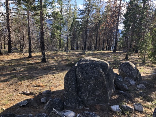
I spent a week in late June doing trail work on a long neglected stretch of the Bigfoot Trail through the remote Yolla Bolly Mountains of Northern California. There were seven of us who worked to reclaim the trail from thorny ceanothus and tenacious manzanita, downed trees, and eroded tread. I was the weakest link in the crew; the hours were long, the work strenuous (at times), and the afternoons were hot. It was exhausting work. But, at the end of each day we felt proud about the visible difference we had been able to make.

I found myself thinking during that week in June about just how much I take the condition of the PCT for granted. Sure there are problems along the length of the trail but the general quality of the trail construction and maintenance is amazing. And that takes countless hours of professional and volunteer time. “Footprints” by Corey Lee Lewis in The Pacific Crest Trailside Reader: California and Bob Birky’s “The Art of the Trail: An Aesthetic Appreciation for What’s Underfoot” in the Oregon/Washington volume speak to the debt that we all owe those that planned, advocated for, financed, built and maintained the PCT so that we could hike it.
Several in our small team of volunteers had worked on a number of other volunteer crews including, Ken Taylor, a regular on the Pounder’s Promise team. [Pounder’s Promise was initiated in 2013 by Charles Williams to perform trail maintenance on the PCT as it passes thru the Northern Sierra (between Hwy 80 and Burney Falls). There have several posts on this website about Pounder’s Promise which can be found using the Search feature.] The photos included on this post are all from work being done in the Jackson Meadow and Packer Saddle area. In many cases they illustrate the ‘before’ and the ‘after’. The PCTA (www.pcta.org) hosts many volunteer opportunities focused on each segment of the trail.
4 notes
·
View notes
Text
Ducket Peak, South Fork Mountain & Little Bally from Coggins Park, Whiskeytown National Rec Area

I wanted to climb a cluster of peaks with little fame west of Redding. Standing at 6,975 ft, Bully Choop is the tallest and most prominent peak in the general area. The interesting name comes from the Wintun people of Northern California. Bully translates to spirit, while the translation for Choop is unclear. When I first saw the mountain, the conical peak was impressively covered with snow. I felt a distant energy emanating from the peak, so perhaps there is a certain spirit within this mountain. While this peak was definitely on my to-do list, it wasn’t what incentivized me to finally visit the area. A patch of peaks on the California Coastal list which includes Buckhorn Bally, Little Bally, South Fork Mountain, Ducket Peak and Shoemaker Bally were begging to be climbed. I saw it as an opportunity to “bag” several peaks in one outing, so I devised a thorough plan over two days that would hopefully allow me to climb all of these and more. I reached out to Daryn, who I knew was also interested in these peaks, and I set off north on a Friday. On my drive-in day, I hoped to bag three peaks towards the later half of the afternoon; Buckhorn Bally, Bully Choop and Paradise Peak. All are essentially drive ups, and I hoped to exert little energy in climbing the trio. From Redding, I followed Highway 299 West, then turned left on East County Line Road. I parked near the highest point of the road no more than a tenth of a mile on the northeastern side of Buckhorn Bally.

I walked through the forest for about 5 minutes until I reached the top.

There were a few rocks laying about, so I climbed several of them just to make sure I stood on the highest one.

I found a register containing familiar names. I was surprised that such a nondescript peak contained a register at all.

I spotted Shasta Bally through a gap in the trees.

I retraced my steps through the forest, hopped back in my Jeep, then continued downhill towards my next saddle. I stopped for a picture once I got my first view of Bully Choop.

The road took longer to drive than I budgeted for. At least I was able to drive all the way to the top. A recently reported snow patch had receded, and while it was rocky for the last mile, my Jeep handled it like a champ.

I climbed the lookout. A chilly breeze blew through me. The forecast was slightly unstable, but I viewed this as a positive thing since I expected the following day’s hike to be warm. Off to the northeast were Shasta Bally, Shoemaker Bally, Little Bally, South Fork Mountain, Ducket Peak and Paradise Peak.

To the south was North Yolla Bolly Mountain.

Shasta Trinity National Forest was shrouded with clouds.

To the northwest were the Trinity Alps, obscured by the late afternoon glare.

I still wanted to climb Paradise Peak and even Shoemaker Bally while I had daylight. I hurriedly drove back down the road.

I could have driven almost all the way to the top of Paradise Peak by approaching from the north, but I didn’t research this peak at all. Instead I approached from the west. I realized my error during my walk, but whatever, I was there to hike anyways. I noted a building on my way, which spooked me out a little. I was concerned that I was unknowingly trespassing, but after some post hike research, I think this is nothing more than a storage building for the lookout. I hiked up a short but steep and sandy trail to the summit where I found a structure and several rocky pinnacles.

I climbed one that was class 3, but was discouraged to find an even higher rock that looked rather technical. I walked to the base and knew immediately that I wouldn’t be able to climb it.

It reminded me of the summit block on Thunderbolt Peak, except with less holds. I think at minimum it is 5.10a. I was a little pissed off because several people have logged successful summits of the peak, but I know for a fact that they didn’t climb it. Now I have to come back with a lasso.

Strike 1. Defeated, I sulked back towards the car. I turned on the radio and listened to the Warriors vs Grizzlies basketball game. They were playing for the 8th seed and the final spot in the NBA playoffs. This was a nice distraction as I drove down the lonely forest roads alone. I felt I could still partially salvage the day with a summit of Shoemaker Bally. I reached the turnoff which climbs up to the saddle just north of the peak, but found the gate closed. This was also the road which led to our planned starting point for the next day’s hike. I considered running up the dirt road, but doing so would add an extra three miles and a thousand feet of gain. I simply didn’t have enough time that evening for a lengthened approach of Shoemaker Bally. In addition, the following day’s effort would now be significantly harder. Strike 2. I decided to sleep in my car at a big flat area next to the gate. Daryn showed up while I was cooking dinner. and listening to the end of the game. It was back and forth, but the Warriors collapsed in the last minute, losing both the game and their chance at the playoffs. Strike 3.

I woke up the next morning ready to bounce back. The day’s itinerary was to climb Little Bally, Ducket Peak and South Fork Mountain. If I had enough “juice”, I hoped to tack on Shoemaker Bally at the end of the day to recoup from my previous day’s loss. I had originally planned on starting from the saddle north of Shoemaker Bally, but the road closure would add mileage and elevation gain to an already difficult day. My brain raced around and after studying the map for a bit, I noticed a road leading towards the general direction of Little Bally from Coggins Park. This route option was out of the question before due to extremely thick brush, but with the Carr Fire of 2018 burning most of the area, I hoped to find a way through. We found another closed gate at Coggins Park, but figured starting here would be good enough.

Even if the gate was open, we would not have been able to drive much further since a small creek washed out the road. The road was very gradual and we followed it for 1.5 miles. Staying on the road would eventually take us up Shasta Bally, so we took an unmarked spur road underneath the northern face of Peak 5493. I had expected to run into the impenetrable brush by this point, but much to my delight, the Carr Fire had cleared out most of it. The road petered out, but it was no longer needed, and we strode east towards the ridgeline above.


Daryn passed the time working on his limerick that incorporated the word Ducket. I swear he could pass for a poet. Shasta Bally was an impressive sight to our north.

Once atop the ridge, South Fork Mountain, Little Bally and Ducket Peak came into view. Climbing all three would be a challenge.

Off to the northwest stood the Trinity Alps.

We continued along the top of the ridge. There were several reference markers along the ridge marking the boundary of Whiskeytown National Recreation Area.

- Shasta Bally

The Carr fire burned a shocking 97% of the entire Whiskeytown National Recreation Area, and all the nasty bushwhacking that previous parties had reported was eliminated. Our three peaks of interest stood ahead of us; first we would climb Ducket Peak on the right, then we would climb South Fork Mountain on the left, and lastly we would climb Little Bally in the middle. With any bit of luck, we could avoid climbing over Little Bally multiple times by sidehilling along its barren flanks.
As we continued along the ridge towards Little Bally, it began to snow. I actually welcomed this, recognizing that I probably wouldn’t find any water throughout the day. The colder the better.

I looked back at Shoemaker Bally and Bully Choop.

- Colorado Four O'clock

- Rainbow Iris

What ensued was an unavoidable one thousand foot drop to the saddle just west of Little Bally. The temperature at the saddle was noticeably warmer. Here stood a small patch of pines that survived the fire. Pine needles covered the already soft sandy ground. This was likely to be the most pleasant area of the hike, but we were looking to climb peaks, not find shelter. We continued along the ridge up the western slope of Little Bally through gaps in the brush which were plentiful and easy to find.

- Shoemaker Bally

The climb went quicker than I expected. There was a false summit in front of us which I was able to sidehill beneath. I’m not sure if this saved any physical effort, but mentally it might have helped me. I looked at Ducket Peak as I approached the saddle between the false summit and the true summit. It looked incredibly clear and pretty straightforward to angle directly towards this peak, so we decided to climb Ducket Peak first.

We took a rest under some shade at the mini saddle. I stashed some water here, knowing I would need some reserves for my return.

We then began our traverse towards Ducket Peak.

Travel was again easier than I expected. I led the way here, finding a route that ran parallel to the contour lines on my topo map. I maintained my elevation across the open swaths along the mountainside, and when my progress became interrupted by new growth, I allowed myself to drop down slightly in elevation to avoid the obstacles. This effective strategy was made easier by the soft sand underneath our feet, and we progressed around the mountain quickly. Once on the southeast side of the peak, we dropped down quickly to the ridgeline leading towards Ducket Peak below.

- One-seeded Pussypaws

I believe we crossed into private property at some point, however I did not see any signage indicating as such. I assume that the area was part of a logging interest, but after the big fire, not many trees remain. We connected with an old road once on the ridge. It hadn’t been driven in years, which eased my concerns. I didn’t want to get turned back by a landowner after all the hiking we had just done. We crossed an intersection with a very nicely graded road that appeared heavily used. The peak was close, but if we were to see anyone, this would be the place.

We crossed the road unperturbed, then continued along the ridgeline. The last section was very steep and sandy. We found a forested summit area. There were two summit contenders. We had to break some branches to sit atop the first rock, but this was the least interesting of the two.

We turned our focus to the boulder problem a few meters away. I studied it quickly, but the best I could think of was to stand on a friction slab then heave my body awkwardly up on top. It wasn’t pretty, but it worked. I found Bob’s register underneath a cairn on top then I simply jumped off. It was a bit high, but there was a soft cushion of pine needles underneath my feet. Then I watched Daryn solve the boulder problem.

I would rate it at V0.

Daryn was able to get up alright, but he had troubled getting off. While I had the advantage of young knees, Daryn needed to be more cautious. I stood with my back facing the rock while Daryn placed his feet on my shoulders. I then lowered down into a squat until we both collapsed onto the ground. Success! We ate lunch and found a benchmark located on a lower rock nearby.

After all that work, we had summited only our first peak, but it was probably the hardest of them all. We backtracked along the ridge towards Little Bally, but our next objective was South Fork Mountain.

Rather than climb up and over Little Bally, we sidehilled underneath Little Bally diagonally towards the saddle between Little Bally and South Fork Mountain. This was unpleasant, but short lived.


We crossed too high in the drainage to get any water from Eagle Creek. Once atop the ridge we had easier terrain as we made our way east towards South Fork Mountain. We found a random bear box on the way. We guessed that this was placed for the fire crews since it looked somewhat new.

My other theory was that there once was a trail along this ridge, and the bear box was placed for recreational purposes. There were a few sections along the ridge that looked like an old trail. While no trail is marked here on the topo map, there is an old road on the east side of South Fork Mountain, so to me it seems plausible that one existed at some point. Below us to our north was Whiskeytown Lake.

The ridge dragged on and on and on. There were more ups and downs than I had expected, as these minor bumps were not significant enough to be represented on the topo map. I started to tire, but all things come to an end.

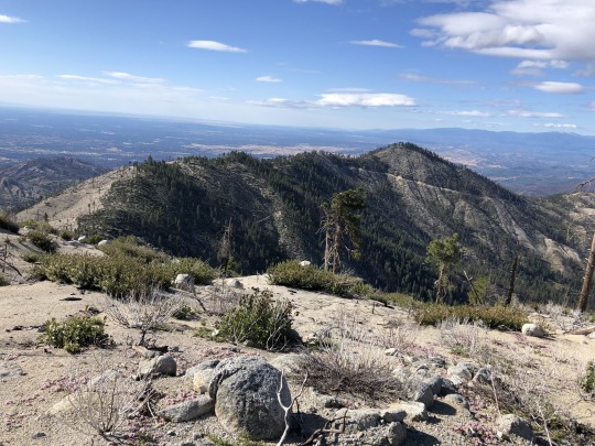
We were thankful to finally reach the summit. To the southwest was Ducket Peak.

To the west were Bully Choop and Little Bally.

To the northwest was Shasta Bally.

To the north was Whiskeytown Lake.

To the east was Sacramento Valley. On a clearer day Mt Lassen would be visible.

We couldn’t find the register at first. I looked around the bushes underneath the summit rock and found it wide open. The pencil was missing but the book was still in tact. Perhaps some rodents had gotten to it. The register container had rusted so we decided to replace it. We added a new pencil and signed ourselves in.

We were as far out as we would be that day, so all we needed to do was head back. I am thankful for the burn because without it, I don’t know if our trip would have been possible. The area kind of reminded me of Ventana Wilderness.

We continued west along the ridge, passing a little garter snake on the way. This time we actually climbed Little Bally, which was the highest of the three named peaks. To the east was South Fork Mountain.

To the northwest was Shasta Bally.

We didn’t spend much time on the summit of Little Bally since we still had a lot of hiking ahead of us. I picked up my water stash and replenished myself. We then dropped back into the deep saddle to our west. I found a bird nest on the ground.

The climb back out of the saddle was a slog, but we were prepared for it. Daryn and I both wanted to climb Peak 5493 as a bonus peak. We skipped this on the way in, and it would only be a short detour to reach it. We continued along the ridge to the high point of our hike, struggling through a short section of manzanita on the way. Looking back to the east were South Fork Mountain, Little Bally and Ducket Peak.

To the north was Shasta Bally.

To the southwest were Shoemaker Bally and Bully Choop. Daryn had already climbed Shoemaker Bally, but I still needed it and I really wanted to get it today, however I was pretty tired. Continuing along the ridgeline looked tough, so I decided to bail with Daryn and head back to the car.

We continued along the ridgeline towards Shoemaker Bally for another half mile, and then we dropped down back to the old road which we used on our approach. Once back on the road, it was an easy walk to the car. I figured that I need to come back for Paradise Peak anyways, so I would be able to combine that with Shoemaker Bally. In the end, it was an 18.5 mile day, and getting Ducket Peak was my main goal, so I was satisfied. I drove back home that night excited to spend the following day with my family.
1 note
·
View note
Text
Ducket Peak, South Fork Mountain & Little Bally from Coggins Park, Whiskeytown National Rec Area

I wanted to climb a cluster of peaks with little fame west of Redding. Standing at 6,975 ft, Bully Choop is the tallest and most prominent peak in the general area. The interesting name comes from the Wintun people of Northern California. Bully translates to spirit, while the translation for Choop is unclear. When I first saw the mountain, the conical peak was impressively covered with snow. I felt a distant energy emanating from the peak, so perhaps there is a certain spirit within this mountain. While this peak was definitely on my to-do list, it wasn’t what incentivized me to finally visit the area. A patch of peaks on the California Coastal list which includes Buckhorn Bally, Little Bally, South Fork Mountain, Ducket Peak and Shoemaker Bally were begging to be climbed. I saw it as an opportunity to “bag” several peaks in one outing, so I devised a thorough plan over two days that would hopefully allow me to climb all of these and more. I reached out to Daryn, who I knew was also interested in these peaks, and I set off north on a Friday. On my drive-in day, I hoped to bag three peaks towards the later half of the afternoon; Buckhorn Bally, Bully Choop and Paradise Peak. All are essentially drive ups, and I hoped to exert little energy in climbing the trio. From Redding, I followed Highway 299 West, then turned left on East County Line Road. I parked near the highest point of the road no more than a tenth of a mile on the northeastern side of Buckhorn Bally.

I walked through the forest for about 5 minutes until I reached the top.

There were a few rocks laying about, so I climbed several of them just to make sure I stood on the highest one.

I found a register containing familiar names. I was surprised that such a nondescript peak contained a register at all.

I spotted Shasta Bally through a gap in the trees.

I retraced my steps through the forest, hopped back in my Jeep, then continued downhill towards my next saddle. I stopped for a picture once I got my first view of Bully Choop.

The road took longer to drive than I budgeted for. At least I was able to drive all the way to the top. A recently reported snow patch had receded, and while it was rocky for the last mile, my Jeep handled it like a champ.

I climbed the lookout. A chilly breeze blew through me. The forecast was slightly unstable, but I viewed this as a positive thing since I expected the following day’s hike to be warm. Off to the northeast were Shasta Bally, Shoemaker Bally, Little Bally, South Fork Mountain, Ducket Peak and Paradise Peak.

To the south was North Yolla Bolly Mountain.

Shasta Trinity National Forest was shrouded with clouds.

To the northwest were the Trinity Alps, obscured by the late afternoon glare.

I still wanted to climb Paradise Peak and even Shoemaker Bally while I had daylight. I hurriedly drove back down the road.

I could have driven almost all the way to the top of Paradise Peak by approaching from the north, but I didn’t research this peak at all. Instead I approached from the west. I realized my error during my walk, but whatever, I was there to hike anyways. I noted a building on my way, which spooked me out a little. I was concerned that I was unknowingly trespassing, but after some post hike research, I think this is nothing more than a storage building for the lookout. I hiked up a short but steep and sandy trail to the summit where I found a structure and several rocky pinnacles.

I climbed one that was class 3, but was discouraged to find an even higher rock that looked rather technical. I walked to the base and knew immediately that I wouldn't be able to climb it.

It reminded me of the summit block on Thunderbolt Peak, except with less holds. I think at minimum it is 5.10a. I was a little pissed off because several people have logged successful summits of the peak, but I know for a fact that they didn’t climb it. Now I have to come back with a lasso.

Strike 1. Defeated, I sulked back towards the car. I turned on the radio and listened to the Warriors vs Grizzlies basketball game. They were playing for the 8th seed and the final spot in the NBA playoffs. This was a nice distraction as I drove down the lonely forest roads alone. I felt I could still partially salvage the day with a summit of Shoemaker Bally. I reached the turnoff which climbs up to the saddle just north of the peak, but found the gate closed. This was also the road which led to our planned starting point for the next day's hike. I considered running up the dirt road, but doing so would add an extra three miles and a thousand feet of gain. I simply didn’t have enough time that evening for a lengthened approach of Shoemaker Bally. In addition, the following day's effort would now be significantly harder. Strike 2. I decided to sleep in my car at a big flat area next to the gate. Daryn showed up while I was cooking dinner. and listening to the end of the game. It was back and forth, but the Warriors collapsed in the last minute, losing both the game and their chance at the playoffs. Strike 3.

I woke up the next morning ready to bounce back. The day's itinerary was to climb Little Bally, Ducket Peak and South Fork Mountain. If I had enough “juice”, I hoped to tack on Shoemaker Bally at the end of the day to recoup from my previous day’s loss. I had originally planned on starting from the saddle north of Shoemaker Bally, but the road closure would add mileage and elevation gain to an already difficult day. My brain raced around and after studying the map for a bit, I noticed a road leading towards the general direction of Little Bally from Coggins Park. This route option was out of the question before due to extremely thick brush, but with the Carr Fire of 2018 burning most of the area, I hoped to find a way through. We found another closed gate at Coggins Park, but figured starting here would be good enough.

Even if the gate was open, we would not have been able to drive much further since a small creek washed out the road. The road was very gradual and we followed it for 1.5 miles. Staying on the road would eventually take us up Shasta Bally, so we took an unmarked spur road underneath the northern face of Peak 5493. I had expected to run into the impenetrable brush by this point, but much to my delight, the Carr Fire had cleared out most of it. The road petered out, but it was no longer needed, and we strode east towards the ridgeline above.


Shasta Bally was an impressive sight to our north.

Once atop the ridge, South Fork Mountain, Little Bally and Ducket Peak came into view. Climbing all three would be a challenge.

Off to the northwest stood the Trinity Alps.

We continued along the top of the ridge. There were several reference markers along the ridge marking the boundary of Whiskeytown National Recreation Area.

- Shasta Bally

The Carr fire burned a shocking 97% of the entire Whiskeytown National Recreation Area, and all the nasty bushwhacking that previous parties had reported was eliminated. Our three peaks of interest stood ahead of us; first we would climb Ducket Peak on the right, then we would climb South Fork Mountain on the left, and lastly we would climb Little Bally in the middle. With any bit of luck, we could avoid climbing over Little Bally multiple times by sidehilling along its barren flanks.
As we continued along the ridge towards Little Bally, it began to snow. I actually welcomed this, recognizing that I probably wouldn’t find any water throughout the day. The colder the better.

I looked back at Shoemaker Bally and Bully Choop.

- Colorado Four O'clock

- Rainbow Iris

What ensued was an unavoidable one thousand foot drop to the saddle just west of Little Bally. The temperature at the saddle was noticeably warmer. Here stood a small patch of pines that survived the fire. Pine needles covered the already soft sandy ground. This was likely to be the most pleasant area of the hike, but we were looking to climb peaks, not find shelter. We continued along the ridge up the western slope of Little Bally through gaps in the brush which were plentiful and easy to find.

- Shoemaker Bally

The climb went quicker than I expected. There was a false summit in front of us which I was able to sidehill beneath. I’m not sure if this saved any physical effort, but mentally it might have helped me. I looked at Ducket Peak as I approached the saddle between the false summit and the true summit. It looked incredibly clear and pretty straightforward to angle directly towards this peak, so we decided to climb Ducket Peak first.

We took a rest under some shade at the mini saddle. I stashed some water here, knowing I would need some reserves for my return.

We then began our traverse towards Ducket Peak.

Travel was again easier than I expected. I led the way here, finding a route that ran parallel to the contour lines on my topo map. I maintained my elevation across the open swaths along the mountainside, and when my progress became interrupted by new growth, I allowed myself to drop down slightly in elevation to avoid the obstacles. This effective strategy was made easier by the soft sand underneath our feet, and we progressed around the mountain quickly. Once on the southeast side of the peak, we dropped down quickly to the ridgeline leading towards Ducket Peak below.

- One-seeded Pussypaws

I believe we crossed into private property at some point, however I did not see any signage indicating as such. I assume that the area was part of a logging interest, but after the big fire, not many trees remain. We connected with an old road once on the ridge. It hadn’t been driven in years, which eased my concerns. I didn’t want to get turned back by a landowner after all the hiking we had just done. We crossed an intersection with a very nicely graded road that appeared heavily used. The peak was close, but if we were to see anyone, this would be the place.

We crossed the road unperturbed, then continued along the ridgeline. The last section was very steep and sandy. We found a forested summit area. There were two summit contenders. We had to break some branches to sit atop the first rock, but this was the least interesting of the two.

We turned our focus to the boulder problem a few meters away. I studied it quickly, but the best I could think of was to stand on a friction slab then heave my body awkwardly up on top. It wasn’t pretty, but it worked. I found Bob’s register underneath a cairn on top then I simply jumped off. It was a bit high, but there was a soft cushion of pine needles underneath my feet. Then I watched Daryn solve the boulder problem.

I would rate it at V0.

Daryn was able to get up alright, but he had troubled getting off. While I had the advantage of young knees, Daryn needed to be more cautious. I stood with my back facing the rock while Daryn placed his feet on my shoulders. I then lowered down into a squat until we both collapsed onto the ground. Success! We ate lunch and found a benchmark located on a lower rock nearby.

After all that work, we had summited only our first peak, but it was probably the hardest of them all. We backtracked along the ridge towards Little Bally, but our next objective was South Fork Mountain.

Rather than climb up and over Little Bally, we sidehilled underneath Little Bally diagonally towards the saddle between Little Bally and South Fork Mountain. This was unpleasant, but short lived.


We crossed too high in the drainage to get any water from Eagle Creek. Once atop the ridge we had easier terrain as we made our way east towards South Fork Mountain. We found a random bear box on the way. We guessed that this was placed for the fire crews since it looked somewhat new.

My other theory was that there once was a trail along this ridge, and the bear box was placed for recreational purposes. There were a few sections along the ridge that looked like an old trail. While no trail is marked here on the topo map, there is an old road on the east side of South Fork Mountain, so to me it seems plausible that one existed at some point. Below us to our north was Whiskeytown Lake.

The ridge dragged on and on and on. There were more ups and downs than I had expected, as these minor bumps were not significant enough to be represented on the topo map. I started to tire, but all things come to an end.

We were thankful to finally reach the summit. To the southwest was Ducket Peak.

To the west were Bully Choop and Little Bally.

To the northwest was Shasta Bally.

To the north was Whiskeytown Lake.

To the east was Sacramento Valley. On a clearer day Mt Lassen would be visible.

We couldn't find the register at first. I looked around the bushes underneath the summit rock and found it wide open. The pencil was missing but the book was still in tact. Perhaps some rodents had gotten to it. The register container had rusted so we decided to replace it. We added a new pencil and signed ourselves in.

We were as far out as we would be that day, so all we needed to do was head back. I am thankful for the burn because without it, I don’t know if our trip would have been possible. The area kind of reminded me of Ventana Wilderness.

We continued west along the ridge, passing a little garter snake on the way. This time we actually climbed Little Bally, which was the highest of the three named peaks. To the east was South Fork Mountain.

To the northwest was Shasta Bally.

We didn’t spend much time on the summit of Little Bally since we still had a lot of hiking ahead of us. I picked up my water stash and replenished myself. We then dropped back into the deep saddle to our west. I found a bird nest on the ground.

The climb back out of the saddle was a slog, but we were prepared for it. Daryn and I both wanted to climb Peak 5493 as a bonus peak. We skipped this on the way in, and it would only be a short detour to reach it. We continued along the ridge to the high point of our hike, struggling through a short section of manzanita on the way. Looking back to the east were South Fork Mountain, Little Bally and Ducket Peak.

To the north was Shasta Bally.

To the southwest were Shoemaker Bally and Bully Choop. Daryn had already climbed Shoemaker Bally, but I still needed it and I really wanted to get it today, however I was pretty tired. Continuing along the ridgeline looked tough, so I decided to bail with Daryn and head back to the car.

We continued along the ridgeline towards Shoemaker Bally for another half mile, and then we dropped down back to the old road which we used on our approach. Once back on the road, it was an easy walk to the car. I figured that I need to come back for Paradise Peak anyways, so I would be able to combine that with Shoemaker Bally. In the end, it was an 18.5 mile day, and getting Ducket Peak was my main goal, so I was satisfied. I drove back home that night excited to spend the following day with my family.
0 notes
Text
Mount Thielsen via West Ridge

Mt Thielsen had been on my radar ever since I noticed its pointy summit from Crater Lake several years back. I was afraid to attempt it, mostly because of the mixed reports on the climbing difficulty. Some trip reports rate the peak as class 5, while others report class 3. While climbing ratings are subjective, I believe Jobe Wymore best summarized the difficulty to me stating, “The climb is class 3. If things get weird, look left or right because you are probably off route.” To be safe, Asaka and I brought our climbing shoes, our harnesses and a rope. While I am very green in my climbing experience, I felt that in the worst case, I could set up a rappel, since climbing down is more difficult than climbing up.
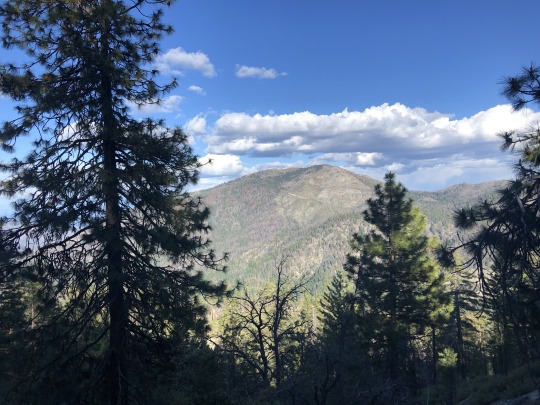
Since the drive from the Bay Area to the Mt Thielsen Trailhead is long, I decided to break it up with a trip up South Yolla Bolly Mountain. This peak is west of Red Bluff and is only about 1.5 miles from trailhead to summit. After stopping for lunch in Corning, we headed west along forest roads to the Ides Cove Trailhead. We followed the ridgeline all the way to the summit.

It was very hot and dry that day. I expected only a minimal effort, but was soaked in sweat by the time we reached the summit. Mt Shasta was visible to the north.

To the west were the rugged coastal ranges.

I checked the time and realized it was getting late and we still had 6 hours of driving to the Mt Thielsen Trailhead. I underestimated the driving time from Highway 5 to the trailhead and back. While I took a break from driving, Asaka expressed concern as I watched some “How to rappel” Youtube videos, and even went so far as to say she wouldn’t join me if roped climbing was necessary. I assured her that we probably wouldn’t need the rope, but it would be better to have it and not need it, than need it and not have it. We pulled up to the Mt Thielsen Trailhead parking lot where we intended to spend the night in the back of the Jeep. This was a poor place to sleep. A combination of noise from the nearby freeway and a rambunctious group of campers made for a unpleasant night.
The next morning we started off a little after 8am. I had to pay for parking, which had me running back and forth between my car and the payment station. The trail climbed gradually through the forest up the western slopes of the extinct volcano.

Mt Thielsen came into view not so long after starting out, but the sun rising behind the peak impaired our views.

We took a short break where the trail intersects the PCT. There were several backpackers here making their ways north. It was hard to envision an easy route to the top.

Down below were Diamond Lake and Mt Bailey.

From the junction, the maintained trail ended and we followed a series of parallel use trail along the top of the west ridge.

There were several other parties on the mountain who all appeared to have different levels of experience. Some people were having trouble simply hiking up the talus field while others had the latest climbing gear and an air of confidence about them.


I crossed paths with a guy who said, “Almost there,” in a very friendly manner. I replied saying that I could see that, which came out somewhat rude, so I went out of the way to befriend him. He had been up the mountain multiple times and this time he was taking his son to the summit. He had a rope and looked to know what he was doing. We hiked around the summit pinnacle and approached the start of the climbing route where we found a team already rapelling off the summit. One lady kicked rocks the whole way down. I looked on in disgust, happy that we had our helmets on. This group appeared to me as a group that thought they knew what they were doing, but actually didn’t. We gave distance until the lady finished, then the group invited us up. They offered to let us climb in between rappels, which we thanked them for and accepted. The route above looked steep but manageable.

We began climbing while the group advised us where to go. I started to question their advice as things became a little “weird.” We continued up what I would call class 3+ steps, while a ledge to our left appeared to be a much easier route. I didn’t want to be rude so I went along with it. There were some awkward moves, but we made it to the top. The last member of their party rapelled off the peak as we finished the scramble, giving us the popular summit to ourselves. To the south were Mt McLaughlin, Mt Scott and Crater Lake.

More details were visible with a zoomed in shot.

To the west were Diamond Lake and Mt Bailey.

To the north were Diamond Peak, Middle Sister, South Sister, Broken Top and Mt Bachelor.

Once again, more detail can be seen with a zoomed in photo.

To the east was the Great Basin.

The vertical drop to the north off the summit cliff was exceptionally vertical.

The weather was perfect on the summit. The gentleman from earlier joined us, explaining that he was setting up the rope for his son who was still on his way. He had climbed most of the Cascade Volcanoes and we exchanged stories of our past adventures. When we felt it was time, we decided to simply down climb the pitch. Since we had our shoes, we decided to put them on to give us a little extra grip. Some of the rocks had been worn smooth from the high amount of climbers. We carefully descended and both Asaka and I made it down without any issues. The guy rapped down, tied in his son and then belayed him up. We chatted with a few people as we changed back into our hiking boots. I carried my harness and rope for no reason after all, but I was glad we didn’t need to use it.

There was another steep drop off on the eastern side. A spring source was visible at the base of the porous volcanic sediment.

We said goodbye to our new friends and began our hike down the rubble pile back to the trail.


Access to the start of the class 3 route is on the right (eastern) side of the summit pinnacle.


The color of the volcanic rock was enchanting.

As the sun moved overhead, the peak became easier to look at.

The hike out to the car was a mindless march through the forest. I really had to go to the bathroom, and the toilet at the trailhead was all I focused on.

We considered continuing north to South Sister, however the long drive home the following day did not sound appealing. Instead we drove to Diamond Lake where we jumped in the water and enjoyed the views.

We settled on climbing Craggy Mountain the next day, an obscure coastal peak near Yreka. We watched the sunset over the Northern Pacific Ranges and slept in the car at the trailhead.

We slept on a remote saddle miles from the nearest human. It was a bit spooky, but quiet. I slept peacefully through the night.
The next morning we woke up less than a mile from the peak.

We followed the ridgeline until we reached a series of craggy pinnacles. Who would have thought that Craggy Mountain is adequately named?

There was some mild bushwhacking until we found ourselves between two challenger pinnacles. We ascended via a keyhole to a higher rock, then I climbed the easier of the two points. The rocks to the west appeared slightly taller, so I made my way over.

There was one class 4 move with really good holds that got me onto the summit.

I found a register left by Bob Burd. I looked back at Asaka who was on the lower crag and told her to come join me.

To the northeast was Mt McLaughlin.

To the east was Mt Shasta.

Down climbing the class 4 summit block was a little tricky but we made it down safely. We enjoyed the rest of our Saturday by climbing the nearby China Peak and later drove most of the way up Dog Creek Mountain near Lake Shasta, which was pretty much a dud. It was an action packed road trip for sure.
0 notes
Text
Re-Introduction to the Bigfoot Trail

For about 40 miles, the PCT and the Bigfoot Trail coincide through the Marble Mountain Wilderness, on to Seiad Valley, and north to Red Buttes Wilderness. Now the Bigfoot Trail is the subject of a new feature-length movie by Scott ‘Squatch’ Herriott which he has titled Asquatchalypse Now. The movie combines his 2016 journey along the length of the trail with his passion for Bigfoot, whose presence has long-been speculated in the dark places of the Klamath Knot. Below is an introduction to this, one of the newest of the long-distance trails.
Overshadowed by its much older and more distinguished siblings – Appalachian Trail and Pacific Crest Trail – our local [the North Coast of California] contribution to the long distance hiking trails family is clamoring for a little attention. The 360-mile long Bigfoot Trail (BFT), named for our most famous mega-fauna, begins in the Yolla Bollys and pushes north through the Trinity Alps and Marble Mountains before turning west through the Klamaths to the Pacific Ocean near Cresent City. This region, often known as the Klamath Knot, comprised of dark forests, steep and wild terrain sculpted by winter rains, and lush understories is a crossroads for biodiversity, both flora and fauna.

The BFT traverses six wilderness areas, a state and national park using a mismash of seldom-used Forest Service roads and established trails. As the website warns, “some sections [of trail] have been un-maintained for many years . . . experience using map and compass as well as the ability to read the landscape are necessary for a successful thru-hike.” Even the map-set includes directions like, “If the trail becomes faint at any time in the next 15 miles, stay on the ridge and the trail should again become evident.” These cautions have been reaffirmed by those who have walked the BFT.
Challenges aside, the Bigfoot Trail offers a unique way to have a “deeper experience in our bioregion,” observed Emily Sinkhorn, who along with HSU Faculty member Erin Kelly hiked most of the trail this past June. They both appreciated the wealth of flowers and trees along the way. David Rains Wallace, who popularized the Klamath Knot moniker, states that our forests are the most diverse west of the Mississippi. Michael Kauffmann, author of Conifer Country, documents 35 species of conifers in this region of which 32 are encountered along the Bigfoot Trail.
The BFT offers an incredible range of experiences. From swimming in the North Fork of the Salmon River to embracing the view of the Pacific Ocean from Little Bald Hills. From trying the ‘pancake challenge’ in Seiad Valley to walking the Kelsey Trail section just as miners had a century and half earlier. From vista-filled ridge hiking near Mt. Linn along the southern part of the trail to following beautiful Clear Creek near the Oregon border. This is some exceptional richness!

It is also important to understand that walking the BFT is an opportunity to experience our wilderness without the press of people (“we often went 5-6 days without seeing anyone,” noted Emily). The sounds of nature are not obscured by manmade noise; the night skies do not compete with the ambient light of civilization. The BFT represents a welcome contrast to the over-used and over-loved John Muir Trail, Pacific Crest Trail or Tahoe Rim Trail.
Filmmaker Scott “Squatch” Herriott used footage shot during his walk of the BFT this past summer as the basis for a feature-length movie, “Asquatchalypse Now”. The movie offers an excellent overview of the trail. You can also find out more about the trail on the website of the Bigfoot Trail Association website - http://www.bigfoottrail.org. The Association sells map sets and offers GPX tracks.
As you make your summer plans, maybe spending some time exploring our neighborhood on the BFT is the right choice. You’ll need to be a bit intrepid, have some outdoors seasoning, and be ready for adventure.
(photo credit - Emily Sinkhorn)
5 notes
·
View notes