#Low Earth Orbit Satellites
Explore tagged Tumblr posts
Text
#Elon Musk#facts#Geopolitical Influence#Global Geopolitics#life#Low Earth Orbit Satellites#Military Communication Systems#Podcast#Private Military Contracts#Satellite Communications#Satellite Warfare#serious#Space Militarization#Space-based Technology#SpaceX#SpaceX Defense Contracts#Starlink Military Use#Starshield#straight forward#truth#U.S. Defense Strategy#upfront#website#Post navigation
0 notes
Text
Satellites: Their Orbits, Tracking Systems, and Essential Uses
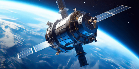
Satellites: Their Positions, Tracking, and Importance
Satellites have become an essential part of modern life, orbiting Earth and providing us with services ranging from communication and navigation to weather forecasting and space exploration. As of 2024, thousands of active satellites are circling our planet, each performing a specific role to enhance the quality of life on Earth. This article delves into the positioning of satellites, how they are tracked, what they track, and the significance of their roles.
Types of Satellite Orbits and Their Positions
Satellites are positioned in various orbits depending on their intended functions. These orbits determine how close the satellite is to Earth, how fast it moves, and what areas it covers.
Low Earth Orbit (LEO): Altitude: 180 km to 2,000 km Satellites in LEO include most Earth observation satellites, the International Space Station (ISS), and some communication satellites. These satellites are closer to the Earth, enabling them to capture high-resolution images. Functions: Used for imaging, remote sensing, and some communication purposes. Examples: ISS, Earth observation satellites like Landsat.
Medium Earth Orbit (MEO): Altitude: 2,000 km to 35,786 km Satellites in MEO are mainly used for navigation. This orbit offers a good balance between coverage and latency. Functions: GPS satellites and other global navigation systems. Examples: GPS, GLONASS, and Galileo satellites.
Geostationary Orbit (GEO): Altitude: 35,786 km above the equator Satellites in GEO move at the same rotational speed as Earth, meaning they stay fixed over one location on Earth. These are mostly communication and weather satellites. Functions: Used for television broadcasts, weather monitoring, and some types of communication. Examples: Weather satellites (GOES series), telecommunication satellites.
Highly Elliptical Orbit (HEO): Orbit shape: An elongated orbit with one point closer to Earth (perigee) and another point much farther away (apogee). Functions: Ideal for regions at high latitudes, providing prolonged coverage over areas like Russia and parts of Canada. Examples: Molniya satellites for communication in Russia.
How Satellites Are Tracked
The sheer number of satellites in space, combined with space debris, means tracking them is essential to avoid collisions and ensure their functionality. Ground stations and dedicated space agencies continuously monitor satellites. Several methods are used to track satellites:
Radar and Ground-Based Systems: Ground stations use radar to track satellites in LEO. These systems bounce radio waves off the satellite and measure the time it takes for the signal to return. By doing this repeatedly, they can track a satellite's location and speed.
Global Positioning System (GPS): Satellites in higher orbits like MEO or GEO are tracked using onboard GPS receivers. GPS helps calculate the satellite’s position and relay that data back to Earth.
Optical Tracking: Telescopes and cameras are used to visually observe satellites in higher orbits. This method is particularly useful for tracking objects that do not emit radio signals or need to be monitored for their physical characteristics.
Space Surveillance Networks: Agencies such as the U.S. Space Surveillance Network (SSN) and similar organizations in other countries continuously monitor satellites and space debris. They catalog objects and issue alerts for potential collisions.
What Satellites Track
Satellites are equipped with various sensors, cameras, and instruments to track a wide array of data on Earth, in space, and beyond:
Weather and Climate Data: Satellites such as NOAA’s GOES series monitor weather patterns, hurricanes, and long-term climate changes. They provide crucial data for meteorological services.
Earth Observation: Satellites like Landsat capture high-resolution images of Earth's surface. These images are used for mapping, agricultural planning, disaster response, and environmental monitoring.
Navigation Signals: GPS and other GNSS (Global Navigation Satellite Systems) satellites send signals that are used for navigation by smartphones, vehicles, ships, and airplanes worldwide.
Communication: Satellites facilitate global communication by relaying TV, radio, and internet signals across vast distances.
Space Exploration: Space telescopes like the Hubble Space Telescope track distant galaxies, nebulae, and black holes, helping scientists study the universe.
Military Surveillance: Many satellites are designed for defense purposes, tracking missile launches, military movements, or spying on potential threats.
Number of Satellites in Space
As of 2024, there are approximately 8,000 operational satellites orbiting Earth. The exact number fluctuates as new satellites are launched and old ones are decommissioned. Additionally, space agencies and private companies like SpaceX continue to launch large satellite constellations, such as Starlink, which alone has over 5,000 satellites in orbit for global internet coverage.
The Usefulness of Satellites
Satellites have become indispensable in modern life, serving a wide variety of purposes that impact everyday activities and critical global functions:
Key Functions of Satellites:
Communication: Satellites enable long-distance communication by transmitting data, television, and internet services. Without them, global broadcasting and real-time communication in remote areas would be impossible.
Navigation: Systems like GPS help millions of people navigate in real-time. They are also vital for the functioning of aviation, maritime travel, and even agricultural practices.
Earth Observation: Satellites provide high-resolution imagery of Earth, helping with disaster management, urban planning, agriculture, and environmental monitoring. For instance, they can track deforestation or observe glaciers' melting rates.
Weather Forecasting: Weather satellites provide the data needed for accurate predictions, storm tracking, and climate monitoring. This information is critical for preparing for natural disasters like hurricanes or floods.
Scientific Research and Exploration: Space telescopes and interplanetary satellites gather data on space phenomena, expanding our understanding of the universe. Satellites also conduct scientific experiments in the microgravity of space.
Defense and Security: Satellites are used for military surveillance, early-warning systems, and missile detection, playing a crucial role in national security.
Satellite Highlights in Brief:
Types of orbits: LEO, MEO, GEO, HEO, each serving different purposes.
Tracking methods: Radar, GPS, optical tracking, and space surveillance networks.
Data tracked by satellites: Weather, Earth observation, navigation signals, space exploration, and military surveillance.
Number of active satellites: Approximately 8,000.
Key roles: Communication, navigation, weather forecasting, Earth observation, scientific research, and defense.
In conclusion, satellites are essential tools for global communication, navigation, monitoring Earth's environment, and scientific discovery. As technology advances and the number of satellites continues to grow, their impact on our daily lives will only increase. Whether improving how we predict the weather, navigate through traffic, or explore the universe, satellites will continue to be a critical resource for humanity.
Go To How Satellites Work and What They Track
#satellite orbits#satellite tracking#satellite functions#low earth orbit#geostationary orbit#medium earth orbit#space technology#GPS satellites#communication satellites#weather satellites#Earth observation#satellite uses#satellite positions#how satellites work#space surveillance#satellite navigation#satellite networks#satellite importance#global navigation systems
7 notes
·
View notes
Text
SPACEX STARSHIP FROM THE AIR!! Upper Stage Failure - January 16, 2025
youtube
youtube
Starship Flight 7 put 0 Starlink satellites into orbit; all Starship flights combined have failed to achieve LEO low earth orbit. Almost negligently killed a lot of people.
#fireworks#plane crash#airliner#boeing 737#emergency#space x#SpaceX#:-(#business class flight#nasa#rocket#🚀#carribean#cuba#puerto rico#the bahamas#bermuda#bermuda triangle#missing plane#youtube#starship#flight7#low earth orbit#starlink#starlink satellite#kessler syndrome#S33#turks and caicos#super heavy
3 notes
·
View notes
Text
2 September 2022
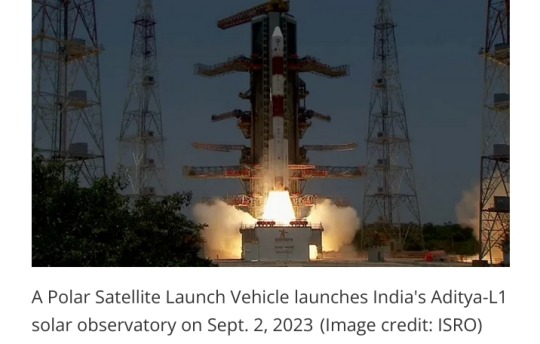
Fresh off its success at the moon, India is now headed for the sun.
The nation launched its first-ever solar observatory today (Sept. 2), sending the Aditya-L1 probe skyward atop a Polar Satellite Launch Vehicle (PSLV) from Satish Dhawan Space Centre at 2:20 a.m. EDT (0620 GMT; 11:50 a.m. local India time).
The PSLV deployed Aditya-L1 into low Earth orbit (LEO) as planned about 63 minutes after liftoff, sparking applause and high fives in mission control.
"Congratulations, India, and congratulations, ISRO [the Indian Space Research Organisation]," Jitendra Singh, India's Minister of State for Science and Technology, said shortly after deployment on ISRO's launch webcast.
"While the whole world watched this with bated breath, it is indeed a sunshine moment for India," Singh added.
The successful launch followed on the heels of another big milestone for India: On August 23, its Chandrayaan-3 mission became the first to land softly near the moon's south pole.
Chandrayaan-3's lander-rover duo are expected to conk out in a week or so, when the harsh lunar night falls at their touchdown site. But Aditya-L1's long journey has just begun.
A long road to a good sun-viewing spot
Aditya-L1 won't stay in LEO forever:
After a series of checkouts, it will use its onboard propulsion system to head toward Earth-sun Lagrange Point 1 (L1), a gravitationally stable spot about 1 million miles (1.5 million kilometers) from our planet in the direction of the sun.
That destination explains the latter part of the mission's name. And the first part is simple enough: "Aditya" translates to "sun" in Sanskrit.
The 3,260-pound (1,480 kilograms) observatory will arrive at L1 about four months from now, if all goes according to plan.
But the long trek will be worth it, according to the ISRO.
"A satellite placed in the halo orbit around the L1 point has the major advantage of continuously viewing the sun without any occultation/eclipses," ISRO officials wrote in an Aditya-L1 mission description.
"This will provide a greater advantage of observing the solar activities and its effect on space weather in real time."
Indeed, another sun-studying spacecraft is already at L1 — the Solar and Heliospheric Observatory (SOHO), a joint NASA-European Space Agency mission that launched in December 1995.
(Several other spacecraft, including NASA's James Webb Space Telescope, are at Earth-sun Lagrange Point 2, which is a million miles from Earth, in the direction away from the sun.)

Solar flares, the coronal heating mystery and more
Once it's settled in at L1, the solar probe will use four three science instruments to study the particles and magnetic fields in its immediate surroundings and four others to scrutinize the sun's surface (known as the photosphere) and its atmosphere.
This work will help scientists better understand solar activity, including the dynamics of solar flares and coronal mass ejections (CMEs), ISRO officials say.
Flares are powerful flashes of high-energy radiation, and CMEs are huge eruptions of solar plasma.
Both types of outburst can affect us here on Earth. Intense CMEs that hit our planet, for example, trigger geomagnetic storms that can disrupt satellite navigation and power grids.
(As a side benefit, such storms also supercharge the gorgeous light shows known as auroras.)
Aditya-L1 will also tackle the "coronal heating problem," one of the biggest mysteries in heliophysics.
The corona — the sun's wispy outer atmosphere — is incredibly hot, reaching temperatures around 2 million degrees Fahrenheit (1.1 million degrees Celsius), according to NASA.
That's about 200 times hotter than the solar surface, which is "only" 10,000 degrees F (5,500 degrees C) or so.
It's still unclear what is responsible for this startling and counterintuitive discrepancy.
(Why would it be hotter away from the sun's core, where the energy-producing nuclear fusion reactions are occurring?)
Aditya-L1 has other science goals as well. For instance, the mission also aims to more fully flesh out the solar wind, the stream of charged particles flowing constantly from the sun, ISRO officials said.
Aditya-L1 will measure the composition of the solar wind and attempt to determine how it is accelerated.
And Aditya-L1 will do all this work on the cheap:
The mission's price tag is about 3.8 billion rupees, or $46 million US at current exchange rates.
That's in the same ballpark as Chandrayaan-3
India's first successful moon-landing mission costs about 6.15 billion rupees, or $74 million US.
For comparison, NASA's most recent big-ticket sun mission, the record-setting Parker Solar Probe, costs roughly $1.5 billion.
This disparity should not be viewed as an indictment of NASA, however; labor costs are much higher in the United States than in India, among other differences between the two nations' economies.
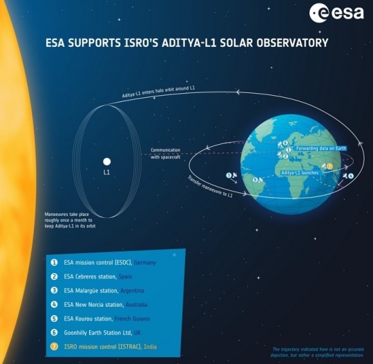
Aditya-L1 is a coronagraphy spacecraft to study the solar atmosphere, designed and developed by the Indian Space Research Organisation (ISRO) and various other Indian research institutes.
#India#Aditya-L1#Polar Satellite Launch Vehicle (PSLV)#Satish Dhawan Space Centre#low Earth orbit (LEO)#sun#Indian Space Research Organisation#Chandrayaan-3#Earth-sun Lagrange Point 1 (L1)#Solar and Heliospheric Observatory (SOHO)#solar flares#coronal mass ejections (CMEs)#coronal heating problem#heliophysics#solar wind#Parker Solar Probe#NASA#solar observatory#solar atmosphere
13 notes
·
View notes
Text
"The ISS is getting old and the wear and tear of being in space has taken its toll. Significantly, its retirement will make way for the commercial utilization of low Earth orbit, with private companies designing their own space stations to take over once the ISS is gone."
[italics for emphasis]
This is a terrible thing. Why do we never learn?
#not good#international space station#commercial utilization of low Earth orbit should piss you off#How are those deep sea subs going for private companies?#It's already terrible how reliant we are on private companies for satellites
0 notes
Text
LEO Satellites - How do they stay in orbit ?
On a clear evening what appears as a slowly moving trail of light could be starlink satellites. You might wonder who turned the lights on in them ?
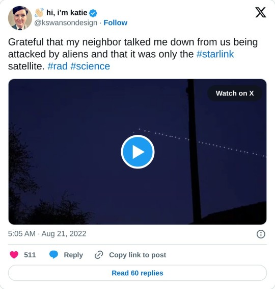
These are starlink satellites that are placed in the Low Earth Orbit - around 200-800 Km from the earth's surface. This is very close to earth for an orbiting satellite. In fact the gravity experienced by these satellites would be almost the same as the gravity experienced at earth's surface.
To understand how they manage to be in orbit, let us to do a thought experiment. Say you throw a stone across a pond. the higher the force that you impart on it, the longer the distance it travels. Now imagine that you manage to impart a force so strong, that it travels the entire earth and comes around to hit you on the head. Well, that is what is happening with these satellites at around 200km above the earth's surface.

There are two major forces that are acting on such a rock that is orbiting around the earth - the gravity and the centrifugal force. While the gravity tries to pull the rock towards the earth the centrifugal force acts on the opposite direction counteracting it.
To understand centrifugal force, let us go back to the childhood play thing of the spinning disk and a post or a devil's wheel of Oktober fest.
youtube
The centrifugal force is the force that is pushing you outward from the spinning disk. The farther from the center, the bigger the force. The centrifugal force can also be increased by increasing the velocity. Thus, for an object to be at orbit without falling, it has to be as far as possible from the earth's surface, and/or have a higher velocity while revolving around the earth.
For an object to be in LEO, it must be travelling at around 7.8 km/s depending on the altitude. And these satellites revolve around the earth around 12-16 times a day, depending on the altitude.
Unlike geo-synchronous (GEO) satellites that are at an altitude of 36000 Kms and are stationary with respect to earth, these satellites move with respect to earth. Hence they need lots of satellites to cover the entire earth and they could need base stations to hand over signals. They also suffer from doppler, which must be corrected as well.
Though the air is less dense at 200km, LEO satellites still face significant air resistance, and they lose their altitude. To correct this they use rockets to boost their altitude three to four times a year. They are powered by solar energy with battery backup.
The International Space Station is also at a Low Earth Orbit, enabling faster and cheaper travel between the space station and the earth. Since the centripetal force and the gravity are equalized, the astronauts at the space station feel weightlessness or zero gravity.

The Starlink satellites reflect the sun, and hence they appear to shine, sparkle and shimmer!
0 notes
Text
The Largest Satellites of Earth 🛰
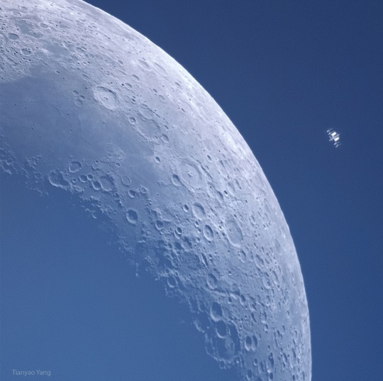
What's that near the Moon? It' the International Space Station (ISS). Although the ISS may appear to be physically near the Moon, it is not ? it is physically near the Earth. In low Earth orbit and circulating around our big blue marble about every 90 minutes, the ISS was captured photographically as it crossed nearly in front of the Moon. The Moon, itself in a month-long orbit around the Earth, shows a crescent phase as only a curving sliver of its Sun-illuminated half is visible from the Earth. The featured image was taken in late March from Shanghai, China and shows not only details of Earth's largest human-made satellite, but details of the cratered and barren surface of Earth's largest natural satellite. Over the next few years, humanity is planning to send more people and machines to the Moon than ever before.
Image Credit & Copyright: Tianyao Yang
#2023#your friendly neighborhood space nerd#space#nasa#earth#moon#satellite#iss#international space station#low earth orbit#astronomy
1 note
·
View note
Text
All-Star Moments in Space Communications and Navigation
How do we get information from missions exploring the cosmos back to humans on Earth? Our space communications and navigation networks – the Near Space Network and the Deep Space Network – bring back science and exploration data daily.
Here are a few of our favorite moments from 2024.
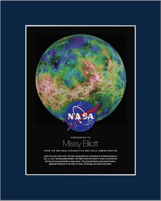
1. Hip-Hop to Deep Space
The stars above and on Earth aligned as lyrics from the song “The Rain (Supa Dupa Fly)” by hip-hop artist Missy Elliott were beamed to Venus via NASA’s Deep Space Network. Using a 34-meter (112-foot) wide Deep Space Station 13 (DSS-13) radio dish antenna, located at the network’s Goldstone Deep Space Communications Complex in California, the song was sent at 10:05 a.m. PDT on Friday, July 12 and traveled about 158 million miles from Earth to Venus — the artist’s favorite planet. Coincidentally, the DSS-13 that sent the transmission is also nicknamed Venus!

NASA's PACE mission transmitting data to Earth through NASA's Near Space Network.
2. Lemme Upgrade You
Our Near Space Network, which supports communications for space-based missions within 1.2 million miles of Earth, is constantly enhancing its capabilities to support science and exploration missions. Last year, the network implemented DTN (Delay/Disruption Tolerant Networking), which provides robust protection of data traveling from extreme distances. NASA’s PACE (Plankton, Aerosol, Cloud, ocean Ecosystem) mission is the first operational science mission to leverage the network’s DTN capabilities. Since PACE’s launch, over 17 million bundles of data have been transmitted by the satellite and received by the network’s ground station.
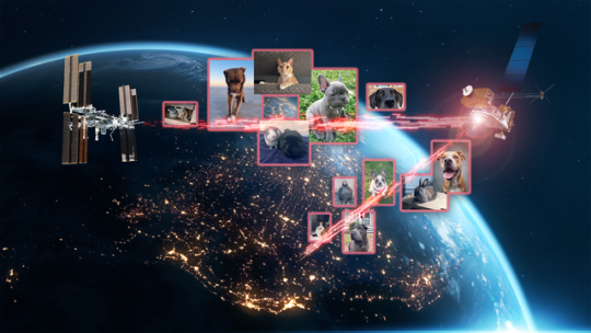
A collage of the pet photos sent over laser links from Earth to LCRD and finally to ILLUMA-T (Integrated LCRD Low Earth Orbit User Modem and Amplifier Terminal) on the International Space Station. Animals submitted include cats, dogs, birds, chickens, cows, snakes, and pigs.
3. Who Doesn’t Love Pets?
Last year, we transmitted hundreds of pet photos and videos to the International Space Station, showcasing how laser communications can send more data at once than traditional methods. Imagery of cherished pets gathered from NASA astronauts and agency employees flowed from the mission ops center to the optical ground stations and then to the in-space Laser Communications Relay Demonstration (LCRD), which relayed the signal to a payload on the space station. This activity demonstrated how laser communications and high-rate DTN can benefit human spaceflight missions.

4K video footage was routed from the PC-12 aircraft to an optical ground station in Cleveland. From there, it was sent over an Earth-based network to NASA’s White Sands Test Facility in Las Cruces, New Mexico. The signals were then sent to NASA’s Laser Communications Relay Demonstration spacecraft and relayed to the ILLUMA-T payload on the International Space Station.
4. Now Streaming
A team of engineers transmitted 4K video footage from an aircraft to the International Space Station and back using laser communication signals. Historically, we have relied on radio waves to send information to and from space. Laser communications use infrared light to transmit 10 to 100 times more data than radio frequency systems. The flight tests were part of an agency initiative to stream high-bandwidth video and other data from deep space, enabling future human missions beyond low-Earth orbit.
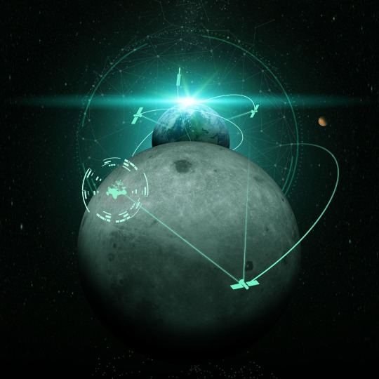
The Near Space Network provides missions within 1.2 million miles of Earth with communications and navigation services.
5. New Year, New Relationships
At the very end of 2024, the Near Space Network announced multiple contract awards to enhance the network’s services portfolio. The network, which uses a blend of government and commercial assets to get data to and from spacecraft, will be able to support more missions observing our Earth and exploring the cosmos. These commercial assets, alongside the existing network, will also play a critical role in our Artemis campaign, which calls for long-term exploration of the Moon.
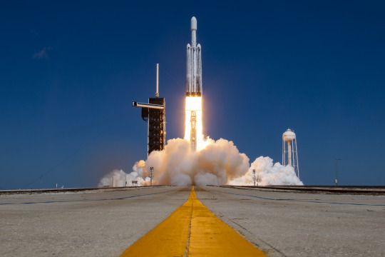
On Monday, Oct. 14, 2024, at 12:06 p.m. EDT, a SpaceX Falcon Heavy rocket carrying NASA’s Europa Clipper spacecraft lifts off from Launch Complex 39A at NASA’s Kennedy Space Center in Florida.
6. 3, 2, 1, Blast Off!
Together, the Near Space Network and the Deep Space Network supported the launch of Europa Clipper. The Near Space Network provided communications and navigation services to SpaceX’s Falcon Heavy rocket, which launched this Jupiter-bound mission into space! After vehicle separation, the Deep Space Network acquired Europa Clipper’s signal and began full mission support. This is another example of how these networks work together seamlessly to ensure critical mission success.
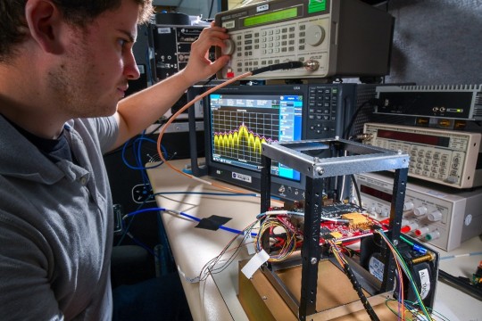
Engineer Adam Gannon works on the development of Cognitive Engine-1 in the Cognitive Communications Lab at NASA’s Glenn Research Center.
7. Make Way for Next-Gen Tech
Our Technology Education Satellite program organizes collaborative missions that pair university students with researchers to evaluate how new technologies work on small satellites, also known as CubeSats. In 2024, cognitive communications technology, designed to enable autonomous space communications systems, was successfully tested in space on the Technology Educational Satellite 11 mission. Autonomous systems use technology reactive to their environment to implement updates during a spaceflight mission without needing human interaction post-launch.
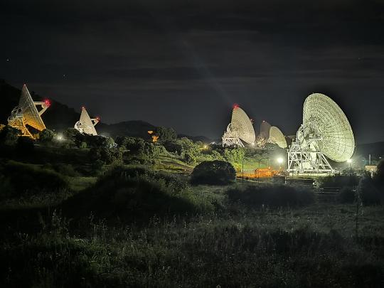
A first: All six radio frequency antennas at the Madrid Deep Space Communication Complex, part of NASA’s Deep Space Network (DSN), carried out a test to receive data from the agency’s Voyager 1 spacecraft at the same time.
8. Six Are Better Than One
On April 20, 2024, all six radio frequency antennas at the Madrid Deep Space Communication Complex, part of our Deep Space Network, carried out a test to receive data from the agency’s Voyager 1 spacecraft at the same time. Combining the antennas’ receiving power, or arraying, lets the network collect the very faint signals from faraway spacecraft.
Here’s to another year connecting Earth and space.
Make sure to follow us on Tumblr for your regular dose of space!
1K notes
·
View notes
Text
youtube
This video showcases my Blender model of the planet that the Scud aliens call home, the fourth and final world I've mapped out for @jayrockin's "Runaway to the Stars" project. A *lot* of maps were created in service of this final render, and also in service of presenting the special qualities of this planet. I intend to show you as many of these as I can under the cut, and also in subsequent posts focusing on some of the more interstitial, ancillary maps and figures that played a part in producing the primary maps you'll see in this main post.
Before I show the first maps I made for this project, what you see below are the satellite-style maps for the Equinoxes and Solstices, in order of (Northern) Spring, Summer, Fall, and Winter, the latter serving as the texture for the Blender object you saw in the video.


__________
With that matter covered, our next focus is this project's foundation: Geology. While I didn't spin as elaborate a tectonic history for this planet as I did for the Ayrum commission, I did work out as much detail as I could for the more recent geological activity, to set the stage for the elevation data - including a narrower focus on the coastal shallows that host the Scud populations.


__________
Once I could move on to climate, my first step was finding this planet's relative Insolation, which I managed thanks to @reversedumbrella's code and coaching. With an obliquity of only 16 degrees, this planet's yearly maximum Insolation levels stick close to the equator, compared to pole-to-pole oscillation we see on Earth

__________
Having a rough sense of where heat would concentrate seasonally and how the landmasses would deflect water in light of the planet's retrograde spin, I was able to set down the bi-annual ocean currents (Northern Summer above and Northern Winter below), then the monthly water temperatures pushed around by said currents, and finally -after factoring in many other considerations- the monthly land temperatures as well (combined in the second gif)


__________
Next came the seasonal air pressure maps and subsequent wind patterns (my first time creating those from scratch), which later factored into the precipitation maps. The incredible temperatures at the largest continent's interior make a desert of most of it, and the other interiors are fairly dry too, but all that heat on the equatorial ocean generates a *lot* of evaporation which ends up coming down elsewhere.


__________
With temperatures and precipitation mapped out for each month, I was able to find how the accumulation and melt of ice and snow played out, too. Given such a hot equator it's surprising to see freezing temperatures hold out in some places, but low obliquity and high elevation shield what areas they can, it seems.


__________
All this monthly data was then painstakingly combined and compared and plugged into equations to produce maps of discrete climate zones, using both the Köppen (left) and Trewartha (right) classification systems. The higher latitudes see some overlap with Earth's conditions, but the Tropics...


__________
I never really finished the map I wanted to make with my own loosely customized classification system, but I *did* get as far as this breakdown of the areas that sometimes surpass 56.7 degrees Celsius, Earth's record for highest surface temperature ever directly measured. And as you can see, that earthly record is broken by a *significant* fraction of this planet's surface, and far exceeded by the equatorial continent's deep interior

__________
The final phase of this project dealt with creating satellite maps of this planet's surface (which you saw at the top of this post), which started with a map of dry and submerged substrate, then a density map of the vegetation that sits atop it, then the colors of that vegetation under annual average conditions (demonstrating how they would appear in-person, rather than the area's appearance from orbit), and finally plant colors under seasonal conditions (same conceit as previous). In concert with the seasonal ice and snow maps, it was the four maps in the last sequence which were overlaid on the Substrate map, using the plant density map as raster masks, to produce the final Satellite-Style maps.


__________
This planet's sophonts being a marine species, it was then worth focusing on the conditions underwater, which included monthly seafloor temperatures (first gif), annual discharge of sediment from rivers (magenta in the 2nd gif), and seasonal upwelling of nutrients from deeper water (blue in the 2nd gif).


The creation of all my maps seen in this post was possible thanks to Photopea, which has been my go-to for several years now. The resolution kinda got crunched when I uploaded these here, so when I share them on Reddit later I'll add those links under this. These have also already been posted on Twitter, which you can see here if you like. Thanks for scrolling all the way down here!
#digital painting#Photopea#digital 3d#Blender#mapmaking#imaginary maps#Runaway to the Stars#Rtts Scuds#speculative planetology#speculative geology#speculative climatology#alien planet#major post#commission#christopher maida artwork#Youtube
742 notes
·
View notes
Text
So, Laika. I see people talking about her recently because it's been 67 years...
But I want to clear up some things:
1. She died for political reasons
2. They did not know how to bring her back.
3. If they'd planned to bring her back, it wouldn't have worked.
To explain: Laika was in Sputnik 2. The launch window for Sputnik 2 was chosen so it'd be the 40th anniversary of the October Revolution, which meant the rocket designers had less than four weeks to design the rocket & capsule. Politicians wanting to have a good PR of a cool space rocket story also influenced the Challenger disaster: politicians always want results faster, and space does not respect haste.
Secondly, this was the SECOND ARTIFICIAL SATELLITE EVER. No one in the world knew how to safely return anything to earth, so from the moment launching a dog was chosen, it was always going to be a one way trip. They tried to make it as comfortable as possible for the dog, yes, but they knew if they launched anything it wouldn't come back. They didn't even know if she'd survive in space? Can animals live in the low-gravity high-radiation environment of space? We didn't know if it was even possible before Laika!
Thirdly: if they had planned to bring her back, it wouldn't have worked. They planned for her to have seven days of food, and the last days of food was poisoned. She'd be gently euthanized.
It didn't work. The rocket core didn't properly detach from the capsule, which fucked the thermal regulation. The capsule overheated, and she died within 5-7 hours of the launch.
If they'd planned some elaborate untested return system, it would have activated after the seven days of the planned orbits. Laika would have been long dead by then.
My point is not to say they did nothing wrong (even one of the scientists who designed Sputnik 2 has said it wasn't worth it: they didn't learn anything useful from sending Laika up), but that you shouldn't misunderstand the context. This was a highly experimental launch, it was politically motivated, and even if they'd tried to bring Laika back, she'd have ended up dead.
And the scientists knew that last bit was likely the case when they decided to do this! They knew they didn't know how to bring animals back to the earth, so they didn't try. If they'd tried, the same result would mostly happen: a dead dog in space.
It wasn't just a matter of "not caring" about her life. They thought this could be a useful contribution to science, the first animal in space... They were wrong. And they were always regretful that Laika died for science, especially since they got so little from it.
All future launches with animals were designed to be returned to earth, and those helped pave the way for humans in space. Dogs were used to to test the Vostok spacecraft that later carried Yuri Gagarin to orbit, making him the first man in space.
My point is that they were never uncaring of the safety of Laika: they thought this was the best of a bad situation and then it got worse. This experiment was not repeated and Laika was mourned. If you need to blame anyone, blame Khrushchev.
479 notes
·
View notes
Text
Before we get into black holes, there are a few myths about them that deserve to be addressed.
First off, they don’t “suck stuff in.” They exert gravity on objects the same as anything else with mass. In fact, if our sun were to be magically replaced, instantly, with a black hole of equal mass, our orbit around it wouldn’t change at all!
Second, that they’re black because their gravitational pull is so large that not even light can escape. This one’s more complicated. Around the singularity, there is a region of space where an observer cannot see “in”, which is called the event horizon. If you’re curious, this region’s size is defined by the black hole’s “Schwarzchild Radius” (Rs), which is defined by the equation Rs = 2GM / (c^2) where G is the gravitational constant, M is the mass of the black hole, and c is the speed of light.
In simple terms, let’s say we send an astronaut into the black hole. As they approach the event horizon, they experience time passing normally. From their perspective, they fall toward the black hole, through the event horizon, and observe whatever is happening beyond it. But from our perspective as an observer, the astronaut appears to slow down. Gravity affects spacetime, and the farther down a gravity well one goes, the slower time moves. This is actually something that GPS satellites need to account for, because this difference is observably present even for Earth’s gravity!
So as observers, the astronaut’s progress continues to slow as they approach the event horizon, to the point that their progress appears to just stop when they arrive at the edge of it. This is where the astronaut will appear to be, forever…if we could still see them. Light is also affected: it appears to slow down too and its frequency decreases. This decrease of its frequency is called redshift, and as the light approaches the event horizon it redshifts out of observable frequencies. So the astronaut, and the light with which we’d observe them, disappear without ever passing the event horizon from our perspective as observers. Remember, from the astronaut’s perspective they’re moving as normal and they pass through the event horizon just fine. So while, yes light can’t escape the event horizon, we’d never see it pass into it in the first place, and that’s why black holes appear black.
The last misconception, which I’m guilty of spreading in my last post, is that all black holes are infinitely dense. This is true in some cases, but supermassive black holes can actually have very low density! When I can find a satisfying answer as to why, I will be sure to share it lol.
This has become another one of my Very Long Posts, so if you would rather absorb this information in video or audio format, PBS Space Time has an excellent video here which I found very helpful in my understanding. All the material I’ve covered in this post is in this video, actually.
2K notes
·
View notes
Text
Connecting the World: Telecommunications Satellites Enhance Global Communication Networks

In an increasingly interconnected world, the role of telecommunications has never been more critical. The rapid growth of digital communication technologies has significantly transformed the way we live, work, and interact with one another. At the heart of this transformation lies a technology that orbits high above us – telecommunications satellites. These sophisticated machines play a pivotal role in bridging gaps across continents, bringing people closer, and enabling the seamless exchange of information on a global scale.
Telecommunications satellites are the backbone of modern communication networks. These satellites are designed to transmit signals across vast distances, overcoming the limitations of terrestrial infrastructure. By relaying signals from one point on the Earth's surface to another, they enable instant communication, regardless of geographical barriers. This capability has revolutionized various sectors, from media broadcasting to internet services, emergency communications, and more.
The Evolution of Telecommunications Satellites
The journey of telecommunications satellites began in the mid-20th century. Early experiments with satellite communication laid the groundwork for what would become a global network. The launch of the first artificial satellite, Sputnik, in 1957 marked the dawn of the space age. However, it wasn't until the launch of the first geostationary satellite in 1965 that the true potential of satellite communication was realized. This satellite, positioned in a fixed location relative to the Earth's surface, could provide continuous coverage to a specific region, paving the way for real-time communication across the globe.
Since then, telecommunications satellites have evolved dramatically. Advances in technology have led to the development of more sophisticated satellites with greater capacity, reliability, and efficiency. Modern satellites are equipped with high-powered transponders, enabling them to handle large volumes of data transmission. These advancements have expanded the capabilities of satellite communication, making it an indispensable part of the global communication network.
How Telecommunications Satellites Work
The operation of telecommunications satellites is based on the principles of radio frequency transmission. These satellites receive signals from ground-based stations, amplify them, and retransmit them back to other ground stations. The process involves several key components:
Uplink: The transmission of signals from a ground station to the satellite. This is typically done using high-frequency radio waves.
Transponder: The component within the satellite that receives the uplink signal, amplifies it, and changes its frequency for retransmission.
Downlink: The transmission of signals from the satellite back to a ground station. This completes the communication loop, allowing the original signal to reach its intended destination.
Satellites are positioned in different orbits depending on their specific functions. Geostationary satellites, which orbit at approximately 35,786 kilometers above the equator, provide continuous coverage to specific regions. Low Earth orbit (LEO) satellites, positioned much closer to the Earth's surface, offer lower latency and are often used for services requiring real-time data transmission, such as internet connectivity.
Impact on Global Communication Networks
The impact of telecommunications satellites on global communication networks is profound. They have enabled a level of connectivity that was previously unimaginable, facilitating the seamless exchange of information across vast distances. Here are some key areas where their impact is most evident:
Media and Broadcasting
Telecommunications satellites have revolutionized the media and broadcasting industry. They enable the transmission of television and radio signals to remote and underserved areas, ensuring that people worldwide have access to information and entertainment. Live broadcasts of major events, such as sports competitions and political speeches, are made possible through satellite technology, allowing audiences to experience these moments in real time.
Internet Connectivity
In many parts of the world, terrestrial internet infrastructure is either insufficient or nonexistent. Telecommunications satellites provide a vital solution to this problem by offering internet connectivity to remote and rural areas. Satellite internet services have become increasingly popular, providing reliable and high-speed internet access to communities that were previously disconnected.
Emergency Communications
During natural disasters and emergencies, terrestrial communication networks are often disrupted. Telecommunications satellites play a crucial role in providing emergency communication services, ensuring that rescue and relief operations can be coordinated effectively. Satellite phones and portable satellite communication devices are essential tools for first responders and humanitarian organizations, enabling them to maintain communication in even the most challenging conditions.
Global Navigation Systems
Telecommunications satellites are also integral to global navigation systems. They provide the precise timing and positioning data required for navigation and location-based services. These systems are essential for various applications, including aviation, maritime, and land transportation, as well as for personal navigation devices used by millions of people worldwide.
Future Trends and Developments
The field of telecommunications satellites is continually evolving, driven by advancements in technology and increasing demand for connectivity. Several trends and developments are shaping the future of this industry:
High Throughput Satellites (HTS)
High throughput satellites represent a significant advancement in satellite technology. These satellites offer substantially increased data transmission capacity, enabling faster and more reliable communication services. HTS technology is particularly beneficial for providing broadband internet access to remote and underserved areas, helping to bridge the digital divide.
Constellations of LEO Satellites
One of the most exciting developments in satellite communication is the deployment of constellations of low Earth orbit satellites. These constellations consist of hundreds or even thousands of small satellites working together to provide global coverage. LEO constellations offer lower latency and higher data transfer rates compared to traditional geostationary satellites, making them ideal for applications such as internet of things (IoT) connectivity and real-time data services.
Advances in Satellite Manufacturing
Advances in satellite manufacturing are making it possible to produce smaller, more cost-effective satellites. These miniaturized satellites, often referred to as smallsats or cubesats, can be launched in large numbers, providing flexible and scalable communication solutions. The reduced cost of manufacturing and launching these satellites is driving innovation and enabling new players to enter the market.
Integration with Terrestrial Networks
The integration of satellite communication with terrestrial networks is another key trend. Hybrid networks that combine satellite and terrestrial technologies can offer seamless connectivity, ensuring that users have access to reliable communication services regardless of their location. This integration is particularly important for providing consistent internet coverage in areas with challenging terrain or sparse infrastructure.
Challenges and Considerations
While telecommunications satellites offer numerous benefits, there are also challenges and considerations to address. One of the primary challenges is the cost associated with launching and maintaining satellites. The development, launch, and operation of satellites require significant investment, which can be a barrier for some organizations.
Additionally, the increasing number of satellites in orbit raises concerns about space debris and collision risks. Ensuring the long-term sustainability of space activities requires careful management of satellite operations and the implementation of measures to mitigate the risk of space debris.
Conclusion
Telecommunications satellites have fundamentally transformed global communication networks, enabling instant connectivity and information exchange across vast distances. From media broadcasting and internet connectivity to emergency communications and global navigation, the impact of these satellites is far-reaching and profound.
As technology continues to advance, the future of telecommunications satellites looks promising. High throughput satellites, LEO constellations, and advancements in satellite manufacturing are set to further enhance the capabilities of satellite communication. By overcoming challenges and embracing innovation, telecommunications satellites will continue to play a crucial role in connecting the world, bridging gaps, and enabling a more connected and informed global community.
In a world where connectivity is essential, telecommunications satellites stand as a testament to human ingenuity and the relentless pursuit of progress. They embody the spirit of exploration and innovation, bringing people closer together and fostering a sense of global unity. As we look to the future, the continued evolution of telecommunications satellites promises to unlock new possibilities and drive the next wave of communication advancements.
196 notes
·
View notes
Text

Metallic balloon satellite inflation test at Langley Research Center, part of the Project Echo that sent the eye-catching spheres, made of ultra-thin mylar sandwiched between even thinner layers of aluminum foil, into low Earth orbit as passive reflectors of microwave transmissions.
207 notes
·
View notes
Text
DID EARTH JUST GET A SECOND MOON??
Blog#439
Wednesday, September 25th, 2024.
Welcome back,
This month, Earth will grab itself a second moon in the form of the tiny asteroid 2024 PT5.
Unlike the moon, Earth's primary companion which has accompanied our planet for around 4 billion years, this "new mini-moon" will stick around for just two months before it heads back to its home in an asteroid belt trailing our planet and orbiting the sun.
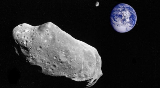
A team of scientists well-versed in the study of so-called "mini-moon events " identified the forthcoming gravitational capture event. They spotted the peculiar dynamic properties of 2024 PT5 as they routinely monitored newly discovered objects for potentially interesting behavior.
"The object that is going to pay us a visit belongs to the Arjuna asteroid belt, a secondary asteroid belt made of space rocks that follow orbits very similar to that of Earth at an average distance to the sun of about 93 million miles (150 million kilometers), research lead author and Universidad Complutense de Madrid professor Carlos de la Fuente Marcos told Space.com.
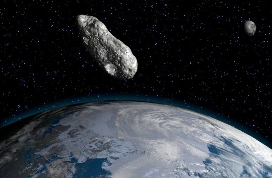
"Objects in the Arjuna asteroid belt are part of the near-Earth object population of asteroids and comets."
Marcos explained that some of these objects in the Arjuna asteroid belt can approach Earth at a close range of around 2.8 million miles (4.5 million km) and at low velocities of around 2,200 miles per hour (3,540 km/h).
"Under these conditions, the geocentric energy of the object may grow negative, and the object may become a temporary moon of Earth. This particular object will undergo this process starting next week and for about two months," he added. "It will not follow a full orbit around Earth.
"You may say that if a true satellite is like a customer buying goods inside a store, objects like 2024 PT5 are window shoppers."
Mini-moon events come in two flavors. The first are long episodes during which the asteroid completes one or more revolutions about our planet, with these gravitational engagements lasting one or more years.

The second type of episodes are short engagements in which the small body does not complete one full revolution. These temporary captures can last just days, weeks or even a few months.
Marcos explained that in order to become a mini-moon, an incoming body has to approach Earth at a close range of around 2.8 million miles (4.5 million km) and slowly at about 2,200 mph (3,540 km/h).
Originally published on https://www.space.com
COMING UP!!
(Saturday, September 28th, 2024)
"CAN SUPERMASSIVE BLACK HOLES MERGE??"
#astronomy#outer space#alternate universe#astrophysics#universe#spacecraft#white universe#space#parallel universe#astrophotography
71 notes
·
View notes
Photo

2024 August 17
Sky Full of Arcs Image Credit & Copyright: Rory Gannaway
Explanation: On August 11 a Rocket Lab Electron rocket launched from a rotating planet. With a small satellite on board its mission was dubbed A Sky Full of SARs (Synthetic Aperture Radar satellites), departing for low Earth orbit from Mahia Peninsula on New Zealand's north island. The fiery trace of the Electron's graceful launch arc is toward the east in this southern sea and skyscape, a composite of 50 consecutive frames taken over 2.5 hours. Fixed to a tripod, the camera was pointing directly at the South Celestial Pole, the extension of planet Earth's axis of rotation in to space. But no bright star marks that location in the southern hemisphere's night sky. Still, the South Celestial Pole is easy to spot. It lies at the center of the concentric star trail arcs that fill the skyward field of view.
∞ Source: apod.nasa.gov/apod/ap240817.html
119 notes
·
View notes
Text
Snow Moon - February 23-24, 2024

Boots and mittens on, witches - it's time for the Snow Moon!
Snow Moon
The Snow Moon is the name given to the full moon which occurs during the month of February. Despite what certain groundhogs will tell you, February is the month that sees the highest rates of snowfall across much of North America, according to the National Weather Service, and many alternative names for the moon and the month in which it falls reflect this.
As with many full moon names, we find the roots of the Snow Moon among the indigenous peoples of North America. In this particular case, a colonist explorer noted in 1760 that the Naudowessie (Dakota) people called this month Snow Moon specifically due to the tendency for snowstorms to come during that month. Some other indigenous names for this moon and month refer to commonly-sighted animals. Some examples include Eagle Moon (Cree), Bear Moon (Ojibwe), Groundhog Moon (Algonquin), and Goose Moon (Haida). Another notable example is Hungry Moon (Cherokee), denoting the scarcity of available food in deep winter.
The Snow Moon this year is what is known as a "micromoon" - basically the opposite of a supermoon. Where a supermoon brings our beloved satellite closer to Earth, at the perigree (or zenith) of its' elliptical orbit, a micromoon is at the apogee (or nadir), placing the moon at a point comparatively farther away. The moon will be at peak illumination at 7:30am EST on February 24th, meaning the moon may appear to be full on the 23rd and the 24th, depending on where you live.
What Does It Mean For Witches?
February is a month of change and transition. Though winter still holds on, many places may be showing early signs of spring. Little buds may be coming out on the trees, certain species of birds are beginning to migrate back, and hibernating animals start to wake up and reappear.
As we begin to turn toward the end of our long winter's rest, it's a good time to think about how we prepare for oncoming change and how we care for ourselves and our practices during times of stagnation.
With the moon in apogee, we might also contemplate the concept of distance as it relates to our practices, be it keeping long-distance bonds fresh, doing things remotely either alone or as part of a larger group, or feeling distant from your craft or your deities. And yes, such things are normal and cyclical. Our inspiration and motivation wax and wane just as the moon does. If it feels like you've been far away from your craft for too long, perhaps it's time to bring it back into your orbit.
What Witchy Things Can We Do?
Gather fresh snow or icicles for moon water, or make your own moon ice by leaving a bowl of water out overnight to freeze, if the temperature drops low enough.
If it snows in your area, you can wish upon a snowball. Grab a handful of powdery snow, whisper your wish to it, and throw the whole thing up in the air to release the wish into the universe
With winter scarcity in mind, practice creating a minimalist spell as an exercise. Create a workable spell with as few components, words, movements, or ritual elements as possible. This is more of a challenge if you're used to using material components or rituals in your spellwork. Many witches cast spells with focused thought or energy work alone.
Explore the concept of self care as magic. Use your routines to create moments of rest and harmony, make a point of being kind to your body and your mind, and cultivate a more positive relationship with yourself - it's the only one guaranteed to last a lifetime.
Connect with your local biome by looking for any early signs of spring in your area. Feed the returning birds and identify the plant and animal species you see around you as they appear one by one.
Happy Snow Moon, witches! 🌕❄️
SOURCES & FURTHER READING:
Bree’s Lunar Calendar Series
Bree’s Secular Celebrations Series
Snow Moon: Full Moon in February 2024, The Old Farmer's Almanac.
Snow Moon: The Extraordinary Full Moon of February 2024, The Peculiar Brunette.
Moon Info - Full Moon Dates for 2024
Calendar-12 - 2024 Moon Phases
Everyday Moon Magic: Spells & Rituals for Abundant Living, Dorothy Morrison, Llewellyn Publications, 2004.
(If you’re enjoying my content, please feel free to drop a little something in the tip jar, check out my monthly show Hex Positive, and find my published works on Amazon or in the Willow Wings Witch Shop. 😊)
#witchcraft#witchblr#witch community#baby witch#witch tips#lunar magic#moon magic#full moon#snow moon#pagan#lunar calendar
201 notes
·
View notes