#Karaka Bay
Explore tagged Tumblr posts
Visit Tumblr Blog
Explore Tumblr blogs with no restrictions, modern design and the best experience.
Last Seen Tumblr Blogs


Fun Fact
Tumblr was acquired by Yahoo for $1.1B in 2013.
Text
Artist Model Work - Ann Shelton 'Public Places'


Ann Shelton's Public Places is a photo series that explores the hidden stories of important or tragic events in New Zealand cities. She takes pictures of everyday places, such as parks and streets, that have witnessed these events but don't show their history at first glance. By leaving people out of the photos, Shelton highlights what’s missing and encourages viewers to think about the forgotten stories in these places, helping us understand how we remember or forget certain parts of our past.
I believe I can draw from this becuase the certain places I have chosen to photograph all have a historical background to them whether it was purely just a memory of upbringing or something much larger.
Bastion Point - A site with historical importance - 506-day Māori land protest in 1977-1978. The Ngāti Whātua Ōrākei tribe peacefully protested the government's plan to develop the land, which led to the return of the land to the iwi and marked a pivotal moment in New Zealand’s land rights movement.
Churchill Park - The place I attend school and walked through my whole childhood
Glendowie Reserve -
Karaka Bay - Was the site of one of the signings of the Treaty of Waitangi. (a place I visit often).
Glover Park - Was once a swamp, until it was drained in the 1950's by the Auckland Council, and is situated on a volcanic 'explosion' crater (the park around the corner from where I live + a place family and friends go to often).
0 notes
Text
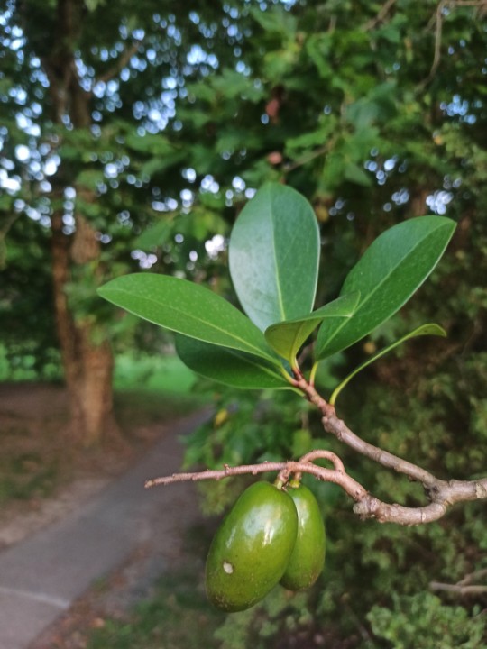
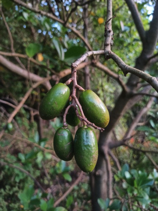
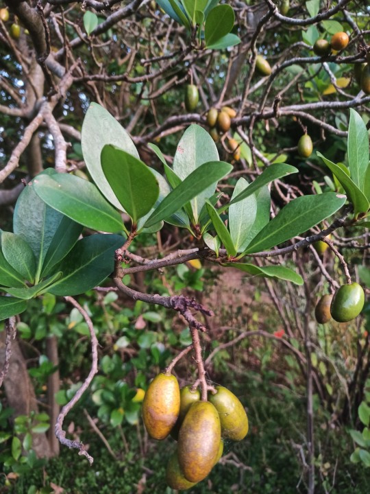

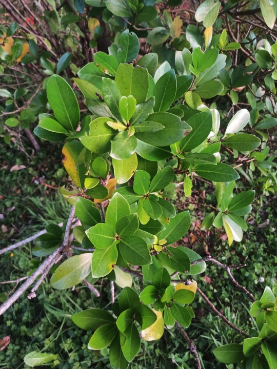


Karaka or New Zealand laurel (Corynocarpus laevigatus). NZ endemic. karaka in Māori language means colour orange.
Clade:Rosids
Order:Cucurbitales
Family:Corynocarpaceae
Genus:Corynocarpus
This evergreen tree is a popular place for smaller birds to sleep during the winter.
The ability to bear fruit in early summer (January) gives this plant an important ecological value, being a good food source for many species, especially birds, at a time when most other berries are not yet ripe.
Every autumn (March to May), pre-European Māori would collect the seeds dropped from the coastal karaka trees. The seeds would be placed in open-weave kete, washed in rivers to remove the outer pulp, afterwards baked and sun dried, a process that would remove toxicity from the seeds. Properly prepared karaka kernels would keep for 2–3 years.
The pulp of ripe fruit is edible, sweet and aromatic, but the fresh kernels contain the toxic alkaloid karakin.
Попробовал один плод. Оказывается, он весь - сплошная большая косточка с натянутой на неё мякотью толщиной миллиметра 3, так что, там мало что есть, некоторые плоды висят уже объеденными птицами косточками.
На вкус очень напоминает шиповник, такая же мясис��о пастообразная мякоть, даже толщина сьедобной части такая же, как у крупного шиповника. Только вкуса шиповника нет, вообще особо характерно уникального вкуса у нее нет, так что если это разновидность шиповника, не обладающего ярким характерным вкусом, что может встречаться как раз у крупного шиповника растущего на морском берегу, то эти плоды вполне можно принять за него.


Sherwood Reserve, North Shore, Browns Bay, Auckland 0630
7PMQ+52R Auckland
-36.7170250, 174.7375030
наземные цветковые растения фруктовые деревья эндемики съедобные
В конце концов к 16 февраля вся земля под деревом усыпана обьедеными косточками
0 notes
Text
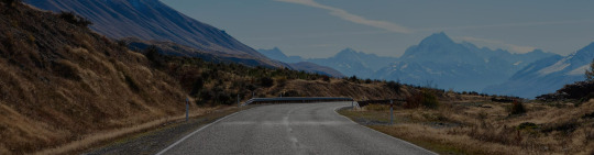
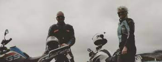
Best Routes and Motorcycle Rental in New Zealand
There are numerous picture-perfect roads in New Zealand that demand to be traveled. Although some could choose to do this via automobile, a motorcycle is unquestionably the finest option. You can rent a motorcycle from a motorcycle rental in New Zealand and go on an exhilarating and difficult ride. The routes you can enjoy by riding on them are listed below.
Loop from Auckland to Clevedon
Local motorcyclists often have favorable opinions of rural Auckland. This particular route is centered around South Auckland and provides unmatched vistas of the Waikato River on the North Island. The State Highway 1 portion of the Auckland to Clevedon Loop travels south before turning left at Karaka, crossing a bridge to reach Waiuku, and finally crossing over to State Highway 2 to enter the Hunua Ranges and complete the ideal loop into Clevedon.
Crossing the Southern Alps by bicycle
The majestic landscapes and picturesque roadways of New Zealand's South Island tend to make people fall in love with it. There are many ways to visit the region's alpine beauties, but a self-guided tour could be the best option if you want to make the most of the diverse landscapes on display. A hand-picked route by South Pacific Motorcycle Tours includes many mountain crossings and stops at local attractions like Queenstown, Milford Sound, and the West Coast. It is an eight-day GPS-guided journey that riders may explore at their own pace.
A loop in the Coromandel
Unquestionably, this is one of the most well-liked motorbike trips in New Zealand. Kiwis adore the Coromandel Loop's difficult, curving roads, which can be dangerous in some spots but are totally worth it if you want to test your driving prowess. The actual route is split into two sections, the 187.8-kilometer (117-mile) Northern Loop and the 129.7-kilometer (81-mile) Southern Loop, both of which offer quick access to the towns and attractions on the Coromandel Peninsula.
The Highway Along the Pacific
An excellent summer road trip that is well-liked by both motorists and motorcycle riders. Pacific Coast Highway on New Zealand's North Island runs from Auckland to Napier in Hawke's Bay, the country's epicenter of Art Deco. You'll see a lot of coastal jewels along the way, including the East Coast city of Gisborne, the Bay of Plenty region, and several charming beach communities on the Coromandel Peninsula.
Glenorchy to Queenstown
Drivers and bikers both adore a different option. This time, you'll be setting out from New Zealand's adventure epicenter directly into Lord of the Rings territory (Glenorchy, as you may know, served as a crucial setting for the creation of Isengard). Although the Queenstown to Glenorchy road is only 46 kilometers (29 miles) long, you should go slowly to really appreciate the surrounding landscape.
From Westport to Christchurch
A fantastic path for anyone looking to explore the TranzAlpine on two wheels. The Christchurch to Westport route travels from the eastern South Island shores to the wild landscapes of the West Coast subregion, much like the famous train journey; the main distinction is that the train arrives in Greymouth, while the road you'll be taking will take you a little bit higher up to the town of Westport via State Highway 7. Hanmer Springs, Lake Sumner Forest Park, and Nelson Lakes National Park are a few possible rest stops along the trip.
In summary, you can get a motorcycle from a motorcycle rental in New Zealand and enjoy your ride on lovely routes.
0 notes
Text
RNZ Pacific 1314 25 Feb 2023
7390Khz 1259 25 FEB 2023 - RNZ PACIFIC (NEW ZEALAND) in ENGLISH from RANGITAIKI. SINPO = 45333. English, s/on w/bellbird int. until pips and news @1300z anchored by Peter McIlwaine. River levels are dropping in Hawke's Bay and an evacuation order for Esk Valley has been lifted, after the region received less rain than forecast overnight, while a route is now open between Auckland and Northland. Gisborne, however, is now effectively cut off by road due to the closure of State Highway 2. Overnight rain caused some flooding near Te Karaka and while the Waipaoa River is receding, mud and silt is covering the road in a number of places. The road is closed between Matawai and Opotiki, which includes the Waioeka Gorge. Traffic south of Gisborne can only get as far as Wairoa and the coastal route to East Cape is closed in a number of places due to slips and damaged bridges. Beef and Lamb New Zealand is reminding farmers to be alert as cases of salmonella and leptospirosis rise in the wake of Cyclone Gabrielle. Leptospirosis lives in water and spikes of the disease are often seen after flood events, while bad weather can also increase the spread of salmonella. Nigerians are going to the polls for a crucial presidential vote that will see the country's next leader elected. The hotly contested poll is being held simultaneously with voting for representatives for the country's parliament. Polls opened in Nigeria on Saturday morning in what will be Africa's largest democratic exercise. Anthony Albanese made history on Saturday night when he became the first Australian prime minister to march in the Sydney Gay and Lesbian Mardi Gras. “It’s unfortunate that I am the first, but this is a celebration of modern Australia ... a diverse and inclusive Australia,” he said. “We need to be a country that respects everyone for who they are.” Sports. @1303z trailer for RNZ "Sunday Night Retro Show". @1304z Weather Forecast: heavy Rain Watch. Rain, heavy at times, easing to isolated showers by afternoon. @1306z "All Night Programme" anchored by Peter McIlwaine. Backyard fence antenna, Etón e1XM. 100kW, beamAz 35°, bearing 240°. Received at Plymouth, United States, 12912KM from transmitter at Rangitaiki. Local time: 0659.
0 notes
Text

Seahorse at Karaka Bay
2 notes
·
View notes
Text
Auckland’s lesser known gems
Auckland’s lesser known gems
During a decade in Auckland I explored a good proportion of it. Here are eighteen of it’s lesser known / visited gems…
Whites Beach An epic West Coast beach likely to be devoid of people as there is no road access. It’s reached via the Laird Thomson Track at the northern end of Piha, offer spectacular views of both beaches.


Connell’s Bay Sculpture Park A beautiful spot on the eastern end of
View On WordPress
#Auckland#Auckland gems#Auckland ideas#Auckland’s hidden gems#Awhitu Regional Park#Browns Island#Connell&039;s Bay Sculpture Park#Devonport Museum#Halls Beach#Hamlins Hill Mutukaroa Regional Park#Harbourview-Orangihina Park#Howick Historical Village#Karaka Bay#Kauri Glen Park#Mt Saint John#Pakuranga Rotary Shared Path#photography#Puhinui Reserve#Rose Hellaby&039;s House#Rotoroa Island#Sunnyhills Coastal Cycleway#Torpedo Bay Navy Museum#travel#Whites Beach#Ōtāhuhu / Mount Richmond
1 note
·
View note
Photo

always love an adventure karaka bay, nz • 15-11-17
2 notes
·
View notes
Text
Yesterday on the 9th of March 2021, at least 8 people were arrested in Auckland, New Zealand, as at least 30 police officers assisted developers onto a site, that had been kept at bay by protestors for months.
Mana Rakaū - Save Canal Road Native Trees, had been at the Avondale site on Canal Rd since July last year in protest of the removal of the grove of 100-year-old native trees. Initially there had been about 50 native trees including tōtara, kahikatea, karaka and pūriri, however initial development had removed at least half of them. Yesterday, the remaining trees were destroyed as police surrounded the perimeter to keep protestors at bay.
Kaitiaki Juressa Lee said the council had failed to listen to the community and its pleas to protect the trees.
"We're about to lose about 30 trees here today, significant trees, native trees, rare trees, trees that don't typically grow in Tāmaki Makaurau. Trees that are the longest growing, slowest growing trees in the world, trees that have significance to Te Ao Māori.”
It is terrible that native trees that are slow growing and are disappearing from our environment rapidly have been felled, especially individuals that were over 100 years old. It is terrible that the cultural and environmental significance to tangata whenua was ignored, and that their calls to protect their land were ignored. It is terrible that police dragged away protestors for a private developer.
If you want to learn more or support the on-going cause of Mana Rakaū - whether that be donate, follow updates, sign petitions or simply stay informed - you can do so here on their website.
Here they have a Facebook page, and here they have an Instagram page. If you’re willing, I imagine they could use some love and support after the events of yesterday.
#and if you say it was 'just a few trees' i will block you so fast#aotearoa#signal boost#important#environmental#maori#conservation#ecology
3K notes
·
View notes
Text
Great Barrier Oasis
On Thursday morning we woke up early and rushed to Wynyard Quarter to catch our ferry to Great Barrier Island. We chose the ferry instead of flights so we could bring our camping gear and food for the whole trip. The ferry was nothing like we envisioned. The majority of the open space was taken up by the carpark, with a single row of seats lining the port and starboard decks. We put on our sweaters and sat on the deck where we were able to enjoy the fresh air and get a tour of the Hauraki Gulf.
We arrived on Great Barrier Island just before 1 PM and picked up our rental car right from the port. From there, we went into the town of Tryphena to rent an additional fishing rod. The mulleted shopkeeper gave us a few tips of things to see on island and we quickly followed his advice. We went straight to the mermaid pools to check them out, but the tides weren’t right so we decided to drive the rest of the way to our campground.
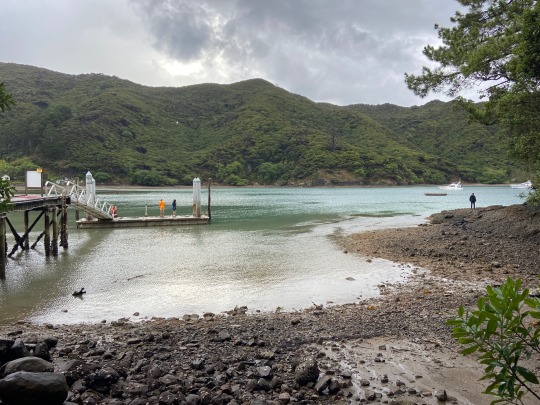
For the first two nights of our adventure we were staying towards the North end of the Island, near Port Fitzroy, at a place called Orama Oasis. The word oasis is often used as hyperbole, but this was the most accurate depiction of the word that I’ve ever experienced. Our campground was located on a patch of grass overlooking Karaka Bay. The grounds were filled with little villas, a rec center, a big shared kitchen, and private bathrooms with flushable toilets and hot showers. I could’ve stayed there for weeks.

After we toured the grounds, it started pouring. Greg and I unpacked the chilly bin and food in the kitchen while Aidan and David went rock fishing. There were several “work-ups” which is a swarm of birds eating small fish on the surface of the water. This is usually a good sign for fishing, as it means that there are likely a bunch of larger fish feeding below. We saw one of the locals urgently pull his tinney into the water and catch a fish within 4 minutes of getting into the water, on his first cast.
Aidan and David had similar luck. They came back with three snappers that were big enough to keep! We watched them show off their filleting skills and then quickly set up the tents while there was a break in the rain. Greg fired up the grill and made us some fresh fish burgers for dinner.

We came back to the campsite to find a puddle in my tent! After about twenty minutes of sopping up water, wringing out the towel, and wiping stuff down, the tent was finally habitable again. We were all tired from the long day and passed out pretty early.
On Friday we slept in a bit and went for a hunt along the grounds for kayaks we could rent. There were plenty of kayaks but, to our frustration, none of them were for hire. We decided to go into Port Fitzroy to explore, where we found a lonely port and a burger shop that sold coffee. Up the hill was a general store where the entertainment for the cashier and guests was a brand new Roomba. If the main islands of NZ are a decade behind the US, then GBI is at least 3 decades in the past.

From the store we spotted a sign for a trek with a waterfall and decided to have a go at it. Warrens Loop Track consisted of a path through the bush, canopied by kānuka trees filled in with silver ferns. We made it to a waterfall that was bigger than anticipated, followed the path down to a road, and then to a campground by Rarohara Bay. Greg ran into one of his frisbee friends from Auckland who we continued to encounter throughout the trip. We ate our lunches at the campsite and explored the coast and then went to Whangapoua Beach. The guys embraced their inner child and had a blast bodysurfing in the waves. We walked the length of the quiet beach and found a pool of mini hermit crabs and snails to observe.

Back at camp, the guys went rock fishing while I stayed back to read and relax. I watched a surreal picturesque sunset over the bay and then started to get nervous that the guys weren’t back yet. They had to climb over oyster-lined rocks to get back and the tide was rising. I donned my headlamp and went out to search for them. I didn’t have to go too far before I found them. Luckily they were all fine, but so much for my relaxation! At least they got a few keepers. We were able to make fish tacos with the fresh snapper that were delightful enough to change my mood.
David made us all G&Ts with his fancy new gin and we played too many rounds of President to count. There was much debate over the Kiwi vs. American rules of the game with some negotiation and a little compromise.
2 notes
·
View notes
Text
Wellington Thematic Study - in relation to Island Bay
“The Ngai Tara Pa formed a line along the ridgeline Te Ranga a Hiwi, extending from Omaru-kai-kuru (Point Jerningham) through Mount Victoria/Matairangi to Uruhau above Island Bay.” 18
“Many old Ngai Tara sites were abandoned for various reasons, particularly those that had been sacked and probably largely destroyed.” 18
The below image shows Uruhau and other archeological sites in Island Bay

Image: Wellington City Council. Island Bay Foreshore Archaeological Issues. 2005, p. 7.
Source of food: paua, fish, marine mammals like seal/kekeno, there would be small fishing camps in the bay. Wellington Harbour was less used than Southern coast pre-European as the Cook Strait was colder and therefore more plentiful. There were seasonal villages and permanent.
“Māori cleared forest and scrub in order to establish their settlements, pa, and gardens. Earthworks were minimal, largely being terraces to establish gardens, or flat places to live on sloping ground. Trees were removed in some areas to stimulate the growth of fern root/aruhe and in other areas for the growth of kumara, and later potatoes, melons, corn and then wheat. In later times, ridge tops cleared for gardens may well have been free of forest, with grasslands also being cleared and planted.” 24
“A sign that Māori pā and kāinga existed are the karaka groves which still dot the coastal areas of Wellington. The groves, or even individual trees, are a very important marker of past settlements” - Are there karaka groves in Island bay?
“The designation ‘fern ground’ can be seen in many places on early maps, showing where forest was cleared to encourage the growth of fern root.” - Are there fern grounds?
“The Māori system of gardening required areas used to grow crops to lie fallow after use for up to 9 years.” This is was done sparsely and then changed with the arrival of Europeans (farming, timber, firewood). In the 19th century urban greening started to take place.
Timber replaced brick and stone construction due to earthquakes for a while. Steel framed happened 1900s and now there are strict requirements.
Homeowners planted trees against winds.
“Māori learned to use the new forest resources they encountered, and continued to use them until the arrival of Europeans. They collected seeds and berries in season from a wide variety of indigenous plants. All building materials were obtained locally, with structural timbers coming from the forest, and raupo and harakeke/flax for thatching being gathered from the swamps. The larger totara trees were used to build waka, which were used for transporting goods, for fishing, and for transporting people in migrations. The bush was the habitat for many birds, which formed an important part of theMāori diet, from the large and clumsy kereru/woodpigeon to the large flightless birds such as the many species of moa, the weka/pakura, whio/blue duck and others. Coastal soils in warm, sheltered localities were used to grow crops such as kumara and, where necessary, they were altered by the addition of sand and gravel to improve growing conditions. There were no high-quality rocks in the area for making tools, with obsidian and metamorphosed argillite being imported from elsewhere. However, limited use was made of the local greywacke for tools, and greywacke was widely used as stones in the hangi or earth oven. Along the shore there were shellfish to be gathered and fish to be caught. Many early settlements were located closet to sandy beaches such as Island Bay, Lyall Bay and Seatoun, where canoes could be easily landed, where there was fresh water available, and where there was a good supply of food.” 30
Quarrying at Red Rocks (Tonks) used for roads
“Seaweeds or algae were used for storage vessels, footwear and for food with karenoa/sea lettuce being commonly eaten raw and cooked.” 34
“Island Bay was established as a fishing station as early as 1870, having (thanks to TaputerangaIsland, the reef and small but deep bay) the only tolerably sheltered anchorage on Wellington’s south coast.” 35
Māori was hunter/gatherers until European settlement - started farming activities. Settlers put off by difficulties of land and climate. Island bay had a pretty large farming community.
“Gardening on hilltops did not use the best land, however, they were chosen for strategic reasons as lookout points, for maximising sunlight and maybe because the areas were easier to clear.”
Boffa Miskell, et al. Thematic Heritage Study of Wellington. 2013.
1 note
·
View note
Text
Contact Sheet Week 9


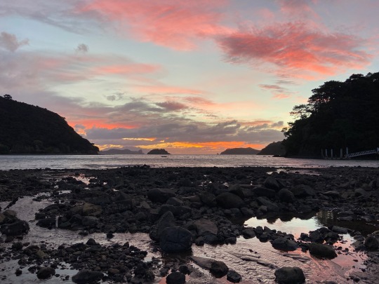
This week, my cousin walked down to Karaka Bay, a bay close to my house and we went down to the beach and the bush part of its trail. We also went to Glover Park where we and our family often visit.
After yesterday's class I went to Looksharp and brought 4 role of cellophane (red, pink,green, and blue) - for this shoot we used each of role of cellophane (expect the blue role) and taped it to the lens of the camera to create a sort of colour filter.


0 notes
Text
Lore Episode 21: Adrift (Transcript) - 16th November 2015
tw: death, drowning, ghosts Disclaimer: This transcript is entirely non-profit and fan-made. All credit for this content goes to Aaron Mahnke, creator of Lore podcast. It is by a fan, for fans, and meant to make the content of the podcast more accessible to all. Also, there may be mistakes, despite rigorous re-reading on my part. Feel free to point them out, but please be nice!
I have a confession to make. Keep in mind, I write about frightening things for a living. I haven’t read a horror novel yet that’s managed to freak me out, and yet, I’m deathly afraid of open water. There, I said it – I hate being on boats. I’m not even sure why, to be honest, I just… am. Perhaps it’s the idea that thousands of feet of cold darkness wait right beneath my feet. Maybe it’s the mystery of it all, of what creatures (both known and unknown) might be waiting for me, just beyond the reach of what little sunlight passes through the surface of the waves. Now, I live near the coast, and I’ve been on boats before, so my fear comes from experience, but it’s not the cold, deep darkness beneath the ship that worries me the most. No, what really makes my skin crawl is the thought that, at any moment, the ship could sink. Maybe we can blame movies like Titanic or The Poseidon Adventure for showing us how horrific a shipwreck can be, but there are far more true stories of tragedy at sea than there are fictional ones, and it’s in these real life experiences, these maritime disasters that dot the map of history like an ocean full of macabre buoys, that we come face to face with the real dangers that await us in open water. The ocean takes much from us, but in rare moments, scattered across the pages of history, we’ve heard darker stories: stories of ships that come back, of sailors returned from the dead, and of loved ones who never stop searching the land. Sometimes our greatest fears refuse to stay beneath the waves. I’m Aaron Mahnke, and this is Lore.
Shipwrecks aren’t a modern notion – as far back as we can go, there are records of ships lost at sea. In The Odyssey by Homer, one of the oldest and most widely read stories ever told, we meet Odysseus shortly before he experiences a shipwreck at the hands of Poseidon, God of the Sea. Even further back in time, we have the Egyptian tale of the shipwrecked sailor, dating to at least the 18th century BC. The truth is, though, for as long as humans have been building sea-faring vessels and setting sail into unknown waters, there have been shipwrecks. It’s a universal motif in the literatures of the world, and that’s most likely because of the raw, basic risk that a shipwreck poses to the sailors on the ships, but it’s not just the personal risk. Shipwrecks have been a threat to culture itself for thousands of years. The loss of a sailing vessel could mean the end to an expedition to discover new territory or turn the tide of a naval battle. Imagine the result if Admiral Nelson had failed in his mission off the coast of Spain in 1805, or how differently Russia’s history might have played out had Tsar Nicholas II’s fleet actually defeated the Japanese in the Battle of Tsushima. The advancement of cultures has hinged for thousands of years, in part, on whether or not their ships could return to port safely, but in those instances where ancient cultures have faded into the background of history, it is often through their shipwrecks that we get information about who they were. Just last year, an ancient Phoenician shipwreck was discovered in the Mediterranean Sea near the island of Malta. It’s thought to be at least 2700 years old and contains some of the oldest Phoenician artefacts ever uncovered. For archaeologists and historians who study these ancient people, the shipwreck has offered new information and ideas. The ocean takes much from us, and upon occasion, it also gives back. Sometimes, though, what it gives us is something less inspiring. Sometimes, it literally gives us back our dead.
One such example comes from 1775. The legend speaks of a whaling vessel, discovered off the western coast of Greenland in October of that year. Now, this is a story with tricky provenance, so the details will vary depending on where you read about it. The ship’s name might have been the Octavius, or possibly the Gloriana, and from what I can tell, the earliest telling of this tale can be traced back to a newspaper article in 1828. The story tells of how one Captain Warren discovered the whaler drifting through a narrow passage in the ice off the coast of Greenland. After hailing the vessel and receiving no reply, their own ship was brought near, and the crew boarded the mysterious vessel. Inside, though, they discovered a horrible sight. Throughout the ship, the entire crew was frozen to death where they sat. When they explored further and found the captain’s quarters, the scene inside was even more eerie. There in the cabin were more bodies: a frozen woman, holding a dead infant in her arms; a sailor holding a tinder box, as if trying to manufacture some source of warmth; and there, at the desk, sat the ship’s captain. One account tells of how his face and eyes were covered in a green, wet mould. In one hand, the man held a fountain pen, and the ship’s log was open in front of him. Captain Warren leaned over and read the final entry, dated November 11th, 1762, 13 years prior to the ship’s discovery. “We have been enclosed in the ice 70 days”, it said. “The fire went out yesterday and our master has been trying ever since to kindle it again, but without success. His wife died this morning. There is no relief”. Captain Warren and his crew were so frightened by the encounter that they grabbed the ship’s log and retreated as fast as they could back to their own ship. The Octavius, if indeed that was the ship’s name, was never seen again.
The mid-1800s saw the rise of the steel industry in America. It was the beginning of an empire that would rule the economy for over a century, and like all empires, there were capitals: St. Louis, Baltimore, Buffalo, Philadelphia. All of these cities played host to some of the largest steel works in the country, and for those that were close to the ocean, this created the opportunity for the perfect partnership – the shipyard. Steel could be manufactured and delivered locally and then used to construct the ocean-going steamers that were the lifeblood of late-19th century life. The flood of immigration through Ellis Island, for example, wouldn’t have been possible without these steamers. My own family made that journey. One such steamer to roll out of Philadelphia in 1885 was the S. S. Valencia. She was 252ft long and weighed in at nearly 1600 tonnes. The Valencia was built before complex bulkheads and hull compartments, and she wasn’t the fastest ship on the water, but she was dependable. She spent the first decade and a half running passengers between New York City and Karakas, Venezuela. In 1897, while in the waters near Guantanamo Bay, Cuba, the Valencia was attacked by a Spanish cruiser. The next year, she was sold and moved to the west coast, where she served in the Spanish-American war as a troop ship between the US and the Philippines. After the war, the Valencia was sold to a company that used the ship to sail between California and Alaska, but in 1906, she filled in for another ship that was under repair, and her new route became San Francisco to Seattle. They gave the ship a check-up in January of that year, and everything checked out good. For a 24-year-old vessel, the Valencia was in perfect working order.
She set sail on the 20th of January 1906, leaving sunny California and heading north. The ship was crewed by nine officers, 56 crew members and played host to over 100 passengers. Somewhere near Cape Mendocino off the coast of northern California, though, the weather turned sour. Visibility dropped, and the winds kicked up. When you’re on a ship at night, even a slow one, losing the ability to see is a very bad thing. Typically, without visual navigation a captain might fall back on the celestial method, using the stars in the same way sailors did centuries ago, but even that option was off the table for Captain Oscar Johnson, and so he used the only tool he had left: dead reckoning. The name alone should hint at the efficacy of the method. Using last known navigational points as a reference, Captain Johnson essentially guessed at the Valencia’s current location. But guessing can be deadly, and so instead of pointing the ship at the Strait of Juan de Fuca, between Vancouver Island and Washington State, he unknowingly aimed it at the island itself. Blinded by the weather and faulty guesswork, the Valencia struck a reef just 50ft from the shore near Pachena Point on the south-west side of Vancouver Island. They say the sound of the metal ripping apart on the rocks sounded like the screams of dozens of people. It came without warning, and the crew did what they could to react by immediately reversing the engines, backing off the rocks. Damage control reported the hull had been torn wide open, water was pouring in at a rapid pace, and there was no hope of repairing the ship. It lacked the hull compartments that later ships would include for just such occasions, and the captain knew that all hope was lost, so he reversed the engines again and drove the ship back onto the rocks. He wasn’t trying to destroy the Valencia completely, but to ground her, hoping that would keep her from sinking as rapidly as she might at sea. That’s when all hell broke loose. Before Captain Johnson could organise an evacuation, six of the seven life boats were lowered over the side. Three of those flipped over on the way down, dumping out the people inside. Two more capsized after hitting the water, and the sixth boat simply vanished. In the end, only one boat made it safely away.
Frank Lehn was one of the few survivors of the shipwreck. He later described the scene in all its horrific detail: “Screams of women and children mingled in an awful chorus with the shrieking of the wind, the dash of rain, and the roar of the breakers. As the passengers rushed on deck they were carried away in bunches by the huge waves that seemed as high as the ship's mastheads. The ship began to break up almost at once and the women and children were lashed to the rigging above the reach of the sea. It was a pitiful sight to see frail women, wearing only night dresses, with bare feet on the freezing ratlines, trying to shield children in their arms from the icy wind and rain”. About that same time, the last life boat made it safely away under the control of the ship’s boatswain, Officer Timothy McCarthy. According to him, the last thing he saw after leaving the ship was, and I quote, “the brave faces looking at us over the broken rail of a wreck, and of the echo of a great hymn sung by the women through the fog and mist and flying spray”. The situation was desperate. Attempts were made by the ship’s remaining crew to fire a rescue line from the lyle gun into the trees at the top of the nearby cliff. If someone could simply reach the line and anchor it, the rest of the passengers would be saved. The first line they fired became tangled and snapped clean, but the second successfully reached the cliff above. A small group of men even managed to make it to shore. There were nine of them, led by a school teacher named Frank Bunker, but when they reached the top of the cliff, they discovered the path forked to the left and the right; Bunker picked the left. Had he instead turned right, the men would have come across the second lyle line within minutes and possibly saved all the remaining passengers. Instead, he led the men along a telegraph line path for over two hours before finally managing to get a message out to authorities about the accident, making a desperate plea for help - and help was sent, but even though the three separate ships that raced to the site of the wreck tried to offer assistance, the rough weather and choppy seas prevented them from getting close enough to do any good. Even still, the sight of the ships nearby gave a false sense of hope to those remaining on the wreckage, so when the few survivors onshore offered help, they declined. There were no more lifeboats, no more lifelines to throw, and no ships brave enough to get closer. The women and children stranded on the ship clung to the riggings and rails against the cold Pacific waters, but when a large wave washed the wounded ship off the rocks and into deep water, everyone was lost. All told, 137 of the 165 lives aboard the ship were lost that cold, early January morning. If that area of the coastline had yet to earn its modern nickname of “the graveyard of the Pacific”, this was the moment that cemented it.
The wreck of the Valencia was clearly the result of a series of unfortunate accidents, but officials still went looking for someone to blame. In the aftermath of the tragedy, the Canadian government took steps to ensure lifesaving measures along the coast that could help with future shipwrecks. A lighthouse was constructed near Pachena Point and a coastal trail was laid out that would eventually become known as the West Coast Trail, but the story of Valencia was far from over. Keep in mind there have been scores of shipwrecks, tragedies that span centuries, in that very same region of water, and like most areas with a concentrated number of tragic deaths, unusual activity has been reported by those who visit. Just five months after the Valencia sank, a local fisherman reported an amazing discovery. While exploring seaside caves on the south-western coast of Vancouver Island, he described how he stumbled upon one of the lifeboats within the cave. In the boat, he claimed, were eight human skeletons. The cave was said to be blocked by a large rock, and the interior was at least 200ft deep. Experts found it hard to explain how the boat could have made it from the water outside into the space within, but theories speculated that an unusually high tide could possibly have lifted the boat up and over. A search party was sent out to investigate the rumour, but it was found that the boat was unrecoverable, due to the depth of the cave and the rocks blocking the entrance. In 1910, the Seattle Times ran a story with reports of unusual sightings in the area of the wreck. According to a number of sailors, a ship resembling the Valencia had been witnessed off the coast. The mystery ship could have been any local steamer, except for one small detail: the ship was already floundering on the rocks, half submerged. Clinging to the wreckage, they say, were human figures, holding on against the wind and the waves.
Humans have had a love affair with the ocean for thousands of years. Across those dark and mysterious waters lay all manner of possibility: new lands, new riches, new cultures to meet and trade with. Setting sail has always been something akin to the start of an adventure, whether that destination was the northern passage or just up the coast, but an adventure at sea always comes with great risk; we understand this in our core. It makes us cautious, it turns our stomachs, it fills us with equal parts dread and hope, because there on the waves of the ocean, everything can go according to plan, or it can all fail tragically. Maybe this is why the ocean is so often used as a metaphor for the fleeting, temporary nature of life. Time, like waves, eventually wear us all down. Our lives can be washed away in an instant, no matter how strong or high we build them. Time takes much from us, just like the ocean. Waters off the coast of Vancouver Island are a perfect example of that cruelty and risk. They can be harsh, even brutal, toward vessels that pass through them. The cold winters and sharp rocks leave ships with little chance of survival, and with over 70 shipwrecks to date, the graveyard of the Pacific certainly lives up to its reputation. For years after the tragedy of 1906, fishermen and locals on the island told stories of a ghostly ship that patrolled the waters just off the coast. It’s said it was crewed by skeletons of the Valencia sailors who lost their lives there. It would float into view and then disappear, like a spirit, before anyone could reach it. In 1933, in the waters just north of the 27-year-old wreck of the Valencia, a shape floated out of the fog. When a local approached it, the shape became recognisable; it was a lifeboat. It looked as if it had just been launched moments before and yet there, on the side of the boat, were pale letters that spelled out a single word: Valencia.
[Closing statements]
#lore podcast#podcasts#aaron mahnke#shipwrecks#the odyssey#the octavius#s. s. valencia#at sea#greenland#canada#phildelphia#hauntings#transcripts#21
4 notes
·
View notes
Video
instagram
Let me know where I should have stopped. - - #art #artwork #inspire #gallery #blackandwhite #drawing #penandink #ink #sketch #sketchbook #instaart #auckland #newzealand #timelapse #pleinair #landscape #timelapsedrawing #timelapseart #speedart #brushpen #dailychallenge #newzealandart #artcritique #artist #timelapsedrawing #sketching #raft #ocean #chaoswingsart #dailyartchallenge (at Karaka Bay) https://www.instagram.com/p/BwbybjjBYd0/?utm_source=ig_tumblr_share&igshid=84ov46smgb4v
#art#artwork#inspire#gallery#blackandwhite#drawing#penandink#ink#sketch#sketchbook#instaart#auckland#newzealand#timelapse#pleinair#landscape#timelapsedrawing#timelapseart#speedart#brushpen#dailychallenge#newzealandart#artcritique#artist#sketching#raft#ocean#chaoswingsart#dailyartchallenge
2 notes
·
View notes
Photo

Milky Way Over Karaka Bay - Great Barrier Island by The Art of Night on Flickr.
96 notes
·
View notes
Text


Karaka Bay phone booth at base of the pier is actually a public lending library
4 notes
·
View notes
Text
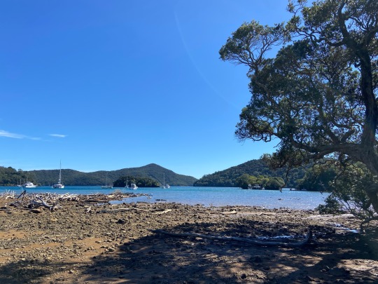
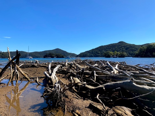
Picton & Marlborough Sounds
Picton & Marlborough Sounds
Gateway to the South Island, Picton is a charming small town of 5,000 people, which most people pass through but relatively few stay in. They’re missing out as it’s a lovely spot to spend time, at the mouth of the magnificent Marlborough Sounds. The Marlborough Sounds cover a huge area, making up nearly 10% of New Zealand’s total coastline, with a large number of islands and peninsulas,…

View On WordPress
#Aratere#Bobs Bay#Edwin Fox#interislander#Kaitaki#Karaka Point#Link Pathway#Marlborough Sounds#New Zealand#photography#Picton#Picton Cemetery#Picton Heritage & Whaling Museum#Port Malborough#Queen Charlotte Drive#South Island#St Josephs Catholic Church#The Snout#travel#Victoria Domain
12 notes
·
View notes