#Geographical indications
Explore tagged Tumblr posts
Text
Geographical Indications (GIs) contribute significantly to intellectual property (IP) law and hold great importance for many countries. Typically, a GI includes the name of a specific place that defines the origin of certain goods.

The protection of GIs can be seen as joint exclusive rights granted to producers in a geographical area eligible for protection. These rights aim to safeguard their interests and help combat unfair competition. Additionally, GIs enhance the value of products and reduce the potential for “consumer deception.���
Evolution of Geographical Indications Laws In India
Before 1999, there was no law in India to protect Geographical Indications. Therefore, the Geographical Indications of Goods (Registration and Protection) Act, 1999 was enacted and came into effect on September 15, 2003. Several rules and amendments followed:
The Geographical Indications of Goods (Registration and Protection) Rules, 2002 The Geographical Indications of Goods (Registration and Protection) (Amendment) Rules, 2020
GI laws are very important for producers and consumers, and it is a law that provides protection to all products of GI. Also, as there is constant evolvement with the aspects of GI, there is a need to have even more rigid provisions under the legislation that can protect any infringement of a GI product. There are still some sellers that fraudulently sell imitated goods for profit.
To know more blog insights, check the link in bio- https://uja.in/blog/legal-chronicle/an-overview-of-geographical-indications-in-india/
Let us know what do you think about this?
#Geographical Indications#Geographical Indications of Goods#legal protection#Article 24.1#Agricultural Products#Rural Development#uja global advisory#ujaglobal
0 notes
Text

This ancient spice, cultivated in the pristine Himalayan mountains, is more than just black cumin. It's a flavor revelation. https://youtu.be/sPi_YJPFo4g
0 notes
Text
WindTalkers' 6th century ride in search of 100 year old Jambhul/ Jamun trees!

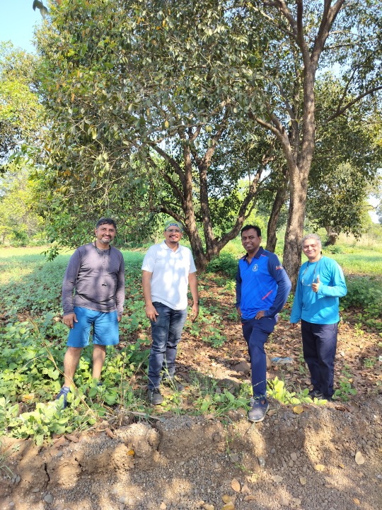
Sunday 10 December 2023, we four friends cycled or biked to BAHADOLI (famously known as JAMBHULGAON) in Palghar, in search of hundred year old Jambhool/ Jamun (?Syzygium cumini). In their search, we cycled more than hundred kilometres!
The blog post is divided as follows:
Jamuns of Jambhulgaon and their 100 years old Jambhul trees.
Photos en route from sunrise.
Other things in Bahadoli.
Return trip by sunset.

I thought hundred year old living beings would look really old. But no. They look young. Almost unbelievable young and strong. What I realised is we compare their age to humans and since humans look really old even before their 100 and that is why the expectation that they should look really old.
JAMUNS OF JAMBHULGAON & THEIR 100 YEARS OLD TREES:
Now the star of our trip! The trees!

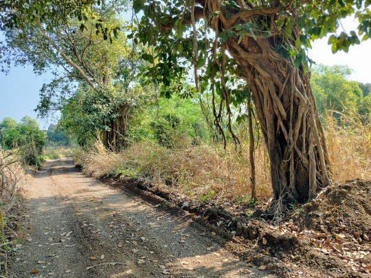
These two may be the original trees in the village, whose seeds, saplings and grafts have spread the Jamun farming in the entire village of Bahadoli , which is now known as JAMBHULGAON.
Here is the link to the article in the newspaper.

We met the villagers in this village, who welcomed us graciously in their home and took us on a tour in their village. They are proud of their efforts. The villagers and the farmers of this village are the real stars, whose efforts have won them the GI tag and their jamun fruits are export quality.
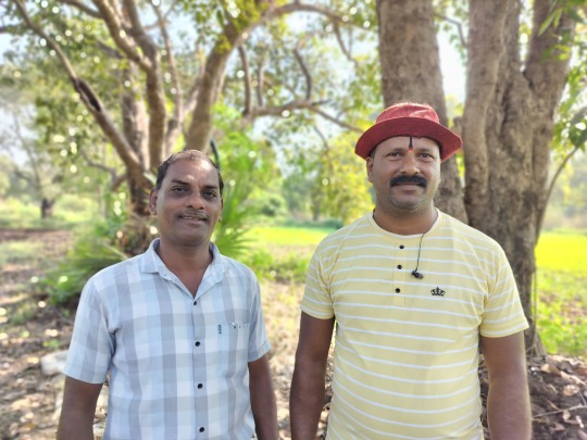


The season for Jamuns is around April-May-June.
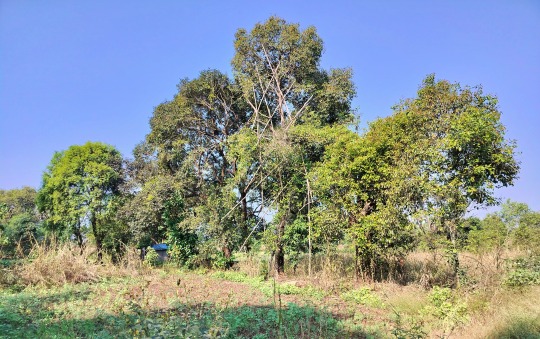
The bamboo scaffoldings protect the trees while picking the fruits. The tree and its branches are delicate. Earlier, when the trees were shaken to collect the fruits, they used to get damaged. If someone climbs a branch to collect fruits, the branch breaks. So an innovative solution was found by the villagers. They climb these scaffoldings and pick up the fruits by hand, without harming the trees.



Mohur of the Jamun/ Jambhul trees.
2. PHOTOS EN ROUTE FROM SUNRISE:
Now let us go for a ride.
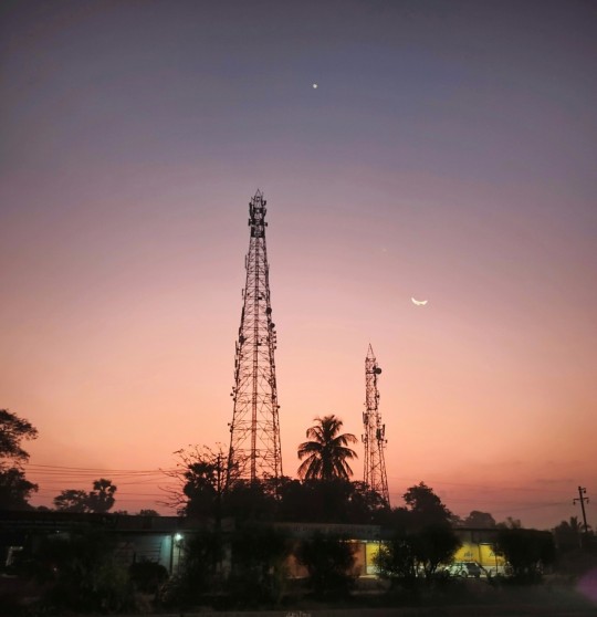
03:45 wake up alarm. 04:40 start cycling. 05:00 meeting of friends. 09:00 breakfast. 10:30 reach Bahadoli (60 kms cycled). 11:00 to 13:00 guided tour of the village. 15:00 to 16:00 lunch halt at NGO Seva Vivek. 19:15 home sweet home.
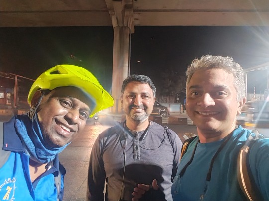
The point of the photo is the waning crescent Moon and Venus conjunction, happening behind us.

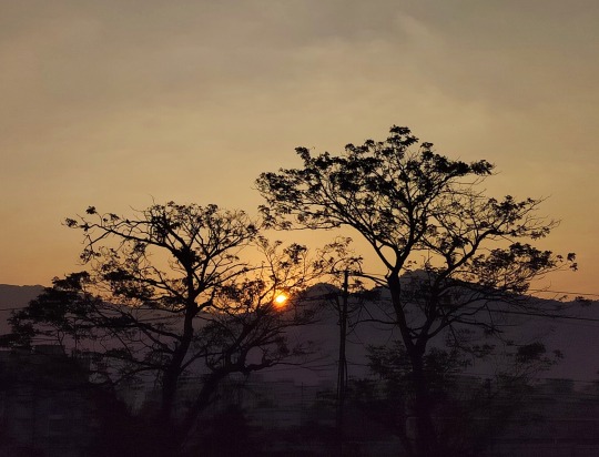
Sunrise

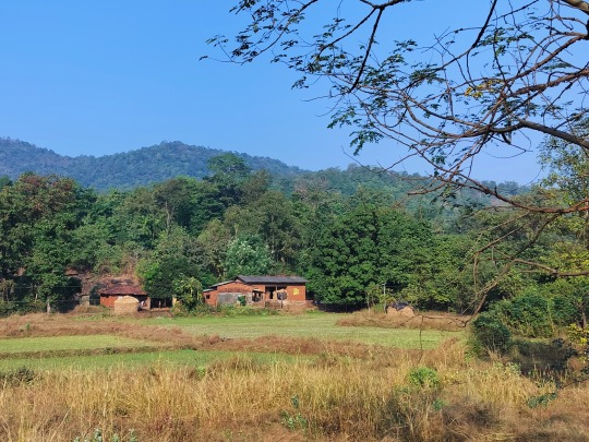
3. OTHER THINGS IN BAHADOLI:

Entering Bahadoli.
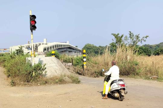

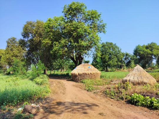
Rice pyramids in Bahadoli with jamun trees around.
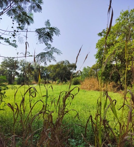
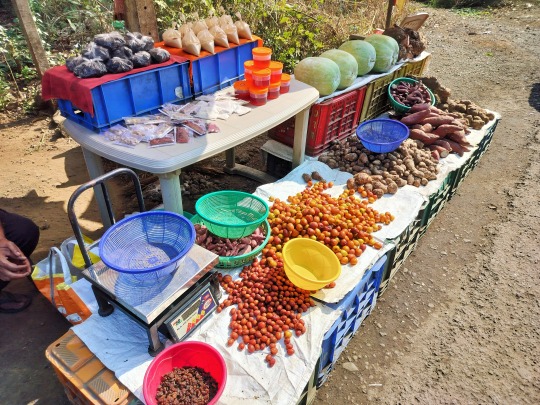
Local produce in the market.
4. RETURN RIDE BY SUNSET:


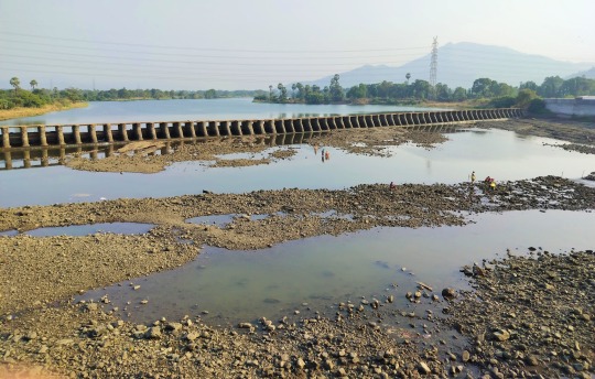
Tansa river.


My friend, PP (Anna), completed his first 100 km cycling ride in this trip!
Many thanks to my friend, Dr JVT, who connected us with the villagers and they welcomed us all, treated to refreshing tea and took on a guided tour of their home and village.
While returning, my cycle's chain malfunctioned and the road-side mechanic solved it using 14 no. pana. We all were home by 19:30. Legs were aching. I was sleepy and dozed off while seeing the photos.
Check this link for more photos and natural beauty of Jambhulgaon here.
For more cycling pleasure with leisure in and around Mumbai - check this link.
#Geographical indications#Jambhul#Jamun#Trees#hundred#100#century#windtalkers#cycling#cyclists#gi tag
0 notes
Text
Dubai; World IP Day 2023 " Women and IP".
Celebration of the WORLD INTELLECTUAL PROPERTY DAY 2023 in Dubai, the United Arab Emirates.
Organizer: Dubai Customs.

#Dubai Customs#intellectual property#WorldIPday#Women and IP#United Arab Emirates#GEOGRAPHICAL INDICATIONS
0 notes
Text

this is fucking insane??? how are you gonna mock people who recognize that Hamas is a fucking terrorist organization, then acknowledge that the hostages exist (a very low bar that so many ppl fail to meet) while also claiming that calling for the hostages to be returned is a bad thing???
#and the way i can't say anything when this person says things that are explicitly xenophobic and/or antisemitic#bc they're the server owner#and i don't wanna get kicked bc there's other ppl (not this person) who i legitimately enjoy interacting with?#also israel literally *is* the only full democracy in the middle east#(cyprus has a slightly higher freedom index score than israel but it's generally considered part of europe even though it's geographically#in the middle east)#the economist democracy index considers israel to be a “flawed democracy” rather than a “full democracy”#but it's only 0.2 pts away from being a “full democracy” based on the 2023 results#the vast majority of other MENA countries are rated as being “authoritarian”#the EDI doesn't have tunisia as a democracy but some other indices consider it to be one#although that's irrelevant if we're only talking about the ME since tunisia is in north africa#she also uses the term “iof” so i honestly don't give a shit about her opinions as a non-muslim or arab goyische white european @ this point
6 notes
·
View notes
Text
GIS In Our Daily Lives
The involvement of Geographic Information Systems (GIS) in our daily lives is pervasive, influencing and enhancing various aspects across different sectors. The integration of GIS into everyday activities has become integral for decision-making, planning, and optimizing resources. GIS helps city planners and transportation experts to provide them with information like maps, satellite pictures, population statistics, and infrastructure data. GIS helps them make better decisions when designing cities and transportation systems that are sustainable and good for the environment.
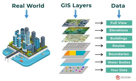
The following points elucidate the notable involvement of GIS in our daily lives:
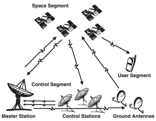
Navigation and Location Services: GIS provides monitoring functions through the visual display of spatial data and precise geographical positioning of monitored vehicles, whereas GPS provides accurate, clear, and precise information on the position and navigation of a monitored or tracked vehicle in real-time and at the exact location.GIS is at the core of navigation applications and location-based services on smartphones. It enables accurate mapping, real-time navigation, and geolocation services, assisting individuals in finding locations, planning routes, and navigating unfamiliar areas.
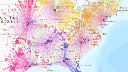
E-Commerce and Delivery Services: GIS software is a powerful tool for supply chain network planning. It helps determine the optimal location for distribution centers, warehouses, or other supply facilities. GIS is utilized in logistics and delivery services for optimizing routes, tracking shipments, and ensuring timely deliveries. E-commerce platforms leverage GIS to enhance the efficiency of their supply chain and last-mile delivery processes.
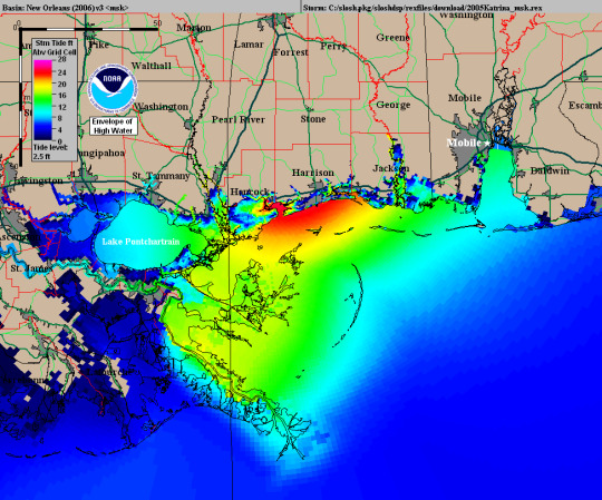
Weather Forecasting and Disaster Management: Many states are using GIS dashboard to monitor the rainfall across the state, on a real-time basis, from the data shared by rain sensors installed at various locationsGIS plays a crucial role in weather forecasting and disaster management. It assists meteorologists in analyzing spatial data, predicting weather patterns, and facilitating timely responses to natural disasters by mapping affected areas and coordinating emergency services.
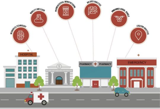
Healthcare Planning and Disease Monitoring: Geographic Information Systems enable the visualization and monitoring of infectious diseases. Additionally GIS records and displays the necessary information that health care needs of the community as well as the available resources and materials. GIS supports public health initiatives by mapping the spread of diseases, analyzing healthcare resource distribution, and assisting in the planning of vaccination campaigns. It aids in identifying high-risk areas and optimizing healthcare service delivery.
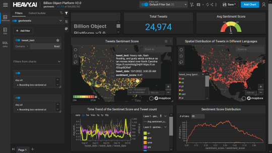
Social Media and Geo-tagging: GIS also helps in geotagging and other location related information in posts, it’s tools can map and visualize the spatial distribution of social media activity. This analysis can reveal trends, hotspots, and patterns in user engagement across different geographic areas. Many social media platforms incorporate GIS for geo-tagging, allowing users to share their location and experiences. This feature enhances social connectivity and facilitates the sharing of location-specific information.
Smart City Initiatives: The Geographic Information System (GIS) offers advanced and user-friendly capabilities for Smart City projects and allows to capture, store and manipulate, analyze and visualize spatially referenced data. It is used for spatial analysis and modeling. It is the cornerstone of smart city planning, enabling the integration of data for efficient urban management. It supports initiatives related to traffic management, waste disposal, energy consumption, and overall infrastructure development.

Education and Research: GIS is increasingly utilized in education and research for visualizing and analyzing spatial data. It enables students and researchers to explore geographic relationships, conduct field studies, and enhance their understanding of various subjects.

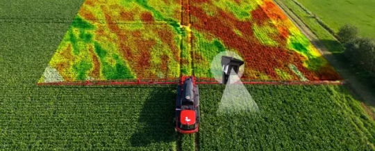
Agricultural Management and Precision Farming: Farmers leverage GIS to optimize agricultural practices by analyzing soil conditions, crop health, and weather patterns. Precision farming techniques, facilitated by GIS, contribute to increased crop yields and sustainable farming practices.
Real Estate and Property Management: In the real estate sector, GIS aids in property mapping, land valuation, and site selection. It provides real estate professionals with valuable insights into spatial relationships, market trends, and optimal development opportunities.
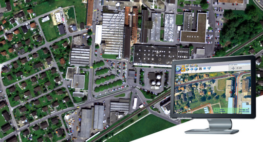
Tourism and Recreation: GIS enhances the tourism industry by providing interactive maps, route planning, and location-based information. It assists tourists in exploring destinations, finding attractions, and navigating efficiently.
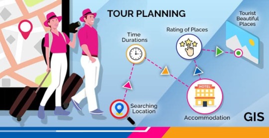
The broad and varied involvement of GIS in our daily lives underscores its significance as a technology that not only facilitates geographic data analysis but also contributes to the efficiency, safety, and interconnectedness of modern society. As GIS applications continue to evolve, their impact on daily activities is expected to further expand and refine.
#gis#architectdesign#architecture#city#education#geographic information system(gis)#geographical indication
13 notes
·
View notes
Text
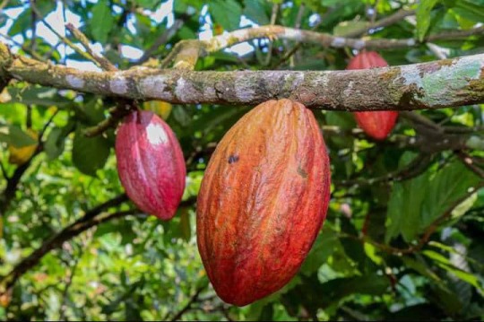
Cameroon Red Cocoa Inches Closer to Labeling
As OAPI Awaits Coloration Analysis, Cameroon's Red Cocoa Inches Closer to Labeling. #Cocoa #Cameroon #agriculture #GeographicalIndication #OAPI #MarketPotential
As OAPI Awaits Coloration Analysis, Cameroon Red Cocoa Inches Closer to Labeling Cameroon red cocoa, acknowledged as a geographical indication (GI) product in 2019, is advancing towards official labeling by the African Intellectual Property Organization (OAPI). In a recent international symposium on geographical indications in Africa, Michel Gonomy, Head of the Geographical Indications,…
View On WordPress
4 notes
·
View notes
Text
youtube
🔥 Rum fans, listen up! 🥃 Richard Seale, the master distiller behind Foursquare Rum Distillery, explains why Barbados Rum needs a geographical indication to preserve its authenticity and quality 👌
2 notes
·
View notes
Text
I actually managed to find the wages as set by the collective bargaining agreement and in the interest of citing my sources, it can be found here
For people over 18, it's 136.74 DKK/hour, ie $19.78
For people under 18, it's 82.16 DKK/hour, ie $11.88
(The weird decimals is because these are monthly wages rather than hourly ones)
It's also worth noting that the usual tax rate in Denmark is around 45%* which, while I don't understand US taxes enough to say by how much, is higher than the US tax rate. I support high taxes ofc, it just complicates the wage comparison a bit in this case.
The price of a Big Mac is 49 DKK ie $7.09 according to here, here, here and here. Places that list a lower price seem to either be out of date or are calculating the price based on if you buy it as part of a menu.
*Technically it's 8% to the labour market + 12.16% to the state + somewhere between 22.5%-27.8% to the municipality, which adds up to 42,5%-47,8 (x). Whenever somewhere lists 37% as the common rate, that's because they're not including the first 8% since that technially works a bit differently.

#cost of living factors into this as well but i don't understand economics well enough to say anything intelligent about it#also the sources i looked at seemed to indicate that the cost of living isn't that much higher than in the us#and i assume cost of living varies wildly geographically in the US anyway
17K notes
·
View notes
Text
Geographical Indication is considered to be a sign that is used on products that have a specific geographical origin and possess qualities or reputation that are due to that origin. Geographical Indications are primarily granted to agricultural, natural, manufactured, handicrafts originating from a definite geographical territory.
0 notes
Text
Geographical indication or as we know GI is a sign that denotes a product of a particular location or locality or originated from that locality or geographical location.

0 notes
Text
0 notes
Text

Geographically tagged dolls aren't just toys, they're cultural ambassadors!
https://youtu.be/5KQwZJnXqLU
#Geographical Indication#Dolls#WorlddollDay#handmade#toys#handicrafts#empowercreator#artisans#channapatna#manipur#Thanjavur#culture#heritage
0 notes
Text
Trademark Registration in Indiranagar
Safeguard your brand identity in Indiranagar through professional Trademark Registration. Expert guidance for a smooth and secure process. Contact us now!
#indiranagar trademark registration cost#registering a food brand trademark bangalore#how to file trademark online indiranagar#business name trademark check indiranagar#legal help for trademark application indiranagar#best trademark filing company indiranagar#trademark lawyers indiranagar#indiranagar trademark registration services#patent and trademark lawyers indiranagar#startup trademark registration indiranagar#it company trademark filing bangalore#fashion brand trademark lawyer indiranagar#geographic indication trademark application indiranagar
0 notes
Text
Teh Java Preanger on DJKI
The particular product is registered in DJKI’s geographical indication. In this blog post i will translate the page and put it on one long passage. Characteristics Characteristics of “Teh Java Preanger” are primarily determined by the results of organoleptic tests, focusing on the distinct taste, aroma, and overall sensory experience of the brewed tea product originating from the specific tea…
View On WordPress
0 notes
Text
If you are looking to build a career in geographic information system(GIS) and remote sensing and the career options in it, then visit our site to explore more. We are on some of the most popular GIS course leading platform in Bangalore. Contact to our team if you are interested.
Location- Bangalore: No 21, Sai Krupa Complex, 1st Floor,16th Cross, Sampige Rd, Malleshwaram, Bengaluru, Karnataka 560003
Phone - +91 9742349602
Phone - +91 8035647405
Email id : [email protected]
1 note
·
View note