#this car climbed mt. washington
Explore tagged Tumblr posts
Visit Tumblr Blog
Explore Tumblr blogs with no restrictions, modern design and the best experience.
Last Seen Tumblr Blogs


Fun Fact
Tumblr has been banned in Indonesia for providing people with access to pornographic content.
Text
From the Home Office in Melrose, NM ...
The Top Ten Reasons Why You're Unlikely to See The Hair Bear Bunch at Clark's Trained Bears act in Lincoln, NH:
10) Their background including time in an ill-managed zoo 9) Scheduling conflicts over the bear mating season 8) The tone and tenor of their humour perhaps being a little too much for the more conservative New England taste 7) Risk for being seen as "unfair competition" in the ursine acting arena, with even Variety taking notice 6) The likelihood of the bears in the Clark's act having heart attacks when they see the madcap ursine trio formerly of the Wonderland Zoo 5) New Hampshire isn't exactly Malibu 4) Their preference for being more in northern Minnesota or Wisconsin, perhaps even in Montana at times, during the ursine mating season 3) Bubi's part of the act potentially crossing the line into ad-libbed raunch which would surprise especially the Boston crowd 2) Titus Moody and/or Earl Pitts likely being in the audience, and unlikely to approve of it when all is said and done 1) Imagine one of those "This Car Climbed Mt. Washington" bumper stickers on Square Bear's Invisible Motorcycle, let alone one for Clark's Trained Bears
With full appy polly loggies to David Letterman throughout
#hanna barbera#headcannons#top ten list#spot the allusion#hair bear bunch#clark's trained bears#trained bear act#unlikely to steal the show#titus moody#earl pitts#this car climbed mt. washington#hannabarberaforever
0 notes
Text
"This Car Climbed Mt. Washington Bumper Plate" from the 1950s

#new hampshire#new england#old photography#photography#history#this car climbed mt washington#mt washington
12 notes
·
View notes
Text
long shot but does anyone remember that art of a car with a million joke bumper stickers... it couldve been a photo but i'm like 80% sure it was a drawing. one of the bumper stickers was a This Car Climbed Mt. Washington sticker but like jokey. like this car fucked it or something like that. that's all i remember i've been thinking about it for weeks😭
1 note
·
View note
Text
"this car climbed Mt Washington" this and "proud parent of an honor student" that. Tell me something exciting. Something new! What about "this car is an honor student" What about "proud parent of George Washington" What about "this car climbed a proud student" Where's the intrigue, where's the suspense
7 notes
·
View notes
Text
that post saying the Old Man of the Mountain is NH's worst attraction is pissing me off because that shit fell down TWENTY ONE years ago. no our worst attraction is mt Washington because of those stupid "this car climbed mt Washington" stickers
0 notes
Text
Were Bumper Stickers Always This Kooky?
Gone are the days of “Coexist” or “This car climbed Mt. Washington.” Bumper stickers have lately gotten a lot weirder, and much more niche. Source link
0 notes
Text
Pair of booty shorts that says “This Car Climbed Mt. Washington”
0 notes
Text
Another poll, as long as it's on my mind
#hanna barbera#today's poll#survey says#least likely to display#this car climbed mt. washington#hannabarberaforever
0 notes
Text
@sexhaver said:
"THIS CAR CLIMBED MT. WASHINGTON" bumper sticker right next to one saying "THIS CAR TRAVELED TO THE DEPTHS OF A NUCLEAR INTERNMENT FACILITY"
THIS CAR CIRCUMNAVIGATED THE GLOBE


im not certain but i think the tunnels here in the onkalo repository are like truck width. really like this image. driving a car down the biggest spiral ramp.... extremely good. i wonder what the lowest point navigable by car is. possibly a mine but maybe some sort of nuclear repository, i think a mine is more likely to have specialized equipment for getting stuff in and out
22 notes
·
View notes
Audio
0 notes
Note
Hi! I’ve been reading through your Buckeride fics and I know this isn’t on your prompt list but I can’t get the idea of long-distance Kelly and 118!Buck where Buck sends him postcards like he used to do with Maddie. Like imagine a post card with a pic of Buck and the first baby he delivers, or Buck mastering a complex Bobby recipe or screenshots of a daring rescue. And Kelly peppering his locker with all of these.
So this is definitely not what you requested, but it's where my weird little brain took me. 1200 words, Buck x Kelly. Buck copes with losing Kelly by hiking across the country. Kelly copes with losing Buck by reading his postcards and sending replies in the form of books. Fair warning, I haven't read all of the books mentioned in this but I'll get around to them eventually.
The first time Buck drops a postcard in the mail to Chicago is a generic shot of the desert, picked up for 60 cents in a tourist trap not far from the head of the trail. Buck prints the address of Firehouse 51 carefully onto the back of the card and spends the rest of the night agonizing over what to write on the rest. In the end he scrawls a messy 2,653 miles to go, wish me luck, and drops it into the mailbox outside of his motel without a return address - he doesn’t have one.
The second is a black-and-white reproduction of Ansel Adams’ Monolith, the Face of Half Dome tucked inside the front cover of the artist’s biography and shipped together in a package from the same post office where Kidd mailed his latest resupply. Yosemite was too fucking crowded. Ansel Adams Wilderness was beautiful though. Did you know he did a whole series on Manzanar, the Japanese internment camp? He was an interesting dude. Hang onto this book for me if you can, please.
His next care package contains a book - Only What We Could Carry: The Japanese American Internment Experience - and even though he hasn’t factored an extra book into his pack weight, he tucks it into his bag along with everything else. When he cracks it open in the fading light of a high altitude sunset he nearly chokes on a mouthful of trail mix. There, on the inside cover, is a note in Kelly’s neat-but-cramped handwriting, just like in every other book he’s ever gifted to Buck. Why do you always pick the most fucking depressing topics to take an interest in? Tell Kidd where I should ship the other 3 books about internment camps when you get off the trail, I’m never going to reread them.
Buck closes his eyes and tips his head up to the sky, staring at the wash of red and orange the sunset paints behind his eyelids until the sting that threatens tears fades away. By then it’s nearly dark - too dark to read, but not too dark to thumb through the pages to find the ones that are dog eared, the passages with stars next to them, the notes in the margins careful never to overlap with the text or images. He doesn’t open it again for almost a week, spends another few days reading it slowly, savoring the notes in the margins and writing his own in return. It’s the continuation of a silent conversation they’ve been having since the first time Kelly picked up one of Buck’s dog-eared, highlighted, scribbled-in books off of the nightstand and returned it to him with three questions and an opinion Buck absolutely had to argue with scrawled inside the back cover.
Except this time...this time Buck can’t read his commentary aloud to Kelly at the end of the day, or ask him to expand on one of the thoughts jotted down at the bottom corner of a page. This time he can’t talk to Kelly at all.
Instead he takes a selfie with the PCT mid point sign and then backtracks to hitchhike into town. He celebrates with a motel room, a shower, and a night in an honest to god bed. Pancakes at the local diner taste like heaven in the morning, he calls Kidd from a curbside bench with a beautiful view of the mountains, and he’s in too good a mood to question it when his feet lead him down the street and into a shop advertising printing.
He has two copies of his selfie printed. One goes into an envelope addressed to 51, alongside a postcard of Mt. Lassen thanking Cindy for the cookies and Mouch for the hockey themed wool socks in his latest resupply. The second he addresses to his old Kelly’s apartment. Thanks for the book. I think I’m going to visit Manzanar after I finish the trail - it’s only a few hours from LA. Maybe I’ll climb Whitney while I’m out there. Hey, did you know Lassen and Shasta are part of the Pacific Ring of Fire? The volcanic landscapes out here are awesome.
Buck almost doesn’t put the second envelope in the mail. He almost puts the book in a box and sends it to Stella instead. But in the end he mails the card, tucks the book deep into his bag where it will sit undisturbed but impossibly heavy with emotion for most of the next two months, and hitchhikes back to the trailhead.
By the time he makes his first stop in Oregon there’s another package: food, socks, a newspaper clipping of Truck 81 saving a little girl and her dog from an overturned car, and a book. Surviving the Stone Wind, clearly purchased used, the cover fraying at the corners and the spine cracked. Inside, beneath a faded note indicating it was once a gift for someone else, Kelly has written Don’t get killed by a volcano. That would be a stupid ass way for a firefighter to go out.
Buck sends a picture of himself from central Oregon tucked inside the cover of the book when he returns it, his handwriting a barely legible scribble beneath Kelly’s sharp letters. At least if I die in an eruption it’ll be quick. I’ve been thinking - there’s a lot of time to think out here - about how we would survive if the Yellowstone Supervolcano ever erupts. The answer is that we probably won’t, but if we did, living through the endless winter afterwards sounds pretty nasty. You know how I hate to be cold.
I bought more hand warmers for the emergency kit, Kelly replies, weeks later, from between the pages of a book about Yellowstone. But I think you’re right. I’d rather go in the explosion.
Buck has another hiker take a picture of him on the Bridge of the Gods, smack in the center of the Columbia river, and scrawls on the back of two copies before sending them off in the mail. The Columbia used to have the largest Salmon run on Earth. I never realized how much we’ve fucked up the environment before spending all this time out in the middle of nowhere. Not that the trail is even the middle of nowhere - thousands of people walk every part of it every year. I wonder what it all looked like before we colonized the West.
The Organic Machine: The Remaking of the Columbia River gets to Buck when he’s a couple of hundred miles into Washington. He flips the cover open eagerly, touches his fingers to the only form of communication he’s had with the love of his life in months. Seems like people have been changing the environment out there since long before white colonizers showed up. They just made it a lot worse. This isn’t going to be one of your “if I had a time machine” obsessions again, is it?
If I had a time machine I’d only go back 10 months, Buck writes inside of the cover. He shoves the book deep inside of his pack, beside the first, and mails back a generic postcard of the Cascades instead.
#911 fanfiction#chicago fire fanfiction#evan 'buck' buckley#kelly severide#buck x kelly severide#bisexual evan buckley#my fic#prompt fills#asks and answers
37 notes
·
View notes
Text
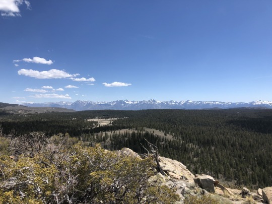
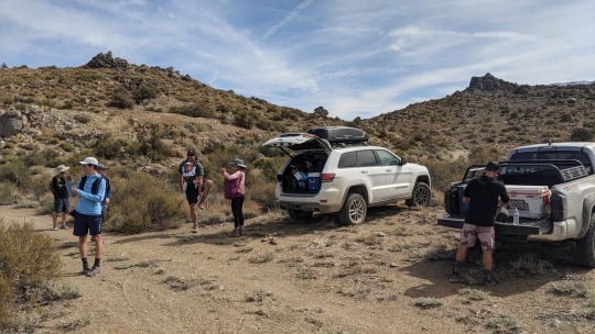
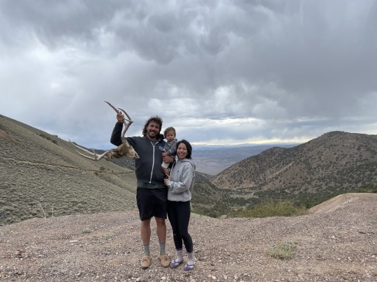
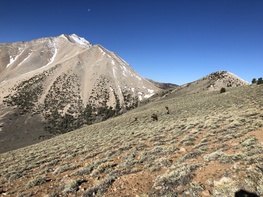
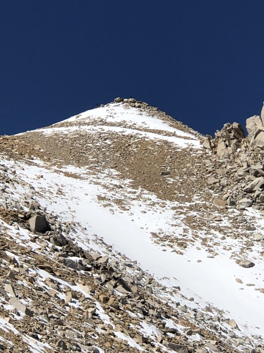
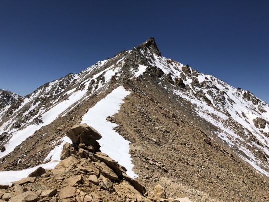
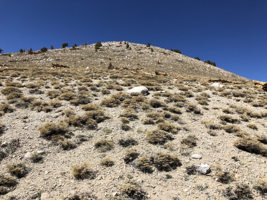
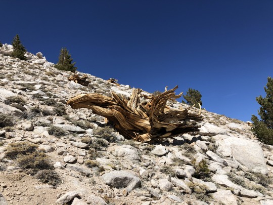
Boundary Peak & Montgomery Peak from Queen Canyon Trailhead
Memorial Weekend was approaching and I wanted to plan a family trip up a noteworthy peak. Believe it or not, I actually caught Asaka perusing Peakbagger one night. She was looking at state high points. She already has climbed the high points of California, Hawaii, Oregon and Washington (in addition to the high points of Mexico and Japan), so it made perfect sense to climb the high point of Nevada next. I had put off this peak for no good reason, so now I finally had enough motivation to write this one down on my official calendar. Also in the nearby vicinity of Boundary Peak is Montgomery Peak, which I needed to climb as well. I studied the distance, elevation gain and difficulty of the two peaks and came to the conclusion that I would be able to carry the baby to the summit of Boundary Peak, but it would not be prudent to continue to Montgomery Peak with the baby. Since Asaka was mostly interested in the Nevada high point, we agreed that I could leave the baby with her on Boundary Peak, and she could get a head start and carry Leif down the mountain without me. The second major challenge was how to manage the long drive. Our solution was to break it up in segments. We planned to lay over one night at my family cabin in Sonora. Our second night we planned to stay at Benton Hot Springs, stopping along the way for lunch and a short hike. Our third night we planned to camp near the trailhead at Queen Canyon Mine after doing a few short hikes in the greater Benton area. For the sake of completion, I will include a short summary of these small side hikes in my trip report.
I sent out some feelers to some prospects that I guessed would be interested. Brett Marciasini, Scott King and Sean King took the bait. I then extended the invite to some of my non-hiking friends Brian and Zach. I refer to them as my non-hiking friends not because they don’t hike, but because our friendships started from working at Texas Instruments at one point in time. They have been projects that I have been sculpting over time in the effort to develop new hiking partners. This would be a good test for both of them, as I planned a hybrid dirt bag weekend. While I usually take care of most of the specifics with regards to preparation, this time I felt they were ready to take on more responsibility, such as managing their own food, lodging and transportation. This new freedom would allow me to focus more on my wife and baby.
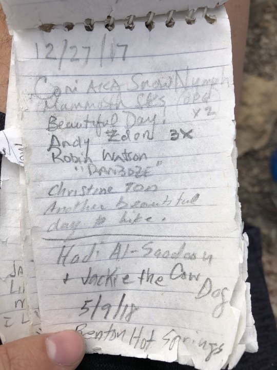
After our first night in the cabin, we drove over Sonora Pass and then down Highway 395 to the Mobile Mart where we had lunch. There was an easy peak called Sagehen Peak referenced in Andy Zdon’s book “Desert Summits” that I wanted to climb. Good dirt roads took us to the Sagehen Saddle, located less than a half mile from the summit. We possibly could have driven up to the summit, but we were all a little restless from riding in the car and we wanted to get some fresh air. After a short walk up the sandy road, we found a rocky outcropping that required a short, easy scramble. It was easy enough for me to climb with the baby in my arms.


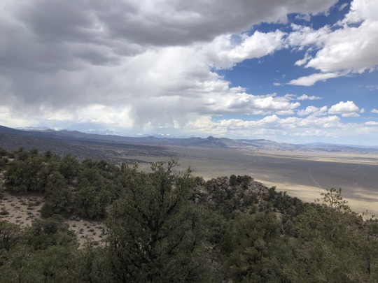
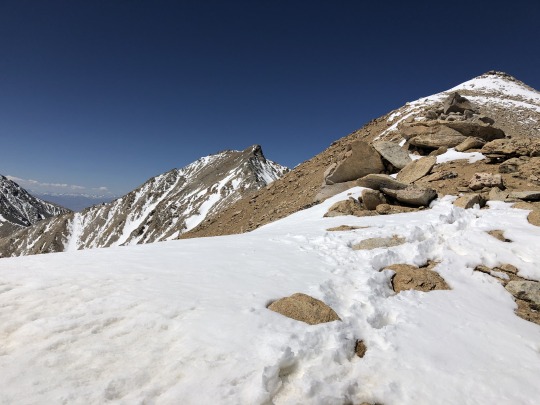
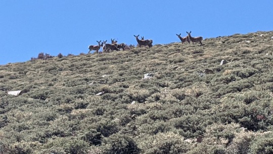
Off towards the east were Boundary Peak, Montgomery Peak and Mt Dubois. A late season storm struck the Whites a week prior, and there was a little more snow that I anticipated.
To the north was Mono Lake.

It was a nice little peak, and we rested awhile on top, but there was a slightly higher summit called Crooked Benchmark to our west. We started back down the road so I could get started on the bonus peak.

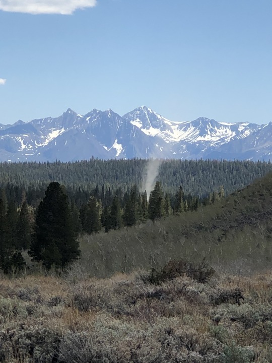
A twister swirled through the forest on this calm and sunny day.
Zach decided to join me for Crooked Benchmark while the others waited at the car. I didn’t even bother putting on my hiking shoes expecting an easy walk up, but we soon found ourselves bushwhacking through willows. Zach decided early on that this was not fun, and smartly made the decision to turn around. My obsessive compulsiveness had me push forward, but it was rather unpleasant. I kept thinking that the brush would abate, but it remained consistent almost all the way to the top. I found a register at the summit and I had a good view of the Sierra Nevada.
I didn’t want to retrace my steps back down to the car. I walked to the ridge and yelled down at the others to pick me up on the south side of the summit. I don’t think they were able to understand me. I also sent a GPS pin to Brian, but received no response so was unsure if he got it. The southern slopes were much easier. I dealt with some sage brush scratching my shins, but this was a minor inconvenience. I walked out the road, and I eventually found the others parked where I left the pin. We then drove to Benton Hot Springs where I checked in for the evening. We barbecued on Zach’s grill and drank some beer.

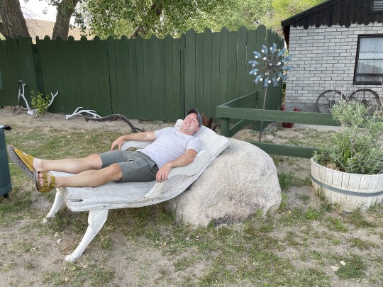
I felt a little awkward since Zach and Brian would be left on their own to camp in the desert while Asaka, Leif and I had reservations at the historic inn. I booked the last available room and there was simply no other option. I drove them to a flat tract of BLM land and apologized. Zach responded by stating something along the lines of, “Are you kidding me? This area is incredibly beautiful and we are happy to stay here.”
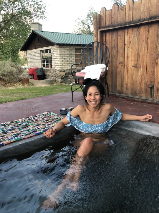
It was beautiful as dusk descended upon the snow covered Boundary Peak and Montgomery Peak above. I no longer felt guilty. Leif was sleeping when I returned, so Asaka and I snuck out to enjoy the hot springs.
Montgomery Peak was visible from our tub.

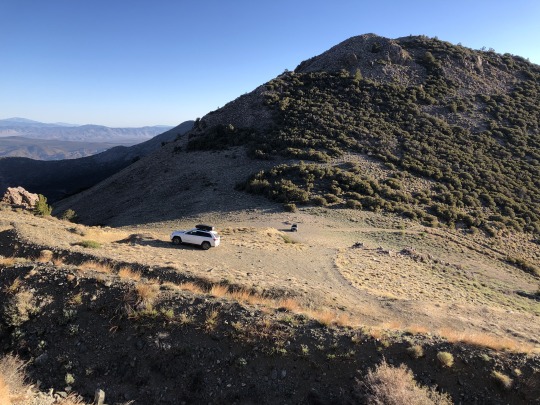
The next morning we regrouped at Benton Hot Springs and awaited the arrival of Brett and the Kings. After a round of introductions, we followed Yellow Jacket Road south through the Benton Paiute Reservation. I turned left on a 4WD road I spotted from satellite view and the topo map. We planned to hike from here, but I decided to see how far I could drive. Scott was a little less zealous about driving up the road than I was, so he and Sean piled into Brett’s truck and they followed me. With a great deal of patience, we made it almost the whole way up the peak. We parked at a mine in between Blind Spring Hill and Diane Peak.

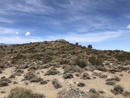
It took us all but five minutes to reach the to of Blind Spring Hill.
To the southwest was the Sierra Nevada.

To the west was Glass Mountain Ridge.

To the east were Montgomery Peak and Mt Dubois.
To the southeast was White Mountain.

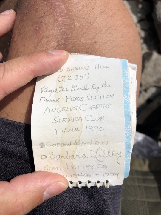
While the peak was “just okay”, the summit register contents were a treat. Scraps went back to 1966.
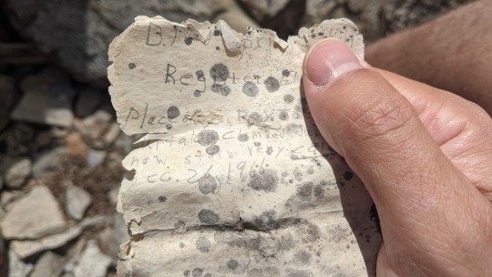
The refurbished book was a standard Gordon Macleod and Barbara Lilley register, which is almost a standard for all the arcane desert peaks throughout the southwest.
One of the early signatures was from Andy Zdon, the author of “Desert Summits”. If was solely because of his book that I decided to climb this peak in the first place.

In addition to Blind Spring Hill, there are six other named summits in close proximity along this ridge. These little peaklets were most likely named because of mining claims, and are hardly peaks at all. Since we had a full day ahead of us, we decided to only climb Diana Peak as a bonus peak, as this was less than a quarter mile from our car.
The little bump was not much of a peak, but allowed us to pad the stats.
We walked back down to the car and drove back to Benton. We were ahead of schedule so we decided to visit Trafton Mountain and Antelope Mountain just north of town. I led the way with my Jeep, but unknowingly made a big navigational error. There is a very good 2WD road that follows a powerline that crosses over the saddle between Trafton Mountain and Antelope mountain, but I somehow missed it. Instead, I led the group up a rarely driven 4WD road. It was incredibly rough and sketchy in parts. At one point we had to get out of our vehicles to move a fallen tree.
youtube
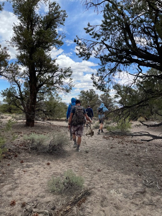
I was relieved to finally reach the better powerline road, but I was a little ashamed. We wasted a lot of time and mental energy dealing with that section of road. Asaka and Leif decided to skip Trafton Mountain and instead ate some lunch. We left them in the shade and started hiking towards the peak.
We hiked southwest up sandy and rocky slopes. It was a little too warm for my liking. Brian ran into a little issue when he kicked a cactus with his finger shoes. It took us about an hour to reach the summit.
We were again blessed with another Zdon signature in the register.
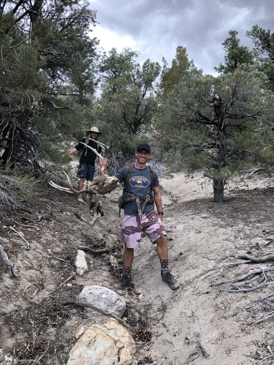
One the way down we found the remains of a deer.

Brett had a go at it, ripping the head clean from the still attached leg.
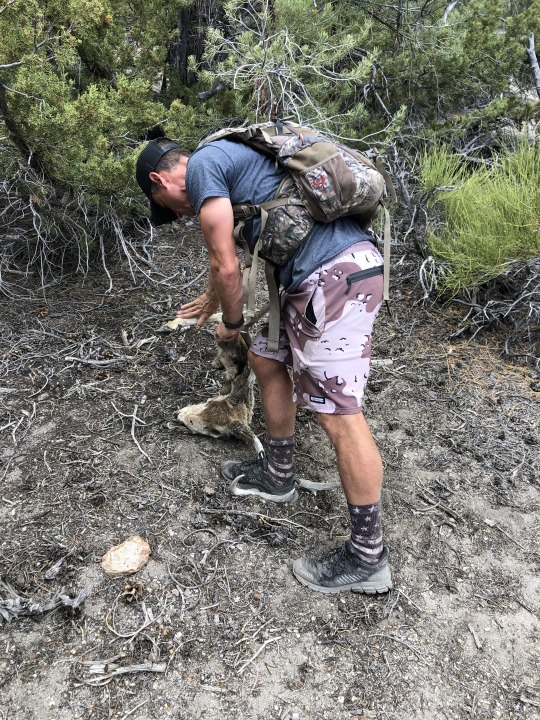
Brian was a little surprised to see us admire the carcass with such enthusiasm. I told him that dismantling dead animals is what white people do for fun.
We found sandy slopes on the way down. In the end it was a 2.6 mile outing.

Once reunited with Asaka and Leif, we got back in the car and followed a spur road all the way to the summit of Antelope Mountain. There were several structures on the summit. To the west was the salt flat called Antelope Lake.

To the south was Trafton Mountain.

I was mostly satisfied after 3 summits from Andy Zdon’s book. We drove back to the freeway following the good road this time. The difference was night and day. After filling up gas in Benton, we drove into Nevada, then took a right on Queen Mine Road. We spotted a Mustang in the canyon below Mustang Peak.
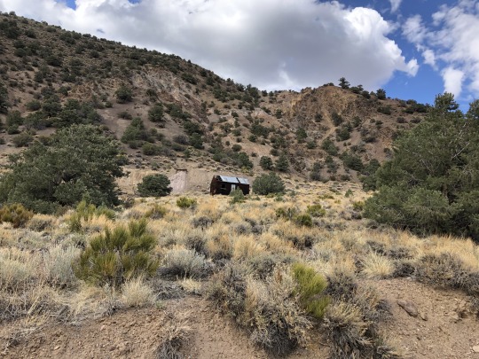

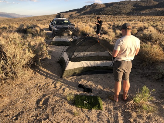
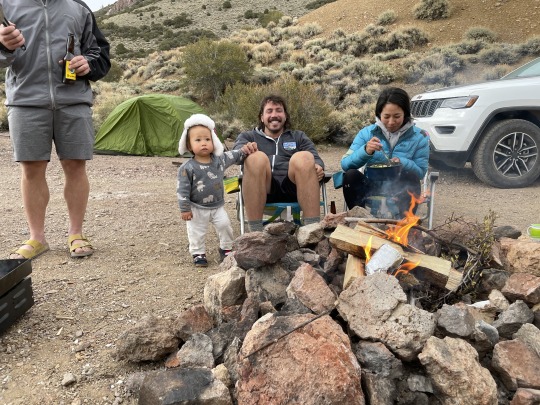
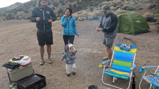
We stopped at Queen Mine where we decided to spend the night. We considered camping at the Queen Mine Trailhead, but settled on this location because it offered wind protection. Also, it was a really cool spot.


We spent the next few hours grilling Brett’s self-killed Bison, drinking beer and listening to music by the campfire. Sean and I thought about heading up Mustang Mountain, but in the end I decided against it, feeling a little worn out from earlier.
youtube
The next morning we drove the remaining mile up the road to the Queen Mine Trailhead. My Jeep and Scott’s 4Runner had no problems with the road.

I told everyone not to wait for me, since I would be slow carrying the baby. Asaka picked up Leif and then left me! That message wasn’t meant for them.

I organized some last minute things then started off at 6:45am.

The trailhead is at 9,800 feet, which is pretty high. I spent the first mile or so focusing on breathing. Asaka thankfully waited for me and we hiked in unison.
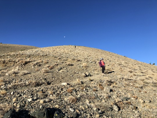
It felt like a Martian landscape with the moon setting above the desolate terrain.

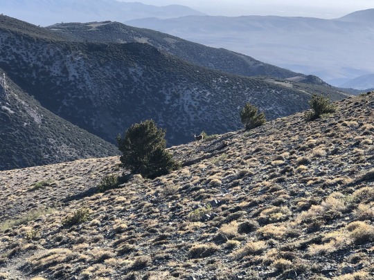
There was a really good trail climbing up the ridge. A lone deer watched me as I slowly lugged my payload uphill.
Even with my extra weight, I passed Brian early on. I hoped that this hike wasn’t too much for him. After a mile, Boundary Peak came into view.

T'was a lovely family day.
The trail stayed flat for 1.7 miles until Trail Canyon Saddle. Brett, Zach and the Kings were already way ahead of us and out of sight.

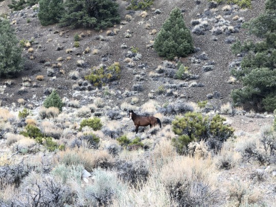
To my pleasant surprised, we ran into a herd of mustangs.
I think one of them was pregnant. There were several foals among the herd.

Brian paused for a while to photograph the ungulates.

We stopped for Leif’s breakfast along this flat portion. Maintaining his schedule is very important, even if it means falling further behind the group. He ate his blueberry oatmeal and banana without a care in the world. I was concerned since Brian hadn’t caught up to us by the time Leif finished his breakfast, but my priority was with my family. We continued all the way to Trail Canyon Saddle.

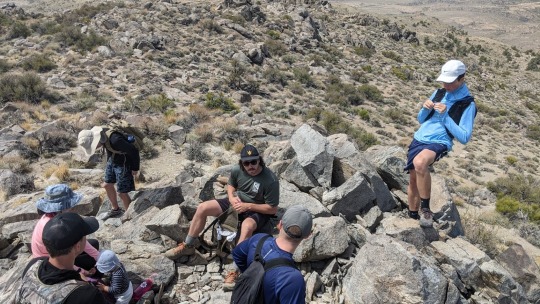
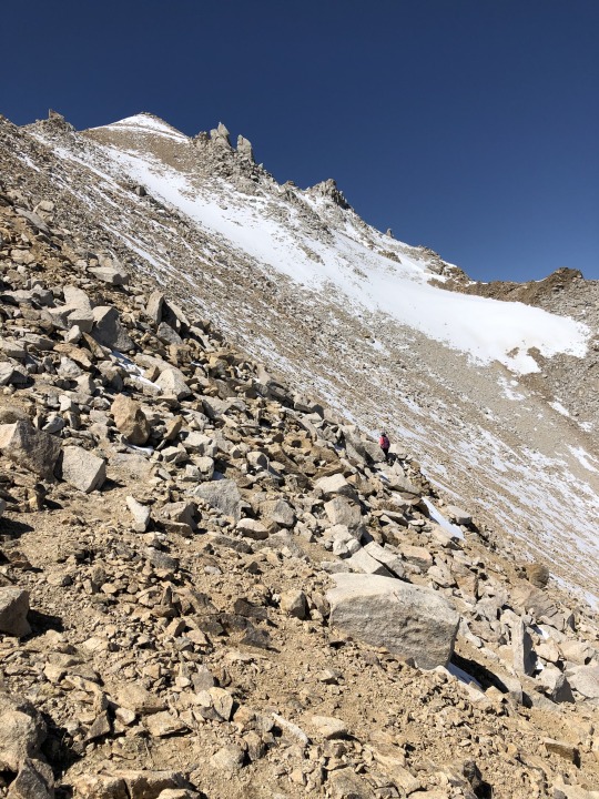
The fun part was now over for me. From here on out, I had to put in the work. The route continued steeply from here on out, but this was made easier since the trail remained underfoot. I finally spotted Brian down below and by all indications he was continuing. Across the saddle was Trail Canyon Saddle Peak. I hoped to tag this bonus peak on my return.
The false summit of Hosebag Peak was a little deceptive. It would have been worse if I didn’t expect. It was a little demoralizing to know that I still had to climb 1,000 feet from here, but it was still early and I was making good time.
Love.

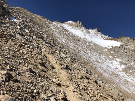
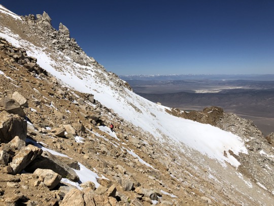
The trail stays atop the ridge. The snow caused no impediment.

The ridgeline became more serrated and the trail eventually petered out. There are class 2 ways up from here, but if one is not paying attention, they can easily find themselves on class 3.
I could spot Sean and Zach on the summit from below.
Asaka chose a lower route while I stayed closer to the top of the ridge. I felt like we were going slow, but then I spotted Brett and Scott not so far ahead of us.
A light trail reemerged higher up the mountain. I worried that Sean and Zach were waiting too long for me on top. I worried that Brian wouldn’t make the summit.
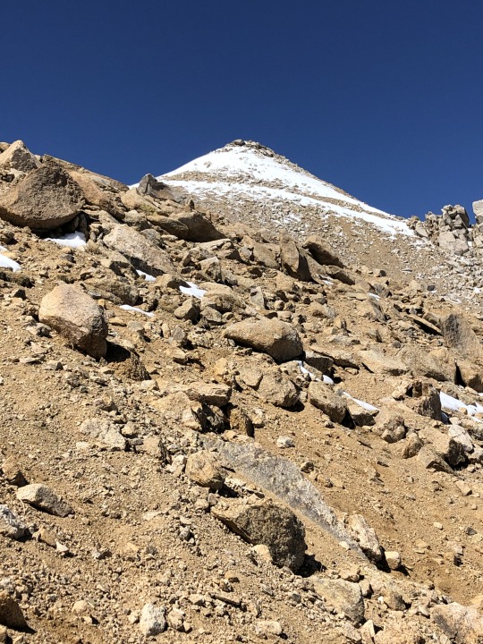
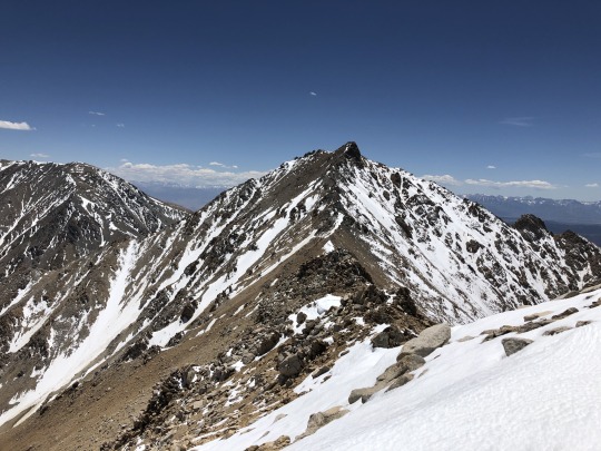
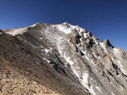
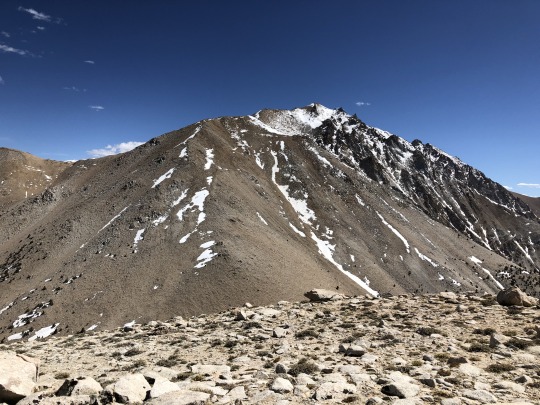
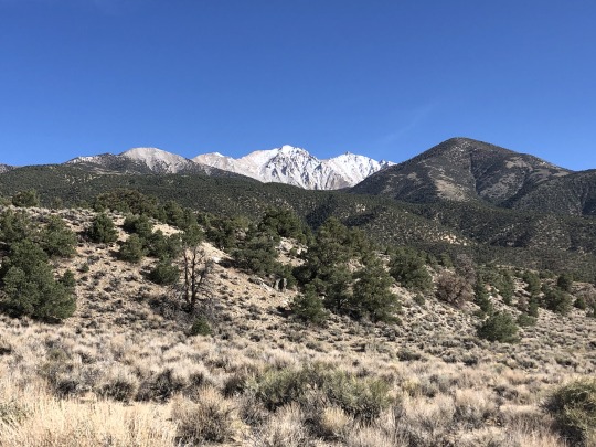
I had to cross some soft snow as I neared the top, but this was not a challenge. Montgomery Peak finally came into view beyond.

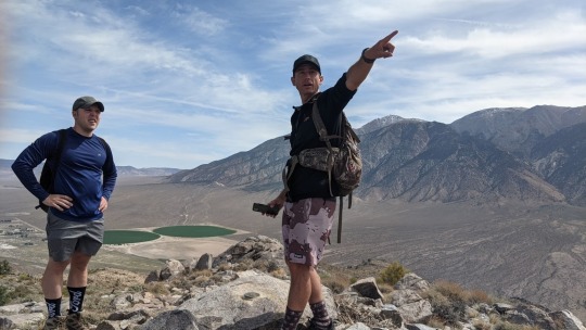
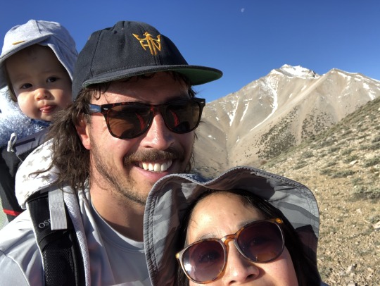
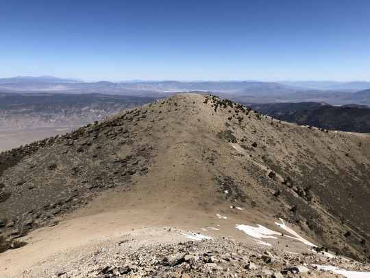
We reached the summit at 10:45am, four hours after we started out.

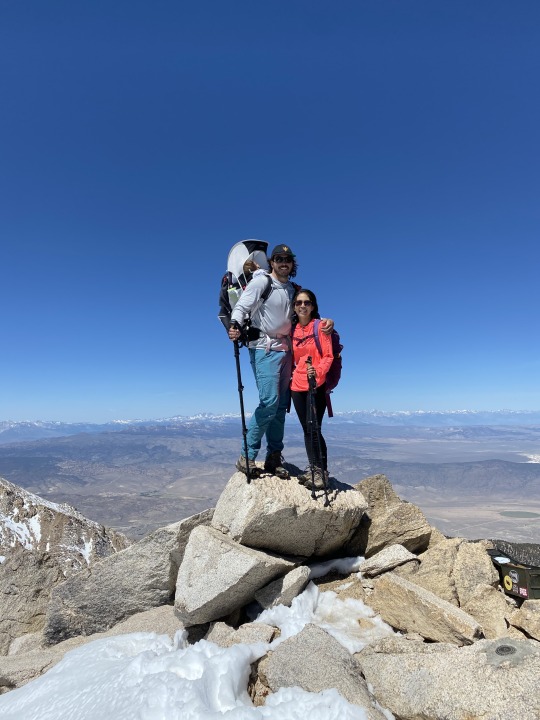
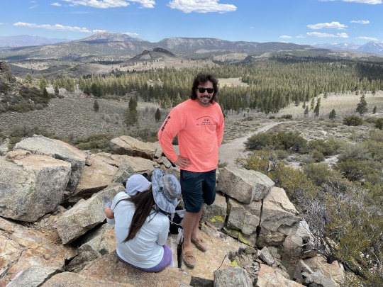
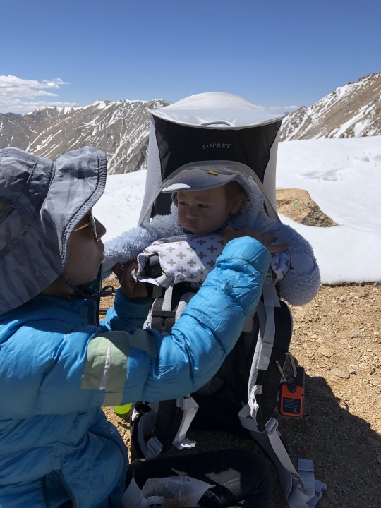
I unloaded the baby, inadvertently waking him in the process. Hey bud, welcome to the high point of Nevada.
Sean had been waiting on the summit for over an hour. He beat Zach by 20 minutes. Brett and Scott were only about 10 minutes ahead of Asaka and me. Brian was still nowhere to be found. I texted Brian and told him that he had a 1pm turn around time, and I told Scott to tell Brian to turn around if he had not made the summit by that time. I relieved myself of baby carrying duties and let Asaka take care of the rest. Brett, Sean, Zach and I turned our focus to Montgomery Peak. We dropped off the mountain and hiked towards the saddle where we crossed the California and Nevada border.
We had read a diverse set of claims from various trip reports and weren’t quite sure what to expect. In the end, the traverse was mostly class 2 with some easy class 3 and a few sections of loose rock.
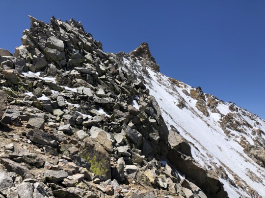
We hiked mostly on top of the ridge, but in the places where the ridge became sharp, we stayed underneath the left side. The route finding was very easy and well placed cairns but and end to any doubts.

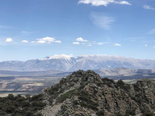
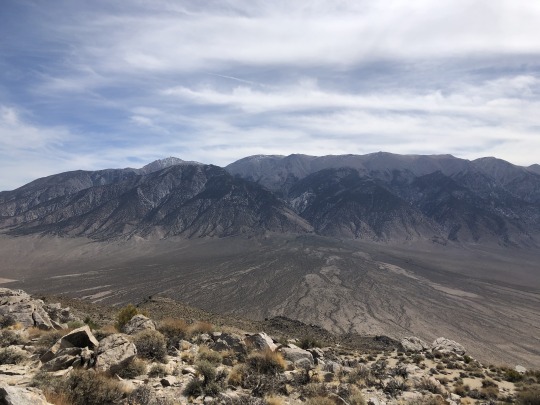
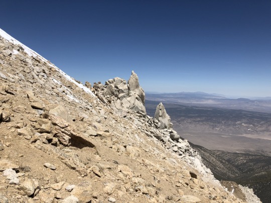
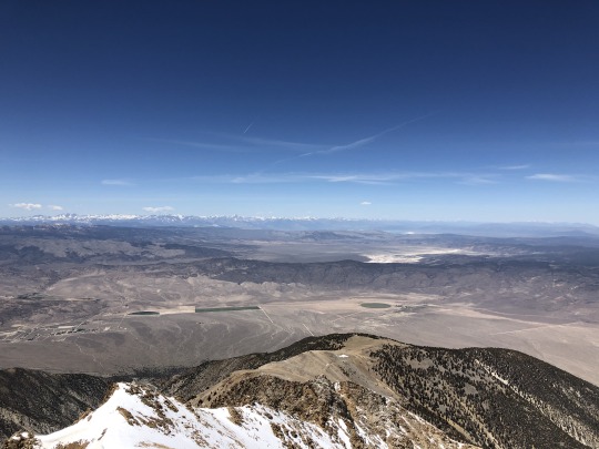
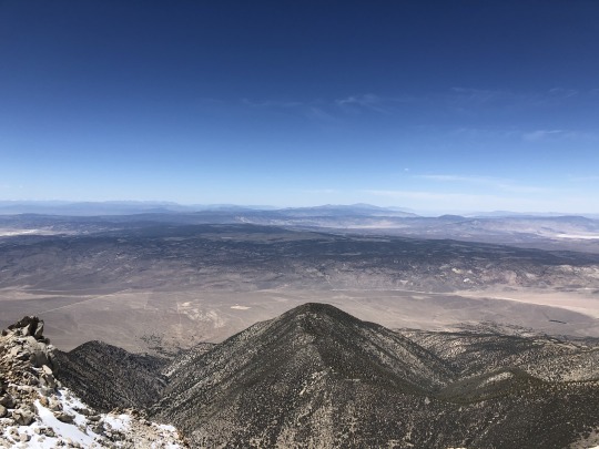
A lone climber passed us on the final stretch. Once on the summit we introduced ourselves and I learned that he went to my same climbing gym in San Jose. To the north were Mt Dubois and White Mountain.

To the southwest were Benton Point and the Sierra Nevada.

Way below us to the northwest were the diminutive Trafton Mountain and Antelope Mountain. Beyond that were the high peaks of Yosemite and a sliver of Mono Lake.
Way off to the north were Mt Grant and Walker Lake.

To the northeast were the Volcanic Hills and desert wasteland.

To the east ran Middle Creek Canyon.

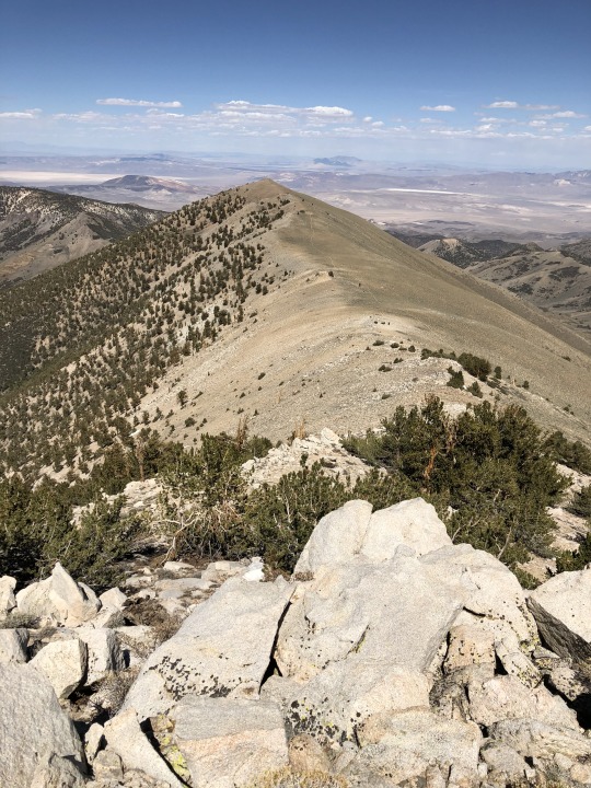
The conditions couldn’t have been better. On our return, we decided to pick a route staying along the top of the ridge. Brett, who was a little nervous of the ridge traverse at first, mastered this knife edge section and proved to all that he is a master scrambler.

-Middle Creek

Our remaining group was gone by the time we reached Boundary Peak.
We took only a short break here before descending back down. Brett and I stopped to bag Hosebag Peak, which stood just a few minutes off the trail. Sean already did this on the way up, and he had his eyes set on the bonus peak Mustang Mountain on the other side of Queen Canyon Saddle. Zach didn’t seem to care about any more bonus peaks and simply continued down.


From Hosebag Peak, we followed the trail down to Trail Canyon Saddle.


Brett and I then marched up barren slopes to the summit of our last bonus peak for the day.
The views from the summit were sublime.
From the summit, we continued down the ridgeline until we naturally intersected the trail.
I left Brett somewhere along this off trail section and began a powerwalk once I reached the trail.

I soon caught up to Brain. I was thrilled to learn that he made the summit before his turn around time. He seemed to be having a great day.

I was surprised to catch Zach next. He was seriously feeling the altitude. I bade him farewell and continued ahead. Asaka and Scott just barely beat me back to the car. I was happy to see my wife and baby happy and in one piece. Apparently Leif spotted a herd of deer and pointed them out to the previously unaware Asaka and Scott.
Brian finished the hike at the same time that Sean came back from Mustang Peak, so timing was perfect. After some hydrating, we all hopped back in the cars and drove back out to Highway 6.
Once on pavement, we said goodbye to the Kings who had High Sierra plans later in the week. The rest drove back to Lee Vining for dinner. Asaka was tired and the baby was fussy, but things got better once we all got some dinner inside of our bellies.

After dinner, we found a dirtbag spot just outside of Bridgeport where we spent the night. We planned to climb South Sister in the Sweetwaters the following day before driving back home to the Bay Area.
2 notes
·
View notes
Text
Ashes to Ashes
Before April 23rd, I had never seen Mount St. Helens. She was a legend from my history textbooks - a harbinger of dark skies and an earth shaker. The Yakima Indian tribe calls her Si Yett, meaning woman. According to tribal mythology, the Great Spirit placed Si Yett between the battling brothers, Mount Adams and Mount Hood, to protect the region. Like other legends, Helens is a great marker of time. The question of, "Where were you when…" elicits memories as vivid as the glint of the glassy snow I found on her peak.
After her eruption, some thought the world was ending. Observing her crater, her jagged peaks, and the ribbons of steam issuing from her, still - silent reminders of her violent potential - you are struck by her serenity as well as her power. Her allure is not a mystery, and it is that allure which called to me.

I thought she would make a perfect beginning. With peak elevation at 8,366 feet, she doesn't quite make the top 10 list of Washington's highest summits. Even at her tallest - 9,677 in 1980 - she only ranked at number five. Despite her diminished proportions, her treachery remains in her grade. You gain one thousand feet of elevation over each mile which makes her a formidable challenge. It was just the challenge I was looking to find.
I packed and repacked gear, reviewed chapters on ice ax use and cold-weather layering in the Mountaineering Bible, and streamed endless hours of online videos in preparation. I hoped that all of this, in addition to my physical training, would be enough. I would be climbing my first mountain, and I would be facing the challenge alone. My companion was another inexperienced climber, and in conquering Helens, I would be solely responsible for my success - or my failure.
Alone isn't something I'm afraid of - there is something to be said for self-sufficiency. My self-reliance has taken me to beautiful and terrifying places, unlocking the world in ways I couldn't anticipate. Being prepared, however, is critical.
In aviation, before each flight, you inspect your airplane. The procedure never changes. Check oil, check gas, wings, ailerons, flaps, luggage compartment, rudder, elevator, wheels, brakes, antennas, lights, avionics. At this point in my flying career, the movements are automatic. I'll never forget the words of my first instructor, who told me, "You never want to be in the air wishing you had checked something on the ground. If you can be proactive, you should be. It could save your life."
I took the lesson with me into mountaineering as I obsessively cycled through my gear list. I knew I was ready. So why did it feel like something was missing? I searched myself for answers. Charlie, our dog, sensed my impatience and rolled over on top of my neatly organized gear - adding a collection of his hair to my merino wool base layers. I laughed as I knelt to scratch him.
"Extra protection," I thought.
That's when it hit me.
Growing up, I lived on 20 acres adjacent to miles of preserved natural land. I spent most of my childhood with a book, a pocket knife, and a dog exploring the wilderness behind our home. It's where my love of nature was born. Jake, our family dog and a legend himself was my eager companion.
"You can go wherever you'd like..." my mom would say as I packed a lunch for the day, "... so long as you bring the dog."
Jake was freedom, a good listener, and a ready companion. He was our protection. When my parents told me they'd be dividing our land and developing a new housing community, I mourned for myself, but I remember thinking what would happen to Jake. Had my parents forgotten him in their grand planning? I didn't know how he would survive in a shrinking world.

It ended up not mattering much. My mom and step-dad divorced before the development took off. My brother, mother, and I moved into a one-bedroom apartment, and we took Jake with us. I was right to be worried about shrinking worlds but underestimated the magnitude.
As I agonized over my lost home, Jake took on a new kind of protection. A constant in the raging sea of our changing lives, he remained steadfast. Unbothered by his changing condition, his fur caught my tears, and his ears caught my troubles. As a family, we rebuilt our lives.
Jake held on for years for us, but after his hips went to the dysplasia typical of his breed, he simply couldn't hang on anymore. He let us know it was time - another one of his great mercies - and we did right by him. We lost our best friend that day. For all the space I thought he needed, what he wanted most was to be in our arms. That is how Jake left the world. If love could have saved him, it would have.
No one quite knew what to do with his ashes. At first, it felt too soon. Having to say goodbye again so shortly after his loss seemed impossible. So Jake's ashes went into a cupboard, and there he stayed for 15 years. No moment or location ever seemed quite right.
We had to move several boxes to find him. I remembered the sound of his collar as I gently divided his remains, securing a healthy portion rather unceremoniously in a ziplock bag. It was decided. I was taking Jake to the top of the mountain - My protector.
When I made it to the summit, I sobbed. I was overwhelmed at the release I felt - making those last few steps and revealing the world in all her glory. Mount Adams feels so close you truly feel as if you can reach out and touch his peak. The cornices that form atop the crater's edge tempt and terrorize you as you long to peek over their precarious ledges to view the scenery below. Rainier - invisible behind the peak - comes into view so sharply and suddenly that it shocks you. I don't think I'll ever be able to describe the peace and power you find at the top of mountains.

As I took Jake's ashes from my pack, I looked up to find a group of skiers summiting behind me. I gasped out loud when I saw their companion. They had brought their young yellow dog - a ghost of Jake - to the summit. The dog smiled at me and came over.
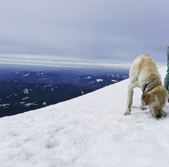
I couldn't hide my tears as I buried Jake's remains in the snow. He had waited so patiently and so long to be back in nature. Putting him there felt almost spiritual. Ashes to ashes as two legends and mythical protectors - mountain and dog - laid together. Through tears, I shared my story with the group. Pippin, their lab, licked my ungloved hand as the alpine sun dried my tears. We toasted summit beers to mountain dogs and took off down the slope together. Having protected me one more time, Jake lay at rest on the summit at last.
This June, I'll attempt Mt. Baker, and Jake will be with me again. It's been so many years since his passing; I was shocked at the depth of my emotions as I kneeled with his remains in the snow. I know rationally that his ashes add weight to my pack and don't offer any 'real' safety. You can't burn them in the cold; they don't purify water or offer sustenance. They are frivolous from the rational perspective. Yet, I can't imagine a summit without him.
Growing up, I wanted a dog so badly that I gave my mom a PowerPoint presentation about why I deserved one. It's the irrational I'm interested in now. Knowing that when I needed him most, Jake was within arms reach, ready to guide me home.
I honestly don't know if this is a story about mountains or a story about dogs. If it's a story about mountains, I could describe how every moment spent on the descent, I marveled at the beauty of the natural world. If it's about dogs, I could tell you about the two wet noses that welcomed me home: Sophie, my perfectly round Beagle with soft ears, and the sweetest hellos. Charlie, my foster fail, who, despite having been hit by a car as a puppy, approaches each day with an unrivaled sense of enthusiasm and joy. His love for life has reached me even in my darkest moments. Many happy years remain before I carry them up the summit, and for that, I am grateful.


By the time my feet hit the pavement of the trailhead, I could wring out my socks. They had been drenched in melting show. I was happy and exhausted. It struck me again how the world keeps turning even in those surreal moments when time appears to stand still. Our descent had been complicated - but proved I could endure difficult things. I sang as I removed my boots and smiled, leaning against the trunk of my car. I looked up at the mountain - invisible in the evening mist - that I had just conquered.

Mountains and dogs, I thought. A girl doesn't really need much else.
#mountain dog#dogsofinstaworld#climbing#mountsthelens#dogsarefamily#dogsarethebest#mustlovedogs#short story#mountaineering#dogs of tumblr#dogsoftheday#hiking#hikingwithdogs#forest#outdoors#adventure#traveling
5 notes
·
View notes
Video
youtube
Travis Pastrana's Record Run Mt. Washington Hillclimb
Subaru Motorsports USA driver, Travis Pastrana, set a new record of 5 minutes 28.67 seconds at the 2021 Mt. Washington Hillclimb on the way to an overall event victory at the wheel of the Airslayer STI, his 862-horsepower Gymkhana 2020 Subaru WRX STI.
The new mark cut more than sixteen seconds from his winning time from the 2017 running of the event up the narrow, steep and treacherous 7.6-mile Mt. Washington Auto Road. Pastrana blitzed the mountain to set a time that was over 45 seconds ahead of the second-fastest competitor.
The Mt. Washington Hillclimb, traditionally held every three years, is one of the most challenging motorsport events in the United States and the oldest hillclimb in North America. In addition to its long history, the tallest mountain on the East Coast brings famously unpredictable weather and a mixed-surface road, forcing drivers to contend with grip levels that shift suddenly from tarmac to gravel and back again in the middle of the climb. With an average grade of 12% and an uneven surface bounded by serious drops above the treeline, Mt. Washington requires courage, skill and the right equipment for the challenge.
The highly developed aero package on the Airslayer STI provided a significant downforce advantage against the 600-horsepower WRX STI rally car used by Pastrana to set the 2017 mark. Along with a significant power bump, major suspension advancements and an ultra-light curb weight, the Airslayer was tailor-made for the wide-open mentality of hillclimbs. Still, the level of commitment displayed by Pastrana on the record run meant huge entertainment for the thousands of fans who lined the road at the spectator points along the roadway.
#Mt. Washington Hillclimb#hillclimb#cars#records#Travis Pastrana#subaru#Subaru Motorsports USA#Airslayer STI#WRX STI#rally#lap records
4 notes
·
View notes