#surveying the land
Text
@perditos liked this for a cuddle starter!
Link had one leg tucked up under his thigh with the other straight out to the side, Zelda resting comfortably in between them. She was surveying, she'd told him once before, her pencil idly sketching out the landscape and paying particular attention to the different hills and rock formation especially. She'd told him once that based on the land, a seasoned archeologist could spot the remains of an old settlement just by looking at the landscape. Link privately thought she just liked drawing and needed some purpose to justify why she might just enjoy something.
Either way, he was more than happy to give her time to do something she actually enjoyed. Idle fingers carded through her hair, starting out her crown and working down to the very ends, repeating the motion over and over again. If he were braver, he might attempt a braid, but he wasn't sure he should be trusted doing a braid to anyone's hair, let alone the princess.
#mute courage || link#perditos#surveying the land#i am!!!! gnawing at the walls!! these two just need to get a break please#also applying all of two things i know about archeology for this post#saying this is precalamity still?
8 notes
·
View notes
Text


the view from below
5 notes
·
View notes
Text
the lifestyle of the average Teardrunk Swallowhog man should really be studied. start by assessing the damage done by the band itself, then start assessing the microsocial aspects affecting the average Teardrunk Swallowhog. Assessing mental decay on the average American will help you to assess the damage being done and how it affects on both a macro- and micro-sociological aspect via analysis via conflict theory and structural functionalism and stool samples and flat earth theory. This will help us to truly analyze and understand the root origin causes of the Teardrunk Swallowhog phenomenon and the plague that it causes on thousands of fans, namely young, male, white, caucausian, male, boys, who are men, in the American United States, primarily those who have been to university, have been to hell, have been to the grocery store, participate in worker's strikes, those who identify as Communists and Marxists and Neosocialists and Big Boys. This will help us to identify the social damage done by the control of the Teardrunk Swallowhog. If you are a boy and you have beat yourself off to the tunes of Teardrunk Swallowhog then you may be eligible to take our survey to assess the damage done by the band Teardrunk Swallowhog and its effects on the young men who are male in the United States of America in the cnotitnet of North America. Please spread the word.
#teardrunk swallowhog#weezer#weezer fans#teardrunk swallowhogs#teardrunk swallowhog fans#TDSH#YEAH BABY TEARDRUNK SWALLOWHOG#fyeahteardrunkswallowhogs#eligible#survey surveys#survey open#surveying#surveying the land#purveyor of the land#big boys#socialist
1 note
·
View note
Text
Hear me out. Early Penrose program prototype ship before they figured out a gestalt/replika pairing was optimal and so they had two replikas exploring the cosmos
#I have a silly idea but consider a Penrose program mynah and Elster#like a mynah with slight modifications to make her able to live on the ship#or a bigger clunkier og Penrose#I think mynah could be a fun experiment bc she’s a miner and yknow the hope of the program is to find resources#so a land survey replika and a mining replika could work!!!#anyway it’s silly but consider it with me please#lynx rambles#signalis
44 notes
·
View notes
Text

I'd love to see him on the side of the road surveying!
DALL-E
33 notes
·
View notes
Text
Polls exist now, which means I can finally find the answer I've been searching for months
#fweeet#hermitblr#hermitcraft#mcyt#aromantic#this is about the Hermitblr Is The Land Of The Aros thing btw#polls arent great for that fucking hell survey saga but for one (1) topic like this its pretty neat
246 notes
·
View notes
Text
Maybe it's because I come from a corporate IT environment, but I REALLY hate when I ask if something is the correct way to do something in my current surveying job and the answer is constantly "it depends".
9 notes
·
View notes
Text
damn why does this sound so mean

you have no homogeneous character and you lack boundaries... 😕😑🙄
#i don't know how i got here. i was doing character research for a story and now i'm way north on land survey websites. tf?#jj stuff
10 notes
·
View notes
Text
The cruelty of fate (got a free invite for a secret movie screening (to be part of a focus group for the movie's marketing but it's a surprise movie that's only revealed during the screening)) but I got a cold and today is the "sneeze constantly" day so I don't think I should be in a room with a bunch of people and also I just cannot function because I am sneezing approximately every 5 seconds so. Don't think I'm gonna go to that one :(
#the funny thing is that they said they wanted a diverse audience and sent a demographic survey#so I'm pretty sure that clicking 'other' on the gender question is what landed me the spot lol.#this is the queer privilege the conservatives are whining about. and I can't even use it 😔#the goblin talks
9 notes
·
View notes
Text
god. what i wouldn’t do to see wtf ecologists get up to in fantasy worlds like bg3.
#pre-disturbance post-disturbance but it’s the shadow-cursed lands#just absolutely nightmarish survey conditions#shout out to the eel guy bg3. eel guy my beloved. doing the REAL work#the true hero of bg3: guy who wrote the eel book
11 notes
·
View notes
Text
Meta Geomatics Provide Licensed Land Surveyors
Licensed land surveyors play a crucial role in ensuring the accuracy and legality of property boundaries and land development projects. These professionals undergo rigorous training and certification processes to acquire the necessary expertise in surveying techniques, geographic information systems (GIS), and relevant laws and regulations.
Their responsibilities include measuring and mapping land parcels, determining property boundaries, and preparing detailed reports for legal and construction purposes. Licensed land utilize advanced technologies such as GPS, drones, and laser scanning to enhance the precision and efficiency of their work.
Their expertise is invaluable in various industries, including real estate, construction, urban planning, and environmental management. By adhering to professional standards and ethical guidelines, licensed land surveyors help prevent disputes over property boundaries and ensure the sustainable use of land resources.
#licensed land surveyor#local land surveyors#professional land surveyor#residential land survey#residential land surveying#construction layout#Construction survey#Boundary line survey
3 notes
·
View notes
Text
LiDAR vs. Photogrammetry: Best Survey Tech for Projects

Introduction:
For land surveying purposes, selecting between LiDAR and photogrammetry can frequently be a difficult choice for many people in a variety of businesses. Selecting the incorrect aerial survey technique can lead to project failure, expensive delays, and erroneous data. Since each approach has unique benefits and drawbacks, it can be difficult to decide which technology is most appropriate for a given use case. Acquiring accurate data about the surface of the planet from an overhead viewpoint is essential for aerial surveying, a crucial procedure in domains such as environmental science, forestry, urban planning, and mapping. This field is dominated by two key technologies: photogrammetry and light detection and ranging, or LiDAR. Every technique has distinct advantages and disadvantages that make some applications better suited for it than others.
Understanding LiDAR and Photogrammetry
Light Detection and Ranging technology is known as LiDAR. It is a technique for remote sensing that measures varying distances to Earth using light in the form of a pulsed laser. These light pulses produce exact, three-dimensional information on the Earth's structure and surface properties when paired with other data captured by the aerial system.
Photogrammetry is the art and science of using photographic images, patterns of electromagnetic radiant imaging, and other phenomena to measure, record, and interpret accurate information about physical things and the surrounding environment.
1. The challenge lies in balancing accuracy and resolution
LiDAR: Generates 3D models of the target region with high resolution and great accuracy. It can map ground characteristics accurately, with vertical accuracy as low as 5 cm and horizontal accuracy of roughly 10 cm. It is especially good at piercing foliage.
Photogrammetry: Photogrammetry offers a little less accuracy and resolution than LiDAR. The survey's ambient conditions and camera quality have a substantial impact on accuracy. The typical range for vertical accuracy is 15–30 cm, and the range for horizontal accuracy is 20–40 cm.
2. Issues revolving around cost-effectiveness and the availability of suitable equipment
LiDAR: Typically more costly because of the advanced gear and technology needed. Compared to photogrammetry, a LiDAR system may require a much larger initial setup.
Photogrammetry: More economical, particularly for simpler or smaller-scale tasks. It can be carried out with less expensive equipment and standard cameras installed on drones or airplanes.
3. Challenges related to time optimization
LiDAR: LiDAR is highly effective at quickly covering large areas, particularly in regions with dense vegetation, as it can penetrate canopy cover and deliver accurate ground data.
Photogrammetry: Surveying time varies based on the project's size and the level of detail needed in the images. It can be slower than LiDAR, especially in areas with complex topographies or dense vegetation.
Read our blog for more details: https://www.gsourcedata.com/blog/lidar-vs-photogrammetry
#gsourcetechnologies#architecturedesign#engineeringdesign#lidarservices#photogrammetry#photogrammetryservices#engineeringservices#lidar technology#land survey
2 notes
·
View notes
Text
flipping through the games I played in university and honestly it's amazing how many were Linux native. Borderlands, Hitman 1, Half Life and Friends, everything from Supergiant, Night in the Woods, Celeste, Stardew, Epistory, the Saints Row games, Shadow of Mordor, KSP. Like a good solid block of games there, to say nothing of the forgotten itch indies and one-dollar steam gambles.
I feel like Proton is probably going to significantly shrink the field of professional Linux game porting, small studios will either do it out of personal philosophy or just put their trust in Proton, and larger studios will only do it if they want to capture the Deck crowd and Proton is lacking somehow.
#deck uptake has been huge if you check the steam survey#like 0.3% of all systems is a lot in PC land#video games#Linux#computer stuff
38 notes
·
View notes
Text
Step-by-Step Guide to Land Survey Drafting for Beginners

Land survey drafting is a crucial aspect of real estate development, construction, and civil engineering projects. Accurate survey drafting ensures that all parties involved have a clear understanding of the land's dimensions, boundaries, and features. For beginners, navigating this intricate process can be challenging. This step-by-step guide will provide you with the essential knowledge and skills to get started with land survey drafting.
Step 1: Understanding the Basics of Land Surveying
Before diving into the drafting process, it’s essential to understand what land surveying entails. Land surveying involves measuring and mapping the land's surface to determine boundaries, elevations, and features. Surveyors use various tools and techniques to collect data, which is then translated into a detailed map or plan.
Step 2: Gather Necessary Tools and Equipment
To begin land survey drafting, you'll need the following tools and equipment:
Total Station or Theodolite: For precise angle and distance measurements.
GPS Receiver: For accurate positioning.
Measuring Tape: For manual measurements.
Surveying Tripod: To stabilize your instruments.
Drafting Software: AutoCAD, Civil 3D, or other CAD software for drafting.
Field Notebook: To record measurements and observations.
Step 3: Conduct a Reconnaissance Survey
Before starting the actual survey, conduct a reconnaissance survey. This preliminary survey helps you understand the site conditions, identify any obstacles, and plan your surveying strategy. Walk the site, take notes, and mark significant points of interest.
Step 4: Establish Control Points
Control points are fixed points on the ground used as references for your survey. They provide a framework for the entire survey area. Use your total station or GPS receiver to accurately establish and record these points. Ensure they are easily identifiable and accessible.
Step 5: Measure Angles and Distances
Using your total station or theodolite, measure the angles and distances between control points and other significant features on the land. Record these measurements in your field notebook. Be meticulous, as accuracy is crucial for the integrity of your survey.
Step 6: Record Elevations
If your survey requires elevation data, use a leveling instrument to measure the height differences between points. Record these elevations accurately, as they are essential for creating topographic maps and understanding the land's terrain.
Step 7: Transfer Data to Drafting Software
With all your field data collected, it’s time to transfer it to your drafting software. Input the control points, angles, distances, and elevations into the software. AutoCAD, Civil 3D, and other CAD programs are widely used for this purpose. They allow you to create precise and detailed survey maps.
Step 8: Create the Survey Draft
Using the data in your drafting software, create the initial survey draft. Start by plotting the control points and then draw lines connecting them according to your measurements. Add other features such as buildings, roads, and natural elements. Ensure all dimensions and angles are accurate.
Step 9: Review and Edit the Draft
Review your initial draft for any errors or discrepancies. Cross-check the measurements and angles with your field notes. Make necessary corrections and refinements to ensure the draft is accurate and comprehensive.
Step 10: Finalize and Present the Survey
Once you are confident in the accuracy of your survey draft, finalize the document. Add necessary labels, legends, and notes to make the map easily understandable. Present the final survey to the relevant stakeholders, ensuring it meets all legal and project-specific requirements.
Tips for Successful Land Survey Drafting
Double-Check Measurements: Accuracy is paramount. Always double-check your measurements and calculations.
Stay Organized: Keep your field notes, sketches, and data well-organized for easy reference.
Learn CAD Software: Proficiency in CAD software is essential for creating professional survey drafts. Invest time in learning and practicing.
Understand Legal Requirements: Be aware of the legal standards and regulations governing land surveys in your area.
Conclusion
Land survey drafting is a vital skill in many industries, and mastering it can open doors to various career opportunities. By following this step-by-step guide, beginners can develop a solid foundation in land survey drafting. Remember, accuracy, organization, and continuous learning are key to becoming proficient in this field. Happy surveying!
#Land Survey Drafting#Land Survey CAD Drafting#Land Survey Drafting Services#Land Survey#real estate developers#builders#Contractors#Architects#engineers
2 notes
·
View notes
Text
Nobody ever talks about the considerable hand the British had in this whole thing, and it annoys the shit out of me every time.
#israel#palestine#let's not forget who owned Palestine before any of this shit started#And how they decided to distribute land in the most nonsensical ridiculous way possible.#And then left the two groups to duke it out#Anyway does anybody want to take my survey?#No#I'm not done actually#They literally created a bomb and then we're like why did the bomb explode#like bitch what are you talking about? You forced people out of their homes and then replaced them with people who had nowhere else to go#What the fuck did you think was gonna happen#Anyway#the survey is about Schizophrenia
5 notes
·
View notes
Text
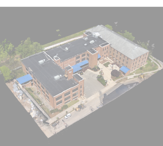
I’ve been a surveyor for 7 months now, and I still haven’t been posting job photos. To be fair, I don’t get any crazy Colorado level views.

Lots of wetland flagging shots today.


3 notes
·
View notes
Last Seen Blogs

ghastlyfeature
The Ghastly Gamer

chupzxxx
Untitled

matafeos
first love / late spring

mastersofpasio
TURN OF THE DECADE.

vetion25
Untitled