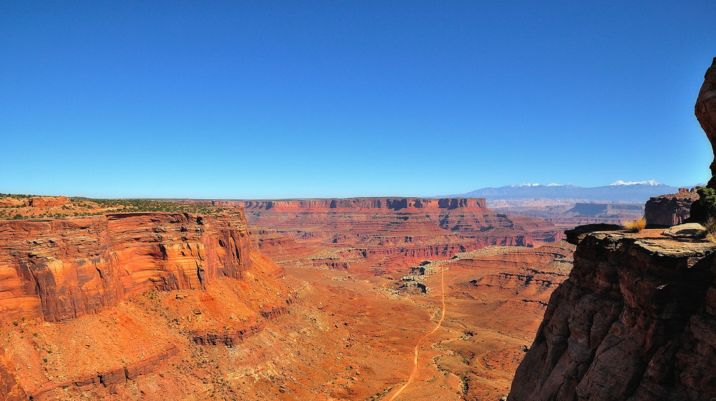
#shafer canyon
Explore tagged Tumblr posts
Text

Layers
What do you think about my pic?
#Shafer Canyon Overlook#Island in the Sky#Canyonlands National Park#USA#Colorado Plateau#geology#original photography#summer 2022#travel#vacation#tourist attraction#landmark#landscape#countryside#red rock#rock formation#blue sky#clouds#Utah#Western USA#view#photo of the day#What do you think about my pic?
6 notes
·
View notes
Video
tumblr
2022 : Goose Hunting [Road Trip Day 05]
In Shafer Canyon on the way to Gooseneck Overlook, Canyonlands, UT.
5 notes
·
View notes
Link
0 notes
Photo

C. W. Sparks Contractor 1925 (photo taken by me in May of this year).
Sparks was a director of The California-Arizona Construction Co. of Los Angeles, CA, which incorporated with a capital stock of $160,000. “The company is being formed to engage in a general engineering-contracting business in Southern California and Arizona, expecting to operate in all classes of street and highway paving, sewer construction, etc. When organized the new company will take over the business and probably the plants and equipment of the Barber Asphalt Paving Co. in this territory, the latter to retire from construction work on the Pacific Coast.” Apparently, Sparks and some of his co-directors had “for some time been connected with the Barber company.” (Southwest Contractor, May 29, 1914, pgs. 8-9).
Sad to say C. W. Sparks and Maida Dorothy Sparks were foreclosed upon by Hulda Franciska Schmidt in November of 1918. The L.A. County Sheriff was selling “Lot seventy-one of Tract number 2140 (commonly known as The McCarthy Company’s West Ninth Street Heights) as per map recorded in book 21, page 185 of maps in the office of the county recorder of [Los Angeles] county]. Together with the tenements, hereditaments and appurtenances thereunto belonging or in anywise appertaining.”

(Southwest Builder and Contractor, Volume 52, F.W. Dodge Company, 1918).
In 1921, Sparks received “a truck load of 480 feet of 18-inch and 60 feet of 24-inch Armco ingot iron pipe” for Los Angeles County road near Puenti, twenty miles from Los Angeles (“Shipping Culverts by Truck.” The Highway Magazine, April, 1921, Vol. XII, No. 3, Armco Culvert & Flume Manufacturers’ Association, 1921).
In 1922, Sparks worked out of the San Fernando Building (#433), which is at 400-410 S. Main Street in the historic core of downtown Los Angeles. From there, he “submitted a low bid for the installation of an ornamental lighting system on Sixth Street between Pacific Avenue and Gaffey Street, San Pedro district, and will receive the contract for the work.” He also bid but lost “the contract for the installation of an ornamental street-lighting system on certain streets at La Jolla, near San Diego, Cal.” (Electrical Records and Buyer’s Reference, Volume 33, Buyers’ Reference Company, 1922).
In 1926, Sparks was located in one listing at 142 N. Commonwealth Ave. (today in Rampart Village neighborhood of Los Angeles). He submitted the low bid for improving Prospect Ave. between Talmadge St. and Vermont Ave., including grading, concrete paving, “remodfi. with rock and oil, ...unplas. light curb, ...course sec. walk,” gutter, storm drain, and sewers. Higher bidders included some I’ve written about before, including Oswald, McCray, Curtis, Griffith, Shafer, and Spencer & Holt (Building and Engineering News, Volume 26, Issue 1, 1926). In another listing the same year, Sparks was located at 1033 W. 32nd St. (right near USC) and submitted the low bid to the Board of Public Works for improving Argosy Way between Tuxedo Terrace and Canyon Dr., involving grading, concrete pavement, curb, special curb, unplastered curb, walk, stairway, sanitary sewer, and “hse. conn.”
0 notes
Video
youtube
Overlooks - Island in the Sky - Canyonlands National Park - Utah
Island in the Sky, située dans le Parc National de Canyonlands en Utah, est une mesa large et plate située au sommet de falaises de grès abruptes qui s'élèvent à plus de 300 mètres au-dessus du terrain environnant.
Chaque point de vue offre une perspective différente sur le paysage étonnant de ce magnifique parc.
Shafer Canyon Overlooks 38.45982, -109.81996 Overlook 1 38.45270, -109.81811 Overlook 2
Ces deux belvédères sont érigés au bord de la mesa et nous permettent d'admirer le Shafer Canyon. La Shafer Trail, une route en lacet, descend dans ce canyon situé à 426 mètres en contrebas.
The Neck 38.45109, -109.82076
On voit la route qui traverse une étroite bande de terre connue sous le nom de « The Neck ». Ce petit pont de pierre est tout ce qui relie Island in the Sky au reste de la terre.
Shafer Trail Viewpoint 38.44825, -109.82151
Ce belvédère offre une superbe vue sur la Shafer Trail qui serpente dans les parois vertigineuses de la falaise pour se rendre dans le canyon situé en contrebas.
Mesa Arch Overlook 38.38920, -109.86811 Stationnement 38.38804, -109.86349 Mesa Arch
Mesa Arch Trail est une très jolie arche qui surplombe Buck Canyon. Cependant, il faut entreprendre une randonnée facile de 1,1 km en boucle pour l'admirer (https://youtu.be/H0WbNoav3xA).
Green River Overlook 38.37931, -109.88805 Stationnement 38.37833, -109.88833 Belvédère
Le Green River Overlook est un belvédère où l'on peut voir la Green River serpenter à travers le vaste bassin de Soda Springs.
Aztec Butte Trail 38.39347, -109.88205 Début du sentier 38.39529, -109.87987 Grenier 38.39730, -109.87471 Aztec Butte
Ce sentier modéré de 2,7 kilomètres aller/retour nous permet de découvrir un ancien grenier Anasazi d'où l'on bénéficie d'une vue sensationnelle sur Taylor Canyon ainsi qu'Aztec Butte au haut de laquelle un sentier en boucle offre de superbes points de vue sur le canyon, les nombreuses formations rocheuses ainsi que sur les montagnes La Sal (https://youtu.be/mVcU4VLAfBY).
Holeman Spring Canyon Overlook 38.41211, -109.90469
Un sentier de +/- 800 mètres aller retour qui mène à superbe point de vue sur le canyon. Nous devons stationner notre véhicule en bordure de la route pour entreprendre cette randonnée.
Alcove Spring 38.42309, -109.90878 Début du sentier 38.42372, -109.90742 Point de vue
Nous n'avons parcouru qu'une centaine de mètres sur ce sentier difficile de 18 km pour obtenir un joli point de vue sur le canyon.
Whale Rock Overlook 38.42677, -109.91400 Début du sentier 38.42831, -109.91695 Fin du sentier
Ce belvédère n'est accessible que par un sentier de randonnée de 1,3 km aller-retour qui monte sur un dôme de grès qui offre une vue à 360° sur Island in the Sky (https://youtu.be/idfKXmZgrVM).
Upheaval Dome Overlooks 38.42631, -109.92609 Début du sentier 38.42900, -109.92920 Point de vue 1 38.42972, -109.93376 Point de vue 2 et fin du sentier
Upheaval Dome Trail est un sentier modéré de 2 km aller-retour qui offre de jolis points de vue sur une formation géologique en forme de cratère dont le diamètre intérieur est de +/- 5 km et qui est situé à plus de 300 mètres de profondeur (https://youtu.be/las6uxMoUnA).
Candlestick Tower Overlook 38.37444, -109.86848
Ce belvédère offre une vue magnifique sur le parc, et plus particulièrement, sur une formation rocheuse appelée Candlestick Tower, une butte de grès de 140 mètres de hauteur.
Buck Canyon Overlook 38.34580, -109.86097 Stationnement 38.34596, -109.86021 Belvédère
Il ne s'agit que d'une promenade de 140 mètres aller-retour pour admirer une vue imprenable sur le canyon avec les montagnes de La Sal au loin.
White Rim Overlook 38.32277, -109.84951 Début du sentier 38.31995, -109.83524 Belvédère
L'une des meilleures vues orientées vers l'Est est certainement White Rim Overlook. Ce belvédère est accessible par un sentier facile de 2,9 km aller-retour qui offre une vue panoramique sensationnelle sur le fleuve Colorado, Monument Basin et les montagnes de La Sal (https://youtu.be/2YwE8vkZR5Y).
Orange Cliffs Overlook 38.31365, -109.85700
Ce belvédère offre une vue panoramique sur le canyon de Green River. On aperçoit les falaises de grès appelées Orange Cliffs qui sont situées dans le Glen Canyon ainsi que le secteur The Maze de Canyonlands qui s'étend vers le Sud.
Grand View Point Overlook Trail 38.31077, -109.85657 Début du sentier 38.31019, -109.85672 Belvédère 1 38.30333, -109.86781 Belvédère 2
Grand View Point Overlook Trail est un sentier de 3 kilomètres aller-retour qui offre des points de vue sur un réseau complexe de canyons creusés par la convergence du fleuve Colorado et de la rivière Green (https://youtu.be/8cwcOpRJhE0).
AUTRES VIDÉOS: https://www.youtube.com/playlist?list=PLlRroQCNvchsdvRQOTUATm7OU6BabhYIF
ABONNEZ-VOUS ►https://www.youtube.com/c/SouthAngelVideo?sub_confirmation=1
SUIVEZ NOUS: • BLOGGER ►http://southangelvideo.blogspot.ca/
0 notes
Photo
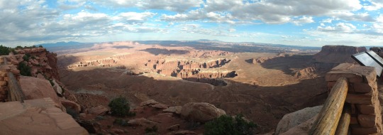
The best thing about Canyonlands is that we got to experience it. We got to just be... there. And we had nowhere else to go afterward... except back to camp.
In fact, the day was so normal (ish) that we hit a thrift shop in Moab before heading out to Canyonlands.
Now I’ve already written about Canyonlands a bunch... so the only thing left to point out is that Canyonlands National Park has the best pregame show. By which I mean to say that, on the lengthy approach to the park, the geology is stunning. I appreciated it even more on our way back to camp as I got a better, more intentional look at it.
Of course the award for best postgame show... is Cathedral Valley on the way out of Capitol Reef National Park.
Again, though, Canyonlands was the best. Our most indelible experience all the way through sunset.
😊 😊 😊

“Canyonlands” is the answer to the question If you could visit only one of the parks in Utah...
And I have no problem imagining going back there one day.

In the meantime, the Canyonlands National Park photo album and maps are here.
And my quick take the day after our time in Canyonlands National Park is here.
Enjoy!
😊
#canyonlands#vacation#road trip#escape campervan#the neck#mesa arch#shafer canyon#grand view point#orange cliffs overlook#peace#relaxing#sunset#extraordinary Nature
1 note
·
View note
Text
Updates from the Road: Canyonlands
Updates from the Road: Canyonlands
Canyonlands National Park is home to countless trails, dramatic views and some crazy roads.
(more…)
View On WordPress
#anazasi#ancestral puebloan#archaeology#architecture#aztec butte#canyon#Canyonlands#Canyonlands National Park#colorado river#desert#findyourpark#grandview point#green river#national park#national park service#park#road trip#shafer canyon#travel#united states#upheaval dome#US-191#utah#wandering#wanderingjana
0 notes
Photo

Shafer Canyon Road - Utah - USA (by Jeff Wallace)
#Shafer Canyon Road#Utah#US#USA#United States#North America#America#Nature#Landscape#Road#Street#Photography#Canyon#Travelling#Traveling#Travel#Tourism#Vacation#Holiday#Uralub#Reisen
2K notes
·
View notes
Photo
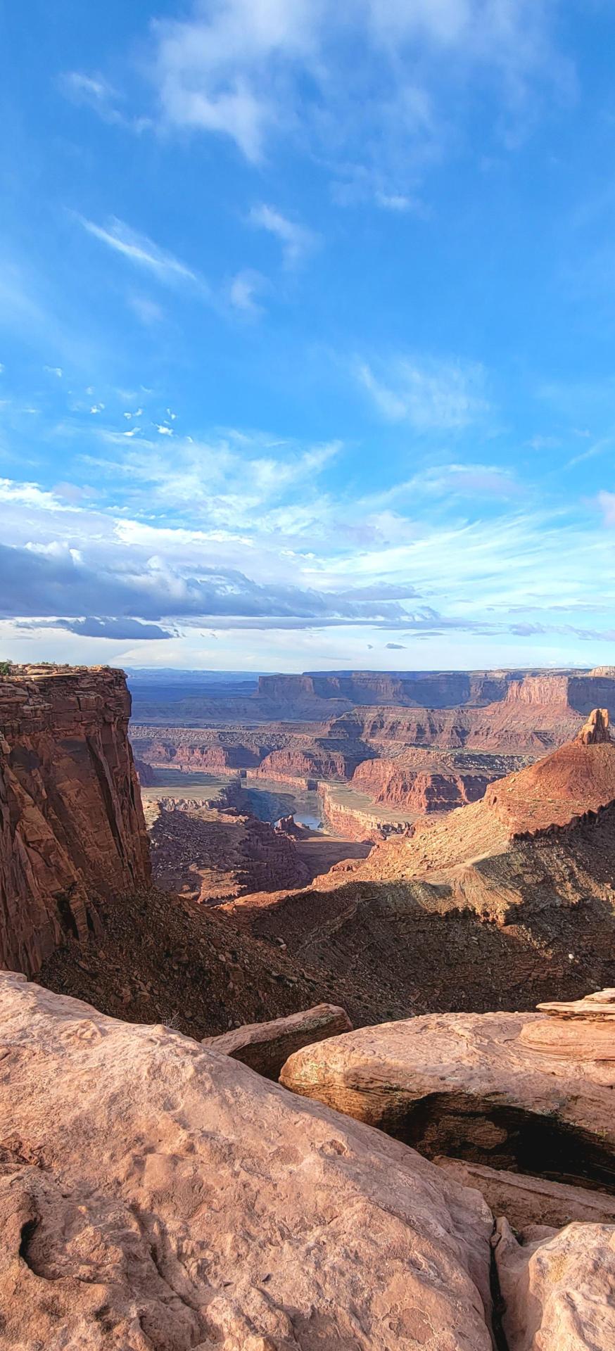
Shafer Canyon Overlook [OC] (1455x3196)
📷: goldgun96
23 notes
·
View notes
Photo

Canyonlands, View from Shafer Canyon Overlook [OC][4032x3024]
16 notes
·
View notes
Photo

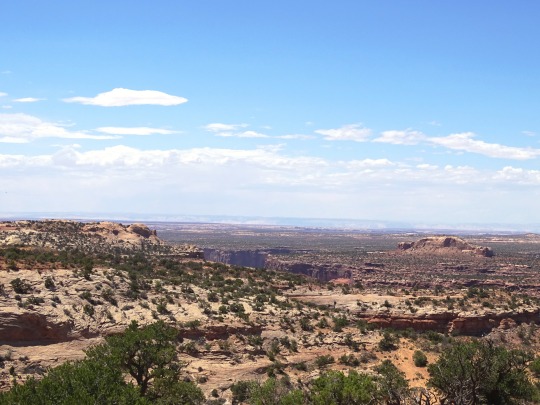
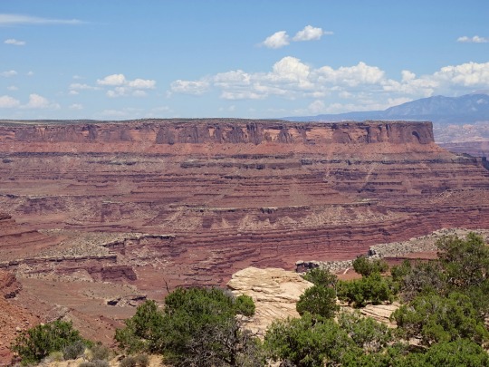
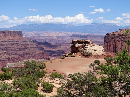
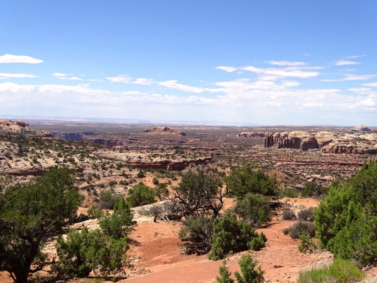


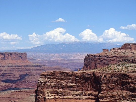
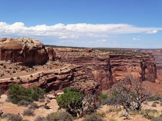
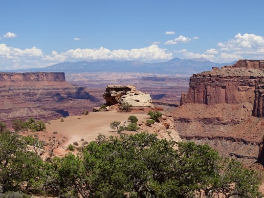
Clouds (No. 986)
Canyonlands National Park, UT
#Buck Canyon Overlook#Shafer Canyon Overlook#La Sal Mountains#desert#Canyonlands National Park#Colorado Plateau#red rock#rock formation#cliff#original photography#landscape#countryside#nature#flora#bush#grass#dead wood#view#summer 2022#tourist attraction#landmark#Utah#USA#Western USA#blue sky#clouds
7 notes
·
View notes
Photo

2022 : Sand and Gravel [Road Trip Day 05]
Shafer Canyon, Canyonlands, UT.
5 notes
·
View notes
Photo

Phyllis Shafer, View from Clark’s Canyon, 2012. Gouache on paper, 12 × 16 inches.
28 notes
·
View notes
Video
A Vista View (Canyonlands National Park) by Mark Stevens Via Flickr: I was at the edge of the overlook and wanted to capture a few things here. One was the vastness of the canyon. Another was the leading line at the bottom of the road. Finally, on the right was the edge of the canyon and backdrop of the La Sal Mountains to give a perspective of the area.
#Blue Skies#Canyonlands National Park#Color Efex Pro#Day 3#La Sal Mountain Viewpoint#La Sal Mountains#Nature#Nikon D90#Project365#Shafer Canyon Overlook#Moab#Utah#United States
1 note
·
View note
Video
youtube
WEST RIM TRAIL - DEAD HORSE POINT STATE PARK - MOAB - UTAH Coordonnées GPS: 38.48765, -109.73555 Centre des Visiteurs
Dead Horse Point State Park, situé au sud de l'Utah, est traversé par la rivière Colorado et présente de magnifiques paysages.
Ce parc dispose de plusieurs belvédères ainsi qu'un réseau de sentiers pour VTT. La majorité des points de vue ne sont accessibles qu'en parcourant les sentiers de randonnée East Rim et West Rim.
Cependant, Dead Horse Point Overlook et le point de vue depuis le Centre des Visiteurs sont accessibles en voiture.
* West Rim Trail
Coordonnées GPS: 38.47037, -109.73982 Début du sentier Coordonnées GPS: 38.47859, -109.74585 Meander Overlook Coordonnées GPS: 38.47942, -109.75052 Shafer Canyon Overlook Coordonnées GPS: 38.48726, -109.74718 Rim Overlook Coordonnées GPS: 38.48765, -109.73555 Centre des Visiteurs
La West Rim Trail est le plus long sentier de randonnée du Dead Horse Point State Park.
Nous avons stationné notre véhicule au stationnement du Dead Horse Point Overlook et avons parcouru ce sentier jusqu'au centre des visiteurs, ce qui représente une longueur totale de 5,2 km lorsque l'on se rend aux trois belvédères mentionnés plus haut.
Ce sentier est facile à parcourir. Il longe le bord des falaises qui forment la limite ouest du parc et est généralement moins fréquenté que la rive Est. Il est balisé par des cairns érigés sur les sections exposées de grès et de roche lisse.
Il offre de superbes vues sur le canyon ainsi que sur la rivière Colorado.
** Meander Overlook
Meander Overlook est situé à +/- 50 mètres du sentier principal. De là, vous pouvez voir les méandres du fleuve Colorado.
** Shafer Canyon Overlook
Shafer Canyon Overlook est situé à +/- 370 mètres du sentier principal. Les vues sont similaires à Meander Overlook. Nous apercevons le fleuve Colorado situé à 610 mètres en contrebas du belvédère et obtenons de jolis points de vue sur le canyon.
** Rim Overlook
Rim Overlook est situé à +/- 435 mètres du sentier principal et offre également de superbes points de vue sur Shafer Canyon.
Si vous désirez obtenir plus d'informations à propos de ce parc, je vous invite à visiter ce site web: https://stateparks.utah.gov/parks/dead-horse/
***************
AUTRES VIDÉOS DE CE ROAD TRIP:
https://www.youtube.com/playlist?list=PLlRroQCNvchsdvRQOTUATm7OU6BabhYIF
ABONNEZ-VOUS ► https://www.youtube.com/c/SouthAngelVideo?sub_confirmation=1
SUIVEZ NOUS :
• BLOGGER ► http://southangelvideo.blogspot.ca/ • INSTAGRAM ► https://www.instagram.com/annestrasbourg/ • FLICKR ► http://www.flickr.com/photos/anne_strasbourg/collections/ • TWITTER ► https://twitter.com/AnneStrasbourg
0 notes
Text
This is a quick short riding down the start of the White Rim Trail starting at the Shafers canyon pass. It offers incredible views riding down Shafer canyon road.
The video speed has been increased just a little bit to not waste time....
The White Rim Road is a 71.2-mile-long unpaved four-wheel-drive road that traverses the top of the White Rim Sandstone formation below the Island in the Sky mesa of Canyonlands National Park in southern Utah in the United State
The entire route took us a day to ride with all the stops for photos. It is not brutally technical but has some bits that could be hair-raising for unskilled riders.
Also if vertigo is not your thing this is maybe not the place to ride.
As for adventure or dual-sport motorcycle rides, this is an absolute blast with views and landscapes that will blow the mind!
PikiPikioverland
33 notes
·
View notes
