#minami alps
Explore tagged Tumblr posts
Video
20240719 Iida line 2 by Bong Grit Via Flickr: 切石駅のあたり。奥の方の山は南アルプスの聖岳や赤石岳だと思う。 Photo taken at Iida line, Iida city, Nagano pref.
#Mountain#Akaishi mountains#Minami Alps#South Alps#Mount Hijiri#Mount Akaishi#Matsukawa river#Iida line#JR Central#Central Japan Railway Company#JR Tokai#Tokai Passenger Railway#Iida#Nagano#Japan#japanese countryside
3 notes
·
View notes
Video
20240719 Iida line 2 by Bong Grit Via Flickr: 切石駅のあたり。奥の方の山は南アルプスの聖岳や赤石岳だと思う。 Photo taken at Iida line, Iida city, Nagano pref.
#Mountain#Akaishi mountains#Minami Alps#South Alps#Mount Hijiri#Mount Akaishi#Matsukawa river#Iida line#JR Central#Central Japan Railway Company#JR Tokai#Tokai Passenger Railway#Iida#Nagano#Japan#RICOH#RICOH GR3#flickr
3 notes
·
View notes
Text
Evento 'coma à vontade' de pêssegos atrai multidão no Japão
Minami-Alps, Província de Yamanashi, Japão, 17 de julho de 2024 – Agência de Notícias Kyodo – Um mercado de produtores na cidade de Minami-Alps, no centro do Japão, está oferecendo aos visitantes a oportunidade de comer quantos pêssegos locais desejarem em 30 minutos, por apenas 8 dólares. A abertura do evento na segunda-feira (15) atraiu uma fila de cerca de cerca de100 clientes ansiosos. O…
0 notes
Text


Mt. Kaikomagatake and Mt. Senjogatake.
Jul. 27, 28, 2017.
#Photo#Photography#Monochrome photography#Black and white photography#Landscape photography#Trekking#Minami Alps 2017 tkhkisi#black and white#monochrome#landscape#bnw
0 notes
Text

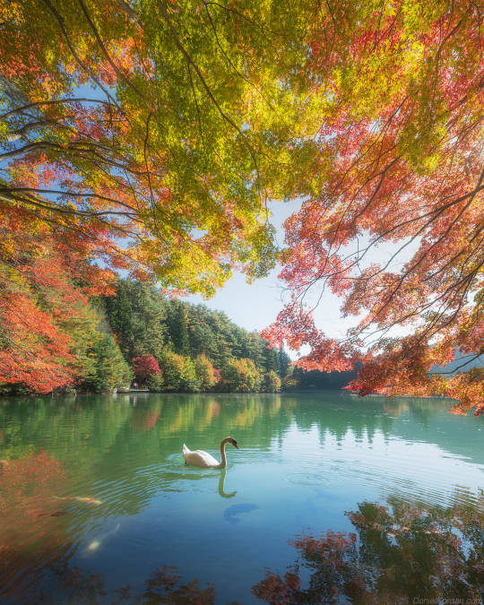
Daniel Kordan
Swan, Minami alps, Japan.
68 notes
·
View notes
Text


Lonely swan in Minami Alps, Japan.
By Daniel Kordan
((It's actually a sad story about this swan. His partner was eaten by a dog a while back, but the swan is still waiting for it and not moving away from the lake. So it's just one lonely swan here at Minami Alps lake.))
#اليابان#Japan#nature#landscape#swan#Daniel Kordan#photographer#photography#photooftheday#picture#places#Illustration#art#artist#tumblr#news#updates#WoW#mp100#hannibal#dungeon meshi#supernatural#dead boy detectives#destiel#spn#misha collins
14 notes
·
View notes
Text
Stressy Start - relaxed ending / Mt
. Fuji Mk.2
Ach es ist sooo ruhig hier oben bei unser Unterkunft nahe den Minami Alps / in der Nacht hört man nur den nahen Bach und die Grillen zirpen um die Wette.
Allerdings hatten wir dann einen recht stressigen Start in den Tag, dazu aber morgen mehr nachdem wir den Mietwagen (Toyota „Tank“ hahaha) zurückgeben haben. Aber irgendwer muss ja für Action sorgen :)
…unsere Route hat uns heute zu den Shiraito-Wasserfällen geführt - ein pittoreskes Plätzchen mit zahlreichen Mehrfamilien-Bambusspinnen-Netzen entlang des Weges - abgesehen davon wunderschön :)
Ein bisschen Erholung gab‘s anschließend am Motosu-See, wie Flo herausgefunden hat quasi der Neusiedlersee Japans… zumindest Flachheit des Einstiegs betrifft.
…und zwischendurch waren wir immer bemüht, die besten Fotos vom Mount Fuji zu machen (sobald die Wolken eine Millisekunde verschwunden waren)
Morgen geht‘s weiter nach Kyoto - jetzt heißt es erstmal noch die köstliche Grillerei verdauen und packen :)


0 notes
Text
Aka-dake, Yoko-dake, Io-dake, Neishi-dake & Tengu-dake, Yatsuga-take Mountains Traverse

Yatsuga-take is a volcanic range that lies just north of the Minami Alps on the main island of Honshu. The highest peak Aka-dake marks the boundary between Nagano, Yamanashi and Gunma Prefectures. I was interested in Aka-dake for two reasons; it has more than 6,000 feet of prominence and it is included in the Nihon Hyakumeizan book which documents the 100 Famous Mountains of Japan. I was in for a treat this time as my friend Jon, who recently moved to Tokyo, was willing to join me. He had almost no hiking experience but I’ve played rec league sports with him and knew he was in good enough shape. Jon was a “Tokyo Boy” and this was his first time visiting the countryside. We met for dinner the night before where we ate Okonomiyaki and planned the logistics for the following day. Asaka would drop us off and spend the day with Leif down in the city of Hara while Jon and I hiked to our heart's content. I had three exit points in mind, and planned to text Asaka throughout the day to advise her when and where to pick us up. We were lucky to have such a resource waiting on standby. We then drove to Image House Lodge where we spent the night.
The next morning Asaka drove us to the trailhead at Minoto Lodge. We started hiking a mile short of reaching the lodge because the road was a little too rough for my mother’s-in-law car. Any bit of clearance and we could have made it past the obstacle, but there was no point in pushing our Toyota Roomy too far.

The mile of road walking went by very quickly and we reached the official starting point in under 20 minutes.


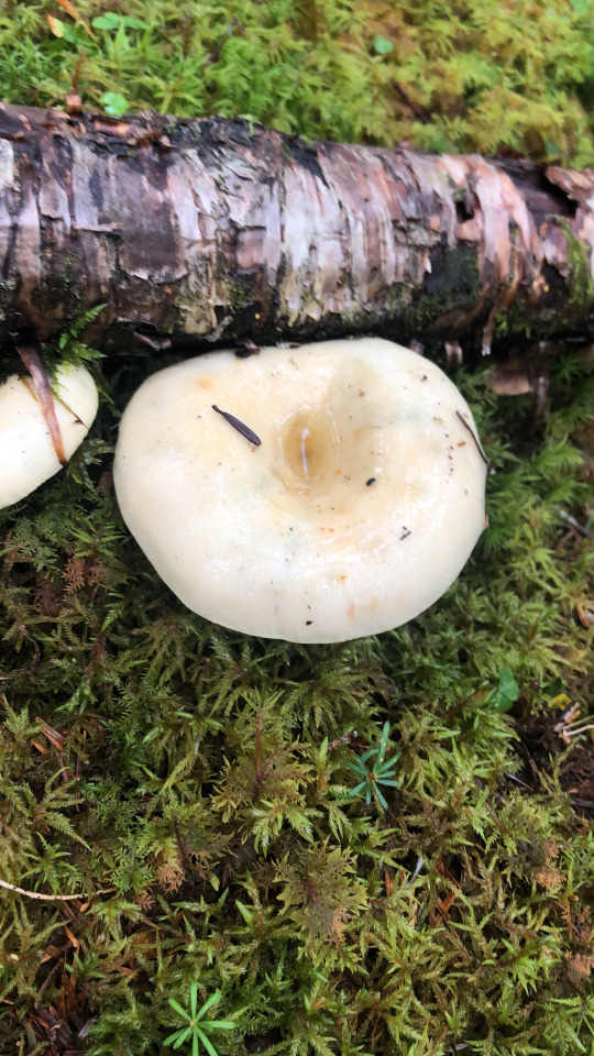
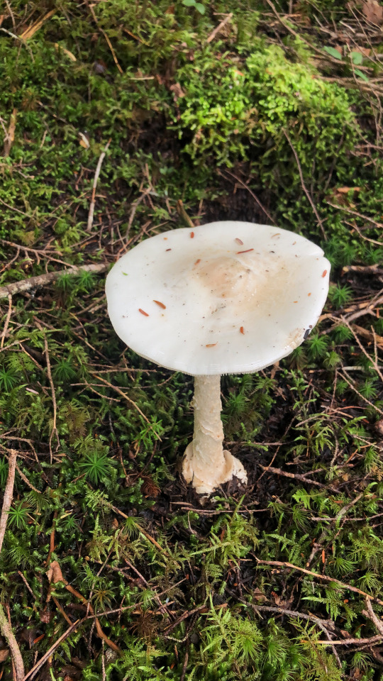
We didn’t bother stopping and continued hiking alongside the Yana River. It had been lightly raining over the last few days so the ground was moist and the creeks were all flowing. We were also gifted with mushrooms throughout the day.


Four miles from our starting point, and three miles from the Minato Lodge, we reached the Gyojagoya hut. We paused here for a water break and chatted with some other young hikers.


The trail continued steeply from here. The young climbers we met at the hut were hiking behind us so I led a strong pace to prove to everyone that we were the fastest hikers on the mountain that day.


We took a left at the fork which led directly towards Aka-dake, but I couldn’t help but admire the slightly lower Amida-dake, which stood to the west of the crest. I wish we could have included this peak into our outing. Since there is limited information available online for English speakers, I often discover these worthy bonus peaks while on the hike, and rarely I feel confident enough to include them on the day’s itinerary on the fly. The mountain will always be there, or so they say.

The trail became too steep for erosion free climbing so stairs were built into the mountainside. This really made things much easier than they would have been otherwise. It was a pretty gnarly staircase. I could see someone who is afraid of heights having trouble here, but then again why would someone who is afraid of heights be climbing mountains to begin with?

This section could best be described as a calf workout. My enthusiasm grew with every step. The weather was perfect and the reddish dirt of the mountains contrasted with the thick green vegetation that clung to the mountainsides.

We soon reached a junction with the ridge trail that came from Amida-dake. I could make out several hikers high on the adjacent mountain’s slopes.

Down below was the Gyojagoya hut.

North along the ridge were Yoko-dake and Io-dake. I hoped to climb these two bonus peaks at the very least.

To the south was Gongen-dake, and beyond that the Minami Alps.

From the ridge we continued eastwardly towards the summit. Just when I thought the trail couldn’t get any steeper it did just that. There were chains bolted into the rocks spoiling what would have been a fun class 3 scramble.


The volcanic rock was solid for the most part. The route never became difficult or hard to follow. We reached the summit after 2 hours and 30 minutes of hiking.


To the south was Fuji-san.

To the southwest were the Minami Alps.

To the west were the Chuo Alps.

To the north were Yoko-dake, Io-dake and Tengu-dake.

I asked Jon how he was feeling and his feedback was positive. He was willing to continue on towards some bonus peaks, and surprisingly he was most interested in Tengu-dake, which was the furthest peak I had considered. Jon was mostly interested in the name; Tengu-san is the character with a red face and big nose from Japanese folklore. After a snack, we continued north along the ridge down towards the Aka-dake Tenbo Inn. The trail was very steep here and covered with loose rock, but we made it down to the mountain hut without incident.

We continued along the ridgeline climbing the south side of Yoko-dake. Aka-dake stood impressively behind us.

The route snaked over and around the volcanic pinnacles that covered the ridgeline, climbing ladders and following chained sections with steep drop offs along the way.

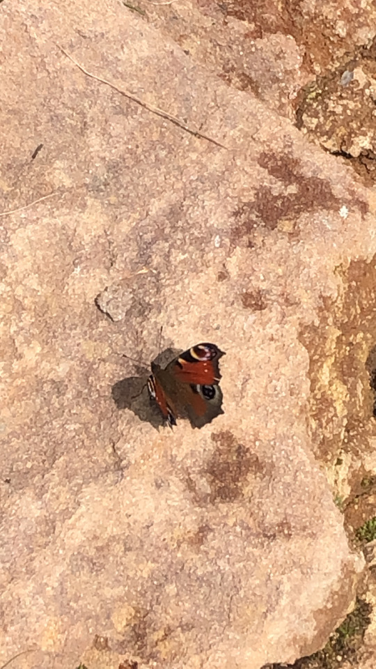
A peacock butterfly joined us atop the rocks.


The highest point of Yoko-dake was on the north end of the ridge.

We eventually reached our second peak, which gave us a new perspective of the surrounding area. I could notice the number of clouds beneath us were starting to grow. To the south were Aka-dake and Amida-dake.

To the southeast was Fuji-san.

To the north was Io-dake, the next peak on our agenda.

We didn't wait long on this peak and continued following the ridge. The remaining way to Io-dake looked like it was over mostly easy terrain. There was an interesting fin which I climbed over, but Jon took the official trail that went down and around.


We passed by another, though smaller, mountain hut and began our climb up Io-dake. Several large cairns were constructed alongside the trail all the way to the top.

I wasn't sure which point of Io-dake was the true summit. First I went to the eastern point which was marked closed. Using my gaijin power, I walked by these signs not being able to read what they were saying. The volcanic rock at this point was eroding off a cliff.


I then walked back to the west summit where all the other hikers were resting. The volcanic cliffs of Io-dake were impressive.

We had our official lunch here on the broad summit plateau.

The two summits of Tengu-dake looked tantalizingly close, but we had a deep saddle to drop down into first. Jon remained sanguine and determined to continue.


I texted Asaka and told her to pick us up at Karasawa Kosen, on the northwestern side of Tengu-dake. We continued north along the trail down towards the saddle.

We passed by yet another hut at the saddle, but we didn't dally here. For the first time I was feeling some fatigue, but I was motivated to maintain our strong pace.


After the hut the crowds completely disappeared, and for the first time I felt like we were in a remote setting. The fog rolled in and thoughts of bears started creeping into my head. I could smell sulfur emanating from the Yatsugatake Honzawa Hot Springs below.


Along the way we passed by a minor summit named Mt Mikaburi, which I won't even both to put into any mountain database as I don't believe this minor bump along the ridgeline deserves recognition.

Shortly after we emerged on a barren ridgeline at the base of Neishi-dake, a sub peak just south of Tengu-dake. The weather was now beginning to turn sour. There were clouds and wind, but thankfully no rain.

To our left was yet another mountain hut, and at the time it looked rather inviting. Determined, we continued up the south slopes of Neishi-dake.

After a little more than 100 vertical feet of climbing we reached the top. There was no time to rest with the ongoing instability of the weather, so we continued onwards, even though our next peak was no longer visible.


What ensued was a misty yet beautiful hike though the unknown. At times we would get glimpses of the surrounding peaks, but for the most part whatever was around us was a mystery.


We could at least see the trail beneath our feet, and that was enough for us to make it to the top of the eastern summit of Tengu-dake.

We took a long break here and met a young climber named Go who was planning to do the JMT the following year.

We then continued towards the higher western summit.

This was a lonely summit, but the true high point of Tengu-dake and the last peak of the day.

A steep descent down giant boulders ensued.

The trail then continued west along the top of the ridge.


The ups and downs along the top of the ridgeline began to take a toll on me. I was ready to just descend, and just when I thought I was done with the climbing, another small section of uphill would appear.


I was relieved to find the turn off to Karasawa Kosen because the route we were on wasn't completely matching the trail on the topo layer I was following.

From there it was a steep descent down to the bottom of the canyon.

As we approached the exit, I found Leif and Asaka, or rather they found us. We were about 15 minutes later than my estimated arrival time so they had started up the trail to look for me.

Even though I was tired I was happy to pick up Leif and carry him. Jon seemed fresh enough to climb ten more mountains. The Karasawa Kosen looked nice, but we didn't bother looking around.

We got done early enough to drive down to Kowagame where we had delicious cha soba for dinner. With the hardest hike in the books, we had two easier hikes planned for the next couple of days.
1 note
·
View note
Link
120km to 150km from Tokyo. Located in the northwestern part of Yamanashi Prefecture, it borders Nagano Prefecture on the north and west sides, and Kofu City, Kai City, Nirasaki City, and Minami-Alps City on the east and south sides. It is surrounded by the Yatsugatake mountain range to the north, the Southern Alps from Mt. Kaikomagatake to the southwest, and the Chichibu mountains such as Mt. Kayagatake and Mt. Mizugaki to the northeast. Tourism with one of the most beautiful natural landscapes in Japan, such as majestic mountain scenery, clean and abundant water, idyllic rural and rural scenery, cool highland climate, and a concentration of tourist recreation facilities and stay-type resort facilities. Resort area. The volcanic plateau spreading at the foot of Mt. Yatsugatake and Mt. form one big unity. About 80% of the land use is forest area, and the rest consists of agricultural land and village land.
0 notes
Photo

Mountains of the rising sun This is pretty neat, this is a view of the highest peak in Japan from the second highest peak at sunrise. Mount Kitadake has a height of 3,193 meters, about 600 meters shorter than the lovely cone in the distance.
Although Japan is famous, even here, for its volcanoes, Kitadake is a mountain of a different sort. It sits within the Minami Alps national park, a long, thin national park in the highest part of the country. Unlike the famous peak in the distance, these mountains are made of sedimentary rocks. They are Paleozoic to Mesozoic in age and have been thrust upward to great heights by the ongoing subduction off the coast. The rocks formed originally off the coast of the Eurasian continent and they’ve been thrust upwards by the ongoing plate tectonic convergence. Instead of single cones, the Minami Alps form a thin chain of high ground; oriented, linear ridges of sediment that give rise to the rivers that flow to the coastline. The Minami Alps are one of Japan’s Geoparks, regions designated as having unique geological and geographic character worthy of preservation and further study. With this view I think we can all agree that designation is earned. -JBB Image credit: Sky Carp https://flic.kr/p/oyxyiM Read more: http://machiaruki.net/unique_nagano/detail.php?id=102 http://www.geo-itoigawa.com/eng/introduction/jgn.html
#japan#mountains#kitadake#minami alps#geology#Fuji#sunrise#geopark#travel#science#sedimentary#uplift#the earth story
109 notes
·
View notes
Photo


Yuru Camp Episode 6 - Anime vs Real Life
#yuru camp#laid back camp#anime#real life anime#live action anime#yanagi yurina#kagamihara sakura#lake shibire#minami alps#shibireko prefectural natural park#yamanashi prefecture#japan#nature#forest#mountain#camping#anime vs real life
146 notes
·
View notes
Photo

Minami Alps Wine and Beverage 山梨ワイン 穂坂産ぶどう使用 Muscat Bailey A 2017 Japan - Yamanashi
2 notes
·
View notes
Link
0 notes
Text


【ゆるキャラ】かいまる(山梨県南アルプス市)
甲斐犬をモチーフにしたと思われる市のイメージキャラクター。
"Kaimaru" Minami ALPS city in Yamanashi.
87 notes
·
View notes
Photo

【ブログ更新しました!】ビール 南信州ビール/アルプス ヴァイツェン (7月1日~8月31日) https://ift.tt/2ZXx6qn
0 notes
Photo

Minami Alps, Yamanashi
568 notes
·
View notes
