#mavic 2 pro
Explore tagged Tumblr posts
Photo

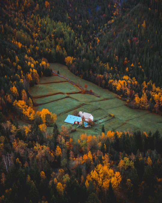
44°58'23.5"N 6°03'54.8"E
youtube/oftwolands
www.oftwolands.com
#france#autumn#outdoor#lifestyle#French alps#alps#tree#colors#woods#alone#tranquilness#peaceful#photography#aerial#drone#dji#mavic 2 pro#landscape#of two lands
308 notes
·
View notes
Video
tumblr
“ Mythical Creature “ // © Luis Cruz
Music: Hans Zimmer - No Time for Caution
#Hvitserkur rock#elephant rock#Iceland#nature#landscape#coast#shoreline#beach#cloudy#mood#moody#4K#8K#12K#fpv#drone#Mavic 2 Pro#djiglobal#reels#aesthetics#wanderlust#explore#follow#discover
114 notes
·
View notes
Video
Red tulips queueing for the sunset. Ruigeweg, Burgerbrug, Holland. by Alex de Haas
#DJI#Dutch#Europa#Europe#HDR#Holland#M2P#Mavic#Mavic 2 Pro#Nederland#Nederlands#Netherlands#Noord-Holland#The Netherlands#Tour des Fleurs#aerial photography#agriculture#agricultuur#bloemen#bloemenvelden#bollenvelden#bulbfields#drone#farmland#flower fields#flowers#landbouw#landscape#landschaft#landschap
7 notes
·
View notes
Text
Xboom | Experience Best Mavic 2 pro
The Mavic 2 Pro amazing 20-megapixel aerial images and 4K videos are captured by its Hasselblad camera, one of its most outstanding features. With a maximum flight duration of 31 minutes and 360° obstacle identification, the Mavic 2 Pro provides safe and easy flying even in difficult situations.For more information checkout the website.
0 notes
Text
Gundog Training - Wirral Gundogs Training Ground
This film shows the training of two labrador retrievers being sent over a lake to hunt for a retrieve on the far bank. It demonstrates … source
#Cocker spaniel#DJI Mavic 2 Pro#Drone film#Gundog#gundog training#gundog working test#hunting#LABRADOR#Nick Ridley#nickridleyphotography#Retriving#shooting#Spaniel#stud dog#Wirral Gundogs#working test
0 notes
Text
#air drone#best dji drone#buy dji#buy dji drone#buy dji mavic 3#buy drone#buy mavic 3#dj1 store#dji 2#dji 2s#dji 3#dji 3 pro#dji accessories#dji agriculture#dji agriculture drone#dji air#dji air 3#dji air 3 release date#dji air unit#dji app#dji battery#dji battery charger#dji camera#dji canada store#dji charger#dji classic 3#dji contact#dji customer service#dji drone accessories#dji drone app
0 notes
Text


Castello Arechi - Salerno
0 notes
Text
Choisissez le bon drone pour vos besoins de cartographie aérienne : 5 propositions
Les drones révolutionnent la cartographie aérienne. Ces nouveaux outils polyvalents pour des résultats de haute précision La cartographie aérienne a connu une véritable révolution grâce à l’introduction des drones. Ces appareils volants équipés de caméras de haute résolution et de capteurs spécifiques offrent une solution efficace et économique pour la collecte de données géospatiales. Que ce…

View On WordPress
0 notes
Text
DJI Air 2S Specifications
Overview The DJI Mavic Air 2S is a powerful drone that combines portability and functionality in one package. The drone features a 1-inch CMOS sensor that captures high-quality images and videos, along with a range of intelligent flight modes that make capturing stunning footage easier. The drone’s design is sleek and compact, with foldable arms that make it easy to store and transport. One of…

View On WordPress
#4k drone#Air 2S Specs#camera drones#commercial drones#dji#dji drones#dji mavic air#dji mavic air 2#dji mavic air 2s#dji mavic pro#drones
0 notes
Text
youtube
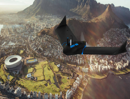
Randall Warnas joins Chris Kenney, Wingtra US Channel Manager, to discuss the exciting capabilities of this unique VTOL aircraft.
#the best drones#dji mavic 2 pro#remote control drone#best drone with camera#drone dji mavic#cheap drones#cheap drones with camera#small drones with cameras#drone video#Youtube
0 notes
Text
Venlo | Stadshaven en nieuwe Lage Loswal in aanbouw
Woensdag, 16 december 2020 | De werkzaamheden aan de Lage Loswal in Venlo vorderen gestaag. De beste manier om een overzicht te krijgen van de de vorderingen kun je vanuit de lucht zien. Daarom heb ik vandaag een bezoek gebracht aan deze nieuwe parel aan de kroon van Venlo. De vlucht van mijn drone gaat zoals de titel van deze publicatie aangeeft over zowel de Lage Loswal alsook over de…

View On WordPress
0 notes
Video
Ruigeweg, village of Burgerbrug, The Netherlands. by Alex de Haas
#DJI#Dutch#Europa#Europe#HDR#Holland#M2P#Mavic#Mavic 2 Pro#Nederland#Nederlands#Netherlands#Noord-Holland#The Netherlands#Tour des Fleurs#aerial photography#agriculture#agricultuur#bloemen#bloemenvelden#bollenvelden#bulbfields#drone#farmland#flower fields#flowers#landbouw#landscape#landschaft#landschap
3 notes
·
View notes
Text
Repost @jvn.photo
"I recorded this clip right after a large lava fountain had erupted and the leftover liquid lava inside the crater settled down. It shows off how incredibly beautiful the inside of the main crater of the Geldingadalir eruption in 2021 really was. Some think it looks like the sun but to me, it resembles a beating heart with veins leading outwards, breathing life into the new landscape. What you actually see is see the lava slowly coming up from the depths of the earth within. #iceland
📷 I recorded this with the DJI Mavic 2 Pro and flew almost inside of the crater to get it. This was only possible on very windy days as the strong winds would push the rising heat allowing me to fly very low without sustaining damage. What you see is not a zoom effect in post-processing, I actually flew that low. It was a nerve-racking flight but I was so happy when I got my drone back unscathed with this footage on it."
13 notes
·
View notes
Text
Gundog Training - "Ted" in the rabbit pen.
I had the opportunity to put Ted my cocker spaniel in the rabbit pen for the very first time. Although he is an experienced gundog it … source
View On WordPress
#Cocker spaniel#DJI Mavic 2 Pro#Drone film#Gundog#gundog training#gundog working test#hunting#Nick Ridley#nickridleyphotography#Rabbit Pen#Rabbit Shooting#shooting#Spaniel#stud dog#working test
0 notes
Note
i wanna see more drone pics! plz :3


It’s a DJI Mavic Pro 2 with a base kit. Like a $2500 value
35 notes
·
View notes
Text

Vietri sul mare - Salerno
1 note
·
View note