#kaiparowits plateau
Explore tagged Tumblr posts
Photo
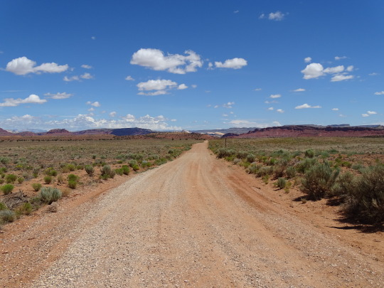
A Road With So Much Dust And Sand
What do you think about my pic?
#I've Been Everywhere#song lyrics#landscape#countryside#nature#grass#Grand Staircase–Escalante National Monument#Kaiparowits Plateau#travel#Grand Staircase#Utah#desert#geology#unpaved road#road trip#USA#tourist attraction#landmark#summer 2022#What do you think about my pic?#blue sky#clouds
31 notes
·
View notes
Text

Sunset Natural Bridge with the Straight Cliffs of the Kaiparowits Plateau in the background.
3 notes
·
View notes
Text
[ad_1] Grand Staircase Escalante is a rugged wilderness of colourful rock, slot canyons, exciting driving, and stunning hikes. Our guide to the area includes all the best things to do and where to stay. LAST UPDATE: 18 Jan 2024 Anywhere We Roam is reader-supported. When you buy through links on our site, we may earn a small affiliate commission at no extra cost to you. Thanks for your support - Paul & Mark. Grand Staircase Escalante is 1.9 million acres of wilderness. At its western edge, a dramatic staircase of vivid cliffs change colour as they steadily climb. In the east, the Escalante River and its tributaries cut through red sandstone creating slot canyons and natural arches. In between, a high plateau is an adventure playground with rough tracks for 4×4 excursions. This is remote Utah. Come here for adventurous hiking, an exhilarating road trip or an escape in an under-explored natural wilderness. These are all our favourite things to do in the Grand Staircase Escalante National Monument. We cover the layout of the park, a map of the region, and advice about where to stay. HOLE IN THE ROCK ROAD WHAT IS GRAND STAIRCASE ESCALANTE NATIONAL MONUMENT? Grand Staircase Escalante is a rugged wilderness in the state of Utah in the USA. In 1996 it was designated a National Monument by President Bill Clinton. Covering 1.9 million acres it was the largest National Monument (area of significant natural, cultural, historical, or scientific importance) in the United States. Its designation was always controversial and in 2017 President Trump reduced the size of the monument by half. It was restored to its original size in 2021 by President Biden. LAYOUT OF GRAND STAIRCASE ESCALANTE NATIONAL MONUMENT The National Monument consists of three distinct landscapes: GRAND STAIRCASE In the west is the Grand Staircase. This aptly named area is a series of colourful cliffs and terraces that rise step-like from Grand Canyon in the south to Bryce Canyon in the northwest. As the staircase rises, the cliff colours change from chocolate to vermillion, white to gray, and finally to pink. KAIPAROWITS PLATEAU In the centre is the Kaiparowits Plateau. This high plateau is a slice of green amongst the predominately red rock. The green is the pinyon-juniper woodland that clings to the high elevation. It is a very remote area and not many people visit here. ESCALANTE CANYONS In the northeast are the Escalante Canyons. This is where tributaries of the Escalante River cut through the red rock to create slot canyons, arches, sculpted slickrock and waterfalls. It is a haven for adventurous hikers. ESCALANTE CANYONS SPOOKY SLOT CANYON MAP | GRAND STAIRCASE ESCALANTE NATIONAL MONUMENT You can find a broad outline of the different areas of Grand Staircase in our map below. Grand Staircase – blue Kaiparowits Plateau – green Escalante Canyons – red The National Monument is accessible via two main roads. Highway 12 (which is stunning) runs through the northern section, while Highway 89 runs through the southern section. The only reasonable road within the National Monument that connects the two main roads is Cottonwood Canyon Road. It is unpaved and can be impassable after rain (purple on map). > How to use this map / Click on the top left of the map to display the list of locations, then click on the locations to display further information. Click on the top right corner of the map to open a larger version in a new tab or the star to save to your Google Maps. HEAD OF THE ROCKS OVERLOOK, HIGHWAY 12 What to do in Grand Staircase Escalante National Monument ESCALANTE CANYONS 1. DRIVE HIGHWAY 12 Often listed as one of the most stunning roads in the country, the All-American Scenic Highway 12 reaches its zenith between the towns of Boulder and Escalante. Leaving Boulder, the road runs along a narrow ridge called the Hogback. The road twists and turns as a dramatic canyon drops below. The red and white rock contrasts beautifully with the green oasis that lies along the canyon bottom.
It’s a beautiful drive. Don’t miss the Head of the Rocks Overlook which offers great views over the road as it cuts through the red and white rock. Kiva Koffeehouse is an atmospheric spot for a break. HIGHWAY 12 ESCALANTE CANYONS 2. HIKE TO LOWER CALF CREEK FALLS Roughly halfway along the Hogback the road passes Calf Creek Falls. Deep down in the canyon the falls are split into the Upper and Lower Calf Creek Falls. The hike to the Lower Falls is one of the best hikes in the Grand Staircase Escalante National Monument. The hike is 3 miles each way (6 miles in total) and leaves from the well signed Lower Calf Creek Falls Trailhead ($5 per vehicle). The trail runs beside Calf Creek as it winds along the bottom of the canyon. It’s a straight-forward walk although part of it is on sand. The Lower Calf Creek Falls is a slender 126-foot-high cascade plunges into a lovely pool. It’s an excellent place for a refreshing dip so bring your swimming gear. Allow 3-4 hours for the round-trip hike and swim. There are no changing rooms at the falls but there are restrooms at the trailhead. CALF CREEK FALLS HIKE ESCALANTE CANYONS 3. ANASAZI STATE PARK MUSEUM The Ancestral Puebloans that inhabited this region over 1,000 years ago are often referred to as Anasazi. The goal of this museum ($5) is to preserve their cultural heritage. The highlight is the Puebloan remains of Coombs Village. Dating back to the 12th century, you can explore the partially reconstructed structures and kivas (subterranean ceremonial room). Outside the museum there’s a completely reconstructed six-room replica of the ancient dwelling. Inside there are a mix of artefacts from the site. In the parking lot, we highly recommend Magnolia’s food truck which does an excellent lunch. ESCALANTE CANYONS 4. DRIVE THROUGH LONG CANYON ON THE BURR TRAIL The Burr Trail (marked in brown on the map above) is a paved road that runs along the northern eastern edge of the Escalante Canyons. As it winds across the barren rugged landscape it crosses two tributaries that have cut pretty canyons through the rock. The first is Lower Deer Creek which deserves a quick stop. The second is Long Canyon and it’s far more spectacular. The Gulch, a major tributary of the Escalante River, has cut a remarkable slot canyon through the rock. The road passes through Long Canyon with walls of red rock rising on either side. Half-way along Long Canyon, there is an offshoot called Singing Canyon with incredible natural acoustics. Next, stop off at the Long Canyon Overlook before returning the way you came. Long Canyon is a 30-minute detour off Highway 12 in Boulder (1-hour return). TIP | BURR TRAIL TO CAPITOL REEF It’s possible to follow the Burr Trail all the way to Capitol Reef National Park (one of the Might 5 National Parks of Utah), but you’ll need a sense of adventure. After leaving Grand Staircase Escalante National Monument the paved road ends and becomes a rough gravel track. It descends the Waterpocket Fold switchbacks and then meets the Notom-Bullfrog Road. Expect it to take most of the day but check conditions with park management before setting off. Don’t attempt after rain. BURR TRAIL CAPITOL REEF ESCALANTE CANYONS 5. DRIVE HOLE-IN-THE-ROCK ROAD The Hole-in-the-Rock Road (marked in red on the map) is a rough track that runs along the western edge of the Escalante Canyons section of the park. It is the access road to the most dramatic slot canyons in the area. Even if you don’t visit the canyons, it’s worth driving down here. Cliffs rise on your right-hand side as strange rock formations appear near the road. The most dramatic is Devil’s Garden, where red and sandy-coloured hoodoos rise above the desert landscape. The Hole-in-the-Rock Road is rough but can usually be driven in a normal 2WD to Devils Garden (12 miles – 30 minutes) and to Lower Dry Fork Trailhead (26 miles – 50 minutes). After that the road gets progressively tougher and you’ll
need a high clearance 4×4 to reach Hole-in-the Rock on the Western Shores of Lake Powell (55.5 miles – 2 hours 30 minutes). DEVIL’S GARDEN ESCALANTE CANYONS 6. HIKE ZEBRA SLOT CANYON A slot canyon is a long, narrow channel with sheer smooth-sided rock walls. Formed as water flows through sandstone or sedimentary rock, they are one of the highlights of Grand Staircase Escalante. Antelope Canyon, in nearby North Arizona, is probably the most famous slot canyon in the world. But you need to join an organised tour to see it. In Escalante you can enjoy this unforgettable experience on your own. Zebra Slot Canyon is a short but very pretty slot canyon with stripey horizontal lines running along the slick walls. The problem is that It requires a 5.2-mile out and back hike (3 to 4 hours) and the canyon often has standing water which means you must be prepared to get wet. The trailhead is 8 miles (15 minutes) down Hole-in-the-Rock Road. In our opinion, it’s better to visit Dry Fork, Peekaboo and Spooky Slot Canyons. Coming up next. ESCALANTE CANYONS 7. HIKE PEEKABOO & SPOOKY SLOT CANYONS Lower Dry Fork Trailhead is 26 miles (50 minutes) down Hole-in-the-Rock Road. It is the starting point for exploring three very different canyons making it one of the best hikes in Grand Staircase Escalante. From the trailhead (with WC) follow the path as it winds along the top of the canyon wall. Then follow the cairns as they drop diagonally down the canyon wall. Be careful as the rock can be a little slippery. The path then descends across the sand to the bottom of the canyon. (Marked with black dot on map above). Turn left and explore Dry Fork Narrows. This canyon is wider than the others and easier to walk along. Head as far as you want before returning. Next explore Peekaboo Slot Canyon. This is a great slot canyon, but the challenge is getting in. The entrance is a 12-foot scramble up a rocky wall. Some steps have been carved into the rock, but it’s still tricky. Once inside walk on the sweeping walls, crouch under the arches, and navigate the cylindrical pockets. Finally explore Spooky Slot Canyon. This is not one for the claustrophobic. The slick rock walls get tighter and tighter, making it more and more difficult to move. At one point it’s just 10 inches wide. SPOOKY SPOOKY SPOOKY ESCALANTE PEEKABOO + SPOOKY LOOP You can walk Peekaboo and Spooky individually (out and back) or combine them in a 1.7-mile loop. If you choose the loop, park authorities ask all hikers to walk in one direction. Head up Peekaboo, then after exiting at the top, follow the cairns to the top entrance to Spooky, then walk back down Spooky into the main canyon. Be aware that midway down Spooky Canyon there is a 10-foot drop aided by a rope, if you don’t fancy it, you can avoid it by doing each canyon as an individual hike. Allow 2 hours for the drive there and back and 3 to 4 hours to explore the canyons. Do not attempt if rain is forecast as slot canyons can be dangerous. GRAND STAIRCASE 8. KODACHROME BASIN STATE PARK Kodachrome Basin State Park ($10 per vehicle) is known for its distinctive sandstone chimneys and spires that rise up to 170 feet in the air. The rock is a striking mix of red, orange, pink and white. The vibrant colours lead the National Geographic Society to name the park after the popular Kodak colour film. Simply drive around the park and stop at whichever formation grab your attention. Strictly speaking Kodachrome State Park is not in Grand Staircase Escalante National Monument, but it is surrounded by it on all sides so it may as well be. KODACHROME BASIN GRAND STAIRCASE 9. DRIVE COTTONWOOD CANYON ROAD The only reasonable road that cuts across the Grand Staircase from north to south is THE 46-mile-long Cottonwood Canyon Road. It’s a great way to get between Highway 12 and Highway 89 without completing a big loop of motorways. From Highway 12 it begins as a paved road, but once it passes Kodachrome Basin State Park it turns to gravel.
The scenery along the 90-minute journey is excellent and can usually be completed in a 2WD car (although not after rain when it is impassable even in a 4×4). Be sure to stop at Grosvenor Arch, a double arch a short detour from the main Cottonwood Canyon Road. BACKCOUNTRY, ESCALANTE GRAND STAIRCASE 10. COYOTE BUTTES NORTH Just over the southern border of Grand Staircase Escalante National Monument is Coyote Buttes North. Officially part of the Praia Canyon – Vermilion Cliffs Wilderness it has two exceptional sights. BUCKSKIN GULCH Buckskin Gulch is the longest and deepest slot canyon in the Southwest and offers obstacles like ladders, rock jams, quicksand, and pools. It’s 1.7 miles from Wire Pass Trailhead to the entrance to the gulch. Simply walk into the gulch for as long and as far as you can before turning around. Day Permit required, usually obtainable online on the day. THE WAVE The Wave is a mesmerising geological formation of undulating swirling patterns in the sandstone rock. Pictures of it look truly staggering. Unfortunately, access is extremely limited and you must be very lucky to get a permit. We applied 5 times without success. There’s an advanced lottery around 4 months in advance and a daily lottery 1 day in advance. Try your luck on blm.gov and If you manage to get a permit, please send us a photo! BUCKSKIN GULCH PERMITS There is no fee to enter the Grand Staircase Escalante National Monument and no permits are required for day trips into the park. If you intend to spend the night camping in the monument you will need a Backcountry Camping Permit. Permits are required to hike in Coyote Buttes North. GRAND STAIRCASE ESCALANTE VISITOR CENTER It’s a good idea for first-time visitors to go to one of the four visitors’ centers in the park. Ask about road, trail, and weather conditions especially if you plan to hike in the slot canyons and drive the backcountry roads. There are helpful maps that can be picked up outside the visitors’ centres, even if it’s closed. The visitors’ centres are at Big Water, Cannonville, Escalante and Kanab. BIG WATER VISITOR CENTER WHEN TO VISIT The best time to visit Grand Staircase Escalante are in the shoulder seasons of spring and fall. May, June, and September have the least amount of rain making these months the best time to hike in the slot canyons. In July and August, temperatures often reach 95 – 105°F making day hikes and exploration challenging. In winter the region is cold and windy with temperatures going below freezing. Snow can cover the higher elevation areas and with increased rain many of the unpaved roads are unpassable. WHERE TO STAY Most of the attractions in Grand Staircase Escalante are best accessed from Highway 12 in the northern section of the National Monument. The most convenient base is Escalante Town which has a gas station, a few restaurants, a grocery store, outfitters, RV park, and a bar. Here are a couple of hotel recommendations. OUR PICK ESCALANTE TOWN THE INN OF ESCALANTE Large comfortable adult-only rooms in the centre of town. The owner, Tom, was full of tall stories, and helpful advice for the day ahead. BOOKING.COM | HOTELS.COM WHERE TO STAY IF YOU HAVE TICKETS FOR THE WAVE If you are lucky enough to get a permit for The Wave, stay in either Kanab or Page. To do the wave, you need to physically attend a Bureau of Land Management Office to pick up your permit and watch a safety briefing. These centres are in Kanab and Page and both are around 1 hour’s drive from the trailhead. WHERE NEXT AFTER ESCALANTE Grand Staircase Escalante is next to 5 stunning National Parks in Utah known as the Mighty 5. All can be explored on a wonderful 2-week US road trip that includes Las Vegas, Grand Canyon & Monument Valley. Here are our recommendations on how to see it all: ANYWHERE WE ROAM ISREADER-SUPPORTED Thanks for reading. To support our blog, you can shout us a coffee or follow us on social media. Big thanks – Paul & Mark.
INSTAGRAM | FACEBOOK [ad_2] Source link
0 notes
Text
Coombs Village Site
Coombs Village Site The Coombs Site appears to have been the largest settlement along the southern slopes of the Aquarius Plateau; as such, it must have exerted considerable influence on peoples residing in its immediate environs. Large open sites are not common in this area or In the adjacent areas which have been subject to investigations (e.g., the Kaiparowits Plateau, the Escalante River…
View On WordPress
0 notes
Text


#Kodachrome basin state park#adventure#travel#desert#my photo#southwest#utah#kaiparowits plateau#colorado plateau#photography#scenery#aesthetic
147 notes
·
View notes
Photo


Endless Highway, Kelly Grade, Smoky Mountain Rd, Grand Staircase-Escalante National Monument, UT
Two views from the edge of the abyss. Just nearing the top of the Kaiparowits Plateau. After reaching the top, the road slowly turned to rocky, rutty garbage, and by the time I hit Escalante (6 hours later), I was glad to be done with it. Once is enough. Way too long and tedious to ever do again.
103 notes
·
View notes
Text
Nasutoceratops titusi
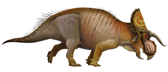
By Scott Reid
Etymology: Large-Nosed Horned-Face
First Described By: Sampson et al., 2013
Classification: Dinosauromorpha, Dinosauriformes, Dracohors, Dinosauria, Ornithischia, Genasauria, Neornithischia, Cerapoda, Marginocephalia, Ceratopsia, Neoceratopsia, Coronosauria, Ceratopsoidea, Ceratopsidae, Centrosaurinae, Nasutoceratopsini
Status: Extinct
Time and Place: Between 76 and 75.6 million years ago, in the Campanian age of the Late Cretaceous

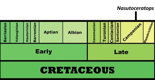
Nasutoceratops is known from the middle member of the Kaiparowits Formation in Utah
Physical Description: Nasutoceratops is a Ceratopsian - so, as with all Ceratopsians, it has an extremely distinctive head! Like other Ceratopsians, it would have been around 5 meters long or so, and had a very bulky body with a short, skinny tail. The legs of this dinosaur - as in others of its kind - were short, bulky, and had very padded and thick toes that made running easy for this animal. The really distinctive aspects of this dinosaur, however, were in its head - again, as in other Ceratopsians, which might as well all be Mr. Potato Heads with the different combinations of horns and frills as the exchangeable parts of the classic toy. Nasutaceratops sported a short frill, a short and high snout, and distinctively long horns. The horns on its brow were more horizontal than most, but they curved inward like those found on modern cattle! The nostril did not feature a horn, but was very high and ridged instead. Interestingly enough, there were extensive cavities in this rounded nose that may have been pneumatic, giving Nasutoceratops a very unique trait compared to other Ceratopsians. It had a very thickly overlapping upper jaw, which would have made it somewhat less flexible than other Ceratopsians. The frill had small round osteoderms all around the edge, and there isn’t a notch on the frill like in other Ceratopsians. As in its relatives, Nasutoceratops would have probably been primarily scaly, though it may have had feather-quills on the edge of its tail or elsewhere on its body. The frill would have probably been brightly colored, for display.
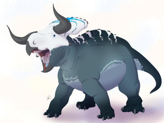
By José Carlos Cortés
Diet: Nasutoceratops would have primarily been an herbivore, feeding on low-lying and medium-level leaves and other plant material, all less than one meter tall.
Behavior: Nasutoceratops, like other Ceratopsians, would have been a very social creatures! These dinosaurs would have spent a lot of time together roaming their home in large herds, and used their frills and fancy horns to display to one another for communication and mating displays. This points back to their fairly complicated social groupings, where the young would have been protected by the adults from oncoming danger. The horns would have also been useful in telling apart Nasutaceratops from other dinosaurs that lived with it, such as the Chasmosaurine Ceratopsian Kosmoceratops. Like other dinosaurs, it would have been warm-blooded, and thus needed to spend a good chunk of the day finding food. It also may have fought with its horns, though that’s somewhat more controversial, especially given their odd shape - though a combination of the bumpy nose and horns . These horns may have had sheaths of fingernail material (keratin) over them, making them longer, but probably not more available for fighting. The colors of the frill may have been able to change, giving even more communication ability. These structures - the frills and horns - wouldn’t have been prominent in baby Nasutoceratops, but grew with the animal as it aged into sexual maturity. Nasutoceratops would have taken care of its young, which would eventually join the herd with the adults.
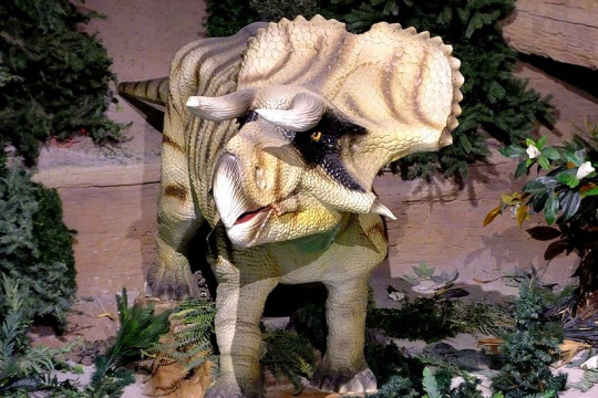
By Kathy Neenan, CC BY-SA 4.0
Ecosystem: Nasutoceratops lived in the Kaiparowits Formation, which would have been a very muddy jungle ecosystem, with a wide variety of animals living very near the Western Interior Seaway. A variety of swamps, ponds, and lakes frequented the entire area, which was surrounded on its other side by highlands and mountains, enclosing it against the sea. It was a very wet and humid environment, allowing for high animal diversity. Among those that lived with Nasutoceratops include other Ceratopsians like Kosmoceratops and Utahceratops, hadrosaurs like Gryposaurus and Parasaurolophus, the ankylosaur Akainacephalus, the Troodontid Talos, the Ornithomimid Ornithomimus, the Oviraptor Hagryphus, and the opposite bird Mirarce! That being said, the main predator of Nasutoceratops would definitely have been the local Tyrannosaur, Teratophoneus. There were also a variety of mammals, turtles, and Neosuchians in the environment, which all took advantage of the wet swampy conditions.
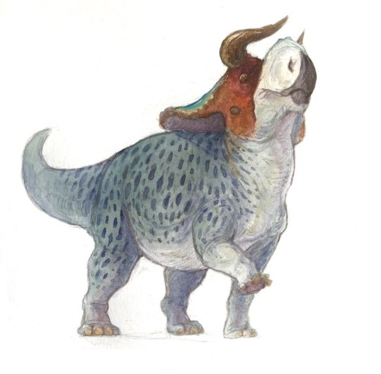
By Ripley Cook
Other: Nasutoceratops was a Centrosaurine, those Ceratopsians more closely related to the likes of Styracosaurus than to Triceratops. Interestingly enough, these Ceratopsians tend to do more weird stuff with their noses - usually giant horns, but Nasutoceratops seems to have gone for a more lightweight option. In fact, Nasutoceratops gave its name to a whole group of these animals, which retained the brow horns of the ancestral ceratopsians (where other Centrosaurines lost them).
~ By Meig Dickson
Sources Under the Cut
Atterholt, J.; J. Howard Hutchison; Jingmai K. O’Connor (2018). "The most complete enantiornithine from North America and a phylogenetic analysis of the Avisauridae". PeerJ. 6: e5910.
Chiba, K., M. J. Ryan, F. Fanti, M. A. Loewen. D. C. Evans. 2018. New material and systematic re-evaluation of Medusaceratops lokii (Dinosauria, Ceratopsidae) from the Judith River Formation (Campanian, Montana). Journal of Paleontology 92 (2): 272-288.
Eaton, Jeffrey G.; Cifelli, Richard L.; Hutchinson, J. Howard; Kirkland, James I.; Parrish, J. Michael (1999). "Cretaceous vertebrate faunas from the Kaiparowits Plateau, south-central Utah". In Gillete, David D. (ed.). Vertebrate Paleontology in Utah. Miscellaneous Publication 99-1. Salt Lake City: Utah Geological Survey. pp. 345–353.
Eaton, J.G., 2002. Multituberculate mammals from the Wahweap(Campanian, Aquilan) and Kaiparowits (Campanian, Judithian)formations, within and near Grand Staircase-Escalante NationalMonument, southern Utah. Miscellaneous Publication 02-4, UtahGeological Survey, 66 pp.
Fowler, D. W. 2017. Revised geochronology, correlation, and dinosaur stratigraphic ranges of the Santonian-Maastrichtian (Late Cretaceous) formations of the Western Interior of North America. PLoS ONE 12 (11): e0188426.
Getty, M. A., M. A. Loewen, E. M. Roberts, A. L. Titus, and S. D. Sampson. 2010. Taphonomy of horned dinosaurs (Ornithischia: Ceratopsidae) from the late Campanian Kaiparowits Formation, Grand Staircase-Escalante National Monument, Utah. In M. J. Ryan, B. J. Chinnery-Allgeier, D. A. Eberth (eds.), New Perspectives on Horned Dinosaurs: The Royal Tyrrell Museum Ceratopsian Symposium. Indiana University Press, Bloomington 478-494
Hone, D.W.E.; Naish, D.; Cuthill, I.C. (2011). “Does mutual sexual selection explain the evolution of head crests in pterosaurs and dinosaurs?” (PDF). Lethaia. 45 (2): 139–156.
Lund, E. K. (2010). "Nasutuceratops titusi, a new basal centrosaurine dinosaur (Ornithischia: Ceratopsidae) from the upper cretaceous Kaiparowits Formation, Southern Utah". Department of Geology and Geophysics University of Utah: 172 pp.
Mallon, Jordan C; David C Evans; Michael J Ryan; Jason S Anderson (2013). [tp://link.springer.com/article/10.1186/1472-6785-13-14 "Feeding height stratification among the herbivorous dinosaurs from the Dinosaur Park Formation (upper Campanian) of Alberta, Canada"]. BMC Ecology. 13: 14.
Roberts EM, Deino AL, Chan MA (2005) 40Ar/39Ar age of the Kaiparowits Formation, southern Utah, and correlation of contemporaneous Campanian strata and vertebrate faunas along the margin of the Western Interior Basin. Cretaceous Res 26: 307–318.
Roberts EM, Sampson SD, Deino AL, Bowring S, Buchwaldt R. The Kaiparowits Formation: a remarkable record of Late Cretaceous terrestrial environments, ecosystems and evolution in western North America. In: Titus AL, Loewen MA, editors. At the Top of the Grand Staircase: The Late Cretaceous of Southern Utah. Bloomington, Indiana: Indiana University Press; 2013. p. 85–106.
Ryan, M.J.; Holmes, R.; Mallon, J.; Loewen, M.; Evans, D.C. (2017). "A basal ceratopsid (Centrosaurinae: Nasutoceratopsini) from the Oldman Formation (Campanian) of Alberta, Canada". Canadian Journal of Earth Sciences. 54.
Sampson, S. D., 2001, Speculations on the socioecology of Ceratopsid dinosaurs (Orinthischia: Neoceratopsia): In: Mesozoic Vertebrate Life, edited by Tanke, D. H., and Carpenter, K., Indiana University Press, pp. 263–276.
Sampson, S. D., M. A. Loewen, A. A. Farke, E. M. Roberts, C. A. Forster, J. A. Smith, and A. L. Titus. 2010. New horned dinosaurs from Utah provide evidence for intracontinental dinosaur endemism. PLoS One 5(9):e12292:1-12.
Sampson, S. D.; Lund, E. K.; Loewen, M. A.; Farke, A. A.; Clayton, K. E. (2013). "A remarkable short-snouted horned dinosaur from the Late Cretaceous (late Campanian) of southern Laramidia". Proceedings of the Royal Society B: Biological Sciences. 280 (1766): 20131186.
Tanke, D.H. and Brett-Surman, M.K. 2001. Evidence of Hatchling and Nestling-Size Hadrosaurs (Reptilia:Ornithischia) from Dinosaur Provincial Park (Dinosaur Park Formation: Campanian), Alberta, Canada. pp. 206–218. In: Mesozoic Vertebrate Life—New Research Inspired by the Paleontology of Philip J. Currie. Edited by D.H. Tanke and K. Carpenter. Indiana University Press: Bloomington. xviii + 577 pp.
Titus, Alan L. and Mark A. Loewen (editors). At the Top of the Grand Staircase: The Late Cretaceous of Southern Utah. 2013. Indiana University Press. Hardbound: 634 pp.
Weishampel, David B.; Dodson, Peter; and Osmólska, Halszka (eds.): The Dinosauria, 2nd, Berkeley: University of California Press. 861 pp.
Wiersma, J. P.; Randall B. Irmis (2018). "A new southern Laramidian ankylosaurid, Akainacephalus johnsoni gen. et sp. nov., from the upper Campanian Kaiparowits Formation of southern Utah, USA". PeerJ. 6: e5016.
Zanno, Lindsay E.; Sampson, Scott D. (2005). "A new oviraptorosaur (Theropoda; Maniraptora) from the Late Cretaceous (Campanian) of Utah". Journal of Vertebrate Paleontology. 25 (4): 897–904.
Zanno, L.E., Weirsma, J.P., Loewen, M.A., Sampson, S.D. and Getty, M.A. (2010). A preliminary report on the theropod dinosaur fauna of the late Campanian Kaiparowits Formation, Grand Staircase-Escalante National Monument, Utah.[permanent dead link]" Learning from the Land Symposium: Geology and Paleontology. Washington, DC: Bureau of Land Management.
Zanno, L. E.; David J. Varricchio; Patrick M. O'Connor; Alan L. Titus; Michael J. Knell (2011). "A new troodontid theropod, Talos sampsoni gen. et sp. nov., from the Upper Cretaceous Western Interior Basin of North America". PLoS ONE. 6 (9): e24487.
#Nasutoceratops titusi#Nasutoceratops#Dinosaur#Ceratopsian#Palaeoblr#Factfile#Prehistoric Life#Mesozoic Monday#Herbivore#North America#Cretaceous#Paleontology#Prehistory#Dinosaurs#Dinosaur of the day#A Dinosaur A Day#A-Dinosaur-A-Day#Dinosaur-of-the-Day#nature#biology#science
313 notes
·
View notes
Text
No hypothetical threats, these
My Artdog Images of Interest for most of this month have focused on places of natural wonder that are under threat, with the hope that–if we’re working to build a better future–they still can be preserved. Mining hasn’t happened at the Grand Canyon yet. No one has begun to drill for oil in the Arctic National Wildlife Refuge . . . yet.
Grand Escalante, at left in blue, with a significantly…
View On WordPress
#Bears Ears and Grand Escalante National Monuments#cliff dwellings#Dark Canyon Wilderness#Dry Fork Slot Canyons#Kaiparowits Plateau#petroglyphs#Toadstool Hoodoos#Trump Administration#tyrannosaur fossil#Wilderness Study Areas
0 notes
Photo

Grand Staircase Escalante National Monument
Located in Utah, this wonderful desert landscape is but a part of one of the most famous series of geological formations on Earth: The Grand Staircase. These sedimentary stacks stretch from the Proterozoic two billion years ago, through the sequence of rocks that form the Gran Canyon (deposited from the Proterozoic to 250 million years ago), Zion National Park (240 to 90 million years ago) and Bryce Canyon (90 to the mid Cenozoic). Together these superimposed sequences form one of the best studied geological columns on Earth, covering most of the Phanerozoic Aeon. Named by geologist Clarence Dutton in the 1870's, it is one of Earth's more complete sedimentary records with 5 major steps, from which the geological history of Western North America has been reconstructed. They were all uplifted 1.5 to 3 km by the formation of the Colorado Plateau during the Laramide orogeny, and erosion has removed most of the post Cretaceous rocks, while recent volcanic rocks dot the entire area.
The Grand Staircase Monument is next to Bryce Canyon National Park, dominated by the north to south running ridge of the Kaiparowits Plateau, with steep slopes beautiful canyonlands to the east and a gentler descent to the west. Cliffs, plateaux, mesas, buttes, hoodoos and canyons dominate the landscape. Ranging from the early Triassic, through the Jurassic Navajo sandstone (forming the cliffs in the photo), followed by an ancient seaway and a lake, the layers peter out in the mid Cenozoic.
Numerous dinosaur fossils dating from the late Cretaceous ( 80 to 75 million years old) have been discovered in the area, including the recently announced oldest Tyranosaurid, nicknamed the King of Gore (which we covered at http://tinyurl.com/kvb2oue). The erosion pattern is favourable as there is more rainfall here than further south, which reveals new fossils for excavation at a faster rate and less forest cover hiding the rock exposures and destroying the fossils through root and soil bacterial action than northwards. In Utah there is just enough rain to erode rock, but not enough to support forests. These rocks have also told us the most of any worldwide about the patterns of changing ecosystems at the end of the Mezozoic era.
Petroglyphs from Native American groups also dot the area, including the Fremont and ancestral Puebloan peoples. Unlike most national parks, the monument is administered by the Bureau of Land Management.
Loz
Image credit: Bob Wick, Bureau of Land Management, California.
Geological cross section: http://en.wikipedia.org/wiki/File:Grand_Staircase-big.jpg http://www.utah.com/nationalsites/grand_staircase.htm http://www.utah.com/playgrounds/canyons_of_escalante.htm http://www.visitutah.com/parks-monuments/monuments-recreation/grand-staircase-escalante/_ _
#Grand staircase#GEology#National monument#erosion#nature#landscape#The earth story#Grand Staircase-Escalante
153 notes
·
View notes
Text


Clouds (No. 1060)
Grand Staircase-Escalante National Monument, UT
#Grand Staircase-Escalante National Monument#Kaiparowits Plateau#travel#original photography#vacation#tourist attraction#landmark#landscape#countryside#blue sky#clouds#nature#flora#unpaved road#desert#summer 2022#USA#red rock#rock formation
0 notes
Quote
While both Utah monuments have drawn criticism, they have simultaneously boosted local tourism. Grand Staircase-Escalante also has spurred significant scientific discoveries. Grand Staircase’s Kaiparowits Plateau ranks as one of the most important examples of the Mesozoic Era, when dinosaurs roamed the area, according to Society of Vertebrate Paleontology President David Polly. About a dozen institutions are conducting expeditions there at any given time, and somewhere between 75 percent and 80 percent of the plateau has yet to be explored. Bears Ears, by contrast, is best known for the tens of thousands of relatively intact archaeological sites and petroglyphs within its boundaries. Some date from the ancestral Pueblo era, and many tribal members continue to visit the area on a regular basis to conduct rituals as well as to gather herbs and firewood.
Trump shrinks two huge national monuments in Utah, drawing praise and protests - The Washington Post
#Bears Ears National Monument#Grand Staircase-Escalante National Monument#national monument#public lands#paleontology#archaeology#conservation#politics#Utah
16 notes
·
View notes
Photo

Membri della Pueblo Bonito Expedition del 1912, sostenuta da National Geographic, viaggiano attraverso il Kaiparowits Plateau, nella contea di San Juan, nello Utah. Durante il viaggio di ricerca l'archeologo Neil M. Judd ha condotto scavi attraverso l'intero Sud-ovest degli Stati Uniti. Fotografia di Edwin L. Wisherd, National Geographic
1 note
·
View note
Text


#kaiparowits plateau#grand staircase escalante national monument#colorado plateau#adventure#travel#my photo#southwest#desert#utah#photography#aesthetic#grosvenor arch
40 notes
·
View notes
Link

(Photo courtesy of University of Utah Geohazards Research) A new plan from the BLM has opened thousands of acres of what was formerly Grand Staircase-Escalante National Monument to mining and drilling. Sunset Arch, pictured, is one of the landmarks that was stripped of protected status when President Donald Trump reduced the size of the monument.
Excerpt from this story from the Salt Lake Tribune:
Hundreds of thousands of acres inside what used to be Grand Staircase-Escalante National Monument will be opened to mining and drilling under a plan the Bureau of Land Management released Friday, renewing charges that President Donald Trump’s executive action reducing the 23-year-old preserve was engineered to promote energy extraction in some of America’s most scenic landscapes.
The plans also greatly expand access for recreation on lands remaining in the monument, with expanded visitor services and signs, group size limits lifted to as many as 50 people, and allowing competitive sporting events, such as next month’s Grand to Grand Ultra footrace, which currently is routed outside the monument.
Friday’s release comes on the heels of the final management plan for Bears Ears National Monument, the other big preserve Trump eviscerated a year into his presidency.
The Staircase plan encompasses much more territory, 1.9 million acres, nearly half of which had been managed as a monument for two decades. It is actually four plans: one each for the three units remaining in the monument — Grand Staircase, Kaiparowits Plateau and Escalante Canyons — and a fourth for the 900,000 acres Trump removed.
“These management plans seek to cement the Trump administration legacy of destroying the Grand Staircase-Escalante National Monument,” said Steve Bloch, legal director for the Southern Utah Wilderness Alliance. “That seems to be the objective certainly for excluded lands, which are going to be in large part available for mineral leasing and extractive development. To make matters worse, the BLM is going to prioritize motorized recreation across a large swath of the original 1.9 million acres.”
Tribal, science and environmental groups have filed multiple lawsuits challenging Trump’s authority to unilaterally decrease the two Utah national monuments. They are being actively litigated in federal court in Washington. The plaintiff groups have argued that the BLM should wait until these cases are resolved before moving forward with new management plans, especially for the Grand Staircase, whose 1.9 million original acres have been managed under a comprehensive plan for more than 20 years. If the courts reverse Trump’s actions, the new management plans could be invalidated.
8 notes
·
View notes
Text
2019 Aug – Utah Hols: Day 6 - Mon 19 Aug 2019 - Bryce Scenic Drive
The second part of our afternoon was spent driving along the Bryce Canyon Scenic Drive (Highway 12). These are the main view points:
Swamp Canyon
Farview Point
Natural Bridge
Agua Canyon
Ponderosa Canyon
Black Birch Canyon
Rainbow Point
Yovimpa Point
Swamp Canyon
This is the start of the Swamp Canyon Loop which takes walkers down into the canyon where you can find a wetland with lush vegetation.


Farview Point
From this view point, not only can you see many parts of Bryce Canyon, but also features of Grand Staircase-Escalante National Monument. You can see the Aquarius Plateau (Pink Cliffs), the Kaiparowits Plateau (Grey Cliffs), Molly’s Nipple (White Cliffs), and parts of the Kaibab Plateau.


Natural Bridge
Natural Bridge is one of several natural arches that can be found in Bryce Canyon. This one is particularly photogenic, sculpted from some of the reddest rock, rich in iron oxide minerals.


Agua Canyon
This viewpoint overlooks two prominent hoodoos. The taller of the two is known as “The Hunter”. To the right is a smaller hoodoo commonly referred to as the “Rabbit”, or alternatively the “Backpacker”.


Ponderosa Canyon
As the name suggests, this view point overlooks Ponderosa Canyon, due to the huge Ponderosa pine trees growing on the canyon floor. Some are more than 5 feet in diameter and 150 feet high. As it happens, the viewpoint is surrounded by a forest of Blue Spruce and Douglas-fir trees.


Black Birch Canyon


Rainbow Point
From this view point, you can view much of Bryce Canyon National Park to the north. From here you can see the snaking rim of the Pink Cliffs, and many of the park’s hoodoo-filled amphitheatres.


There was a lot of building work going on and we couldn’t find a sign to Yovimpa Point.
0 notes
Photo

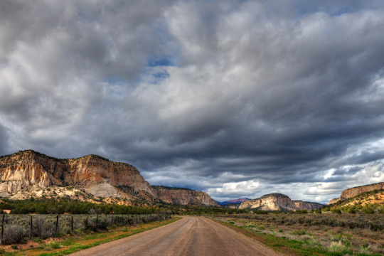
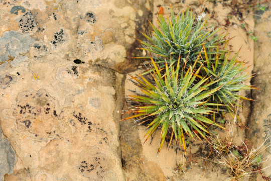

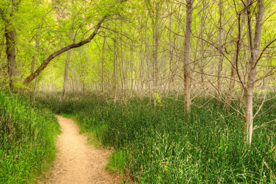
Accepting Applications for the 2017 Artist-in-Residence program at Grand Staircase-Escalante National Monument!
The Grand Staircase-Escalante National Monument in Utah is accepting applications for the May 2017 Photography Artist-in-Residence program. The selected volunteer will use their photography skills to promote awareness of the exceptional natural and cultural treasures preserved and protected by the Grand Staircase-Escalante National Monument (GSENM). The residency will last three weeks and include at least two public events, participation in Kane County’s Amazing Earthfest!, and promotion of good stewardship practices.
The Grand Staircase-Escalante National Monument was established in 1996 and became the Bureau of Land Management’s (BLM) first national monument. At nearly 1.9 million acres, it is the largest area in the National Conservation Lands system, which includes some of the West’s most spectacular landscapes set aside for conservation, protection, and restoration of their nationally significant cultural, ecological, and scientific values. From the spectacular Grand Staircase of cliffs and terraces, across the rugged Kaiparowits Plateau, to the wonders of the Escalante Canyons, the Monument’s size, resources, and remote character provide extraordinary opportunities for scientific research and exploration. Its spectacular scenery of other-worldly landforms, outrageous combinations of colors, vegetation that ranges from ponderosa forests to lush riparian corridors, and light that is forever changing, provides artists with limitless inspiration and material.
Applications for the May Photography Artist-in-Residence Program are due February 12, 2017.
Visit the Grand Staircase-Escalante National Monument AiR page
Learn more about the Artist-in-Residence program here
Previous artists’ work can be viewed on YouTube
View photos from past Artist-in-Residence programs on Flickr
Follow BLM Utah on Facebook and Twitter
#blmutah#utah#grand staircase#national monument#conservation#artists in residence#art#beauty#photography#education#application#apply#volunteer#glen canyon#conservation lands#explore#discover#GSENM#mondaymotivation#happymonday
180 notes
·
View notes