#hike alberta
Explore tagged Tumblr posts
Text
Alberta Wildfire Resource Links

Considering the ongoing wildfire impacts on our Alberta communities, environment & outdoor enthusiasts, we are revamping our info links post to be a more permanent resource on our socials & blog for easy access.
** Stay Up To Date On Provincial Fire Bans Across Alberta**
Alberta Wildfire Status Dashboard This is an Alberta map showing all active wildfires in the province and their status (controlled / not controlled, etc).
Government of Alberta Wildfire Status Page Find active wildfires on the wildfire dashboard, see wildfires of note and find the latest forest area updates.
511 Alberta Highway Closures Highway Closure Webpage ; specific information on highway and road closures. This may also include roadway closures due to accidents or other natural disasters.
Alberta Parks Fire Bans Info **There is a Fire Ban in effect Alberta Wide. This website gives you fire bans and is searchable by area / location. Scroll down to find the map and location search table.
Water Levels & Other Environmental Planning Information
Alberta Parks and Environment River Basin Water Level Interactive Map This interactive map gives specific information on all Alberta Rivers, including water levels and ice flow warnings and forecaster warnings for upcoming weather events that might impact water levels.
Government of Canada Water Level and Flow webpage This page gives real-time hydrometric data (real-time water level data) and historical hydrometric data (historic water level data). Canada wide.
Government of Canada, Alberta Water Level and Flow webpage This page gives real-time hydrometric data for the province of Alberta.
We strongly encourage you to:
Plan before travel / hiking.
Prepare an emergency backup plan incase fire breaks out where you are camping/hiking & leave a trip itinerary with a friend/family member at home. If you are caught in an emergency situation this will give first responders an idea where to look for you.
Know wildfire locations & risk levels
Know Highway/roadway closures
70 notes
·
View notes
Text


Ribbon Falls
@letsgohiking.ab
1K notes
·
View notes
Text

Entrance to the Valley Of The Crooked Trees.
Jasper National Park, Alberta
1955
#vintage camping#campfire light#alberta#jasper national park#pray for jasper#camping#history#hiking#wildfires#road trips#1950s
676 notes
·
View notes
Text
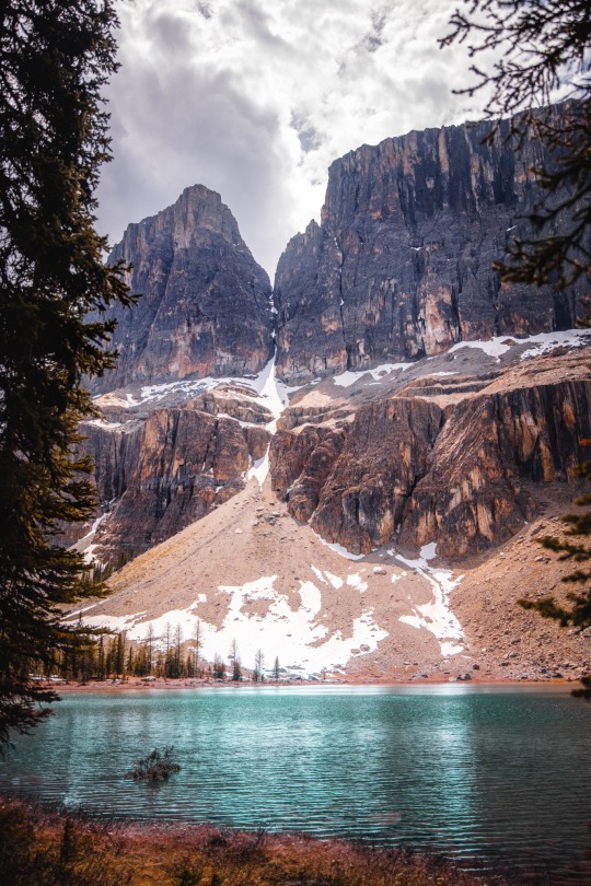
Castle mountain, Banff National Park🇨🇦
#castle mountain#banff national park#Alberta#Canada#aimeekb#my photography#canadian national parks#canadian rockies#lesbians who hike#hiking#forest#adventure#explore#lake#glacier lake#mountains
3K notes
·
View notes
Text

Happy New Year! I have some BIG goals for 2025 and I can't wait to get started! :-)
Photo: Banff, Alberta, Canada
#banff#moraine lake#banff national park#alberta#canadian rockies#canada#rocky mountains#mountain lake#mountains#canoes#nature#god's creation#the great outdoors#hiking#travel#tourism#adventure#explore#happy new year#o canada#nature's beauty#lake#western canada#north america#see the world#international travel#vacation
22 notes
·
View notes
Text


We did still get in some mountain time this weekend (needed this)
10 notes
·
View notes
Text


A trek to Larch Valley in Banff National Park.
I was a little tight on time to get up there and back to the bus, but it was a beautiful peaceful sanctuary up there amongst those cloudy peaks. A difficult hike but I am glad I did it.
11 notes
·
View notes
Text

Moraine Lake - now named one of the world's 10 most beautiful lakes
#Moraine Lake#Banff National Park#Alberta#natural beauty#Valley of the Ten Peaks#wilderness#hiker#Canadian Rockies#hiking#mountains#scenic view#nature photography#pristine
16 notes
·
View notes
Text
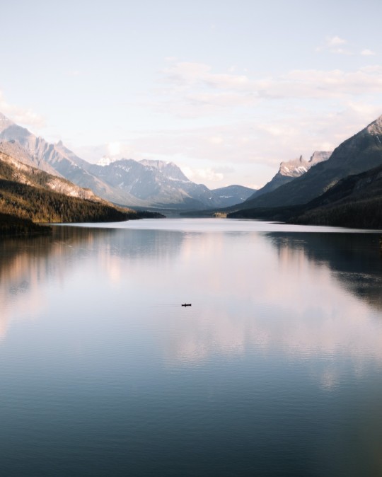
Waterton Park, Alberta, Canada. Photo by Jaime Reimer.
#rvlife#camping#rv living#adventure#traveling#rvadventures#travel#campfire#rvliving#travel photography#alberta#canada#hikingadventures#hiking#rvlivingfulltime#vanlove#vanlife#vanliving#beautiful photos#photooftheday#photography#landscape photography
106 notes
·
View notes
Text

#border collie#canada#my photo#hiking#canon#photography#british columbia#nature#alberta#alberta canada#explorebc
7 notes
·
View notes
Text

*Check out our Maligne video link at the end of the post!
“So, is it a 14 footer..?” he asked me, inspecting my little canoe critically “No... it’s technically about 13, give or take” I replied. He side-eyed me with that “one raised eye brow” look. He totally expected me to say yes, thinking to himself that even 14 feet would still be too small a canoe in his opinion to navigate the longest natural lake in the Canadian Rockies.
Christened ‘The Black Bunny’ this year (2021), albiet my little canoe is different compared to the large and very weighty crafts we often see.
I admired our new acquaintances’ canoes; I researched so many before getting my own. An aluminum gruman, a gorgeous custom wood model shipped from Ontario, and multiple other 16-17 footers. I knew my little canoe wasn’t as fast, or couldn’t hold as much weight, but she's done us well, carried our gear and kept us safe, and is well suited to our particular needs. I couldnt imagine portaging out of our Murtle Lake situation with anything heavier plus our gear. As two women paddling out into adventure, I smirk just a little each time someone asks about my canoe, because I know the canoe is not the only thing they are questioning, and I think quietly to myself, hey man... you’re out here too.
The Most Wild Of Wild Places, Maligne Lake
Maligne Lake is one of the premier and most sought after backcountry experiences in Canada. Nestled between the Colin and Maligne Mountain Ranges, about 45 minutes south of the quaint Alberta town of Jasper, Maligne is world renowned for its stunning aqua-coloured waters, scenery and wildlife. The famous Spirit Island, the historic Maligne Lake Resort, the Skyline Trail, Medicine Lake, Mount Brazeau and Brazeau lake just beyond, all are found here. When you first walk out onto the dock and lay your eyes on the scene before you, aw-struck is the only term that comes to mind. The first few rays of brisk morning sunbeams part curtains of mist and cloud above the peaks that tower over turquoise water, sun sparkling showers and dew-jewelled trees. It is no wonder this is called the Valley of the Gods.
It’s a striking name, Valley of the Gods. One that conjures up images of ancient tribes, explorers, a time when humans revered nature and marvelled at its majesty and ferocity. The name was actually bestowed by the area’s indigenous tribes because the mountains on either side of the lake are believed to be a physical representation of their ancestors. When contemplating on spirit island, the members of the tribe are in the presence of greatness, wisdom and family.
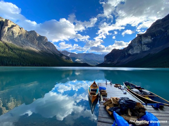
Maligne Lake is fed and drained by the The Maligne River having received its name for its treacherous northward, outflowing exit from the lake. The story goes that every horse Father Pierre-Jean De Smet (1801–1873) attempted to herd across, sadly, met a watery end. The priest hence forth referred to it as ‘the wicked or malicious river’ which in his native french tongue was Maligne. The river winds 45 km north and bubbles up in the magnificent, and equally treacherous, Maligne Canyon, full of twists, turns, steep drops and thundering falls. Popularity and dangerous natural formations have led to a history of accidents in the general area with spikes through covid. In 2020 an 11 year old girl fell into river at the 5th bridge in the canyon hike and tragically perished. In Feb. 2021 a 70 year old man succumbed to a similar fate after falling while ice climbing and later that summer a 21 year old nursing student fell in the river and luckily was rescued. On my own hike in Maligne Canyon in 2020 we saw a young man recklessly doing yoga on a fallen tree over the gushing water. Whether its the popularity of the location, the thrilling risk, or the draw of the dangerously beautiful, the area has a way of tempting those who are naive to its perils.
Despite the reputation, when safety measures are followed properly, the river and canyon are a sight not to be missed while you’re in the area.
While at Maligne Lake you might also see a range of wildlife such as grouse, moose, deer, elk, wolves, cougars, various bird species, including Osprey, and even black or grizzly bears. We also managed to spot rarely seen pika. Caribou, while high up on most wish lists, sadly, are extremely rare being nearly extirpated from Jasper National Park (due primarily to human activities), however a lesser known hot topic phenomena of Maligne lake is its trout. The trout, not being indigenous, were introduced by people several years ago, and have since sparked heated wildlife debates between parks services and locals. This unique/rare situation means that Maligne Lake is the only fishable lake in the Jasper area and a favourite spot for locals, particularly in late September before the fishing season closes. While you are not likely to pull any record-holders out of Maligne due to the harsh living conditions, it does make for an extremely secluded wilderness fishing experience.
Accessing Maligne Lake
Maligne Lake is located in Jasper National Park in Alberta, Canada. If you are staying overnight in the park, including the town of Jasper, you must purchase a Park Pass. Passes can be purchased at the toll booth entering the park, or online in advance.
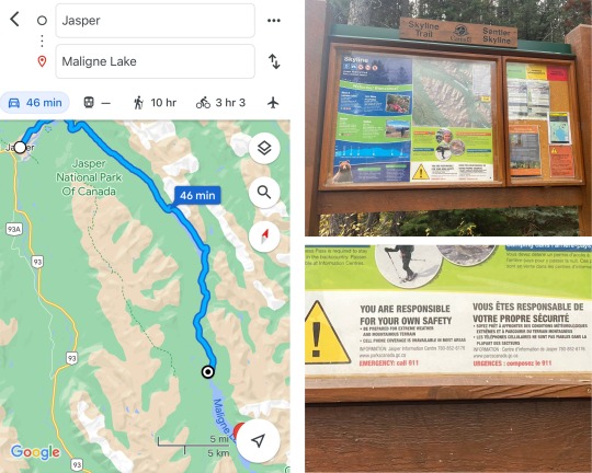
Overnight, you can stay at one of the many hotels in the town of Jasper, at the Maligne Park Lodge or a local campground. There are no campgrounds around the Maligne Lake resort/dock area. All options are popular and book up quickly.
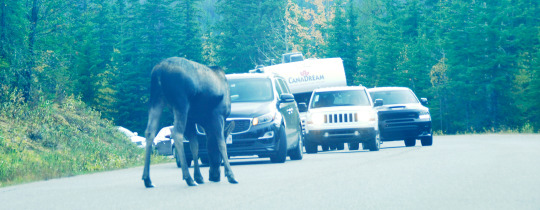
Maligne Lake is accessible only by Maligne Lake Road; a two lane, long and winding, scenic route that branches off highway 16 just east of the town of Jasper. It is open spring to fall, weather permitting. There is often moose and bears around the southern tip of Medicine Lake, traffic may back up as onlookers admire them. Remain in your car and pass with caution. Never feed wildlife. Animals that are too comfortable with humans pose safety risks and are often relocated or even killed. Keep them wild, keep them (and you) safe.
Arriving at Maligne Lake, past the resort, you will come to a large Parks Canada parking lot with outhouses (there is no location here to camp). Parking in the lot is free, there is a large dock and boat launch from which to launch your canoe and head off to your planned/booked backcountry campsite.
*Note: It is illegal to ‘camp’ in Jasper National Park while not in a designated camp site. This includes sleeping in your car.
Planning And Booking
Both front and backcountry campsites in Jasper are booked through the Parks Canada website or by phone and, if needed, canoes can be rented through Wild Current Outfitters on the Jasper Travel website here. These canoes are located on Maligne Lake, (so no towing or loading required).

Website Booking
Parks Canada has a NEW website in 2023! Reservation Service opens each year early spring. While Maligne Lake’s campsites and surrounding trails book up quickly, you might still find availability later in the year if there are cancellations.
Log into the Parks Canada Reservation site the day before opening day to create your GC Key account for the park and test out the reservation system so you know how it works.
Be prepared reservation opening day with time to spare (consider blocking off the day).
Sign into the website waiting queue early.
Have your credit card and list of booking sites ready and a few backup dates in case you don’t get your preferred date.
The website can be tricky opening day. With thousands of people on at the same time, it can be tough to nab your preferred dates. It really turns up the pressure.
Campsites & Daily Distances
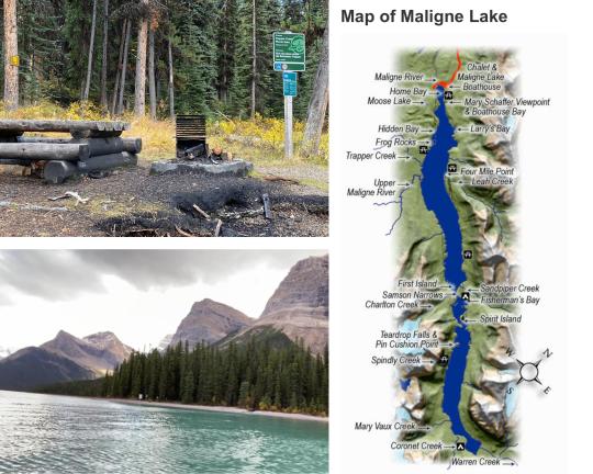
The three backcountry campsites on Maligne Lake in order from North to South are, Hidden Cove, Fisherman’s Bay and Coronet Creek. The four picnic/fish cleaning stations are, Trapper’s Creek, 4 Mile, Samson and Spindly Creek. Each campsite can be booked for a maximum of *2 nights each (then you go to the next).
It can be tough to decide how to choose a site and how far to travel in a day. This should be decided first on your experience level, second the time of year (anticipating weather).
Recommendations
Although we did the full length of the lake in one day, its not something I’d necessarily advise for a few reasons. Maligne Lake is really long, 22 km, and that makes for (surprise!) a long, exhausting day. If the weather isn’t good, if the wind whips up, you’re battling the elements on a whole other level. On a lake this size, even a little wind gathers momentum, making large waves and we did experience challenges that I’ll get into later. Reservations account only for enough space for people who have made them. If you can’t make it to your reserved campsite there may not be space at another (and of course legalities/penalties).
If you are experienced, aim for Fishermans day one and then continue to Coronet. Take your time, enjoy the scenery along the way!
If you are new to canoeing, consider Hidden Cover to start, the shelter with its wood stove is amazing. Fishermans is also a worthy goal if you’re up for the challenge.
If you decide to go for gold all the way to Coronet, we can’t say we haven’t done it, but be prepared, don’t take unnecessary risks, pull over for a break if needed. The weather often changes on a dime up here, start at the earliest light possible so you have lots of time... and read on for insights!
Would You Paddle The Whole Lake In One Day ...?
Paddling the full length of Maligne (22km) in one day was admittedly NOT what I set out to plan for us. Its a super popular spot, booking is usually crazy, but booking during covid (2021) was beyond and long story short, we either had to do it or wait another year, so we went for it. Although breathtaking, I need to emphasize that it was challenging for a few reasons:
1. Weather: The weather in late September in the Canadian Rockies is extremely unpredictable. It was fun, we felt very accomplished, but at times it was a very rough go. While sunny, it was cold, very windy and both rained AND snowed. This can happen in summer months too, not just fall.
2. Daylight: Our days were very short by late September. If you have longer daylight hours, maybe June/July/August, you would have time on your side .
3. National Park Regulations: I dare say in an emergency any authority would tell you its better to be safe and hole-up somewhere, say, if the waves got too high, a storm swept up, etc, than risk danger. Im sure anyone would rather be conducting a rescue vs a recovery mission. However, in any Canadian National Park, legally, you are required to camp where you booked a registered camp location. So it’s on you to weigh the risk appropriately vs your skill level.
This being said, Krista and I had paddled the full length of Murtle Lake the year before in good and bad weather (23km). So we felt well equipped to understand what we were up against. Maligne is a different beast though and did surprise us with a few curve balls.
Get To The Story - Bright And Early... And Wind, Oh My!
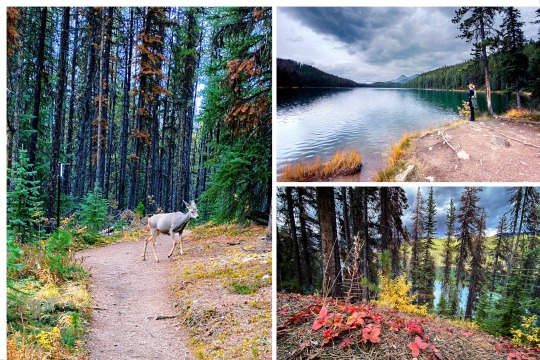
We left Edmonton Saturday morning, arrived early and decided to kill time checking out the canoe launch and hiking the Skyline a few kilometers shy of Little Shovel. The lakes and scenery on this end of the Skyline Trail are stunning. Heading back a female deer popped out of the trail behind us and wandered past. She would be the first of many amazing wildlife adventures to come.

The wind woke us early Sunday morning, whistling through the trees... I lay in the dark for a few minutes, acknowledging the great SWOOSH and the subsequent creaking and groaning. At 5 am I already knew it would be a challenging day of paddling.
We arrived back at the boat launch while it was still dark, wanting to start as soon as possible. Early morning is usually the calmest time on the water, but the brisk autumn dawn greeted us with growing waves as if to say, “are you up for challenge?”. Krista hopped in the canoe and I handed her our bags.
‘You ready for this...?” I asked, “Yep!” she replied, enthusiastic as always.
At 9:30 am we pushed off the dock, heading straight into the wind, and on our way.
youtube
What To Expect
The water is deep, cold and clear; you can see massive rocks below on a sunny day. The tour boats rotate by regularly, but you have lots of clearance from them in this section. Once past ‘home bay’, facing a headwind, it only took us about an hour to reach Hidden Cove. You can only enter on the north side of the island, the beach to the south is consumed with extremely sharp rocks as we discovered later on. You cannot cross the shallow waterway between the island and the shore in a canoe. We didn’t stop on our way in, but our last night/day would be spent in this amazing spot.
A recent suggestion to prepare a playlist of ‘magical and epic’ adventure songs made the day. We usually prefer the natural setting, don’t want to annoy others... aware of your surroundings (blah, blah, blah...). But! This was FUN! Paddling a whole day gets monotonous, the music added rhythm to coordinate to - pirate songs, viking songs, Lord of the Rings themes; we felt like we were on the high seas in search of treasure, the giant waves from the passing tour boats didn’t help, lol. (we turned it down approaching others - considerate Canadians and all).
The sun greeted us around noon as we made our way along the ‘belly’ of the lake. The wind/waves died down and we made great time. We kept a map handy and were able to easily track our progress here using the streams and well marked fishing day-use areas. We passed Trapper Creek and 4 Mile and by 1:30pm had made it to Samson Narrows.
Near Death Flashbacks... Remember That Time We Nearly Died? Which Time? The Actual Time.
At the mouth of Samson Narrows, suddenly and without warning, the canoe began to spin... for a split second we had flashbacks to the Murtle River incident the year before. We couldn’t correct it and couldn’t stop it. What the EFF’in - SH*T... NOT us... NOT again - ?!
“Are we in a river?!” Krista yelled back at me; she was scared, I could hear it in her voice... “There aren’t supposed to be any outflowing rivers here!” I had to yell over the wind now, even though she was right in front of me. “Then what’s happening?!”, her panic was rising... my panic was rising, but we had to stay cool. It was imperative.
... The WIND! It came over the mountain and down with such ferocity and speed there was no time to react. NONE.
It blew the tail end of our tiny canoe with such force that even as we both paddled, it spun the canoe immediately, illogically, around. Now sideways as waves crashed against us, and needing a better plan, I instructed Krista to stop fighting it. Go with the wind, its counter intuitive in the moment, but it worked. We did an about face 360 and made a bee-line for the large island at the mouth of the narrows.
Safely ashore, but still battling the frigid gale, we took the opportunity to calm our nerves, warm up, have lunch, consult our map and assess our situation. Confirmed for safe measure - not a river or an under current. Just a powerful wind. Shocked, but reassured, we hung out for about 20 minutes and it died down as quickly as it swept up. We carried the canoe around to a better launch point and set out once more.
Samson Narrows
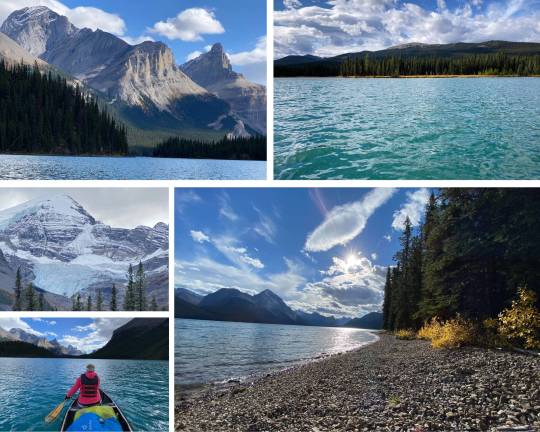
Once inside Samson Narrows the water is calm as glass. The surface area of water is much smaller and more protected from the wind. It is spectacular and amazing. The canoe glided across sun sparkled water like silk and we took turns snapping photos and videos of the serene scenery. The world, still and quiet, the sun warm on our faces, our paddles making soft bobbing noises as they dipped in and out of the water. It was magic.
The tour boat shattered the moment, getting a bit too close for comfort in the slender water way. As the mammoth waves rolled near, our tiny canoe bobbed up several feet and then down again, a scooner on the mighty ocean, as viking drums channeled our rhythm. We were the lake, and it was us.

youtube
Spirit Island
We arrived at Spirit Island around 2:30pm. All the water craft pile into the bay area behind the island.
When the tour boats land it gets very busy. Hang tight ‘til the tour boat throngs leave again, or consider going before/after the boats begin or end the day if you’re keen on taking tourist-free photos. The best location (IMO) is at the top platform, slightly to the left along the railing.
Spirit island is special to the local Indigenous tribes and is considered a spiritual and sacred place (hence the name). It is considered so because of its location, in the Valley of the Gods, and it behooves one to tread consciously and with respect on this ancient ground that holds so much meaning. With mountains representing ancient ancestors on both sides, the tiny peninsula sits on the water and amongst spiritual greatness.
Our time here was short, but we took every opportunity to drink in the beauty. The leaves shimmered, the water was calm, the light filtering through the clouds. A yellow canoe coming ashore against the azure water. A brief moment in time, picture perfect.

Just Around The Bend... I Might Kill You (With Love??)
Now several hours in, we were weary and it was beginning to show. There were more creeks in this area (marked and unmarked) making it difficult to track our progress.
By 5:30pm Krista had her fill. As we passed a pair of unsuspecting fishermen with an electric motor and I said ‘we’re almost there, it’s just around this bend’ for the upteenth time, the look of daggers she gave me became the running joke around the fire we shared that night (thankfully; death by dagger gaze wasnt my preferred way to go!).
Coming down the home stretch between the un-named creek and Coronet, we hit another head wind. It was all we could do to keep paddling.
“Are we even moving??” Krista was gritting her teeth, this wind was on her last nerve... We had to be, I thought, at least, I think we are... The only way we knew we were moving was because the shoreline was slowly getting closer.
Adding insult to injury, a mighty and gorgeous custom wood craft manned by a single soul, (who we later met as ‘Ziggy’), sliced the water to our left, leaving us in the dust. We just looked on in awe (and maybe jealousy). Later that evening we felt a bit better when the fishermen we’d passed earlier laughed about attempting to come back and tow us (out of gentlemanly kindness), but their battery died and they too limped to camp via paddle power (chivalry among Jasperites is not dead, but apparently batteries are - lol).
Finally landing at Coronet, I thought Krista might kiss the ground. We hopped out and wearily carried our little canoe ashore around 6pm, just as the last rays of sun were disappearing behind the looming mountain backdrop.
“Thank God!”, she proclaimed... and I lived to see another day.
Coronet Creek, The Campsite Legends Are Made Of
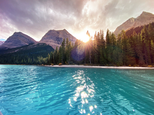
If you can make it to Coronet, it IS the BEST campsite on Maligne Lake. A true backcountry experience, it is the farthest possible location, the most remote, spacious, and truly wild. We had the absolute pleasure of the company of a small group of locals making the most of the last weekend the lake was open for fishing and it 100% made our whole trip.
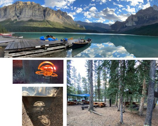
Friendly, kind and considerate they shared their tarps, smartly erected above the picnic tables to give shelter from the autumn rains. By firelight we heard told exuberant tales of annual trips gone by, sharply ended by blizzards so thick you couldnt see your hands and wind ripping rainflys off tents in the night. A cautionary recount of a pair of fishermen out after dark whos canoe was sunk by a rogue wave. Forced to swim ashore in imobolizingly cold water, they walked several kilometers back to camp in the dark, soaking wet and without shoes (I cant even fathom how they didnt succumb to hypothermia, my feet were numb just walking in and out all day). But! Fret not, the canoe itself was later retrieved by local divers.
Overall, Coronet was, undoubtedly, one of the best backcountry experiences I’ve had in large part due to the amazing company. If you're an avid fisherman, some of the locals offer guided fishing tours and we highly recommend checking it out.

The Cinderella Story Of Campsites
Our first morning in Coronet we were thrilled to just sleep in. On our way to the morning facilities we were delightfully greeted by Gary the Grouse and his lovely little harem of chickens, softly cooing and clicking as they pecked up their breakfast bugs. Despite some limited contact in summer, for the most part humans are almost alien to the area; animals around maligne are unmarred by people and unsure of what to think of us.
Each campsite has a guest book in a small locker on the side of a tree. Campers can detail their stories, when they visited and the adorable nicknames for all the animals. For example, Buttons is the name of the deer. However, Buttons literally makes a guest appearance at every single campsite, and for a deer, Buttons sure gets around! (Every deer is Buttons, we do not discriminate between Buttons 1, 2, or 44,000 here). We skimmed through the book, enjoying our coffee and some laughs while the little grouse family toddled on by like something out of Cinderella.
youtube
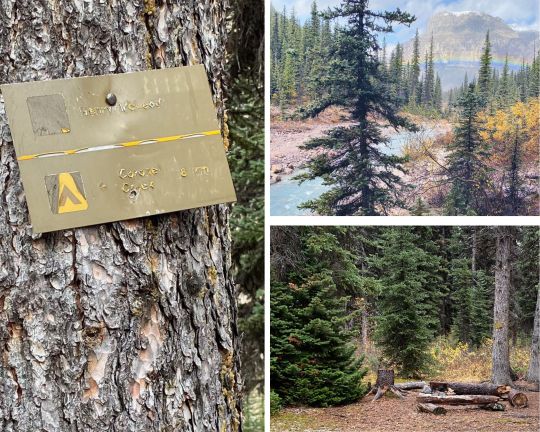
Henry MacLeod Trail
Later that afternoon we hiked up to Henry MacLeod Campsite. Located high up the mountain, it’s the only one near Maligne Lake that doesn’t require a booking to stay there. It’s exceptionally remote, but the scenery was worth it!
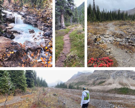
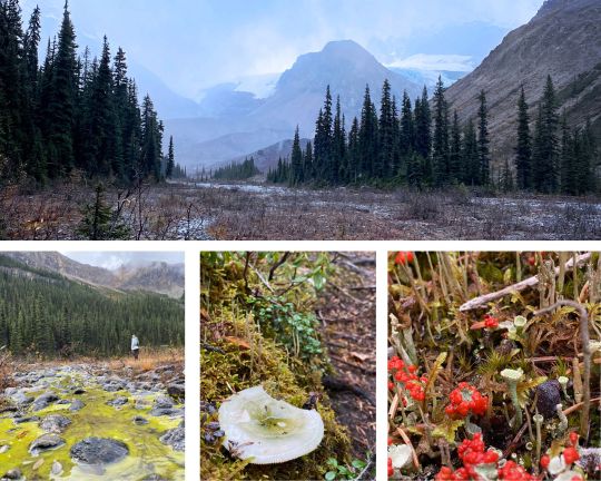
The trail is well marked and from Coronet it took us roughly 3 hours to get there and a little over 2 to get back. It leaves Coronet Campsite northward and follows the creek nearly all the way up the mountain. There are spectacular falls and just past the second lookout [over the falls], turn around for a stunning, high altitude view of the lake. We missed it the first time but caught it on the way back.
Reaching Henry MacLeod, you can continue up along the creek to the edge of the glacier. It was sleeting rain/ice and we didn’t linger long. Even though it’s mountainous, the ground is oddly thick and mossy, retaining a lot of water. Back at Coronet, we were surprised to find that despite waterproof boots, we had both soaked our footwear clean through.
youtube
As we sat, enjoying the warmth of the morning a fire and drying our soaked feet, an excited shout rang out from the dock.
“Quick! Come See!”
We sprang up and headed for the dock where the few remaining campers had gathered. Down the beach, running along the shoreline where the fisherman’s canoes were trolling, was a lanky, dark, grizzly bear. I grabbed for my camera but he was just far enough away that even my biggest lens couldn’t quite nab the shot. We sat and watched him until he disappeared into the forest once more.
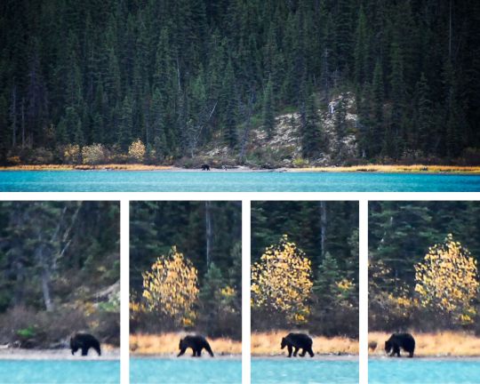
We were cautioned that shortly before we’d arrived back, likely the same bear had cut through camp across to the beach we had been on. It would be the first of several bear encounters to come.
That night we exchanged adventure stories and Ziggy (owner of the awe-inspiring wood canoe) and the locals, offered us their best hiking and boating suggestions, including Lake Minnewanka and Rockwall, that we took to heart and intend to make good on in 2022. We also heard tell that a pair of adventurers had canoed on Maligne this weekend with skiis in tow intending to hike up, and then race down, the glacier. But while we slept winds whipped up great waves, washing their canoe and gear out to the middle of the lake. Returning Sunday morning they [luckily] were able to enlist help to retrieve the canoe and what soaked items remained (I couldn’t possibly make this stuff up).
Tuesday Is A Good Day For Snow And Grizzlies
The next morning we woke up to a chill in the air. Still in my mummy bag, I rolled over and looked at Krista,
‘is it me or is it colder?” ‘it feels colder I think”, she groaned from deep in her sleeping bag.
Overnight it had snowed. Lightly, white, frosty and breath taking. When we could eventually smell faint whiffs of smoke we ventured out, enticed by the promise of a hot coffee and a toasty fire.
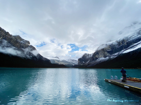
After the fishing canoes ventured out, we walked along the curve of the beach for a bit towards the quieter, north edge of the campsite, looking for other signs of wildlife in the early morning. Finding nothing and feeling a bit skunked we walked back to the canoe and went for a paddle around the bay area, which is much smaller than it appears to be.
When we returned to the campsite, a local fisherman we had become familiar with said ‘did you ladies see the bear!?”
‘the one last night?” we asked, a little confused.
“NO”, his eyes now big as saucers. “I saw the bear coming up the beach this morning when you guys were walking along the shoreline! I tried to yell but you couldn’t hear me. He headed straight for you”
Dumbfounded... Krista and stared at each other. How could we MISS that?! The curve along the beach must’ve hidden him from view.
The man continued, “yep, he made it all the way to the campsite and about 20 feet from the dock, turned and walked into the bush. He probably cut right through camp”.
The ground is so soft you can’t hear anything, it just muffles the sound. Even when the animal is hundreds of pounds, in most cases, you are completely oblivious.
We were unsure whether we should be thankful or terrified, settled on grateful and left it at that. Bears are amazing, majestic even... but from afar, and definitely not first thing in the morning, catching you off guard when coming at you. Like, the ‘to be admired from a really safe distance’- type afar is even better (is my preference).
Another fascinating observation made by other campers, amidst all the bear activity, Gary the grouse and his little harem who had previously been so actively, were suddenly, noticeably, scarce, along with all birds and other small wildlife. Perhaps an early warning sign, had we recognized it.
Just One More Night..?
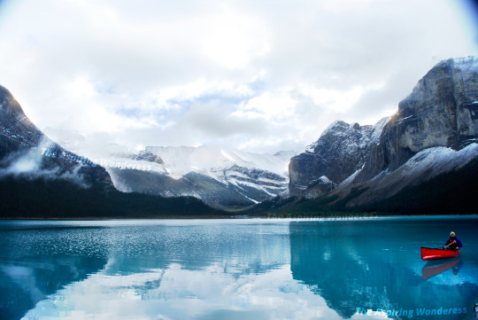
We loved our time at Coronet Creek, but we had one more night booked at Hidden Cove and we were so looking forward to the fabled camp stove and shelter there. The paddle back was again long, the weather once more unkind. Only having reached Spindly Creek, waves forced us to break and wait for the blustery winds to subside. We met a quiet fellow taking refuge in the form of a nap here and even though we unintentionally disturbed him, he kindly made a little fire for us to warm up by and in turn we shared a snack. A tree planter, he was visiting the lake to clear his head and contemplate his next year’s plans. We admired his canoe’s electric motor running on a solar panel setup.
Another couple from Coronet arrived also, facing the same predicament. The tree planter bid us adieu and moseyed on. We followed suite and set out once more.
The wind haunted us mercilessly and in the distance we could see dark storm clouds brewing over the mountain. Presumably snow, we were mildly concerned if we’d make it to Hidden Cove in time, luckily sliding into home base just as the storm held its ground over the resort and not an inch closer.
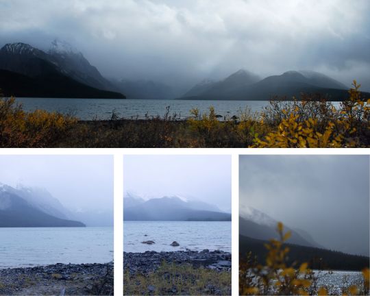
Hidden Cove, A Gem Among the Rockies
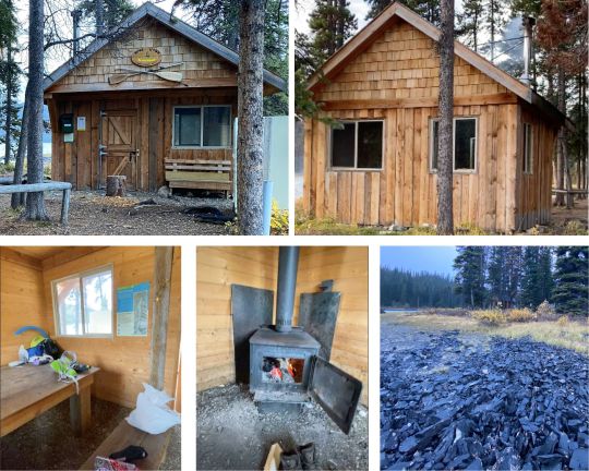
Hidden Cove is a stunning campsite. Designed more for family use and trips with children, it has a fantastic, fully enclosed, day-use shelter complete with a wood stove. There is an axe for chopping firewood, (though it’s extremely dull), and a few excellent tent pads with AMAZING views! The campsite is situated on a tiny island. In spring I imagine the water completely cuts it off from the shore, but in late fall the water is low enough that you can rock hop across.
The tent pads are laced through the island, some overlooking the south view of the lake and others facing more inward towards the shelter of the cove. There are some little paths to explore and a nice dock to sit on and enjoy the sunset.
Cold and tired, we immediately stoked a fire, set up our tent and hunkered down to enjoy a well deserved, hot, dinner. A couple of love-birds on a kayak date arrived shortly after and we graciously shared the shelter till the later hours, playing trivia cards and exchanging hiking stories over the stove fire.
*For a complete view of the cabin, check out the video at the end of the post.

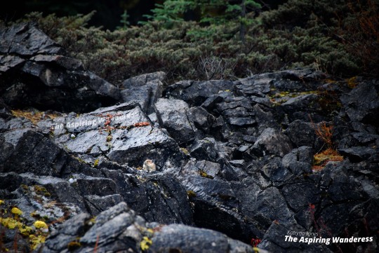
Homeward Bound, As Always, Too Soon
We woke the next morning and the kayak couple had gone, leaving us to our own devices. We enjoyed coffee in the shelter and spent the morning wandering the paths around the shoreline from the cabin. In a rocky outcropping we had the amazing luck of seeing some adorable pika (a highlight for me!). We didnt meander long, being very aware of the high bear activity in the area lately and around 11:30am we shoved the canoe off once more, heading for home bay.
Along the way we once again came across Ziggy and his magnificent wooden beast, also making his way towards the resort. We chatted a bit along the way and caught up with him later back at the parking lot to say goodbye and wish him safe travels. The trip had been epic, wild and demanding. But amazing. There is nothing like the feeling of accomplishing something that challenges you, and challenge us Maligne did.
The canoe packed up and the suv ready to go, I turned to Krista;
“Well, was it everything you thought it’d be...?” “100%” she said, a little smile creeping in
Yep, I thought to myself, it definitely was 100%
Author, Katryna Jones, Sept 2021
Click here for our Maligne Lake Video!
#hike#jasper#Jasper National Park#maligne#Maligne Lake#hike alberta#travel ab#travel jasper#hiking#maligne lake alberta#canoe#canoeing#henry macleod trail#Canoeing Maligne Lake
0 notes
Text


Winter sunset
Pictures from our trip to a lake
The sky looked like cotton candy
3 notes
·
View notes
Text

Waterton Lakes from Bear's Hump Mountain.
Alberta, Canada 1988
#vintage camping#campfire light#alberta#canada#history#hiking#road trips#waterton lakes national park#outdoors#travel#1980s
232 notes
·
View notes
Text
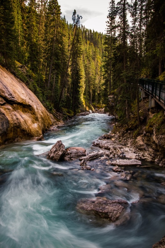
Johnston Canyon, Banff National Park🇨🇦
#johnston canyon#banff national park#Canada#aimeekb#Alberta#waterfall#river#lesbians who hike#hiking#forest#adventure#nature#explore#travel#mountains#canadian rockies#canadian national parks#my photography
4K notes
·
View notes
Text
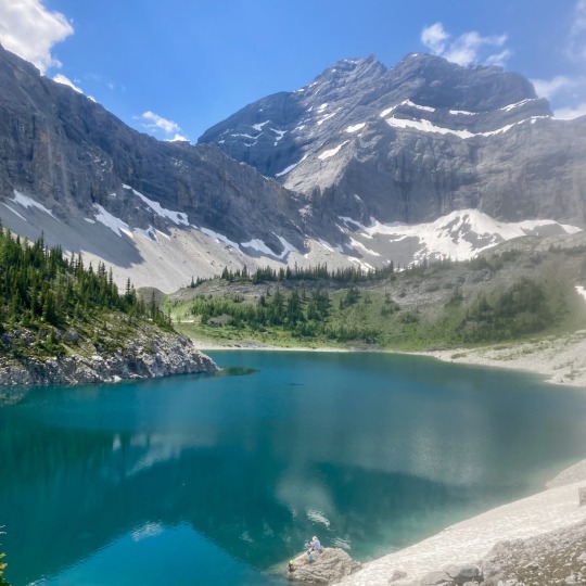
Galatea, July
22 notes
·
View notes
Text


Solo sunset hikin' this evening on Prairie (with Jacques)
#for someone who was terrified of the blair witch project#i sure spend a lot of time playing chicken with the dark in the woods (and sometimes i lose)#yyc#kananaskis#furby buddy#safe furby#alberta#jacques the hiking furb
8 notes
·
View notes