#geologia
Explore tagged Tumblr posts
Text

#419#sociedade#biologia#geologia#culturanerd#cinderela#sapatinho de cristal#rato#ratos#abóbora#abobora#historinha#historinhas#contos#conto#carruagem
637 notes
·
View notes
Text

Muscovite with an interesting habit.
From the Museum of Geosciences of the University of São Paulo, Brazil.
87 notes
·
View notes
Text
Paleo-caves in Death Valley
You have probably heard of "caves", or a natural void formed in rock. Caves are formed in a number of ways, but the most familiar are probably those formed in limestone - called karst or karstic. Karst caves are formed by the steady dissolving of limestone rock by naturally acidic groundwater percolating through the ground, often along faults or other natural weak areas.
Death Valley in California is not a hotbed of limestone caves, though evidence of them can be seen in a number of places! Ancient caves, often tens or hundreds of millions of years old, sometimes collapse or fill in with silt/minerals/debris. An ancient cave formation is called "paleokarst", and there are a few areas in Death Valley where you can find it. The easiest to access is in Titus Canyon, a major canyon who's lowest reach carves its way through limestone bedrock, leaving behind towering polished rock walls and revealing the internal structure of the rock.

Titus Canyon's narrow section is carved through the Bonanza King Formation, a Cambrian-age (538 - 485 million years ago) marine sedimentary rock package several kilometers thick. It's found in many areas of Death Valley and the surrounding region. Across its area and thickness, it alternates from dolomite to limestone (dolomite minerals versus calcite minerals). Dolomite doesn't usually dissolve and form caves, but limestone does - and the many fractures in this rock appear to have allowed numerous tiny caves to form somewhere in the distant past. Most of these have since been filled in with calcite minerals, making them paleokarst.

In this image, you can see the void of the cave lined with thinly-layered calcite. It has a flat floor, and these features are characteristic of having formed in a cave. In Titus Canyon, we can find these from a few inches to a few meters across, and as the canyon has been carved into the rock, these voids are exposed. This one below tells an exceptionally clear story:

You don't need to be a geologist to see how this differs from the first example. There's a weird pendant-shaped protrusion hanging from the top, there are layers in the minerals, the bottom half is red… there's a lot going on. Let's get some lines on there and figure out what we can see:

That's better. OK - I've separated out the parts of this outcrop which from my desk look to be distinct. Here's a close-up of part of the left-center area to show how it appears different up close.

OK, so we have the blue-gray limestone bedrock on the right, top, and lower left, then a gray-red area with layers and what looks like gravel or other angular pieces of the limestone. Above that is a finely-layered calcite deposit (remember? that's cave-like!), and above that is a layer of calcite which is rather porous. The top surface of this area is sort of scalloped and curved, which is also characteristic of limestone caves.

Here's the fully interpreted version. Let's go through the sequence of events. First, we have the limestone bedrock of the Bonanza King Formation (BKL). At some time in the distant past, a portion of it dissolved away and formed a cave. Over time, silt and debris filled in the bottom of this cave. Because it is ancient, we call it paleo-fill (OPF). This might have happened at a time when the cave was dry (not containing water), since if it was wet we would expect some amount of calcite to be deposited around its perimeter as is typical in limestone caves.
Above that is a layer of thinly-layered calcite, the cave mineral. This layer contains some reddish silt and the occasional fragment of the limestone, so the cave was probably happily active during the time that was deposited! This is the oldest cave mineralization phase I can discern in this outcrop, so I call it Old Cave Calcite (OCC).
Next, we have a slightly porous, light-colored calcite deposit. The porosity suggests to me that it was deposited faster, but I am not an expert on cave deposits so will not comment further. This unit fills the cave to its top in most places! I call this the Middle-age cave calcite (MAC).
Finally, the youngest unit is another cave-deposited calcite (YCC). As in the first cave picture above, it is a coarser-grained pale yellow color with layers that parallel the sides of the void. Most of the paleo-caves you can find in Titus Canyon are filled with this sort of calcite, and it may be geologically recent (last million years?). It filled the final remnant of this ancient paleo-cave, and is contrasting with the material around it. This visual and textural contrast is what inspired me to write this post in the first place - the best example I've seen in person of paleo-karst and the evolution of a miniature cave system, right in the heart of Death Valley - my favorite place in the world.
#geology#photography#adventures#bettergeology#california#rocks#death valley#death valley national park#cave#paleokarst#limestone#california geology#geologia#i love rocks
94 notes
·
View notes
Text

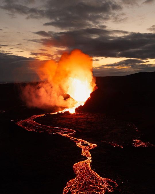
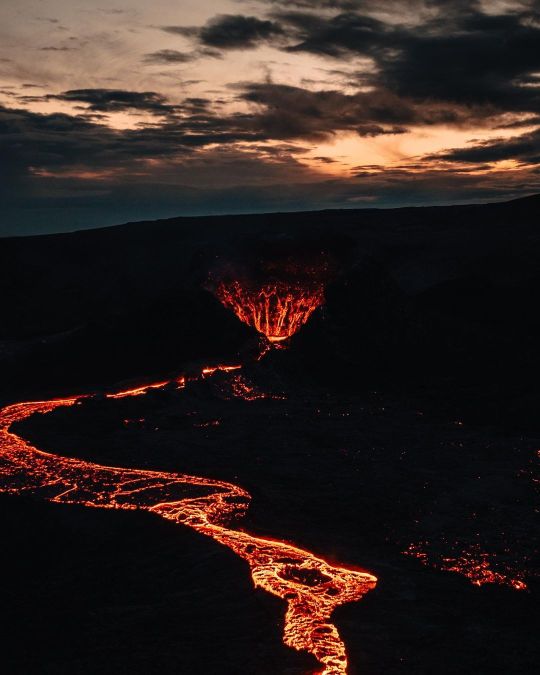

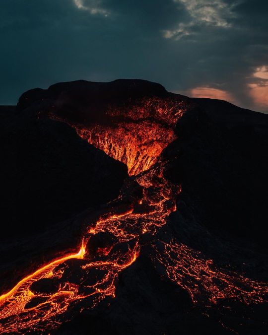
Que en Islandia hay volcanes no es nada nuevo. Lo nuevo son las fotos y vídeos que hay de ellos. Estas imágenes son de la última erupción.
230 notes
·
View notes
Text
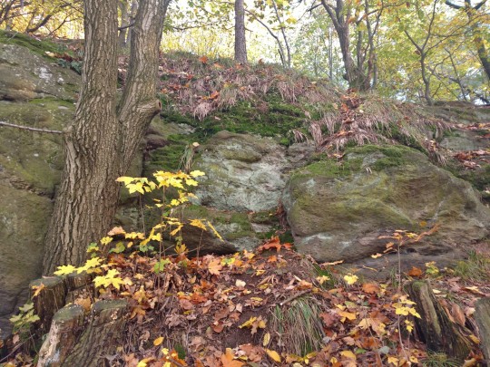
It's official! Skalickie Skałki (Skalice Rocks) confirmed as the oldest rock outcrop in entire Poland. Made of sillimanite gneisses they were said to be even a billion years old, but current estimations are closer to 600 mln yrs.

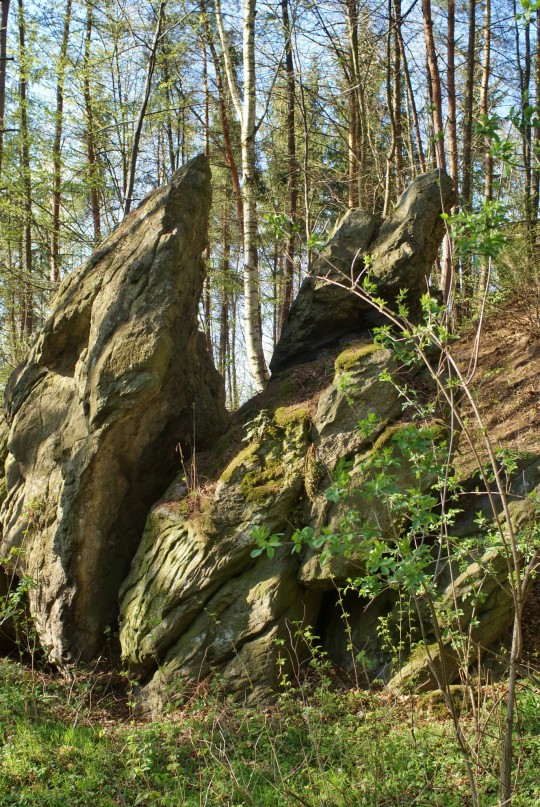
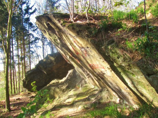

#My favourite spot#Skalice#wzgórza strzelińskie#lower silesia#geology#geotourism#geologia#poland#sudetes#geology of poland#my photography#rocks#sillimanite gneiss#proterozoic
302 notes
·
View notes
Text
it's so sad that rocks look so tasty they look like candy but they hurt to bite😥😥😥😥😥😥😥😥😥😥😥😥😥😥😥😥😥😥😥😥😥😥😥😥😥😥😥😥😥😥😥😥😥😥😥😥😥😥😥😥😥😥😥😥😥😥😥😥😥😥😥😥😥😥😥😥😥😥😥😥😥😥😥😥😥😥😥😥😥😥😥😥😥😥😥😥😥😥😥😥😥😥😥😥😥😥😥😥😥😥😥😥😥😥😥😥😥😥😥😥😥😥😥😥😥😥😥😥😥😥😥😥😥😥😥😥😥😥😥😥😥😥😥😥😥😥😥😥😥😥😥😥😥😥😥😥😥😥😥😥😥😥😥😥😥😥😥😥😥😥😥😥😥😥😥😥😥😥😥😥😥😥😥😥😥😥😥😥😥😥😥😥😥😥😥😥😥😥😥😥😥
176 notes
·
View notes
Text

When Biology and Geology Meet
Cuando la biología y la geología se encuentran
#biology#lichen#davideragland#photographers on tumblr#biologia#geologia#rocks#arizona#nature#photography#original photographers#david e ragland#sonoran desert#american southwest#desert#wonder of nature#naturaleza#hiking#desert landscape#desert southwest
17 notes
·
View notes
Text

Geologia del dom de Rixat, a Mauritània.
3 notes
·
View notes
Text

5 notes
·
View notes
Text
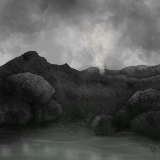
The first land plants arise! | O surgimento das primeiras plantas terrestres!
🇬🇧
As a paleobotanist, this is my favorite part.
At the onset of the Late Ordovician, Earth's continents were clustered near the South Pole in a supercontinent known as Gondwana. The climate was generally warm, and the sea levels were high, creating extensive shallow marine environments. It is within this dynamic context that the first land plants began to evolve.
Early land plants are thought to have originated from green algae, adapting to life on land over millions of years. Fossil evidence suggests that the first land plants were simple and lacked complex vascular tissues. These primitive plants were likely small and inconspicuous, resembling modern-day liverworts, mosses, and algae.
The transition from aquatic to terrestrial life posed several challenges for these early plants. They had to develop adaptations to cope with the harsh conditions of land, such as desiccation, ultraviolet radiation, and the absence of a buoyant aquatic environment. Over time, these plants evolved various structures, such as cuticles to retain water, rhizoids for anchorage, and sporangia for reproductive purposes.
The colonization of land by plants during the Late Ordovician had profound implications for Earth's ecosystems. As plants gained a foothold on land, they contributed to the development of soil, altered local climates, and provided new habitats for other organisms. Additionally, the process of photosynthesis by land plants had a significant impact on atmospheric composition, leading to changes in oxygen and carbon dioxide levels.
While the Late Ordovician marks the initial steps of land plant evolution, it was in subsequent periods, such as the Silurian and Devonian, that more diverse and complex plant forms emerged. The evolution of land plants played a crucial role in shaping Earth's ecosystems and paved the way for the establishment of terrestrial life as we know it today.
🇧🇷
Como paleobotânica, essa é minha parte favorita.
No início do Ordoviciano Tardio, os continentes da Terra estavam agrupados perto do Polo Sul em um supercontinente conhecido como Gondwana. O clima era geralmente quente, e os níveis do mar estavam altos, criando ambientes marinhos rasos extensivos. É dentro desse contexto dinâmico que as primeiras plantas terrestres começaram a evoluir.
Acredita-se que as primeiras plantas terrestres tenham se originado a partir de algas verdes, adaptando-se à vida em terra ao longo de milhões de anos. Evidências fósseis sugerem que essas primeiras plantas eram simples e careciam de tecidos vasculares complexos. Provavelmente, eram pequenas e pouco perceptíveis, assemelhando-se às atuais hepáticas, musgos e algas.
A transição da vida aquática para a vida terrestre apresentou vários desafios para essas primeiras plantas. Elas tiveram que desenvolver adaptações para lidar com as condições adversas da terra, como a dessecação, radiação ultravioleta e a ausência de um ambiente aquático e flutuante. Com o tempo, essas plantas evoluíram diversas estruturas, como cutículas para reter água, rizoides para ancoragem e esporângios para fins reprodutivos.
A colonização da terra por plantas durante o Ordoviciano Tardio teve implicações profundas nos ecossistemas da Terra. À medida que as plantas conquistavam a terra, contribuíam para o desenvolvimento do solo, alteravam os climas locais e forneciam novos habitats para outros organismos. Além disso, o processo de fotossíntese pelas plantas terrestres teve um impacto significativo na composição atmosférica, levando a mudanças nos níveis de oxigênio e dióxido de carbono.
Embora o Ordoviciano Tardio marque os passos iniciais da evolução das plantas terrestres, foi em períodos subsequentes, como o Siluriano e Devoniano, que formas de plantas mais diversas e complexas surgiram. A evolução das plantas terrestres desempenhou um papel crucial na formação dos ecossistemas da Terra e abriu caminho para o estabelecimento da vida terrestre como a conhecemos hoje.
#science#paleontology#geology#paleobotany#universe#biology#earth#digital painting#artwork#paleozoic#paleoart#ordovician#biologia#geologia#arte digital#paleozóico#paleontologia#paleobotânica#paleostream#rocks
16 notes
·
View notes
Text
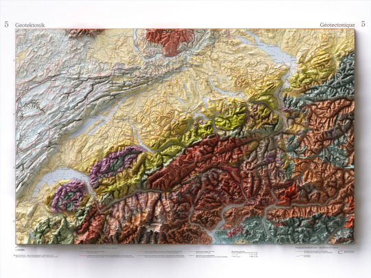
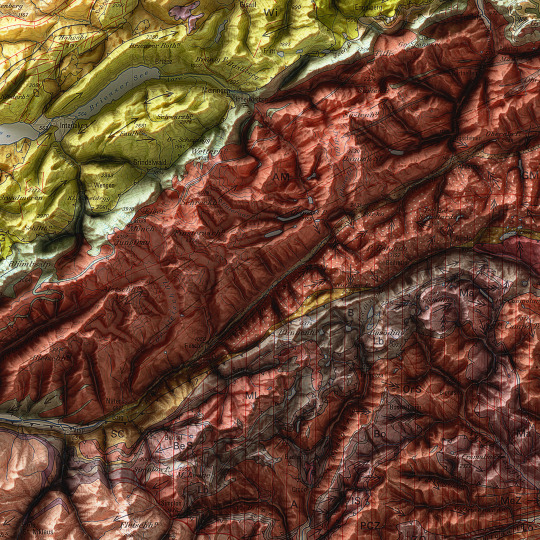
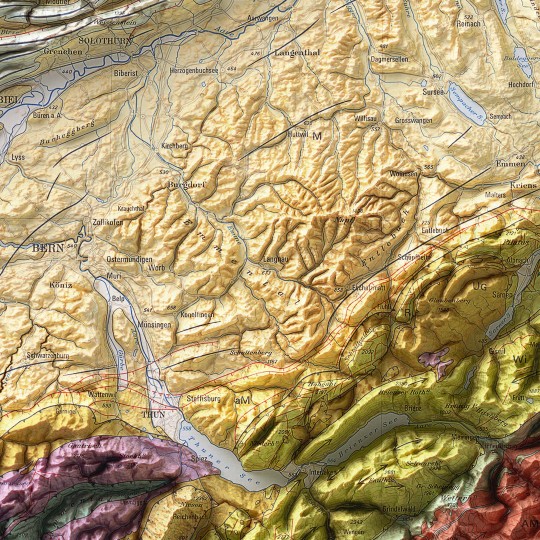
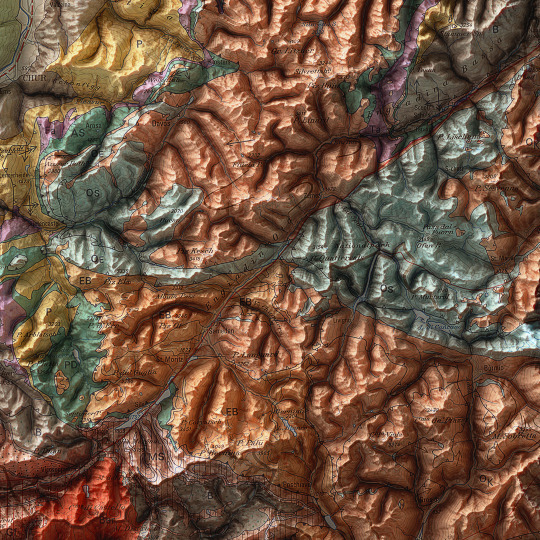
As announced, a new map has been added to the European collection.
We had started this paper years ago, but it had never been finalized. Since we didn't even have a dedicated map of Switzerland yet, we thought it was appropriate to remediate!
This is a geotectonic map of Switzerland that among the authors also has Imhof. It was realized in 1972 but published in 1978 inside the Atlas of Switzerland.
You can find the original sheet in the David Rumsey Map Collection.
If you like our work, want to see our daily updates (or want to say hello to our studio), consider to follow our Instagram or Twitter account. Otherwise if are interested in our prints or have a custom request check our shop.
#switzerlandnature#switzerland🇨🇭#switzerlandtour#switzerlandmylove#switzerlandvacations#berna#ticino#ticinoturismo#geneva#ginevra#geotettonica#geotectonic#geologia#geologist#MapCenter#designmap#shadedreliefmap#shadedrelief#gis#blenderart#blenderartist#cartography#imhof#imhoff#digitaldesign#digitaldesigner
11 notes
·
View notes
Text


Garnet lherzolite from South Africa in thin section.
137 notes
·
View notes
Text
Castlepoint Reef
Skała z latarnią w Castlepoint to nie jedyny popularny widok do sfotografowania tam; drugim przykuwającym wzrok miejscem jest Castle Rock: stupíęćdzięsięciometrowe wzgórze, a właściwie jego resztki. Z lądem łączy je krótki, wysunięty w morze grzbiet wystrzelający nagle w górę stromym trawiastym stokiem, po czym spadający jeszcze ostrzej, pionowym urwiskiem prosto w huczące fale Pacyfiku.

Castle Rock

Castle Rock, fragment
Castle Rock jest najwyższym punktem wynurzającej się z oceanu grzędy skalnej i jej drugim końcem, przeciwnym do tego, na którym stoi latarnia. Cała ta dwukilometrowej długości formacja, o bardzo zmiennej wysokości i poprzerywana w kilku miejscach niszczącymi siłami wody, nazywana jest Castlepoint Reef.

Geologicznie miejsce to jest aktywnym uskokiem tektonicznym; szybciej się wypiętrza, niż jest niszczone przez ocean. Jest też rafą w sensie skały przybrzeżnej, jednak nie koralową. Dominującymi utworami są młode, dwumilionoletnie zlepieńce muszlowe (ang. coquina, shell limestone) o genezie podobnej do wapieni, ale nie posiadające ich jednorodnej tekstury. W licznych ich odsłonach możemy dostrzec, że składają się niemal wyłącznie z fragmentów lub całych muszli różnych wielkości. Są też słabo scementowane.


4 notes
·
View notes
Text
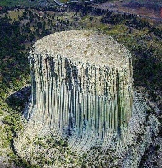
Os acordáis de Encuentros en la tercera fase, una más de las empalagosas películas de Steven Spielberg. Es la columna de basalto conocida como la Torre del Diablo en Wyoming.
#devil's tower#torre del diablo#wyoming#encuentros en la tercera fase#close encounters of the third kind#geology#geologia#basalt#basalto
28 notes
·
View notes