#azimuthal equidistant
Explore tagged Tumblr posts
Visit Tumblr Blog
Explore Tumblr blogs with no restrictions, modern design and the best experience.
Last Seen Tumblr Blogs


Fun Fact
Tumblr was created by web developers David Karp and Marco Arment.
Text
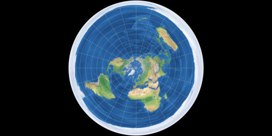
it's clear why flat earthers chose the azimuthal equidistant projection for their map, cus its the one that lets commercial flights go all around the earth without teleporting by just going in a circle around the north pole. but like, why center it on the north pole? why is antarctica the one that gets stretched out into the barrier between terra & infinity? it's gotta be northern hemisphere bias, like if a majority of flat earthers lived in australia or south africa or southern argentina/chile then they'd pick the other pole to be the ice wall.
874 notes
·
View notes
Text
Highlights:
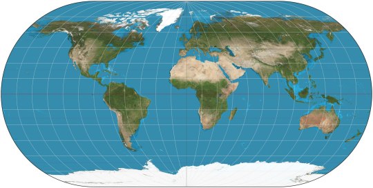
CYLINDRICAL (meridians are equally spaced vertical straight lines, parallels are horizontal straight lines)
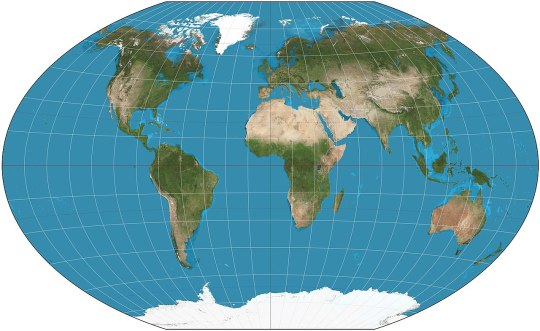
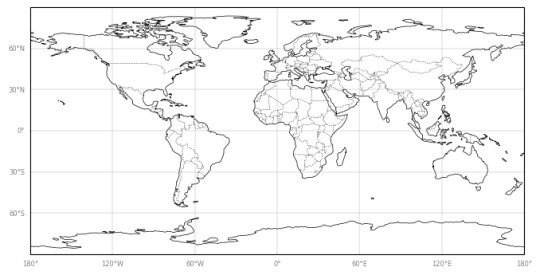
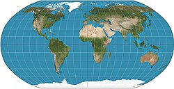
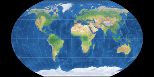
Equirectangular (ca. 120 CE): my favorite! X-Y coordinates on the map correspond exactly to latitude and longitude on Earth's surface, simple and straightforward. Parallels and meridians are all evenly spaced perpendicular lines. Doesn't preserve perfectly shapes or relative sizes, but approximates both.

Cassini (1745): the equirectangular projection, if first Earth is rotated 90° so that the central meridian becomes the Equator
Mercator (1569): gets a bad rep because it inflates areas at high latitudes (so mostly northern continents, since the southern are close to the Equator). In fact, it cannot show the Poles because they'd be infinitely far away. However, it perfectly preserves shapes and it's useful for navigation because sailing with constant bearing always traces a straight line on this map. Some variant of it is used in most web maps.
Gall (1855): variant of Mercator's that can actually show the poles. Landmass shapes are no longer perfect.
Gall-Peters (1855): kinda the reverse of Mercator: they sacrifice landmass shapes to preserve perfectly their relative areas. Landmasses near the Poles are squashed rather than stretched infinitely. Lambert (1772) has a less extreme version.
PSEUDOCYLINDRICAL (the central meridian is a vertical straight line, but other meridians may be curves, though still equally spaced on any given parallel; parallels are still horizontal straight lines)
Ortelius (1540): preserves neither shapes nor areas, but compromises between both. All meridians except the central one are arcs of circles.
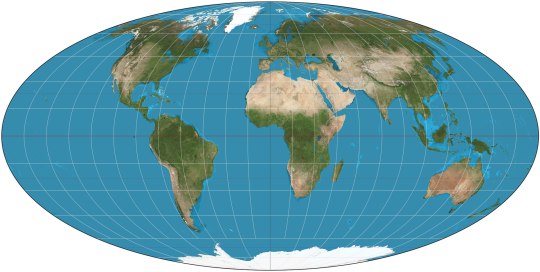
Mollweide (1855): preserves relative areas. Fits exactly in an ellipse, and all meridians except the central one are arcs of ellipses.
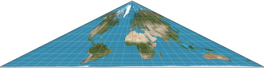
Collignon (1865): triangle. Preserves relative areas, somehow.
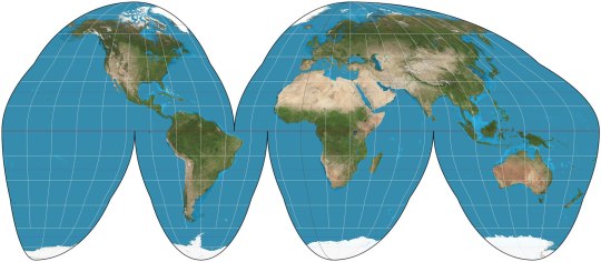
Goode Homolosine (1923): preserve relative areas and keep landmass shapes reasonably well, at the price of cutting huge gashes through the oceans.
Loximuthal (1935): constant bearing lines are straight lines on the map, like in Mercator. Preserves neither shapes nor areas. Weirdly asimmetrical hemispheres.

Robinson (1963): preserve neither shapes nor areas, but approximates both quite well. Kavraisky has evenly spaced parallels. The similar Equal Earth (2018) preserves relative areas.
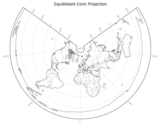
CONIC (meridians are converging straight lines, parallels are arcs of circles)
Equidistant conic (ca. 150 CE): another of the old ones. Preserves only the distances along meridians, like the equirectangular.
PSEUDOCONIC (the central meridian is a straight line, the others may be curves)
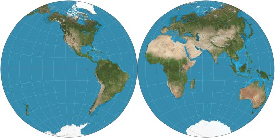
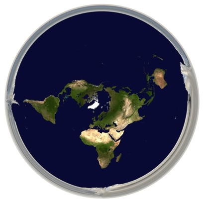
Nicolosi globular (ca. 1000): splits the map in two circles, replicating the feeling of watching the world from space from two sides.
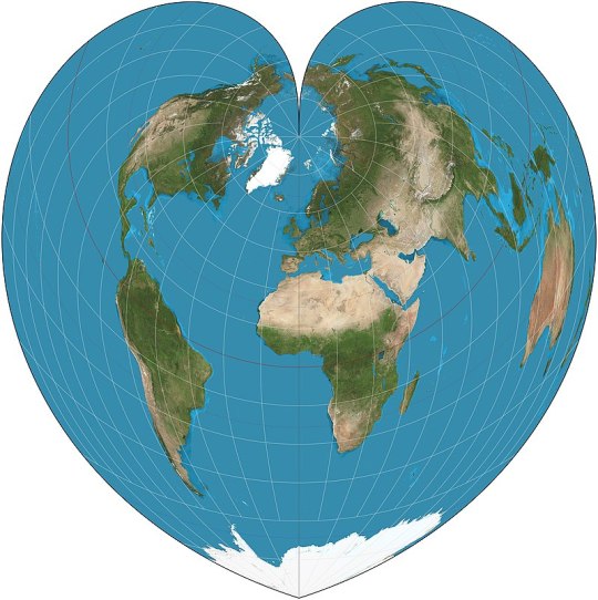
Werner (ca. 1500): heart-shaped, preserving relative areas, with the parallels being concentric circles around the North Pole.
AZIMUTHAL (meridians are straight lines meeting at the center, parallels are concentric full circles)
Gnomonic (ca. 580 BCE): probably the oldest map projection. Unfortunately it can only show at most part of one hemisphere, with the Equator being infinitely far away, much like the Poles in Mercator.
Stereographic (ca. 150 BCE): as before, but only the opposite pole is infinitely far away. The far hemisphere is still distorted, so it's still used in two parts, each centered on one pole.
Orthographic (ca. 150 BCE): basically just what the Earth would look like if observed from infinite distance: it shows exactly one hemisphere.
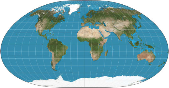
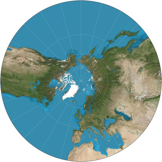
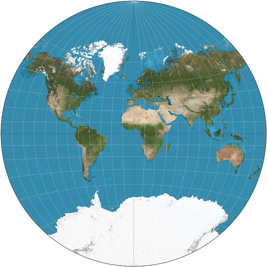
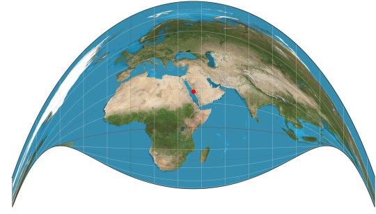
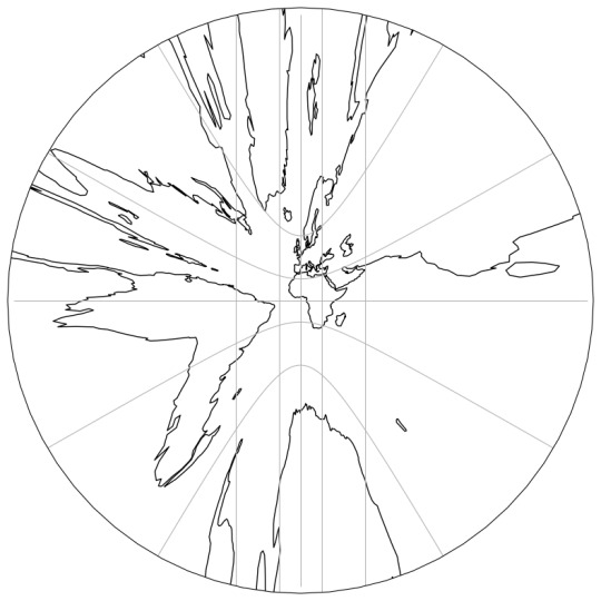
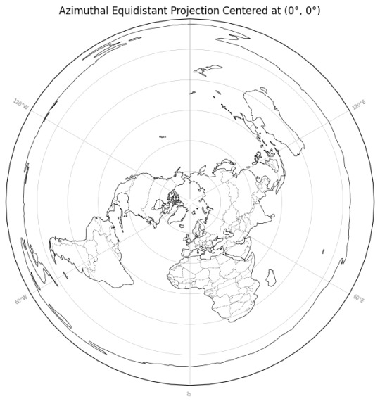
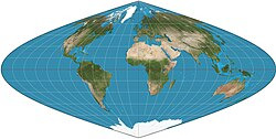
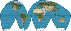
Azimuthal equidistant (ca. 1000): all parallels are full circles centered on the North Pole, and the South Pole is also a circle surrounding all. The map used on the flag of the United Nations. Most Flat Earthers think the Earth has this shape.
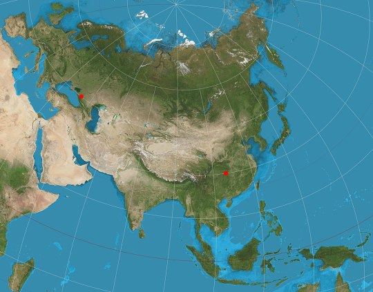
Two-point equidistant (1919): preserves distances on the straight line that passes thrrough two arbitrary points. A favorite of history atlases: it's usually used to portray Asia with as little distortion as possible despite its unfortunate proximity to both North Pole and Equator.

Hao projection or plane terrestrial globe (2002): popular in China, replicates as much as possible the curvature of a globe.
PSEUDOAZIMUTHAL (central meridian and equator are straight lines; other meridians curve toward the central meridian, other parallels curve away from the equator)

Wiechel (1879): the meridians form a pinwheel! Preserves relative areas, but which great distortion of the opposite hemisphere.

Aitoff (1889): looks like the Mollweide with diverging parallels. Mostly relevant because of:
Winkel Tripel (1921): arithmetic mean between Aitoff and equirectangular; the map used by National Geographic.
OTHER
Peirce quincuncial (1879): a perfect square that can be tiled regularly in all direction. I think Flat Earthers should start claiming that Earth look like this and that there are infinite copies in every direction.
Van der Grinten (1904): built ad hoc to map the Earth onto a circle, preserving exactly neither area nor shapes.
Craig's retroazimuthal or the Mecca Map (1909): looks crazy, but preserves the direction from any place on Earth to one specific point; in fact it was invented to help Muslims find easily the direction to the Mecca.
Cahill's Butterfly (1909): adorable, and can be folded into a perfect octahedron.

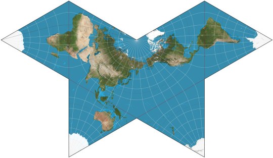
Dymaxion (1943): approximates shapes and areas, and preserves close connections between continents, at the price of a really weird shape.
63 notes
·
View notes
Text
Flat Earthers, Will Duffy, and the Final Experiment
Will Duffy has organized a trip to Antarctica for several flat-earthers and several round-earthers, to make observations together (especially of the overhead-circling 24-hour sun visible in the southern summer) and make progress in the "debate." The trip is happening in a few days. This has been the #1 topic for both flat-earthers and anti-flat-earthers making videos for the last year.
Throughout all this, it's been sad and remarkable watching Duffy's gradual loss of innocence. All the top flat-earthers have always said they wanted to go to Antarctica-- and all of them have always agreed that observing a 24-hour sun in Antarctica was impossible on a flat earth model, so such an observation would falsify flat earth theory. They acted confident that there was no 24-hour sun in Antarctica.
So, Duffy started this project in the hopes that flat-earthers would be open to the project and be excited to finally get their wish. A few flat-earthers agreed to go, but most rejected it vehemently.
Duffy has been pretty much the nicest guy ever in his treatment of flat-earthers. Over the last year, he has been disappointed again and again. Many flat-earthers have changed their story in sudden and drastic ways-- now saying that the observations in Antarctica don't matter at all, that the Gleason's Azimuth Equidistant Projection Map is no longer important (but haven't presented an alternative), that any flat-earther who accepts the free trip to Antarctica is a sell-out, and that Duffy and all the round-earthers going on the trip are literally possessed by demons.
22 notes
·
View notes
Text
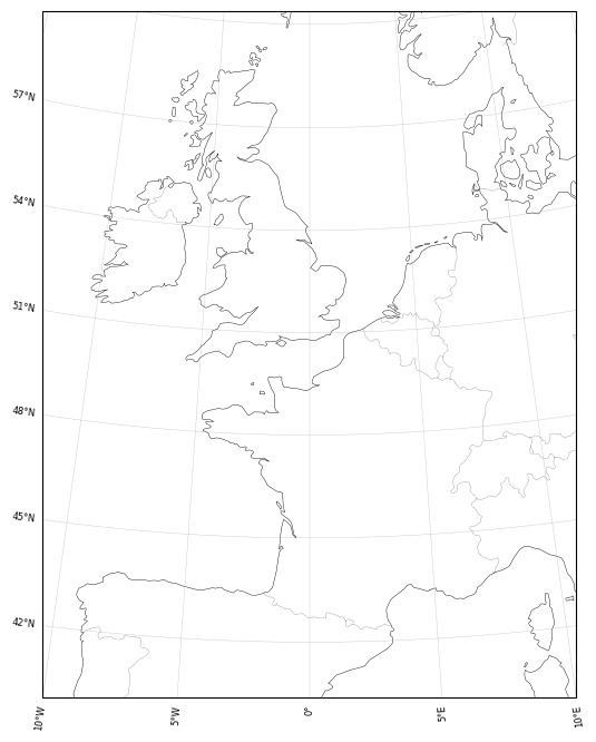
Tagged by @arnaerr (thumbs up emoji) Last Song: Prods the Fire with a Bone, Rolls over with a Snake - Širom Last Book: The Left Hand of Darkness - Ursula K Le Guin Made it a resolution to always take a book with me to uni as I have way too much free time between classes. Spending that time now reading books instead of staring at the phone. Last Movie: On The Silver Globe probably. I watch like 1 movie a year tho Last Show: Uuuuhhhh Last thing I searched: azimuthal equidistant projection angles Favourite colour: black, pastel orange, pastel pink Sweet\savory\spicy: Everything but sweet. Relationship status: Lmao Looking forward to: Visiting @watchingforcomets. My fucking Geomorphology classes too ig. Current obsession: I'm making a map for Dracul's lands in my worldbuilding and it's pretty much the most exciting project I started this year, I literally constantly stare at it. Besides that, Hades 2 and gardening.
13 notes
·
View notes
Text
WIP. The Flat G'eth
I re-edited my previous map of the Realm of G'eth.
Now it's portrayed via an Azimuthal equidistant projection. Instead of the previous Nicolosi globular projection.
12 notes
·
View notes
Text
Mapping
Gnomonic Projection (c. 580 BC)

Stereographic Projection (c. 150 BC)


Orthographic Projection (c. 150 BC)


Equirectangular Projection (c. 120 BC)
Equidistant conic (c. 150)

Sinusoidal (c. 1600)


Lambert azimuthal equal-area Projection (1772)


Mollweide Projection (1805)
Goode Homolosine Projection (1923)

Robinson Projection (1963)
0 notes
Text
The Flat Earth Map: An Exploration of Its History, Beliefs, and Controversies
The concept of a flat Earth has been a topic of debate and intrigue for centuries, despite overwhelming scientific evidence supporting a spherical Earth. Central to the flat Earth belief is the flat Earth map, which depicts the Earth as a flat, circular plane surrounded by a boundary, often represented as an ice wall.
This article delves into the history of the flat Earth map, explores the beliefs held by flat Earth proponents, and examines the controversies and challenges associated with this perspective.
Historical Background of the Flat Earth Map
The idea of a flat Earth has ancient origins, dating back to early civilizations such as the Babylonians and ancient Egyptians, who conceptualized the Earth as a flat disc.
Ancient Greek philosophers, including Anaximander and Thales, also entertained the idea of a flat Earth, although this view was later challenged and largely replaced by the spherical Earth model advocated by Pythagoras and Aristotle.
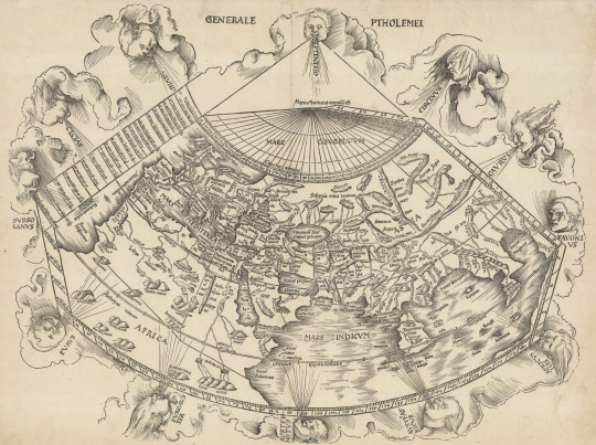
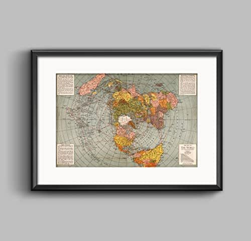
The modern flat Earth map, often referred to as the Azimuthal Equidistant Projection, was popularized in the 19th century by Samuel Rowbotham, a prominent figure in the flat Earth movement.
Rowbotham’s book, "Zetetic Astronomy: Earth Not a Globe," laid the foundation for the contemporary flat Earth model. His map portrayed the North Pole at the center, with continents and oceans radiating outward, and Antarctica forming a boundary around the edges as a massive ice wall.
Key Features of the Flat Earth Map
Azimuthal Equidistant Projection: The flat Earth map is typically based on this projection, which shows the Earth as a circular plane with the North Pole at the center. This projection is used in some legitimate contexts, such as radio navigation, but in the flat Earth model, it is interpreted literally as the true shape of the Earth.
Central North Pole: On the flat Earth map, the North Pole is situated at the center, unlike the conventional globe where it is positioned at the top. All longitudes radiate from this central point, with distances increasing outward.
Perimeter Ice Wall: The outer boundary of the flat Earth map is often depicted as a giant ice wall, representing Antarctica. Proponents argue that this ice wall contains the world's oceans and prevents water from spilling over the edge.
Sun and Moon Circuits: In the flat Earth model, the Sun and Moon are believed to move in circular paths above the Earth, casting light in localized areas rather than illuminating the entire planet. This is used to explain the occurrence of day and night as well as seasonal changes.
The flat Earth map represents a controversial and scientifically discredited view of our world, yet it continues to captivate a segment of the population. Understanding the history, beliefs, and arguments of the Flat Earth movement provides insight into how alternative theories persist in the face of overwhelming evidence to the contrary.
While the scientific community widely accepts and validates the spherical Earth model, the flat Earth map serves as a reminder of the importance of critical thinking, education, and the need to address misinformation in the digital era.
0 notes
Text
Wouldn't this work if you constructed said """square""" on a cone, and then projected it onto a 2D surface using an azimuthal equidistant projection
I love seeing a meme and being like oh, tumblrs going to love this one
66K notes
·
View notes
Text
1421
Note: Theoreticians have long postulated that Siberian migrants crossed the Bering Strait and founded modern-day America between the 30th and 10th millennium BC. Later traceable contacts, minor as they would be, are accredited to the Phoenicians and Portuguese, whose ships met demise and never returned to their homeland. However, the history of human migration and exploration is divisive and far more nuanced than it is presented in books, and in an era where oral myths and traditions were enough to revise history, time and space came together in a single tantalizing riddle when Gavin Menzies proposed that a Chinese sailor discovered the Americas in 1421. [y'all I hated this book so much I had to write an essay rant]
Ma Sanbao, descended from the Mongol empire and an area in modern Uzbekistan, is the Chinese explorer at the forefront of Menzies’ conspiracy. After conscription into the Chinese army in late childhood, nineteen-year-old Ma Sanbao distinguished himself as an officer and diplomat with imperial connections. Under the tutelage of the recently ascended Yongle Emperor, Ma Sanbao became Zheng He. With the country in disarray following wars, the Ming courts sought to display China’s power while returning foreign treasures.
Peculiarly, Menzies’ iteration deviates from traveling to South and Southeast Asia and depicts Zheng He visiting every corner of the globe, excluding the entire European continent. An index of supporting evidence includes thousands of: (1) archaeological artifacts such as pottery; (2) cartographical evidence from maps penned during the late Ming era; and (3) astronomy-related devices used for circumnavigating. (pp. 429-462)
In addition, Menzies claims Chinese seamen toured Maya lands, hunted in Greenland, and established trade ports in the Amazon. His travels to the supposed locations of Zheng He’s voyages support these claims. Accompanying unique personal experiences, vignettes told in a lively, engaging style propose an alternative and ultimately faulty reimagining of exploration history as modern historians know it. The chronology presented by Menzies falls under scrutiny when analyzing the Piri Reis map, one of his primary sources.
Named for a famed Ottoman admiral and cartographer, the Piri Reis map is incorrectly believed to be the most accurate cartographical catalog of the 16th century. Pertaining to Menzies' assertions, the closest the map veers towards depicting North America hardly represents the continent, save for a slim portion of coastline and an island labeled Antila, which may be modern-day Newfoundland.
This fascinating relic of navigators enters the scope of ice-age civilizations, shifting poles, and ancient astronauts, i.e., aliens. Charles Hapgood tailors the Piri Reis to justify a “pre-existing notion of an ice-free Antarctica.” He believed the earth’s poles had shifted, and the Piri Reis’ sources originated from maps of an ancient, unknown civilization that accurately mapped the coastline of a piece of South America. Hapgood also believes this part of the continent broke off to form Antarctica.
Swiss writer Erik von Daniken proposed the concept of “an azimuthal equidistant projection,” which, in brief, denotes extraterrestrials. Many would later disprove the Hapgood Hypothesis using Hapgood and Daniken’s evidence against their claims. Finally, Paul Lunde proposed that Piri Reis ran out of parchment and turned the coastline to the east to make space. It is no mystery why a theorist like Menzies would manipulate this map to his guiles; the phenomenon of Piri Reis lies solely in its earlier complement date, as more accurate cartography would arise in the same decade. An additional account from January 2009 presents another map assumedly dated to 1400 as “plainly a hoax.” Although the Shanghai bookshop that founded it claims the object as a late Ming-era artifact, the map depicts the Americas as enormous; yet each curve of Alaska and the Yucatan peninsula is accurately measured and mapped. Scholars, domestic and abroad alike, rubbish the find; the cartography depicted is stylistically European, while the characters are not in the proper medieval variation. A cursory study of this instance would lead one to believe in its ultimatum, but further research displays a bias among experts in the given field.
As Chinese dynasties tended to destroy evidence of prior ones, this replica would suffice in lieu of a verifiable original. The closest one could hope for a cartographic delineation of the Americas predating Columbus is the Vinland map, which shows a North American coast despite being of Greenland. After much scrutiny, Vinland scholar RA Skelton asserted it remains “the only known cartographical delineation of American lands [prior to the voyages] of Columbus and Cabot.” Comparatively, the Vinland map presents a historical origin in Viking Leif Eriksson, who claimed the first known settlement of modern America by outsiders. Considering the Shanghai map, faking a circumnavigation is simply baseless grounds for further chauvinism, which has entrapped outsiders with its perceived novelty. Menzies frequently misinterprets Chinese imperial policy and fails to cite sources, and those he does mention are fraudulent.
Furthermore, Menzies allots amateur studies excessive weight on his website, Friends of the 1421. Herein, Menzies cites a Croatian geneticist who reports on long-standing local rumors stating the presence of “Oblique-eyed yellow Easterns” in the Adriatic sometime before 1522. If a fleet of Chinese junkers had appeared in the Adriatic, in a continent of intellectuals undergoing a renaissance of history, bureaucracy, and art, such an instance would have survived the five-hundred-odd years since then, yet evidence to support this claim has not been found. Even outside the inaccurate and bloated Yellow Registers Archives of Imperial Ming China, the only evidence connecting Ming voyages with European affairs is a mythological figure resulting from misinterpreting sources.
With such verbose diction, 1421 is more analogous to a novel than a factual, historical account. The claims presented rival Velikovsky in terms of fallacies and reach; there is an apparent surplus in Chinese geographical history, yet leaves much for desire in a lack of support with socio-economic policies. The Ming Emperors, suspicious and vigilant against foreign presence, would guard such precious information for the Europeans, equating to high risk with little benefits for the Chinese.
While any discovery entails a comprehension of significance before facts, 1421 demonstrates a view with little space for refutation. This stringent speculation ultimately classifies Menzies’ work as pseudohistory; abusing scientific tools to rewrite world history on such a grand scale is impossible, and the endeavor is enterprising at best.
0 notes
Text
Riley Inventive Options 1943 Flat Earth World Map | Polar Azimuthal Equidistant
Value: (as of – Particulars) Riley Inventive Options 1943 Flat Earth World Map | Polar Azimuthal Equidistant Projection Map | Massive Wall Artwork Poster Print (3 Sizes) (11"x16")GREAT POSTERS FOR THE OFFICE: Are you struggling so as to add that basic contact of magnificence to a room in your workplace? Classic type posters assist broaden your adorning choices and harness the ability of…
View On WordPress
0 notes
Text
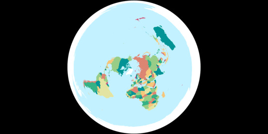
KAVRAYSKIY VII vs AZIMUTHAL EQUIDISTANT
Kavrayskiy VII Pseudocylindrical Compromise
Created in 1939 by Vladimir V Kavrayskiy (Sometimes transcribed from Cyrillic differently, Kavraisky seems to be the most common alternative, used by G.Projector) for use as a general-purpose compromise projection in Soviet atlases. It has seen little use outside the area of the former Soviet Union, where usually the Robinson is used instead.
Mathematically it is the same as the Wagner VI projection horizontally compressed by sqrt(3)/2, however it has very low distortion values on many metrics, comparable to the Winkel Tripel.
This projection is mentioned in passing under the Winkel Tripel's entry in xkcd 977.
Azimuthal Equidistant Azimuthal Equidistant
While it may have been known as far back as the ancient Egyptians, the Azimuthal Equidistant projection was first described by al-Biruni around the year 1000. As an equidistant projection all distances from the chosen centre point can be measured correctly, meaning it is often used for things like missile range maps and other uses where only the distance from a single point is important.
Because of its circular shape, the polar aspect is often used for maps in logos such as the emblem of the UN. It can also be cropped to show a single hemisphere, and can be shown as two hemispheres side by side in the equatorial aspect like this.
[link to all polls]
Political:
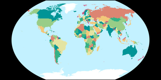
Tissot's Indicatrices:
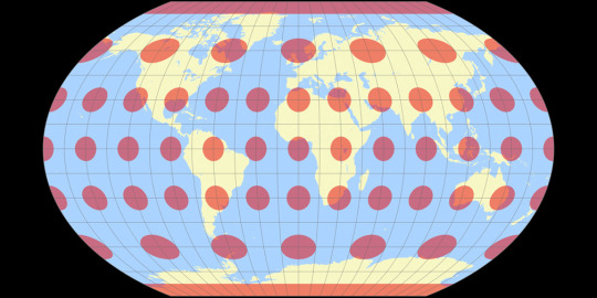
Images created by Tobias Jung (CC BY-SA 4.0) from map-projections.net
12 notes
·
View notes
Text
there WAS a contingent of flat earthers at some point who were prepared to argue that the azimuthal equidistant projection is completely literal and australia is actually twice as wide as it is tall, but i guess that was too falsifiable? dunno why they took that projection literally in the first place.
thinking about the updated flat earth map that just squishes australia back to normal. straight up booped it. gave it the oll pinchy pinchy
598 notes
·
View notes
Text

Johngalli’s interest expanded into star maps temporarily in addition to planetary interests.
At that point in his life, he attempted to memorize the inner-workings of the the azimuthal equidistant projection. This would lead him to eventually get the three tattoos of the world on his back and shoulders.
He would receive these not too long after his cataracts began to truly injure his sight to an irreversible extent.
#headcanon ;; johngalli a#something short-- But I was doing some research on star maps and it's relation to pi#and started to learn more about azimuth--for the most part the azimuthal equidistant projection#I really like the idea of Johngalli being quite good at math and astronomy(he does have the planet on his back)#(and those symbols on his cheeks look AWFULLY like pi ))#but something short uvu i'm in a big mood for this boy
2 notes
·
View notes
Text
Peta bumi menjadi dua kubu besar antara Rusia dan Amerika saat perang melawan Nazi Jerman
Peta dunia menjadi dua kubu Besar, INI adalah peta perjuangan dunia yang akan menandai titik balik peradaban. Perjuangan membagi dunia menjadi dua kubu besar: mereka yang mendukung kita (dalam berbagai derajat) dan mereka yang melawan kita (juga dalam berbagai derajat). Di antara ekstrem-ekstrem ini ada yang netral, ada yang condong ke satu arah, ada yang lain. Semua gradasi ini dijelaskan dalam kunci di halaman yang berlawanan.
Beberapa poin penting mengenai peta ini harus diperhatikan. Yang pertama adalah bahwa seluruh konflik berputar di sekitar A.S. Ini bukan hanya karena penempatan A.S. di pusat penyebaran: melainkan terletak pada sifat perjuangan. AS adalah poros (a) karena posisi geografisnya, yang merupakan pusat lautan; selengkapnya klik dibawah 👇.
#Peta dunia menjadi dua kubu besar#TERSENTRIFUSI DUNIA.#PROYEKSI EQUIDISTANT AZIMUTHAL POLAR UTARA Prinsip proyeksi ini dapat diilustrasikan oleh seorang penari#PROYEKSI EQUIDISTANT AZIMUTHAL POLAR UTARA Prinsip proyeksi ini dapat diilustrasikan oleh seorang penarip#Peta bumi bajak laut#Peta bumi seorang nelayan#Peta bumi seorang penjelajah dunia#Peta bumi menurut agama#Peta bumi peradaban Yunani kuno#Peta bumi peradaban Islam#Peta bumi menurut sejarah
0 notes
Text
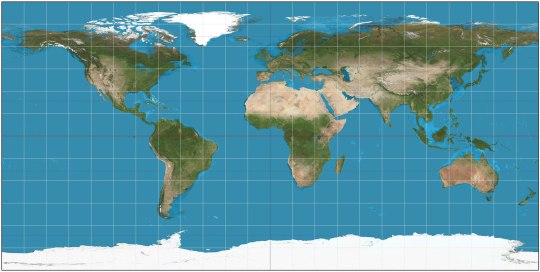
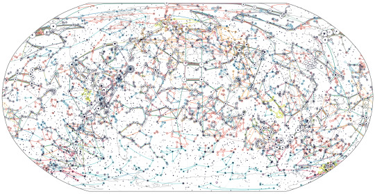
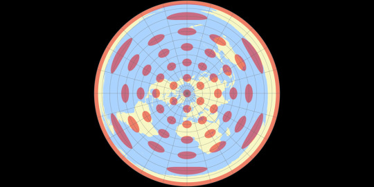
Update: I wrote the above post several months ago, and I have learned more about the flat earth discourse since then. In my original post, I said there was a consensus among flat-earthers that Antarctica was a ring around the known world (as per the Alexander Gleason azimuthal-equidistant map pictured above). This is basically the consensus among high-profile flat-earthers on YouTube, and it seems to be the sizeable majority view among modern online flat-earthers in general. However, I have since learned there are a few flat-earthers who propose alternative maps.
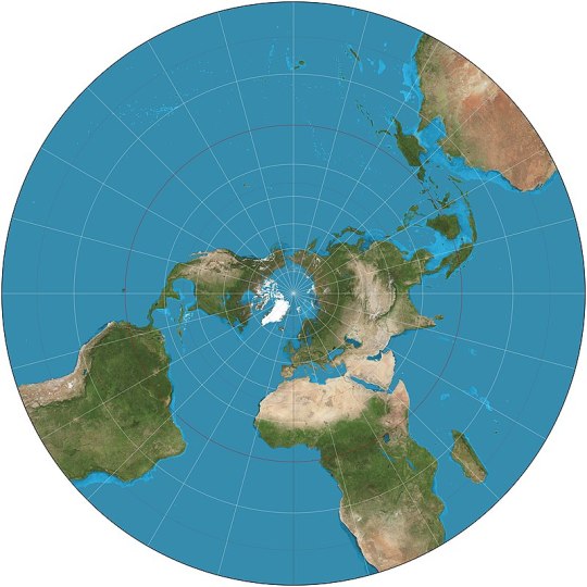
A few flat-earthers propose an “inverse azimuthal-equidistant” map, where the Arctic Ocean is around the perimeter, and Antarctica is in the center. The Inverse AE map has nearly all the problems of the regular AE map, plus a bunch of new problems such as failing to explain why there are way more flights over and near the Arctic than there are flights over and near the Antarctic. Moreover, while the inverse AE map can explain the 24-hour sun in Antarctica during one half of the year, it has an inverted version of the same problem–it cannot explain the 24-hour sun in the Arctic, during the other half of the year. Even most flat-earthers acknowledge that the 24-hour sun in the Arctic is real, denying only the 24-hour sun in the Antarctic. Will Duffy, who led the Final Experiment, made one or two videos debunking the Inverse AE map.
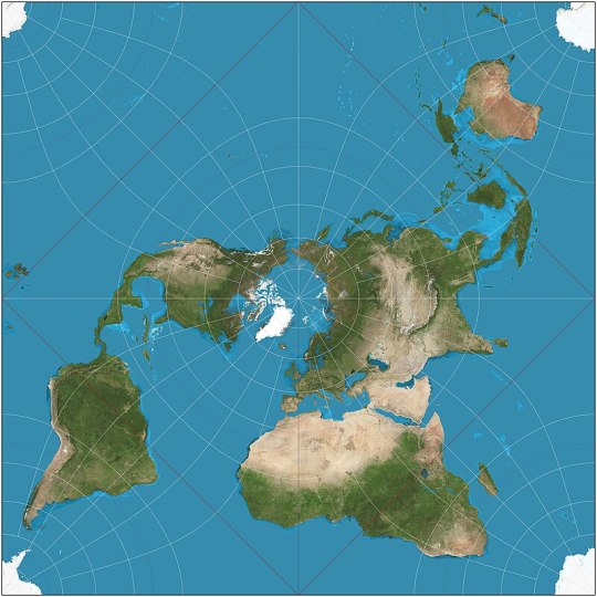
There are several other even more fringe flat-earth maps as well. While the Gleason AE map and the Inverted AE map are both mono-pole maps (denying the existence of one geographic pole or the other), a few other flat-earth maps are “bi-polar.” Elizabeth Blount was a flat-earther who proposed a bi-polar model in the early 1900s. Even earlier, before Rowbotham, the anonymous author of “The Anti-Newtonian” also proposed a bi-polar model. A bi-polar model was also revived by a single fringe flat-earther several years ago, Colin Sweeney, who specifically aimed to account for the 24-hour sun in the Antarctic. However, these models never caught on among most flat-earthers, for whatever reason. (I’m not sure precisely how to refute Sweeney’s model, but I’m pretty sure his main arguments badly mangle how celestial geometry works.)
Finally, there are a few other flat-earthers who propose models that either require, or flat-out insist on the existence of, portals from west to east. These are also quite fringe, even by flat-earth standards, and are rejected or ignored by nearly all flat-earthers.
All these alternative flat-earth maps do generally preserve the parallels and meridians, but at the cost of egregious distortions of the shapes of known geographic regions (which, to be clear, is already a serious cost of the Gleason AE map, especially in the southern hemisphere [‘hemiplane’]).
So, the Final Experiment is still a rebuttal to the map that is most widely accepted by flat-earthers (the Gleason AE map), even if it does not address a few even more fringe flat-earth maps.
Oh, another caveat. I’ve said the Antarctic 24-hour sun is not possible on a flat-earth model. This is true only if we ignore the fact that the flat-earth model actually requires a 24-hour sun in all parts of the world at all times of the year. It has been demonstrated that flat-earthers’ own models entail that the sun should be at least 10 or so degrees above the horizon at all times, no matter where you are or what time of year it is. Flat-earthism makes sunsets impossible altogether. I’m ignoring this problem for the purpose of discussing the Antarctica phenomenon in particular.
Moreover, Antarctica poses a problem also because the sun is often visible to the south, which should not be possible on a flat-earth model, since most flat-earthers think the sun never goes farther south than the Tropic of Capricorn. During about half the year, someone in Antarctica will see the sun encircle them overhead, going 360 degrees from right to left over the course of 24 hours. So the problem is not precisely that a 24-hour sun is visible, but where the sun appears in the sky.
In late December, the sun never fully sets when you view it from Antarctica—a 24-hour sun. This only makes sense on the globe earth model, and is precluded by all flat earth models. All flat earth maps depict Antarctica as a massive ring around the rest of the world (pictured below). All the high-profile modern flat earthers, until recently, have had a consensus that the sun surely DOES set in Antarctica—and that every single one of the existing 24-hour Antarctic sun videos are fake.
However, in recent months, a globe earth model advocate (i.e. normal person) has announced and confirmed a plan to fund an expedition for some flat earthers to visit Antarctica and record their observations under rigorous and mutually agreed-on conditions. This is Will Duffy’s project of “The Final Experiment.”
Since then, many flat earthers have begun hedging. Now some flat earthers acknowledge it may be possible that the sun sometimes *doesn’t* set in Antarctica—and insist that this possibility *is* (somehow) consistent with the flat earth model after all.
For instance, Eric Dubay always consistently said the sun DOES set in Antarctica—but recently he started saying that it doesn’t matter whether the sun sets in Antarctica or not. Now he says that what you see in the sky obviously has nothing to do with the shape of the earth.
As far as I can tell, no flat earther has explained *how* a 24-hour Antarctic sun is possible on a flat earth model. Flat earthers believe the sun travels in a circle above the earth, and that the sun sets when it is sufficiently far away (contrary to the laws of optics). *Where* exactly does the sun travel, in order to sometimes be visible from Antarctica but simultaneously invisible from most other areas?
I’m not aware of any flat earthers positing a model where Antarctica isn't a ring around the known world, as is required for a flat earth map that maintains the standard latitude and longitude. Any other model would probably require saying the parallels and meridians are all wrong, which would make it extremely hard to explain how basic navigation works. Even flat earthers have seemingly been reluctant to say everything we know about navigation is wrong, or that every captain and pilot ever has been in on the conspiracy.
Some other flat earthers are saying that the one or two flat earthers who travel to Antarctica may be shills, so it won’t matter even if they say the sun didn’t set. And some are saying there could be a “sun simulator” to project a fake sun into the sky to fool people into thinking the sun didn’t set.
One of the few flat earthers who seems intellectually honest is a guy called Jeranism, who has accepted the offer to travel to Antarctica. He has clearly stated that all the flat earth models render a 24-hour sun impossible, so if there’s a 24-hour sun in Antarctica at any time, that shows the earth isn't flat. He’s been consistent on this and has called out other flat earthers for being cowards. Of course, other flat earthers are now accusing him of being a shill.
I also note that until recently, many flat earthers have habitually claimed that nobody is ever allowed to travel to Antarctica—in total ignorance of the fact that there is Antarctica tourism, and thousands of people travel there every year. Flat earthers have long said they wish they could travel to Antarctica to prove the flat earth. Now that they have a chance, they say accepting the offer means you’re a shill. (Arguably, Antarctica tourism *should* be banned for environmental reasons. But the fact remains that it isn’t banned, but is merely expensive.)
41 notes
·
View notes
Photo

UN redesign
from /r/vexillology Top comment: Definitely prefer it to the weird azimuthal equidistant projection on the current one
35 notes
·
View notes