#UNESCO World Biosphere Reserve
Explore tagged Tumblr posts
Text
Genocide experts warn that India is about to genocide the Shompen people
Who are the Shompen?
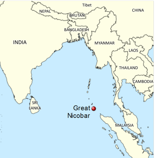
The Shompen are an indigenous culture that lives in the Great Nicobar Island, which is nowadays owned by India. The Shompen and their ancestors are believed to have been living in this island for around 10,000 years. Like other tribes in the nearby islands, the Shompen are isolated from the rest of the world, as they chose to be left alone, with the exception of a few members who occasionally take part in exchanges with foreigners and go on quarantine before returning to their tribe. There are between 100 and 400 Shompen people, who are hunter-gatherers and nomadic agricultors and rely on their island's rainforest for survival.
Why is there risk of genocide?
India has announced a huge construction mega-project that will completely change the Great Nicobar Island to turn it into "the Hong Kong of India".
Nowadays, the island has 8,500 inhabitants, and over 95% of its surface is made up of national parks, protected forests and tribal reserve areas. Much of the island is covered by the Great Nicobar Biosphere Reserve, described by UNESCO as covering “unique and threatened tropical evergreen forest ecosystems. It is home to very rich ecosystems, including 650 species of angiosperms, ferns, gymnosperms, and bryophytes, among others. In terms of fauna, there are over 1800 species, some of which are endemic to this area. It has one of the best-preserved tropical rain forests in the world.”
The Indian project aims to destroy this natural environment to create an international shipping terminal with the capacity to handle 14.2 million TEUs (unit of cargo capacity), an international airport that will handle a peak hour traffic of 4,000 passengers and that will be used as a joint civilian-military airport under the control of the Indian Navy, a gas and solar power plant, a military base, an industrial park, and townships aimed at bringing in tourism, including commercial, industrial and residential zones as well as other tourism-related activities.
This project means the destruction of the island's pristine rainforests, as it involves cutting down over 852,000 trees and endangers the local fauna such as leatherback turtles, saltwater crocodiles, Nicobar crab-eating macaque and migratory birds. The erosion resulting from deforestation will be huge in this highly-seismic area. Experts also warn about the effects that this project will have on local flora and fauna as a result of pollution from the terminal project, coastal surface runoff, ballasts from ships, physical collisions with ships, coastal construction, oil spills, etc.
The indigenous people are not only affected because their environment and food source will be destroyed. On top of this, the demographic change will be a catastrophe for them. After the creation of this project, the Great Nicobar Island -which now has 8,500 inhabitants- will receive a population of 650,000 settlers. Remember that the Shompen and Nicobarese people who live on this island are isolated, which means they do not have an immune system that can resist outsider illnesses. Academics believe they could die of disease if they come in contact with outsiders (think of the arrival of Europeans to the Americas after Christopher Columbus and the way that common European illnesses were lethal for indigenous Americans with no immunization against them).
And on top of all of this, the project might destroy the environment and the indigenous people just to turn out to be useless and sooner or later be abandoned. The naturalist Uday Mondal explains that “after all the destruction, the financial viability of the project remains questionable as all the construction material will have to be shipped to this remote island and it will have to compete with already well-established ports.” However, this project is important to India because they want to use the island as a military and commercial post to stop China's expansion in the region, since the Nicobar islands are located on one of the world's busiest sea routes.
Last year, 70 former government officials and ambassadors wrote to the Indian president saying the project would “virtually destroy the unique ecology of this island and the habitat of vulnerable tribal groups”. India's response has been to say that the indigenous tribes will be relocated "if needed", but that doesn't solve the problem. As a spokesperson for human rights group Survival International said: “The Shompen are nomadic and have clearly defined territories. Four of their semi-permanent settlements are set to be directly devastated by the project, along with their southern hunting and foraging territories. The Shompen will undoubtedly try to move away from the area destroyed, but there will be little space for them to go. To avoid a genocide, this deadly mega-project must be scrapped.”
On 7 February 2024, 39 scholars from 13 countries published an open letter to the Indian president warning that “If the project goes ahead, even in a limited form, we believe it will be a death sentence for the Shompen, tantamount to the international crime of genocide.”
How to help
The NGO Survival International has launched this campaign:
From this site, you just need to add your name and email and you will send an email to India's Tribal Affairs Minister and to the companies currently vying to build the first stage of the project.
Share it with your friends and acquittances and on social media.
Sources:
India’s plan for untouched Nicobar isles will be ‘death sentence’ for isolated tribe, 7 Feb 2024. The Guardian.
‘It will destroy them’: Indian mega-development could cause ‘genocide’ and ‘ecocide’, says charity, 8 Feb 2024. Geographical.
Genocide experts call on India's government to scrap the Great Nicobar mega-project, Feb 2024. Survival International.
The container terminal that could sink the Great Nicobar Island, 20 July 2022. Mongabay.
[Maps] Environmental path cleared for Great Nicobar mega project, 10 Oct 2022. Mongabay.
#shompen#genocide#stop genocide#india#indigenous#indigenous peoples#indigenous rights#human rights#anthropology#stateless nations#end occupation#andaman and nicobar islands#nicobar islands#great nicobar#💬#asia#geopolitics#ecocide#sustainability
23K notes
·
View notes
Text
Золотистый закат на острове Межной. Русский север.
Golden sunset on Mezhnoy Island. Russian North.
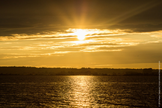

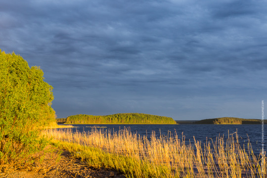

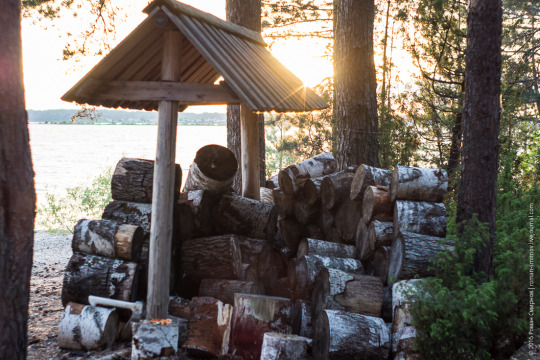


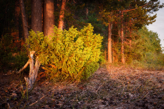
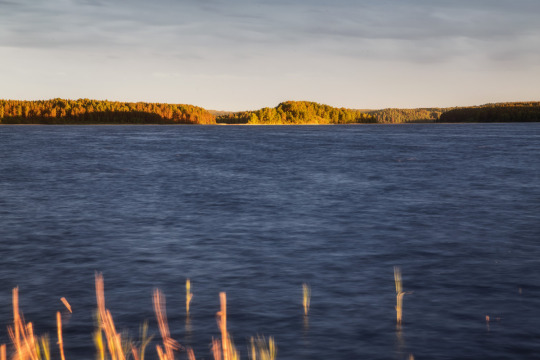

Остров Межной расположен в Кенозерском национальном парке в Архангельской области. Территория парка представляет собой природный и историко-культурный комплекс, расположенный в юго-западной части Архангельской области, его западная граница проходит по границе с Республикой Карелия. В 2004 году Кенозерский национальный парк получил статус биосферного заповедника и был включён в Список биосферных резерватов ЮНЕСКО. С 2014 года является кандидатом на включение в список объектов Всемирного наследия.
Кенозерье называют озёрным краем — территория Парка имеет развитую гидрографическую сеть и насчитывает 251 озеро, 67 ручьёв и речек. Каждый из многочисленных водоёмов Парка открывает свою неповторимую красоту в изгибах берегов, плеске волн, цвете воды. Площадь Кенозера — 68,6 км², с островами — 99,4 км². Всего островов — 70! Берега и холмистые острова озера покрыты сосново-еловым и сосново-берёзовым лесом. Есть по берегам и пляжи с чудесным белым песком.
Mezhnoy Island is located in the Kenozersky National Park in the Arkhangelsk region. The territory of the park is a natural, historical and cultural complex located in the southwestern part of the Arkhangelsk region, its western border runs along the border with the Republic of Karelia. In 2004, Kenozersky National Park received the status of a biosphere reserve and was included in the UNESCO List of Biosphere Reserves. Since 2014, it has been a candidate for inclusion in the list of World Heritage Sites.
Kenozerie is called the lake region - the territory of the Park has a developed hydrographic network and has 251 lakes, 67 streams and rivers. Each of the Park’s numerous reservoirs reveals its unique beauty in the curves of the banks, the splash of waves, and the color of the water. The area of Kenozero is 68.6 km², with islands - 99.4 km². There are 70 islands in total! The shores and hilly islands of the lake are covered with pine-spruce and pine-birch forests. There are also beaches with wonderful white sand along the shores.
Источник:https://roman-smirnov.livejournal.com/223355.html, /osipovvas.livejournal.com/50214.html, /www.kenozero.ru/o-parke/prirodnoe-nasledie/reki-i-ozera/, /ru.wikipedia.org/wiki/Кенозерскийнациональныйпарк, /pomorland.travel/what-to-see/natsionalnyy-park-kenozerskiy/.
#Russia#Kenozero national park#Mezhnoy Island#nature#nature aesthetic#landscape photography#trees and forest#lake#sky#clouds#sunset#travel#wonderful#Россия#природа#Пейзаж#туризм#Кенозерский национальный парк#Остров Межной#лес#озеро#небо#закат#облака
150 notes
·
View notes
Photo
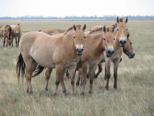
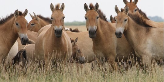
Przewalski’s horses of Askania Nova nature reserve, Ukraine.
Askania Nova is the largest protected steppe in Europe and is among UNESCO World Network Biosphere Reserves. The Russian invasion of Ukraine has unleashed mass ecological damage across the country that will take centuries to heal. Askania Nova is home to many critically endangered species of flora and fauna, and it is imperative to both Ukrainian and world heritage to preserve this precious biome.
You can donate to help Askania Nova’s brave stewards continue to care for the animals through the Ukrainian Nature Conservation group, which accepts both Euros and USD. Be sure to add "Допомога для заповідника «Асканія-Нова»" ("Help for the Askania Nova Nature Preserve") in the donation notes.
#przewalski's horse#ukraine#animal photography#wildlife photography#nature photography#equine photography#horses#przewalskis wild horse#animals#askania nova#ecology#my post
546 notes
·
View notes
Text
GOOD NEWS:
Ecuadorians reject oil drilling in the Amazon, ending operations in a protected area
Ecuadorians voted against drilling for oil in a protected area of the Amazon, an important decision that will require the state oil company to end its operations in a region that’s home to isolated tribes and is a hotspot of biodiversity. With over 90% of the ballots counted by early Monday, around six in 10 Ecuadorians rejected the oil exploration in Block 43, situated within Yasuni National Park. The referendum took place along with the presidential election, which will be decided in a runoff between leftist candidate Luisa González and right-wing contender Daniel Noboa. The country is experiencing political turmoil following the assassination of one of the candidates, Fernando Villavicencio. Yasuni National Park is inhabited by the Tagaeri and Taromenani, who live in voluntary isolation, and other Indigenous groups. In 1989, it was designated, along with neighboring areas, a world biosphere reserve by the United Nations Educational, Scientific and Cultural Organization, also known as UNESCO. Encompassing a surface area of around 1 million hectares (2.5 million acres), the area boasts 610 species of birds, 139 species of amphibians and 121 species of reptiles. At least three species are endemic.
#south america#amazon#rain forest#science#animals#nature#yasuni#yasuni national park#ecuador#politics#oil
127 notes
·
View notes
Text

Excerpt from this press release from the Center for Biological Diversity:
The UNESCO World Heritage Committee renewed its call today for urgent action to protect the critically endangered vaquita porpoise in Mexico. With merely six to eight individuals estimated remaining, the vaquita faces imminent extinction from entanglement in illegal fishing gear.
The committee agreed to retain the Islands and Protected Areas of the Gulf of California World Heritage site — the only home to vaquita — on its List of World Heritage in Danger. In its review, the committee determined that Mexico’s recent enforcement actions to quell illegal fishing in the area were “not fully effective” in protecting the vaquita. The committee also approved a suite of corrective measures for Mexico to implement to safeguard the species.
“I appreciate the committee’s continued pressure, but it’s disheartening that Mexico still hasn’t kept its promises to protect the quickly vanishing vaquita,” said Alejandro Olivera, senior scientist and Mexico representative at the Center for Biological Diversity, who is attending the committee meeting in Delhi. “Despite a 2020 ban, lethal gillnets still plague these little porpoises’ habitat. Mexico needs to step up immediately, expand the vaquita’s protected area, and enforce the law by stopping illegal fishing.”
Under the World Heritage Convention, a site may be listed as “in danger” if development projects or major public works threaten the natural values the site was designated to protect. According to UNESCO, the aim of the list is to “inform the international community” of the situation and “encourage corrective action.”
The vaquita population has declined drastically, falling from nearly 600 in 1997 to fewer than 10 in 2024 because of entanglement in gillnets used for illegal fishing. These nets target shrimp and a variety of fish, including totoaba, an endangered species whose swim bladder is coveted in China. Despite some reduction in illegal fishing within a no-fishing zone known as the zero tolerance area, the practice remains widespread outside this zone, posing a continuous threat to the vaquita’s survival.
The committee decided that for the “in danger” designation to be lifted, Mexico must enact the following corrective measures:
implement sustainable fishing practices that avoid harming marine life
demonstrate a five-year increase in the vaquita population with healthy individuals and calves
effectively protect the area from illegal fishing
eliminate gillnets from the Vaquita Refuge and Biosphere Reserve
collaborate internationally to combat illegal totoaba poaching and trafficking
16 notes
·
View notes
Text
A few hundred metres above the commune of Cruis, in the Alpes-de-Hautes-Provence region, Sylvie Bitterlin, a 62-year-old actress, stands in front of the security fence of a brand-new solar farm.
“Look, they've destroyed everything,” she says.
On the 17-hectare site, the garrigue or scrubland of Provence has been replaced by several thousand solar panels.
The project has been under construction for several months and is nearly finished. According to the operator, Boralex, a Canadian renewable energy company, the site will generate 14.9 megawatt-peak hours of electricity, enough to power a community of 12,000 residents.
Boralex’s managing director, Jean-Christophe Paupe, claims the park makes “an indispensable contribution ... at a time when France is lagging behind in the development of renewable energies”.
But as the project nears completion, Bitterlin makes no secret of her frustration and anger.
Since 2019, she and about twenty other members of the local citizens group Elzéard, Lure en résistance have been fighting tooth and nail to prevent the plant from going ahead.
They say the solar park, partly installed in an area classified as a “biosphere reserve” by UNESCO, will endanger several protected species and their habitat.
Alexanor butterfly and ocellated lizard
“We're told that Provence has poor soil, that there's nothing in it. But this is totally false. We have medicinal plants, thyme, rosemary, orchids ... These are fantastic plants, home to protected species. It's all about life,” says Bitterlin, who has become the movement's spokeswoman.
“Before, this landscape stretched all the way to the top of the mountain,” she says, against the backdrop of the picture-postcard setting of the 1,826-metre-high Montagne de Lure. “What destruction! What a disaster! Where's the ecology when we raze forests and destroy biodiversity to produce energy?”
According to Pierrot Pantel of the Association Nationale pour la Biodiversité (ANB), who took up the case on behalf of the Elzéard collective, 88 animal species have been recorded in the area.
These include several protected species of birds, butterflies such as the Alexanor, with its yellow and black wings, and lizards such as the ocellated lizard – the largest in Europe. “Many animals will have fled their habitat or will have died during the construction work,” he says.
Boralex insists that the project, officially launched in 2009, is the result of “more than five years of environmental and landscape studies, in partnership with the French government”, and that “everything possible has been done” to protect biodiversity.
“Initially, the park was designed to cover several dozen hectares, but its size was reduced to take account of this issue,” explains Paupe.
“And we have put in place a whole series of measures to preserve species: we have adapted our work periods, set up biodiversity corridors, restored habitats,” he says.
But opponents of the solar farm decry these measures as inadequate and say they are just “smoke and mirrors”.
In an area known for its biodiversity, a few "ecological corridors" won’t compensate for the damage caused by building the site, they say.
'An example of what needs to be done in the EU'
Paupe says that the farm "aligns perfectly with French and European ambitions for energy transition” and is “essential in the fight against global warming”.
“What's more dangerous for biodiversity: climate disruption or photovoltaic panels?” he quips.
Indeed, the European Green Deal's overarching aim is to make the EU the world's first "climate neutral bloc" by 2050.
The EU is therefore aiming to massively accelerate the development of renewable energy in a bid to reduce its dependence on fossil fuels, which are the main cause of climate change.
Under the terms of the deal, renewable energies will account for 42.5% of the energy mix by 2030, up from 23% in 2022. France shares this aspiration and passed a law to accelerate the production of renewable energy in March 2023.
But Paupe argues that "this ambition is only achievable if we agree to develop large-scale projects, like the one at Cruis", drawing on studies carried out by RTE, France's electricity transmission company.
“Today, we can't be satisfied with solar panels on the roofs of houses and in areas that are already industrialised. Of course we need solar panels in these places too. But that won't be enough.”
Boralex says there were good reasons for selecting the Lure mountain area for the solar park.
“The PACA region has a lot of sunshine and strong photovoltaic potential. However, it currently imports a large proportion of its electricity. The Cruis power plant therefore helps to resolve this paradoxical situation,” he continues. “In short, it's an example of what needs to be developed across the European Union to move away from fossil fuels. But it will take multiple projects like this one to get there.”
Apart from the arguments put forward by Boralex, projects like this one also provide significant funds for the municipalities concerned.
In Cruis, revenues generated by the solar plant make up 20% of the municipal budget, according to mayor Félix Moroso.
“Over the past two years, it has enabled us to renovate a parking lot, start work on the school and reintroduce aid for disadvantaged groups,” says Moroso, who has been the mayor of the village of 700 inhabitants for 35 years.
“All this at the cost of photovoltaic panels on 1% of our commune”, he adds, expressing annoyance at the actions of the park’s opponents.
But Bitterlin says the project is “not the solution. We're razing forests to put up photovoltaic panels. We're caught in a paradox."
“The first thing to do is to reduce our consumption. If we really adopted more sober lifestyles, would we still need these huge power plants in natural environments?”
“The problem with these parks is their giant size. We wouldn't be against reasonable photovoltaic projects, in line with the needs of the population,” she says. “Unfortunately, we've adopted the financial logic of companies and communes that seem to simply want to make money.”
Months of mobilisation
The situation in Cruis became particularly tense in September 2023 when construction began. “We'd spent years trying to alert and educate the population, to no avail. So when we saw the construction equipment arriving on the mountain to destroy everything, we decided to take action," Bitterlin noted.
For weeks, and in all weathers, Bitterlin and the other activists tried almost daily to block the construction site.
“Never in my life did I think I'd ever chain myself to construction machinery, get under its wheels or climb trees to block work,” said Bitterlin, who says she’s never been the rebellious type. “But the cause was too important,” she says.
On October 4, 2023, Bitterlin and fellow activist Claudine Clovis, 72, were arrested by gendarmes as they lay under the wheels of earth-moving machinery.
They were taken into custody and detained overnight. They were eventually found guilty of obstructing traffic in February 2024 by the criminal court in Digne-les-Bains and sentenced to a suspended fine of €1,200 and a three-month suspension of their driving licenses. The two defendants will also jointly pay €5,000 towards Boralex's legal costs.
Although they have decided to appeal the decision, their arrest put a stop to their campaigning. “We had to keep a low profile and, above all, Boralex stepped up its surveillance,” Bitterlin says. “And, frankly, we were exhausted both physically and morally by those weeks of fighting.”
But the Elzéard group has not given up entirely. Although no one is currently physically blockading the Cruis solar plant, the activists have taken their fight to the courts, with legal assistance from Pantel and ANB.
Over the past four years, the collective – with support from a dozen other environmental groups – has filed three complaints with the Digne public prosecutor for “destruction, alteration and degradation of the habitat of protected animal species” and “undermining the conservation of protected animal species”. According to Pantel, Boralex had in fact begun work on the plant before obtaining all the necessary permits.
A victory in court
In a big win for the activists, on Friday May 31, Boralex and the French government were found to be at fault by the Marseille Administrative Court of Appeal for failing to find an alternative site which would have had less impact on biodiversity.
The administrative judges found in favour of the collective, whose complaint had been dismissed by the court of first instance. The complaint challenged an order issued in 2020 by the Prefect of Alpes-de-Haute-Provence, granting Boralex an exemption from the prohibition on destruction, intentional disturbance or degradation of specimens and habitats of protected animal species.
“It's a great victory. The site is now considered illegal. Work will have to stop and the site cannot be exploited for the time being," says Pantel. “It also legitimises our actions and the disruption to the site – which is important for the Sylvie Bitterlin and Claudine Clovis trial. Finally, it's educational: this judgment shows that you can't destroy a natural habitat with impunity.”
Anticipating that Boralex will take this judgment to the Conseil d'État, the highest court of appeal, Pantel now hopes to reach a final ruling. “We will then go and demand restoration of the site, recognition of the ecological damage and we'll try to question the State's responsibility.”
For its part, however, Boralex believes that the cancellation of this protected species exemption “does not call into question Boralex's right to operate the Cruis solar power plant, nor does it call into question our presence on the site or the finishing work on the plant, which is not affected by this protected species exemption”, the company told AFP.
“This judgment also legitimises our future actions,” says Pantel. Aside from Cruis, some thirty photovoltaic projects are currently under way on the Lure mountain, eventually covering a thousand hectares, according to Pantel’s estimate.
“And we intend to prevent as many as we can,” adds Bitterlin.
A network of sentinels
One of the activists’ new battlegrounds lies a few kilometres from Cruis, in the commune of Montfort. Some 20 hectares have already been cleared.
In January, construction equipment levelled the pines and oaks and soon earth-moving machines will install a new photovoltaic park, operated by Engie Green. It will be the fourth park in this commune of 300 inhabitants.
“We weren't informed when the work started. We arrived too late to prevent the felling of the trees," says Bitterlin.
At the end of May, accompanied by her friend Véronique, also an activist, they came to see the progress of the site. “We were worried about seeing earth-moving equipment,” they say.
With a tape measure in hand, they walked around the site with one objective in mind: to check that Engie Green was complying with all regulations. Cut down a protected tree? Destroy the habitat of a protected species? An information panel removed? Everything is carefully examined. But today, everything seems to be in order.
“We won't be demonstrating here, and we won't be obstructing the work. In any case, it's already too late – once the clearing is done, there's not much left to defend,” they say.
“But we remain vigilant to strict compliance with the rules and are putting our energy into other projects.”
A few kilometres away, in the commune of Banon, Sophie and Nadine keep watch on the areas affected by other solar projects, including one led by a Korean company, QEnergy.
Aged 64 and 72 respectively, the two pensioners admit to being “constantly on the lookout”, “tracking down the slightest noise of construction work” to “check that building work isn’t starting”.
“I go walking in the area every day anyway,” explains Sophie. “Here, at certain times of the year, you can hear deer snorting. It's an incredible natural place. It can't disappear,” she says.
In her large garden with a totally unobstructed view of the surrounding countryside, she says she’s proud of having her own photovoltaic panels, but “only those necessary for her personal electricity consumption”.
“Do we really need to develop large-scale power plants? Isn't the solution first and foremost to take stock of our energy use?” she asks, echoing opponents of such projects in France.
“It's really the multiplication of these projects that's worrying. Are we really going to punch holes in the mountain from all sides?” asks Nadine.
“In addition to biodiversity, we're also touching on a whole literary heritage, the mountain so dear to Jean Giono!” she warns, referring to the writer who drew such inspiration from the Lure mountain.
The Green Deal was a central feature of outgoing EU president Ursula Von der Leyen's last term of office, and a new parliament will be formed after European elections on June 9.
Bitterlin said she hopes that the issue of solar parks in environmentally sensitive areas will be taken up by candidates for the new EU parliament.
“We've succeeded in making Cruis a symbol of our campaign,” she says, adding that what matters now is to prevent other environmentally disruptive projects from being built.
#nunyas news#maybe instead of tearing out a bunch of nature#you just start planting those solar panels on peoples roofs#give them a bit of a discount on electricity in exchange for the space
8 notes
·
View notes
Text

I am very pleased to announce that I have been invited to teach at the Sitka Center for Art and Ecology near Lincoln City Oregon! It's one of my dream teaching venues, so I am incredibly excited for this opportunity. Registration is now open for my two-day Nature Identification for the Amateur Naturalist class to be held on July 7-8, 2023.
Did you ever want to be able to identify the animals, plants and fungi around you? You don’t need a biology degree! Learn how anyone can explore nature in more depth regardless of educational background. The first day will be spent in the studio exploring concepts, skills, and tools for identification. Day two will be in the field practicing using these for identifying living beings as we encounter them to gain confidence through real-world experience.
Since 1970, Sitka has been about collaboration between art and science, across diverse groups of people and with the land itself. The Center operates on roughly an acre of coastal Sitka spruce forested land donated by the developer of Cascade Head Ranch, an environmentally sensitive residential community at the mouth of the federally protected Salmon River estuary. A 270-acre Nature Conservancy preserve borders this community, which also is part of a national Scenic Research Area and a UNESCO Biosphere Reserve.
The class is filling up fast, but you can secure your spot by registering here!
#nature identification#nature#biology#zoology#botany#mycology#Oregon#Pacific Northwest#PNW#Sitka Center#Lincoln City#Oregon coast#naturalist#outdoors#wildlife#plants#fungi#science#scicomm
76 notes
·
View notes
Text
Sagarmatha National Park: The No. 1 Best Destination for Trekking and Mountain Expeditions
Sagarmatha National Park is highly renowned for housing the world’s tallest mountain, Mount Everest (8,848.86 meters), and the popular trekking destination, Everest Base Camp. Sagarmatha National Park is a true ecological hotspot, with its diverse geography, native flora and fauna, breathtakingly lofty mountains, and vibrant Sherpa culture.
Background and History
The name of Sagarmatha is derived from two Nepali words: "Sagar,” meaning sky, and "Matha,” meaning forehead. So altogether, Sagarmatha means the forehead of the sky, and it is known as Chomolungma in Tibetian, which means "Goddess Mother of the Earth." Since the 1950s, tourism has taken the shape of mountaineering and trekking in the Everest Region, resulting in a positive change in the local economy as well as a change in the landscape, livelihood patterns, resource management, and infrastructure development. As a response to concerns about conservation, the Sagarmatha National Park was established on July 19, 1976 AD.
Following its establishment after three years, Sagarmatha National Park was also listed on UNESCO’s World Heritage Site List for its ecological diversity and unique culture. Furthermore, on January 1, 2002, a 275-square-kilometer buffer zone was declared, including the park's settlements. Then, on September 23, 2007, Gokyo and its surrounding lakes were recognized as��Wetlands of International Importance under the Ramsar Convention.
Sagarmatha National Location, Map, and Getting There

Located in the north-eastern part of Nepal, the Sagarmatha National Park spans 1,148 square kilometers, encompassing the Himalayan ecological zone of the Khumbu Region. The protected area also adjoins the Makalu Barun National Park and Rolwaling Valley of the Gauri Sankar Conservation Area to the east and the Qomolangma Biosphere Reserve in the Tibetan Autonomous Region of China to the west.
The route to Sagarmatha National Park and also the popular trekking destinations such as the Everest Base Camp Trek, Gokyo Lakes Trek, and the Three High Pass Trek, as well as the Everest expeditions, and Kalapathar follow the same path. The distance of the SNP from Kathmandu is about 135 kilometers. So, you have the option of a flight to Lukla, which is either from Kathmandu or Manthali, Ramcehhap. The flight is about 25 minutes. Alternately, you can also catch a flight to Phaplu or Tumlingtar and trek the remaining distance, which is two days of walking. There is also the option of a direct helicopter ride to SNP.
The best route by road is to take a bus to Salleri, then, from there, another ride to Thamdada. From Thamdada, you will have to trek for another two days to reach the Sagarmatha National Park.
Flora and Fauna
The Sagarmatha National Park is one of the ecological hotspots in the Himalayan region of Nepal. The area inhabits rare and endangered species of both plants and animals, which has brought about the conservation efforts of this protected area. 69% of the total land in the protected area is barren above the altitude of 5000 meters, 28% is grazing land and the remaining 3% is covered with forests.
The park has six different types of vegetation. The lower subalpine zone is above 3,000 meters and has forests of blue pine (Pinus wallichiana), east Himalayan fir (Abies spectabilis), and drooping juniper (Juniperus recurva). The upper subalpine zone is above 3,600 meters and has a birch-rhododendron forest with Himalayan birch (Betula utilis), Rhododendron campanulatum, and R. campylocarpum. The lower alpine is above the timber line at 3,800–4,000 meters and has scrubs of Juniperus species Rhododendron anthopogon and R. lepidotum. The upper alpine zone is above 4,500 meters and has grassland and dwarf shrubs. The sub-nival zone is between 5,750 and 6,000 meters and has cushion plants.

The park also has a thriving faunal habitat with 152 high-altitude breeding species of birds, including blood pheasant (Ithaginis cruentus), robin accentor (Prunella rubeculoides), white-throated redstart (Phoenicurus schisticeps), grandala (Grandala coelicolor), and several rosefinches. There are also a total of 28 species of mammals, such as the northern plains grey langur (Semnopithecus entellus), jackal (Canis aureus), grey wolf (Canis lupus), Himalayan black bear (Ursus thibetanus) (VU), red panda (Ailurus fulgens) (VU), yellow-throated marten (Martes flavigula), Siberian weasel (Mustela sibirica), snow leopard (Panthera uncia) (EN), Himalayan musk deer (Moschus leucogaster) (EN), Himalayan tahr (Hemitragus jemlahicus) and Himalayan goral (Naemorhedus goral).
There is limited information regarding the documentation of reptiles and amphibian species. It is estimated that there are seven reptiles and six amphibians, while there have been records of 30 species of butterflies within the protected area, among them the orange and silver mountain hopper (Carterocephalus avanti), which is not recorded elsewhere in Nepal, and the rare red apollo (Parnassius epaphus).
Note: VU-Vulnerable, EN-Endangered
Mountains, Rivers, and Glaciers in the Sagarmatha National Park
The mountains of the Himalayas are considered to be geologically very young mountains, including the world’s highest Mt. Everest (8848.86 meters). Other notable peaks over 8000 meters include Cho Oyu (8,188 meters) and Lhotse (8,516 meters), along with 6000 and 7000-meter peaks such as Baruntse, Nuptse, Pumo Ri, Guachung Kang, Nangpai Gosum, Ama Dablam, Lobuche, Tabuche, Kang Tega, Thamserku, and many more.

The upper headwaters of the Bhote Kosi, Dudh Kosi, and Imja Khola rivers, which splinter beneath the Himalaya Mountains on the Tibetan border and converge close to Namche Bazar, the area's primary settlement, make up the core portion of the park. The rivers in Sagarmatha National Park are fed by glaciers at the top of each valley. Key glaciers include Imja, Nangpa, Ngozumpa, and Khumbu.

The 20-kilometer-long Ngozumpa Glacier is bordered by four Gokyo lakes. While all glaciers are retreating, Imja Dzo has expanded since the 1970s, now covering 1,200 hectares and 45 meters deep. Several new glacial lakes have also formed recently.
Communities and Culture of the Khumbu
The natives of the Khumbu region are the people of the Sherpa caste. The history of the Sherpas dates back to the late 1400s and early 1500s when the Samlo Gang in the eastern Tibetan territory was said to escape from military and political pressure. In the early 1530s, they migrated into Nepal over the Nangpa La Pass, splitting into two groups that settled in Khumbu and Solu, further south.
One of the biggest influences on the Sherpa communities has been the introduction of mountaineering in the 1950s, which revolutionized their economy. They are the followers of Tibetan Buddhism, which was founded by Guru Rinpoche. Monasteries like Tengboche and Pangboche and other smaller gompas are held in high regard, which is the prime location for their celebrations and ceremonies. The routes and trekking trails are often covered with inscriptions and flags of the Buddhist prayer Om mani padme hum, "praise to the jewel of the lotus flower."
Seasons, Weather, and Climate
The weather and temperature of SNP vary in accordance with the season and the diversity of the geographic location. Lower alpine regions such as Namche Bazaar are considerably humid with seasonal monsoons during summer, whereas the higher altitudes are very cold and dry, even dropping to a negative 25 degrees Celsius during the winter season. Autumn and spring have a more moderate temperature and a clear sky, which is the perfect time to visit SNP.
Even so, the average temperature in the Himalayas has increased by 1°C since the 1970s, nearly twice as quickly as the 0.6°C global warming that the Inter-Governmental Panel on Climate Change (IPCC) reported. This indicates that climate change is a serious problem. There have been visible impacts, such as the risk of the Glacial Lake Outburst Flood (GLOF), retreating glaciers, untimely snow and rainfall, and reduced snowlines.
Trails and Landmarks of the Sagarmatha National Park

The Sagarmatha National Park should be on your list to visit at least once in your lifetime. There are a variety of options you can choose from; from trekking to mountain expeditions to having a religious retreat, this protected area has got you covered. Here are some popular destinations within the National Park:
Everest Base Camp
The Everest Base Camp Trek is the most popular trek of Nepal. A trail within the park offers the best view of the Everest along with other majestic mountains and an immersive experience of the Sherpa culture.
Tengboche Monastery
Built in 1916, it is the largest monastery in the Khumbu region. An integral part of the Buddhist and Sherpa communities, at an elevation of 3,867 metres (12,687 feet), Tengboche Monastery is also known as the gateway to Everest.
The intricate architectural design, with the beautiful backdrop of Mount Ama Dablam, makes the monastery even more spiritual. It is a place of great importance for both the Sherpa and Buddhist communities.
Gokyo Lakes

TheGokyo Lakes Trek with ebc is another popular trekking journey among adventurers. It is a site of great importance, in terms of both natural and religious importance. Gokyo and its associated lakes are part of important wetlands around the world. Along with the lakes, the Gokyo Ri Trek also offers the best view of the Himalayan mountains.
Three High Passes trek
The Three High Passes Trek is a challenging adventure where the trails go through the famous high passes of the Everest region: Kongma La, Cho La, and Renjo La. A long and formidable trekking journey around the Sagarmatha National Park, with all-round views of Everest.
Namche Bazaar
Namche Bazaar is a bustling Sherpa town at an elevation of 3,440 metres (11,286 ft). It lies within the Sagarmatha National Park and is a trading hub for the Khumbu Region. It is the main transit for Everest treks or expeditions. Despite the lack of access to roads, Namche Bazaar has ample amenities and services that meet the demands of tourists.
Ultimately
Sagarmatha National Park is not only a significant part of the trekking and mountaineering community but also holds equal importance in regard to ecology and biodiversity. With majestic views of some of the highest mountains in the world and glimpses of rare wildlife, SNP is the best place to quench your thirst for outdoor adventure in every sense.
If you are planning a journey to Everest, allow us to guide you. From Everest Base Camp to Gokyo, you are guaranteed the best time with our experienced guides at your service, who will take you on an unforgettable adventure in the Sagarmatha National Park.
Reference
Daconto, G., & Sherpa, L. N. (2010). Applying scenario planning to park and tourism management in Sagarmatha National Park, Khumbu, Nepal. Mountain Research and Development, 30(2), 103–112. https://doi.org/10.1659/mrd-journal-d-09-00047.1
DNPWC. (n.d.). Department of National Parks and Wildlife Conservation. https://dnpwc.gov.np/en/conservation-area-detail/72/
Sagarmatha National Park. (n.d.). https://www.snp.gov.np/about-us
Unep-Wcmc. (2017, May 22). SAGARMATHA NATIONAL PARK. World Heritage Datasheet. http://world-heritage-datasheets.unep-wcmc.org/datasheet/output/site/sagarmatha-national-park/
#nepal#hiking#travel#outdoor#adventure#Nepaltreks#Trekking in Nepal#Annapurna region#everest region#everest trek
2 notes
·
View notes
Text

✨ Is your bucket list filled with world-renowned attractions? Come over to Nakhon Ratchasima, and you’ll hit not one, not two, but three UNESCO destinations in one go. This vibrant metropolis in northeastern Thailand is one of the only four places in the world to be called ‘UNESCO Triple Heritage City.’
❇️ The first, which is the UNESCO World Heritage Site, goes the Dong Phayayen–Khao Yai Forest Complex.
❇️ The second, the UNESCO Biosphere Reserve, is for the Sakaerat forest in Wang Nam Khiao district.
❇️ The third, which is the UNESCO Geopark, covers a massive area in the middle to lower Lam Takhong River Basin that features the Cuesta (or Eto) mountain landscape and fossils from three eras, connected with the dry evergreen forest ecosystem and the lifestyle of people dating back more than 4,000 years.
To plan your trip to Korat now, go at 👉 https://www.tourismthailand.org/Destinations/Provinces/Nakhon-Ratchasima/580
#AmazingThailand #สุขทันทีที่เที่ยวไทย #YourStoriesNeverEnd
2 notes
·
View notes
Text
Introduce
Nha Trang bay Nha Trang Bay - Natural wonder of Vietnam
Nha Trang Bay is one of the most beautiful bays in the world, recognized by UNESCO as a world biosphere reserve. The bay is located east of Nha Trang city, Khanh Hoa province, Vietnam, including 19 large and small islands with a total area of about 500km2.
Nha Trang Bay has a temperate climate, warm and sunny all year round, with an average temperature of 27°C. This sea has a rich and diverse ecosystem, with more than 1,500 species of coral and more than 1,000 species of fish.
Nha Trang Bay is an attractive tourist destination, attracting millions of tourists each year. This place has many attractive tourist activities, including:
Scuba diving: Nha Trang Bay is a famous scuba diving destination with a rich coral reef ecosystem.
Swimming: Nha Trang Bay has many beautiful beaches, with fine white sand and clear blue water.
Visit the islands: Nha Trang Bay has many beautiful islands, with attractive tourist activities such as climbing, exploring caves, scuba diving,…
Some famous tourist destinations in Nha Trang Bay:
Hon Mun: Marine protected area with rich coral reef ecosystem.
Hon Tam: An island with many beautiful beaches and high-class resorts.
Hon Chong: An island with large rocks lying next to each other forming a unique shape.
Coral Bay: Sea area with many coral reefs, caves and reefs.
Nha Trang Bay is a wonderful tourist destination, bringing visitors interesting and memorable experiences. You want to explore Nha Trang Bay but don't know how to go? Let us support you and bring you an exciting entertainment experience in Nha Trang! Contact Info : An Nam Tour Travel Service Trading Company Limited Address: 05A Dong Nai, Phuoc Hai Ward, City. Nha Trang, Khanh Hoa Province Email: [email protected]
Website : https://annamtourist.com/ Hotline 24/7: 0903-223-235 - 0902-235-359
2 notes
·
View notes
Text
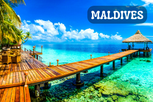
Maldives Tour Details: Everything You Need to Know
Introduction: Exploring the Paradise on Earth
If you're looking for a dreamy tropical getaway, the Maldives is an idyllic destination that should be at the top of your travel list. With its pristine white sandy beaches, crystal-clear turquoise waters, and vibrant marine life, the Maldives offers a slice of paradise like no other. In this comprehensive guide, we will delve into the Maldives tour details to ensure you have all the information you need to plan a memorable trip to this stunning archipelago.
Maldives Tour Details: A Closer Look
The Maldives is an archipelago located in the Indian Ocean, southwest of Sri Lanka. Comprising of 26 atolls and over 1,000 coral islands, this tropical nation offers an array of breathtaking landscapes and natural wonders. From luxurious resorts to thrilling water sports activities, the Maldives caters to all types of travelers, whether you're seeking relaxation or adventure.
FAQs about Maldives Tour Details
1. What is the best time to visit the Maldives?
The Maldives enjoys a year-round tropical climate, but the best time to visit is during the dry season, which spans from November to April. This period offers clear skies, calm seas, and plenty of sunshine, making it ideal for beach activities and underwater exploration.
2. How do I reach the Maldives?
Most international visitors reach the Maldives by air. The Malé International Airport, the main gateway to the country, receives flights from major airlines worldwide. From there, you can continue your journey to your resort or desired island either by seaplane, speedboat, or domestic flight, depending on the distance.
3. What are the accommodation options in the Maldives?
The Maldives is renowned for its luxurious resorts that provide a lavish and indulgent experience. From overwater villas with private pools to beachfront bungalows, you'll find a wide range of accommodation options to suit your preferences and budget. Additionally, there are also guesthouses and budget-friendly hotels available on local islands, offering a more affordable alternative.
4. Are there any water sports activities in the Maldives?
Absolutely! The Maldives is a haven for water sports enthusiasts. You can indulge in activities such as snorkeling, scuba diving, kayaking, jet skiing, and parasailing. The pristine coral reefs teeming with colorful marine life make it a paradise for diving enthusiasts, while the calm lagoons provide the perfect setting for snorkeling adventures.
5. Can I experience the local Maldivian culture?
While the Maldives is famous for its luxury resorts, it's also possible to immerse yourself in the local Maldivian culture. You can visit the capital city, Malé, and explore its bustling markets, mosques, and historical sites. Additionally, you can take part in cultural excursions to nearby islands, where you can interact with locals, sample traditional cuisine, and learn about their way of life.
6. What are some must-visit attractions in the Maldives?
The Maldives is home to numerous stunning attractions that are worth exploring. Some of the must-visit places include the vibrant capital city of Malé, the Baa Atoll Biosphere Reserve, which is a UNESCO World Biosphere Reserve, and the stunning underwater restaurant located in Rangali Island. These attractions offer a glimpse into the beauty and uniqueness of the Maldives.
Conclusion: Embark on an Unforgettable Journey to the Maldives
As you can see, the Maldives offers a myriad of opportunities for an unforgettable vacation. Whether you're seeking relaxation, adventure, or a mix of both, this tropical paradise has it all. From the
Bottom of Form
Read more Other Packages
Dubai
England
Qatar
Malasia
Switzerland
4 notes
·
View notes
Text
Russia is losing the war. Drunken Russian combatants are even shooting at each other. So in desperation, Vladimir Putin blew up the most important dam in southern Ukraine. The result was the ecological equivalent of an atomic bomb.
Ukrainian scientists are waiting for the water to subside before fully assessing the environmental impact of the Kakhovka dam breach, but one former minister warned it could prove the country’s worst ecological disaster since the Chornobyl nuclear meltdown.
Ukraine’s president, Volodymyr Zelenskiy, called an emergency meeting of his security council after the partial collapse of one of the biggest dams in the world. The country’s public prosecutor said it is investigating a possible case of “ecocide”.
[ ... ]
Analysts told the Guardian that the scale of the damage would depend on the amount of water released and the extent of the damage to the barrier, both of which are still unknown. At the very least, it has forced the evacuation of thousands of people, flooded national parks and jeopardised water supplies to millions of people. In the worst-case scenario, it may pose a long-term danger to Europe’s biggest nuclear plant, Zaporizhzhia, and could also spread agrotoxins and petrochemicals into the Black Sea.
This Putin-made disaster, like Chernobyl, will have an impact outside Ukraine.
Former minister of ecology Ostap Semerak told the Guardian that in his opinion this was the greatest threat currently posed by the breach, but other dangers could emerge in the days and weeks ahead as flood waters engulf cities, petrol stations and farms, become contaminated by agrochemicals and oil products and then flow into the Black Sea.
“This will have an impact on Romania, Georgia, Turkey and Bulgaria. It will be harmful for all the region” he said. “Our government has announced this is the biggest environmental catastrophe in Europe over the past 10 years, and I think it may be the worst in Ukraine since Chornobyl in 1986.”
The turbine room at the hydropower plant is already under water and 150 tonnes of industrial lubricants have been washed away, according to Zelenskiy.
Olena Kravchenko, the director of the Ukrainian Environment People Law NGO, said Russia’s “ecocide” risked “unprecedented environmental consequences” to the areas downstream of the Dnipro River, the Dnipro estuary, and ecosystems in the coastal area of the Black Sea.
With images of entire houses being washed away, she says the river will be polluted by debris and hazardous chemicals. Water supplies could be reduced or cut in several cities, including Kherson, and irrigation may prove impossible in swathes of agricultural land, affecting crops.
[ ... ]
She expected to see mass mortality of fish, mollusks and other aquatic species, widespread habitat disruption and negative impacts of ecologically important national parks: Nyzhniodniprovs’kyi, Kam’yanska Sich, Biloberizhzhia Sviatoslava, the Black Sea Biosphere Reserve (which is also a Unesco biosphere reserve) and the Kinburn Spit Regional Landscape Park.
Putin is not just a war criminal, he is an enemy of the planet.
She argued that if Russia had breached the dam, it would be sufficient for a charge of “ecocide” under Article 441 of the Criminal Code of Ukraine.
Denys Tsutsaiev from Greenpeace Central and eastern Europe told the Guardian that the dam destruction caused by the Russian military presence “once again puts in danger thousands of lives of civilians and nature”.
Despite the rantings of Tucker Carlson and his pals in the Kremlin, US intelligence points to Russia being responsible for the dam's destruction.
It had been suspected since the Russian retreat from Kherson late last year that they had tried to destroy the Nova Kakhovka dam. It is possible that they failed to do so last year but weakened it badly enough so that it finally gave way this week. From November 12th...
Damage found on major Ukrainian dam after fears Russia could blow it up and flood area
US satellite imagery company Maxar, which released the pictures, said: "Satellite images this morning ... reveal significant new damage to several bridges and the Nova Kakhovka dam in the aftermath of the Russian retreat from Kherson across the Dnipro river.”
It added sections of the northern extent of the dam and sluice gates had been "deliberately destroyed".
The possibility of Russia destroying the Kakhovka plant was previously raised by the Institute for the Study of War (ISW), a major US think tank.
The ISW said in its 21 October update: “Russian forces will likely attempt to blow up the dam at the Kakhovka Hydroelectric Power Plant (HPP) to cover their withdrawal and to prevent Ukrainian forces from pursuing Russian forces deeper into Kherson Oblast.
“Russian forces will almost certainly blame Ukraine for the dam attack.”
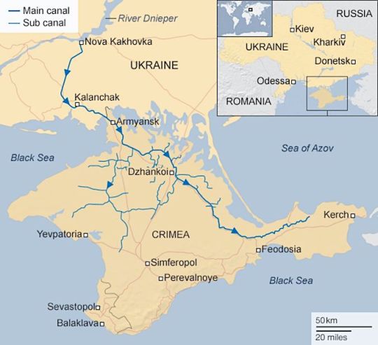
There's other talk that Russia blew up the dam as a prelude to a retreat from Crimea. Much of Crimea's water comes from the North Crimean Canal which flows out of the Kakhovka Reservoir at Nova Kakhovka.
Putin will, of course, blame the dambusting on Ukraine and then possibly say that Russia needs to leave Crimea due to the disruption of the water supply.
As @neil-gaiman would say, "wait and see".
#invasion of ukraine#ecocide#russia#war crimes#environmental catastrophe#vladimir putin#nova kakhovka#kakhovka dam#north crimean canal#ostap semerak#olena kravchenko#denys tsutsaiev#volodymyr zelenskyy#нова каховка#північно-кримський канал#екоцид#россия#владимир путин#путин - военный преступник#путин хуйло#путлер#добей путина#союз постсоветских клептократических ватников#россия - террористическая страна#путин – это лжедмитрий iv а не пётр великий#вторгнення оркостану в україну#україна переможе#володимир зеленський#слава україні!#героям слава!
4 notes
·
View notes
Text
And another post in support of Ukraine.
Next site, the Danube Delta Biosphere Reserve in Odesa Oblast. It's almost 194 square miles of territory. The delta also covers part of Romania. The reserve is believed to be the largest swampland reserve in Europe. Part of the reserve is included in UNESCO's World Heritage List. There's hundreds of different species of rare plants, animals, and fish in the reserve. The main animal inhabitants are birds, but there's also over 40 species of mammals, 100 different kinds of fish, & reptiles & insect life.
#StandWithUkraine
#SlavaUkraïni 🇺🇦🌻


5 notes
·
View notes
Text
Kabini experience: A ChatGPT piece
Based on our experiences earlier this year, I entered a few points on the Kabini river and Nagarahole national park and asked ChatGPT to create a write-up. This is what it came up with - an impersonal generic marketable material fit to be published on tourist brochures.
Embark on an unforgettable journey across the Nilgiri biosphere reserve, and explore the exquisite beauty of the Kabini river, which is the lifeline of South Karnataka. This magnificent river originates in Kerala and flows along the border of Kerala and Karnataka, offering some of the most stunning vistas that you will ever come across during your travels.
The Kabini River: An Overview
The Kabini river is not only a stunning sight to behold, but also has an important role to play in the flora and fauna of the region, sustaining the large herds of wildlife found in the area. It is also home to an array of aquatic creatures such as fish, otters, and turtles. Moreover, the river divides the northern region of the Nilgiri biosphere reserve into the Nagarahole and Bandipur national parks, making it a hub for wildlife enthusiasts and nature lovers alike.
Exploring the Nilgiri Biosphere Reserve
The Nilgiri biosphere reserve is a vast expanse of natural beauty that stretches across three states of Karnataka, Kerala, and Tamil Nadu. It was declared a UNESCO World Heritage Site in 2012, highlighting its immense biodiversity and crucial role in the conservation of the Western Ghats.
The pristine forests of the reserve are home to a wide variety of flora and fauna, including endangered species like the tiger, elephant, and gaur. The reserve also boasts a large population of elusive leopards, making it an ideal destination for wildlife photographers and nature enthusiasts.
A River Safari on the Kabini
One of the best ways to explore the Kabini river and the surrounding environs is by embarking on a river safari. During this safari, you can witness the incredible wildlife that congregates around the riverbanks, while enjoying the calm and serene waters of the Kabini.
You can also indulge in outdoor activities like camping, trekking, or birdwatching, and immerse yourself in the picturesque landscapes of the Nilgiri biosphere reserve.
In Conclusion
The Kabini river is indeed the lifeline of South Karnataka, offering an unforgettable experience for those who seek to explore the natural beauty of the region. The Nilgiri biosphere reserve is truly an exceptional destination, offering a range of activities to suit every traveler's interests. So, pack your bags, and set out on a journey to discover the wonders of the Kabini river and the Nilgiri biosphere reserve!
#Kabini#rivers#Karnataka#Nilgiris#Nilgiri biosphere reserve#national parks#Bandipur#Nagarahole#wildlife#forests#chatgpt#travel writing#river safari#safari#jungle safari
3 notes
·
View notes
Photo

FANCY LIVING ON TOP OF THE WORLD? . Luxury development of 18 individually designed sustainable villas in Benahavis. The villas are located just 15 minutes away from Marbella in a beautiful area bordered by a UNESCO Biosphere Reserve. The stunning views of the Mediterranean Sea, Gibraltar Straits, and Africa are simply breathtaking. This gated community sits at the foothills of the La Concha Mountain. Everything is designed to maximise the views. Each villa’s design and concept is customised to highlight the location’s natural beauty. The lounge and terrace merge seamlessly into one large living space. The windows disappear into the walls and frame the unobstructed views of the idyllic natural surroundings. All villas are positioned for maximum privacy on individual plots. Each has large terraces, ample gardens and true Infinity pools. Residents also have access to bespoke spaces that can be used for entertainment rooms, gyms, and home offices. The combination of custom-designed furniture along with a stunning selection of artwork is what makes a this stunning complex something to be truly proud of… . For more information: https://www.xcaperealestate.com/en/property/id/826430-luxury-villa-development-stunning-views-benahavis . #luxuryhomes #millionairehomes #marbellalifestyle #marbella #marbellalife #luxuryrealestate #luxuryliving #interiordesign #millionairelifestyle #millionairelife #luxuryrealtor #marbellarealtor #marbellaluxury #marbellaestateagent #marbellarealestate (at Marbella, Spain) https://www.instagram.com/p/CpzaBaotrgq/?igshid=NGJjMDIxMWI=
#luxuryhomes#millionairehomes#marbellalifestyle#marbella#marbellalife#luxuryrealestate#luxuryliving#interiordesign#millionairelifestyle#millionairelife#luxuryrealtor#marbellarealtor#marbellaluxury#marbellaestateagent#marbellarealestate
3 notes
·
View notes
Text
1. People on a living wage in Belgium have doubled in 20 years
An unmistakable rise in the number of people on a living wage in Belgium has been recorded by the Federal Planning Bureau, which stressed an urgent decrease is needed if Belgium is to attain the UN's Sustainable Development Goals (SDGs). Read more.
2. Belgian gas consumption falls by more than EU average
Belgium's gas consumption fell by far more than the European average last year despite relatively high household demand, a recent study has found. Read more.
3. Weekend break: J’aime Durbuy
Though it claims to be the smallest city in the world, Durbuy is big on charm, boasting a medieval castle, upscale restaurants and megalithic natural surroundings. Read more.
4. Giant sinkhole appears on West Flanders road as sewer system collapses
Part of the road surface in the municipality of Tielt (in the West Flanders province) collapsed on Wednesday evening, creating a large sinkhole of about four metres deep and six metres wide. Read more.
5. Two Belgian nature spots seek to become UNESCO Biosphere Reserves
Two nature domains in Belgium are looking to be recognised as UNESCO Biosphere Reserves, which would help with efforts to preserve and increase biodiversity here. Read more.
6. Here comes the sun: Temperatures to reach 26° in Brussels
The sun will finally make a long-anticipated reappearance in Belgium on Thursday, bringing what feels like the first summery day in weeks. Read more.
7. Hidden Belgium: La Source Beer Co.
The Brussels microbrewery La Source recently launched a programme of concerts featuring indie bands from Belgium, France and the United States. Read more.
4 notes
·
View notes