#Tioga Forest
Explore tagged Tumblr posts
Text
A Busy Saturday. Two College Graduation Ceremonies And A Quick Hike In Tioga State Forest
It was a busy Saturday. I was up early. I was proud to attend two graduation ceremonies. After waking up at 6 a.m. I walked 3 1/2 miles near my home in Hazle Township Luzerne County. I then took a nice drive to Bloomsburg under partly cloudy skies . My niece Brooke graduated from Bloomsburg University with a Bachelor of Science Degree in Language and Speech Pathology. It was a…

View On WordPress
0 notes
Photo

The forest had a cold-blue hue before the sun crested the mountain top, but then a (slightly) warm-looking glow instantly afterward. Interesting, how different the scene, within just a few moments.

#lunaladee photos#winters past#memories of snow#mid-april#tioga state forest#pine creek gorge#original photography
36 notes
·
View notes
Text
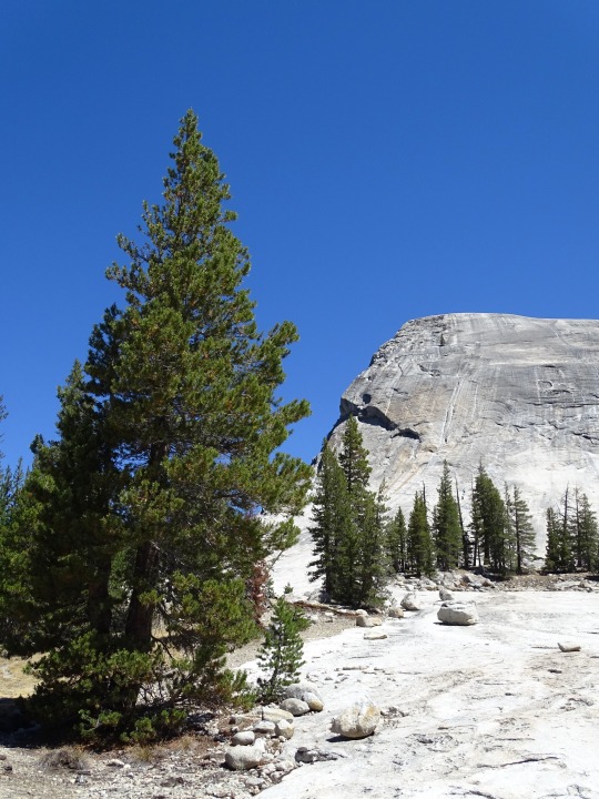
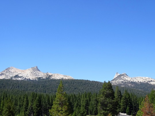
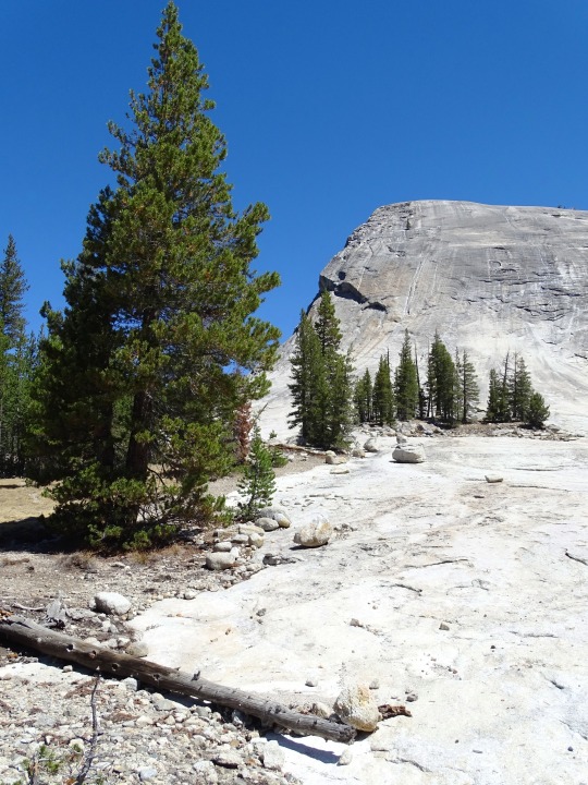


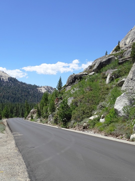
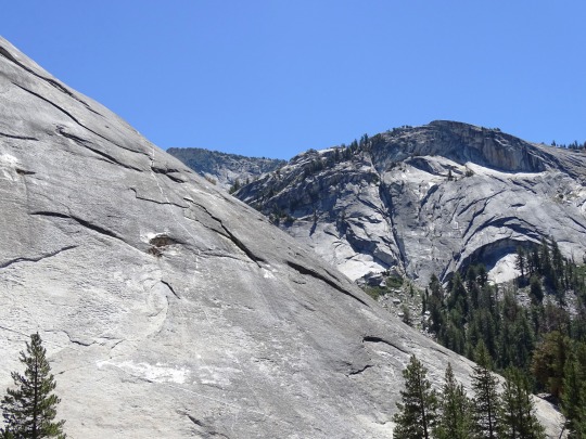
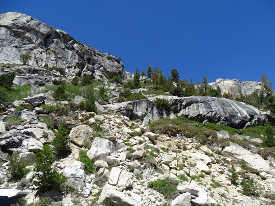
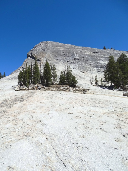
Yosemite National Park, CA (No. 5)
The word Yosemite (derived from yohhe'meti, "they are killers" in Miwok) historically referred to the name that the Miwok gave to the Ahwahneechee People, the resident indigenous tribe.[16][17][18] Previously, the region had been called "Ahwahnee" ("big mouth") by its only indigenous inhabitants, the Ahwahneechee.[16] The term Yosemite in Miwok is easily confused with a similar term for "grizzly bear", and is still a common misconception.
In 1855, entrepreneur James Mason Hutchings, artist Thomas Ayres and two others were the first tourists to visit. Hutchings and Ayres were responsible for much of Yosemite's earliest publicity, writing articles and special issues about the valley. Ayres' style was detailed with exaggerated angularity. His works and written accounts were distributed nationally, and an exhibition of his drawings was held in New York City. Hutchings' publicity efforts between 1855 and 1860 increased tourism to Yosemite. Natives supported the growing tourism industry by working as laborers or maids. Later, they performed dances for tourists, acted as guides, and sold handcrafted goods, notably woven baskets. The Indian village and its peoples fascinated visitors, especially James Hutchings who advocated for Yosemite tourism. He and others considered the indigenous presence to be one of Yosemite's greatest attractions.
Source: Wikipedia
#Tioga Road#Yosemite National Park#Sierra Nevada#Mono County#geology#flora#California#summer 2022#tourist attraction#landmark#landscape#countryside#USA#nature#forest#woods#fir#pine#rocks#travel#original photography#vacation#creek#Lembert Dome#granite#Mount Althuski#Unicorn Summit#Cathedral Peak#California State Route 120
5 notes
·
View notes
Text
Central PA's Most Scenic Hiking Trails - Find Your Next Adventure Now
Central Pennsylvania is known for its scenic beauty and abundance of outdoor recreation opportunities. One of the best ways to experience the region's natural beauty is by exploring its numerous hiking trails. Whether you're a seasoned hiker or just starting out, there's something for everyone in Central PA's most scenic hiking trails.
Here are some of the top hiking trails in Central Pennsylvania that offer breathtaking views, challenging terrain, and unforgettable experiences.
The Mid State Trail
The Mid State Trail is a 327-mile trail that runs through the heart of Pennsylvania from the Maryland border to the New York border. The trail passes through some of the most scenic areas in the state, including the Allegheny Mountains, the Bald Eagle Valley, and the Susquehanna River Valley.
Hiking the entire Mid State Trail is a challenge that only a few accomplished hikers have completed. But you can still enjoy sections of the trail that offer stunning views and diverse terrain. Some popular sections of the Mid State Trail include the Seven Mountains, the Quehanna Wild Area, and the Tioga State Forest.
The Thousand Steps Trail
The Thousand Steps Trail is a popular hiking trail located in Huntingdon County, PA. The trail is known for its challenging terrain and stunning views of the surrounding countryside. The trail is named for the thousand stone steps that hikers must climb to reach the top of the mountain.
The Thousand Steps Trail is a great workout for hikers looking for a challenging hike. The trail is steep and rocky, but the views from the top are worth the effort. Hikers can enjoy panoramic views of the Juniata River Valley and the surrounding mountains.
The Loyalsock Trail
The Loyalsock Trail is a 59-mile trail that runs through the Loyalsock State Forest in Sullivan and Lycoming counties. The trail is known for its rugged terrain and stunning scenery, including waterfalls, rocky outcroppings, and dense forests.
The Loyalsock Trail offers a challenging hiking experience for seasoned hikers. The trail is not well-marked, so hikers should be prepared with a map and compass. But for those who are up for the challenge, the Loyalsock Trail offers some of the most scenic views in Central Pennsylvania.
The Pine Creek Rail Trail
The Pine Creek Rail Trail is a 62-mile trail that runs through the Pine Creek Gorge in Tioga and Lycoming counties. The trail follows the path of the former Jersey Shore, Pine Creek, and Buffalo Railway, which operated from 1883 to 1988.
The Pine Creek Rail Trail is a popular hiking and biking trail that offers stunning views of the Pine Creek Gorge. Hikers can enjoy the beauty of the canyon and the surrounding forests, as well as the wildlife that calls the area home.
The Standing Stone Trail
The Standing Stone Trail is a 84-mile trail that runs from Cowans Gap State Park to the Rothrock State Forest. The trail passes through some of the most scenic areas in Central Pennsylvania, including the Tuscarora and Bald Eagle Mountains.
The Standing Stone Trail offers a variety of terrain, including rocky ridges, deep valleys, and mountain streams. Hikers can enjoy stunning views of the surrounding countryside and the opportunity to see a variety of wildlife, including black bears, white-tailed deer, and wild turkeys.
The Appalachian Trail
The Appalachian Trail is a 2,190-mile trail that runs from Georgia to Maine. The trail passes through 14 states, including Pennsylvania. The Pennsylvania section of the trail is known for its rocky terrain and stunning views.
Hiking the entire Appalachian Trail is a challenge that few hikers can accomplish. But you can still enjoy sections of the trail that offer stunning views and diverse terrain.
In conclusion, Central Pennsylvania boasts an abundance of stunning hiking trails that are sure to satisfy the most avid outdoor enthusiasts. From the challenging mountain paths of the Appalachian Trail to the tranquil forests of Bald Eagle State Park, the region offers something for everyone. Whether you're seeking a day hike or a multi-day backpacking adventure, you'll find it here. So, what are you waiting for? Plan your next hiking excursion and explore the natural beauty of Central PA today! And for more travel tips and adventure ideas, check out Online World News.
2 notes
·
View notes
Text
0 notes
Text
Road Blog: Up Toward Yosemite, Rim Fire Aftermath and Bonus Comet
Along the road to Hetch Hetchy, snags still stand eleven years after the Rim Fire swept through Stanislaus National Forest and parts of Yosemite National Park. To keep it short and sweet: We’re taking a quick trip over to the Eastern Sierra. The past few years, this has involved a drive from Berkeley and a sunset stop along the road near Tioga Pass. This time we splurged and stopped at one of…

View On WordPress
0 notes
Text
A Day Trip to Yosemite from Merced, California: What to See and Do.
Nestled in the heart of California's Sierra Nevada mountains, Yosemite National Park stands as a testament to the state's natural beauty and diversity. For visitors based in Merced, a day trip to Yosemite offers a breathtaking escape into one of the most iconic national parks in the United States. Here’s how to make the most of your journey, exploring the wonders Yosemite has to offer.
Getting There
Merced serves as an ideal starting point for a day trip to Yosemite, located approximately 80 miles away from the park's entrance. The most direct route from Merced to Yosemite National Park is via CA-140 E, which takes you through picturesque landscapes and small towns before entering the park at its Arch Rock Entrance.
Morning: Arrival and Exploration
Arriving in Yosemite Valley: As you enter Yosemite via CA-140, the landscape transforms dramatically. Towering granite cliffs, cascading waterfalls, and lush forests greet you as you descend into Yosemite Valley. Begin your exploration with a stop at Tunnel View, one of the most famous scenic viewpoints in the park. From here, you can take in panoramic views of El Capitan, Half Dome, and Bridalveil Fall.
Exploring Yosemite Village: Next, head to Yosemite Village, the hub of activity in the valley. Here, you can visit the Yosemite Museum, which offers insights into the park's natural and cultural history. Grab a bite to eat at one of the village's cafes or enjoy a leisurely stroll along the Merced River.
Midday: Outdoor Adventures
Hiking Opportunities: Yosemite is renowned for its hiking trails, catering to all skill levels. For a moderate hike with stunning views, consider the Lower Yosemite Fall Trail, which takes you to the base of North America's tallest waterfall. If you're up for a challenge, embark on the Mist Trail, leading to Vernal and Nevada Falls, offering spectacular vistas along the way.
Photography and Sightseeing: Photographers will find endless opportunities throughout the park, capturing iconic landmarks such as Half Dome and the serene Mirror Lake. Wildlife enthusiasts may spot deer, black bears, or even elusive mountain lions in their natural habitat.
Afternoon: Iconic Sights and Relaxation
Visit Glacier Point: In the afternoon, make your way to Glacier Point, accessible via a scenic drive or shuttle bus. This vantage point offers unparalleled views of Yosemite Valley, including Yosemite Falls and the high country. It's an excellent spot for photography or simply soaking in the grandeur of the Sierra Nevada.
Picnic at Sentinel Meadow: For a relaxing break, consider picnicking at Sentinel Meadow near Yosemite Village. Surrounded by towering pines and with views of Yosemite Falls, it's a perfect spot to unwind and reflect on the day's adventures.
Evening: Sunset and Departure
Sunset at Olmsted Point: As the day draws to a close, head towards Olmsted Point along Tioga Road (seasonally accessible) for a memorable sunset experience. This viewpoint offers a unique perspective of the park's high country, with Half Dome and Clouds Rest silhouetted against the evening sky.
Return to Merced: After witnessing Yosemite's natural spectacle, begin your journey back to Merced, reminiscing about the day's highlights and planning your next adventure in this stunning national park.
Tips for Your Trip
Timing: Start early to make the most of your day in Yosemite, avoiding midday crowds and maximizing your time for exploration.
Weather: Check weather conditions and pack accordingly, as temperatures can vary significantly within the park.
Permits and Reservations: Some hikes and activities may require permits or reservations, especially during peak seasons. Plan ahead to ensure a smooth experience.
Conclusion
A day trip from Merced to Yosemite National Park promises an unforgettable adventure amidst some of California's most awe-inspiring landscapes. Whether you're marveling at iconic waterfalls, hiking through ancient forests, or simply enjoying the tranquility of nature, Yosemite offers something for every visitor. Embrace the beauty and grandeur of this natural wonderland, and take home memories that will last a lifetime.
0 notes
Video
Mountain Oasis by Mark Stevens Via Flickr: While at a roadside pullout along Tioga Road with a view looking to the south to ridges and peaks of the Sierra Nevada mountains in this part of the Inyo National Forest. Tioga Peak is the prominent peak off in the distance.
#Along Roadside#Azimuth 175#California and Oregon Road Trip#Cloudy#Dana Area#Day 4#DxO PhotoLab 5 Edited#Forest#Forest Landscape#Hillside of Trees#Landscape#Landscape - Scenery#Looking South#Mostly Cloudy#Mountain Peak#Mountains#Mountains in Distance#Mountains off in Distance#Mountainside#Nature#Nikon D850#No People#Off Side of Road#Outside#Overcast#Pacific Ranges#Project365#Ridge#Ridgeline#Ridges
0 notes
Text
Unlocked Book of the Month: North Pennsylvania Minstrelsy
Each month we’re highlighting a book available through PSU Press Unlocked, an open access initiative featuring scholarly digital books and journals in the humanities and social sciences.

About our June pick:
Henry W. Shoemaker was already an established writer of Pennsylvania’s popular folklore by the time North Pennsylvania Minstrelsy was published in 1919. While much of Shoemaker’s previous work was literary folklore, this volume comprises his first collection of ballads and what has been argued to be one of his most significant contributions to the scholarly folklore conversation.
Compiled by Shoemaker over two decades, with the assistance of John C. French and John H. Chatham, this volume includes over one hundred songs and ballads from Union, Snyder, Centre, Lycoming, Clinton, Tioga, Potter, McKean, Forest, Cameron, Elk, and Clearfield Counties in Pennsylvania. Shoemaker prefaced much of his work with words on preserving the wilderness, and with it the romantic simplicity of the preindustrial “golden age” of Pennsylvania. In this volume, he ties the ballads to this ideal by noting, “Work without music is too modern, too grinding; it was not the life for the Pennsylvania mountaineer whose soul overflowed with melody. . . . Simplicity was his foremost vital trait; he was close to the Eternal Source and the harmonies of Nature.”
This facsimile edition of Shoemaker’s 1919 original publication includes ballads and fragments of ballads from across the northern counties, accompanied by Shoemaker’s introduction and annotations to each ballad, which often include context as well as the name of the county where it was collected and from whom.
Read more & access the book here: https://www.psupress.org/books/titles/978-0-271-04881-9.html
See the full list of Unlocked titles here: https://www.psupress.org/unlocked/unlocked_gallery.html
1 note
·
View note
Photo

16 acres timberland with camper bordering West Hill State Forest in Hornby NY. Escape to this very private piece of timberland with a year-round stream situated just north of the City of Corning. A gated drive leads off the road to an established campsite with a gravel pad and an existing 27 ft. Forest River Salem Camper overlooking the stream. Cross the creek and hike through the property using existing trails. The property slopes gently to the back of the property extending more than 500 yards from the road and consisting entirely of timberland. The forest consists primarily of hardwoods with some areas of pine and hemlock. A great opportunity to own a turn-key hunting and recreational property bordering state land. Several existing metal tree stands have been strategically placed and successfully hunted over the last decade by the current owner and will convey with the property. Step across the road and enter West Hill State Forest, an additional 887 acres of land to hunt, hike, and explore. Endless recreational opportunities in the area with several state forests and thousands of acres of public land nearby. Quality fishing in the region is provided by Meads Creek, Tioga River, Cohocton River, and Chemung River all located within 5 miles of the property. $54,900. Contact Dan Heisey 607-661-0029 for more information. @nylandquest #hunting #camper #camping #private #trails #bordersstateforest #creek #hornbyny #steubencountyny #westernny https://www.instagram.com/p/CrTYoMTuFau/?igshid=NGJjMDIxMWI=
0 notes
Text
Another Hike In The Tioga State Forest Near Arnot In Tioga County
I slept well after my busy Saturday. I awoke early at my hotel in Mansfield in Tioga County. It was overcast and cool but I still planned to hike in the Tioga State Forest again. I had a quick cup of coffee, checked out of my hotel and was on the road by 6:15 a.m. I drove to the small village of Arnot and again parked just outside of the town along the Arnot Road. I walked along Arnot road…

View On WordPress
2 notes
·
View notes
Text

Desert weak . . .
8 notes
·
View notes
Text

Mountain Road
What do you think about my pic?
#Yosemite National Park#Sierra Nevada#travel#USA#Tioga Lake#original photography#vacation#tourist attraction#landmark#landscape#countryside#summer 2022#California#Western USA#forest#woods#flora#tree#blue sky#photo of the day#What do you think about my pic?
6 notes
·
View notes
Photo

08.20.20 Did a 17 mile stretch of the rails-to-trails path along Pine Creek
7 notes
·
View notes
Video
Campbells Run Falls, Tioga County, Pa by Jeremy Krieger Via Flickr: If you take notice to the unsecured ladder with the sketchy rope on the right side heading up the falls, that is the route up to yesterdays upload of Amphitheater Falls
#campbells run falls#campbells#run#waterfall#nikon#d500#nature#landscape#water#falls#pa#pennsylvania#tioga county#cascade#outdoor#hike#forest#trail#scenery#scenic
2 notes
·
View notes
Video
Pine Creek Gorge by David Oakill
#PA#Pennsylvania#Pine#Creek#Gorge#Nature#landscape#landscape photography#pine creek gorge#PA Grand Canyon#Tioga#Forest#hiking#outdoors#outside#trees#vista#Appalachian mountains#endless mountains#mountains
3 notes
·
View notes