#Tectonic
Explore tagged Tumblr posts
Visit Tumblr Blog
Explore Tumblr blogs with no restrictions, modern design and the best experience.
Last Seen Tumblr Blogs


Fun Fact
China blocked Tumblr because of pornography and censorship problems in 2013.
Text

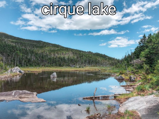
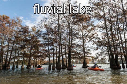

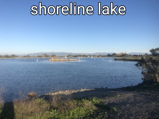
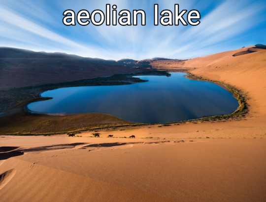
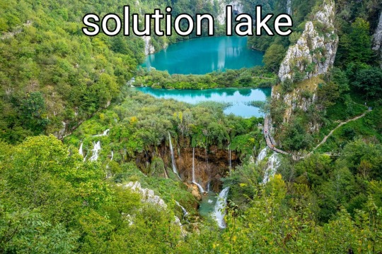


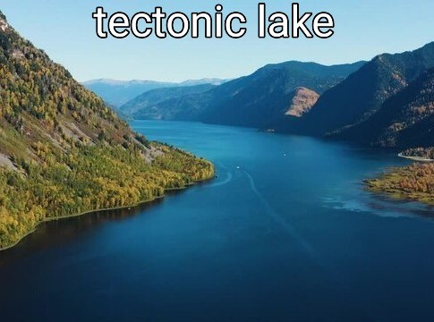
#lakes#lakeposting#poll#geology#geomorphology#nature#lake#naturecore#beautiful#limnology#science#ecology#aquatic ecology#water#meteor#meteorite#volcanic#glacier#glacial#tectonic#earth#environment#environmental science
2K notes
·
View notes
Text
Tectonic plates typically move at speeds ranging from 1 to 10 centimeters (approximately 0.4 to 4 inches) per year. Despite the slow pace, these movements accumulate over millions of years, driving major geological events like mountain formation and continental drift.
45 notes
·
View notes
Text

Aaaand here is Tectonic!
This is LoveBug's partner and he's huge
As you can see in these work doodles


They are so cute together QvQ
10 notes
·
View notes
Text
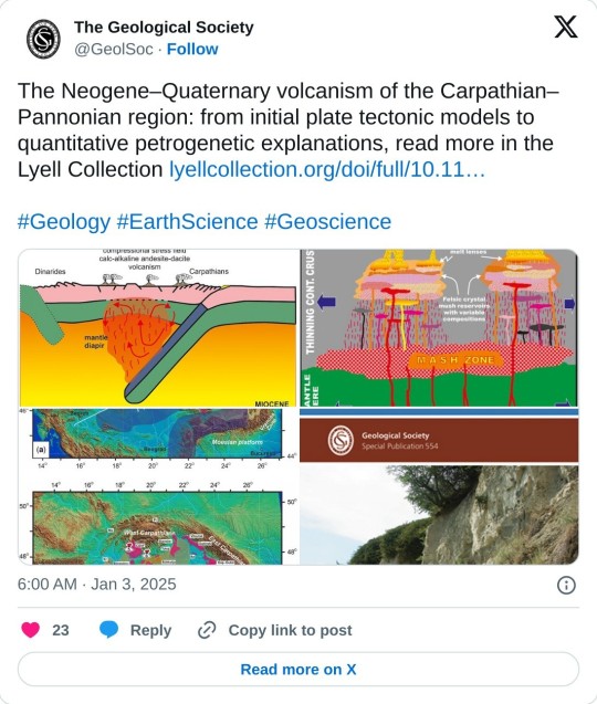
#Neogene–Quaternary volcanism#Carpathian���Pannonian region#tectonic#plate tectonics#Geology#Earth Science#Geoscience#petrogenetic#explanations#science
6 notes
·
View notes
Text

From lightest (oldest) to darkest (youngest) tectonic plates. No, I do not differentiate the sea and land plates, hence the numbers as markings (also easier ID without colors). The third one is a bit darker than the second one IRL.
#fantasy world#fantasy map#geography#ttrpg art#ttrpg maps#worldbuilding#plate tectonics#tectonic#geografia
6 notes
·
View notes
Text

Geological main fault with large joints fracture’s pattern eroding by the River, air photo view Pietrosa rumänia, maya tour
#air photo#original tumblr photographers#ggg#photographers on tumblr#nature#earth#River#geology#Maya#tectonic#fractures#joints
4 notes
·
View notes
Photo


(via Förstberg Ling clads "introspective" extension with charred pine)
2 notes
·
View notes
Text
tumblr will alwys be home no matter what bc
(check the tags)
0 notes
Text
Sandstone uranium deposits
Sandstone uranium deposits are mineralizations hosted in medium- to coarse-grained sandstones that were deposited in continental fluvial or marginal marine environments. These deposits are typically associated with interbedded impermeable shale or mudstone units, which often lie immediately above and below the mineralized sandstone. Uranium is precipitated under reducing conditions, which can be…
#basal channel#deposits#fluvial#mafic dykes#marine#Mineral Deposit#Radioactive Mineral Deposits#reducing conditions#roll-front#Sandstone#sedimentary#tabular#tectonic#Uranium
0 notes
Text
@uncanines
It was becoming more and more obvious to Matai that he was way in over his head in this "training seminar" that they had all been dropped into. Teamwork was not something that Matai had ever been the best at - it was why he had been someone that had always thrived in single sports, like fighting - and so he certainly had trouble giving into the mindset that they were a team. Of course, it didn't help, either, that he was still pretty new to this whole... Pandora thing. Some of the agents here already seemed chummy enough with one another, and it made him feel like the odd man out.
Far more than he already did feel.
Still, as he finally found a safe spot - or a somewhat safe spot - to rest, in the stone canyon, he could feel the vibrations in the earth of people walking. There was one vibration, though, that he focused on, one that he felt was familiar, and he couldn't help but smirk as he felt it drawing more and more near. "Did you feel out for me, Pulse, or am I just lucky enough that you stumbled upon me?"

1 note
·
View note
Text
12.02...?
youtube
1 note
·
View note
Link
SpaceTime Series 28 Episode 16 The Astronomy, Space and Science News Podcast New Discoveries on the Moon, Venus Exploration, and Titan's Atmosphere In this episode of SpaceTime, we delve into a groundbreaking study revealing that the Moon may not be as geologically inactive as previously believed. Observations of small ridges on the lunar far side suggest recent tectonic activity, indicating that the Moon's geological history is more dynamic than once thought. Researchers found that these features, formed within the last 200 million years, could have significant implications for future lunar missions. NASA's Davinci Mission to Venus We also discuss NASA's upcoming Davinci mission, set to explore the mysteries of Venus. This innovative mission will deploy a descent probe into the planet's thick atmosphere, capturing high-resolution images and analyzing its unique geological features, including the ancient Tesserae that may provide insights into Venus's past. Understanding Titan's Atmosphere Additionally, we explore new research on Saturn's moon Titan, which maintains its dense nitrogen-rich atmosphere through chemical reactions occurring deep beneath its surface. The findings suggest that Titan's atmosphere, which features liquid methane rain and a complex organic chemistry, is replenished by internal processes that have puzzled scientists since its discovery. 00:00 Space Time Series 28 Episode 16 for broadcast on 5 February 2025 00:49 New findings on the geological activity of the Moon 06:30 Overview of NASA's Davinci mission to Venus 12:15 How Titan maintains its atmosphere 18:00 Increase in temperature-related deaths in Europe 22:45 Discovery of magma chambers in dormant volcanoes 27:00 Creation of bipaternal mice using stem cell engineering 30:15 Overview of Deepseek AI chatbot www.spacetimewithstuartgary.com www.bitesz.com 🌏 Get Our Exclusive NordVPN deal here ➼ www.bitesz.com/nordvpn. Enjoy incredible discounts and bonuses! Plus, it’s risk-free with Nord’s 30-day money-back guarantee! ✌ Check out our newest sponsor - Old Glory - Iconic Music and Sports Merch and now with official NASA merchandise. Well worth a look... Become a supporter of this Podcast for as little as $3 per month and access commercial-free episodes plus bonuses: https://www.spacetimewithstuartgary.com/about ✍️ Episode References NASA https://www.nasa.gov Planetary Science Journal https://www.elsevier.com/journals/planetary-science-journal Geochemistry, Geophysics, Geosystems https://agupubs.onlinelibrary.wiley.com/journal/15252027 Nature Medicine https://www.nature.com/nm/ Nature Geoscience https://www.nature.com/ngeo/ Cell Stem Cell https://www.cell.com/cell-stem-cell/home TechAdvice Life https://www.techadvice.life/
#activity#astronomy#atmosphere#davinci#exploration#geology#lunar#mission#moon#news#news-podcast#planetary#podcast#saturnian#science#space#surface#tectonic#titan#venus
1 note
·
View note
Text
Transform plate boundaries are tectonic regions where two lithospheric plates slide horizontally past each other along strike-slip faults.
Transform plate boundaries are one of the three primary types of tectonic plate interactions, alongside divergent and convergent boundaries. Transform boundaries are characterized by horizontal motion between two plates, resulting in a transform fault.
#geology#tectonic#Transform plate boundaries#divergent#convergent#resulting in a transform fault.#transform fault
6 notes
·
View notes

Text

Tectonic
#Tectonic#Tectonic Plates#Sign of Life#Ancient Structures#Ancient Monolithic Structures#Stone Figure#Ancient Stone Face#Sleeping Giant#Sleeping#Asleep#Desert Monolith#Pen and Ink#Chris Mighton
1 note
·
View note
Text

Source: Geomorphology Rules
"The Swiss Tectonic Arena Sardona in the north-eastern part of the country covers a mountainous area of 32,850 ha which features seven peaks that rise above 3,000 m. The area displays an exceptional example of mountain building through continental collision and features excellent geological sections through tectonic thrust, i.e. the process whereby older, deeper rocks are carried onto younger, shallower rocks. The site is distinguished by the clear three-dimensional exposure of the structures and processes that characterize this phenomenon and has been a key site for the geological sciences since the 18th century. The Glarus Alps are glaciated mountains rising dramatically above narrow river valleys and are the site of the largest post-glacial landslide in the Central Alpine region." - UNESCO
Photo from Hiking Trail Naraus – Segneshütte – Alp Nagens
Via https://www.dong.world/.../swiss-tectonic-arena.../amp/
0 notes