#Ridge Way Military Cemetery
Explore tagged Tumblr posts
Text
30 June 2023
This Earth
Lille 30 June 2023
In July 1916, as the meatgrinder of the Somme wound on, the British high command looked for methods to divert German troops from that sector of the front. At this stage, the area near Armentières was already soaked in the blood of the BEF - the catastrophic attack at Aubers Ridge on the 9th of May 1915 comes to mind. Now there would be a new attack by Richard Haking’s IX Corps, pushing against the German positions at the town of Fromelles. Two divisions would be involved; the British 61st Division and the newly arrived Australian 5th Division.
Haking’s planning was rushed, and intelligence was poor. Generally, one wants to attack when one outnumbers the enemy by about three to one - at Fromelles, the Australians and British attacked an enemy that outnumbered them two to one. The ground had not been reconnitorered, and the attack required men to advance on a narrow front into German pillboxes and breastworks that covered just about every inch of the flat ground of advance.
The result was an unmitigated military disaster and the elimination of the 5th Division as an effective military unit for a very long time afterwards. The AIF suffered over five thousand casualties and two thousand dead - it remains the bloodiest day in Australian military history.
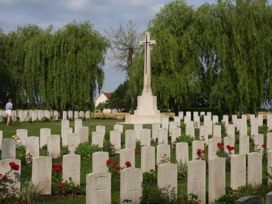
We departed Ypres early this morning and crossed the border into France, arriving at Le Trou Aid Post near Aubers Ridge around 9am. Most of the graves here are British troops killed either in late 1914 or in the disaster of 9th May 1915, but there are scattered names from later battles, including Australians killed at Fromelles. There is one French soldier mixed in with the British, easily identifiable by the French cross headstone, and in the corner what we believed was an unnamed French civilian. Like Essex Farm, Le Trou was an obvious place for a cemetery, being the place where the wounded were carried to be processed or - more often than not - to die.
A little way down the road from Le Trou was VC Corner. This is one of two wholly Australian cemeteries on the Western Front - the other is somewhere in Flanders - and one of the most stark and brutal of the CWGC’s sites. When the dead were exhumed after the war, not a single man could be identified - their bones had become entangled together, with only the shrapnel of their uniforms to tell that they were Australians. It was decided that it would be too much to have a cemetery filled entirely with headstones reading ‘Known Unto God’ - it would be an obscenity - so the men were reburied in two mass graves, covered by flat stone crosses and squares of roses. The names of the missing of Fromelles were engraved at the back of the cemetery, behind the Cross of Sacrifice. There are 410 men here, of 1299 missing altogether.
It was here that I finally got that opportunity to read Wilfred Owen’s Anthem for Doomed Youth that I’d been angling for. I think my professor was a little hesitant to let me, but afterwards he agreed that this was the best place to read it.

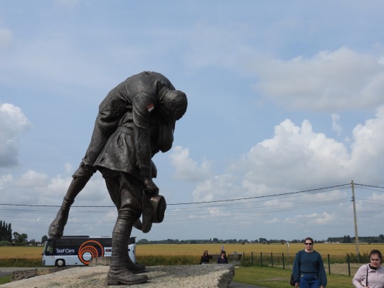
Between VC Corner and the modern Digger Memorial is what was No Man’s Land, and few poorer places for a general advance I have ever seen. It is a perfect killing ground - especially in 1916, when the concept of the creeping barrage and combined arms were in their infancy. Many of the bunkers are still there, albeit mostly decrepit - some enterprising farmers preserved trenches and fortifications after the war, knowing they could make a quick franc off of British tourists in the area. The Digger Memorial is a recent installation, erected during the centenary - it depicts an Australian soldier carrying a wounded comrade, and it faces back towards Australian lines. It’s a poignant piece, but it’s a bit of an example of selective memory. In some parts of the line, the Germans allowed this, but in others they used wounded men as bait to draw others into their fire. It all depended on who was in charge and the character of the unit, and I’d be dishonest if I said the Allies never did it too, but the memorial is a conscious choice to focus on remembering compassion rather than killing. This is a good thing, but it’s always good to have a pesky historian around to remind you that war is fundamentally a violent affair.
We proceeded from there into Fromelles itself, although we went to the museum just outside the town rather than the town itself (not that Fromelles is particularly large.) The museum is recent, for a reason we’re about to get into, and it’s a fairly small and simple affair. It resembles a lot of French museums I’ve seen - the French love their mannequins, even if some look a little disconcerting. It’s a good primer to the battle, so if you’ve never visited the site I’d recommend it. It ends with the story of the recovery of the dead - not in the early 1920s, but in the early 21st century.
I have met Lambis Englezos, and I want you to understand that I mean this in the most affectionate way possible. Like most people who make history, he’s absolutely insane. In the 2000s, Lambis carried out extensive research and posited that a mass grave existed at Pheasant Wood near Fromelles. He worked this out through a number of primary sources - perhaps most notably, looking at the old German light railway lines behind their front, and aerial photographs from the summer of 1916. His ideas weren’t taken entirely seriously by historians, and there was a hesitancy to dig. It’s hard to blame them - here was this oddball, who didn’t even have a degree never mind a doctorate, proposing to dig up a wood in France to find bodies the Australian government had given up on in 1924. Lambis persisted - in 2007, the government commissioned a geological survey that found out that he could well be right, and in 2008 he was allowed to dig. His team found 250 bodies, mostly Australian but a few British, and for the first time in fifty years, the CWGC was tasked with building them a cemetery.
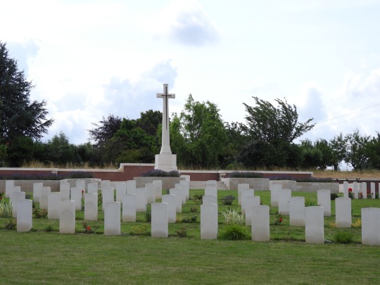
Pheasant Wood Cemetery is the result, and it’s one of the most poignant cemeteries on the Western Front. All other cemeteries record on their epitaphs the words of a lost generation; here, the worlds are ours. There remain the exaltations of sacrifice and giving one’s life for another - and there’s nothing wrong with that, I must add - but among them are reminders of communities, memorials to parents and siblings long past, even nods to how commemoration has evolved since 1918. Wilfred Owen is quoted - even if, thanks to the guidelines of the CWGC, it’s not one of his more condemnatory verses - as is Eric Bogle. Yet for all of this, there’s a sense of disconnection. There’s comfort in calling these deaths sacrifice, in saying they laid their life down for mates or country or king - but from my historian’s perspective, I think this battle was a total waste of human life, not so much a sacrifice but an act of murder by incompetence. Of course, the CWGC would never let you say that on an epitaph, but I think some people found their own ways to get past the censors. One particularly stark one was that of Private J. R. Smith, 31st Battalion. His grave has no cross, just a stark white space between the date of his death and his epitaph.
‘This Earth, his final peace.’
Sometimes the most simple language is the best.

We left Fromelles for Neuve-Chapelle. Neuve-Chapelle was attacked in March 1915 by Canadian, British and Indian troops - it is here that the latter are commemorated. Hindus and Sikhs are cremated after death, and as a result you will not find many in a CWGC cemetery. Instead, their names are listed here - nearly 5000 died on the Western Front. (All in all, at least 74,000 Indians died during ther Great War.) The First World War sits awkwardly in Indian history - the British Indian Army was entirely voluntary, and Indians went to fight because they fought war an honourable, or because they genuinely believed in the cause and were loyal to the Empire, or because it was simply a job and a roof over one’s head. Many supported the war because they believed Indian participation would coax the British into allowing them greater independence, perhaps as a dominion - a lawyer named Mohandas Gandhi being one of them. Instead, they were rewarded with great repression after the war, including the inexcusable and hideous massacre at Amritsar. The combination of the failure of Britain to adequately acknowledge the Indian participation in the war, and the piles and piles of dead bodies at the Jallianwala Bagh (and other places) put paid forever to the idea of peaceful Indian independence within the British Empire. The seeds of the Indian Independence Movement - and Partition - were planted in this war.
Nearby is the memorial and cemetery of the Portuguese Expeditionary Corps, or CEP. The CEP had a bad war - it was absolutely smashed at the Battle of the Lys in April 1918, with a third of its force killed, wounded or (overwhelmingly) taken prisoner by the Germans. This is not to say that the Portuguese were not brave nor good soldiers - the Peninuslar War a hundred years earlier is testiment that they were - but they were not at all prepared for the Western Front, to say nothing of the hurricane bombardments and stormtrooper attacks of the German Spring Offensive. We didn’t go into the cemetery, but it felt remiss not to mention it.

We entered Lille, and that ended the day. I had an early lunch - the first McDonalds I’ve had in what feels like ages, to be completely honest - and settled in to write this. Now, France is currently participating in it’s favourite pasttime, that being rioting, but I feel fairly comfortable and safe where I am, so don’t worry too much about me - and tomorrow we’ll be fairly rural, heading down to the Arras sector of the line.
3 notes
·
View notes
Text
2023 Bahama Cruise, Part 28. May 12 Governors Harbor, Alabaster Beach, Eleuthera.

This is the chart blow up of Governors Harbor, to give you an idea of the area. Against advice on the chart and our friends who were here a couple of days earlier. We anchored inside the harbor. Our anchor dug in well, and we recklessly never dove it.

After a quick trip to the grocery store for a dozen eggs and another bottle of Coconut Rum. We walked around the harbor shore line. We visited the old cemetery near the water. It was well kept with some very old Grave Stones. Behind the cemetery was the St. Patrick’s Anglican Church, built in 1848.

Just around the corner from the church was this beautiful building. It is the “Haynes Library” built much later in 1897. Notice the huge concrete buttresses at the corners, facing 45 degrees from the building. The ones in the back go almost all the way up the second floor. This library was built to withstand a Hurricane. Hurricane Andrew came nearby in 1992 as a Category 3 Hurricane.

Cupid’s Cay makes the outer hook of the harbor. Not sure if it was a separate Cay originally or not as the name would suggest. But today it is connected to the mainland by a substantial causeway. Cupid’s Cay was the home of the first Bahama Parliament in 1736.

On Cupid’s Cay was the first U.S. Consulate to the Bahamas in 1789.
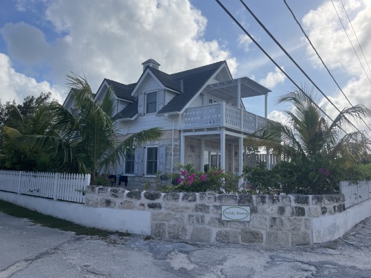
This is a hotel rental on the Cupid’s Cay. This reminds us of old Key West. We walked back to the dinghy and then moved to the boat for the night.
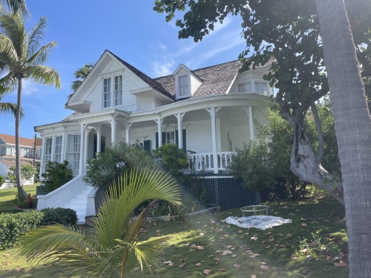
The next morning we did a quick walk through the better part of town. These were well kept up old houses that you can rent. Grounds were green with landscaping and well kept. Really reminds us of Old Key West.
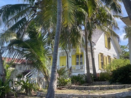
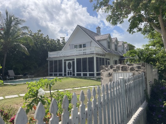
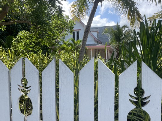


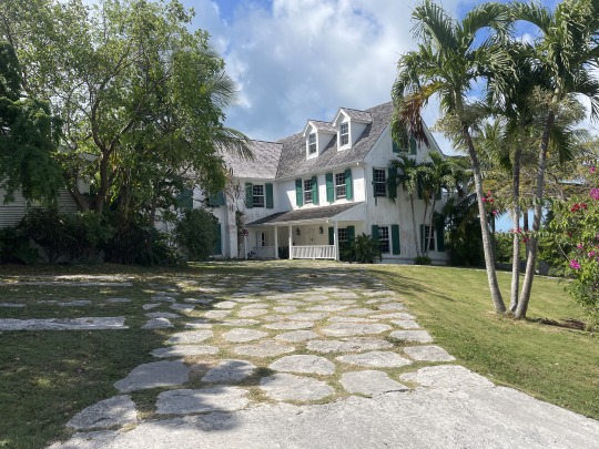

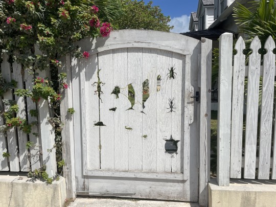
This walk took us over the top of the ridge about 142 ft. high. The ends up going through a carved out are to keep it from being so steep. There was an cement cistern reservoir at the top to supply water pressure to the neighborhood.
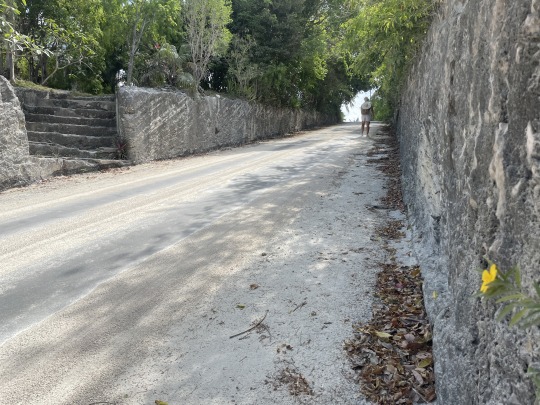

From the top we could see both coast of the island. Once we finished this short walk it was back to the boat and move anchorages. Governors Harbor left a good impression with us. Part of it was like most of the settlements. Parts were going high class rentals. Lots of history in this town.


As always the few people we met were very nice and friendly. Apparently there are no snakes on this Island. The chickens and rosters have run amuck. The crowing starts early and is continuous for hours before daybreak.
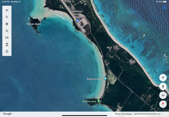
This is Alabaster Bay. It is 6 miles north of Governors Harbor.
On Monday 13th, we hike 3.7 miles round trip. First across the island to the abandoned US Navy Base. Right turn and a 1 mile plus hike down the beach. Lunch at “The Deck” then continuing clockwise out to the Queen’s Highway and home.
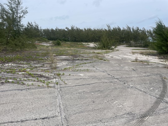
In 1950 this USNavy Base was started as an experimental SOSUS (Sound Surveillance System) having 6 hydrophones deployed off shore. Then in 1958 it became a missile tracking site for US missiles launched from Cape Canaveral. Typical of USNavy bases on islands, they concrete the sides of hills to catch the rain water at the bottom. See photo above, there were several of these. The base was closed in 1982. During its tenure, usually only the Base Commander was actually in the military. The other personnel worked either for Pan American Airways (Pan Am) or Radio Corporation of America (RCA).
In 1957 the base became the Eleuthera Auxiliary Air Force Base (AAFB).

Being a sailor I can’t help but drag a large clump of net and floats up to the high tide mark. It would be a nightmare if you fouled your prop in the open ocean with something like this.

This is “The Deck”. A bar and grill on the oceanside. It is owned by Mark Robert a descendent of the original settlers at Hope Town Abaco.
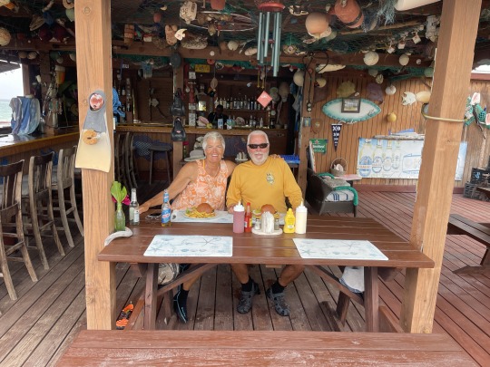
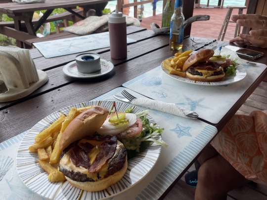
Bacon Cheese Burgers in Paradise. We learned a new trick. When flies are giving you a problem, light a can of sterno. Even after you put it out they stay away for several minutes.
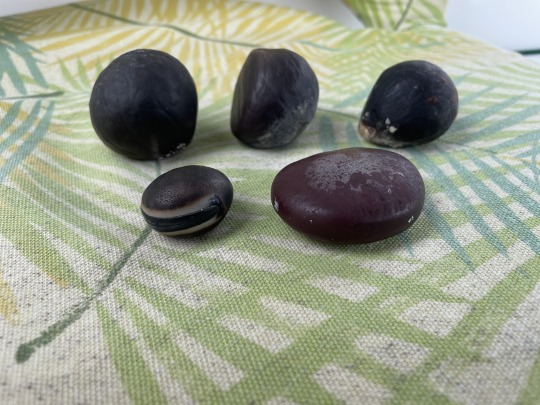
This is all the treasure we collected on the beach. The most prized of the different sea beans, is the “Hamburger bean” (front left).
It was a slow hike back to the boat after the huge lunch. Nancy cut my hair and beard. After a short recovery time from the lunch. We pulled anchor and sailed north to Hatchet Bay. We tried to out run some storms coming up from the south. Didn’t work out so well.
Using Standard WaterTribe rules. We reefed early. If reefing even enters your mind, then you should go ahead and reef (pull in) your sails. Since we did, the gust from the storm never materialized.

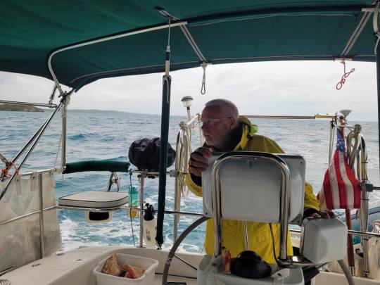
This very well could be a hairy entrance., it is 80 ft. wide and has rock cliffs. Large amount of current to get in and out of this small cut. We had 2 ft. swells and 12-15 kt. winds.
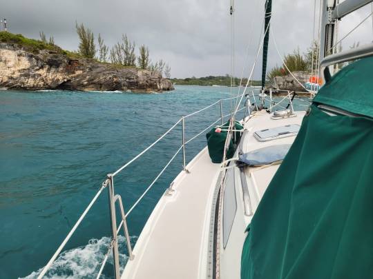
We came into the bay and put out a “Security call” on VHF announcing our entry into the bay. The mailboats and car ferries never say when they are approaching or exiting the harbor. We assume they have a VHF, but they seldom ever answer.
We entered during the top of the flood tide, so no current was evident. We put our anchor down in the north end of the harbor. Only 8 cruisers here. Three left the next morning.
S/V Sea Breeze, Alabaster Bay, Eleuthera, Bahamas.
4 notes
·
View notes
Text

Written in the Stars - Zodiac Challenge - Aries - Recap
Cadence Goth, daughter of my Asylum challenge sim Callie Grubb, was the first generation sim for my custom Zodiac challenge playthrough. I wanted a fun way to continue playing my save after Callie successfully left the asylum and fulfilled her dream of being a Selvadorada treasure hunter. Cadence was born from a fling between Callie and Mortimer Goth, and Callie had Cadence later in life, passing away just before Cadence graduated high school, and Mortimer had died years before, leaving Cadence an orphan.

A lawyer contacted Cadence to inform her of the inheritance of Ophelia Villa, the Goth family home in Willow Creek, and Cadence moved in, deciding to renovate and work locally instead of going off to college. She married her high school sweetheart, Wyatt Jeong, and she eventually joined the military.

One day, she found out she was pregnant, and continued to progress her career during her pregnancy. Their twins, Adam and Audrey, were born. A couple of years later, their daughter Bailey followed.


Ophelia Villa, originally a dark, dusty and long-abandoned house became a warm and inviting home for the Jeong family. The children grew, went to school, and began to develop their own dreams as Wyatt and Cadence grew older and watched their children thrive.


They celebrated many Spooky Days, Winterfests, and Harvestfests together. Adam graduated from high school early, Audrey graduated as Valedictorian, and Bailey simply graduated which, given her wild, youngest-child nature, was a feat in itself. Adam bought a small plot of land in Chestnut Ridge to start a farm, Audrey eloped with her boyfriend, much to Cadence's dismay, and Bailey moved in with her boyfriend a couple of neighborhoods over in Willow Creek. Time was moving fast, and before Cadence even realized what was happening, her children were gone, and her time was drawing near.


One year, Wyatt passed first, just before Harvestfest, and the children returned home to spend the holiday with their mother. It was there that Cadence told them her wishes. The three would receive equal cash inheritances, and Audrey would inherit Ophelia Villa since Adam was now in Chestnut Ridge. It was also there that Adam announced that he was getting married to his high school sweetheart: Hadley Martin.

A few months later, just before Easter, Adam and Hadley married at their small farm in Chestnut Ridge. Cadence, assisted by Audrey and Bailey, made the journey in order to see her son marry and to meet his new bride, as well as their dog, Bear.


A couple months later, Cadence passed away, and the children reunited to bury their mother next to their father in the Willow Creek cemetery, where their grandmother Callie and grandfather Mortimer were also buried. A long life, that was well-lived and full of love, had ended.

And now the torch passes from Aries to Taurus.


♡ website ♡ x ♡ instagram ♡ ko-fi ♡
2 notes
·
View notes
Text
The Best Presidio Walking Trails for History Buffs
The Presidio of San Francisco is a 1,500-acre national park that offers some of the best walking trails in the Bay Area. For history buffs, it's a perfect destination to explore the rich military history of the park and learn about its cultural significance. In this article, we'll provide a guide to the best Presidio walking trails for history buffs.
Main Post Historic Trail:
The Main Post Historic Trail is a 2.4-mile loop that takes you on a tour of Presidio's most historic sites. You'll start at the Presidio Officers' Club, once the military post's social hub. From there, you'll visit the Chapel of Our Lady, the San Francisco National Cemetery, and the Fort Point National Historic Site. The trail is stroller-friendly and has plenty of interpretive signs to help you understand the history of each site.
Rob Hill Trail:
The Rob Hill Trail is a 1.7-mile loop that takes you through a forest of cypress trees and offers stunning views of the Golden Gate Bridge. Along the way, you'll see Battery Mendell, which dates back to the early 1900s and was an essential part of the Presidio's coastal defense system. The trail has some uphill sections but suits history buffs who are comfortable walking on uneven terrain.
Bay Area Ridge Trail:
The Bay Area Ridge Trail is a 6-mile loop that takes you on a tour of Presidio's most iconic landmarks. Along the way, you'll see several historic military batteries that were once used to defend the bay. The trail also offers stunning views of the Pacific Ocean and the Golden Gate Bridge.
Batteries to Bluffs Trail:
The Batteries to Bluffs Trail is a challenging 3-mile round-trip hike that takes you down to the beach at Baker Beach. Along the way, you'll see several historic military batteries that were once used to defend the bay. The trail also offers breathtaking views of the Golden Gate Bridge and the Pacific Ocean.
Presidio Promenade:
The Presidio Promenade is a 2.5-mile loop that takes you on a tour of some of Presidio's most beautiful landscapes. Along the way, you'll see several historic buildings from the Presidio's military past, including the Montgomery Street Barracks and the Letterman Digital Arts Center. The trail also offers stunning views of the Golden Gate Bridge throughout.
No matter which trails you choose, there are a few things to remember when hiking in the Presidio as a history buff:
Bring plenty of water and snacks. No food vendors are on the trails, so coming prepared is essential.
Dress appropriately for the weather. Even in the summer, San Francisco can be foggy and chilly, so layering is key.
Take the time to read interpretive signs and learn about the history of each site.
The Presidio offers unique opportunities for learning about military history, cultural significance, and environmental conservation.
In addition to the walking trails, the Presidio offers several cultural institutions and historical sites worth exploring for history buffs. You can visit the Presidio Officers' Club, Fort Point, or the Nike Missile Site to learn about the Presidio's rich military history.
In conclusion, the Presidio of San Francisco is a perfect destination for history buffs who want to explore the rich military history of the park and learn about its cultural significance. From the Main Post Historic Trail to the challenging Batteries to Bluffs Trail, there's a trail for every level of hiker. Be sure to bring plenty of water and snacks, dress appropriately for the weather, and take the time to learn about the history of each site. With some preparation, you can create unforgettable memories exploring the Presidio's natural beauty and cultural significance.
0 notes
Text
Some slightly interesting historical context, with one other stop that I haven't tagged yet over in the cemetery.


From that, I figured the cemetary memorial was probably more directly connected to all the activity through the somewhat nearby Bulltofta airfield. (As mentioned through that link in the OP, on the same ridge formation as us and the cemetery.)
But, apparently not!
That is evidently specifically connected to the graves of two guys who died in a crash up closer to Gothenburg. I wouldn't be too surprised if they ended up buried here because so many more airmen ended up in this area, though.
I probably found all of that more interesting because one of my grandfathers spent the war stationed at airfields in England. Didn't fly himself, that I ever heard of, "just" one of the multitude of ground crew.
Not that either grandfather really wanted to talk about the war, though that one did not come back Changed in the same way as the other. (Where it was less delicious fish and chips in Leeds, and more combat medic action through North Africa.) One of the reasons that I have been freaking amazed at some of the apparent sociopolitical trends in the US since 2001.
I grew up around too many WWII and Vietnam vets, in one of the regions where the military has historically preyed on kids the most when they weren't just straight-up drafting people. And the ones who would talk about any of it did not have much flattering to say.
A pretty pleasant outing earlier this evening. Didn't get as many photos today, but I decided to head back by the park and through the big cemetery again. There are a few gyms and pokestops I hadn't hit yet in that direction, and more trees than people.
Also decided to set another route on the way back, because it was a nice enough roll.

I have no idea why the game is claiming this is in San Francisco by default. It most certainly is not, and there was no obvious way to correct that.
I also circled around to that cluster of buildings off to the northwest there, which include the East Church this churchyard is attached to.

Yep, looks like some kind of church! From a parking lot, lurking behind a hedge there was no clear path through.

My little prehistoric buddy here seemed to enjoy some open space. So did I.
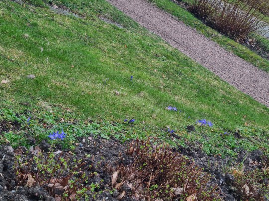

Some spring bulbs, and very bad pics. Looks like some Scilla species I couldn't quite narrow down. May be a hybrid variety. Someone obviously planted all the bulbs at some point.


A little different type of Scilla. There were some white ones like this too. As seems to be pretty typical here, everything is almost creepily manicured. I was semi-excited to spot some moss growing on one path.
Some pic I may have taken by accident, but why not. Open space!
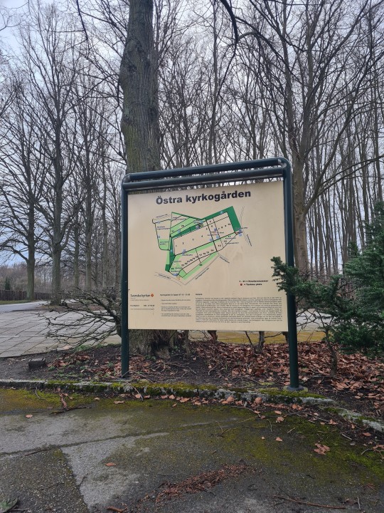
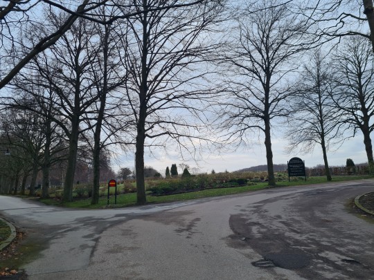
Starting back. And yes, this is pretty hilly by local standards. Getting close to the highest point in Malmö here!
#personal#clatterbane ventures forth#flowers#spring#pokemon go#östra kyrkogården#malmö#sweden#Rosengård#wwii#history#memorials
3 notes
·
View notes
Text

• Len Waters (Australian RAAF Pilot)
Leonard Victor (Len) Waters was the first Aboriginal Australian military aviator, and the only one to serve as a fighter pilot in the Royal Australian Air Force (RAAF) during World War II.
The fourth of 11 children to Donald and Grace Waters, Len Waters was born at Euraba Mission, near Boomi in northern New South Wales on June 20th, 1924. He grew up at Nindigully, near St George, Queensland, and was educated to the seventh grade at Nindigilly State School. Hearing tales of pioneering aviators Charles Kingsford Smith, Amy Johnson, and Charles Lindbergh, and reading stories of Flash Gordon, and Buck Rogers, he had, as he put it, his "head in the clouds" from an early age. Waters left school when he was 14 to support his family, working alongside his father as a ring barker.
Although the military had officially barred or restricted the recruitment of Aborigines in earlier periods, these impediments were significantly relaxed after Japan entered World War II, and Australia came under direct attack for the first time. Waters volunteered for service in the RAAF on August 24th, 1942, at Brisbane, and was accepted. He began training as an aircraft mechanic, but later volunteered for flying service, and commenced initial training at Somers, Victoria, in December 1943. The aircrew interviewer thought he looked "a bit rough" but "should make a fighter". Waters believed his lack of education would be a disadvantage, and studied nights to make up for it. Keen to be a pilot, he was concerned that he would be allocated to duty as a wireless operator because he showed an aptitude for Morse transmission early on. He was also asked to imagine himself as the tail gunner in a Lancaster or Halifax heavy bomber, to which he replied, "I had a very disappointed look on my face, sir!" So convinced was he that he would not achieve his dream of becoming an aviator, Waters made three separate bets against himself being selected, and had to pay out £15 when he was nevertheless chosen.
Waters undertook his basic flight instruction at No. 1 Elementary Flying Training School in Narrandera, New South Wales, where he flew De Havilland Tiger Moths. He completed his training on CAC Wirraways and received his wings as a sergeant pilot at No. 5 Service Flying Training School in Uranquinty. Posted to No. 2 Operational Training Unit at Mildura, Victoria, he converted to P-40 Kittyhawk fighters. Once, while he was on leave, Waters was reportedly gaoled in Moree, New South Wales, for not carrying an identity card, which was one of the racially discriminatory institutions affecting Aborigines at the time. On November 14th, 1944, he was posted to No. 78 Squadron, a fighter unit based on the island of Noemfoor, off Dutch New Guinea. When he arrived, he was allocated a P-40 Kittyhawk. By chance, a previous pilot had nicknamed the plane "Black Magic" and painted those words on its nose. Waters found the name of his plane an amusing coincidence and chose to retain it.
By this stage of the war, Japanese aircraft were almost non-existent in the South West Pacific theatre; No. 78 Squadron's main role was ground attack, bombing and strafing enemy positions. Waters flew 95 sorties from Noemfoor, and later from the air bases at Morotai and Tarakan, in Borneo. During one mission, his aircraft was struck by a 37 mm cannon shell that embedded itself behind him in the cockpit without detonating. He flew for another two hours, with the possibility of the shell exploding at any time, a situation he likened to having a loaded gun against his head. "I'll tell you what", he said after returning to base, "that was the best landing I ever made". On January 1st, 1945, he was promoted to flight sergeant. By the end of the war, Waters was commanding operations which included commissioned officers. A colleague described him as a "gaunt, genial figure, humble despite his daring feats". One of Len Waters' brothers, Donald Edward Waters, had served as an infantryman with the Australian Army during the war. With the end of the Pacific War in September 1945, Len considered volunteering for the Australian component of the British Commonwealth Occupation Force in Japan, if his brother did also. Donald Waters declined at the time, so Len returned to Australia and left the air force with the rank of warrant officer on January 18th, 1946.
After returning to Australia, Waters attempted to start a regional airline serving South West Queensland. However, he was not able to secure finance or bureaucratic agreement. He reportedly wrote four letters seeking government approval, but never received a reply. He never flew a plane again. While racism in the military during World War II was considered to be minimal, Waters and other Aborigines who had served their country found that the skills they had acquired were not valued in peacetime. He wrote later that, having put off his uniform, he simply "returned to being a blackfellow". Four weeks after his discharge from the Air Force, Waters married Gladys Saunders, with whom he raised six children. He worked as an automotive mechanic, but was forced to cease by union rules, which required him to serve an apprenticeship. Waters was then briefly employed by a local council in Queensland as a road worker, before turning to sheep shearing, which took him away from his family to properties stretching from North Queensland to Victoria. Waters applied for housing commission accommodation and was allocated a house at Inala, Brisbane, in August 1956. He eventually bought the property and lived there for 33 years. He died on August 24th, 1993 at the age of 69 in Cunnamulla, and was buried in St George Cemetery.
In 1995, Waters was commemorated in several ways: Australia Post depicted his portrait on a stamp and that of his P-40 Kittyhawk fighter "Black Magic" on an aérogramme, as part of its Australia Remembers series; a brand of port was named after his personal Kittyhawk; Len Waters Place, a park in Inala, was opened; Moree Plains Shire Council dedicated Leonard Waters Park in Boggabilla, New South Wales; and Len Waters Street in Ngunnawal, Australian Capital Territory, was named after him. In 2003, Balonne Shire Council erected a monument to Waters and another local RAAF identity, Squadron Leader John Jackson, in St George. In 2011, the Sutherland Shire Council recognised Len Waters' memory and achievements by dedicating Len Waters Park, with a memorial plinth and plaque, at Timbrey Circuit, Barden Ridge, New South Wales.
#second world war#world war 2#world war ii#ww2#wwii#australian history#australian aboriginal history#indigenous people#indigenous people's day#military history#history#long post#british commonwealth#biography
107 notes
·
View notes
Photo
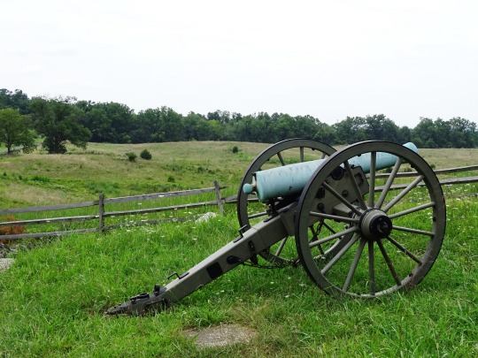

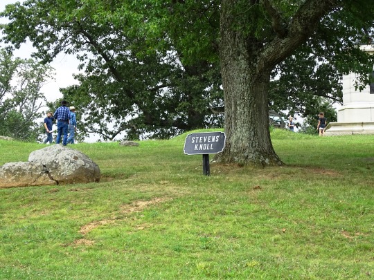
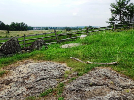
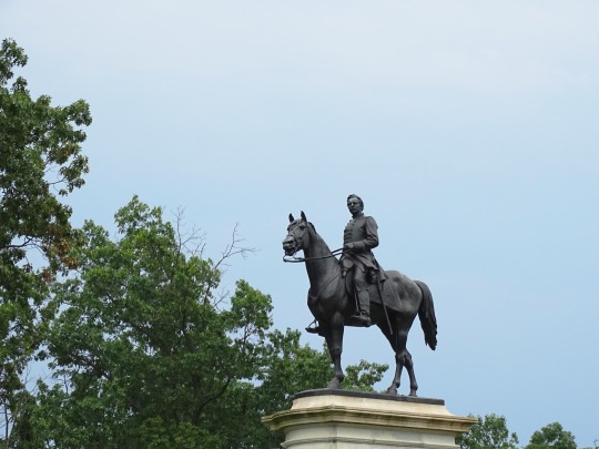
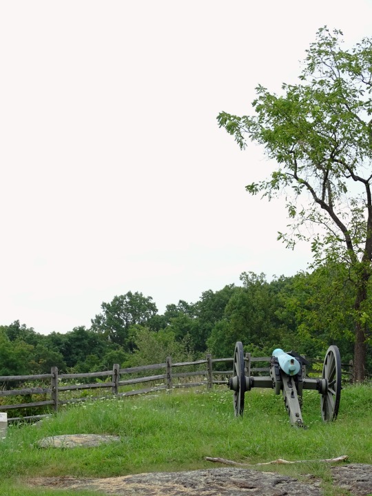


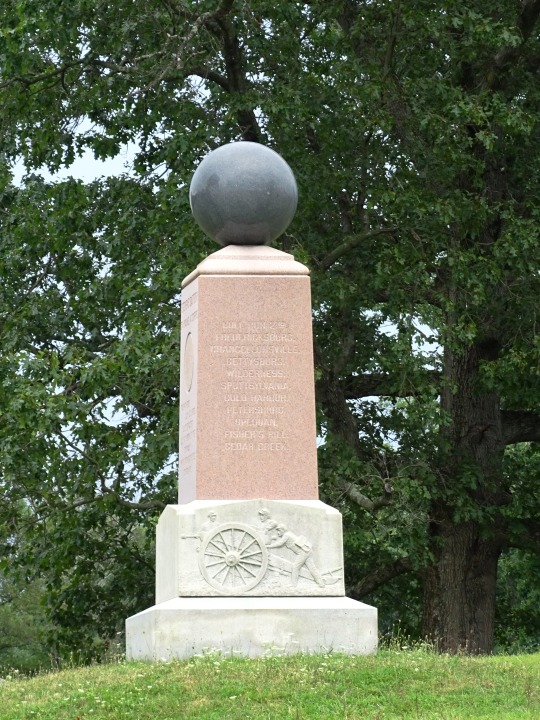

Gettysburg National Military Park (No. 41)
Southeast of Gettysburg the high ground of Culp’s Hill and Cemetery Hill is connected by a low ridge dominated by a little knoll. Originally known as McKnight’s Hill, since the battle this high ground has been known as Stevens Knoll, after Captain Greenleaf Stevens, the commander of the 5th Maine Battery (Battery E, Maine Light Artillery) that occupied it and fought off Confederate General Jubal Early’s assault on the evening of July 2nd.
Few other monuments share the ridge, and traffic finishing its circuit of Culp’s Hill (both Slocum Avenue and WIlliams Avenue are one way to the west) rarely stops, making this area a bit of an oasis between often-crowded Culp’s and Cemetery Hills.
Source
The monument to Major General Henry Slocum is south of Gettysburg on Slocum Avenue. It was dedicated on September 19, 1902 by the State of New York.
The monument is a bronze equestrian statue created by sculptor Edward Clark Potter. Potter made a number of equestrian statues but is best known for the lions in front of the New York Public Library. Slocum’s statue weighs 7,300 pounds and stands 15′ 6″ tall. It rests on a 16′ tall base of Barre granite designed by A.J. Zabriskie. Large bronze inscribed tablets are inset into the base on each side.
Source
#Gettysburg National Military Park#Stevens Knoll Area#Pennsylvania#USA#travel#summer 2019#original photography#landscape#countryside#vacation#American Civil War#US Civil War#Major-General Henry Slocum#Edward Clark Potter#Stevens' Battery 5th Maine Artillery Monument#cannon#flora#nature#tourist attraction#landmark#US history
5 notes
·
View notes
Text
Thursday, 9 April 1840
7 1/2
11 1/2
Fine morning – No sun – Reaumur 6 1/4º on the window seat close to my bedhead at 8 1/2 – Slept very well but the terrible jolting one has day after day makes one a sort of lassitude even on getting up after a few hours sleep – I slept from about one last night to 7 a.m. – Cold here so high among the mountains – Casbek after Elbrus the highest summit of the Caucasus – Breakfast over at 9 1/2 then sat reading Murray till now 10 3/4 article Persia II. p.[page] 396 et seq. and here is the account of the Province of Shirwan &c. now ceded to Russia –
A-[Ann] sketched the little church neat new ashlar red stone church and its very pretty picturesque little clock separate standing on 4 little arcades open at the bottom – Out from 11 1/4 to 1 1/2 – I sauntered about 1st by myself then sought George – Went up to the little Gurian (as George called it) rude chapel and cemetery at a little height on the hill (East) above the Town – The chapel oblong very small door towards the West – Fast –
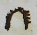
Rather tapering – Roof of rough walling retiring roof wise stood on little knoll above the chapel gazing till I could see nothing my eyes ached towards Casbek –

The monastery full in view for 3 or 4 minutes or more at 12 1/4 then clouded over – Kasbek appears to be behind rather South of the monastery – From the glimpse of his centreforts he must be magnificent and 1/3 way up the horizon seen from this little knoll – The monastery handsome looking high dome-topped church and handsome tower (round topped?) clocher – Largeish handsome looking place – 5 v.[versts] from Kasbek –

The Gergeti Trinity Church, above Stepantsminda (Kasbek in Anne’s time), which Anne deemed a “monastery”. (Image Source)
A village en route about 1/2 way? up the hill or not so much – But this village flat topped like the village town here – Counted 40 squares at 6 families each these squares like little bomb roof forts or casemattes – Covered with gravel at top – Quite like a fine gravelled square to walk – 4 or 6 little round openings are chimneys for the 2d.[2nd] story the ground story has little loop holes at each side front and back which let out the smoke and give all the light there is – The fire on the ground à la Calmuck – It seems I did not over calculate houses or people the latter = 1000 an old man said his house was very ancient was standing in Peter the Great’s time –
There are 2 towers (tapering square) in the ville – The one we passed last night is quite in ruin only the 2 sides towards last night, standing, and the fog so soon hid it, could see nothing it – Appears (at the distance I saw it, from the cemetery above named) to have had 6 étages and was perhaps gathered up into a stone roof – Singular Town this – The 1st instance we have seen of the quite flat gravelled walk-like roofs of the East –
Some of the better places open into a little court the 2d.[2nd] story entered by rude stone (black schist from the neighbouring mountains) stairs and a broad balcony gravelled like the roofs – This reminds me of Mouravieff’s description of Khiva &c. Perhaps the 50 chambers of the Palace of Priam were something in this style - ∴[therefore] might be one or 2 stories high – Here the squares are sometimes the dots signify the fire places and there is no division between 2 families –

The middle part is a sort of passage divided off by a wattling – For calves &c. &c. which also seem to be admitted even into the family apartment – The people never wash – Terribly dirty – Had just written so far now at 2 1/2 – A new road from here, George says; but the old one, by Kobi, tho’ longer still the one travelled – Probably the other not yet quite monté – Inquire – From here the defile fait fourche –
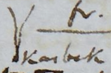
Ours is the one of Terek to the right en sortant Kasbek – Paid the post horses 3 Kopek en argent per v.[verst] per horse 16 1/2 v.[versts] = 4/95 + -/12 greasing en argent – ‘Tis now 2 3/4 – Off at 2 50/’’ from Kasbek a very interesting place – It has made me understand the Ossetine Towns – The fort is 2 pieces of canon in the courtyard the sight of the Town except the 2 tall Towers soon lost – At 3 little wood bridge over little stream - At 3 10/’’ right, little distance, on high promontory of rock –
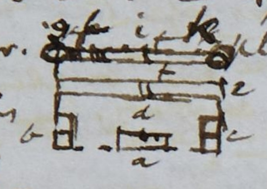
a Inn
b Mr. Bachmetieff’s house
c another corresponding house
d great court and parade yard
e line of barracks for the soldiers
f stable yard
g blacksmiths shop
h Cossack stable for about 12 horses
i large joiners shop and sort of coach house?
k post horse stable for 18 or 20 horses all one story buildings ascended by a step or two

View from a fort on the Russian side of the border. Forts like this one were common along the sides of the Georgian Military Road, which Anne and Ann are using in this stage.
1st village 1 lofty Tower 5 stories high and 2 lower Towers – All tapering square – About 6 of the squares (as at Kasbek) reckoned them at 6 families per square but they are all 2 stories high, and there are generally 6 on one floor or at least 4 families in these Sacles (Sacle signifies house in the language of the people) say 50 families in this village (but there are more?), and reckon 50 families = 200 souls just after this village that was high above us, Crocuses along our road purple and white 1st time and a thorny low, whitish little shrub covering the bottom of the Defile (Zizyphus? No! What is it?)
At 3 1/4 at the fourche a fine ravine left (saw no traces of the new road George mentioned) and a few coarse grass thatched stone huts, and enter our prong 2d.[2nd] of the fork, right, at 3 1/4 – At 3 20/’’ another fortification-like village (right) on the steep perpendicular rock, with 2 or 3 square Towers but low ones, and a little white line of mountain streamlet (misseau) tumbling down from the high summits close on this side the village – The 1st of these misseaux so common in the Alps and Pyrenees that we have seen here and on pinnacle of rock above the 2d.[2nd] village another village – Several square dry walled flat roofed stone houses along the flat bottom about a verst 3d.[3rd] wide good road –
At 3 25/’’ the village on pinnacle of rock above the 2d.[2nd] village – 2 more rock-seated picturesque villages in sight ahead of us the nearest with high tapering chimney like Tower 4th little Towerless village or hamlet left on the plaine rather in the glen defile to the left – At 3 33/’’ descend upon little wood bridge over little rapidy streamlet – 4 Ossete women on the bridge in picturesque costume mouths covered with dirty white handkerchiefs –
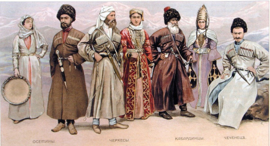
Traditional costumes of the people of the North Caucasus. Ossetian costumes are first from the left.
Another little village or 5th hamlet beyond the last and a peep at still another on the mountain side above the 5th village still farther in the the glen to the left
6th
8th the tall chimney-tower fortification old castle like village (vide line 7 above) on steep rocky projection high above us, left – The tall Tower 10 to 15 yards high – Narrows one half – The base seemed about 4 yards the top about 2 yards wide – One of the Towers at Kasbek seemed to narrow (to diminish) 1 yard in 5 yards of height – I could not see it quite from the bottom – The base might be 5 yards wide? –
Steep descent and drag now at 3 40/’’ down into glen (ravine) with little stream and wood bridge just below the chimney Towered village or Ossetine Town this tall small Tower seen from far in all directions – Little Tower on high rock on the other side of us opposite village no.[number] 8 – This pass has been well fortified in ancient times – The tall Tower of no.[number] 8 walled with lime – Looks a large old fortified place towards the South, out works a good way along the ridge that stretches (towards the South) up to the high mountain – The rock quite perpendicular towards our road – 2 great caves in the hill side joining part of the ridge strewed without works, more walling –
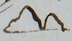
Ruined Tower &c. – Very picturesque – A little beyond us – 9 and 10 on the other side the deep ravine of river, at 3 55/’’ 2 villages on high ridge at a little distance apart one beyond and above the other – There must be plenty of common juniper near tho’ not seen by us for here we passed a Drovne on wheels loaded with it –
Astonishing the no.[number] of villages on the high steep rocks, and ridges, and bits of platforms under the high mountains – 11 another little village at 4, on the same ridge, on high point of rock above the 2 last villages there must be a little high valley between this ridge and the high mountains –
And now at 4 Terek 200 ft.[feet] in steep ravine close below us (right) – No guard – We might easily slip off the side of the narrow road into the river, a blueish, whitish, rapidy, 8 or 10 yards broad stream – Here, red, perpendicular schistose, irony? coloured mountain on the other side (left bank) of Terek, and on our left, always singularly rough, projectiony-pointed mountains –

I think there may be 2 or 3 more villages along the same ridge above named to the end of it but the mist is lowering now at 4 1/4 and all to lower than the top of this ridge will soon be hid on our right –
The bottom of our Defile becomes more strewed with big stones as well as little – The little at Kasbek and everywhere today gathered into large heaps to clear the champs which they sow with corn a small grain said one of the Ossetes at Kasbek – Blé sarrazin i.e. buck wheat? But he said it was all burnt up last summer –
12th village at 4 16/’’ with tapering not high square tower on the side of high mountain right – 13 village a little beyond and much lower down them the last on the same mountain side 14 ditto at the foot of the same mountain close upon stream? (rather far from us) an affluent of the Terek from deep glen or little valley from the North westward –
Little frozen small snow flying about now at 4 20/’’ as we toil up to higher ground a broad plateau above the deep ravine of river Terek – And in a minute or 2 steep pitch thro’ the snow narrow road along the brink of deep ravine going down to the Terek – The Courier wanted us to alight – He alighted and walked up –
15 at 4 1/2 (right) on mountain side village with square Tapering tower at a little distance above and beyond it but this village unlike all the rest has some sloping roofs tho’ looking fortress-like outside – All the villages of dark coloured stone hardly distinguishable from the rock –
High plateau of débris on each side Terek thro’ which it has formed the deep ravine – The mist covers 1/2 way down right, and now the ragged pointed summits left – We are perhaps 200 yards from foot of high mountains left and perhaps 300 or 400 yards from foot of ditto right – Some deep water courses down the mountains right but dry now –
4 40/’’ more snow on the road and mountains left much covered with snow, and very streaky right – At 4 50/’’ Kobi just in sight peeping from behind mountain head, right – At 5 steep descent from our plateau into the bottom down to the river divided into several little streams in the little basin like opening out of defile in which the dot near a is Kobi at 5 5/’’ cross little wood bridge over one of the streams still driving small snow –
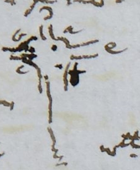
d our road tomorrow
b castle
e Defile of the Terek 12 v.[versts] to its source said Colonel G-[Grauert] they say here one can go 15 v.[versts] along this defile and no farther –
c village
f ditto
16 old castle and at 5 10/’’ on rocky ridge (left) about in a line with Kobi, and at a little distance below this castle little fort-like village in and at the entrance of the little Defile to the East and about opposite another village at foot of high mountain right –
Enter Kobi at 5 1/4 thro’ little street of low flat-roofed shops about 8 on a side – Right side with little rude covered passage (portico) – At 5 17/’’ alight at our nice little stone? yellow washed Inn – This and 2 more such like buildings and the Ossetine Sâcles form the whole town of Kobi – No Krepost – The few Cossacks in low flat roofed huts near the Sacles – Delivered our 3 letters – The Prince of the place came – To be off very early – The Courier with empty carriages at 4 1/2 a.m. and we at 6 a.m. –
A-[Ann] and I went out – She sketched – I (with a soldier) went to the Sacles – Less good than those at Kasbek – 20 or 30 families or more – A neat little white washed stone church just before entering the village –
Tea over at 8 – ‘Tis now 11 5/’’ as I have just written so far – Fine day till the driving small snow in the afternoon (vide above) – Tonight they want us all to set off together – An officer and 25 men instead of 10 as the Prince said – 3 Traineaux – 2 for baggage instead of one! Our people frightened – I told George I should set off after the Courier and empty carriages – took off only pelerine and lay down in my gown and black stuff cloak at eleven and a half
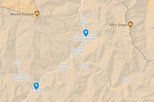
Anne’s and Ann’s route on this day.
[symbols in the margin of the page:] + 𐐥
[in the margin of the page:] Kasbeck
[in the margin of the page:] Leave Kasbek
[in the margin of the page:] Population of village
[in the margin of the page:] steep pitch
Page References: SH:7/ML/E/24/0077 and SH:7/ML/E/24/0078 and SH:7/ML/E/24/0079
3 notes
·
View notes
Photo

The Geology of Cemetery Ridge
156 years ago today a small hill in rural Pennsylvania was the scene of a battle that would change the course of American history. This is a page on Earth science, and every good geologist (and military commander) knows that the geomorphology can be your best friend. Ridges don’t just exist by chance; their existence says something about the bedrock and evolution of the area.
The small ridge seen in the background of this image, rising less than a hundred feet above the surrounding plains and marked by military memorials is known as Cemetery Ridge. It sits just outside of the small Pennsylvania town of Gettysburg. On July 1, 1863, a battle began in this area. Union forces retreated from several surrounding locations and gathered their armies on this ridge. On July 2, 1863, Confederate forces attempted several attacks on hills to the south of Cemetery Ridge, attempting to take positions which would make the Union defenses on Cemetery ridge untenable.
On this day, July 3, 1863, Confederate forces under General Pickett charged directly at the Union lines on Cemetery ridge and were almost totally destroyed.
Cemetery ridge is actually not a very good place to put a defensive position. It isn’t just high ground, it’s also very rocky; whatever the rocks are, there is very little soil developed on them, making it very difficult to dig fortified positions or trenches. The only defense on Cemetery ridge comes from fences and any other fortifications built on top of the rocks; soldiers just can’t dig in.
The rocks of Cemetery ridge played a key role, therefore, in this fight. The area around Gettysburg is made up of sedimentary rocks formed during the Triassic. At this time, the mountain ranges to the east were growing due to collisions between North America, Africa, and Europe. Those collisions built mountains that were shedding sediments into basins to the west. The plains around Gettysburg are made of these rocks; layers of sandstone and shale that are easily eroded and do not form high ground.
The high ground in the Gettysburg area comes in the form of long, linear ridges like Cemetery Ridge. To the south of Cemetery Ridge sits other high ground, including features such as Round Top and Little Round Top which sit on the same line as Cemetery Ridge.
These features are made of a type of igneous rock known as diabase. Diabase is a term for a rock that has a composition like basalt or a gabbro, but has a grain size in-between those 2. There can be some crystals large enough to see, but not many. The rocks are made up of solidly-intergrown, small crystals with little space for water to intrude. The tight packing of these crystals makes the rocks difficult to erode, leading to the formation of high-ground and thin soils.
The diabase in the Gettysburg area forms a type of structure called a sill. A sill forms when magma rises up through the crust but reaches a level of neutral buoyancy – the magma is too dense to rise through the lighter rocks above and instead pushes its way into the rocks. The magma forms a sheet in-between other layers of rock, becoming part of the stratigraphy.
This magma was formed nearly 200 million years ago, during the Jurassic period. It formed as a consequence of the end of Pangaea; as North America and Europe tore apart, cracks formed throughout the Eastern U.S. and magma flowed up into those cracks. One of those cracks formed the sill which created Cemetery Ridge and the other high-ground in the Gettysburg area.
Finally, the rocks in the area were tilted some as the continent continued to evolve, and erosion exposed the rocks seen today.
Several hundred million years ago, a normal series of geologic processes, including deposition of sedimentary rocks and intrusion by ordinary magmas, created the ground on which the American Civil War’s key battle was fought.
-JBB
Image Credit: National Park Service found here: http://npsgnmp.wordpress.com/2012/05/10/the-cavada-brothers-two-soldiers-two-wars/
Geology and the Gettysburg Campaign: http://www.dcnr.state.pa.us/cs/groups/public/documents/document/dcnr_014596.pdf
Volcanic Rocks of Pennsylvania: http://vulcan.wr.usgs.gov/LivingWith/VolcanicPast/Places/volcanic_past_pennsylvania.html
#Holiday#July 4th#diabase#sill#igneous#rock#science#magma#erosion#little round top#gettysburg#pennsylvania#pickett's charge#history#the earth story
60 notes
·
View notes
Text

Welcome !
ー
Scroll down to start exploring ...
ー
Or go directly to ...
○ Acid Castle Rocks
○ Ashland Creek At Van Ness Avenue
○ The “A” Street Ghost House
○ “A” Street Warehouse Alley
○ Blackberry Way
○ Family Life Bible Church
○ The Giant Stone Steps
○ Golden Spike Way
○ Hanami Locations
○ Hargadine Cemetery
○ Hearts Nature Trail
○ Lithia Park Stairs
○ The Lithia Park Swimming Hole
○ The Little White Door and the Rose
○ The Missing Blue Telephone Box
○ The Old Car, the Old Military Jeep, and the Old Bits and Pieces
○ The Old Ghost Tree
○ 166 1/2 Hargadine Street
○ The Ridge Road Puddles
○ The 6th Street Tree Tunnel
○ Terrace Street and Glenview Drive View
○ The Vampire House
○ The View From the Downtown Parking Garage
○ The Wall of Grapes
○ Water Street Echo Tunnel
ー
Scouting soon ...
○ Ashland Ponds
○ Ashland Sanitarium
○ Central Bike Path
○ Clay Street Haunted House and Spooky Tree
○ Hargadine Stairs
○ Iowa Street Garage Ruins
○ Lithia Spring Water
○ The One-Hour Clock
○ The Oredson Todd Waterfall
○ The Site of the Old Ashland Greenhouses
ー
2 notes
·
View notes
Text
18th Battalion Association[i] Windsor and Detroit Branch *MEMORIES*
In the mid-thirties, Bobby Watson and I were strolling along Ouellete Avenue when we noticed a small crowd gathered in front of the vacant lot just south of the Tunnel[ii] entrance. Bobby was in the First Battalion. When we arrived, we found they were watching some workmen erecting a large outdoor sign for the Marley Company.
Most of the carpentry work was completed and the three painters were already on the platform. The one painter was painting a rather wide Blue and Yellow border, while the other two were working on the inner portion of the picture. The one on the left was painting the face of a ruddy-cheek baby who was holding a bottle of milk. It was likely Purity as Purity Dairies had leased the sign board. We watched him for some time and when he came down to replenish his supplies, I immediately recognized him as a former member of the Eighteenth from our days at Queens Park although I did not know him.
I remembered, however, that he was the young man who had done the tattooing on the S.S. Grampian while we were going overseas. I assume there are some former members of the Battalion left with the 18th badge tattooed on their forearm or shoulder as he seemed to be doing a thriving business.
When we arrived in France, he was the one in charge of the Battalion’s little white crosses. When one of our men was killed in action, he would neatly print his Regimental No., Rank and Name on one of the crosses, most of which were erected in the little cemetery at Ridgewood. I always thought that the Eighteenth Battalion crosses were whiter, neater, and more numerous than those of the other Battalions which were in the Fourth Brigade.
Several years later, I mentioned this incident to John Handyside[iii] and he knew exactly who I was talking about. Jim stated that the young man’s name was George (Scottie) Dixon[iv] [Dickson] and he believed he was in our “A” Company.
Mr. Dixon could still be with us as he was quite young when he was with the Battalion. In fact, he could be still painting outdoor signs. He was awfully good at it.
1930s era sign promoting the Detroit-Windsor Tunnel
Pedestrian Exit to the Detroit-Windsor Tunnel. Windsor side. Note the large billboard attached to the builing.
From the past the post-war world of Windsor, Ontario comes into relief in this short “memory.” Two veterans of the Great War are walking along Ouellette Avenue and happen upon some workmen erecting and painting a sign. Perhaps this was at the vehicle access to the tunnel or the pedestrian access. Either one would make sense to place a sign as there would be constant traffic into the tunnel and, especially if there were delays for vehicle traffic, a captive audience for the signs as they waited to enter the tunnel. The Detroit-Windsor Tunnel had been opened in 1930 with an official dedication on November 1, 1930 by President Hoover who remotely rang bells from Washington D.C. as part of the ceremony.
This slideshow requires JavaScript.
Perhaps the deft skill and precision of one of the painters drew the eye of the author to increase his attention upon that painter? Whatever the reason that connection between memory and the present on that day in Windsor was made and the connection was made between two men of the 18th Battalion.
This memory, though short, relates an interesting detail about the life of the soldiers. Tattoos where well represented and documented on the Attestation Papers. A section of the document entitled “Distinctive marks and marks indicating congenital peculiarities or previous disease” allowed the examiner of the soldier to note any items, such as birth marks, scars, vaccination marks and other distinctive marks on the soldier’s body. The range and description of tattoos were legion. For example, one soldier, a Private John Patrick Duggan, reg. no. 766808, had the following description for his tattoos: “Tattoo of Womans [sic] Head on Right Forearm. Cow on Left Forearm.”

Private Duggan’s 2nd page of Attestation Papers with notes to his tattoos.
It helps create an image of the S.S. Grampian moving inexorably through the Atlantic towards the Battalion’s next stage of its war experience. In the converted berths of the former passenger steamship liner, the soldiers wait out their transit. During the day the soldiers, in platoons, probably drilled and exercised in relays above decks, but a significant amount of time would be whiling away the evening before “lights out” with reading, letter writing, and talking. Private Dickson used his peace-time skills as a sign painter were used to probably make a little money on the side and to help “brand” the soldiers of the 18th with a very visual reminder of the dedication they had for their unit. One can imagine a group of soldiers surrounding Dickson and his customer as he painstakingly created an 18th Battalion crest on their forearm or bicep. Perhaps he did other images to satisfy the needs of his comrades.

Private Dickson’s attestation paper showing his trade or calling as “Sign Painter”.

Private Dickson’s attestation paper showing his trade or calling as “Sign Painter”.
Obviously, his skills were recognized in a more another capacity as he painted the crosses marking the graves of the men of the 18th Battalion. Ridge Wood Military Cemetery holds 292 Canadian dead, of which forty-two are members of the 18th Battalion who perished during the Battalions involvement in that sector from Fall 1915 to Spring 1916. Perhaps he painted every single cross and this experience contributed to him suffering from neurasthenia in December 1918.
It would be a morbid task. As he served in his capacity as a soldier with all the incumbent duties and responsibilities he would be called upon, after one of his comrades was killed, to prepare his materials and tools to paint another cross marking the grave of a soldier of the 18th. Perhaps some of these men, like Private James Taggart[v], who was the first soldier to be buried at Ridge Wood had one of Private Dickson’s tattoos on his arm. His service record had no notice of marks or tattoos but is affinity to the Battalion may have motivated him to get one. We will never know but as life move through its arc there are connections like this that may have happened that may have affected Dickson as he went about honouring his comrades with the crosses that “…were whiter, neater, and more numerous than those of the other Battalions…”
Private Dickson did survive the war, but he did not survive until the date that this memory was written. It would appear that he was not involved with the 18th Battalion Association as they were not aware that he had passed on December 12, 1958 at the age of 64-years. During the war he served in “B” Company and he married and upon his demobilization in London his documents show he was to work a sign painter with a company called Glen Brothers Sign Painters in London, Ontario.

Documentation showing Private Jackson’s post-war employment. It is not known with whome he was working for when he was in Windsor.
The “memory”, with its detail about the soldier that used his artistic skills for profit and to honour the dead of the 18th Battalion touches on one man whose actions had a broader reach. His entrepreneurial drive set up a bit of trade on board ship to supplement his $1.10 per day as a serving soldier overseas with the C.E.F. would earn. His work honouring the men of the 18th Battalion may have been an official task, but I think he did it on his own volition because he created a stronger connection with the men of the 18th while he was tattooing them. Private Dickson got to talk and know his customers from all the companies and when the first fell he wanted to find a way to acknowledge his comrade’s sacrifice.
Those crosses have been replaced at Ridge Wood Military Cemetery by those of Portland stone. Though beautiful, I would have preferred the hand-painted crosses of Private Dickson.
[i] The blog has come into the possession of an exciting and valuable series of documents care of Dan Moat, a member of the 18th Battalion Facebook Group. His Great Grand-Father, Lance-Corporal George Henry Rogers, reg. no. 123682 was an active member in the 18th Battalion Association and the Royal Canadian Legion. With is interest in the post-war Association a series of “MEMORIES” in the form of one-page stories relate many of the Battalion’s experiences from the “other ranks” soldiers’ point-of-view.
It appears that the documents were written in the early 1970s, a full 50-years after the end of The Great War and are a valuable social history of soldiers’ experiences as told in their own words about the events that happened a half-century ago to them, and now a full century for us. This is the first of the series, and suffice to say, the reference, names, experiences, and strong immediacy of these stories bring the men of the 18th Battalion alive.
[ii] For information about the Detroit-Windsor Tunnel see this link.
[iii] C.S.M. James Handyside, reg. no. 54226.
[iv] Private George Dickson, reg. no. 53410.
[v] Taggart, James: Service no. 53858.
Tattoos on the Grampian 18th Battalion Association[i] Windsor and Detroit Branch *MEMORIES* In the mid-thirties, Bobby Watson and I were strolling along Ouellete Avenue when we noticed a small crowd gathered in front of the vacant lot just south of the Tunnel…
#"B" Company#C.S.M. James Handyside#Detroit-Windsor Tunnel#graves#Private George Dickson#Private James Taggart#Purity Dairy#Ridge Way Military Cemetery#S.S. Grampian#sign painter#tattoo
0 notes
Text
signs as haunted places in Pennsylvania
(This post is part of a series where I assign haunted places from each state to the signs)
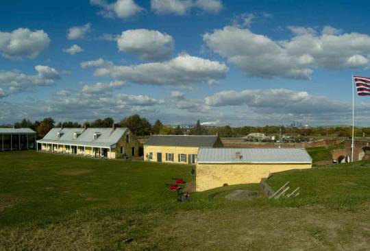
Aries: Fort Mifflin, Philadelphia PA- Built by the British in 1771 to protect the city of Philadelphia, it was in American hands during the Revolutionary War. In 1777, the British basically destroyed their own handiwork as they blasted cannonballs though the fort walls, an estimated 1000 rounds every 20 minutes. About 250 men were killed at the fort. However, the fort never surrendered. It was rebuilt 20 years after the war and served as a garrison during the War of 1812 and a prison during the Civil War. Nowadays, it is used as a site for war reenactments. There is supposedly a ghost who resides on the second floor on the fort, known as the lamplighter. This is the spirit of the man who would light the oil lamps every evening. People who claim to see him describe him as a pale and barely discernible figure carrying an oil lamp. There is also the spirit of a woman known as “The Screaming Woman”, who is often heard in the Officer’s Quarters. Heard countless times with such volume, the Philadelphia police have even been called out on numerous occasions only to find no woman on the grounds. Many believe the woman is screaming at the loss of her husband during the war. The woman is often identified as Elizabeth Pratt. In Casement 5, there have been reports of seeing a faceless man. One of the stranger encounters people have had is an entity known as the “tour guide”, who while dressed in period clothing, has been mistaken for an actual tour guide. This spirit supposedly has given tours to unsuspecting guests when no actual guides had been scheduled to be present. In addition to these apparitions, there have been accounts of people smelling burning wood and bread baking as well as hearing disembodied voices and feeling like they are being pushed or touched.
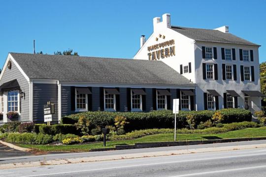
Taurus: Black Powder Tavern, Wayne PA- This historic inn was founded in 1746 and served as a respite for stagecoach travelers heading westward as well as a rendezvous point for some famous American leaders such as Marquis de Lafayette and even George Washington himself. It is believed that during the infamous winter of 1777, military figure Friedrich Von Steuben used the tavern to hide secret stashes of gunpowder (black powder) for army messengers. Throughout the Revolutionary War, it provided soldiers with food, shelter and cheer. Today, the building still stands as a functioning restaurant and houses many unknown spirits- perhaps soldiers who died and found comfort in the place they felt safe and happy. Some are believed to be the spirits of those who died in the Duffy’s Cut massacre in 1832. Duffy’s Cut is a stretch of railroad tracks that run near the tavern where the bodies of 57 Irish immigrant railroad workers were found. Many died due to a cholera outbreak however forensic evidence shows that some may have been murdered due to fear of the cholera spreading. Both customers and workers alike claim to hear disembodied footsteps as well as seeing unexplained flashes of light and feeling sudden cold spots. There is a ghost of an innkeeper named Mary from the Victorian era who sometimes messes up newly set tables as well as the ghost of a teenage girl and her cat who have been seen at the top of the stairs and is known to haunt the second floor. Workers claim they cannot leave running clocks upstairs because she drains the batteries and often times she will leave pennies lying around even after the workers claim they had just cleaned the area. One woman even claims that she heard someone run down the stairs after closing, and thinking it was her coworker, thought nothing of it- however she later found out her coworker had left 20 minutes earlier and she was the last person in the building.
Gemini: Woodfield Manor, Cresco PA- This building, founded in 1808 and located in the Pocono Mountains, was originally an exclusive hunting club and a stage stop for the wealthy. It was expanded into a resort under new ownership in the 1950s, with a swimming pool and tennis courts being added. Although this may seem like a romantic and relaxing getaway resort, for decades guests and employees alike have experienced strange happenings inside the hotel. Many claim there is a spirit of a woman who haunts to building. Employees have said they have seen an apparition of her in the reception hall. One specific worker says that he believes the woman is the previous owner as he had seen an old photograph of her and was shocked to find out that woman he had seen in the reception hall had the same face as the woman in the photograph. The spirit, however, is a benevolent one. She is actually known to be helpful. One employee claims that when she went to a room to put up curtains, she realized she didn’t have any. However, she felt drawn to room 27, and when she got there, there were curtains laying out on top of the bed ready for use. However, not all of the spirits are friendly. One of the first owners of the building was a woman who drowned her two children in the bathtub. Room 13 is supposedly the most haunted room, where objects will suddenly move or shift, electronic devices malfunction and the sound of running water can be heard when the room is unoccupied.

Cancer: Farnsworth House Inn, Gettysburg PA- Although the exact date is unclear, this building is thought to be built around 1810. During the Civil War, it was used as a makeshift hospital as well as a resting place for Confederate soldiers. During the war, the building was caught in crossfire and the walls still contain about 135 bullet holes. Today, although the inn is still functional as a bed and breakfast, there is a room called the Garrett which is closed off to visitors as it is supposedly too spiritually active. The room was apparently a post for three Confederate sharpshooters during the war and one was shot and killed there. There are claims that the bathroom can sometimes be found full of blood splatters. The lock on the door is known to rattle on its own. Another room upstairs holds a spirit of a man who is constantly is sobbing uncontrollably and can be seen wandering the halls as he holds a child wrapped in a blanket. The cellar is known to hold an apparition of a soldier trying to help a wounded comrade walk. Sometimes a soft singing voice can be heard from the cellar, as well. Other rooms contain strange occurrences as well, such as the McFarland Room which guests claim to contain unusually heavy breathing in their ear. The Schultz Room is known to have a spirit of a nurse who tries to tuck you in at night as well as a spirit of a young boy named Jeremy. The room also supposedly sometimes smells strongly of cigars. There are many online reviews of former guests who claim to have felt being touched during the night and multiple even say they’ve captured reflections of apparitions of the nurse from the Schultz Room after taking a photo. Some skeptics say their beliefs have really been challenged after staying at the Farnsworth house Inn.

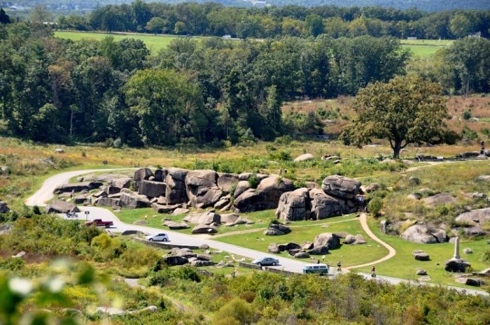
Leo: Devil’s Den on Gettysburg Battlefield, Gettysburg PA- The Battle of Gettysburg in 1863 began July 1st and ended on July 3rd. After it was over, approximately 45,515 people were either dead, wounded or missing. The second day of fighting was the bloodiest. It is estimated that during the battle, casualties came at a rate of about 1 per second. One of the areas on the battlefield, nicknamed Devil’s Den, was a ridge with large boulders strewn about. Throughout the 19th century, many people believed that in the crevices of the rocks lived a 15 foot long snake. The snake became known as “The Devil”, and thus the area became known as ”Devil’s Den”. On the second day of battle, approximately 3,235 people were killed or wounded there. The valley surrounding Devil’s Den then became known as the Valley of Death and a creek that ran near Devil’s Den became known as Bloody Run because the creek literally ran red with blood. On July 4th, the heavy rain caused the creek to flood and drowned wounded soldiers who were left behind. Today, Devil’s Den is known as being one of the most active paranormal hotspots in Gettysburg. A frequent sighting in the area is that of a disheveled man. He’s said to be wearing shabby clothing, a floppy hat and also be barefoot. He will walk up to people and say “What you’re looking for is over there,” and he’ll point to Plum Run (Bloody Run). He then promptly disappears, leaving those who have encountered him completely bewildered. People have nicknamed him the “Helpful Hippy”. Another encounter with the spirits of dead soldiers occurred in 1939 and even made its way into the Harrisburg Telegraph newspaper. Someone reported seeing two men walking along the side of the road and they appeared to be injured. The person stopped their car to see if they needed help and noticed that they were carrying rifles and were dressed in stained and bloody old-fashioned military uniforms. The men told the driver that their friend was propped up on a nearby tree and needed help. He walked with the men to the tree and saw a man with a bloody wound to the chest. He told them he’d drive to the nearest gas station and get help. When he got to the gas station, the attendant said don’t bother going back to help; they won’t be there; they are the restless dead of Gettysburg. Apparently this person wasn’t the first who had experienced this strange encounter.
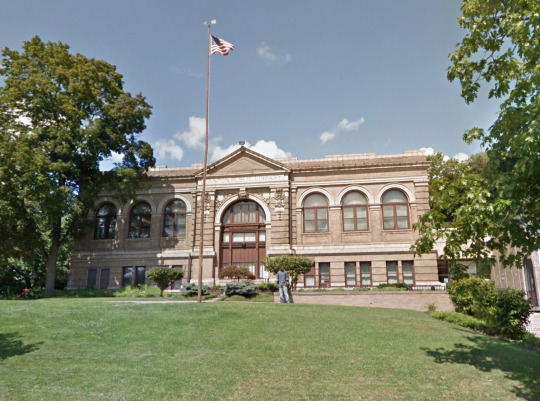
Virgo: Easton Area Public Library, Easton PA- This library was constructed in 1903. When construction started at the site, it was discovered that the thickly wooded and overgrown area they were building upon was actually an old german reformed cemetery with 514 graves. In order for construction to continue, they had to move the graves- and while many family members were able to claim the corpses, about 30 remained unclaimed. The remains of the 30 unknown bodies were unceremoniously dumped into a large cement vault which basically became a large unmarked mass grave. As additions were added onto the library, the mass grave was paved over in order to create the parking lot. Even today, you can see an indentation in the pavement which shows where the grave lies. A prominent figure however had her grave moved to a more respectable plot on the grounds. Elizabeth Bell Morgan, known as “Mammy” Morgan, was a Quaker from Philadelphia who married a physician who also specialized in law. After her husband’s death, she inherited his law books and many would travel to her for legal advice until her own death in 1839. For decades, workers claim to see her wandering the library grounds. The second floor is supposedly the most haunted where filing cabinets can be heard violently rattling as well as doors slamming in the early morning as employees enter to open for the day. Workers also claim that sometimes while stacking books, they feel someone touching and playing with their hair. One even claims she witnessed a doorknob turn and open right in front of her yet no one else was in the room. However, none of them say they feel threatened by the supposed ghosts, despite the spirits having a reason to be angry as their remains were disturbed and highly disrespected.
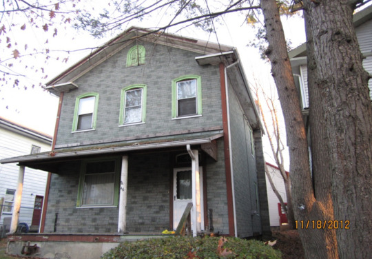
Libra: Welles House, Wilkes Barre PA- Built by industrialist Augustus Laning in 1846, this house has seen plenty of death throughout the years. During the time Laning was still the owner, the street the house resided on had a number of odd deaths occur. After building the house, tragedy began to strike Laning. His factories burned to the ground in 1850 and his nephew was killed after a lightning bolt hit the barn he was in. He perished as he was trapped under the carcass of a horse who had been killed in the fire. There was also a report of a man dropping dead in front of the house in the 1850s. From the late 19th century to the mid 20th century, the house had been the location of 2 suicides and 4 other deaths. Over its 160 year history, the house had been rented out over 50 times. For years it was believed to be haunted, however locals didn’t think so until the 1970s when the Bennetts moved in and their reports were brought to light. The family reported there being unexplained bangs and scurrying noises from one end of the house to the other as well as unexplained sudden illnesses and depression. They claimed they would sometimes see the apparition of a well-dressed man and a young girl walking through the doorway and then vanishing. The attic seemed to house an entity that would shriek, moan and cry. They also claimed they would sometimes get scratch marks and they could sometimes hear the sound of heavy footsteps, as if someone wearing heavy boots were walking up and down the upstairs hallway when everyone was downstairs. The house is believed to be the site of a demonic presence.
Scorpio: Carbon County Jail, Jim Thorpe PA- This two-story, fortress-like jail was built in 1869 and was in use up until 1994. This building is home to one of the most famous ghost stories in Pennsylvania. In 1877, a day known as “Black Thursday”, ten men were hanged because they were suspected of being “Molly Maguires”- a 19th century Irish secret society which fought for better treatment and working conditions for Irish immigrant coal miners. Many Irish coal miners had been working in the area and due to the poor conditions, many died from black lung. One of these men, Alexander Campbell, was executed, however he always proclaimed his innocence. Before he was led to the gallows, he left a dirty handprint on his cell (Cell 17) and said it would always remain there as a sign of his innocence- and remain it did. His handprint is still there to this day and people from all over visit the jail to see it for themselves. Despite many attempts to remove it, including trying to wash it off, paint over it, and even build an entirely new wall, the handprint always comes back. A former inmate, Walter “Mountain Main” Rodriguez, was placed in cell 17 by himself after his arrest in connection for the murder of a teenage girl. The inmate had supposedly begged to be moved to different cell out of fear. People who have visited the jail report having their hair being touched and feeling hands on their shoulders.


Sagittarius: Hill View Manor, New Castle PA- Built in 1925, Hill View Manor was originally known as The Lawrence County Home for the Aged, which housed the mentally ill, the poverty-stricken, orphaned children and the elderly whose families had abandoned them. It was practically a dumping ground for society’s outcasts. The heads of the institution, the Snyders, were accused of incompetence at the home in 1944 and resigned. Under new management, in the late 1960s, the building went under renovations and was converted into a skilled nursing facility. However, by 1970 the building was facing severe overcrowding issues. It finally closed in 2004 due to financial problems. Throughout the years that it housed people, many of the inmates died within the walls, most likely due to poor treatment and living conditions, yet some under questionable circumstances. There have also been numerous suicides that occurred on the grounds. There are numerous reports of shadow people being seen peeking around corners. Many claim they have also encountered full-bodied apparitions, flickering lights, mysterious screams and bangs, slamming doors and disembodied voices. In the chapel, an apparition of a doctor dressed in white has been reported. The pedals on the organ there supposedly move on their own and can be heard squeaking as if someone is pressing down on them. On the second floor, there is a stairwell by the women’s cafeteria where an inmate by the name of Angel hung himself. There are reports of extremely cold spots as well as the sound of something dragging across the floor. There are many other rooms in the building said to be haunted, such as Joe Miller’s Room, where people say cigar smoke can often be smelled and a shadow person can be seen. There is also John Robinson’s Room, where an inmate jumped out of the window and died. Loud banging can be heard from this room, some believing it is the sound of the window flying open or shut. There is also an old boiler room which is said to be haunted by a man named Eli Sorry, who became inebriated and passed out. Other inmates dragged him into the boiler room and shoved him under the stairs where he later died from either intoxication or exposure. Some claim they hear moaning and coughing in this area as well as feeling suddenly cold. Flashlights also apparently turn on and off in this area. These are just a few accounts of hauntings within the building. The structure currently sits abandoned at the top of a grassy hill above highway 65.

Capricorn: Moravian College, Bethlehem PA- Moravian College was founded in 1742 and is the sixth oldest college in the United States. Before being known as the liberal-arts college that it is today, it’s gone through its periods of transitions. There is a building on campus called the Brethren’s House, which currently serves as the music and art building, however it was converted into a hospital during the Revolutionary War and supposedly has its fair share of ghostly residents. One encounter happened in 2016 where a girl took her boyfriend (a non-believer of the supernatural) to Brethren’s House to do some ghost hunting. She did not expect much to happen and figured he would stay skeptical. After exploring the second floor with not much luck, they decided to head back down to the first floor. As they headed down the first floor hallway, they both heard an extremely loud rumbling noise coming from above them; so loud that they couldn’t hear each other speak. She claims it sounded as if 50 people were running up and down the upstairs hallway. They both ran out the door into the Main Hall. After confiding in a friend about the experience, she told her that she had the same experience and so had others. The sound was known on campus as the nurses from the Revolutionary War desperately running up and down the hallways with gurneys. Another haunted building on campus is Comenius Hall, where a nurse is said to haunt it and is aggressive towards anyone who is on her territory. There are often technological malfunctions and unexplained scratching and banging can frequently be heard. One incident happened during a Halloween haunted tour where a worker was in the basement to turn off the lights for a group that was coming up. He made three attempts to turn off the lights however they kept flipping back on. He gave up and headed back upstairs. As the tour guide led the party towards the basement, a guide dog within the group started signaling danger and seemed to be desperately trying to keep its owner from going forward. Although there was no visible danger, it simply refused to enter the basement. Afterwards however, no one on the tour claimed to notice anything suspicious. These are just two examples of paranormal experiences that have happened on campus. There are other buildings known to be haunted, one called Rau Dormitory, where 3 people hung themselves in the 1960s. The music building, a sorority as well as a couple other dormitories are known to be haunted as well. Endless amounts of detailed paranormal experiences from students and visitors alike can be found online. There is no doubt that there is something more to Moravian College than meets the eye.

Aquarius: Mishler Theatre, Altoona PA- This theatre was built in 1906 and was named after its owner, Isaac Charles Mishler. Not even a year later, the neighboring building caught fire which quickly spread to the theatre and destroyed the interior. It was rebuilt and reopened in 1907. Over the past few decades, it has gained attention due to the supposed hauntings. Many claim they have seen the ghost of the late Isaac Mishler wandering the building as well as walking through a wall where the door to his office used to be, all while leaving a trail of cigar smoke. Some claim you can sometimes see a trail of smoke rising up from one of the seats in the audience even whole no one else is in the theatre. One specific testimony comes from a now 12 year old girl, whose encounter happened when she was only 2 years old. Her mother used to work at the theatre and would sometimes bring her along to work. She recalls sharing fun times with a man in “funny hats” while her mother set up lights and sound equipment. She said sometimes he would show up in a floppy hat and other times a tall black hat. He would talk to her about his love of theatre and they’d go for walks around the set. When she described what the man had looked like, the description matched Isaac Mishler. Perhaps his love for theatre was so strong that he decided to stay, even after death. Two other supposed spirits are that of a woman who haunts the restroom and a dog who can be heard howling throughout the day and night.
Pisces: Providence Quaker Cemetery and Chapel, Perryopolis PA- Dating back to 1789, this cemetery was founded by Quaker pioneers and today is known to be associated with strange occurrences and curses. It was once a spot used to execute those believed to be witches as well as a place to practice black magic. Dark spirits are now said to haunt the grounds as a result. In the center of the cemetery is a small stone church where a spirit is said to reside. People who have entered report feeling extremely cold, hearing disembodied footsteps and getting a heavy feeling in their chest when they are inside. The cemetery also has its share of spirits. There are two unknown entities who haunt the yard and will push people down if they dare disrespect the graves. One of the gravestones in the cemetery supposedly holds a curse. The gravestone is that of Ella Mae Lynch, whose inscription reads “Remember youth as you go by, as you are now, so once was I, as I am now, so you shall be, beware for death and follow me.” Many believe the inscription indicates that reading it curses you to die in the same manner as Lynch herself. In 1980, a man reported driving past the cemetery and having his car chased by a large black dog. However, once he passed the grounds the dog had completely vanished.

New Jersey
(Let me know what state I should research next...)
#the signs#signs as#the signs as#zodiac#zodiac signs#pennsylvania#haunted pennsylania#ghosts#halloween#ghost stories#paranormal#scary#aries#taurus#gemini#cancer#leo#virgo#libra#scorpio#sagittarius#capricorn#aquarius#pisces#horoscopes#horoscope#astrology#the stars#scared-aquarius#mine
96 notes
·
View notes
Text
San Francisco Trails for Walking
If you're searching for a walk in San Francisco, there are several options around The Presidio. First, you may climb one of the paths or stroll along the Presidio Promenade. Next, try the Batteries to Bluffs trek for a lengthier hike. For one and a half miles, it curves around the cliffs. The Presidio Promenade and Battery East trails are connected to this one. Along the shoreline, there are other pathways, including the Ecology Trail. You may also go to Inspiration Point or Andy Goldsworthy's Woodline sculpture.
A network of 340 miles of trails spans the mountain ridges in the Bay Area, including the Presidio Bay Area Ridge Trail. It starts at the Arguello Gate, and the 2.5-mile section circles the Presidio Golf Course. Before joining the San Juan Bautista National Historic Trail, which continues north to the Golden Gate Bridge, it passes three beautiful viewpoints.
The path combines elements of nature, history, and art. The National Cemetery Overlook, an ex-army observation post, is one of its main draws. The Rob Hill Campground, San Francisco's only overnight campground, is also a part of it. Additionally, it is the location of Andy Goldsworthy's "Spire," a 100-foot artwork constructed of cypress trees. For those who enjoy the outdoors, the route also runs through cypress and eucalyptus trees.
The Presidio Bay Area Ridge Trail is a great place to stroll, ride or trek since it has many beautiful vistas. It leads you through three picturesque vistas, a forest in the Presidio, and important historical sites. The sculpture Spire by Andy Goldsworthy, made from chopped Monterey cypress logs, is also included. Along the way, you'll see Rob Hill Campground, a four-acre campground constructed at Presidio's highest point.
The 0.7-mile Battery to Cliffs Trail offers excellent views of the ocean and bluffs below. Given the range of activities available for all ages, this stroll may be especially entertaining for families with young children. The walkway provides a chance to see the San Francisco skyline as well.
Batteries to Bluffs Trail: The Presidio's Batteries to Bluffs Trail hugs the area's western waterfront and is a lovely, quick walk. On a high note, the trail begins at Lincoln Boulevard and continues along the seashore. Views of the Golden Gate Bridge, cliffs, and the Pacific Ocean may be seen from this walk.
Battery to Bluffs Trail: The Battery to Bluffs Trail meanders through former military defensive facilities and along coastal slopes. It comes to an amazing beachfront with a magnificent view of the Golden Gate Bridge. Since it is a sandy path solely accessible to hikers, the trail is less congested than others. However, hikers must be cautious and mindful of any nearby dangerous fall.
In San Francisco, the Lobos Creek Valley Trail is a fantastic choice if you want to go on a nature trek. The Lobos Valley Overlook is close to the conclusion of this 0.8-mile circle, which starts close to El Camino Del Mar. It offers primarily natural views with a few city and house developments.
Near the southwest corner of the Presidio, the walk meanders across dunes that have been repaired. To understand more about the past, present, and future of the region, it also provides an interpretative tour. The region once supported a variety of habitats, including dunes and Lobos Creek, before the Presidio was built. Unfortunately, this natural ecosystem was significantly damaged by years of military use.
The boardwalk that the Lobos Creek Valley Trail begins on ends in a multi-use asphalt walkway. The Anza Trail and Wedemeyer Street are parallel at the Lobos Valley Trail's terminus. You may stroll to the overlook to get a beautiful view of the valley. The Park Presidio Greenway, which starts at the southwest corner of Lake and Funston streets and finishes at Park Presidio Blvd., is another choice for a beautiful stroll around the Presidio.
Three streams converge at Lovers' Lane Bridge to form the Tennessee Hollow Watershed Walks on the Presidio walking route. Seasonal freshwater marshes and a significant riparian corridor may be found in the watershed. Near the eastern edge of the Presidio, the stream empties into the Crissy Marsh. The route has public art, endangered flora, and a walking path. This route highlights Presidio's worth and beauty.
The 1.5-mile Tennessee Hollow Watershed Walks meanders across a watershed that covers 270 acres. The watershed is home to many ecosystems, including urban neighborhoods, groves of trees, and sports grounds. It is being revitalized and is home to numerous historical artifacts.
A special chance to discover the park's natural treasures and discover more about water flows is provided through the Tennessee Hollow Watershed Walks. The watershed is a large, intricate ecosystem that directs snowmelt and rainwater to several outflow sites. Over a third of South America is drained by the Amazon River, its greatest watershed. The Tennessee Hollow Watershed Walks on the Presidio route is a mile-long moderate walk with some hilly portions. As a result, there may be some rough spots on the unpaved landscape.
0 notes
Photo

July 3 It’s time for the last grand events! Our day starts with the Union boys on Culps hill regaining their footing and pushing back the Confederates in the early hours. East of town JEB Stuart finally goes into action against DM Gregg’s forces including one very fashionable individual in George Custer. Now if only JEB had succeeded. - Back at the center the Confederate artillery begins a barrage of the Federal lines on Cemetery Ridge. After some time the Congrderates of Pickett, Pettigrew, and Trimble (and some under Anderson and Rodes who don’t really do a whole lot) make their way across the mile long open ground towards the Union center. Holding that line is mr The Superb himself Winfield Scott Hancock. As the fight begins to close in Hancock was pressed to get off his horse and present less of a target. His reply? “There are times when a corps commanders life doesn’t count”. He is then subsequently wounded. The confederate s reach the line but are quickly thrown back. - The last bit of fighting occurs further south on the extreme left of the Union line. General Judson Kill Caval…sorry…Kilpatrick sends two brigades under the newly promoted brigadiers Wesley Merrit and Elon Farnsworth out against the Confederate right. While Merrits front is quite calm, Farnsworth is ordered out on a charge over HORRIBLE ground. The attempt is met with heavy resistance both by lead and rock and leads to the gallant brigadier becoming another high ranking casualty. Big oops there Judson Ol boy. - This the battle of Gettysburg comes to a close. While the campaign is not completed, the fighting around the small town has calmed. Now the work picks up for the medical staff as Lees ambulances carry the wounded away, the wounded Union are brought together. Though the fight is done we cannot forget those roughly 7,000 men whose flames were extinguished as a result of the hard fighting. May we remember them so their story never fades. - (at Gettysburg National Military Park) https://www.instagram.com/p/CfkC46MugY2/?igshid=NGJjMDIxMWI=
0 notes
Text
2017 best picture nominee aesthetics ; repost, don’t reblog. Bold whatever applies to your muse. Tag someone , feel free to add to the categories if you wish .
Tagged by: @suzumesoul Tagging: ¯\_(ツ)_/¯
Arrival
blurry memories. helicopters flying overhead. fog pouring over mountains. ominous feelings. stuttering voices. dark, cavernous chambers. protective suits. hazy skies. smooth and mysterious rock. in a relationship with death. defied gravity. a chirping bird in a cage. white, bleak emptiness. the soft hands of a child. a barrier between them and you. moaning voices of unknown creatures. odd languages. tentacles. flat landscapes. ink. the circle of time. silhouettes. a window overlooking a body of water. strange perceptions of time. moving from shadows to light. possible threats. the laugh of a child. déjà vu. government secrets. conversations without speaking. military uniforms. sickness. confessions. a lover friend once there and now gone. strange dreams. paranoia. disturbing the peace.
Fences
strained relations. exercising power. laundry hanging on the line. providing. tears streaming down hurt cheeks. masculinity. family. claustrophobic houses. youth and inexperience. the hollow sound when a baseball hits a bat. football jerseys. framed photos of relatives. throwing punches. second chances. muted colors. prison. unacknowledged sacrifices. post-war. streets framed by rusted metal. sitting on steps. sticking your fingers through the holes of a fence. cross necklaces. unflinchingly hard circumstances. railroad tracks. pride being suffocated by self-pity. being rooted in the same place for years. building a dream. maternal abandonment. pecking someone goodbye. bad timing. losing a dream. long-standing marriage. knitting. covering your ears with a pillow. infidelity. brick walls.
Hacksaw Ridge
bullets whizzing past your ears. dust. bodies littering the dirt. helmets. scraped up faces. hospitals. obligations. pacifism. taking someone in your arms. a photo tucked away in a bible. warfare. a cemetery full of plain white tombstones. smoke. saving lives. rough terrain. a rifle set aside. enemies. allies. underground tunnels. perseverance. water and blood streaming down one’s face. being the odd one out. staying true to what you believe. the smell of gunpowder. people crying out for mercy. spiritual transcendence. someone waiting. a cliff leading to nowhere. fire and brimstone. no man’s land. barbed wire. trust. white rock. faceless danger. carrying somebody on your back. heroes.
Hell or High Water
sleepy towns. a windmill turning. pickup trucks. the cocking of a gun. cowboy hats. summer heat. doing things for family. robberies. stand-offs. locking eyes with somebody in a bar. dirt roads leading to nothingness. masked faces. badlands. justice. crosses painted on the sides of buildings. the west. dust bowls. the badge pinned to a cop’s shirt. hot tempers. burying past mistakes. guns on belts. slow drawls. shattered glass. piles of money. browns and beiges. gambling. hot and sprawling landscapes. a lack of moral salvation. tattoos hidden by sleeves. blinding sun. getting away. getting caught. generations of poverty. thunderstorms on the horizon. loose-fitting shirts. farms. not knowing if you’re going to heaven or hell or somewhere else.
Hidden Figures
junky cars. close friendships. vintage lamps. pursuing the impossible. rocket ships. satellites. running in heels. computers. chalk drawn on a whiteboard. mathematics. pulling up after being pushed down. kodachrome. files being slammed on desks. standing out among the rest. dark computing rooms. pencils moving on paper at high speeds. warm homes. being depended on. getting ahead and having the finish line moved. space age. meetings full of suits and ties. crowbars. grainy footage. crowds of women. black and white televisions. counting numbers. no windows. astronauts. a little girl walking through the trees. sepia. breaking boundaries. long hallways. watching through glass. making history.
La La Land
auditions gone wrong. neon streets. highways jammed with cars. vivid colors. piano keys. spotlights. dreaming of goals. christmas jingles. romances that sweep you off your feet. dancing. telescopes. old hollywood movies. lighthouses. parties. movie sets. jazz music. galaxies upon galaxies. fights over dinner. purple skies. blue skies. car radios blaring from vehicles. murals on the walls. arms spread wide. candy-colored fantasies. nostalgia. standing on a stage all alone. brightly colored clothes. lingering eye contact. theater seats. the seasons flying by. singing your heart out. elegance. losing love. jumping into a swimming pool. lamps lighting up dark streets. film burning out on the screen. coffee shops. kisses where the world ends. fireworks.
Lion
gut feelings you can’t shake. yellow butterflies. walking alongside the tracks of a train. a child running around freely. dangerous alleyways. elegant pinks. a family who you haven’t seen in a long time. falling apart. being lost. bright green grass by an ocean. foreign landscapes. looking for answers. being locked in a room. searching the internet. maps. crowds of unrecognizable people. noisy traffic. holding hands. catching a stray leaf floating in the wind. being chased down dark streets. no one understanding. rainbows appearing in the rain. dust-colored browns. trash dumps. florescent figures in a home. letting go. banks of a river. thumbtacks. home. rare but bright colors. standing in water. the train departing. the roughness of eroding brick. fruits. finding a way back.
Manchester by the Sea
boats on clear water. regret. shoveling snow. driving without a clear destination. florescent lights in a hospital. orphans. tears clinging to your eyelashes but never falling. aimlessness. hockey. small towns. running into someone from long ago. sidewalks. a house burning to the ground. funerals. dressing for the cold. jarring human memories. pointless conversations with some meaning. teenagers. empty pizza boxes. life going on. having people over. haunting beauty. bands playing bad music. trauma. bar fights. fishing nets. seagulls. depression. dreams you don’t know aren’t real. confronting the past. grief. tough love. unopened boxes. annoying relatives. depending on someone else to get by. punching glass and shattering it.
Moonlight.
violins. dusk. visiting an old friend. repressed emotions. searching for an identity. bullying. well-lit diners. running away. rich skin tones. alienation. the moon over glistening seas. burgeoning sexuality. darkness making your skin look blue. keeping your head above water. glints of light. dream-like senses of reality. flashy cars. pink hallways. screaming but there’s only silence. crystalline blues. avoiding home. bath tubs. palm trees. being scolded. dreams. moist skin. hotboxing. sun-drenched neighborhoods. struggling with addiction. first kisses. songs coming on the jukebox. reflections in the mirror. high contrast. hands digging in the sand. forgiveness. bright mid-daylight. blowing smoke. true love.
#[ MEME ]#[ AESTHETIC ]#I just checked this blog's drafts and this thing was completed but never posted what the fuck#I guess I never saw it under my 500 drafts but ???????
2 notes
·
View notes
Text
Lexington: VMI, W&L, and more
After traveling from our college campus on a winding road for about an hour through the Blue Ridge Mountains, we reached the historic town of Lexington, Virginia. Home to two notable institutions of higher learning that continue to contemplate their ties to famous Confederate Generals, Robert E. Lee and Stonewall Jackson, we knew that a stop in this tiny place was an essential stop during our travels. With the varying opinions in the public of what to do with this history, Lexington is ripe with ongoing discussions, and we sought to make a stop at each current site of controversy or recent action.
We were lucky enough to get a decent parking spot that was close to the modest home of General Thomas “Stonewall” Jackson and Mary Anna Jackson, his second wife. Tickets to see the site were at an affordable price in the gift shop, and we quickly meandered through the small exhibition just beyond the cashier. We learned various facts about Jackson’s life, his legacy, and also that the building housed a hospital from 1907 to 1954 before turning into a museum. Artifacts and displays did not romanticize the life of Jackson, but we were not starstruck by any means. However, when we began the self-guided tour of the home, the first stop was the kitchen and slave quarters in the basement. Right away, we were provided grounds for comparison to the lived experiences of slaves and those of the Jacksons upstairs. Though we were following along okay with tour videos provided on the museum website, we met a historical interpreter named Brian who had been working at the museum for decades. We found out through Brian that the staff had been sharing the enslaved narratives since the house became a museum. Though the Jackson family did not own as many slaves as other rich families in the Antebellum South, we felt some sense of relief that the presence of the enslaved was a permanent element of any visit to the home. We passed through the upstairs dining room, the bedroom, a study, and a sitting room, while also learning about the short-lived marriage between Stonewall and his first wife, Elinor Jackson. The marriage only lasted such a short time because she died in childbirth. Two years before the end of the Civil War in July of 1863, Stonewall was mortally wounded accidentally by one of his men. He never returned to his home in Lexington after leading a brigade out of the nearby Virginia Military Institute, where he had taught for a brief time. By 1865, the Union won the war, and Mrs. Jackson had to free the family’s enslaved workers. David informed us that Mrs. Jackson was dumbfounded in finding out that an enslaved woman was dissatisfied with her family being in bondage. Mary Anna said something along the lines of “We had been through everything together.” Though Stonewall did not speak vehemently in favor of the peculiar institution of enslavement of human beings, he did believe in his Christian faith not giving him any moral right to question its existence. This was probably the most important detail that we learned from David during our visit, and we believe it is grounds for serious discussions of revisions in how Stonewall Jackson is remembered throughout the South, especially in Virginia. While he is a hero to some, he is reviled by others.
On our way to Oak Grove Cemetery, formerly Stonewall Jackson Memorial Cemetery, we saw a few historic churches, a veterans memorial, and historic signs by the Righteous and Rascals of Rockbridge. The best part of our walk however, was my (Tomi’s) trip into the Rockbridge Republicans headquarters. I walked into the headquarters to see a small area, no bigger than 16x12 feet. Two women were in the small room, one at a desk and the other right across from her. It was somewhat dark, filled with signs for Glenn Youngkin, old Trump signs, and other Republican names known to those in Virginia. The sign that caught my eye first was “Retain the Name” in reference to Washington and Lee’s possible name change. I walked in and asked the two women what the organization did in Lexington and that I was a student doing research from Randolph College. The response I got was much more elaborate than I could have asked for. The woman at the desk began to speak, but was cut off by the other. She told me they were trying to defend history. “They were like midnight riders when they came by and took down all the Confederate flags on the bridge”, “They (50 Ways Rockbridge) want to erase all of our history”, “There was no vote to change the name of the cemetery! (Oak Grove) The city just did it!” “The Generals Redoubt is an organization we align with about keeping Washington and Lee’s name the same.” All the things she was saying came from the simple question that I posed. All I could do was smile and nod with the bombardment of information. Her passion for the preservation of the Confederate flags on city bridges, supporting Generals Redoubt, and wishing the cemetery still kept it’s old name are all valid beliefs she is entitled to have. However, the misinformation she believed and was spreading is not. When she said that the city had removed the flags and Stonewall’s name from the cemetery without a vote, I knew that this was not true. According to the Richmond Times-Dispatch, Lexington’s city council voted and made the decision in 2011 to remove the Confederate flags from city poles and in 2020 about the name change for Oak Grove. Nothing good can ever come from the spread of misinformation. I spoke with the other woman, who agreed with the beliefs of her colleague, but did not express them in the same way. She mainly expressed that she wanted to keep the history in Lexington alive. She informed me that she was born in the Stonewall Jackson Hospital in its last year, so she didn’t want to see such an important place to go away. Thankfully, I could enlighten her from our previous visit to the home, they preserved that history and Stonewall Jackson’s as well. In this conversation, I learned from these women how easy it is to be uninformed by choice. Nothing is wrong with being a Republican. Nothing is wrong with having these views. We are all entitled to our opinions as this is America. There is something very wrong with spreading and believing information that is incorrect.
In the last paragraph, 50 Ways Rockbridge was mentioned. This is an organization with “a group of concerned citizens from Rockbridge County, Virginia, working together to research, educate, and act on major issues that affect all of the 50 United States, especially Virginia and our local area. Our guiding political principles are inclusion and fairness.” This organization has worked to help the community with resources like PPE during COVID-19. They have a political agenda and have worked hard to create a more inclusive environment in Lexington. They are on the complete opposite side of the spectrum of the Rockbridge Republicans. It was very interesting to see one group condemning the other. We hope to chat with some of the board members of 50 Ways to see their dynamic in this small town.
Our visit to Oak Grove Cemetery, formerly known as Stonewall Jackson Cemetery, required us to make a short walk in the sweltering Summer heat of Central Virginia. When we reached the cemetery, we were quickly able to find the gravesite of the man whose home we had just visited. There were some strong storms the night before, so a few workers were clearing some downed trees around the tall memorial dedicated to Jackson. Though it was very loud and hard to take in the memorial as intended, we did not find much wrong with the statue or the pedestal. Sure, it was extravagant and grand in size compared to the other gravesites, but there was no troubling Lost Cause language that had bothered us in places like Monument Avenue in Richmond. Perhaps this is because the infamous United Daughters of the Confederacy or Sons of the Confederacy did not have much to do with its placement. Whatever the case may be, we do not feel that this statue has to come down. If a tourist wants to visit Jackson’s grave and leave a lemon (a tradition because he ate one before every battle), they are free to do so. If they do not want to seek it out, they do not have to. A memorial of this size at Jackson’s grave is less problematic than one on a busy municipal street. The renaming of the cemetery by the City government seems to be the most appropriate action and the furthest they should go.
Before stopping at the campus of Washington and Lee University, we got a quick bite at a unique Burger and Doughnut restaurant called Pure Eats. Though this is not a food blog, we thought it would be appropriate to highlight one of our favorite lunches of the Summer. It’s a small dive joint that every college town needs, but their burgers were especially fantastic. If there is one thing that Lexingtonians can agree on in their complicated environment, it is the food. After hydrating and freeing our faces from any embarrassing dribbles of ketchup and mayo, we headed up the hill to see VMI’s campus, their museum, and W&L to see the Lee Chapel, which is soon to be renamed.

After lunch we went to the fortress that is Virginia Military Institute. We drove around the circular campus multiple times to find a good parking spot to start off our visit. Finally reaching the museum after a long hike up stairs, we entered the glass doors to find an interesting smell. Sadly, as we found out from the museum clerk, there had been intense rainstorms that had flooded the lower part of the museum. We were only able to look around the first level, which was the history of VMI. Before looking around the museum, we spoke more with the clerk. We were just chatting about the museum when she got very emotional about how Jackson was being treated on campus. “He was a good man. He actually educated his slaves when it wasn’t allowed. I don’t understand why they are treating him this way. Hopefully something good will end up coming from it.” Her sympathies seemed oddly personal, we all wondered if this is a commonality among staff at VMI. We walked through the museum which went through the history of VMI from the beginnings to the present. The school began in 1839 to train young men for the Virginia Militia. As the oldest state-supported military college, it has a lot to be proud of and shows off the institution's many achievements. The museum did not shy away from talking about the more difficult history, but they did not tackle it in its entirety. The two main examples of the museum lacking the full story is about African American cadet, Adam Randolph and the issue of allowing women to attend. In talking about admitting African Americans to the college and Adam Randolph, the plaque stated he “left VMI after his third year to pursue other opportunities.” While this is true, the reason for him leaving was left out. The Richmond Times-Dispatch quoted Randolph for his reasoning to transfer to Hampton University: “I just kind of had it, VMI is a great school- but it’s not for everybody.” The article explained the institution’s ties to the Confederacy with statues and traditions like playing “Dixie” at sporting events “troubled” Randolph’s mind. With women attending the institution, the museum blatantly left out the firm opposition VMI felt to women becoming cadets. As detailed in Women in the Barracks: The VMI Case and Equal Rights, VMI was firmly against women attending the school and fought hard in court to avoid the integration of women on campus. The museum completely left this out. Going through the museum was an absolute must to understand the complex and interesting history of VMI.
On VMI’s campus we explored around to see where General Jackson’s statue once stood, but what caught our eyes most was the building right behind the former statue. “STONEWALL JACKSON” adorned the notorious barracks building named after the former physics professor at the school. As we were told in the Jackson House by a wonderful guide named David, Jackson wasn’t the beloved professor he has come to be known. He was a firm lecturer who struggled with expanding on the topic more than what the texts from books he read. Former students of Jackson felt as if he was very hard and unwilling to let go of his West Point ties to how he was taught. There is nothing wrong with the school honoring former teachers as they do throughout the campus with the naming of buildings. However, we feel as if Jackson has become a mythologized hero. His legacy at VMI is not one that is more important than another professor, but the institute has made it that way. As we see the building named for him, none of us are shocked or moved as this is understandable and a tradition for the college to do for former professors. But, what shocked us most was the blatant erasure of his name below Jackson’s own quote. “You may be whatever you resolve to be- Stonewall Jackson” is what the building used to read. Now, there is only the quote. There is a difference between reinterpretation and erasure of history. Taking down the statue of Jackson that literally put him on a pedestal makes sense. But, removing his name from his own quote is wrong. As with anything, we must give credit where credit is due. Keep his name with his own words or remove the entire quote. There should be no in between.
Though we were not able to get inside the Lee Chapel, we at least wanted to see the building that had been in the news of late. From what we gathered, the chapel will be split into two components - one being space for campus services at the university and the other being the tombs of Robert E. Lee and Mary Custis Lee. The Recumbent Statue by Edward Valentine depicts General Lee asleep on the battlefield. While the building is being returned to its original name of University Chapel, the tomb will remain intact. In doing so, W&L will continue to allow folks in to visit Lee’s tomb, but will not force all students to feel imposed by his presence while worshipping. Just outside in the quad, the statue of Cyrus McCormick and the obelisk for John Robinson have signage that offers honest interpretation for two men with troubling histories. Though McCormick is credited with inventing the mechanical reaper, his family enslaved many. In 1826, “Jockey” John Robinson sold his land to Washington College, now Washington and Lee University. 73 enslaved African-American women, men, and children were enslaved for ten years as a part of this purchase. By placing signs around these statues for historical context, the institution is acknowledging its past for a more just future. While the Board of Trustees decided that Lee will remain in the school’s name just a few weeks ago, going against the wishes of most of its faculty, the school is confronting its past adequately to appear open to increasing diversity and welcomeness for all.
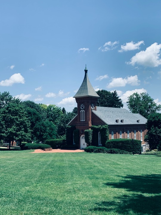
1 note
·
View note