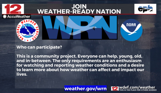
#NOAA Weather Ready Nation
Explore tagged Tumblr posts
Visit Tumblr Blog
Explore Tumblr blogs with no restrictions, modern design and the best experience.
Last Seen Tumblr Blogs


Fun Fact
The KCSC sent more than 20K requests to delete posts related to prostitution and porn to Tumblr from January to June 2017.
Text
"Building a #WeatherReadyNation requires more than government alone. It requires bringing together organizations of all kinds that want to be part of the solution. We must involve everyone in an effort to move people – and society – toward heeding warnings, taking action..."
0 notes
Text
Things the Biden-Harris Administration Did This Week #28
July 19-26 2024
The EPA announced the award of $4.3 billion in Climate Pollution Reduction Grants. The grants support community-driven solutions to fight climate change, and accelerate America’s clean energy transition. The grants will go to 25 projects across 30 states, and one tribal community. When combined the projects will reduce greenhouse gas pollution by as much as 971 million metric tons of CO2, roughly the output of 5 million American homes over 25 years. Major projects include $396 million for Pennsylvania’s Department of Environmental Protection as it tries to curb greenhouse gas emissions from industrial production, and $500 million for transportation and freight decarbonization at the ports of Los Angeles and Long Beach.
The Biden-Harris Administration announced a plan to phase out the federal government's use of single use plastics. The plan calls for the federal government to stop using single use plastics in food service operations, events, and packaging by 2027, and from all federal operations by 2035. The US government is the single largest employer in the country and the world’s largest purchaser of goods and services. Its move away from plastics will redefine the global market.
The White House hosted a summit on super pollutants with the goals of better measuring them and dramatically reducing them. Roughly half of today's climate change is caused by so called super pollutants, methane, hydrofluorocarbons (HFCs), and nitrous oxide (N2O). Public-private partnerships between NOAA and United Airlines, The State Department and NASA, and the non-profit Carbon Mapper Coalition will all help collect important data on these pollutants. While private firms announced with the White House plans that by early next year will reduce overall U.S. industrial emissions of nitrous oxide by over 50% from 2020 numbers. The summit also highlighted the EPA's new rule to reduce methane from oil and gas by 80%.
The EPA announced $325 million in grants for climate justice. The Community Change Grants Program, powered by President Biden's Inflation Reduction Act will ultimately bring $2 billion dollars to disadvantaged communities and help them combat climate change. Some of the projects funded in this first round of grant were: $20 million for Midwest Tribal Energy Resources Association, which will help weatherize and energy efficiency upgrade homes for 35 tribes in Michigan, Minnesota, and Wisconsin, $14 million to install onsite wastewater treatment systems throughout 17 Black Belt counties in Alabama, and $14 million to urban forestry, expanding tree canopy in Philadelphia and Pittsburgh.
The Department of Interior approved 3 new solar projects on public land. The 3 projects, two in Nevada and one in Arizona, once finished could generate enough to power 2 million homes. This comes on top of DoI already having beaten its goal of 25 gigawatts of clean energy projects by the end of 2025, in April 2024. This is all part of President Biden’s goal of creating a carbon pollution-free power sector by 2035.
Treasury Secretary Janet Yellen pledged $667 million to global Pandemic Fund. The fund set up in 2022 seeks to support Pandemic prevention, and readiness in low income nations who can't do it on their own. At the G20 meeting Yellen pushed other nations of the 20 largest economies to double their pledges to the $2 billion dollar fund. Yellen highlighted the importance of the fund by saying "President Biden and I believe that a fully-resourced Pandemic Fund will enable us to better prevent, prepare for, and respond to pandemics – protecting Americans and people around the world from the devastating human and economic costs of infectious disease threats,"
The Departments of the Interior and Commerce today announced a $240 million investment in tribal fisheries in the Pacific Northwest. This is in line with an Executive Order President Biden signed in 2023 during the White House Tribal Nations Summit to mpower Tribal sovereignty and self-determination. An initial $54 million for hatchery maintenance and modernization will be made available for 27 tribes in Alaska, Washington, Oregon, and Idaho. The rest will be invested in longer term fishery projects in the coming years.
The IRS announced that thanks to funding from President Biden's Inflation Reduction Act, it'll be able to digitize much of its operations. This means tax payers will be able to retrieve all their tax related information from one source, including Wage & Income, Account, Record of Account, and Return transcripts, using on-line Individual Online Account.
The IRS also announced that New Jersey will be joining the direct file program in 2025. The direct file program ran as a pilot in 12 states in 2024, allowing tax-payers in those states to file simple tax returns using a free online filing tool directly with the IRS. In 2024 140,000 Americans were able to file this way, they collectively saved $5.6 million in tax preparation fees, claiming $90 million in returns. The average American spends $270 and 13 hours filing their taxes. More than a million people in New Jersey alone will qualify for direct file next year. Oregon opted to join last month. Republicans in Congress lead by Congressmen Adrian Smith of Nebraska and Chuck Edwards of North Carolina have put forward legislation to do away with direct file.
Bonus: American law enforcement arrested co-founder of the Sinaloa Cartel, Ismael "El Mayo" Zambada. El Mayo co-founded the cartel in the 1980s along side Joaquín "El Chapo" Guzmán. Since El Chapo's incarceration in the United States in 2019, El Mayo has been sole head of the Sinaloa Cartel. Authorities also arrested El Chapo's son, Joaquin Guzman Lopez. The Sinaloa Cartel has been a major player in the cross border drug trade, and has often used extreme violence to further their aims.
#Joe Biden#Thanks Biden#kamala harris#us politics#american politics#politics#climate change#climate crisis#climate action#tribal rights#IRS#taxes#tax reform#El Chapo
772 notes
·
View notes
Text
We are heading into severe weather season in the US soon (and by soon I mean tomorrow) (disclaimer, this is all general advice. pay attention to the official weather sources in your area for alerts and important information. I am not an expert, weather info is just a hobby for me.)
National Oceanic and Atmospheric Administration (NOAA)/National Weather Service (NWS) has (for now anyways) the Storm Prediction Center (SPC) which is a great source of information to stay weather aware.
The SPC puts out Convective Outlooks. These show where thunderstorms and severe weather have the potential to pop up. (With temperatures warming up, the movement of warm air leads to convection in the atmosphere which results in thunderstorms and sometimes severe weather. There is a good blog post going into more detail here)
Specifically, the outlooks are:
Day 1 Outlook (today and early tomorrow morning)
Day 2 Outlook (the next 24 hours following early tomorrow morning)
Day 3 Outlook (the next 24 hours)
Day 4-8 Outlook (the next days, but these are never too certain due to the way the models work)
These outlooks are timestamped with Zulu time aka Coordinated Universal Time (UTC). You can see how that compares to your local timezone here.
Today (3/13/25), the weather outlook is okay, just a slight risk of thunderstorms across the US. However, Friday (3/14/25) and Saturday (3/15/25) both have a widespread risk of severe weather including strong winds and tornadoes.


If you are in any of these colored regions, stay weather aware! Now, this doesn't mean you have to panic, but keep an eye on the weather reports in your area!
I tend to check the SPC in the morning so I know when I have to really be paying attention to the weather for the day/coming days.
Below is more info on the color coding which you can read more about here. (In addition here is a powerpoint from the NWS with more information "12 Things You Need to Know: Severe Weather Outlooks")

Tips on staying weather aware, it's important to have access to several weather sources.
Check the SPC for updates!
Find your closest NWS Forecast Office via zip code on weather.gov
Keep an eye on the local news and local weather reports
Consider getting a weather radio! (info here from NWS) This is good for if you lose power/internet as you can check the automated radio stations near you
Check the radar (I use the radarscope app) but you can check online with websites like radar.weather.gov or wunderground.com
Ryan Hall Y'all is a youtube channel that livestreams during most severe weather outbreaks
More weather info:
Severe Weather 101
How NOAA Satellites Help Us Stay Ahead of Severe Weather Season
How to Use and Interpret Doppler Weather Radar
TropicalTidbits - Info on hurricanes and other tropical weather
NWS - Emergency Supplies Kit Info
Weather Prediction Center - similar to SPC but more generalized
What to do During a Tornado (via NWS):
Stay Weather-Ready: Continue to listen to local news or a NOAA Weather Radio to stay updated about tornado watches and warnings.
At Your House: If you are in a tornado warning, go to your basement, safe room, or an interior room away from windows. Don't forget pets if time allows.
At Your Workplace or School: Follow your tornado drill and proceed to your tornado shelter location quickly and calmly. Stay away from windows and do not go to large open rooms such as cafeterias, gymnasiums, or auditoriums.
Outside: Seek shelter inside a sturdy building immediately if a tornado is approaching. Sheds and storage facilities are not safe. Neither is a mobile home or tent. If you have time, get to a safe building.
In a vehicle: Being in a vehicle during a tornado is not safe. The best course of action is to drive to the closest shelter. If you are unable to make it to a safe shelter, either get down in your car and cover your head, or abandon your car and seek shelter in a low lying area such as a ditch or ravine.
NOAA and NWS are under threat from everything going on right now. (Hundreds of weather forecasters fired in latest wave of DOGE cuts.) They provide vital services and do very important research about our weather and climate. While 5calls.org does not currently have a template centered on NOAA/NWS, they have similar ones that you could reference, modify, and use. (I have modified one below that you might consider using.) (5calls.org also has other very important scripts that you might use for other issues.) Please consider calling your representatives and telling them how important weather information is to everybody and that they should be protecting it, not defunding it. Not only for severe weather, but for climate change research and more.
Hi, my name is [NAME] and I’m a constituent from [CITY, ZIP]. I'm calling to demand that [REP/SEN NAME] oppose any legislation, or efforts by the executive branch to dismantle or abolish the National Weather Service or the National Oceanic and Atmospheric Administration. The recent reduction in staff is unacceptable, and will put Americans' lives and property at risk to severe weather. Reduced warning capabilities will put lives at risk and could potentially make response and recovery more hazardous and more expensive. Thank you for your time and consideration. IF LEAVING VOICEMAIL: Please leave your full street address to ensure your call is tallied.
While this is geared towards the US, a lot of this information can be applied via resources specific to your country. And finally, to quote Ryan Hall, Don't be Scared, Be Prepared.
#weather#severe weather#information#psa#us weather#thunderstorms#noaa#nws#national weather service#i might do a followup specifically about reading radar and how to see rotation etc but with the severe weather in the next couple of days#wanted to do a brief overview#if anyone has better templates to call representatives with pls add them on. im not the best at that kinda phrasing#dont be scared. be prepared#tornadoes#thunder storms
167 notes
·
View notes
Text


DxP REWRITE - Coal Badge
(Please see special note below!)
Part 1 of the Gym Montage, starting off with Oreburgh City & those first few steps through Sinnoh! Emmet tested Ansy a lot during the first few badges, much like Barry does in BDSP & in DPPt, but with Double Battles, & something better than a slow-evolving Starly lol. Oreburgh is where he gets his fossil Pokémon: Ballast, the now Shieldon!
Meanwhile, Team Galactic being more of a classic, Pokemon theft team, quickly learns that Ansy still nurses a special grudge towards their type lol. (It was super effective!)
—
⭐️ In case you missed our special weather report last night, I’m gonna be collabing with a friend from Instagram, Professor Case, in efforts to raise relief funds for Hurricane Helene & Milton. We’re thinking of setting up a donation & making little Pokémon thank you doodles in return. Luckily, I have a cushion of completed comics ready to go, so when we got this all set up, I’ll be ready! ✍🏻
If you’re in Milton’s path today, PLEASE stay safe! Whether it’s batten down the hatches or evacuation, do so as safely as you can. In the meantime, follow NOAA (National Oceanic & Atmospheric Administration) for the most accurate forecast! Lots of love from your more northern neighbor 🩵
—
🔼 Diamond x Pearl REWRITE 🔽
<<Previous / Next>>
#pokemon#fancomic#BDSP#OC#Sinnoh#gym leader roark#subway boss emmet#submas#サブマス#クダリ#silly antics#the journey begins!
337 notes
·
View notes
Text
News of the Day 6/12/25: Too Damn Hot
Paywall free.
When we talk about climate change, I usually think about big storms, hurricanes especially. Maybe fires like out in LA or the tornadoes that battered the Midwest in February and March. The simple fact that it's getting hotter is less obvious, but it's still having huge impacts. What I think of as "Too Damn Hot" is about 20 degrees (F) cooler than what Phoenix's soldiering through right now. Spokane's in the low 100's, and they're really not equipped for this (X). And that's just the US. The Global South is hit hardest and least able to respond, obviously. A Swiss insurance company recently reported more people die from extreme heat than floods (X), for instance. And here in the US the roads are buckling. People can't work outside, which drives prices up. Any one of these would be a big deal.
Never fear; the government's on it (ha!).
Paywall free.
The good news is this is something you can get involved with and make a difference at a local level. Climate change advocacy is one thing and obviously crucial on its own, but I'm talking more about extreme weather resiliency. Most towns have what we call "heat hubs" around here, air-conditioned places where people without AC can shelter during extreme heat, even overnight.
I'd suggest starting with local homeless groups, public libraries, or your mayor's office. They may have ways for you to volunteer or even just donate. And of course talk to your Rep. or Senator especially about FEMA and NOAA cuts.
More on the Impacts of Extreme Weather
How is climate change impacting home insurance markets
Can We Refreeze the Arctic’s Ice? Scientists Test New Geoengineering Solutions (X)
After Trump Cuts, a Kentucky Weather Office Scrambles for Staffing as Severe Storms Bear Down (X)
With climate change intensifying droughts and reducing summer rain, wildfire risk is predicted to more than double by 2100. Do we have to learn to live with fires? (X)
Flooding Caused by Atmospheric River Over Maryland Shows How Climate Change Is Stressing Inland Communities (X)
‘Air conditioning is probably needed’ in NYC as temperatures near 90 degrees mid-week (X)
Minnesota as a Refuge From Climate Change? Three Wildfires Show Otherwise. (X)
Republicans Attack Rules Designed to Keep Workers Safe From Heat (X)
The World Isn’t Ready for the Mental Health Toll of Extreme Heat (X)
How seaweed is a powerful, yet surprising, climate solution (X)
& Trump’s Non-Action on Climate Change and Extreme Weather
NOAA Has ‘Ground to a Halt’ as Lutnick Has Left Contracts Unsigned (X)
The National Weather Service Is Understaffed and Underfunded. Here’s Why That Matters. (X)
House Democrats will introduce legislation to 'save NOAA' (X)
FEMA Has Canceled Its 4-Year Strategic Plan Ahead of Hurricane Season (X)
Acting head of FEMA said he wasn't aware U.S. has a hurricane season, sources say (X)
Josh Hawley Begs Trump Administration to Approve FEMA Aid for Missouri (X)
Trump administration denies North Carolina request for Hurricane Helene relief at level Biden approved (X)
Energy Department now says gas export environmental impacts ‘outside’ its authority (X)
The Senate just voted to block California’s gas car ban. Here’s why that’s such a big deal. (X)
Congressional Republicans are trying to cut programs that hep the poor and the elderly stay cool—and stay alive. (X)
Documents Show E.P.A. Wants to Erase Greenhouse Gas Limits on Power Plants (X)
Disaster authoritarianism: how autocratic regimes deal with earthquakes (X)
Some good news to close on. Small, but every bit helps. :-)
Paywall free.
And something for the smile file, because we all need that too.
9 notes
·
View notes
Text
As rescue crews continue their frantic search for missing children along the Guadalupe River, experts warn that similar incidents could continue to happen as the federal government slashes funding for weather forecasting, shuts down climate websites and databases, lays off scientists and researchers and weakens disaster response capabilities at a moment when climate change is increasing the frequency of such events.
That includes California, where the National Oceanic and Atmospheric Administration and its subsidiary, the National Weather Service, are reeling from cutbacks ordered by the Trump administration. In May, at least two California offices of the NWS said they no longer have enough staff to operate overnight: Hanford and Sacramento, which together cover nearly all of the Central Valley and the Sierra Nevada, some of the state’s most fire-and-flood-prone areas.
Nationally, more than 600 scientists and meteorologists have already been laid off or taken a buyout from NOAA this year. The Trump administration is planning to cut thousands more employees next year — approximately 17% of its workforce — and slash the agency’s budget by more than $1.5 billion, according to the fiscal 2026 budget request. The president has said the changes will help reduce federal waste and save taxpayers money.
Yet these and other changes come as human-caused climate change contributes to larger and more frequent floods, wildfires and hurricanes, among other worsening disasters. The Texas flood, in particular, was marked by the type of extremely intense, highly localized downpour that is becoming much more common because of global warming. Portions of the Guadalupe River rose 26 feet in less than an hour, state officials said.
“This is one of the hardest things to predict that’s becoming worse faster than almost anything else in a warming climate, and it’s at a moment where we’re defunding the ability of meteorologists and emergency managers to coordinate,” said Daniel Swain, a climate scientist with the University of California Agriculture and Natural Resources. “That trifecta seems like a recipe for disaster.”
Indeed, just how frequently such events occur will soon become harder to tell, as the Trump administration has already eliminated NOAA’s database for tracking billion-dollar disasters. Its last update before the shutdown confirmed that there were 27 weather and climate disasters with losses exceeding $1 billion each in the United States in 2024. In the 1980s, the nation averaged just 3.3 such events per year, the database shows.
The administration last week shut down the U.S. Global Change Research Program’s website, which housed congressionally mandated reports and research on climate change. Meanwhile, the NWS has begun halting weather balloon operations at multiple locations due to staffing shortages, reducing the amount of data that’s available.
Details about the Texas incident are still unfolding. Some state officials were quick to point the finger at the National Weather Service — including Texas Division of Emergency Management Chief Nim Kidd, who said forecasts did not adequately predict the amount of rain that fell on the area.
Agency officials said they did their job — issuing multiple warnings in advance of the incident, including some that advised of potentially catastrophic conditions. A timeline provided to The Times by the National Weather Service indicated that an expanded flood hazard outlook was issued on the morning of July 3, and that multiple, increasingly urgent alerts followed.
3 notes
·
View notes
Text

I asked chatgbt to make an image of Florida running out of homeowners insurance and flooded by a hurricane.
* * * *
LETTERS FROM AN AMERICAN
September 27, 2024
Heather Cox Richardson
Sep 28, 2024
Last night, at about 11:10 local time, Hurricane Helene made landfall in the Big Bend area of Florida, where the state’s panhandle curves down toward the peninsula. It was classified as a Category 4 storm when it hit, bringing winds of 140 miles per hour (225 km per hour). The Saffir-Simpson Hurricane wind scale, developed in 1971 by civil engineer Herbert Saffir and meteorologist Robert Simpson, divides storms according to sustained wind intensity in an attempt to explain storms on a scale similar to the Richter scale for earthquakes.
The Saffir-Simpson scale defines a Category 4 hurricane as one that brings catastrophic damage. According to the National Weather Service, which was established in 1870 to give notice of “the approach and force of storms,” and is now part of the National Oceanic and Atmospheric Administration (NOAA), a Category 4 hurricane has winds of 134–156 miles (209–251 km) per hour. “Well-built framed homes can sustain severe damage with loss of most of the roof structure and/or some exterior walls. Most trees will be snapped or uprooted and power poles downed. Fallen trees and power poles will isolate residential areas. Power outages will last weeks to possibly months. Most of the area will be uninhabitable for weeks or months.”
Hurricane Helene hit with a 15-foot (4.6 meter) storm surge and left a path of destruction across Florida before moving up into Georgia, North Carolina, South Carolina, Tennessee, Virginia, and Kentucky with torrential rain, flash floods, high winds, and tornadoes. A record level of more than eleven inches of rain fell in Atlanta, Georgia. At least 45 people have died in the path of the storm, and more than 4.5 million homes and businesses across ten states are without power. The roads in western North Carolina are closed. Moody’s Analytics said it expects the storm to leave $15 to $26 billion in property damage.
Officials from NOAA, the scientific and regulatory agency that forecasts weather and monitors conditions in the oceans and skies, predict that record-warm ocean temperatures this year will produce more storms than usual. NOAA hurricane scientist Jeff Masters noted that Helene’s landfall “gives the U.S. a record eight Cat 4 or Cat 5 Atlantic hurricane landfalls in the past eight years (2017–2024), seven of them being continental U.S. landfalls. That’s as many Cat 4 and 5 landfalls as occurred in the prior 57 years.”
President Joe Biden approved emergency declarations for Alabama, Florida, Georgia, North Carolina, and South Carolina before Helene made landfall. Tennessee governor Bill Lee, a Republican, did not ask for such a declaration until this evening, instead proclaiming September 27 a “voluntary Day of Prayer and Fasting.” Observers pointed out that with people stuck on a hospital roof in the midst of catastrophic flooding in his state, maybe an emergency declaration would be more on point.
After a state or a tribal government asks for federal help, an emergency declaration enables the federal government to provide funds to supplement local and state emergency efforts, as well as to deploy the Federal Emergency Management Agency (FEMA) to help save lives, protect property, and protect health and safety. Before Helene made landfall, the federal government placed personnel and resources across the region, ready to help with search and rescue, restore power, and provide food and water and emergency generators.
The federal government sent 1,500 federal personnel to the region, as well as about 8,000 members of the U.S. Coast Guard and teams from the Army Corps of Engineers to provide emergency power. It provided two health and medical task forces to help local hospitals and critical care facilities, and sent in more than 2.7 million meals, 1.6 million liters of water, 50,000 tarps, 10,000 cots, 20,000 blankets, 70,000 gallons of diesel fuel, and 40,000 gallons of gasoline to provide supplies for those hit by the catastrophe.
FEMA was created in 1979 after the National Governors Association asked President Jimmy Carter to centralize federal emergency management functions. That centralization recognized the need for coordination as people across the country responded to a disaster in any one part of it. When a devastating fire ripped through Portsmouth, New Hampshire, the day after Christmas in 1802, Congress agreed to send aid to the town, but volunteers organized by local and state governments and funded by wealthy community members provided most of the response and recovery efforts for the many disasters of the 1800s.
When a deadly hurricane wiped out Galveston, Texas, in 1900, killing at least 6,000 residents and destroying most of the city’s buildings, the inept machine government proved unable to manage the donations pouring in from across the country to help survivors. Six years later, when an earthquake badly damaged San Francisco and ensuing fires from broken gas lines engulfed the city in flames, the interim fire chief—who took over when the fire chief was gravely injured—called in federal troops to patrol the streets and guard buildings. More than 4,000 Army troops also fed, sheltered, and clothed displaced city residents.
When the Mississippi River flooded in 1927, sending up to 30 feet (9 meters) of water across ten states, including Arkansas, Mississippi, and Louisiana, killing about 500 people and displacing hundreds of thousands more, President Calvin Coolidge appointed Commerce Secretary Herbert Hoover to coordinate the federal disaster response and pull together the many private-sector interests eager to help out under federal organization. This marked the first time the federal government took charge after a disaster.
In 1950, Congress authorized federal response to disasters when it passed the Federal Disaster Assistance Program. In response to the many disasters of the 1960s—the 1964 Alaska Earthquake, Hurricane Betsy in 1965, and Hurricane Camille in 1969—the Department of Housing and Urban Development established a way to provide housing for disaster survivors. Congress provided guaranteed flood insurance to homeowners, and in 1970 it also authorized federal loans and federal funding for those affected by disasters.
When he signed the Disaster Relief Act of 1970, Republican president Richard Nixon said: “I am pleased with this bill which responds to a vital need of the American people. The bill demonstrates that the Federal Government in cooperation with State and local authorities is capable of providing compassionate assistance to the innocent victims of natural disasters.”
Four years later, Congress established the process for a presidential disaster declaration. By then, more than 100 different federal departments and agencies had a role in responding to disasters, and the attempts of state, tribal, and local governments to interface with them created confusion. So the National Governors Association asked President Carter to streamline the process. In Executive Order 12127 he brought order to the system with the creation of FEMA.
In 2003, after the September 11, 2001, terrorist attacks on the U.S., the George W. Bush administration brought FEMA into its newly-created Department of Homeland Security, along with 21 other agencies, wrapping natural disasters together with terrorist attacks as matters of national security. After 2005’s Hurricane Katrina required the largest disaster response in U.S. history, FEMA’s inadequate response prompted a 2006 reform act that distinguished responding to natural disasters from responding to terrorist attacks. In 2018, another reform focused on funding for disaster mitigation before the crisis hits.
The federal government’s efficient organization of responses to natural disasters illustrates that as citizens of a republic, we are part of a larger community that responds to our needs in times of crisis.
But that system is currently under attack. Project 2025, a playbook for the next Republican administration, authored by allies of the right-wing Heritage Foundation and closely associated with Republican presidential candidate Trump and vice presidential candidate Ohio senator J.D. Vance, calls for slashing FEMA’s budget and returning disaster responses to states and localities.
Project 2025 also calls for dismantling the National Oceanographic and Atmospheric Administration and either eliminating its functions, sending them to other agencies, privatizing them, or putting them under the control of states and territories. It complains that NOAA, whose duties include issuing hurricane warnings, is “one of the main drivers of the climate change alarm industry and, as such, is harmful to future U.S. prosperity.”
LETTERS FROM AN AMERICAN
HEATHER COX RICHARDSON
#Heather Cox Richardson#letters from an american#American History#weather#hurricanes#Project 2025#FEMA#NOAA#flooding#Army Corps of Engineers#Heritage Foundation
8 notes
·
View notes
Link
A Falcon 9 stands ready for a Starlink mission at Cape Canaveral’s pad 40. File photo: Adam Bernstein/Spaceflight Now. SpaceX is preparing to launch its first Starlink mission from Cape Canaveral Space Force Station in more than two weeks. The last time the company attempted to launch the Starlink 10-2 mission, it encountered a rare scrub as the Falcon 9’s first stage Merlin engines began firing. Liftoff of the rescheduled flight is set for 1:15 p.m. EDT (1715 UTC) from Space Launch Complex 40. Spaceflight Now will have live coverage beginning about an hour prior to liftoff. Activity in the tropics creates some uncertainty for the launch from a meteorological perspective. On Saturday, June 22, the 45th Weather Squadron issued a launch weather forecast that suggests just 50 percent odds of favorable launch weather at the opening of the launch window. That deteriorates to just 20 percent by the close of the window. Meteorologists are tracking cumulus clouds, anvil clouds and lightning probability as primary concerns. “Deep tropical moisture will remain entrenched across the Florida peninsula into early next week, and as a result, scattered to numerous showers and thunderstorms can be expected each day, largely favoring the afternoon and evening hours,” the forecast stated. “While atmospheric flow will remain weak enough to allow daily seabreeze development, an incoming trough will likely result in delayed formation and westward progression by Monday and Tuesday, with initial storm development closer to the coast on those days.” The 24-hour back-up launch opportunity is generally the same, but the opening of the launch window is 60 percent favorable for liftoff. The Falcon 9 first stage booster supporting this mission, B1078, will be launching for an 11th time. It previously launched the astronauts and cosmonaut of the Crew-6 mission, the USSF-124 mission and seven previous Starlink flights. A little more than eight minutes after liftoff, B1078 will land on the SpaceX droneship, ‘A Shortfall of Gravitas.’ This will be the 75th booster landing for ASOG and the 321st booster landing to date. However, B1078 wasn’t always the intended booster for this mission though. The original flight plan had B1073 as the first stage booster. However, the booster was swapped out following a last-second scrub on June 14. SpaceX hasn’t elaborated on the issue or issues that caused the scrub during engine ignition, but in a June 15 post on X (formerly Twitter), Kiko Dontchev, the vice president of Launch at SpaceX said: “Tough week dealing with production challenges and then a rare scrub at engine startup yesterday on 10-2. “Unfortunately there is a real issue so we need to go inspect the hardware in detail on this vehicle… Painful, but safety and reliability are the priority.” Here are moments leading up to engine ignition and the ultimate abort of the Starlink 10-2 at the moment of T-0. Watch: pic.twitter.com/a8wVmKFr9x — Spaceflight Now (@SpaceflightNow) June 14, 2024 This will be the 45th launch of Starlink satellites so far in 2024 with another planned for Sunday evening, which is set to launch from Vandenberg Space Force Base at 8:45 p.m. PDT (11:45 p.m. EDT, 0345 UTC). Starlink 10-2 will add another 22 satellites to the growing megaconstellation. Following the launch, SpaceX will have launched 1,007 Starlink satellites this year alone. According to expert orbital tracker and astronomer, Jonathan McDowell, there are more than 6,000 active Starlink satellites on orbit. Falcon Heavy prepares to fly again While SpaceX is preparing to launch a pair of Falcon 9 rockets on both sides of the country, in Florida, it’s also working with NASA and the National Oceanic Atmospheric Administration (NOAA) to launch a new weather satellite on June 25 at 5:16 p.m. EDT (2116 UTC). NASA’s Launch Services Program (LSP) contracted SpaceX to launch the final satellite in the Geostationary Operational Environmental Satellites-R (GOES-R) series. NOAA describes these as “the Western Hemisphere’s most sophisticated weather-observing and environmental-monitoring system.” Crews transport NOAA’s (National Oceanic and Atmospheric Administration) Geostationary Operational Environmental Satellite (GOES-U) from the Astrotech Space Operations facility to the SpaceX hangar at Launch Complex 39A at NASA’s Kennedy Space Center in Florida beginning on Friday, June 14, 2024, with the operation finishing early Saturday, June 15, 2024. Image: NASA In an interview with Spaceflight Now on Friday NASA’s launch director, Dr. Denton Gibson, said the launch team will be monitoring the weather over the next few days. “We have some planning to do or decisions to make in terms of when we roll the vehicle out and before we do all of our final preps for launch,” Gibson said. He said they would make a determination on whether a rollout of the Falcon Heavy rocket from the hangar to the pad would make more sense on Sunday or Monday. The Falcon Heavy has a backup launch date of June 26, but if it slips beyond that, Gibson said there would need to be discussions with the Eastern Range before a new date could be booked. Watch live views of the Falcon Heavy launch pad.
2 notes
·
View notes
Text
The system could cause heavy rains in Florida on the Gulf Coast The National Hurricane Center monitored a low-pressure trough off the Atlantic coast of northern Florida on Monday, July 14, saying it could cause heavy rain to the area, as well as some Gulf states. A predictor at the Hurricane Center said the trough is currently producing disturbed showers and thunderstorms in Florida, the Bahamas in the northwest and adjacent Atlantic waters. “The system is expected to move west across Florida the following day or so, and west to the Bay by late Tuesday,” the Hurricane Center said on July 14, with environmental conditions favorable enough to support the progressive development of the system.” “Regardless of development, heavy rain could cause local flash floods to light parts of Florida and parts of the Northern Gulf from central to late this week,” the Hurricane Forecaster said. Atlantic hurricane season officially began on June 1st and continues until the end of November. Aggressive hurricane weather usually peaks between mid-August and mid-October. Atlantic Storm Tracker This predicted track shows the most likely path in the center of the storm. The full width of the storm or its impact is not shown, and the storm center can move out of the cone for up to 33% of the time. How do hurricanes form? Hurricanes originate in the tropical regions above warm waters. Thunderstorm clusters can develop across the ocean when water temperatures exceed 80 degrees Fahrenheit. If conditions are correct, clusters are swirling into tropical waves and storms known as tropical depression. Tropical depression becomes a named tropical storm when its sustained wind speed reaches 39 mph. When the wind reaches 74 mph, the storm officially becomes a hurricane. Get ready for a hurricane now Potentially delaying preparations for salvation can mean waiting until it’s too late. “Get disaster supply while the shelves are still in stock and flood insurance requires a 30-day waiting period, so get that insurance inspection early,” NOAA recommends. Establish an evacuation plan: If you are at risk of a hurricane, you will need an evacuation plan. Now is the time to plan where you will go and how you will get there. Assemble disaster supply: Whether you’re evacuating or evacuating, you’ll need supplies not only to get through the storm, but also for the potentially long aftermath. Get an insurance inspection and document your property: Contact your insurance company or agent now to ask for an insurance inspection and make sure you have sufficient insurance to repair or replace your home or belongings. Remember that home insurance and tenant insurance don’t cover floods, so you’ll need a separate insurance for that. Flood insurance is available through your company, agent, or through your national flood insurance program. Flood insurance requires a 30-day waiting period, so take action now. Create a family communication plan: NOAA said he took the time to write down your hurricane plan and share it with your family. Determine where family gatherings are to be located and include out-of-town locations in the event of evacuation. It strengthens your home: Now is the time to improve your home’s ability to withstand the effects of a hurricane. Trim the wood; attach storm shutters, accordion shutters, and/or impact glass. Seal the wall opening. Gabe Hauari is a national trending news reporter for USA Today. You can follow him with X @geuna Alternatively, email him at [email protected]. The post The system could cause heavy rains in Florida on the Gulf Coast appeared first on US-NEA. Tags and categories: USA via WordPress https://ift.tt/RkqtsJo July 15, 2025 at 12:44AM
0 notes
Text
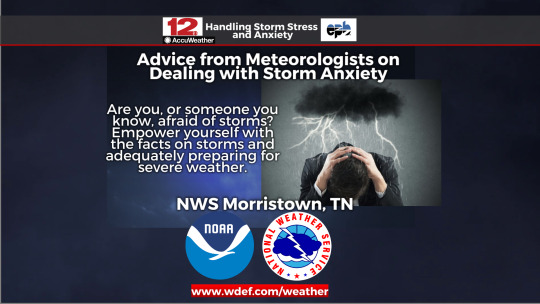
"In our area, we will see storms every year, and unfortunately, there’s nothing we can do to stop them. This can make you feel powerless.
But there is a way to empower yourself and that’s through knowledge and preparation. It can be helpful to think about what exactly it is about severe weather or storms that makes you afraid, stressed or nervous, Knowing what it is that makes you stressed or anxious can help you find ways to deal with that stress and anxiety." - NWS Morristown
#National Weather Service#What NOAA Does#Severe Weather Anxiety#Storm Anxiety#NWS Morristown#keeping calm during storms#getting ready for storms#preparing for severe weather
0 notes
Text
How to Protect Your Outdoor Space This Hurricane Season

As hurricane season approaches, homeowners in Southwest Florida—especially those in coastal areas like Naples—must take action to protect their outdoor living spaces. High winds, flying debris, heavy rainfall, and salt-laden air pose serious threats to patios, lanais, and outdoor furniture. The good news is that with durable lanai screen enclosures in Naples, FL, you can shield your home’s exterior and enjoy greater peace of mind throughout the season.
How Hurricanes Impact Outdoor Spaces
The National Oceanic and Atmospheric Administration (NOAA) forecasts an above-average 2025 Atlantic hurricane season, with up to 25 named storms and several major hurricanes expected. These storms often bring winds exceeding 150 mph, turning unsecured outdoor items into hazards and causing widespread flooding.
According to the Insurance Institute for Business & Home Safety (IBHS), loose patio furniture and outdoor items are a leading cause of storm damage. They can increase the risk of personal injury and lead to extensive property repairs.
The Risk of Unprotected Patios and Furniture
Unprotected patios and lanais are especially vulnerable during hurricane season. Without structural protection, outdoor furniture can become projectiles or suffer severe damage. Patio flooring can warp, crack, or deteriorate due to constant exposure to water and storm debris. In coastal areas like Naples , the additional factor of salt air accelerates corrosion and structural wear.
Why Lanai Screen Enclosures Matter
Installing a lanai screen enclosure Naples FL is one of the most effective ways to protect your patio or pool enclosures Naples FL area. Reinforced with hurricane-rated materials and sturdy aluminum frames, these lanai enclosures in Naples FL help deflect wind, block flying debris, and reduce overall storm impact.
Hurricane Season Maintenance Tips for Lanai Screens
To keep your lanai screen enclosure in Naples storm-ready, follow these maintenance tips:
Inspect screens regularly. Look for tears or worn areas and schedule repairs promptly.
Check fasteners and framing. Loose or corroded hardware can compromise structural integrity.
Secure outdoor furniture. Anchor or store items indoors during severe storms.
Clear nearby debris. Trim overhanging branches and clean gutters to reduce storm-related damage.
Schedule professional inspections. A local Naples lanai screen repair expert can check for vulnerabilities and suggest necessary reinforcements.
Trust Aluminum Master LLC for Quality Lanai Screen Enclosures in Naples, FL
At Aluminum Master, we offer more than just protection—we provide a seamless, stylish outdoor extension to your home. Our experienced team designs and installs custom lanai screen enclosures, and pool cage Naples, built to endure Florida’s harshest weather while complementing your property’s aesthetic.
Call (239) 449-9934 or message us online to schedule your free on-site estimate today.
1 note
·
View note
Text
Jul 8, 2025
After the deadly flooding in Texas, there are questions about the weather forecasts and warning systems meant to save lives. Deema Zein spoke with meteorologist Matthew Cappucci of MyRadar.com about the origins of the storm and why it dumped so much water on the region....
Matthew Cappucci, Senior Meteorologist, MyRadar:
So the warnings were good. The forecasts were flawed.
The other frustrating thing too has been people trying to use this for political advantage, people saying, oh, DOGE cuts caused this flood. No, typical National Weather Service forecast office staffing is like two to three meteorologists for this overnight shift. They had five in place at the Weather Service in Austin, San Antonio. They were staffed up. They were doing their thing.
They knew in advance what was coming and they had folks there doing the job. Staffing was not an issue. If anything was an issue, the imperfect forecast going in may have been degraded by the reduction of weather balloons over parts of the Great Plains and the Midwest. We have fewer balloons going up to get data because of budget cuts.
Then you have less data going into weather models and less accurate weather model simulations. So that may have been a factor, but that's something we have to sort of iron out a little more.
Deema Zein:
What can you tell people as a meteorologist on the situation and how it could be prevented and what really went wrong?
Matthew Cappucci:
This absolutely could have been prevented. It doesn't take three hours to get to higher ground. A lot of folks had two to three hours warning.
Many of the fatalities were children. There needs to be a responsible adult who is making these decisions and keeping abreast of the weather. There needs to be a plan in place ahead of time. Every school, every camp in America should have a NOAA weather alert radio and have a plan for any type of alert that can come their way. And so few people do.
And until we live as a more weather-ready society with these plans, taking these steps, listening to the warnings, I don't think anything's going to change.
0 notes
Text

Space storm capture advances coronal mass ejection research
Local weather alerts are familiar warnings for potentially dangerous conditions, but an alert that puts all of Earth on warning is rare.
On May 31, the U.S. Naval Research Laboratory's (NRL) space-based instrumentation captured real-time observations of a powerful coronal mass ejection (CME) that erupted from the sun, initiating a "severe geomagnetic storm" alert for Earth.
"Our observations demonstrated that the eruption was a so-called 'halo CME," meaning it was Earth-directed, with our preliminary analysis of the data showing an apparent velocity of over 1,700 kilometers per second for the event," stated Karl Battams, Ph.D., computational scientist for NRL's Heliospheric Science Division.
A geomagnetic storm is a major disturbance of Earth's magnetosphere that's caused by the highly efficient transfer of energy from the solar wind into our planet's surrounding space environment. These disruptions are primarily driven by sustained periods of high-speed solar wind and, crucially, a southward-directed solar wind magnetic field that can peel away Earth's field on the day side of the magnetosphere. Energy from the solar wind can open Earth's magnetic shield.
The National Oceanic and Atmospheric Administration's (NOAA) Space Weather Prediction Center classified the recent solar storm as G4, the second-highest classification on its five-level geomagnetic scale.
Powerful storms such as this are typically associated with CMEs. The repercussions can range from temporary outages and data corruption to permanent damage to satellites, increased atmospheric drag on low-Earth orbit spacecraft altering their trajectories, and disruptions to high-frequency radio communications.
"Such disturbances can compromise situational awareness, hinder command and control, affect precision-guided systems, and even impact the electrical power grid, directly affecting military readiness and operational effectiveness," Battams said.
CMEs are colossal expulsions of plasma and magnetic field from the sun's corona, often carrying billions of tons of material. While CMEs generally take several days to reach Earth, the most intense events have been observed to arrive in as little as 18 hours.
"CMEs are the explosive release of mass from the sun's low corona and are a primary driver of space weather, playing a central role in understanding the conditions of Earth's magnetosphere, ionosphere, and thermosphere," explained Arnaud Thernisien, Ph.D., a research physicist from the Advanced Sensor Technology Section within NRL's Space Science Division.
The May 30 event saw a relatively slow but powerful solar flare erupt from the Earth-facing side of the sun. The energy released blasted a CME directly toward Earth, leading to the geomagnetic storm that has produced auroras as far south as New Mexico.
NRL's space-based instrumentation, operating on NASA and NOAA spacecraft, provided vital real-time observations of this event. Notably, NRL's venerable Large Angle Spectrometric Coronagraph (LASCO), which has been in operation since 1996, and the Compact Coronagraph 1 (CCOR-1), launched in 2024, both relayed critical data.
Such observations are paramount for operational space weather monitoring, allowing forecasters to predict the timing of the event's arrival at Earth and the potential geomagnetic storm it could induce. While precisely predicting the severity, exact timing, or duration of a geomagnetic storm remains challenging, these advance warnings are vital for enabling the Department of Defense (DoD) and other agencies to prepare.
The potential impacts of severe geomagnetic storms on DoD and Department of the Navy missions are significant and far-reaching. These events can disrupt or degrade critical systems and capabilities, including satellite communications, Global Positioning System (GPS) navigation and timing, and various remote sensing systems.
"NRL has been a pioneer in heliophysics and space weather research since the very inception of the field, dating back to the first discovery of CMEs through NRL space-based observations in 1971," Battams said. "Since then, NRL has consistently maintained its position at the forefront of coronal imaging with a portfolio of groundbreaking instrumentation that has driven heliospheric and space weather studies."
This includes:
LASCO coronagraphs operating on the joint ESA-NASA Solar and Heliospheric Observatory (SOHO) mission since 1996
Sun-Earth Connection Coronal and Heliospheric Investigation (SECCHI) instrument packages on the twin NASA Solar Terrestrial Relations Observatory (STEREO) spacecraft since 2006
Wide-Field Imager for Parker Solar Probe (WISPR) instrument on NASA Parker Solar Probe (PSP) since 2018
Solar Orbiter Heliospheric Imager (SoloHI) on ESA's Solar Orbiter mission since 2019
NOAA's CCOR-1, designed and built by NRL, operating on NOAA's GOES-19 since 2024
These assets, particularly instruments like LASCO and CCOR-1, are indispensable for providing the crucial real-time imagery necessary for forecasters to analyze and assess CMEs, determine Earth-impact likelihood, and issue timely warnings.
"They form the backbone of our ability to anticipate and mitigate the effects of space weather. As the G4 severe geomagnetic storm watch continues, the public and critical infrastructure operators are encouraged to visit NOAA's Space Weather Prediction Center for the latest information and updates," Thernisien said.
The journey of the CME, from its fierce eruption on the sun to its arrival at Earth, approximately one million miles away, highlights the dynamic nature of our solar system and the ongoing importance of NRL's vital contributions to heliophysics research and space weather preparedness.
The data collected from events such as this will be instrumental in future research, further enhancing our understanding and predictive capabilities and ultimately bolstering the resilience of national security and critical infrastructure.
1 note
·
View note
Text

Andrew Palfrey, better known to the worldwide yachting fraternity as “Doggy” will give us the benefit of his vast experience in factoring wind, weather and currents into our sailing and its importance in planning the conduct of your race. This is part one in a series of excerpts from an interview I did with the high-achieving sailor, olympian and coach. FREE BOOK - TIPS FROM SAILING LEGENDS Brett: Doggy, because the interview is primarily about weather and how to use observations to run a race day or regatta strategy, can you tell us how sailors who are looking to get better should go about gathering information and then utilising it to give themselves the best advantage on the racetrack. Perhaps a little history of your weather journey would be really helpful here. Andrew: This sort of thing has become so much easier in the last few years. I didn't start Olympic campaigning until 1998 properly. I was in my thirties. And back then, it was hard, it was difficult. I can't even remember how we kind of did it back then or probably didn't do a lot of it. But these days it's obviously, it's a hell of a lot easier on the internet. And it's like the United States, for example, the NOAA resource, N-O-A-A, I don't even know what it stands for, National something, something. It's just a huge resource. There are so many layers and you can get historical data and so on. Really, I mean, as we know, you really just got to plug in, you know. I'm heading to Nassau in a couple of weeks, just plug in Nassau for historical weather data for December, and it's there, it's three clicks away. So I think the challenge is to decipher that and to filter through that and to figure out what the important information is because there's a lot of stuff there that, it's not rubbish but it's just not relevant to what you need. FREE SAILING GLOVES Brett: How much information do you gain from fellow competitors about venues, especially those that you have raced at previously or from locals such as fishermen who may have relevant observations that you can learn from? Andrew: I guess through this lifetime of sailing, we gain a network of friends, or at least acquaintances. We tend to go back to the same sorts of places, the same sorts of locations, year after year. You'll know someone, and that person will know someone. My experience, like I know for sure when I get contacted about the weather in a place I'm living, I don't mind spending a little bit of time or whatever, with the person, if I know they're kind of quite keen. And I kind of like that human-human interaction, that side of it. So I think that a lot of it comes back to that. But in terms of in the pre, sort of getting ready to go away side of things, make contact with that person and your questions would be, "Where do you look, what do you look at for your weather for that location?" And they might say, "I look at Windguru is generally the best here, or this, or that." And all of a sudden, bang, you've just saved yourself a whole lot of time. AUSSIE SAILORS - BOOK AND BONUSES Brett: Are you asking about what is likely to happen at the time of the regatta or are you delving in to history of previous years at that time of the year and how far out do you plan? Andrew: I think it goes back further than that, further than the day. It might even be as fundamental as even several months out. You might make some decisions on equipment or where you want your, for example, the Etchells Worlds next year. It's in San Francisco and we've all got time...time is a limited resource, we're all in the same boat there, it doesn't matter how big your budget is. Time is the same for everyone. So you want to make the right decisions early so you're not spending your time going down the wrong path. A lot of people are already saying, "Oh, San Francisco. It's going to be windy." But the fact is, it’s very late in the summer that we go there and there was a regatta this year, at the same time, that was three out of four days were light air. And so, that information is critical. You could turn up in San Francisco or you could sort of get to San Francisco two weeks before the Worlds, let's say, quite well-prepared, well-resourced, all that sort of thing. And you'll start talking to locals and they might say, "Oh, no, no, no. It's actually, there's a fair chance we might get some light air here." And you're thinking, "Shit! I've invested all...I've exactly invested all this..." It might even be, I mean, you might have your light sails there. You've shipped them over or whatever you did but you haven't spent time using them. So harping back to these decisions we made months before, they can... Probably, a lot of people don't realize, even as they come away from these events, that those decisions were probably more of an impact than what people realize. Read the full article
0 notes
Text
Hurricane Season Is Soon—NOAA Says It’s Ready, but Weather Experts Are Worried
CLIMATEWIRE | The National Oceanic and Atmospheric Administration insists it’s ready for the above-average hurricane season that meteorologists expect this summer. But scientists across the country are sounding the alarm about personnel shortages and budget cuts, which they say could strain the agency’s resources and risk burnout among its staff. The tension was on display Thursday as NOAA…
0 notes