#MapArt
Explore tagged Tumblr posts
Text
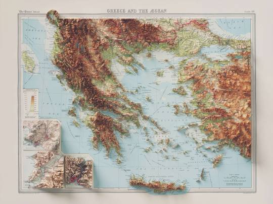
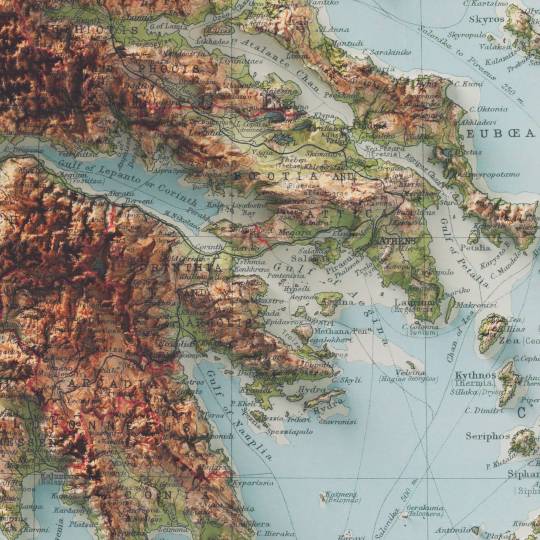
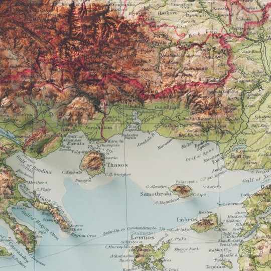
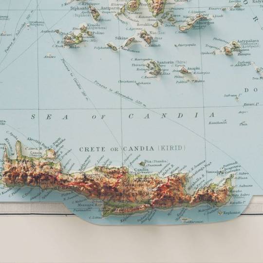
I love this map, and this atlas too. I think is one of the best result we achieved with the shaded relief maps, and I hope to find more time to find vintage maps on Mediterranean sea and coutries.
If you like our work, want to see our daily updates (or want to say hello to our studio), consider to follow our Instagram or Twitter account. Otherwise if are interested in our prints or have a custom request check our shop.
94 notes
·
View notes
Text

speaking of ghastling, i made a 2d mapart for my bday party at blossom💗
@billstar08846 i use your Larr meme thing, also i add ghastling and smol me at their head🥰
at 19 april, i hosting bday party at tulip, i hope you join hehe

#minecraft#a villager's night#minecraft villager#villagernight#villager#minecraft mapart#mapart#happy ghast#ghastling#mc skin#birthday
13 notes
·
View notes
Text
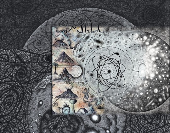
"Kosmische Karte: auf der Suche nach dem Ur-Atom"
55 notes
·
View notes
Text
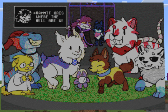
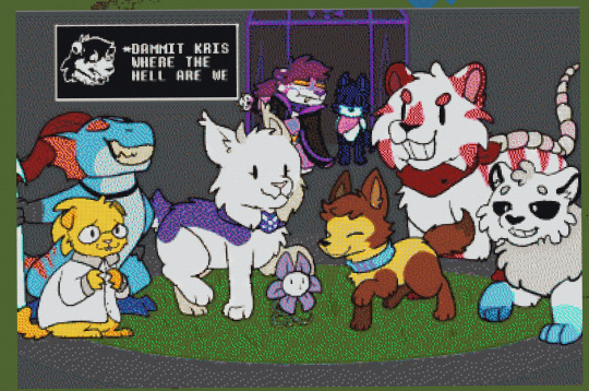
FINALLY
384x257 mapart of @pawtale, around 100,000 blocks, took around a month and a half.
Original image:

75 notes
·
View notes
Text


The Birth of Venus
Project Nebula is home to many amazing map artists! including MisterFlatworm who has made many renditions of classic paintings like this 3x2 3D version of The Birth of Venus!


9 notes
·
View notes
Text

Moonbow Island Map Digital artwork by me, 2024 This map is a continuation of artwork that I posted yesterday of a fictional island called Moonbow Island I looked at its 3D model from top view and started to think about what would a map of the island be and how the island would function. I like fictional maps and confined settings, so I decided to continue and 'live' here a little longer and draw out a vector version of the map. It was quick and fun to do but in order to get this finished, I didn't think up a very serious and extended lore and all the history of the places. Truthfully, Moonbow Island came about visually when playing around with the 3D program and I was inspired slightly (I think) by games like Stardew Valley and Melée Island from Monkey Island. I think it would be a fun game map to explore.
#digitalart#map#mapart#island map#fantasy map#island#cartography#fantasy cartography#setting#scenery#isle
4 notes
·
View notes
Text
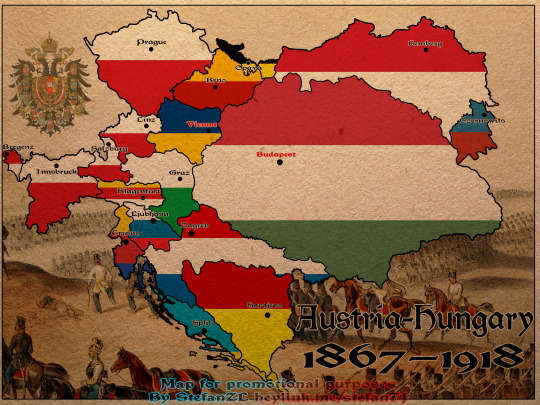
One of my earlier posters/maps features Austria-Hungary. It highlights its borders, the internal divisions into provinces, and their respective capital cities.
#AustriaHungary#HistoricalMaps#Cartography#MapLovers#HistoryBuff#Austria#Hungary#HabsburgEmpire#DualMonarchy#HistoryNerd#MapsOfEurope#VintageMaps#Geography#MapArt#HistoricalPoster#EuropeanHistory#OldBorders#HistoryEnthusiast#Provinces#CapitalCities#AustriaHungaryMap#HistoricBorders#EmpireMaps#HistoryCommunity#MapDesign#CulturalHistory#HistoricEurope#PoliticalDivisions#HistoryIllustration#MapPoster
4 notes
·
View notes
Text
OH!! Ive been making maprts on 6b6t of initial d too!!
I'm working on one more of the volume 14 cover on a square crop and then i'm making a proper minecraft base. But all these images as-is are now mapart on 6b ᏊˊꈊˋᏊ
I really like the 86, maybe if i have the patience i'll do a staircased instead of flat,,


2 notes
·
View notes
Text
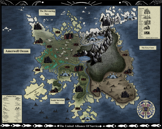
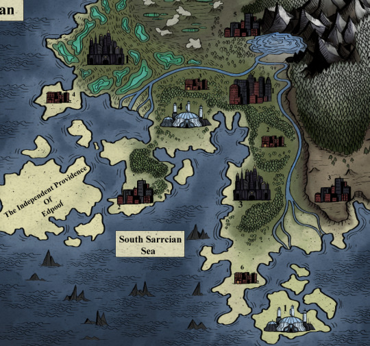
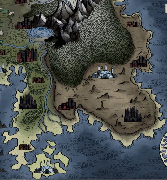

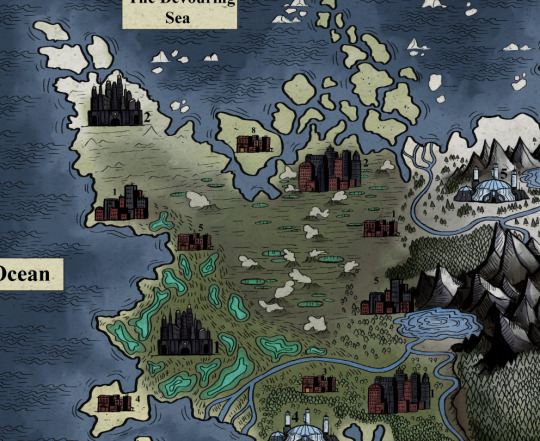
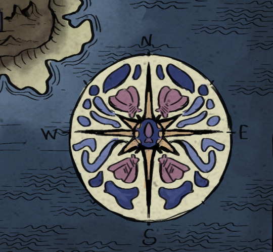

<<Repost of map from awhile ago with better formating and less wall of text>> Map Of Sarrica, A harsh and mysterious land, surrounded by unknowable seas.
Its not perfect but its a map of my world setting which I am current and actively developing so there may be another version of this in the future, but for now I have worked on this long enough and have decided to post it. Basic world concept is a sort of mix between heavily industrial retro-futurism setting with lots of seaside town/dock inspired elements. Basic world concept is a sort of mix between heavily industrial retro-futurism setting with lots of seaside town/dock inspired elements. I'm taking heavy visual inspiration from the 1930's but this may be prone to change Sarrica is ruled over by a capitalist oligarchy headed by 5 extremely powerful and influence families that opperate from the centers of their heavily fortified , militarized walled cities. Said to be places of safety from the more harsh outside they are anything but, they are often extremely restrictive and suppressive of their people, built as imposing labyrinths- they are not made for people to live in, but to be used. It is by luck and their lack of interest that only the walled cities are under their complete dominion. The only places with a little more freedom lay outside the walls and belong to what I'm gonna nickname as the "Market Union" they are far from perfect, as they are still often in the pockets of the walled cities families, they are also the capitals of Sarrica, and were there long before the walled cities, they tend to look and feel older, and usually handle their own, working more communally when the walled cities families aren't sticking their fat fingers into them. The more remote towns and cities are more free of interference, but are dangerous and often harsh, but have their own strengths, usually mining, farming or lumber communities built up around a resource they head to the market cities to trade. The only thing not related to Sarrica gov/people is the Prometheus bases, where are the centers of operations for the various wings of The Prometheus Organization, who work to study and contain anamolus events, such as rifts, they work with,, "outer" forces so they have more advanced technology than most and use it to help people when they can. Some of this is subject to change but theres some of the basics, okay bye now thanks for reading!! Feel free to ask questions!
#salted sal#illustration#artists on tumblr#art#artwork#art tag#small artist#my art#digital art#artistsupport#artist on tumblr#worldbuilding#fakemap#mapart
10 notes
·
View notes
Text

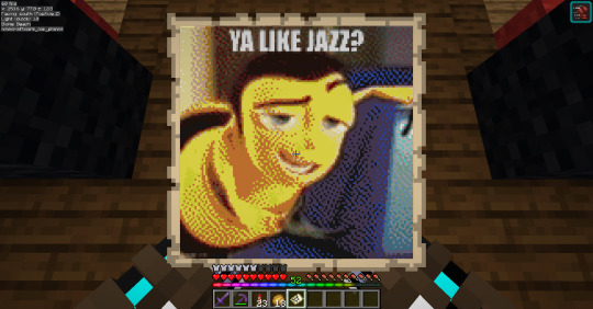
Mapart that Lectriz aka @dinowizards made on our server because they like to see the world suffer. Join us at FarmersMarketMC.net! LGBTQ+ Friendly!
#minecraft#lgbtq#minecraft server#lgbt minecraft#minecraft lgbtq#lgbt#minecraft lgbt#minecraft lgbt server#mineblr#minecraft mapart#mapart#minecraft meme#ya like jazz#bee movie
10 notes
·
View notes
Text
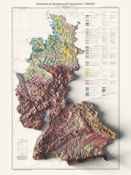
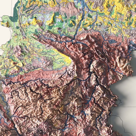
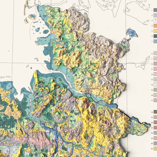
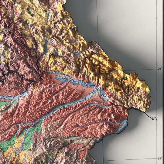
An unusual map of BDR from 1962.
🗺️ 𝗠𝗔𝗣 𝗜𝗡𝗙𝗢
Bodenkarte Der Bundesrepublik Deutschland, Bundesanstalt Fur Bodenforschung; 1963. Source: ESDAC.
If you like our work, want to see our daily updates (or want to say hello to our studio), consider to follow our Instagram or Twitter account. Otherwise if are interested in our prints or have a custom request check our shop.
4 notes
·
View notes
Text
BEHOLD
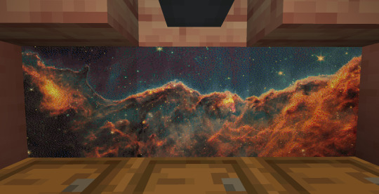
MY 3 PART MAPART OF THE COSMIC CLIFFS
4 notes
·
View notes
Text

"Secret Map for Shrooms to find ATLANTIS"
#mapart#kunst#zeichnung#cybersurrealism#new art#modern art#original illustration#original drawing#map art
10 notes
·
View notes
Text
Hampter mapart done B) it barely looks like its part of the game in this pic. I swear its not clever editing.
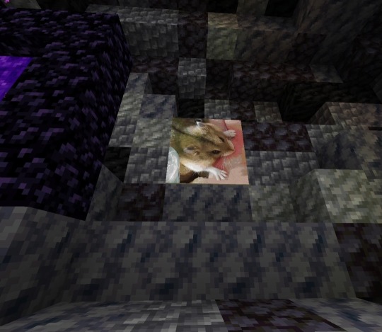
I got started on a quarry (big machine that mines entire chunks of the world) cus i need tuff, which will probably take another month :3 then ill finally be back to building things
2 notes
·
View notes
Text
Immerse yourself in Hubert Roguski's transformative 'Metropolis' exhibition. Witness cityscapes recreated with a fresh, innovative twist.
#HubertRoguski #MetropolisExhibition #CityWood #ArtShow #LaserArtistry #ReimaginedMaps #ArtAddicts #CuttingEdgeArt #GeoCraft #ArtInWood #NewArtTrends #ArtisticRevolution #MappingArt #WoodArtMagic #NewAgeCartography #CityArtistry #ContemporaryArtTrends #DesignMuse #ArtSphere #ArtScene #ArtExpressions #BreakthroughArt #ArtisticJourney #ViralReels #ArtMuse #TrendingArt #SharedArt #FeaturedArt #ArtForToday
#mapart#thecitywood#hubertroguski#citywood#woodmap#woodenmap#anniversarygift#map#anniversarygifts#anniversary#exhibition#art exhibition#art show
2 notes
·
View notes
