#Golden Gate National Recreation Area
Explore tagged Tumblr posts
Text


The first civilian prisoners arrived at the Federal prison on Alcatraz Island on August 11, 1934.
#first civilian prisoners#arrived#Alcatraz Federal Penitentiary#San Francisco#United States Penitentiary Alcatraz Island#California#11 August 1934#USA#interior#exterior#original photography#summer 2017#travel#vacation#landmark#tourist attraction#prison cell#guard tower#Main Cellhouse#Golden Gate National Recreation Area#90th anniversary#US history#museum#architecture#cityscape
8 notes
·
View notes
Video
Pacifica, California Aerial View by David Oppenheimer Via Flickr: Pacifica Municipal Pier and Seapointe in Pacifica, California aerial view - © 2024 David Oppenheimer - Performance Impressions aerial photography archives - performanceimpressions.com
#Pacifica#Pacifica real estate#Pacifica coastline#Pacifica coast#Pacifica aerial#San Mateo County#coast#west coast#Seapointe#pier#Pacifica Pier#Pacifica Municipal Pier#beach#Sharp Park Beach#Sharp Park#Golden Gate National Recreation Area#Milagra Ridge#Milagra Valley#Pacifica Manor#Manor Beach#California#Silicon Valley#houses#homes#architecture#real estate#aerial photography#aerial#aerial photo#aerial photographer
0 notes
Text
Hawk Hill, California, United States: Hawk Hill is a 923-foot peak in the Marin Headlands, just north of the Golden Gate Bridge and across the Golden Gate strait from San Francisco, California. The hill is within the Golden Gate National Recreation Area. It is the lookout point for the largest known flight of diurnal raptors in the Pacific states. Each autumn, from August into December, tens of thousands of hawks, kites, falcons, eagles, vultures, osprey, and harriers are funneled by the peninsular shape of Marin County into the headlands. Wikipedia
168 notes
·
View notes
Text
Today's Wall O'Text:
GEAR UP AND GET READY TO ACT, folks. At least 100 executive orders are gonna be sprung on America right out of the gate, obscure unheard-of laws will be leveraged against us, these bastards will try to drown us in a deluge of shit. STAY STRONG. STAY SMART. KEEP YOUR HEAD TOGETHER. We will not lose heart, we will not give up, we will fight, we will endure, we will prevail.
From the article: "During a two-hour meeting with Senate Republicans, Trump said he plans to immediately enact his MAGA vision instead of waiting for Congress to act, according to a new report in the Wall Street Journal. He has already prepared about 100 executive orders, and he has no qualms testing the legal limits of presidential authority, he said. "For months, Trump’s aides have been looking at obscure laws passed about 50 years ago that he can invoke to unilaterally carry out his plans and bypass congressional funding limits. Instead of feeling preemptively constrained by constitutional checks and balances, he plans to do what he wants and take his chances with the courts, the Journal reported.
"For example, to help pay for his mass deportations, he plans to use the 1976 National Emergencies Act, which he also used to fund parts of his border wall during his first term. Previous presidents used the act to fund things like the response to the Sept. 11, 2001, terror attacks—not to fund something Congress had explicitly declined to pay for, the Journal noted.
"Trump is also eyeing a provision in the 1944 Public Health Service Act called Title 42 that lets the government expel migrants coming from countries with communicable diseases. The Centers for Disease Control and Prevention used it to lock border entry during the COVID-19 pandemic, and now, Trump is disease-shopping to find a new excuse to invoke it."
[Emphasis added.]
Hunter Thompson's words come roaring to mind: no one wanted this, but it's here now, so let's get it on. ***
The statue of Congressman Phillip Burton of San Francisco, seen here at the Great Meadow of Fort Mason in the Golden Gate National Recreation Area, reminds me of what it takes to get good things done in this country. From the NPS website: "Powerful, Profane, Brilliant, Fierce. Phil Burton wasn't a moderate man. Elected to Congress from San Francisco in 1964, he fought for workers' rights, for seniors and people with disabilities, and for the impoverished and under-privileged. Once convinced that creating national parks close to where people live would improve their lives, he fought for park legislation. He fought and he won." In the right pocket of his suit jacket, there's a note with a partial Burton quote visible: "The only way to deal with exploiters is to" -
the full quote: "The only way to deal with exploiters is to terrorize the bastards."

[photo: Gerald Winsor/Google Images]
#it's a fucking battle cry#he fought and he won#we will fight and we will win#we do not lose heart#grampa mutt is on the march#hold my leash and march with me
55 notes
·
View notes
Text
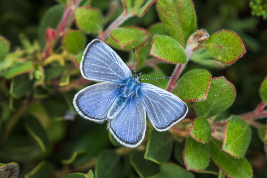
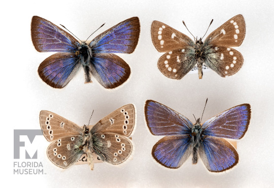
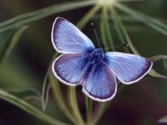
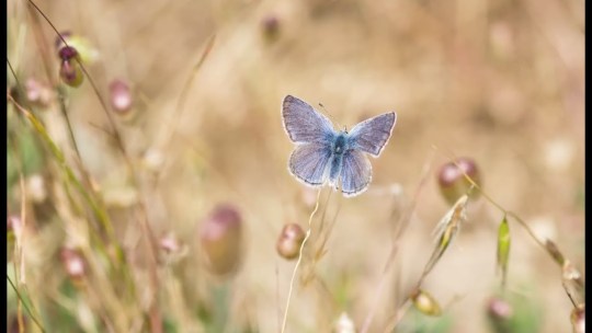
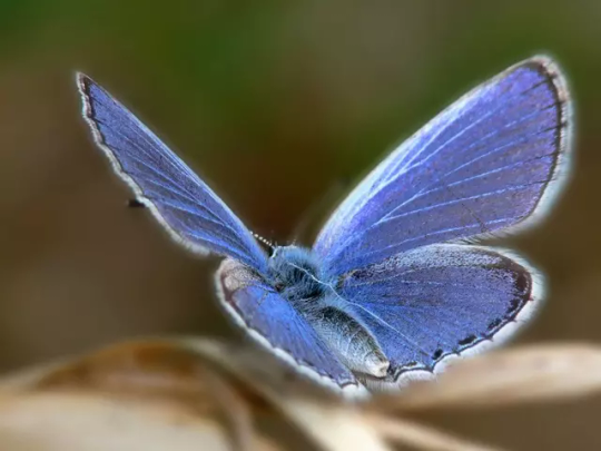


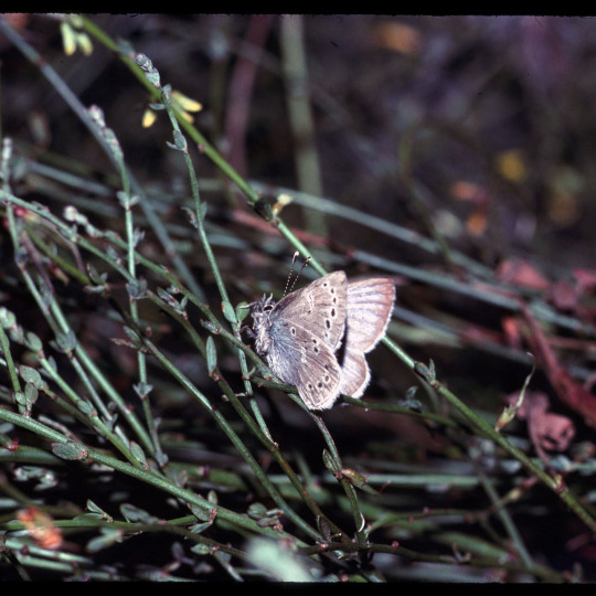
Glaucopsyche xerces, better known as the Xerces blue butterfly or simply xerces blue is a recently extinct species of butterfly in the gossamer-winged butterfly family, Lycaenidae. The species was first described and documented in 1852, and was named after the French spelling of "Xerxes", the Greek name of the Persian kings Xerxes I and Xerxes II of the fifth century BC. Reaching around .7 to 1.18inches (18 to 30mm) in wingspan length, the xerces blue is a small, brightly colored butterfly characterized by iridescent blue on the upper wing surfaces of males, and pale spots below. It was endemic to the coastal sand dunes of the upper San Francisco Peninsula where the Xerces fed on vegetation belonging to the genus Lotus and Lupinus. The loss of the Lotus plant that the butterfly fed on while in its larval stages is believed to be the main reason for the extinction of the Xerces blue. As growing urban development resulted in extensive disturbance and loss of habitat of which the lotus plant couldn’t survive. Lupinus, the Xerces blue's other main adult food source, was not suitable for the larval stages. By the early 1940s the Xerces Blue was driven to extinction, becoming one of the first and most well-known butterflies in the United States lost due to human impact, with the last confirmed sighting of a xerces blue occurring in 1943 on land that is now part of the Golden Gate National Recreation Area. The butterfly’s extinction inspired the foundation of the Xerces Society for Invertebrate Conservation in 1971, as well as ushering the need for insect and invertebrate conservation into the public mindset. Today there are ongoing efforts to reestablish related butterflies in the Xerces blue's former habitat such as the silvery blue and the Palos Verdes blue. Also the possibility of reviving the xerces blue via de-extinction is being explored.
#pleistocene pride#pliestocene pride#cenozoic#holocene#extinct#animal#animals#insect#butterfly#animal facts#xerces#xerces blue#bug#bugs
30 notes
·
View notes
Text

Did you know San Francisco had a large saltwater public bathhouse, called the Sutro Baths? During high tides, saltwater would run into the baths to recycle the water, and during low tides, there was a pump system which could be activated to cycle the water. The bathhouse was built in 1894 and closed in 1964, when it was sold to a developer after attempts to keep it profitable failed (including converting part of the baths to an ice rink). In 1966, the building burned down while it was in the process of being demolished, and the ruins of the baths are included in the Golden Gate National Recreation Area, which is protected and operated by the National Park Service.
"View of swimming pools, swimmers, and interior of Sutro Baths. Ping pong tables are seen in the right foreground." c. 1900s, from our online catalog.
#sutro baths#san francisco#history#california#bathhouse#bath house#saltwater baths#sutro#california history#ruins#bay area
198 notes
·
View notes
Text
The Camp Jupiter Map never ends. It consumes
Gang I’m so like, not put together but I gotta start writing lol. Wish me luck 🫡 something something I’ll like. Actually make an informative post one of these days
Woah! Ominous titles aside lol, I have. Continued my downward spiral into insanity and I present you with,

The map. Not the fully finished map but a version of the map that’s drafted out a bit. This is heavily intwined now to HoO re-imagined RIP to anyone who. Don’t like this lol.
Also like SO much not like, scaled at all. I don’t know how big that lake is or how big anything is comparatively. But I think it’s like the thing with the English Channel were you could swim across it if you were trained and wanted to, but also like. No sir, also something something no idea if that’s fresh or salt water I don’t know I’ll figure that out later.
Also in the spirit of that, all of this could change!! Not necessarily the location (Tennessee trail in golden gate national recreational area because I’ve already written rodeo beach into the story. And Percy can still miss camp to get to rodeo beach and the lagoon via trails and the terrain and that stuff.) but like, if Kleos ever learns what scale is then yeah. Also maybe one day I’ll design New Rome but for the most part it gives me headaches so I won’t 😁😁.
But yeah, uh, map subject to change. Something something. ALSO!! Gotta mention the whole new Mt. Tam situation, mt. Tam is now way closer to camp Jupiter. Honestly just makes the war more fun for me and it’s like, a feature. Camp’s double edged sword because of the natural protection the mountain and its monsters give from other aggressors. But also all the monsters lol.
This also puts Octavian within a very short distance of a Build a Bear and that totally didn’t play into this choice/hj
ALSO ALSO!! Uh, SoN re-imagining will probably drop soon, along with chapter 3 of Octavian girdle quest. I am a like, a shit writer lol so don’t expect that it’s amazing. The whole, first 2 chapters for Octavian girdle quest will be getting a whole like, update re-write but yeah :3 those’ll be a thing soon.
#hehe :3#idk how to tag this#hoo re-imagining#son re-imagining#hoo re-imagined#son re-imagined#hoo#hoo fanfic#hoo headcanon#pjo hoo toa#camp jupiter#idk#okay bye
9 notes
·
View notes
Video
Westerm Bluebird by David Assmann Via Flickr: Fort Mason, Golden Gate National Recreation Area, San Francisco
8 notes
·
View notes
Text
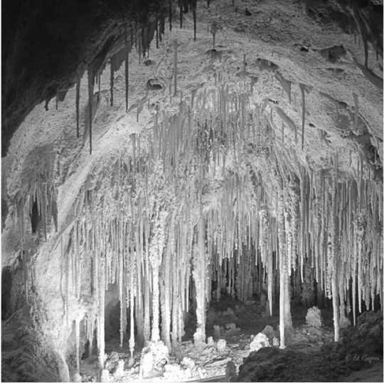

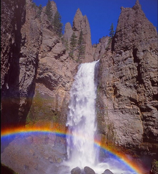
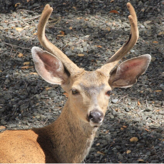

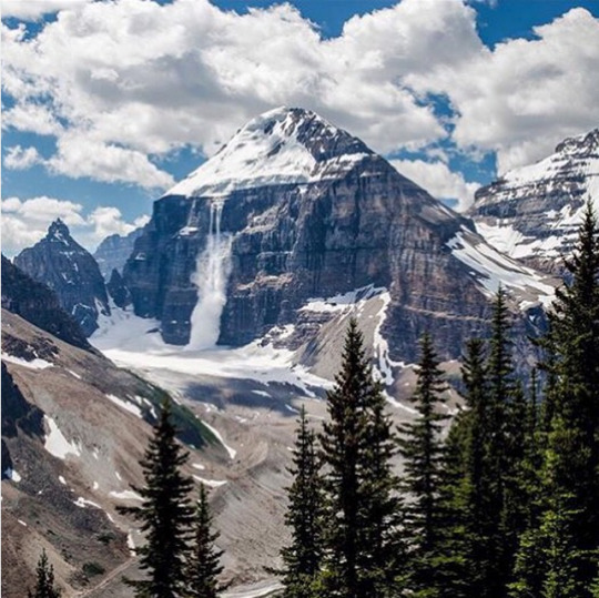

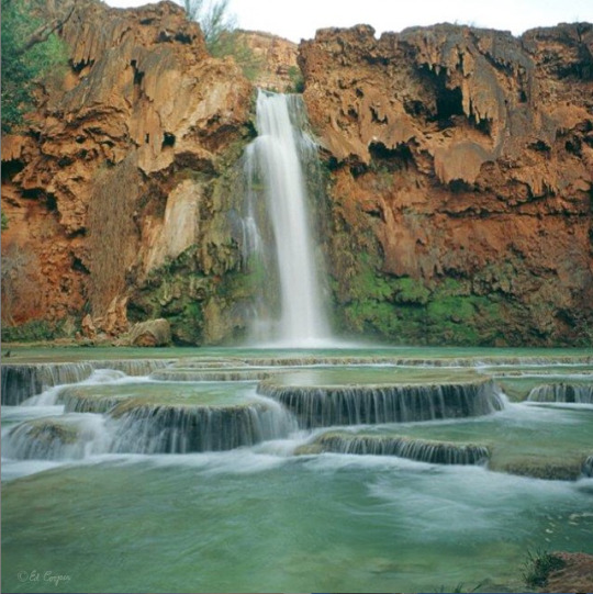
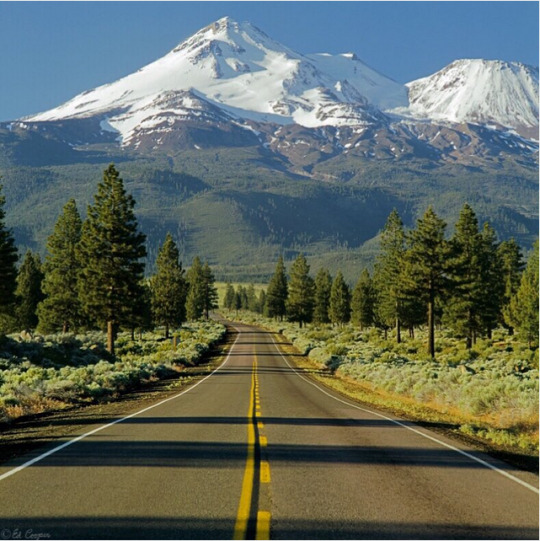
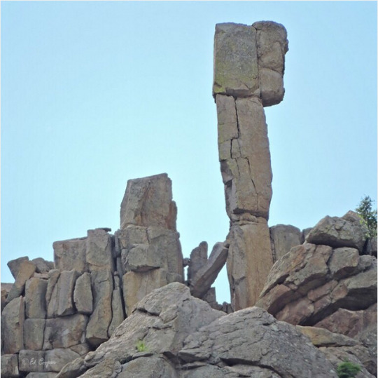
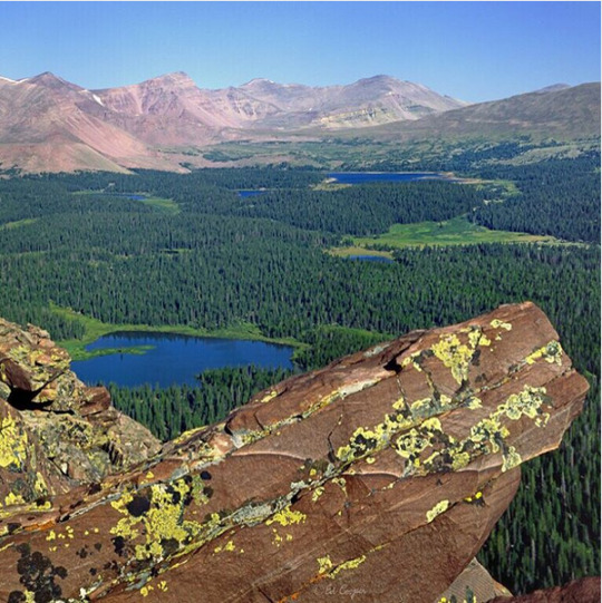
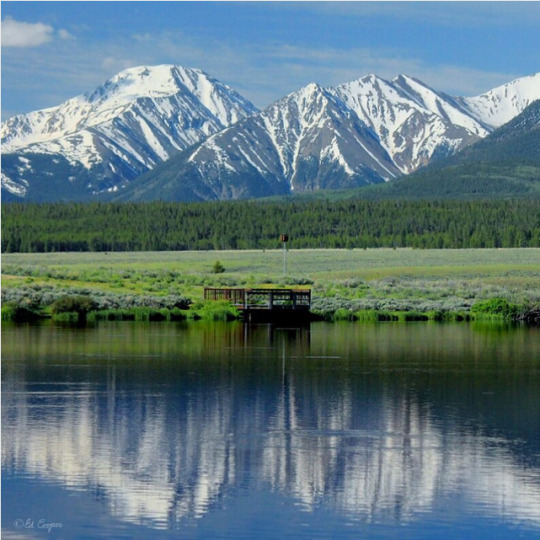
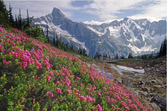
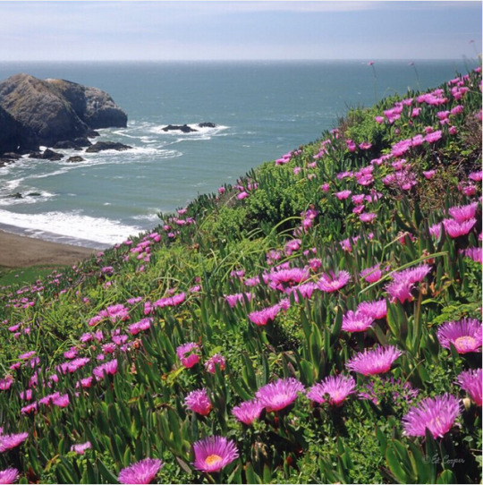


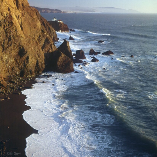
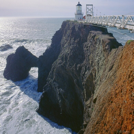
Photos and texts: @ed_cooper_photography
1-. Here we see the slightly creepy and surreal Dolls Theater formation, in Big Room Cave, Carlsbad Caverns NAtional Park. New Mexico. Image taken Feb. 1975!
2-. Here we seen sunrise on El Morro, rising about 60m, above the valley floor, located in El Morro National Monument, New Mexico
3-. Tower fall, 40m., with a rainbow, in the northeast part of Yellowstone National Park, Wyoming. This waterfall is in the Absaroka Mountain Range and feeds the Yellowstone River
4-. Here we see a mule deer, Odocoileus hemionus, taken yesterday right next to our home here on Sonoma Mountain, California, in the Cooper Biological Preserve
5-. A Confederate wall carving by Augustus Lukeman of, left to right, Jefferson davis, Robert E. Lee & Stonewall Jackson on Stone Mountain, Georgia
6-. Canadian Rockies
7-. El Morro Nat. Monument. New Mexico
8-. Havasu Falls, in the Havasupai Indian reservation, in the Grand Canyon (but not in the national park)
9-. Here we see a road leading us to Mt. Shasta (4317m.), in the northern part of California
10-. Here we see a rock pinnacle in the Cimarron Palisades, Cimarron Canyon State Park, New Mexico
11-. Here we see King's Peak, 4123m., the highest peak in the state of Utah, in the high pristine Uintas Wilderness Area
12-. Here we see Mt. Hope (4217m), reflected in a pond in Arkansas Headwaters Recreation Area, Colorado (13-6-2014)
13-. Here we see Pink Mountain Heather, in the Northern Picket Range, of North Cascades Nationa Park, Washington
14-. Here we see Rodeo Beach with Sea Fig Ice Plant in the foreground, in the Marin Headlands, Golden Gate National Recreation Area, just north of San Francisco, California
15-. Here we see the amazing Valley of Ten Peaks, in Banff National Park, Alberta, Canada
16-. Here we see the China Wall formation in Slaughter Canyon Cave (new cave) in Carlsbad Caverns National Park. New Mexico - Feb. 1975
17-. Here we see the lighthouse and Black Sand Beach at Point Bonita, in the Marin Headlands, Golden Gate National Recreation Area, just north of San Francisco, California
18-. Here we see the lighthouse and natural rock arch at Point Bonita, in the Marin Headlands, Golden Gate National Recreation Area, just north of San Francisco, California
2 notes
·
View notes
Text
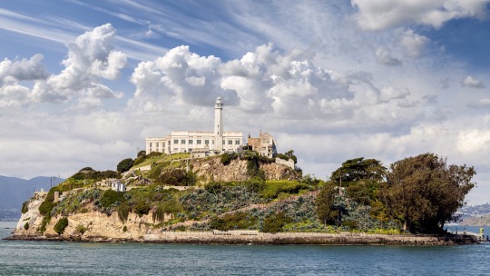
Alcatraz Island still draws tourists for its history as a federal penitentiary. But it also has a rich past as little-known military base, erected to guard against foreign invasion. Image Credit: Mbprojekt Maciej Bledowski, iStock
Ground-Penetrating Radar Reveals Military Structures Buried Beneath Alcatraz Penitentiary
Using non-invasive techniques, archaeologists have confirmed the presence of a coastal fortification beneath what was once the prison’s recreation yard.
— By Katherine J. Wu, Published March 4, 2019 | August 02, 2023
Alcatraz might be best known as a popular tourist destination, the site of the former high-security prison that once held Al Capone. But a team of archaeologists has now unveiled new evidence of this San Francisco Bay island’s often overlooked military history.
In the study, published last Thursday in the journal Near Surface Geophysics, researchers used non-invasive technologies to pull back the curtain on a stunningly well-preserved 19th century coastal fortification that lies beneath the ruins of this infamous federal penitentiary. The work confirms that while prison construction in the early 1900s destroyed much of the former military installation, several structures were buried more or less intact, enshrining a critical sliver of Alcatraz’s colorful past.
“This really changes the picture of things,” says study author Timothy de Smet, an archaeologist at Binghamton University. “These remains are so well preserved, and so close to the surface. They weren’t erased from the island—they’re right beneath your feet.”
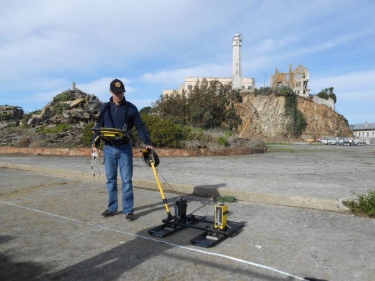
Study author Timothy de Smet used non-invasive techniques to create a subsurface map of remains of Alcatraz Island's former military fortification. Image Credit: Timothy de Smet, Binghampton University
Prior to the mid-1800s, Alcatraz Island was a barren strip of land capable of supporting little more than a raucous population of seabirds. But in the wake of the California Gold Rush, the United States government looked to the rocky outcrop as a potential military base to protect the newly bustling city from foreign invasion. Over the next several decades, a stone- and brick-based fortification was erected, then rebuilt as earthen structures better equipped to handle erosion. But Alcatraz struggled to keep pace with the rapid changes in artillery during and after the Civil War era, and by the late 1800s, the island’s defenses were essentially obsolete. Military pursuits on Alcatraz were abandoned shortly thereafter.
When the island’s prison was erected around the turn of the 20th century, little physical evidence of its former architecture remained—or so many thought. The new study, led by de Smet, says otherwise. To look beneath the surface, the researchers deployed ground-penetrating radar, which pulses electromagnetic waves into the earth, returning signals that can visualize remains without excavation. The strategy uncovered a labyrinth of subterranean structures, including an earthwork traverse, a kind of defensive trench, running beneath the penitentiary’s former recreation yard.
“Below the Surface, Alcatraz is Still Full of Mysteries”
“This really reinforces what several historians and archaeologists had long suspected,” says study author and Alcatraz historian John Martini. “Up until this point, we had nothing to go on except for a few visible trace remains and maps—and a lot of suspicion.”
In a way, Martini says, the findings reflect just how limited real estate was on Alcatraz, which clocks in at less than 50 acres. “On a small island, there’s only so many places you can build,” he says. “And it’s unlikely they went to the trouble of demolishing all this stuff.”

A 15-inch Rodman cannon and its gun crew, 1869. These were the largest guns mounted on Alcatraz. Image Credit: National Park Service, Golden Gate National Recreation Area
Because they’re both sensitive and non-destructive, techniques like ground-penetrating radar are crucial for these kinds of investigations, and can complement historical records that survived the era, says Jolene Babyak, an Alcatraz historian who was not involved in the study.
With these results in hand, de Smet and his colleagues plan to continue archaeological investigations under Alcatraz. Going forward, only time will tell what this rock will reveal, Martini says. “Below the surface, Alcatraz is still full of mysteries,” he says. “There’s still a whole lot to be learned.”
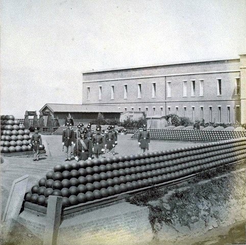
Soldiers posing in the island’s ordnance yard. A brick Citadel capped the summit of Alcatraz. 1869. Image Credit: National Park Service, Golden Gate National Recreation Area
#NOVA | PBS#Ground-Penetrating Radar#Military Structures#Alcatraz Penitentiary#Non-invasive Techniques#Archaeologists#Coastal Fortification#Tourist Destination#High-Security Prison#Al Capone#San Francisco Bay#Military History#Near Surface Geophysics#Timothy de Smet#Binghamton University#California Gold Rush#Civil War Era
4 notes
·
View notes
Text
Why Tullik’s Odyssey?
Tullik is the Iñupiaq word for plover. The species’ annual migration journey starts in the Alaskan Arctic, the traditional homeland of the Iñupiat among other Alaska Native peoples. And odyssey because they course through northern Canada to the northeastern United States, dart across the Atlantic Ocean, and wind up in Argentina. To return—no big deal—it cuts through northern South America, across the Gulf of Mexico, through the middle contiguous U.S., then Canada, and returns to the Arctic tundra.
…
One thing that puts shorebirds more at risk than other types of birds is their dependence on beaches, wetlands, and open areas that a lot of people also like to enjoy. Therefore, human recreational disturbance can be a major threat to shorebird populations. Plus, people tend to visit the beach during the same time of year when these birds are there to eat, refuel, and sometimes nest.
“When they get disturbed by recreationists, that ends up having a cumulative impact on their ability to either breed or to migrate to the breeding grounds,” Gates says. “And so if people take into consideration that putting a dog on a leash will make a bird that's traveled 2,000 miles that day have a little bit of an easier rest for a couple of days before their next part of the journey—having that information in your head and an actionable item—I think is really powerful.”
4 notes
·
View notes
Text


The Golden Gate Bridge opened to pedestrian traffic on May 27, 1937, creating a vital link between San Francisco and Marin County, California.
The Golden Gate Bridge opened to vehicular traffic on May 28, 1937.
#Golden Gate Bridge#opened#27 May 1937#28 May 1937#anniversary#US history#San Francisco#California#USA#original photography#architecture#engineering#summer 2012#travel#Crissy Field#Golden Gate National Recreation Area#Irving Morrow#Joseph Strauss#Charles Ellis#Golden Gate#Pacific Ocean#landmark#tourist attraction#Art Deco#vacation#cityscape#2022
9 notes
·
View notes
Text
Muir Beach - Golden Gate National Recreation Area, CA, USA | Activities, Dogs, Free Parking

Explore Muir Beach in California's Golden Gate National Recreation Area! Enjoy dog-friendly beaches, free parking, hiking, fishing, bike rentals, fire pits, and more.
0 notes
Text
Day 449 art meditation, “Trust Yourself, Joyfully” Tree Ring Art
February 3, 2025
Dear You,
I feel like art and messages of the heart are pointless right now, because every day with Darth Vador(s) in the white house are doing something illegal. Despair and overwhelm is what the far-right wants us to feel. This is a critical week in getting information out about Musk infiltrating the US Treasury, and also how do we stand up against the other Darth Vador, (Russel Vought), so please follow these women on Substack (independent non-corporate media) – for activism and legal support: lawteaandtruth.substack.com, chopwoodcarrywaterdailyactions.substack.com, Jess on Instagram: jesscraven101.
Also please let non-voters and republicans who aren’t paying attention, that their Social Security benefits are now at risk too. (Here goes the constant “I told you so” theme.)
I want to be mad at the people who trust themselves so LITTLE and have such low self esteem that they can either not vote, or vote for the darth vador types. But I do know that you can’t force inner growth.

My new art - “Trust Yourself, Joyfully” is about the idea of trusting our vulnerable inner heart spaces, when our ego-spaces like to feel like we belong, and be dominant. There are two kinds of self-esteem - heart and ego. And each has a sliding scale …
The heart-space kind of self esteem is much harder to do. Less immediate rewards. At 56 I’m late in life learning how to trust myself, let alone joyfully, and especially now.
If ONLY we could each trust our beautiful inner heart spaces so much that people like those “in power” now would never reach any sort of power. If there is any sign of severe cluelessness, radical right, maga-ism, bullying, toxic masculinity, immediately send them all to art school plus grad school in art. Take all that patriarchal negativity and have them make ART.
On a gratitude note: when was the last time you heard anyone in the Gop express genuine gratitude? Just simple gratitude about how beautiful a sunrise was, or how amazing dinner was?
I’m SO grateful that G and I finally visited the Orchid farm that is near us. I needed something to lift my soul up. We found out that it partners with the National Parks Service/Golden Gate National Recreation Area. It was beyond magical … Every time we drove past the sign I just thought it’s going to be a small garden, but it’s huge, and G and I both agreed that so much comes down to marketing - what do we value, what can we be talked into … Which is political too.
What a beautiful country we live in … I’m so grateful for the pockets of every kind of love and beauty. Sharing photos.


Adding Wall Murals to my store - “Trust Yourself, Joyfully”. (Material: Controltac Adhesive Print Print.)
Love,
Anne
#trustyourself #art #heartspace #vulnerability #gratitude #alllinesarebeautiful #truth #bethechange #heartspace #heart #artsoulfully #design #heartliving #heartartbundles #heartartbundle #heartart #love #artexpandshearts #light #bethelight #authentic #expandlove #soulfulliving #soul #soulart
◎
Ⓒ 2025 Anne Hunsicker | All Lines Are Beautiful. All rights reserved.
#alllinesarebeautiful#artsoulfully#art#art soulfully#lifeisart#beauty#brand bundle#love#artmeditation#brand
0 notes
Text

Why Miyapur is Becoming a Top Choice for Families and Professionals
If Hyderabad had its own version of the Oscars for neighborhoods, Miyapur would definitely snag the “Best All-Rounder” award! Over the past few years, this buzzing suburb has transformed into a real estate hotspot and a dream location for families and working professionals alike. So, what’s making Miyapur real estate the talk of the town? Let’s dive in!
1. Strategic Location with Superb Connectivity
Miyapur sits at the perfect crossroads between bustling IT hubs and tranquil suburban living. It boasts seamless connectivity to major parts of Hyderabad:
Metro Accessibility: Miyapur is the starting point of the Hyderabad Metro Rail, giving residents quick access to Hitec City, Kukatpally, and beyond.
Outer Ring Road Proximity: Easy drives to Gachibowli and Financial District make it a go-to choice for professionals.
Well-Connected Roads: National Highway 65 ensures smooth travel to Patancheru, BHEL, and other industrial zones.
For families, this connectivity means less time commuting and more time at home or enjoying what the area has to offer!
2. Thriving Infrastructure and Amenities
Miyapur isn’t just about convenience—it’s about lifestyle. From education to entertainment, this locality checks all the boxes:
Top-Notch Schools: Access to premier institutions like Sentia Global School and Silver Oaks ensures your kids get the best education.
Healthcare Excellence: With hospitals like KIMS and Ankura nearby, quality medical care is never far away.
Retail Therapy: Whether it’s weekend shopping sprees at Manjeera Mall or grabbing groceries at Ratnadeep, everything you need is within reach.
3. A Hub for Property Investment
Real estate in Miyapur is booming, and for good reason. With skyrocketing demand and steady appreciation, Miyapur property investment offers long-term value.
Why Choose Gautami Heights?
Among the many projects in Miyapur, Gautami Heights by Anuhar Homes stands out. Here’s why:
Luxury Flats for Sale in Miyapur: Thoughtfully designed 2, 2.5, and 3 BHK apartments for modern living.
Prime Location Advantage: Just 10 minutes from the Miyapur Metro Station.
Affordable Luxury: Combines top-tier amenities with cost-efficiency.
Whether you’re looking to settle down or grow your investment portfolio, Gautami Heights is your golden ticket!
4. Work-Life Balance Redefined
Miyapur is more than just a residential hub—it’s a lifestyle upgrade. With its mix of peaceful surroundings and urban conveniences, professionals find it ideal for unwinding after a long day. For families, parks and recreational centers make it a kid-friendly haven.
5. Future Growth Prospects
Real estate experts predict a bright future for Miyapur real estate:
Upcoming Developments: New infrastructure projects, including road expansions and flyovers, promise smoother commutes.
IT Corridor Expansion: The spillover effect from nearby Hitec City and Gachibowli is driving growth.
Demand for Rentals: Proximity to IT parks ensures a steady stream of tenants, making it a landlord’s dream!
6. A Green Oasis in the Urban Jungle
Families love Miyapur for its balance of urban development and greenery. The serene Hafeezpet Lake and nearby parks provide a much-needed escape from the city’s hustle. It’s the perfect place for morning jogs, picnics, or simply soaking in nature.
Why Gautami Heights is the Perfect Fit for You
At the heart of Miyapur lies Gautami Heights, a project designed to offer everything families and professionals could want:
World-Class Amenities: From clubhouses and gyms to landscaped gardens and kids’ play areas.
Secure Living: Gated community with 24/7 security.
Well-Designed Spaces: Vastu-compliant apartments with excellent ventilation and natural light.
Final Thoughts
Miyapur is more than just a location—it’s a lifestyle. With its strategic location, thriving infrastructure, and booming real estate market, it’s no wonder families and professionals are flocking here. Whether you’re planning to buy your dream home or make a smart investment, luxury flats for sale in Miyapur, like those at Gautami Heights, offer the best of both worlds.So, what are you waiting for? Your perfect home and a thriving future await in Miyapur!
#best flats in miyapur#luxury flats for sale in miyapur#luxury flats in miyapur#best apartments in miyapur#gated community flats in miyapur hyderabad
0 notes
Text
Tower-ing Fiction #23: Starfleet Headquarters, Star Trek Into Darkness (2013)
Starfleet Headquarters, depicted across many of the Star Trek feature films and some of the franchise’s series, is typically located in San Francisco, adjoining either side of the Golden Gate Bridge. often occupying the Golden Gate National Recreation Area and/or the Presidio. In the Kelvin Universe films—Star Trek (dir. JJ Abrams, 2009), Star Trek Into Darkness (dir. JJ Abrams, 2013), Star Trek Beyond (dir. Justin Lin, 2016)—Starfleet Headquarters and its various associated buildings are located just south of the Golden Gate Bridge, seemingly between the Presidio and Golden Gate Park, inset into a 2259 San Francisco skyline dominated by skyscrapers.
The main Starfleet Headquarters buildings are put on prime display during an establishing shot ahead of a nighttime attack.
Composed of three cylindrical towers, they appear to be forty or fifty stories tall, connected by a series of skybridges, set into a circular plaza at the intersection of a couple of major roads. One of the towers seems to be interestingly attached to the center column, with its base some twenty or so stories in the air. Moody lighting dominates, which will be contrasted with the flat daytime light in the morning after the attack that kills much of Starfleet command.
Designed by VFX house Pixomondo, the main Headquarters building’s odd design can be seen below:
The interiors combine various bureaucratic locations and stylings, combining real filming locations and sets that will be part of Khan’s attack on Starfleet command.
The actual command room overtly evokes the War Room from Dr. Strangelove (dir. Stanley Kubrick, 1964), foreshadowing the film’s revelation that militarism is taking over the core functions of Starfleet.
Once the main action scene commences, John Harrison/Khan (Benedict Cumberbatch), in an assault ship, fires on the leadership of Starfleet command, while James T Kirk (Chris Pine) attempts to stop him from the connecting hallway. The framing of the exterior shots gives a nice view of the upper floors of two of the towers and the corridor between them, with stylized lighting and a layer of smoke.
As Kirk attempts to thwart Khan, the ship weaves back and forth, providing more shots of these upper floors.
Kirk is eventually successful, with Khan transporting away, leaving his ship to crash into slightly lower floors.
In the attack’s aftermath, we see various shots of the building still mostly intact, giving a sense of the plaza below and the damage done, with a spotlight highlighting where Kirk fought back from.
The next morning, we see the towers the aftermath, with the camera pan revealing the Golden Gate Bridge to the north.
In other scenes, we see the base of Starfleet Headquarters, including the rounded façades of its towers, along with attached buildings clad in stone and Starfleet logos.
Filmed at the J Paul Getty Museum in Los Angeles, these plaza scenes don’t fully align with the digital Headquarters model, but establish the geography, with the bay and the rest of the city beyond, setting Kirk, Spock (Zachary Quinto), and Scotty (Simon Pegg) in the scene and helping match the digital and physical locations.
The other side of Starfleet Headquarters appears late in the film during Kirk’s closing speech, giving another look at the cylindrical components. Filmed in front of the Cultural Center of the Christ Cathedral (formerly the Crystal Cathedral) in Garden Grove, the curved forms and styles match those of the Getty quite well.
The rest of San Francisco in Star Trek Into Darkness is presented as a dense skyscraper-laden city, with skybridges and flying transports connecting the upper levels of these buildings, complementing the remaining street-level traffic. Iconic buildings like the Transamerica Pyramid (853’/260m) are complemented by even larger buildings, while the San Francisco Ferry Building is the anchor of some of the film’s nightlife.
Designed by ILM, the cityscape is quite elaborate, anchoring the film’s final act, in which Khan crashes a militarized Starfleet ship through the city, is chased by Spock at street level, leading to an extended fight sequences on a flying transport. This mostly presented against computer-generated buildings, though Khan does run through Creative Artists Agency Building and across South Grand Avenue in Los Angeles.
These street-level and aerial scenes are richly detailed, elaborating on the city around Starfleet Headquarters and the residents of San Francisco imperiled by Khan.
In the prior film, Starfleet Academy is also in San Francisco, with views of both the Golden Gate Bridge and the city proper.
Filmed at Oviatt Library of California State University, Northridge, though the bay and cityscape have been pasted in around it.
Note that this view of San Francisco (looking west?) also features the Transamerica Pyramid, though with a different cluster of buildings around it than its sequel.
In that film, another villain, Nero (Eric Bana) threatens the city (and planet), giving nice aerial views and unifying the geography when he deploys his main weapon.
#Starfleet Headquarters#Star Trek (2009)#Star Trek Into Darkness (2013)#film#tower#Tower-ing Fiction#Shawn Gilmore
0 notes
