#Alpine Lakes Loop
Explore tagged Tumblr posts
Text
I have autism and mood disorder and ADHD and PDA and OCD and chronic fatigue &illness. that means everything stops for emotions &feeling Bad. everything. even food and water and hygiene and rent and job and friend. it always has but the more shit happens the more intense the Stopping is emotions backlog. I am tired. I keep trying. I could process for a century. I have been in therapy for so many years. being wrapped in cedar branches and floating in an alpine lake until this body turns into a fish is my only desire. lease God just let this round of medications work. 🅱️lease. I am so tired of feeling impossible and hopeless and frozen in time loops and bad at connecting. today I give up. I play video games. the problems of this world, will not be solved by me. not tonight.
12 notes
·
View notes
Text
Hiking Journal: Waterton Lakes NP,
Bauerman/Blakiston Valleys Loop Part II, July 22

We ate our largely flavourless protein-rich oatmeal with its nicer chunks of freeze-dried fruit by the lake as dawn fell down along the east aspect of Avion Ridge. The most ambitious plan for the day had been 10km of up-and-over alpine walking along the top of the ridge, descending via the Castle River Divide to Snowshoe campground. But as morning winds rose, hesitancy prevailed and we opted to return to the low valley road. In the morning light, the unnamed middle peak between Anderson Peak and Mount Bauerman made a cool sight as we came down from Goat Lake the way we’d come up the afternoon before.

Back in the valley floor it was hot again, but thankfully we quickly passed the end of the 2017 burn so the forest was more shaded. I’d almost forgotten what real trees with wide green boughs looked like. We arrived to Snowshoe in time for lunch.
After pitching camp, it was agreed we could try tackling Avion Ridge from the other side, which seemed to be the more popular direction anyway. Some other campers from Goat had taken the ridge and we re-encountered them, telling of a good traverse. So we made our way gradually up through the trees to the Castle River Divide, the edge of the park and border of less-regulated Castle country. From that subalpine saddle the trail up the side of the ridge turned steep, and hot. The views were alright, but it was a slog. We turned around well before the summit and returned to a lazy camp dinner.

4 notes
·
View notes
Text
Barb and I just finished a challenging 8 day backpacking trip in Yosemite, led by the Sierra Club. We hiked The Matterhorn Loop, 55 miles starting from Twin Lakes, near Bridgeport. We had excellent weather and beautiful alpine vistas. I’m grateful to be able to visit these remote and beautiful places.


2 notes
·
View notes
Text

pnwjordyn
Last week Bho and I hiked a segment of the Blue Lake Trail 3422, From the Marion Lake junction, up to the Bowerman/Duffy Lake junction. Initially we wanted to do the 16 mile lollipop loop but read that Minto pass trail back to Marion lake is mostly blowdown from burned trees and un-maintained trail. We hiked 18 miles all in all, and it was so diverse. So many alpine lakes, (Ann Lake, Marion Lake, Blue Lake, Jorn Lake, Tito Lake, Melis Lake, Jenny Lake, Bowerman Lake, Little Bowerman Lake, and several no name lakes) tons of tiny baby frogs all over, Mt Jefferson, Three Finger Jack, Saddle Mountain and Marion Mountain, huckleberries everywhere (I made a pie with the berries we picked) old growth patches, and then spots that had been completely decimated by the 2020 fires. It was one of the longest but most exciting trails Bho and I have been on together. Here’s my crispy man taking a dip in the nameless lake that sat below the Eight Lakes View base. (Which I still prefer Mt Krumpet vs Eight Lakes View)
12 notes
·
View notes
Text
I'm starting to warm up to Train Sim World 3, a game I got via Microsoft's game subscription model. A huge part of that is because it has a lot of good tutorials for all the very non-obvious parts of it. Those non-obvious parts are there for realism, to be clear; most trains aren't designed to be obvious, they're designed to be run by trained personnel who got special training for all the details of each train they're on.
Anyway, the basic tutorials are all set in a fantasy location, the Training Center. It's a magic place where you will find German, British and American trains all next to each other on decidedly German infrastructure.

The setting is all over the place, with some alpine stuff, a lake, several station platforms, and the whole thing is notably not an A-to-B line. Instead it's a combination of different loops and sidings for shunting around that feels more like a model railroad than a real thing.

Clearly this is completely made up, right?
Well, no. While all the scenery is purely fantasy and quite a bit of the details are wrong, the track layout is in fact a real piece of railroad infrastructure. Specifically, this is the track layout of the Siemens Test Centre in Wegberg-Wildenrath, Germany, near… well, not really anything, but Mönchengladbach is the closest city.
This facility, built on the site of a former British airfield, is where Siemens (and to a small extent other manufacturers) tests new trains, both prototypes and sometimes individual ones. All the tracks are for testing trains at different speeds and in different conditions, and a lot also for storing trains. There are also big workshops, used for finishing touches, indoor tests, but also as an independent repair and maintenance facility, and to assemble trains built in other places.
According to its own description, it's the most modern of such test centres. I have no way of checking that. It is definitely not the biggest, that is VUZ in Velim in the Czech Republic, which has a much bigger outer loop allowing for higher speeds, but less other equipment and tracks as far as satellite images say. VUZ is still seeing a lot of use, though. Maybe they'll use that one as the training centre for Train Sim World 4.
Access to the Wegberg facility is difficult for rail fans. It isn't hidden by any means, it's about an hour's drive from where I live, but all the really fun parts are hidden behind gates and fences, and security patrols the area. They held I think like two open days for the public, in total, and the last one as far as I can tell was in 2012.
And of course I was there.
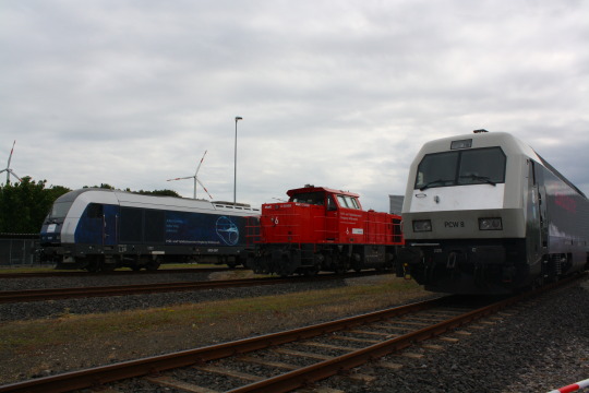
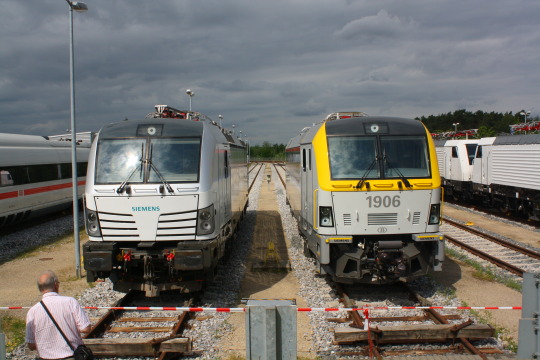
Hey, remember those days when the Vectron was fresh and new, and Siemens was still actively selling the class 189 (ES64F4) and that in-between generation they only ever sold to Portugal, Belgium and Lithuania? That sure was a while ago, now they've sold well over a thousand Vectrons and those beasts are everywhere.
First big difference between video game and reality: In reality, the outer loop is only single track, while the video game has it double-tracked.
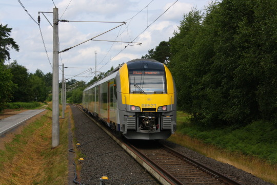
The video game also gives me a top speed of 300 km/h for this outer loop. In reality, as far as I know the limit ist 160 km/h. Apparently the track gets checked and realigned weekly, to be sure that the measurement results are all accurate.
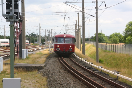
Yes, that is an Uerdinger Schienenbus. Yes, that did retroactively become a Siemens product, because the Uerdinger Waggonfabrik that built this dinky little rail bus ended up becoming Siemens's Krefeld plant (specifically the Uerdingen part of Krefeld, no longer an independent town), where they build all their high speed trains among others. Surprised the hell out of me too.
In the game, all lines are electrified and have British style third rail power. In reality, that is actually fairly close. Many tracks are not electrified, though (they have diesel shunters to deal with that, including some hilariously old ones). Even fewer have the British style third rail, although that is in use because Siemens does sell a lot of trains to Britain. Instead, some tracks, such as the inner loop, feature Berlin style third rail, raised, with a plastic cover and designed for bottom contact.
And in fact there's a fourth rail here, which the video game doesn't have. This is to test meter gauge trains; generally speaking that means trams. However, for the opening ceremony 25 years ago, they apparently did have a steam train from nearby historic steam railroad Selfkantbahn. Definitely the second-greatest historic steam railroad around Aachen.
Anyway, the point of this is… none whatsoever. I just thought it's funny. The makers of the game aren't hiding that they just took the Wildenberg-Wegrath track layout, you can find a number of news articles referencing this. But if you just downloaded the game because you got Game Pass and it says "train something", as you do, then you may never notice unless you're already aware of this test centre.
7 notes
·
View notes
Text
An extremely controversial ranking of Mariokart 8’s 95 courses.
I know there’s 96 but I’ve missed one and can’t figure out for the life of me which one it was. Please help.
Wii rainbow road - nostalgic banger, made easier in this game tho
3DS rainbow road - fucking beautiful, was my number 1 but wii just had a special place in my heart
Big blue - a masterpiece
Mount wario - another masterpiece
Coconut mall - let down by its remakes but still a classic
Maple treeway - pumpkin spice latte
Waluigi stadium - it’s fucking waluigi stadium
Daisy circuit - a beautiful and classic course
Sunshine airport - the star cup in 8 is just the best cup
DK’s snowboard cross - prefer Wii’s but I still love it nonetheless
Waluigi pinball - DS had me in a chokehold
Daisy cruiser - mesmerising
Squeaky clean spirit - probably the best new course out the whole pack
Bowser’s castle 3 - simple but fucking amazing
Bowser’s castle - a banger
Mute city - speed
DK mountain - why are the turns harder to pull off in 8
Peach gardens - was my favourite as a 6 year old
Excitebike arena - carnage
DK Jungle - the great banana
Dolphin shoals - George Michael
Electrodrome - boing
Singapore speedway - shiny
Moonview highway - wii nostalgia
Merry mountain - um overhated it’s fucking Xmas themed
Wario stadium - again, loved it on DS and 8 did it justice as a remake
Koopa cape - the most butchered wii remake
Rosalina’s ice world - SUPER OVERHATED IDC I LOVE IT THE MUSIC WAS BEAUTIFUL IN 8 DEFINITELY A STEP UP FROM 3DS SUCK MY DICK
Royal raceway - pretty pink
Yoshi valley - playing this with noobs is the best
Melody motorway - 3DS nostalgia
Grumble volcano - meh
Mushroom gorge - best on wii
64 rainbow road - meh, still fun
Wario’s goldmine - prefer it on 8 cause wii was just rage inducing
SNES rainbow road - shroom high
Shy guy falls - mew woosh
Kalimari desert - meh
Piranha plant cove - ooh pretty :0
Hyrule Circuit - dun duuuun dun dun dun dun dun duuuuun
Cloudtop cruise - meh
Mario circuit - can’t even remember which one this was
Toad harbour - used to love it but now I get bored
Yoshi’s island - never played it so don’t really care
Boo lake - good remake
Tick tock clock - got bored of this one
Cheep cheep beach - loved it on DS
Vancouver velocity - music is alright
Mario kart stadium - boring
Ribbon road - pretty good (would swap rankings but I cba)
Rainbow Road 8 - I wanna like it but it’s just so meh
Moo moo meadows - fight me
Piranha plant pipeway - alright I guess
Baby park - mehhhhhhhh
Mario circuit DS - mehhhhhhhh
Alpine pass - done dirty
Sydney sprint - eh
Toad circuit - get fucked
Sweet sweet canyon - cool aesthetic lame ass gameplay
Paris promenade - alright
Choco mountain - overhyped
Thwomp ruins - not keen
Mario circuit - again I don’t know which one this is
Sherbet land - no
Snow land - no
Koopa city - I like the vibe but I hate it online
Animal crossing - mEh
Riverside park - a let down
Donut plains 3 - heheheheheb 69
Athens dash - alright
Bangkok rush - mEh
New York Minute - eh?
Berlin Byways - music is good but it’s boring
Tokyo blur - for Tokyo this sucks
Toad’s turnpike - womp womp
Water park - water who
Twisted mansion - just put luigi’s mansion in instead and we’ll all be happy
Madrid drive - this comes up like 50 times online and I hate it
Sunset wilds - boring
Dry dry desert - I hate the desert ones
Ice ice outpost - wouldn’t pick it
Super bell subway - liked it at first but it got old quickly
Wild woods - sick of it
Sky High Sunday - an eyesore
LA laps - not enough shit
Shroom bridge - had enough shit
Sky garden - let down
London loop - easy, boring
Rome avanti - the city tracks just flop huh
Ninja hideaway - I HATE IT I HA IT HATE IT
Mario circuit 3 - why is this in every game
Amsterdam drift - I hate the dutch
Dragon driftway - I cant stand it
Bone dry dunes - worst track ever
Cheeseland - wait no, this is. I hate cheese land. It makes me feel sick. I’m lactose intolerant but I love cheese. But I hate cheese land. Whenever anyone picks it I officially hate them as much as I hate this course. Kill it. Burn it. Erase it. Get rid of it.
#super mario#mario bros#mario kart#mario kart 8#booster course pass#rainbow road#nintendo wii#nintendo 3ds#nintendo#nintendo ds#snes#gba#double dash#mario kart wii#coconut mall#you just got coconut malled#rosalina#princess peach#princess daisy
3 notes
·
View notes
Text
please don't go: a last of us fic
chapter 10
after David / Silver Lake / post-episode 8
angst, Joel & Ellie bonding, 99% canon compliant
rating: mature - content warnings re: s/a, violence, more
ch 1 | ch 2 | ch 3 | ch 4 | ch 5 | ch 6 | ch 7 | ch 8 | ch 9 | ch 10 | ch 11
link to whole story (work in progress) on AO3
-----
Joel’s been ignoring it for too long, now, and his body is screaming it at him - he's freezing.
He makes sure things are in order quickly - pistol next to Ellie - still just lying there, looking at nothing - he’s got his knife on him, rifle in reach. Flashlight. The first aid kit container - a bit more melted - not nearly enough, since he keeps forgetting to actually put it under the blanket with him, goddammit. He takes a few gulps from the thermos - pacing himself still so he doesn’t get sick - the nausea is constant. Needs to keep enough on hand for Ellie, today, anyway.
He takes one of the paper maps from under the shelf before he settles, groaning again, down on the floor in front of the door like he had been all night. Knees bent up, feet flat - wraps the blanket around himself so he’s huddled in it - shivers starting to run through him and settle in deep. He tucks the first aid kit under his knees, close enough to his body it might stand a chance to thaw more.
He needs to take a few deep inhales, waiting for the lightheaded feeling to fade a bit. After a few minutes - feeling less at risk of passing out again - he flips on the flashlight again and unfolds the map.
Crimson Ridge runs across the top. It’s a campsite map - “Crimson Ridge Campground & Park” - a few loops of road that connect with each other, dozens of little rectangles marking off sites. Near the bottom corner of the map there’s a box that reads “Ride the Shuttle!” next to a little bus symbol, and a few destinations listed out: Golden Ascent Trail. Alpine Serenity Reservoir. Silver Lake Resort.
There are two little squares marked near the road leading in to the campground - Registration Office & Outfitters Store. The odds of anything being there still, untouched after 20 years, are slim to none - the remoteness of this little outpost they had come across was all that kept it from being wiped clean years ago, he’s sure. He has no doubt that people in the area would have fled to the campground at different times over the years after the outbreak - maybe trying to get away from other people, knowing they couldn’t make it trying to survive in the actual wilderness. Might have met a quick end, if they were lucky.
Most weren’t.
But, even if there’s nothing inside - could be four walls and a roof. Could be another place for them to shelter - if it’s close enough to where they are now to make it on foot. And where they are now is… where, exactly? - he scans his eyes around the map - glances up at the one on the wall - considers standing to look at it closer but still a bit too shaky - needs a minute to work up to that. He looks back to the map in front of him, and sees a little arrow, pointing along the main road and off the edge of the map, labelled “Hiking and Backcountry Camping access point (4.6 m.)”
He takes a guess and flips the map over - there we go.
It’s like the one on the wall. A park map, alright - plain to tell from up close, now that’s he really paying attention to it. Colour coded trails weaving out in different directions from a little red building symbol marked Trail Information / Overnight Registration - right beside the little yellow star marking their spot.
So - about 5 miles, then, to get from here to that campground, if that’s the right way to go. He doesn’t like it - the snow is going to make it hard enough, all on it’s own. With how hurt Ellie is - and him, still so fucking weak - they were going to be slow.
If this building worked as a registration office for campers and hikers, it must mean there’s a parking lot somewhere, right? Would have to be walking distance, if this is the check-in point - maybe used to be a trail for visitors to trek on the way.
He’s right - finds a “P” symbol on a beige rectangle. There’s a faint line trailing from it - the parking area at the end of some side road, maybe? - eventually it connects to a sliver of the main road, just barely included at the bottom corner of the map. The same main road shown on the campground map.
About two miles, maybe, from here to that road. Bit less.
Hmm.
He looks up, finds Ellie is still laying awake and looking at the wall.
“Ellie?” She turns her head to look at him. “Can - d’you feel a map in the coat pocket?”
She stares at him for a few seconds before she starts to feel around the jacket. Pulls out the state map from one of the interior pockets - thank god he hadn’t lost it - imagine that being how he got them killed.
“Thanks - toss it here?” He asks, but she doesn’t move.
He waits a few seconds, and then feels a bit uneasy as she continues to stay still and quiet.
“You - ok? I’ll - I can come get it, it’s alright,” he says, starting to push himself up to his feet, clenching his teeth as he feels the hurt throb in his gut. It’s getting fucking old.
Standing, now - and she’s still not moving. He tries not to look overly concerned but feels the worry starting to build.
She bites her lip and looks down at herself.
“I - have your coat?” It comes out as a question.
“Uh - yeah, it’s - s’alright, Ellie - just -”
She’s dropped the map and is shrugging her way out of the coat already. When she gets it off she throws it towards him, but doesn’t say anything.
He’s a bit baffled, here - not sure what is going on and afraid to say the wrong thing.
But she breaks the quiet first. “Why? All night?”
Oh. This, again.
“Yeah - these sleeping bags are plenty warm enough. You don’t h-”
“You went - outside, before - without a coat?” There’s a bit of an angry edge to her voice.
He responds in a slow, quiet tone - “Yeah, baby - it was -”
“Why would you do that, Joel -” she almost whines at him - “I don’t want -” looks for all the world like she might start to cry again, “it’s - you need a coat, I don’t - because of me -”
“It’s ok, Ellie - I was fine, you needed it more -”
“Not the whole time!” She says, exasperated. Then continues in a quiet, stubborn sounding voice, “Don't. That's fucking stupid. We both need a coat. If - if we have one - we share it. ”
She’s nearly glaring at him as she says it, and he wants to tell her how wrong she is - he would never wear it if it meant she would suffer without it - but he’s died on enough hills to know this one isn’t worth it. Surrenders.
She’ll wear it when they’re out. As long as she’s tucked in the sleeping bag like this she should be ok with her sweater - he’ll make sure she is.
“Alright,” he says. Goes to pick up the coat from where she tossed it, biting back another groan.
“What are you doing?” She asks.
“Just - takin’ a look at the map - tryin’ to see where we might - get back on the road, when we do.” She looks at him with a bit of a cloudy expression.
Ellie always wanted to be included - help out. He’d learned that about her time and again since they’d met, and she’d always enjoyed looking over their maps in the truck, on the road - running her fingers along different routes, trying to pronounce the names of different cities, asking him if she got it right.
He worries that it might upset her - seeing the resort location, wrapping her head around where they were - where she’d been taken - the distance from here and where they had come. But he knows her well enough to guess that she’ll ask soon anyway - probably just take the map and figure it out on her own when he’s sleeping. It’s not something he can keep from her.
And she should know, anyway. Needs to know - if something happens to him.
“Did you - d’you wanna look with me?”
She nods with no hesitation.
“Mind if I come over?” He asks, and she shifts up off of his pack to sit more upright - almost looking eager.
Map and flashlight in one hand, coat in the other - he uses a foot to roll the thermos over to Ellie’s, kicking his sleeping-bag over too. Trying to minimize the amount of times he’s bending and standing - Jesus he’s in rough shape - hopes she doesn’t notice. He carefully slides the first aid kit over so it’s near where he’s going to sit - then he does one last scan of the tiny space, decides to nudge a few of the remaining glucose-tubes over from the first-aid-kit-supplies pile - makes sure they're within reach of Ellie (careful to avoid the little pile of spit and water she’d puked on the floor - stomach clenching with a pulse of guilt when he sees it.)
He can’t hold in another grunt as he sits next to her and she gives him a worried look that he ignores.
He tugs the blanket up to cover him again - makes sure it’s overlapping plenty onto her, too - she’s still in the sleeping bag but her upper body is uncovered with the way she is sitting up now. He slides the first aid kit safely under the blanket next to his legs - and then he gives the coat an exaggerated shake before draping it onto them both - half on her (she’s so small it easily crosses her whole torso), half on him.
“Sharing - see?” He says pointedly, raising his eyebrows at her. Gets an actual eye roll from her, and she wiggles closer, leaning into his side a bit. He feels warmer.
“Ok,” he holds up the paper map of the park - finds he doesn't really need the flashlight over here, with the sky brightening by the second and more light coming in the window. He points out the star marking their location - has to awkwardly worm his arm out from under the bottom of the coat to point, trying not to jostle it off of her. She holds onto it a little from the inside, keeping it in place.
“Crimson Ridge,” she says, reading from the top.
“Mhm,” he confirms, “guess this building was, ah - a place to register for camping? If people - took a trip. People would drive and park, and then walk a bit to get here. So -” he points to the little “P” on the beige rectangle - “this is a parking lot, and a road - probably the easiest way to get back onto a main road from here. If - if that’s what we do.”
“How far is it?” She asks him.
“Mile or two.”
She nods, says quietly, “Ok - and then… where… does the road go?”
He flips over the map to show the campground side - she furrows her brow a bit.
“Well, some old campground for sure - but that’s far as I got - gotta look on the other map and see if we can figure that out.”
She nods a little, then asks, “How far is - this?”
He’s struggling to get the state map unfolded to the section that he needs - it’s gotten badly creased and the folds aren’t cooperating.
“The campground?” He asks to clarify, and she nods again. “About - little under 5 miles.”
She twists her mouth a bit at that. “Not far - but - far,” she says.
He thinks that sums it up perfectly.
“Here -” he shakes the park map at her a bit, and she reaches her arm out to take it in her hand. "Hold this - need both mine for a sec.”
Finally he gets it open to the section he needs. He points it out to her, and she’s looking at it with curiosity.
He clears his throat. “Ok,” - it takes him a second to find it - “The - the university. Here.” He touches the spot on the paper, throat feeling a bit tight. He glances at her face, trying to gauge her reaction. She doesn’t say anything - just looks where he’s pointed.
He leans over to look for a road number on the park map, and then returns to the state one, scanning his eyes over it.
He sees the blood before he remembers it - and then it’s too late to try to hide it from her. The little dots smeared around, marking the resort. Marked by a dead man. The blood has dried, brown more than red, at least - he hopes she won’t notice it.
The blood spots narrow his search zone, though - he finds the road number easily. Puts a finger on it, and traces it. And there it is - a faint, dotted line mapping the border of the park - Crimson Ridge.
“Here,” he says, voice tight. “We’re - somewhere here.”
She looks at the spot he’s pointing to, and he sees her eyes flicks back to the university.
And then she asks, because it’s Ellie - “Where did … you find me?"
He slides his finger back to the blood spots. Barely has to move it.
His brain is doing the work automatically - no longer half frozen to death, the “couple of miles” he had taken note of when he first checked out the wall map yesterday seems horrifyingly, dangerously small. It took him and Ellie hours - four, maybe longer, he guesses, in their state - impossible to really tell with how panicked and cold he’d been -
If anyone from that resort was coming - and he can think of more than one motive that might be sending men after them, all shards of fear pushing into him - revenge, for whoever’s blood was all over Ellie, and for the blood he’d sprayed too - hunger, for fucks sake - and reasons he can’t let his mind go to but that feel like jaws snapping at their fucking heels -
They might have taken the rest of yesterday to lick their wounds, too - but anyone who wanted to tail them would be heading out today, no doubt, he thinks. They wouldn’t be injured - moving faster. They could get here - to them - at any time - probably wouldn’t even hear them coming from in here.
It makes him feel like he’s drowning.
“Get some water down, Ellie,” he says. “And - another of those sugar things, too - if you can.” He feels like he’s hearing himself on a couple-seconds-long delay.
He needs to move - do something. Now. He pushes himself up to his feet quickly, a bit recklessly - Ellie leans back to avoid getting jostled by his sudden shift.
“I think -” he says, “We should get some ice on you - that ok? If - if we get ahead of the swelling a bit it’ll - it’ll help.”
If it comes to it - if there’s a threat - she needs to be able to move - there’s no way she can move.
He feels paralyzed.
She looks up at him, says, “Ok.”
He almost takes a step forward before he says “I’m - I’m going to get snow - make a bit of, ah - an ice pack thing. I’ll just - be out for a second. That alright?”
She hesitates, then nods - reaches her arm out, handing him the coat.
----
link to whole story (work in progress) on AO3
6 notes
·
View notes
Text
I think it's Summer (or at least Spring)
The snow is finally, finally starting to melt out here in the PNW. That means it's been adventure run time.
A couple weeks ago I had an epic weekend -- I started by running up and down three close by peaks on Saturday: Mount Tenerife, Mount Si, and Little Si. All said and done I had about 7K vert, and 16 miles under my belt. A beautiful day to get out, move and have fun.
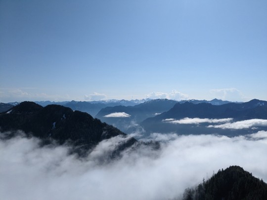
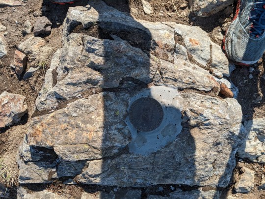
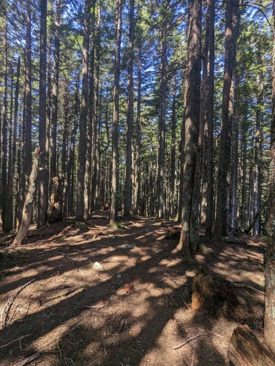
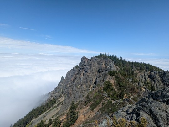
The Monday after, a friend and I tried an even more daring loop circumnavigating Granite Mountain on foot, connecting a bunch alpine lakes on the way (the original plan was to go up to Kaleetan Peak but it was too snowy to get there safely in just running shoes). It was beautiful, but grueling. We ended up doing about 22 miles and almost 9K of vert that day, the first bit moving really slowly with our detour to Kaleetan.

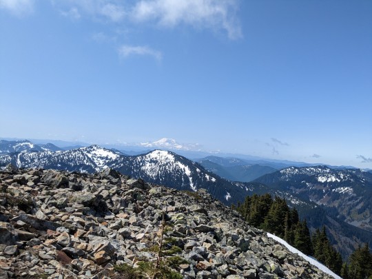
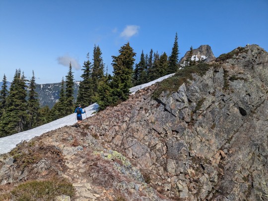
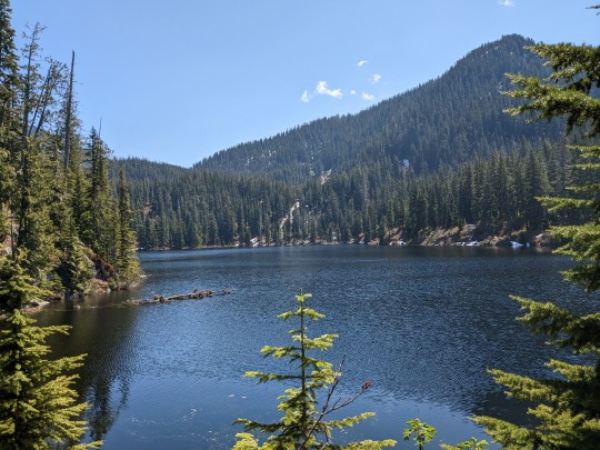
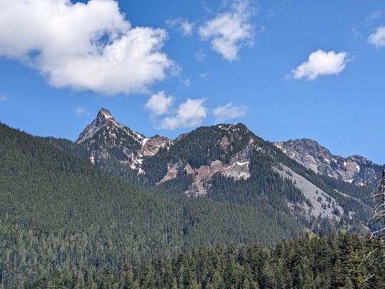
Happy for the change of seasons!
3 notes
·
View notes
Text
Glacier Peak Wilderness
Exploring Glacier Peak Wilderness: The Untamed Beauty of Arlington, WA
Nestled in the rugged Cascade Mountains of Washington State, Glacier Peak Wilderness is a stunning, unspoiled expanse of pristine forests, alpine meadows, and towering peaks. Encompassing over 575,000 acres, this breathtaking wilderness area is one of the largest in Washington, offering an unparalleled experience for outdoor enthusiasts. Located east of Arlington, WA, this remote and rugged landscape is home to Glacier Peak, a stratovolcano that dominates the region and gives the wilderness its name. For hikers, backpackers, and nature lovers, Glacier Peak Wilderness offers an immersive adventure into one of the most untamed and awe-inspiring destinations in the Pacific Northwest.
The Majestic Landscape of Glacier Peak Wilderness
Glacier Peak Wilderness is renowned for its diverse landscapes, ranging from dense, old-growth forests to alpine tundra and glacier-fed rivers. The area is crisscrossed by more than 450 miles of trails, providing endless opportunities to explore the region’s stunning scenery. As visitors traverse the trails, they will encounter:
Towering Mountains and Glaciers – Glacier Peak, standing at 10,541 feet, is the crown jewel of the wilderness. It is surrounded by numerous glaciers, rocky ridges, and deep valleys carved by ancient ice flows.
Lush Forests – The lower elevations are covered in dense coniferous forests featuring Douglas fir, western hemlock, and cedar trees. These forests provide habitat for a rich array of wildlife.
Alpine Meadows – Higher elevations feature sprawling meadows blanketed with wildflowers in the summer, creating a breathtaking contrast against the rugged mountain backdrop.
Rushing Rivers and Pristine Lakes – Glacier Peak Wilderness is home to crystal-clear alpine lakes, glacial streams, and major rivers like the Sauk and Suiattle, offering abundant fishing and water recreation opportunities.
Hiking and Backpacking in Glacier Peak Wilderness
With its extensive network of trails, Glacier Peak Wilderness is a hiker’s paradise. Whether you're looking for a short day hike or a multi-day backpacking expedition, there are trails suitable for all skill levels.
Popular Trails in Glacier Peak Wilderness
Pacific Crest Trail (PCT) – Glacier Peak Section
One of the most famous long-distance trails in the United States, the Pacific Crest Trail (PCT) passes through Glacier Peak Wilderness, offering some of the most scenic stretches of the entire trail. Hikers can experience dramatic mountain views, wildflower-covered meadows, and challenging alpine passes.
Image Lake Trail
One of the most iconic destinations in the wilderness, Image Lake offers jaw-dropping views of Glacier Peak reflected in its pristine waters. The trail is moderately challenging, with a 20-mile round-trip hike that rewards adventurers with breathtaking scenery.
Spider Gap – Buck Creek Pass Loop
For those seeking an epic multi-day backpacking adventure, the Spider Gap – Buck Creek Pass Loop is a must-do. This 44-mile loop traverses dramatic mountain passes, alpine lakes, and stunning vistas, providing one of the most immersive experiences in the region.
Boulder River Trail
For a family-friendly hike, the Boulder River Trail offers a gentle path through lush forests, leading to spectacular waterfalls and serene river views. It’s an excellent choice for those looking for a more accessible yet rewarding wilderness experience.
Wildlife and Ecosystem
Glacier Peak Wilderness is a biodiversity hotspot, home to an array of wildlife species that thrive in its varied ecosystems. Visitors may encounter:
Black Bears – These majestic creatures roam the forests and meadows, often foraging for berries.
Mountain Goats – Commonly spotted on rocky ridges and high-altitude slopes.
Elk and Deer – Roosevelt elk and mule deer frequent the lower elevations.
Wolves and Cougars – Though elusive, these apex predators play a crucial role in the ecosystem.
Birdlife – From bald eagles soaring above to colorful songbirds in the meadows, birdwatching opportunities abound.
Visitors should always practice Leave No Trace principles and carry bear-proof containers when camping in bear country.
Camping and Outdoor Adventures
Camping in Glacier Peak Wilderness offers an authentic backcountry experience. Unlike developed campgrounds, this area requires visitors to be entirely self-sufficient.
Backcountry Camping
There are no designated campsites within the wilderness, but dispersed camping is allowed. Popular areas for overnight stays include:
Image Lake Basin – Offers spectacular sunrise and sunset views over Glacier Peak.
Lyman Lakes – A serene, high-elevation camping destination with stunning alpine scenery.
White Chuck Basin – Features dramatic landscapes and fewer crowds.
Fishing and Water Activities
Glacier Peak Wilderness is an angler’s paradise, with numerous pristine lakes and rivers teeming with trout. The Suiattle and Sauk Rivers provide excellent fly-fishing opportunities, while alpine lakes offer peaceful settings for casting a line.
Climbing Glacier Peak
For experienced climbers, summiting Glacier Peak is a challenging but rewarding endeavor. Unlike other prominent Washington volcanoes, Glacier Peak is one of the least climbed due to its remote location. Most ascents begin from the White Chuck Trailhead, requiring a multi-day trek through rugged terrain.
Best Time to Visit Glacier Peak Wilderness
The best time to visit Glacier Peak Wilderness largely depends on your preferred activities:
Summer (July – September) – Ideal for hiking, backpacking, and wildflower viewing. Snow has melted from most trails, and temperatures are mild.
Fall (September – October) – Fewer crowds and stunning autumn colors make this a great season for exploring the wilderness.
Winter (November – March) – Best for experienced backcountry skiers and snowshoers. Harsh weather and deep snow make access challenging.
Spring (April – June) – Melting snow creates stunning waterfalls, but many trails remain impassable until mid-June.
Preserving Glacier Peak Wilderness for Future Generations
As one of the most pristine wilderness areas in the country, Glacier Peak Wilderness is protected under the Wilderness Act of 1964. This designation ensures that the land remains undeveloped, preserving its natural beauty for future generations.
Visitors are encouraged to follow strict conservation practices, including:
Packing out all waste – No trash, including food scraps, should be left behind.
Minimizing campfire impact – Use a camp stove instead of building fires.
Sticking to designated trails – Prevents erosion and protects fragile ecosystems.
Respecting wildlife – Observe animals from a distance and never feed them.
How to Get to Glacier Peak Wilderness
From Arlington, WA, visitors can access Glacier Peak Wilderness via several trailheads, including:
Suiattle River Road – Leads to popular trailheads like PCT access points and Miners Ridge.
Mountain Loop Highway – Provides access to trails such as Boulder River and North Fork Sauk.
White Chuck Road – Once a primary access point, but roads have been impacted by past landslides.
A high-clearance vehicle is recommended for some of the rougher forest roads leading to trailheads.
Conclusion
Glacier Peak Wilderness is a true hidden gem of Washington State, offering an unparalleled outdoor experience for those seeking adventure, solitude, and breathtaking scenery. Whether you’re summiting Glacier Peak, hiking through wildflower meadows, or simply soaking in the unspoiled beauty of the Cascades, this remote wilderness promises an unforgettable journey into nature’s raw splendor. Plan your visit, respect the land, and embrace the untamed beauty of Glacier Peak Wilderness.
Here is another local business to support
Darrington, WA 98241, United States
Visit this next site
0 notes
Text
Your Guide to Building and Renovating Homes in Jindabyne with Lean2Constructions
Jindabyne, a stunning town located at the foot of the Snowy Mountains, has been attracting home buyers, renovators, and builders for many years. Its natural beauty and proximity to major attractions like the Snowy Mountains, Lake Jindabyne, and skiing resorts make it an ideal location for both permanent residents and holiday homeowners. Whether you're considering building a new home or renovating your kitchen, working with a professional and trusted builder is crucial to ensure the highest quality of work. In this blog, we will explore the services of Lean2Constructions, a leading Builder Jindabyne, and how they can help you create the perfect home, be it through new home building or kitchens renovations Jindabyne.
Let’s dive into some tips, advice, and insights that will help guide you in making the right choices for your next project.

Why Choose a Local Builder Jindabyne: Lean2Constructions
When it comes to new home building or kitchen renovations in Jindabyne, hiring a local builder is essential for many reasons. A local builder like Lean2Constructions understands the unique landscape, weather conditions, and regulations of the area. They are familiar with local suppliers, contractors, and the best materials suited for the environment.
One of the biggest benefits of hiring a local builder Jindabyne is that you can rely on their established reputation within the community. Lean2Constructions has worked on a range of projects in Jindabyne, building homes and renovating kitchens that meet the unique needs and preferences of the locals.
Whether you are building from scratch or renovating an existing space, working with a new home builder in Jindabyne who knows the area will make the process smoother and more efficient. You’ll also have peace of mind knowing that they’re just a call away if you need any adjustments or have questions during the process.
Tips for Choosing the Right New Home Builder Jindabyne
Building a new home is one of the most significant investments you'll ever make, so choosing the right new home builder Jindabyne is crucial to ensuring a smooth and successful project. Here are some key factors to consider when selecting a builder for your dream home:
1. Experience and Reputation
It’s important to hire a builder with experience and a good reputation in Jindabyne. Lean2Constructions has been building quality homes in Jindabyne for years and has developed a strong reputation for delivering high-quality projects on time and within budget. Their experience allows them to handle any challenges that may arise during construction, ensuring a stress-free process for homeowners.
2. Portfolio of Past Projects
Before hiring a new home builder Jindabyne, take a look at their portfolio of completed projects. This will give you an idea of their style, craftsmanship, and the types of homes they build. Lean2Constructions offers a diverse range of designs, from traditional alpine homes to modern, eco-friendly constructions. Their portfolio is full of inspiring homes that showcase their skill in designing and building homes tailored to the needs of each homeowner.
3. Transparent Communication
Clear and open communication is vital when working with a builder. Lean2Constructions understands the importance of keeping their clients informed every step of the way. They provide regular updates, answer questions promptly, and make sure you’re always in the loop. Transparent communication helps avoid misunderstandings and ensures that the project runs smoothly.
4. Local Knowledge
As previously mentioned, a local builder Jindabyne will have invaluable knowledge of the area, which is crucial when it comes to planning and building your new home. They’ll be familiar with local council regulations, zoning laws, and the best materials to use for the local climate. This expertise ensures that your home is built to last and meets all the necessary regulations.
The Importance of Kitchens Renovations Jindabyne
The kitchen is the heart of any home. It’s where families gather, meals are prepared, and memories are made. Whether you're looking to upgrade your current kitchen or completely renovate it to suit modern needs, Lean2Constructions can help turn your vision into reality with kitchen renovations in Jindabyne.
Here are some reasons why renovating your kitchen with a professional builder like Lean2Constructions can add value to your home and enhance your lifestyle:
1. Increased Home Value
A well-done kitchen renovation can significantly increase the value of your home. If you're planning to sell in the future, a modern, functional kitchen can make a big difference in attracting potential buyers. Lean2Constructions understands how to design and renovate kitchens that not only look beautiful but also add value to your property.
2. Enhanced Functionality
A kitchen renovation allows you to make better use of your space. Whether you want to create a more open layout, add additional storage, or incorporate energy-efficient appliances, a professional kitchens renovation Jindabyne can enhance the functionality of your kitchen. Lean2Constructions takes the time to understand your lifestyle needs and designs kitchens that meet your unique requirements.
3. Modern Aesthetic
Outdated kitchens can make your entire home feel less inviting. With a kitchens renovation Jindabyne, you can update your space with contemporary finishes, modern cabinetry, and stylish countertops. Lean2Constructions helps you choose materials and finishes that fit your style, whether it’s sleek and modern or rustic and cozy.
4. Energy Efficiency
Energy efficiency is a top priority for many homeowners. During a kitchens renovation Jindabyne, it’s a great opportunity to upgrade your appliances, lighting, and insulation to save energy and reduce utility bills. Lean2Constructions incorporates sustainable practices in their renovations, ensuring that your kitchen is both beautiful and environmentally friendly.
The Step-by-Step Process of Building a New Home or Renovating Your Kitchen in Jindabyne
Whether you’re working with a new home builder Jindabyne like Lean2Constructions or renovating your kitchen, understanding the process can help you feel more confident and prepared. Here’s a breakdown of the typical steps involved in both building a new home and renovating a kitchen:
1. Initial Consultation
The process begins with an initial consultation where you meet with your builder to discuss your vision. Whether you’re looking to build a new home or renovate your kitchen, this meeting is crucial for understanding your goals, budget, and timeline.
2. Design and Planning
Once your ideas are clear, the design phase begins. For a new home, your builder will help you design a layout that works with the land and your preferences. For kitchen renovations, the builder will help create a functional layout and select materials that suit your style.
3. Obtaining Permits and Approvals
Building a new home or renovating a kitchen often requires permits from the local council. Lean2Constructions takes care of this for you, ensuring all the necessary paperwork is filed and approvals are obtained before work begins.
4. Construction or Renovation
The construction or renovation phase is where the magic happens. Lean2Constructions will manage the entire process, from demolition (if necessary) to building or renovating your new space. They oversee all aspects of the project, from hiring subcontractors to ensuring that work is completed to the highest standards.
5. Completion and Final Inspection
Once the project is complete, there will be a final inspection to ensure everything meets your expectations. Lean2Constructions takes pride in delivering quality work, and they’ll ensure that every detail is perfect before handing over the keys to your new home or renovated kitchen.

Build or Renovate with Confidence in Jindabyne
Building a new home or renovating your kitchen in Jindabyne can be an exciting and rewarding experience. With the right builder Jindabyne, like Lean2Constructions, you can ensure that your project is completed to the highest standards, on time, and within budget. Whether you’re looking to build a brand-new home or renovate your kitchen to match modern trends, Lean2Constructions is committed to bringing your vision to life.
From their extensive knowledge of the local area to their commitment to quality craftsmanship, choosing Lean2Constructions as your new home builder Jindabyne or for kitchens renovations Jindabyne ensures that your project is in capable hands. Don’t hesitate to reach out to them today for a consultation and take the first step toward your dream home or kitchen renovation.
0 notes
Text
Northern Utah 🥾 Favorites & Recap
Recap of the Trip
Felt peaceful being mostly alone this trip. Didn’t make an effort to meet people except Brooke because we planned to meet back in May when I was supposed to be here. It’s always amazing randomly meeting people you really jive with though. That’s what happened meeting the Jackson family 💞
Cooking was quite a fail this time around. The dinner flavors were just not it. Did go through a cherry tomato phase. Ate so much key lime yogurt and toast with whipped ricotta, pesto, sunflower seeds, and cherry tomatoes
Enjoyed not being in the big city. Only went in a few times. Enjoyed the nature and the places with less people. But still enjoyed weekend markets where I can see people and families enjoying the nice weekend weather as well
Favorite activities during the trip besides the hikes: ➯ Watching people paragliding during sunset at the Flight Park ➯ Alpine Coaster at Park City. It was a quick activity but very exciting ➯ Head massages at Pretty Lash Studio. Enjoyed it so much that I came back the morning of my flight home to get another massage. It was a new offer for them cause they typically do lashes here. They mentioned they will be opening a location for the head massages
Best story moment: car telling me it was about to shut off and to pull over while I was going uphill on a no emergency lane mountain with lots of other cars behind me and on the other side. Luckily, got to a pullout spot, car fixed itself, made it back down and did not see the message again the rest of the trip 😂
Day Hikes
Bear Canyon Suspension Bridge
Three small parking lots that was pretty empty at 4 PM on a Thursday
Start at Orson Smith Trailhead by the bathrooms
Little slop in the beginning. Pretty easy to follow trail with signs at break points. The bridge loop was easy to follow as there were many signs specifically pointing to it. There are other trails along the way
Took the left side (clockwise) loop. Pretty quick hike. About 1 – 1.5 hrs to do the whole thing with little stopping. Did miss where I was supposed to turn to go down. Noticed about 10 mins in
🐍 There was a snake on the trail on my way down. It moved away soon
Bridal Veil Falls
Trail to the fall was paved and shaded. Great spot for an afternoon stroll but wouldn’t call it a hike unless you want to get to the top of the falls. Kind of shady
Tons of families and kids on the trail up to the falls which wasn’t far from the parking lot. Kids were getting in the water at the falls. There were people there picnicking, playing card games, painting. What a peaceful time. There was also a guy playing the flute by the bridge. I tipped him and sat nearby to enjoy a snack
Willow Heights Trail
Parking on side of the road. Easy to find
Steady incline until you get to the meadow. Pretty on the way up
You can take either trail to the lake at the meadow. Going left, clockwise, is shorter
The small lake was nice to sit and watch the three little ducks. Was also sitting there ease dropping on the college kids’ conversation on the simple days of party drama only. The meadow felt very peaceful. Looking far out at the green, light green, yellow trees. Spent some time standing there just enjoying it
Cascade Springs
Not really a hike. More of a stroll through what felt like a garden
There are two parking lots, but I don’t know where the other one is. It was $10 credit card parking using a machine
The bathrooms here have been out of commission for a while. Something about low water.
I enjoyed this place! It made me feel like we were at a botanical garden or some kind of swamp land. It was a really easy walk with a couple of places to sit if you wanted to. No picnics though. I could see myself finding a place to sit and read. There weren’t that many benches and nowhere for you to sit on the grass
Battle Creek Falls
Plenty of parking at 4 PM on a Wednesday
There are bathrooms, but I didn’t check if they worked
The first portion before the mini bridge was a steady incline, but not bad. After the bridge was when it became a steep incline, where my calves could feel it
The waterfall area was very cool and refreshing. Little bit of shade to sit under. The view above the waterfall looking out was very nice
There were shaded areas on and off throughout the trail. I did make it further up to another smaller waterfall, but not much further. Because the incline looked really steep and going down would be a pain. There were two river crossings but had nice big branches that made it easy
There weren’t many people on the trail. As I was going back down around 5:30 PM there were more people coming up
Lower Bell Canyon
Small lot but only one other car when I went at 4 PM on Thursday. By the time I was done around 5:30 PM there were about five more. There are multiple routes to the lake so you’ll see more people than you expect
Walks through side of residential area at first. Big steps
Nice peaceful lake to sit at. Wish I brought my Kindle. Would have sat longer. Had people fishing. Ducks were making bubble blowing sounds as they ate something
Primrose Outlook via Horse Flat
Decent size parking lot but was full early on Saturday. Got lucky as someone was leaving
Forget how much the parking cost. There are envelopes but no pen. You can also pay online
You can do clockwise for counterclockwise, but we did clockwise. I enjoyed it this direction. It’s a little bit of a climb with some flat areas going up and then a steady decline going down
The view at the top was amazing 🤩 would’ve liked to spend more time up there
Stewart Falls
Medium size parking lot that was only partially full when I arrived. $10 parking fee
Would label this an easy-medium trail. Easy to follow. Only one spot that felt like you may fall off the cliff. Not a heavy incline
Bathrooms at the beginning of the trail
~3 miles = ~2 hours
Horsetail Falls
Very small parking lot. Have to go super early. This would be a good summer hike cause it’s next to the water and it’s mostly very shaded. Cold in the fall/winter though
Lake Mary Trail
On a resort so there was plenty of parking. Not sure how this would be during ski season
Breathing was hard here. Took it very slow to get to the lake. There were other trails to other lakes we could get to
Lake was completely quiet around 4-5 PM. The water was so still. Actually, it was kind of eerie 😰 maybe because it was also a cold, gloomy day
Gloria Falls Trail
Was so pleasantly surprised on the drive there that there were still so much yellow! The waterfall at the end was interesting to look at. It wasn’t the biggest but the way the water fell had me watching it for a while
Decent size parking lot. Was full around 4 PM on a Wednesday so I parked on the side by the entrance
The hike was mostly shaded. There were groups of people there that was clear they were on a work trip. I asked someone about it. They said it was a company gathering of people from across the country. There was also film crew
0 notes
Text
Top 10 Must-Visit Travel Destinations in 2025
Looking for the best travel deals for flights, hotels, car rentals, and activities? Look no further! With Trip, you’ll enjoy: ✅ Incredible discounts on global travel. ✅ Easy-to-use platform for planning your trips. ✅ 24/7 customer support to ensure smooth travels.
✨ Special Offer: Sign up through my link and unlock amazing travel discounts!👉 Start Your Journey Now
Plan your dream vacation today with Trip and save big on every booking. Don’t miss out!
As 2025 opens up a world of travel opportunities, there’s no better time to explore breathtaking destinations across the globe. Whether you’re looking for dramatic landscapes, cultural adventures, or unique wildlife experiences, this list will inspire your next getaway. Let’s dive into the top 10 must-visit places for 2025!
1. Slovenia

Nestled in Europe, Slovenia is a compact country that offers diverse landscapes, from the majestic Alps to the sparkling Adriatic Sea.
Lake Bled: A picturesque lake with a charming island and a historic church. Don’t miss the hiking trails that offer stunning views.
Soca River: Famous for its turquoise waters, perfect for swimming and floating along its gentle current.
Postojna Cave: Take a thrilling train ride 4 km underground to explore one of the largest cave systems in Europe.
Hilltop Churches: The Church of St. Thomas is a standout, set against a backdrop of the Alps for postcard-perfect views.
2. Austria

If you dream of alpine beauty and quaint villages, Austria is your destination.
Hallstatt: A fairytale village on the edge of a lake. Take a ferry ride for an unforgettable perspective.
Schafberg Mountain: Ascend Austria’s steepest train for incredible panoramic views.
Sky Ladder via Ferrata: An adventurous climb near Gosau that rewards you with unparalleled adrenaline and scenery.
3. Namibia

For an otherworldly experience, Namibia in southern Africa offers dramatic deserts and unique wildlife.
Deadvlei: Walk among 700-year-old tree skeletons set in a surreal clay pan.
Big Daddy Dune: Hike the tallest sand dune in the region for awe-inspiring desert vistas.
Desert Elephants: Track these rare, majestic creatures in the remote wilderness.
Sandwich Harbour: Witness the stunning meeting point of the Namib Desert and the Atlantic Ocean.
4. Vietnam

Southeast Asia’s gem, Vietnam, is a haven for adventurers and nature lovers alike.
Ban Gioc Falls: The largest waterfall in Southeast Asia, set against dramatic karst mountains.
Halong Bay: Cruise through emerald waters and limestone islands for an unforgettable experience.
Ha Giang Loop: A multi-day motorcycle journey through surreal, Dr. Seuss-like landscapes.
Tea Fields of Moc Chau: Perfectly manicured fields surrounded by rolling hills — a photographer’s dream.
5. El Salvador

Central America’s hidden gem is a haven for surfers and adventure seekers.
El Tunco: A vibrant beach town with world-class waves and unforgettable sunsets.
Santa Ana Volcano: Hike to the crater’s edge for breathtaking views of the surrounding landscapes.
Lake Coatepeque: Relax at this stunning volcanic lake, perfect for swimming or dining lakeside.
Looking for the best travel deals for flights, hotels, car rentals, and activities? Look no further! With Trip, you’ll enjoy: ✅ Incredible discounts on global travel. ✅ Easy-to-use platform for planning your trips. ✅ 24/7 customer support to ensure smooth travels.
✨ Special Offer: Sign up through my link and unlock amazing travel discounts!👉 Start Your Journey Now
Plan your dream vacation today with Trip and save big on every booking. Don’t miss out!
6. Norway’s Lofoten Islands

Located within the Arctic Circle, these islands are a magical blend of beaches, mountains, and quaint fishing villages.
Henningsvær: A charming fishing village with one of the most scenic soccer fields in the world.
Kvalvika Beach: Hike down to this secluded paradise for a peaceful escape.
Reinebringen: Climb stone steps for an iconic view of the islands, fjords, and mountains.
7. Greece’s Islands

With over 6,000 islands, Greece is a destination that offers something for everyone.
Santorini: Famous for its whitewashed houses and vibrant sunsets.
Milos: Known for its relaxed vibe, lunar-like landscapes at Sarakiniko Beach, and crystal-clear waters at Kleftiko Bay.
Zakynthos: Home to the iconic Shipwreck Beach and towering white cliffs with azure waters.
8. French Polynesia’s Moorea

Known as the “Pearl of the Pacific,” Moorea is a paradise of jagged peaks and turquoise lagoons.
Mount Mouaputa: Hike to this shark-tooth-shaped peak for unbeatable views.
Tiahura Beach: Relax at this serene beach and soak in the stunning scenery.
Boat Tours: Swim with blacktip sharks and explore vibrant coral reefs.
9. New Zealand

This land of epic landscapes offers a mix of fjords, beaches, and snow-capped mountains.
Cathedral Cove: A stunning coastal gem accessible by boat or hike.
Mount Cook: Trek to the base of New Zealand’s tallest peak for jaw-dropping glacier views.
Milford Sound: Cruise through this iconic fjord, surrounded by towering cliffs and cascading waterfalls.
10. Australia

From vibrant cities to pristine nature, Australia has it all.
Western Australia: Explore the whitest sands and clearest waters around Esperance.
Uluru: Witness the magic of this massive sandstone monolith in the Outback.
Lord Howe Island: A secluded paradise with lush landscapes and the world’s tallest sea stack, Ball’s Pyramid.
Looking for the best travel deals for flights, hotels, car rentals, and activities? Look no further! With Trip, you’ll enjoy: ✅ Incredible discounts on global travel. ✅ Easy-to-use platform for planning your trips. ✅ 24/7 customer support to ensure smooth travels.
✨ Special Offer: Sign up through my link and unlock amazing travel discounts!👉 Start Your Journey Now
Plan your dream vacation today with Trip and save big on every booking. Don’t miss out!
No matter where 2025 takes you, these destinations promise unforgettable memories. Which place are you most excited to visit? Let us know in the comments!
Happy travels! 🌍✈️
#trending#search engine optimization#seo agency#seo company#seo marketing#marketing#seo services#google ads#travel blog#travel#travestiizmir#travis kelce#travis scott#traveſtiizmir#traveling#travel photography#tourism#travel destinations#Travel
0 notes
Text
Taylor Swift Explores the Majestic Beauty of the Rocky Mountains

Music icon Taylor Swift recently ventured into the heart of the Rocky Mountains, trading her usual spotlight for the serene wilderness of Colorado. Known for her poetic lyrics and powerful stage presence, Taylor’s trip revealed a quieter, reflective side as she immersed herself in the breathtaking landscapes of this iconic mountain range.
A Scenic Retreat
Taylor’s journey began with a drive along the Trail Ridge Road, one of the highest paved roads in North America. With views of snow-capped peaks and alpine meadows, the road offered her a front-row seat to the Rockies’ grandeur. “It’s like stepping into a painting,” she wrote in a post featuring her perched on a rock, gazing out at the endless horizon.
Hiking Through History
The singer-songwriter didn’t stop at scenic drives. Taylor laced up her hiking boots and hit the trails, exploring Bear Lake and the Dream Lake loop. Along the way, she stopped to admire wildflowers, shimmering glacial lakes, and towering pines. In a candid moment shared with fans, she reflected on the history of the land and its deep connection to the indigenous people who first called it home.
“Every step here feels like a song,” she said. “There’s so much history, so much beauty—it’s impossible not to be inspired.”
Music Meets Mountains
Known for finding inspiration in the world around her, Taylor revealed that the Rockies had sparked ideas for new music. “There’s something about these mountains—their silence, their strength—that makes you want to create,” she shared in a short video featuring the soft sound of wind rustling through the trees.
A Call for Preservation
Throughout her trip, Taylor emphasized the importance of protecting natural spaces. She encouraged her followers to support conservation efforts and to tread lightly while exploring. “This beauty isn’t ours to keep—it’s ours to protect,” she reminded fans.
A Star Among the Peaks
Taylor Swift’s adventure in the Rocky Mountains showcased her love for nature and her ability to find artistry in every corner of the world. It was a reminder that even amidst the tallest peaks, there’s always room to dream.
0 notes
Text
Breathtaking Travel Destinations for 2025: An Engaging Blog Post
youtube
Calling all travel enthusiasts! With borders reopening and wanderlust at an all-time high, 2025 is shaping up to be an epic year for exploration. Buckle up as we unveil 10 incredible destinations that deserve a spot on your 2025 bucket list!
1. Slovenia: A European Gem

Slovenia packs a punch! This compact European nation offers a diverse landscape, from the majestic Julian Alps to the turquoise Adriatic Sea. Explore the charming capital, Ljubljana, or hike to the scenic Lake Bled, a postcard-perfect spot with a charming island church. Don't miss the Škocjan Caves, a vast underground network that feels like stepping into another world.
booking your travel from here
2. Austria: Alpine Charm and Fairytale Villages

If you love dramatic scenery and charming villages, Austria should be your next stop. Nestled amidst the Alps, Austria offers stunning landscapes, delicious food, and rich history. Explore the fairytale village of Hallstatt, take a ride on Austria's steepest cogwheel train to the top of the Schafberg mountain, or challenge yourself with the exhilarating Sky Ladder via Ferrata near Hallstatt.
booking your travel from here
3. Namibia: A Different Kind of Africa
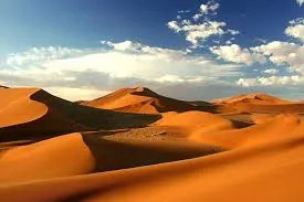
For an otherworldly adventure, head to Namibia. This southern African country boasts landscapes unlike anything you've ever seen. Witness the stark beauty of Deadvlei, a clay pan dotted with the skeletal remains of ancient trees. Hike to the top of Big Daddy, the tallest dune in Sossusvlei, for breathtaking 360-degree views. Embark on a thrilling journey to spot the elusive desert elephants, a unique adaptation to the harsh environment.
booking your travel from here
4. Vietnam: Backpacker's Paradise
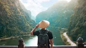
Vietnam is a Southeast Asian gem that caters to all types of travelers. Immerse yourself in the natural wonders like the majestic Ban Gioc Falls, the largest waterfall in Southeast Asia. Cruise through the emerald waters of Ha Long Bay, dotted with limestone pillars, for an unforgettable experience. Explore the rice terraces of Bat Trang, a picture-perfect landscape sculpted by human hands. For the adventurous souls, the Ha Giang Loop motorbike adventure through the mountains will leave you speechless.
booking your travel from here
5. El Salvador: Central American Surprise

El Salvador might surprise you! From world-class surfing at El Tunco Beach to breathtaking volcanoes like Santa Ana, this Central American nation offers something for everyone. Hike to the rim of Santa Ana Volcano and marvel at the turquoise Lago de Coatepeque at its base. Take a refreshing dip in the lake after exploring the surrounding area.
booking your travel from here
6. Lofoten Islands, Norway: A Tropical Twist in the Arctic
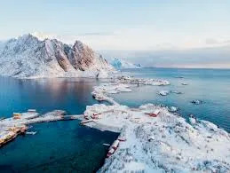
Believe it or not, Norway's Lofoten Islands offer a taste of the tropics in the Arctic Circle! With stunning beaches and surprisingly mild weather, these islands are a paradise for nature lovers. Explore the charming fishing village of Henningsvær, built on a cluster of islands. Hike to the top of Reinebringen for panoramic views of the fjords and surrounding villages. During the summer months, witness the magical phenomenon of the midnight sun.
booking your travel from here
7. Greece: Island Hopping Paradise
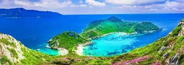
Greece, with its over 6,000 islands, offers endless options for island hopping. While Santorini is a popular choice, consider Milos for a more relaxed vibe. Explore the lunar-like landscapes of Sarakiniko Beach in Milos, perfect for cliff jumping. Relax on the white sand beaches of Kleftiko Bay, accessible only by boat. For a truly unique experience, visit the Sikia Cave, a collapsed cave opening into the sea, with crystal-clear water and stunning rock formations.
booking your travel from here
8. Zakynthos, Greece: Dramatic Landscapes and Shipwreck Beach

Zakynthos, another Greek island gem, boasts dramatic landscapes with towering white cliffs and crystal-clear turquoise waters. Explore the world-famous Shipwreck Beach, where a beached cargo ship creates a stunning backdrop. Hike to the cliffs above the beach for breathtaking views. Don't miss the impressive rock formation of Navagio, especially captivating at sunset with the contrasting colors of the sky, water, and greenery.
booking your travel from here
9. French Polynesia: Escape to Paradise

French Polynesia, with its crown jewel Bora Bora, is the epitome of paradise. This island destination boasts luxurious overwater bungalows, crystal-clear lagoons, and lush green mountains. Hike Mount Otemanu, the island's iconic peak, for breathtaking panoramic views. Relax on the pristine Matira Beach, a perfect spot to soak up the sun and turquoise waters. Explore the underwater world with a snorkeling or diving trip and encounter a kaleidoscope of marine life.
booking your travel from here
10. Slovenia

We can't resist mentioning Slovenia again! This small European nation deserves a second look. Explore the Postojna Cave, a vast cave system with stunning formations. Discover the charming coastal
booking your travel from here
#bestplacestovisit#TravelDestinations2025#Wanderlust#TravelInspiration#SloveniaAdventures#ExploreAustria#NamibiaTravel#VietnamBackpacking#ElSalvadorHiddenGem#LofotenIslands#GreekIslands#ZakynthosViews#DreamTravel#TravelGoals#NatureLovers#AdventureAwaits#ScenicViews#SoloTravel2025#CouplesTravelIdeas#EcoFriendlyTravel#OffTheBeatenPath#TravelTipsAndTricks#TravelPhotography#ExploreTheWorld#WanderlustVibes#TravelBlogger#VacationIdeas#Youtube
1 note
·
View note