#AT2014
Explore tagged Tumblr posts
Visit Tumblr Blog
Explore Tumblr blogs with no restrictions, modern design and the best experience.
Last Seen Tumblr Blogs


Fun Fact
There are dozens of funny blogs to kill time on Tumblr.
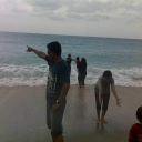
Photo

I know I posted this months ago but I still can’t express how strange this is to me.. I have no memory of wanting to hike or climb as a kid. Maybe it was some latent frustration.. maybe that’s why it’s so freeing now.. don’t know but I can’t wait to frame this some day. 😜 #lifegoals #fullcircle #hiking #pct2018 #at2014 #ne67 #nh48 #lt2014 #jmt2018 #hikemoreworryless https://www.instagram.com/p/CLKFXcFLV0I/?igshid=13z0hswzumxxx
0 notes
Photo

9/19 Georgia to Maine via Appalachian Trail. 9/20 Mexico to Canada via Pacific Creat Trail. What a time with amazing friends. . . . . . #at2014 #pct2017 #thruhike #appalachiantrail #pacificcresttrail #outdoorcollective #natgeoyourshot #wildernessculture #mexicotocanada #georgiatomaine #thetrek https://www.instagram.com/p/Bn6cUeBFiPc/?utm_source=ig_tumblr_share&igshid=18vmrdhdivgol
#at2014#pct2017#thruhike#appalachiantrail#pacificcresttrail#outdoorcollective#natgeoyourshot#wildernessculture#mexicotocanada#georgiatomaine#thetrek
0 notes
Photo

Finally got Green Giant's book. Look forward to reading it! #at #at2014 #appalachiantrail #wheresthenextshelter #thruhike #hikertrash
0 notes
Text
Looking Back: 1 Year

A year ago, I waved at my dad with my hiking pole in the pouring rain, setting off on the Appalachian Trail in Georgia. My 6-month adventure had begun. I was so high on life I almost couldn’t breathe. Grinning like a maniac, I stomped through mud puddles as big as I was and tried to ignore my pack weight. All of a sudden, I could see it – the plaque I’d heard so much about, seen countless photos of:

Hello, Springer Mountain and the start of the Trail! I giggled, throwing my hands up and looking across the mountains.
I finished my six months with an email to my boss from Greece after four other countries, telling him I was ready enough to come back to work. I started hiking knowing that the AT had plans for me, was going to teach me a lot – and it did. Life doesn’t go according to plan, and there is simple beauty in that. I didn’t get very far on the Trail last year – though that depends a bit on who you ask. I’ll finish it someday.

As Ent, I met fun-loving fellow hikers, new friends, Trail Angels, and the part of me that can sleep through the night alone in a tent, throw a mean foodbag line, and wake up to snow on the ground with laughter (even though we went to Town that day). ACO became my partner in crime for awhile, until she hitched a ride out. We healed most of our homesickness and what-did-we-get-ourselves-into together, finding a sunny day to keep going. The hiking community is extraordinary: everyone’s got your back, and you have theirs. Hitch a ride, goof off in town, stand drooling in a grocery store at the endless food you can’t fit in your pack. Recognize what people look like after a shower. On what became my last full day on the Trail, I ran, laughing, around camp to get every single inch of the footpath under my belt – then watched as five others followed suit. I hiked two 12-milers back to back, and groaned when my body protested. I hiked through 2 and a half solid days of rain, nursed hot spots, and managed to burn oatmeal.

And I miss it every day. This surprises non-Trail people. After all, I left it. It was rainy, and cold, and one of the hardest things I’ve ever done – true. But I loved it, and leaving it was just as hard. Mountain air is freeing. Campfires are like blankets to tuck you in at night. There is a wild sort of joy in carrying everything you need on your back. And fresh spring water? Nothing can compare.
Once I got back, I had to go again. I bounced around the US for awhile, and then embarked on a new journey: Southeast Asia. I visited my best friend in Hong Kong, joined Habitat for Humanity in Sri Lanka, toured Siem Reap and Angkor Wat in Cambodia, and spent a couple random nights in Thailand before flying home via Hawaii. Soon after that, my mom and I went to Greece to fulfill a 10-year dream. All of them hold special memories to me.

But the Trail – the Trail is another home. I miss it most when I’m not really paying attention, and all of a sudden it hits me: a fresh breeze, walking in my hiking boots, dreaming of times when I wouldn’t have to be afraid of getting hit by cars on a regular basis.
I feel happier than when I started a year ago. I’m more content. So for all you hikers setting off this year, cherish it. You may not finish, and that’s okay. Push yourself and give it your all, though: chances like this are rare. Love, Ent PS – in honor of my Trail-iversary, I dyed my hair again, more purplish this time:


3 notes
·
View notes
Text
Springer-versary!

Where were you one year ago? We were just starting our journey.
It doesn't seem that long ago. I remember the drive up and the butterflies in my stomach. Where we prepared? Would we make it? Was this an utterly dumb life decision?
Looking back on it now I can’t help but laugh at myself. It was the best decision ever! I would make the same choice 100 out of 100 times.
I want to encourage you: don’t wait until the end of your life to chase your dreams. There is no better time to do those things that are most meaningful to you in life than right now.
2 notes
·
View notes
Photo


It's hard to decide whether this 23 mile stretch (including Pinkham Notch) was more difficult than it was scenic. The steepness of some of those climbs was unreal! The plus side? We got to come back to Gorham for a second wonderful evening at the White Mountains Lodge and Hostel.
1 note
·
View note
Photo

Made it to New Hampshire!! Only 2 beautiful states left!
2 notes
·
View notes
Text
Section Hiking The A.T.
Due to many different constraints (job, finances, desire, etc.) many people feel that a year long thru-hike is not feasible for them, but they still dream of one day completing the entire trail.
They then become a "section hiker". These are hikers that go out for some length of time and hike a section of the AT. The beauty of it is that you have the flexibility to hike wherever and whenever you want. Only want to hike when the flowers are blooming or the leaves are turning...go right ahead! You can plan to go in the optimum season for each section; avoid the crowds and unpleasant weather.
With that in mind, I decided to come up with a list of some section hikes that I think are really nice. These hikes hit a lot of the famous spots along the AT, or the spots that are "worth it" in terms of views. They are compiled in this spreadsheet here.
It lists the section, mileage, maps for start and ending trail-heads, a description of the major points of the hike, and some links to things of interest like hostels.
Also listed at the top is general information about the AT: shuttles, trail updates, and permitting for some of the parks.
This list is for everyone, but also for ourselves. These are areas of the trail that we loved and look forward to going back to and exploring again.
0 notes
Link
If you guys want to know what I've been up to for the past two weeks, here's a little compilation brought to you by the boys of Alpha Company (Combat Engineers) of the 50th Brigade Special Troops Battalion of the New Jersey National Guard.
1 note
·
View note
Photo

Wish I could bring these kinds of rooftop views back home with me. Mixed feelings about only having 465 miles left.
1 note
·
View note
Text
Why the AT Is so Incredibly Easy; Or, Why a Lot of People Like to Think It Is
Many people look at the Appalachian Mountain Range and have the following thought process:
"Hmm, those don't look to be all that tall. What's the highest elevation...not even 7,000 feet!? Wow, practically half the US is higher than that! That AT must be pretty easy"
In response, I did some digging around for total elevation gain for the big 3: Appalachian Trail, Pacific Crest Trail, Continental Divide Trail.
Here is what I found:
Appalachian Trail, 2200 miles: ~515,000 - 529,051 ft
Pacific Crest Trail, 2700 miles: ~489,418 ft
Continental Divide Trail, 3100 miles: ~400,000 ft
Data for the CDT is limited since the trail is not complete. Summing up all of the available data (which does not include New Mexico and some other small stretches) is 271,225 ft. I think the 400k ft is a reasonable assumption.
The elevation of Mount Everest is 29,029 ft. Hiking each trail is like climbing this many Mount Everest's:
AT: 18
PCT: 17
CDT: 14
While on the AT you ascend over 97 miles! To put that in perspective: hiking any of these trails is enough elevation gain to put you into outer space. The AT puts you right at Low Earth Orbit.
It is clear that on a mile-per-mile basis the Appalachian Trail is steeper (which is just one indicator or ruggedness). This, however, by no means devalues any of the other trails or their thru-hikers. Thru-hiking is an amazing accomplishment and takes an incredible amount of strength. All trails are equally challenging in their own regard; hiking on the lowly east coast is just as difficult than hiking out west.
3 notes
·
View notes