A blog dedicated to the history and geography of the Forgotten Realms. A pet project and side blog of Snat-Snailcat
Don't wanna be here? Send us removal request.
Text
Reconstruction Junction: Yartar
The title of this type of entry will be workshopped. However, it is key to my history of the Realms that I start somewhere in my lofty aspirations to chronical and redraw areas of Toril.
Today, such a journey begins with the city of Yartar. Why, you may ask? Because the name is fun to say, and because I have a personal project that does, at some point, utilize Yartar as a setting.
Where, you might ask, is Yartar located? For this I will point to our most recent canonical map of the Sword Coast.

As the griffon flies, it is about 250 miles (~375 km) from Neverwinter, and 283 miles (425 km) from Waterdeep, though the actual journey usually takes a longer route.
Yartar is situated in a region known as the Dessarin Valley, which has a rich history, and information that can be found as far back as in the original AD&D books. The most information comes from The North: Guide to the Savage Frontier, a 1996 box set, in which I was able to discover so many things about this small town full of thieves and rapscallions, run by a longsuffering public servant.
Sadly, the things that 5e brought to Yartar were mostly changes for the worse. I can’t blame them for not following previously laid out details: a lot of change happens in 130 years to a town. But let’s go over some of them.
Governing Body/Person’s title: Waterbaron
The Waterbaron is so named for the three rivers that connect nearby to Yartar, and the prominence the rivers have on life there. The position is elected democratically and directly by the citizens of Yartar, and serves a life term. The current Waterbaron at any given time inhabits and holds court in the Waterbaron’s Hall.
Important details:
Population:~6,000 in 1366 DR, more by 1491 DR. Mostly human.
Alliances: Member of the Lords Alliance. Other factions operate throughout the city.
Main industries: Barge-making, fishing, trade
Factions: Hand of Yartar, Harpers, Zhentarim, and the Kraken Society, among others
Totally-Not-Petty Rivalry: The town of Triboar
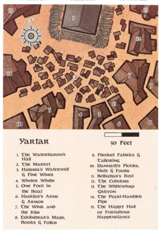
The first map of the town of Yartar (I would hesitate to call it a city), appears in Volo’s Guide to the North (2), with a colored version of the exact same map appearing in the box set The North: Guide to the Savage Frontier (1). The map above is from the latter.
Yartar is, first a foremost, a town with a reputation for less-than-legal dealings. As described in Cult of the Dragon, “Yartar is a caldron of bubbling plots schemes, and under-the-table alliances- but without any single unifying evil presence”(1). Previous Waterbarons, such as Alahar Khaumfros, had ties to the Kraken Society (8), while the Zhentarim always had at least a few agents to keep an eye on the place.
The Hand of Yartar is a group of young thieves that have struggled to truly form any real guild over the decades. Sources as far back as 1366 DR describe the group as being mostly young and female (7), but by 1491, the group has a reputation of being all-female (5).
Legal trade exists as well, as merchants and caravans are almost constantly passing through the town, as well as coming by water via the three rivers. The Fishyard, the marketplace in front of the Waterbaron’s Hall, brings fresh fish, crab, and eels every day to the citizens of Yartar (6,7). Several stores also surround the market, primarily providing goods and services that are in-demand for the adventurers and merchant caravans who pass through (6). The Lionshield Trading Coster operates out of Yartar, but is known throughout the Dessarin Valley (5)
It is at this point that I risk becoming a wiki page for this little town, so let’s mix it up.
There are some key features of this city that I immediately fell in love with.
The first are the Light Lasses. I don’t know if that is an official title for these girls, but it’s the closest thing I could find. By tradition, Yartar is not lit at night, except for the torches that burn around the Waterbaron’s Hall. Anyone who wishes to brave the city in the dark can either take their chances, or hire a Light Lass, who knows all the streets by heart, and carries a small light with her (6).
Though I understand that this sounds dangerous, that any thief might be able to take advantage of the lasses, I will point to the mostly/all-female thieves’ guild. My theory is that either the lasses and thieves have an agreement and help each other, or perhaps that the Hands of Yartar are (sometimes) also Light Lasses, who can pull a knife in the blink of an eye should a client try anything. That also implies that one of the Hands of Yartar could simply take a client into an alleyway (of which there are many) and mug them, then put out their light to leave the poor person blind.
Beldabar’s Rest is a lovely inn that is built almost entirely underground, which actually really helps in keeping it at a reasonable temperature regardless of the season. I have a plan of making a separate write-up on this establishment in full at a later date.
Halassa’s Waterwell & Fine Wines gets a small mention here, at risk of me getting carried away, because each day, Halassa provided one free bucket of water to each household in Yartar. There is no mention of her past 1366, but I would like to imagine that someone else has taken up the mantle of carrying out this public service.
The Wink and the Kiss is a fun and informal feast hall that I hope to one day map out. In 1361, it was owned and run by two brothers, Beldorm and Asklar, two humans that stood at 7 feet tall (6). This place was intentionally built to be a labyrinth, with secret passageways hidden behind tapestries and under tables, and many twisting corridors. Of course, in a city of illicit deals, the brothers had to establish some rules. The Wink and the Kiss has been declared a safe-ground by the Hand of Yartar, and the staff put rules in place.
The thing is, unlike a number of places that will ask you to leave your weapons at the door, or just ask you not to fight, The Wink and the Kiss in the 14th century DR required all gear and even clothing to be removed. Patrons then donned costumes provided by the establishment (changing rooms were provided) before being sent into the fray (7).
This is just the most delightful thing I can think of. I want to go to this place. I can just imagine it, the food is hardly more than mediocre, but the atmosphere? Delightful. Sure, shady dealings may go on, but also you can travel secret passageways in the funny outfit they put you in, place hide-and-seek, drink something silly and themed appropriately. I am so disappointed that when The Wink and the Kiss appeared again in 5e, that this concept for the feast hall had been removed. At some point in the 125 years between 2e and 5e, the costumes fell out of use, and even weapons were no longer required to be left at the door. At least, this is the conclusion that I am drawn to, considering one of the encounters in Princes of the Apocalypse that takes place in The Wink and the Kiss can result in a character’s bodyguards drawing blades on the player characters (4). What I’m saying is, the old management would never let that happen.
Princes of the Apocalypse does provide something that I did not expect: an updated map of Yartar. It doesn’t cover any new area from the previous map, sadly, but it does show some of the buildings that remain.

This map is entirely lackluster. The rendering leaves something to be desired, even if this image didn’t have the warping from my scan. The Market, the Waterbaron’s Hall, the The Wink and the Kiss are the only things that are truly the same. The Cointoss, a tavern bar, seems to have been entirely demolished or merged with its neighbors, whereas Halassa’s place seems to have been merged with Winter Winds, which was a clothing store, and Beldabar’s Rest. Since the Rest is underground aside from a gatehouse, it is possible that it still exists. It is also possible that the buildings were renovated into some sort of strip mall setup, as odd as that seems in such a setting. Between Winter Winds and the Waterwell, I firmly believe that the well has remained in operation all these years, because it’s a useful service, even if Halassa has long since past on.
One Foot in the Boat, a tavern known for being noisy and crowded (7) also appears to still be standing, though whether or not it is the same business is neither confirmed nor denied. If it was as busy as it is described, I am certain that it still stands, though likely under new ownership.
To the west, just above Y2, should be the Pearl-handed Pipe, an inn that could accommodate for about 600 people a night. This business is confirmed to still be around, and to have kept its reputation as an excellent place to stay (4). Likewise, the White-Winged Griffon, a rather rickety old inn, remains standing somehow (4). It is, presumably, located north of the upper right of the new map, based on the older one (7)
The Happy Hall of Fortuitous Happenstance would be just north of the upper left corner of this map. This temple to Tymora, known oft as “Two Hap Fort Hall” or simply “Two” by the locals, often sponsored groups of adventurers, and is known throughout the valley for the festival it holds on Shieldmeet (7). Again, I will perhaps some day make a separate write-up on it, for this has gotten too long.
The Shield Tower: On the west bank of the Surbrin River, this tower is a fortress for the city guard. 150 mounted guards act as law enforcement within the city, and a militia outside of it, mostly to keep monsters at bay (7). The tower has an inner and outer wall, the former far stronger as the latter crumbles. It is said that the space between the walls is warded to conjure guardian skeletons if anyone goes there without authorization, but no one has tested it in years (4, 7). Paddocks for traveling livestock are here for public use, and there are docks built into the side, where the Waterbaron’s Barge is stored.
Other known areas:
Fields, North of Town: The Hiring Fair, held each year that Shieldmeet does not occur, is said to take place here. It is likely that these are outside of the city walls (7).
Three Rivers Festhall: Was once, and might still be, a front for the Kraken Society (8).
Dannath’s Pickles, Nuts, and Food: A provisions store, where in 1366, Dannath and his “three strong daughters” sold preserved goods for travelers. It was known to be expensive, but worth the cost (7).
Esklindrar’s Maps, Books, and Folios: A store for maps, books, etc. ran by an eccentric old human. A map of Faerûn was painted onto the ceiling, and I would kill to see it (7).
Firelust Fabrics and Tailoring: A multi-generational and highly talented family of tailors. High prices, but worth the coin (7).
Hasklar’s Arms and Armory: A collection of every type of metal armor and weapon in all sorts of sizes. No metal smith (7).
Docks, along the river(s), for the fishers.
A bridge on the west side. It is wide enough to “accommodate two wagons with room to spare,”(4).’
The Villa, a Harper base in the heart of Yartar, made from a crumbling building and with a beautiful garden behind its stone walls (5).
The Glowing Gem: An inn. This appears to be the starting point for the Gateway to the Savage Frontier video game for the Commodore 64, Amiga, and DOS. I will not be playing this game for my analysis. However, it does say that this inn was close to the western gate.
Actually, looking into this game I found a map that includes a portion of Yartar close to the western gate, as well as a number of other things. This map was put together by user MicktheMage on Old Games, click here to see the interactive version. I was going to just have this as a footnote, but forgive me, because I may have stumbled onto something.

This gives us a few more names of things to work with:
Frydhazes’ Shop of Unusual Items
Boat Rentals
The Tired Traveler (Bar)
The Yartar Armory (Shop)
The Hall of Training
Yartar Bargeworks
Because of the extremely limited constraints of this map, it is unlikely I can really base much of my final map on it, but I do appreciate the insights given, as well as the depiction of the river running through the middle of the town.
Additional known names of alleys/passages (8):
The Long Creep
Mindulspeer Lane
Dead Cat Cut
Shadowskulk
Spitting Adder Lane
And so, I begin sketching.
I’m not normally a city planner, but I do know that there are often things that are often missing from fantasy maps, usually to make life easier. These include things like chicken coops, public spaces, greenspace, livestock paddocks for residents as well as travelers, wells for water, etc.. It’s really easy to design something that looks and acts like our world today, whether that be a strict grid system or a cul-de-sac neighborhood. But people from other times and places have very different needs to ours, and a naturally growing village in Faerun is going to look much different from a small town in rural America.
Updates as the project continues.
Bibliography under the cut.
(1) Cult of the Dragon. TSR, 1998.
(2) Dragons of Faerûn. Wizards of the Coast, 2006.
(3) Power of Faerûn. Wizards of the Coast, 2006.
(4) Princes of the Apocalypse. Wizards of the Coast, 2015.
(5) Storm King’s Thunder. Wizards of the Coast, 2016.
(6) Sword Coast Adventurer’s Guide. Wizards of the Coast, 2015.
(7) The North: Guide to the Savage Frontier box set. TSR, 1996.
(8) The Savage Frontier. TSR, 1988.
(9) Volo’s Guide to the North. TSR, 1993.
Other sources:
Lost Mine of Phandelver, Dungeons & Dragons Starter Set. Wizards of the Coast, 2014.
Silver Marches. Wizards of the Coast, 2002.
#forgotten realms#maps of the realms#map reconstruction#Yartar#sword coast#dessarin valley#faerun#Dungeons and Dragons#multiple editions
6 notes
·
View notes
Text
cats of all types and sizes are god’s perfect killing machines and i can only hope and dream to achieve the raw athletic potential and destructive force that felids are capable of. all while looking like :3
16K notes
·
View notes
Text
Snippet from Dragon Magazine about Eilistraee:

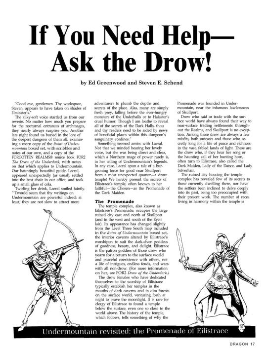


Issue #176
107 notes
·
View notes
Link
[[ Ed Greenwood has launched a Patreon for Forgotten Realms lore!
Show your support as I continue my adventure to tell the best stories possible by writing new material, shooting videos, traveling to events, and more! Get access to all of my exclusive #RealmsLore and access to polls which will help determine what we talk about on my various channels.
The content on these pages is not affiliated with Wizards of the Coast or Hasbro in any way. This is fan content by the biggest and first fan of the Realms, its creator. Much of what you read here is for my personal Forgotten Realms campaign.
Some of these musings on the Realms would be cleaned up and expanded if they were to ever appear in an official publication, but becoming a patron will allow you an inside look into my process. From inspiration, to “writing out loud”, to almost finished, the #RealmsLore contained herein is in various stages of development. Some of the less finished ones might make great topics of conversation in the Discord!
Permanent invite link to his Discord server: https://discord.gg/hP3sYh6fPP ]]
26 notes
·
View notes
Text
Forgotten Realms Campaign Setting Box Set - 1993

Whilst I toil away at mapmaking, I did reward myself with a bit of treasure! In my deep plunges into the interwebs, I did in fact stumble across a wonderful artifact indeed. (But do forgive me for the photo quality, I was too excited for touch-ups!)
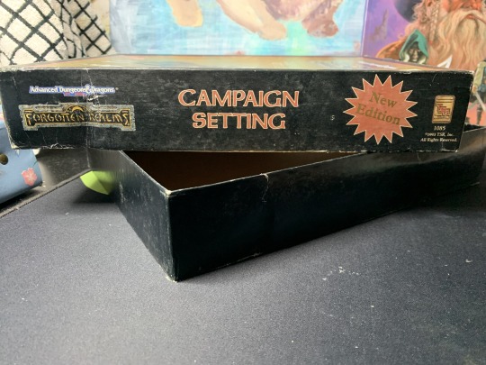
From thirty years ago, the “New Edition” of the Forgotten Realms Campaign setting! What a find! Though the box itself has a few dings and dents (a sign of much love, I’m sure), the treasures inside this chest were in far better condition.

Near mint, if I do say so myself! We see here our good friend Elminster here in some of my favorite art of him, but a Drizzt Do’Urden can also be spotted on the Grand Tour of the Realms, among other familiar faces.
I have not yet read through all of these, but soon I will be able to dispense what knowledge I find!
In addition to these fine books, the set came with a number of loose papers and maps, of which I had never seen before in digital or physical form.
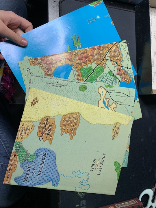
Four in total! Two of eastern Faerun, and two of western. Once I am able to do so safely, I will be creating high resolution scans of these maps to share on this very blog, so do keep your eyes out!
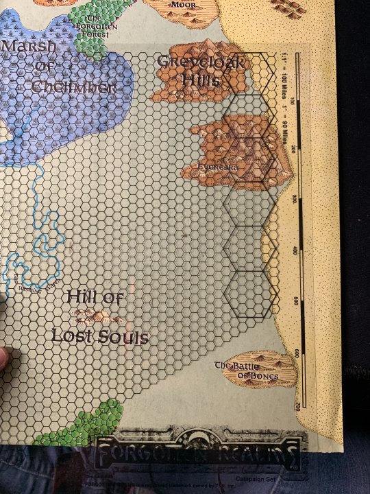
But even more ingenious, included in the box was not one, but two of these! The transparent overlay seen here is made to show scale, and to be moved across the maps. As they all are drawn to the same scale, the overlays can be used between any of them, and having two copies of the overlay means more than one can be placed at a time, or, in case one is lost, there is a backup. These will provide themselves invaluable in reconstructing maps of the realms.
It also makes me wonder why we do not see these more often in more modern reproductions of these maps. I have not seen such overlays in any other piece of media for the Realms or any other setting, but they seem so useful, as well as inexpensive to produce! Perhaps this can be traced to the phasing out of overhead projectors and other such common technology of the 80s and 90s that saw the use of transparencies such as these. Wet erase markers faded out of use, and purchasing transparency films has become more difficult over time. Still, I hope that tools such as this can make a return. If nothing else, it sure beats getting out strings to try to measure the distances!

Following the maps, we find these sheets of symbols. My first thought was, are these sticker sheets? But thankfully, no! No aged glues or sticky pages greeted me (for surely stickers would not age well over three decades). These are actually cards, meant to be cut out and referenced. I am infinitely grateful that the previous owners of this box did not do so, since being in one piece has kept these from being lost or damaged, in the way small pieces often are.
The first three pages include runes and symbols. Some are for factions, such as the recognizable harp of the Harpers on the first page. Some are magical, namely the runes in green, and others are simply to convey a message.
The last two pages are the symbols of various gods and powers in the Realms, though some of the page is still dedicated to runes. Again, I will be creating scans, both front and back, to share.
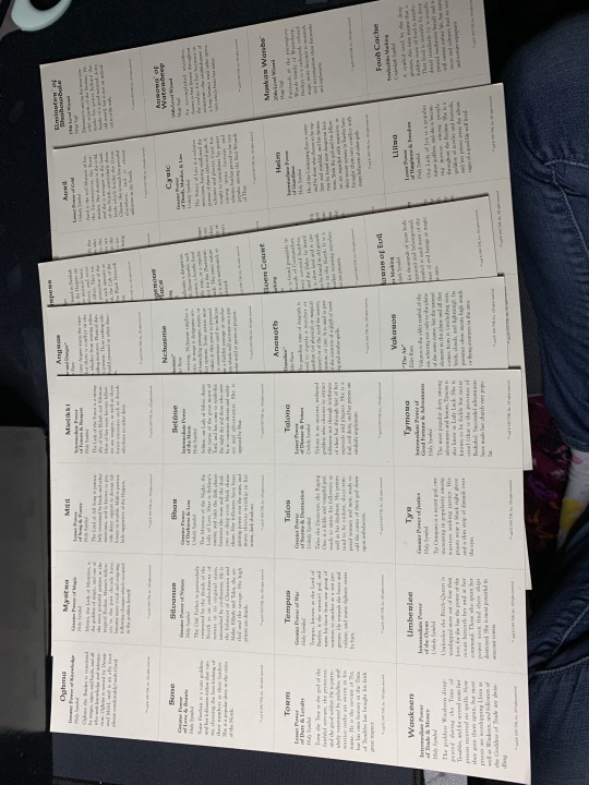
And yes, the backs of all of them contain some information about the image on the front. I cannot wait to make copies so that I feel confident in cutting out and using the cards, while still keeping the originals in good condition.
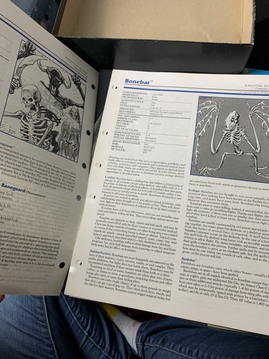
The final portion of this treasure chest of information is a bestiary. The pages are unbound, but punched to fit into a ringed binder. I adore all the art. Like before, I will create scans, and perhaps write on more specific aspects of the creatures therein.
But before I go to work on my maps again, I grant you the most wonderful gift that this box has to offer:
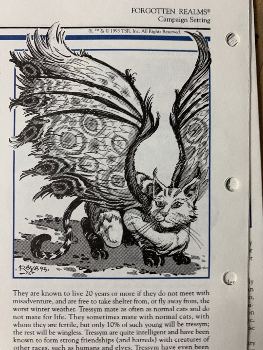
Thank you all, and safe journeys, travelers~
#forgotten realms#faerun#forgotten realms campaign setting#dungeons and dragons#ad&d 2e#AD&D#forgotten realms atlas#treasure trove#tressym#books of the realms#dnd#d&d#product review#I think this counts as a review?#30 year old things can still be reviewed#even if they are a pain to buy#also I got this for $60!!!!#the find of a lifetime truly
79 notes
·
View notes
Photo

Today, from the margins of the adventure book in the AD&D 2e box set, Ruins of Zhentil Keep, page 47, I bring you, him.
That is all.
#forgotten realms#art#dnd 2e art#AD&D#creature#eyes#old dnd art#relics of the realms#dungeons and dragons#ttrpg
4 notes
·
View notes
Text
A Note on the Collaborative Nature of the Realms
The Realms are a living entity, feeding on the creative energies of all its contributors, writers, artists, and map-makers.
-Jeff Grubb, May 1990
Since the days of old, when Ed Greenwood himself began to play with and construct the Forgotten Realms as we know them, the Realms have been a creation of many. In the introduction to the 1990 Forgotten Realms Atlas, both Greenwood and Grubb write their introductions in praise of the work that has been accomplished by each and every contributor, most of all Karen Wynn Fonstad, the artist behind this book.
Part of the allure of the Realms for myself is that collaboration. For 35 years, people around tables, among friends or in writing alone, have all added their own pieces to this world, this section of the multiverse. For years before anything involving the Realms was ever published, Ed Greenwood and his friends constructed the bones, they filled the seas.
Whether it be the dozens of novelists who have woven together the setting, or the players that have inhabited it, everyone who have set foot in the Realms has, in some way, shaped it.
In that same vein, not all minds think alike. For these decades, each artist has just a slightly different view of the worlds of Abeir-Toril. That is the nature of art, no two people’s interpretations are going to be the same. In many ways, those interpretations are encouraged in a collaborative storytelling medium such as Dungeons and Dragons. However, after so many years, pieces of what is canon can become... muddled. They sometimes contradict each other, or misplace items on timelines.
But, isn’t that how history works? We must study it, to pick apart what remains and decide what we know, what we speculate, and what we may never fully comprehend.
That is to say, that going forward with this project, I will focus on research and I will site my sources. However, I will also be adding in my own interpretations of these people and places. The synthesis of the things I have learned will no doubt be missing something, or change something. I guess that means that it is “my” version of the Realms. But it isn’t, is it? Because no matter what, these are our Forgotten Realms. Each of us are just cartographers, mapping what we see as most important as we travel across these lands.
“...for the Realms belongs now to all of us. Elminster showed it to me for the first time over twenty years ago, and I’ve since shown it to you. I wish you the same fun exploring its life, mysteries, splendors, and odd corners that I’ve had, thus far.
- Ed Greenwood, January 1990 (Forgotten Realms Adventures, TSR)
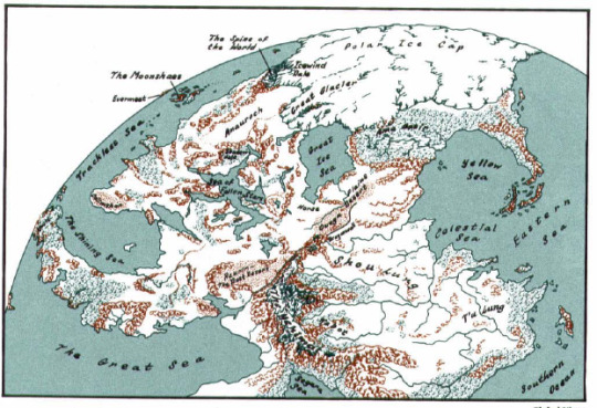
And, as a treat for reading to the end, take a look at this beauty! I will try to get a clearer scan, but I have never see a map of Toril from this angle, and Karen Wynn Fonstad really knocked it out of the park on this one.
#meta analysis#forgotten realms#collaborative storytelling#dungeons and dragons#faerun#ed greenwood#mapmaking#forgotten realms atlas#D&D#dnd
10 notes
·
View notes
Text
Introduction to the Forgotten Realms Atlas
Greetings!
Around the beginning of March, 2022, I was picking my way through the files of the Trove when I stumbled across a treasure most impressive. Buried amidst an archive of Dragon magazines and a program to teach you the rules of AD&D 2e, was this:
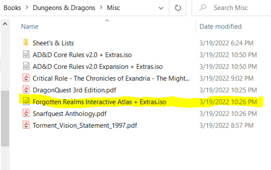
So, like any self-respecting adventurer who had just come across a treasure chest, I did not check for mimics, and immediately opened it up (after speaking with a few of the Installation Wizards).

Behold, what I found inside that chest!
Now, I want to preface my findings with a few important details about myself. For years now, I have had a special fascination with the Forgotten Realms, call it inexplicable, call it what you will, but something has endlessly pulled me into this world. First, my interests were focused primarily on Drow: their culture, society, and lore. But soon, my exploration through the pages of the Forgotten Realms Wiki (for purposes personal and game related) broadened my horizons, you could say.
And curiosity begets curiosity begets a lust for knowledge.
As it turns out, the planet that the well-known Faerûn is situated on, Toril, has remarkably few canon maps that show it in full, at least not easily accessible from a cursory image search. There are a number of maps of more well-known areas, primarily within Faerûn, as it is the most well-established continent in the canon. Some are beautifully rendered in high resolution, such as the 5th edition map of the Sword Coast, released in 2015 by Wizards of the Coast (art by the WotC Extra Life Team, for download here)

This map is beautiful. I have a 54x36″ print of it hanging on the wall of my room. The detail is stunning, even if nearly half of it is covered in water. The issue is, this map only includes a fraction of Faerûn, and nothing of other continents of this world. This is the best map that 5e offers players in the Forgotten Realms in terms of sheer magnitude of places to be explored. But here we are, seven years out from it’s creation and release, without a world map.
So, I went to other editions, because the plethora of lore that is held in those books is astounding, and makes me wish that I had entered into this field of study far earlier in my life, or perhaps, that I was born just a little earlier, so I could have appreciated them at the time they were released.
The 4th edition map of Faerûn has a few key things that need to be noted before you look at it too deeply. As many know, 4e was the edition that introduced the Spellplague to the Forgotten Realms setting. I will make no moral judgements of this event in this entry, but I will point out the things that it changed in the world, the majority of which were undone by the Second Sundering and the ushering in of 5e.
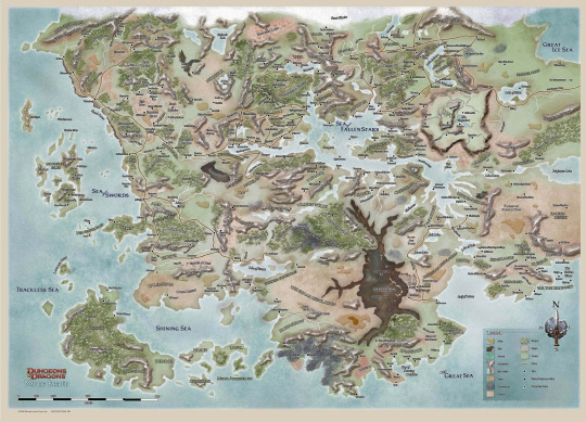
This map, as you can see, features a much larger area, including just about all the land that makes up the continent of Faerûn. However, I must point out what many scholars of the realms already know.
1) The art on this map is... well it’s poopy. I don’t want to be rude, but the dreary color palette does it no service, and the Underchasm is a large brown stain that draws your eyes to it. I’ll let you do with that what you will.
2)The problem with Chult.
Since I am traveling backwards in time to reach my destination, I feel here is where I must skip around a wee bit. You see, Chult is a location that has been featured through numerous iterations of the Forgotten Realms, appearing in books as far back as the very first Forgotten Realms Campaign setting (1987). It has jungles and dinosaurs, and its own set of critiques and criticisms that I will surely dive into another time.
The short of it is, Chult was originally a peninsula, meaning that it was a land mass that went out to sea, but was still attached via land to the mainland of the continent. With the events of the Spellplague, it was made into an island, and then returned to being a peninsula. For reference, we can use the next map on our journey, the 3rd edition map of Faerûn.
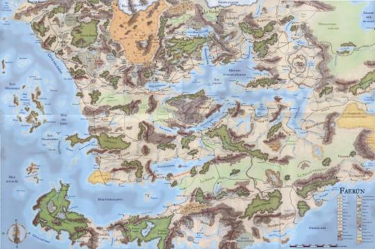
It may not have the details and aesthetic of the 5e map, but thankfully, it also does not have the unpleasant skid mark of the Underchasm that the 4e map so graciously provides us.
And, most importantly, it shows us how Chult was, and how it presumably returns to post-Second Sundering.

I’ll go into detail regarding this another day, but needless to say, the 4e map is... sub-par for our purposes.
And so, in our time machine, we make it to the year 1999, when the Forgotten Realms Interactive Atlas comes to Forgotten Realms Enthusiasts about to brave the new millennium.
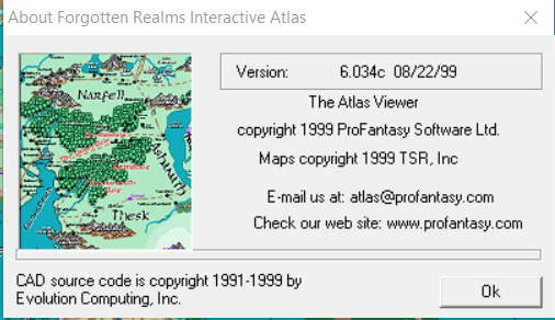
A thrilling piece of software, this. After three major updates, it came to contain over 800 maps of the Forgotten Realms, including cities, streets, and even building interiors. All of them accessible in such a way that they could be exported and printed to be used at the table. But, the most impressive part by far, was the globe.
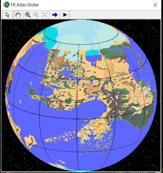
I dare not post a gif of it in motion as it sometimes even gives me a headache, but rendered in stunning 2D, was a globe that you could click and drag to move. But it was more than that! By using the zoom tool, clicking an area would bring you to a “child” map of the area you wished to see in detail. On more fleshed-out areas of Toril, this means you can go as far as to a single city street in Waterdeep, following the chain of parent-child maps.
Google Earth’s initial release was not until July of 2001, nearly two years later. This must have been a massive undertaking for the artists and programmers involved, and it fills me with joy.
But there’s more?!
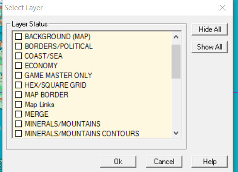
There are 28 different options that can be toggled for you to view, from contours to waterways, political boarders to structures to vegetation.
And, the glory of it all, I find a canon map of Toril.
I am jumping around once more, but technically, we were given a map of Toril in 3rd edition. However, it looked like this:

Meanwhile, the Forgotten Realms Interactive Atlas provides us with this:

(Pardon the quality, I screenshot-ed the original program from 1999, and it’s chunky at best)
But the art and resolution aside, this is stunning! This is everything at a scale and level of detail that tells us much more than the 3e outlines ever could. AND you can choose areas to zoom in on.
The only downside is, we do not see the same level of detail on many of the continents that we do for Faerûn. This is supposed to represent how, in Faerûn, they actually do not know much about these places, and have not mapped them out yet. Also, I am sure that not including those details made this project feasible in the first place, and I respect that. It was 1999, computers could not handle the things they do now, and certainly not at a price that an amateur hobbyist could purchase and use, considering the audience was mostly school-aged kids and teens to my understanding.
So, you might be asking, what does this all mean?
Well, not long after this discovery, I came across a book in a game store, carefully wrapped in plastic to preserve it.
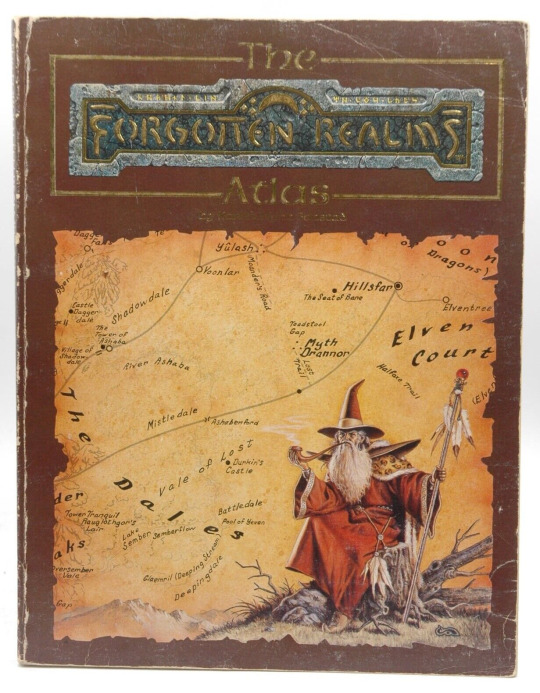
Published in 1990.
As of writing, I have yet to unpack the contents of this atlas, but I want to do it in a way that is meaningful, and can also provide a reference to others. This blog will be dedicated to my research and ramblings on everything that I find.
So, welcome adventurers! It’s time we set off on our journey!
#Forgotten Realms#dungeons and dragons#meta analysis#faerun#faerûn#maps#D&D#dnd#ttrpg#map making#forgotten realms atlas#ed greenwood#dnd 2e#dnd 3e#dnd 4e#dnd 5e#fantasy#introduction post
23 notes
·
View notes