#wanderinghop
Explore tagged Tumblr posts
Photo

#Repost @beersandbedtime ・・・ Taking “Wet Hop” to another level... A bath with fresh hops might just be up there with one of my favorite things I’ve ever done. All the hop aromas were released when they hit the warm water and the aromatics were lovely. Paired with a crowler of @wanderinghop Not of this World.... Special double dry hopped edition, seemed appropriate. This will not be my last hop bath 🛁 💚#hophead #freshhops #wethops #hopbath #wanderinghop #yakimahops #wabeer #wabl #womeninbeer #beerissexy #allthehops #treatyoself #fortheloveofbeer #yakimabeer #beerpassion #beerlife #beerlover #allthebeer #beergirl #craftbeer #yakimawa #cheers #beersandbedtime https://www.instagram.com/p/B1eWqVpH17p/?igshid=x5ukmiartieq
#repost#hophead#freshhops#wethops#hopbath#wanderinghop#yakimahops#wabeer#wabl#womeninbeer#beerissexy#allthehops#treatyoself#fortheloveofbeer#yakimabeer#beerpassion#beerlife#beerlover#allthebeer#beergirl#craftbeer#yakimawa#cheers#beersandbedtime
9 notes
·
View notes
Text
Wandering Hops: The Wynoochee Washout
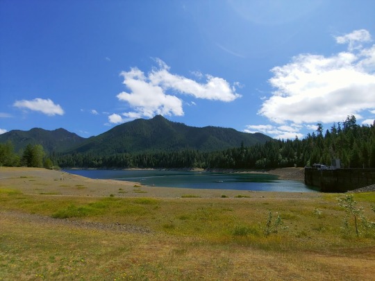
The Olympic National Forest is a parkland full of many wonders, including the Hoh Rain forest, one of the largest temperate rain forests in the US.
Stretching out over the Washington Peninsula, bordering the Puget Sound on one side, and the Pacific Ocean on another, it is emblematic of what people think of when they envision the Pacific Northwest. Long stretches of thick and verdant green canopy dominate the views, broken up by rivers and the towering Olympic Mountains.
The location itself seems almost unreal, something you might find in a fantasy book, or a sci-fi epic detailing a strange and distant world consisting only of plant life, but it’s easily accessible, and just a few hours from my front door, yet I had never been.
When planning a hike there’s a lot of cost-benefit analysis and time management that comes into play. This is mainly because hiking is often (but not always) a remote activity, on top of being a time sink. On average, a fourteen mile hike for me takes about five hours if there's not too much elevation, and up to seven if there’s heavy gains and lots of climbing.
However, I could always overnight.
Returning home from my failed hike on Sunday, I almost went for it immediately. Wynoochee Lake sits at the edge of the Olympic National Forest, but still appeared like a spectacular hike from the reviews I could see. People reported elements of the trail as being overgrown, with multiple tree falls, but I had heard all of that before.

State and National Parks are often the first places to feel budget cuts and financial restraints which often means reduced maintenance and upkeep. Still, as long as the trails are regularly hiked, they tend to stay passable, so long as you’re comfortable with pushing through some brush.
At 14.9 miles through peaceful lush woods, a bit of brush dodging seemed a small price to pay, so I quickly found a campsite, and took the time to prepare, making certain to give myself the room I needed to not face it frantically.
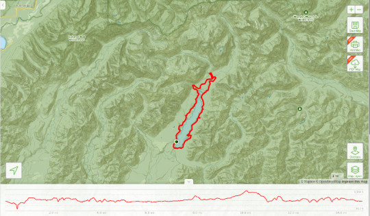
Initially, everything seemed to be going my way, after a short email exchange the camp director agreed to hold a site for me, the local Sportsman Warehouse was full up on my favorite flavor of pro bar, and everything seemed well.
When Thursday morning rolled around, I woke up on time, left on schedule, and headed north towards Olympia looking forward to a good long hike.
Everything had been planned for, I had extra food and water, and even a camp chair, and a few other comforts of home since I was camping beside my truck. This was going to be a day filled with adventure, followed by a nice dinner and a quiet night in a peaceful campsite.
Resolving to set up camp first, I arrived at Satsop Center to find it a wonderful site, complete with showers, ample tent sites, and a friendly husband and wife pair that ran the place. She told me to pick any open spot, and report back for payment, though the fee was a flat twenty dollars.
So far so good.
Forty five minutes later, and I was standing again on their doorstep, eagerly looking forward to my day at Wynoochee Lake. The trail, again clocking in at 14.9 miles, was also listed as a National Scenic Trail, a special moniker assigned by the park service for hikes that are especially beautiful.
As I turned to leave, she called out, “I hope you have fun, but the lake is mighty low, unusual for this time of year.”
The Olympic Peninsula, including the Hoh Rainforest a few hours to the north of where I was, is currently undergoing a drought, but looking around, it would be hard to tell.
Rivers still flow, and the forest is still thick and green. A heavy humidity permeated the air, and the sky on my arrival was grey and overcast, but as I set up camp, and headed for the lake, the weather began to clear, until the sun peeked through the dense canopy overhead, while birds sang and bees buzzed.
It was getting to be near 1100 hours, and I needed to get on the trail.
Starting out, moving quickly over an asphalt footpath, I headed for the dam, knowing that as soon as I got to the other side of the lake I would be far from the tourists, and the man-made madness that dominated the parking area.
The trail, suddenly disappeared. Checking my Maps and GPS, it told me I was on the right course, but I couldn’t see anything, save for a small opening in the brush to my left.
Checking out the small gap in the wall of green, I found my trail, or what was left of it. What was there, was heavily washed out. Regardless, I didn’t want to turn back. Even though it would involve a bit of scrambling, it seemed to be passable.
Moving carefully, I descended down to the first segment of what appeared to be a stable platform, only for it to crumble beneath me, causing me to slide a half foot before I was able to dig in my poles and come to a stop with my heart now beating a fearful cadence half out of my chest. I was now overlooking a staggered drop of at least thirty feet. From my new vantage point, it was easy to see that the trail was gone, there was no way forward, and I wasn’t even a half mile in.
Moving slowly, and thankful my gear had just prevented me from stumbling into a dangerous situation. I pushed back from the edge of disaster, and turned back to look for any other sign of the trail, some missed detour, or a route I had missed. Ultimately I headed up an abandoned forest service road, only for my GPS to tell me I was out of route.
There was nothing left to do, but turn back.
Still, the day wasn’t over yet. Wynoochee Lake Trail is a loop, and so, I began to backtrack, following the markers, only to be dumped out on the beach, losing the trail again in a sea of rocks, and clumps of grasses. Here though, there was no danger in pressing forward, and so, using my GPS as a guide, I pressed on until I encountered a boat ramp and another dead end.
At this point, my excitement was quickly dying only to be replaced by a deep frustration. It just didn't feel like it was my week, dear reader. This was my second hike in a row that was going wrong.
Three miles in, losing time, and my way, I was now looking out past the boat dock on the lake wondering what to do next.
With nowhere to go but up the ramp, I sullenly turned, wondering if I should head back to the truck, break camp and go home. Then I found the trail head.
My hope soared. There it was, snaking off into the woods, the Wynoochee River Trail. Somehow, even though I was following the markers, I had ended up diverted onto a side path that ran the lake. Feeling encouraged, I moved forward, determined to get as many miles into the wood as I could, before turning back and heading for the truck.
In that moment, as the campground area disappeared behind me, the day didn’t feel all that lost. Soon, I was swallowed up by forest, and the traffic dwindled until, suddenly I found myself alone, in the quiet. Towering old growth douglas firs towered majestically up into the sky, framed at their roots by frond heavy ferns.
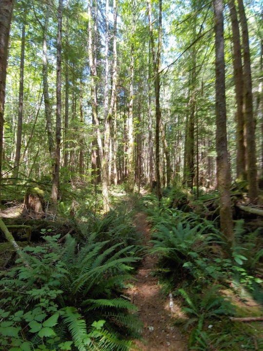

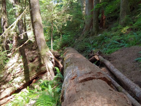
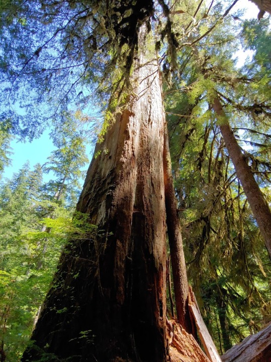
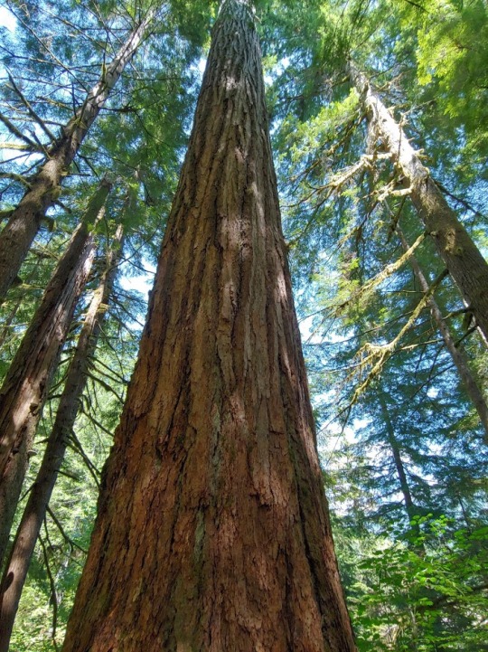
This was what I had come to see. The forest thickened as I moved forward, as fallen branches, and whole trees obscured my path forward, causing me to scramble under or climb over them to continue.
If anything, this trail was proving to be an entirely new type of physical challenge.
Eventually, after crossing a dry river bed, I came to the grave of two old growth firs. Their massive trunks had fallen across the trail and caused the ground around them to collapse under their weight. With a bit of work, I could climb over them, but I didn’t know about the stability on the other side, and I had already pushed my luck earlier that day.

This was where my hike ended. As much as I wanted to press forward, it was time to stop, in the interests of safety and sanity. I had spent the day lost, confused, only to be rewarded by the barest snippets of a hike, my final distance just a little over five miles, including retracing my steps back to the truck.
In many ways, the Wynoochee Lake Trail was a washout, and, one could argue, a failure, but as I hiked back to my campsite to break it down early and head home, it still felt like a victory, even if it was a strange one.
I had persevered, I had seen it though, and relied on my experience, and gear to see me safe, taking it as far as I could go, and that experience included knowing when to stop.
#wanderinghops#hiking#pacificnorthwest#trail#trailreport#wynoocheelake#olympic national forest#overgrown#lost#studioprey#hikerhare#snowy#adventure#camping#overnight#PNW
19 notes
·
View notes
Text
Wandering Hops
Hello everyone!
Starting this Wednesday the 31st, Wandering Hops will be wandering to Wednesdays. Allowing us to wander ever further!
6 notes
·
View notes
Text
Hey Jealousy
by wanderinghope
summary:
Established Relationship. Quinn and Rachel make up after their first fight.
8 notes
·
View notes
Photo

#wanderinghope #waitingforyou #hopelagon #hopewanders #hopewrites #waiting #praying #patiently #future #hubby #husband #february #life #love #kilig #poems #poetry #poetrycommunity #writings #quote #quotes #hopeful #poet #writer #dreamer #hope #wander #writing #textgram
3 notes
·
View notes
Photo

It's gonna be a great weekend! Just dropped in my town two days ago! Be safe and enjoy the weather! 🍻🍻 @melvinbeer #2x4 #melvinbrewing #melvin #hubert #tgif #memorialdayweekend #pnw #wa #beer #craftbeer #wanderinghop #ipa #dipa #mpa #feelslikesummer
#wanderinghop#ipa#memorialdayweekend#wa#mpa#melvinbrewing#pnw#2x4#beer#hubert#dipa#melvin#tgif#feelslikesummer#craftbeer
15 notes
·
View notes
Text
Wandering Hops: Hitting the Wall

I don’t really know how to stop.
On its face, this seems like a super power.
“You don’t know how to stop? Cool! So, how’s the progress on the novel coming?”
In short, it’s not. That and every project I’ve been working on for the last month has felt like it’s moving further towards the horizon, all the while, no matter how fast or hard I run, I look down to find myself on a treadmill, making no progress, save for keeping pace.
That’s the way it feels, even if that feeling isn’t exactly fair to the facts. July, which seems to have lasted forever, has been a phenomenal month in a lot of ways. I’ve hit goals, and achieved things I never thought I’d achieve again, like driving independently. In addition, I’ve kept up with this blog, my training, and even gotten some solid writing done in Starfall. It might not be as much as I’d like, but progress is progress.
Except for me, it’s not...I tell myself that progress is progress, all the while I feel like I’m dying inside because I’m not living up to the standards that I’ve set for myself.
In short, as said, I don’t really know how to stop, and to quote Yoda…

Tuesday I arrived late on a flight from San Francisco, and immediately dived into catch up mode, handling things neglected while I traveled, all the while dealing with a tsunami of obligations, appointments and commitments that seemed to spring up like weeds after a rainstorm.
Days just melted away, as I moved from thing to thing. While this was going on, a nagging guilt was building that personal goals like my writing, weren’t being met, and then suddenly it was Saturday, with a hike still to plan and a Wandering Hops left to write…

See the ship burning in the background? See the smoke in the air? Watch me juggle, watch me dance...
Frantically, I dove into my apps, and began a desperate kind of trip planning, racing through, trying to check boxes.
This wasn’t about enjoyment any more, it was about work. It was about taking the next step, checking the next box so I could cross it off the list, meet the standard I had set myself and get it out of the way so that I could work on Starfall and everything else that was continually piling up like a Tsunami of Stress.
Oh, and did I mention I’m heading down to LA on the 5th of August?

Last minute plans complete, I got to bed forty-five minutes late, with an 0530 alarm scheduled. The night passed fitfully, the alarm went off and I dragged myself out of bed, got ready, went through my checklist, threw the gear in the truck and got on the road, not even allowing myself to stop for coffee on my way out, until I started feeling the tiredness get to me, as I pushed north for Olympia.
My whole focus wasn’t about a fun day on the trail, but my opening sentences, how I was going to write this up.
Check the box, keeping moving, one paw in front of the other… don’t stop… For the love of the Gods… Don’t stop.
Arriving at 9:30, late by my own set schedule, I arrived to disaster.
For one there was no self pay kiosk to purchase for a discover pass, which would prevent my vehicle from being towed. This was the first problem.
The second was that I seemed to have found a very popular and active trail with the local motorized dirt biking crowd. There were close to thirty waiting in the parking lot, tuning up their bikes, getting ready to shred the trail that I was about to be hiking on. This included steep drop offs and narrow paths.
Shock, despair, frustration... and maybe even a tinge of anger followed, as I stood in front of my truck, with my hands on my hips internally cursing. Finally shrugging my shoulders, I hopped back in, and shifted towards damage control.
It was still Sunday, I could still make my deadline, but I had to find another hike. To do that, I had to get home.
My mind immediately jumped to a location I had hit upon the night before, but it was over three hours away, and 14.9 miles, but that was fine, I could plan, throw in an overnight.
Working out the math, I found that if I left by 0600, I could be on site a little after nine, hopefully score a campsite, and then be on the trail by eleven, then return the next day and write it up.
It would mean bumping Wandering Hops to Wednesday, but I had been considering that anyway. All the while, the chorus was ringing in my ears.
Don’t stop… Don’t stop…
I set out from the house to run errands and make a quick loop around Sacajawea park, with a strange and growing anxiety rising in my chest like an oncoming thunderstorm. Arriving at the camp store, I found my normal selection of vegan backpacking meals out of stock, and the anxiety built higher, as I tried to roll with it, and went for the Pro-Bars instead. Next, I headed to the park, because today was supposed to be a hike day…
Suddenly it all hit. The wave of pressure and anxiety slammed into me like a concrete wall, and I couldn’t calm down. My chest felt like it was fluttering, and my mind wouldn’t stop racing. If you’ve watched our livestreams as of late, you’ve heard me speak of my anxiety condition.
Well this was an anxiety and panic attack from stress, and one of the worst ones I had in awhile, but still… I kept walking around the park.
Don’t Stop… Don’t stop…
Amid the raging storm, there was a quiet whisper of revelation, that somehow drew my attention. It rose in the form of a question, shortly after I completed the second mile of the loop.
Why am I doing this to myself? Doesn’t this all seem a bit nuts?
Revelation broke the storm clouds of my panic like rays of sunshine as I slowed, finding a sudden and unexpected modicum of calm, and I realized that I had to stop. I had to give myself some room to breathe, and recover, or I was going to crash, and hard.
I’ve had experience with this, dear reader. It’s one of the reason’s Rise of the Forgotten took almost five years to write. \
Feeling guilty that I couldn’t keep up the pace I had set for myself, I went home and unloaded all of what was going on to my husband, and then my Dragon team, expecting them to be disappointed in me, because, I was disappointed in me.
Stopping is not something I do.
They told me, each one, that they were proud of me, because stopping, acknowledging that I needed to stop, was something that I needed to learn.
I sat there, shocked and bewildered, completely unprepared for that response, and began to work out a plan.
As I did, and settled down, I began working on this blog, writing out today’s experience, as a way of both processing and sharing it all with you.
Ultimately, I am going to slow myself down, try to keep up with the beats, but give myself some room to breath. We aren’t machines, and even if we were, they need maintenance sometimes too.
We romanticize pushing past our limits, extolling such behaviors as virtues of strength and maturity. Sometimes though it takes even more strength to acknowledge that you need to rest, and acknowledge that there’s a wall before you. After all, impacting into it only means you will shatter, but if you slow down, and accept where your limits are, you give yourself the room to climb over them.
#wanderinghops#studioprey#hiking#travel#travelblog#overstressed#stress#frantic#busy#overworked#support#Family#overcoming#limits
20 notes
·
View notes
Text
The Disneyland Fandango

Disneyland is like Alice stepping through the looking glass; to step through the portals of Disneyland will be like entering another world. -Walt Disney
On July 17th, 1955, Walt Disney achieved his dream, opening his park to great fanfare in Anaheim California. At the time of its founding there was no other amusement park like it in the world, and one could argue, ever since. Even though it has often been imitated, expanded and duplicated by both the Disney company itself and their competitors.
Disneyland stands out as a wholly unique experience, authored out of the unique vision of a complicated and at times controversial paragon of his time.
But, is this hiking?
To be honest, dear reader, the point could be argued either way. I spent a total of four days in the park, some days totaling 16 hours or more, with my Garmin Instinct clocking over 11 miles for each day. In that spirit alone it is definitely a hike, or, as we have jokingly called it here at the house, The Disney Death March. Arriving at 0800 full of energy, a hot day under the California sun slowly wittles you down as you move from ride to ride until you return to your hotel room well past midnight, only to flop into bed and do it all over again the next day.
Vacation! Fun! Rides!
See also, soreness, acetaminophen, and mysterious bruises…
For those that have never been, it’s truly hard to capture how effectively the park can manipulate your perception. Entering through the main gate, you face a giant wall of flowers, with two tunnel-like entrances that take you under the train station. Nothing else is visible going forward, save for those two entrances.
Above each is a plaque, informing you that you are about to enter another world...

Emerging out the other side, I found myself in what could have been any town square from early 20th century America, save that far down it, rests a beautiful castle that would be perfectly at home anywhere in Europe.

It’s subtly disorienting and breaks up your perception. I can remember my first time there, feeling almost uneasy, because the park has a feeling of curated reality that’s just slightly out of phase with the one I’m accustomed to, all the while also serving as a type of liminal space.
People are always, always, moving at Disneyland, often in great knots and throngs as they move from ride to ride. Some are in costumes, many were dressed like Jedi or Sith from the recent Star Wars movies.
Looking back, once on the other side of the tunnel, standing on Main Street, the main gates are not visible. The rest of the world is not visible, there is only Disneyland, but it doesn’t stop there.
Merging into the morass of human activity, descending down Main Street, the castle grows ever larger, until you see a statue of the man himself, Walt Disney, holding hands with his iconic creation, Mickey Mouse.

The statue represents a type of nexus, or hub, to the various worlds of Disneyland, from Adventureland, patterned after the jungle and tiki themed movies of the 1950s, to Tomorrowland, based off the pop sci-fi of the same era.


No matter which way you choose, you cross a bridge, go through the Castle portcullis, or enter under an archway, as the scenery and theming subtly shifts until you find yourself, yet again, in another world perfectly curated to represent what it’s supposed to be.
Stopping to think about it, it feels eerie, as if you have actually entered into a world of magic and wonder, a place where anything can happen and reality is fully mutable.

It is no wonder that rumors and ghost stories about the park abound. However, to most people, this seems to pass by without notice. Everyone seems distracted, hopped up on park food, and preoccupied with their own fun as they move quickly from ride to ride, or more often, line to line.
It’s all rhythms, the specially curated scenery shifting around you. Get off the ride, scurry to the next, wait, ride… repeat… over and over, as the day gets hotter, and the miles grow longer, until it can have a strange kind of hypnotic effect, as the day descends into a blur of experience.
These factors, to me, are what make Disneyland a hiking experience. As I said in the Urban Runner, it does not have to be a solely remote, rural activity to far flung locations.
Hiking is about adventure, and challenge, pushing your limits, and trading on your exertion for unique experiences, and in this respect, Disney certainly fits the bill. Everyone has their favorite ride, their reason for visiting, and ends up curating their own adventure. No two people experience the park in the same way, which is, I feel the secret to its success.
It makes the impossible, accessible, and real in a way no one else has ever been able to replicate. Which makes the park the stuff of both dreams… and nightmares.
Be certain to catch the Amazon release of Ghosts of the Nightmare Gods-- out August 29th!

In the end, everything is connected, like life is just one big, never ending song
#disney#disneyland#vacation#wanderinghops#urbanhiking#travelblog#blog#writing#ghostsofthenightmaregods#studioprey#kinfriday#adventure#reality#mickeymouse#tomorrowland#frontierland#adventureland#fantasyland#themepark
16 notes
·
View notes
Text
Wandering Hops: Disappointments
Growing up in the deserts of West Texas gave me a special appreciation for the ocean, and temperatures below 115 degrees. Our summers got so hot, I became convinced that heat was one of our chief exports to hell. No matter where you are, it seemed like it was always hotter somewhere in Texas.
However, being on the beach does not make you immune from the sun. I learned that living in Southern California, but at least the breeze coming off the Pacific is cool, and makes the days bearable.
Even down in Corpus Christi, Tx near the Gulf of Mexico, eight hours from where I grew up, the air was so thick with humidity you could cut slices of it out of the air, and save it for later. Which made it a dubious respite at best and a “living in the worlds largest dryer vent simulator” at worst.
Does it sound like I’m complaining? Maybe I’m just venting. I’ve apparently built up some steam about this topic.
Ok, there’s our terrible pun allotment for this blog post… Moving on.
To summarize, the ocean has always held a type of special allure to me.
For one, any large expanse of sparkling blue water was a rarity in my life, and for two, the sight of the Atlantic was associated in my mind with a one time summer trip to Disney World when I was six, and visiting my Mom’s side of the family in the North East. We’d go to the “Shore” (bonus points for you if that tells you the state) and spend a few days enjoying the colder waters, enjoying our respite from the desert sun.
Yet my entire life, up until I was 26, I had never ventured further west than Albuquerque. The Pacific was a mystery to me. The first time I saw it, was from the dirty window of an eighteen wheeler, hauling freight while in driver training. Far off down the street was a horizon of shimmering blue, during a spring-like November day in Los Angeles.
The traffic had been hell, the parking worse (my vehicle was 70ft long, tip to tip) but suddenly, all of my problems lifted.
There it was, off in the horizon, the big blue water of the west. Fabled in song and story.
The Pacific Ocean.
It is a treasured memory, and has stuck with me, even though I ended up living in Southern California with my then fiance, and now husband. Ironically, in many ways, the Ocean is a desert in its own right. Nothing truly lives only on the surface amongst its waves. In fact, most life there is out of sight, far below the water line. Yet the climate, and it’s beauty is so radically different from anything I had ever really known, outside of a few moments from my youth.
And, amidst the wonder, the grind of daily life, and all those memories, I somehow had yet to visit the Pacific Ocean here in my home state of Washington.
In short, I decided it was high time to fix that.
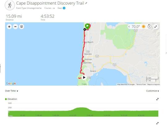
The North Head Discovery trail is a there-and-back hike rated as moderate difficulty. Its challenge arises mainly from its mileage, and the slight increase in elevation at its end. My hiking app gave me maps which combine it with the Cape Disappointment Lighthouse trail, giving it an elevation challenge.
I set out from the parking lot of a resort that donates parking space for trail goers. The trail itself was wide and paved, nothing like what I was accustomed to. A discovery trail is different from your normal hiking trail, in that it focuses on historical and/or scientific curiosities in the area. It’s not just an adventure, it’s a field trip, and for a history buff, this made it especially appealing. You see, Lewis and Clark were there, in 1805. Strewn along the straight, southern path are tiny diversions leading to monuments, and statues, detailing their journeys, and pages from their journals describing events they encountered on the very ground you are walking upon connecting you to their time.

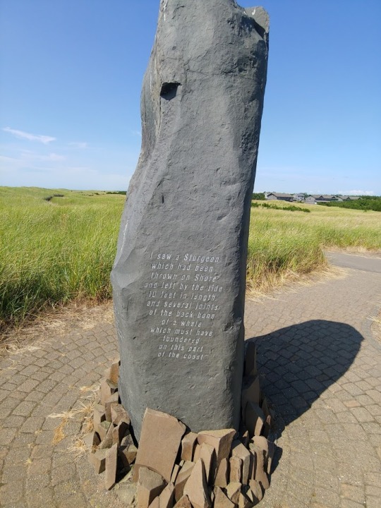
There are gateway arches over the entrance to each parking lot you cross that in proud, bold numbers, proclaiming 1805 showing the pride the community takes in their current history.
The focus is mainly upon the expedition itself, and the local flora and fauna, but there is one placard detailing a limited history of the Chinook, the indigenous people that called that area home before they were ultimately, and unfairly displaced off their land by America’s dream of manifest destiny.
In this, I found the trail especially lacking. To know more of this people, and their history, while venturing on the shorelines where they once lived, thrived, and built their society would have served as a fitting counterpoint to the Lewis and Clark Expedition which ultimately functioned as a herald of the end to their way of life.
Overall, this feeling of imbalance greatly stuck with me as I veered south after my first quarter mile. I was now easily able to hear the roar of the waves, smell the ocean, and feel the cool breeze but I still could not see it. An endless sea of dune grass instead, like the world’s largest shag carpet, stretched out before me as I moved along the easy, wide path, wondering when I would get my chance.
At half a mile in, I couldn’t take it anymore, and diverted down a side trail, heading sharply west. Breaking over the sand dune, and there it was in all of its majesty
I stood there, and took it all in. Here I was, well over 1500 miles from where I had first seen it, and yet, this was the same patch of big blue water. The enormity of it boggled my mind, and caused me to take a deep breath, if only to recenter myself, as I pondered the vastness of the machinery of the Earth.
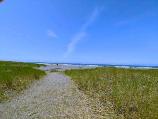
Still, I was not there to stare, not there to have a day playing upon the beach. I was there to hike a trail, and make miles. Taking one last look, I turned back towards my task, and got to work, stopping at a convenient bench to knock the sand out of my shoes.
Soon, the ocean disappeared behind the dunes, and I was back amongst the grassy expanse, cooled by the breeze and all the while being baked by the sun; heading south at a constant, rhythmic pace.
It got meditative. There wasn’t much to do, and there wasn’t much to see besides occasional informational placards and monuments, which sometimes broke me out of my forward moving stupor, and other times, failed to arouse my interest. The first hour passed, and then, about half way through my second, I came to an inescapable realization.
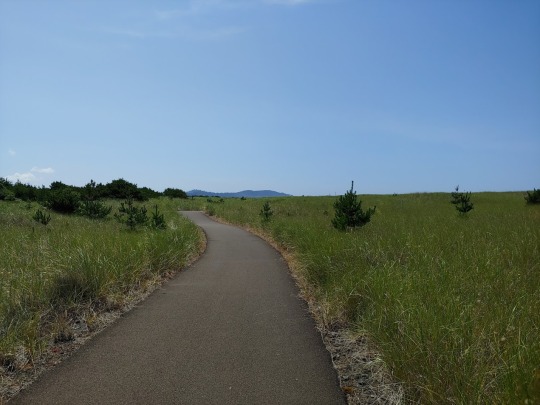
I was bored.
In the hiking community, watching videos, I’ve heard the term “type two fun.” Type Two fun is something that is fun after the fact. You look back on the memory of its accomplishment fondly, even though at the time you were, uncomfortable, overworked, bored, or any number of mildly to severely unpleasant feelings.
As I plodded along it seemed to me that, save for a few moments, this hike was going to be full of the type two fun, and I found myself disheartened. Stopping in my tracks just over four miles in I looked back the way I came as questions danced through my mind.
Should I go home? Give up? Call it an early day? Did I really want to complete this trail, or was I content with saying I tried, and it wasn’t for me?
The decision grew heavier, as I looked forward towards my goals. When I hike the PCT in 2020, I know there will be times when I’m bored, and when I just don’t want to hike. I might be sore, or just fed up, and as I pondered, it became apparent to me that giving up, was a habit, as was perseverance. If I quit today because I was bored, or uninterested, it was going to be that much easier to quit next time… when the workout got hard, or the trail challenging, or when the sentence wouldn’t come for my novel.
That simply wouldn’t do, so, turning back towards the south, I dug in, kicked on my audio book, and enjoyed the scenery I did have, putting away my expectations.
I’ll be honest, there were times when the trail seemed to drag by with all the rapidity of a snail on ketamine but I set a goal for myself to clear as quickly as I could to work on my pacing.

With a goal in mind, and a good audiobook pouring from my headset, another hour passed, as a small mountain came into view, and suddenly, there was a full beach to my right with the ocean pounding against the waves.
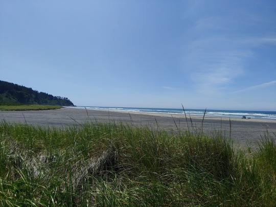
Here before me was a profound type of liminal space. Not just ocean and shore, but ocean, shore and forest all meeting in one collision of juxtaposed beauty. Breaking out of the dune grass, there was an entirely new vista before me now, as the trail tilted up, carrying me forward, and providing me with some elevation challenge, until I crossed one parking lot, then another, and came upon an old lighthouse perched at its top, with a sweeping view of the Pacific before me.
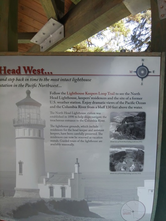


It was an experience I would have never had, if I had turned back. Enjoying my reward, snapping a few pictures for posterity, I took a deep breath, steeled myself, and turned around for the 7.5 mile journey back to my truck, happy that I had stayed on the trail.
#hiking#pacificnorthwest#discoverytrail#lewis and clark#chinook#trail#dayhike#trailreport#wanderinghops#studioprey#persistence#ocean#pacific#bored#lighthouse#hiker#history
24 notes
·
View notes
Text
Wandering Hops: The Urban Runner
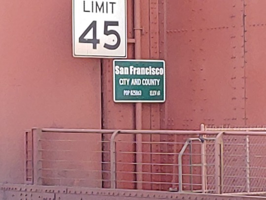
San Francisco, the city by the bay. This sprawling metropolis is purported to have it all, fine dining, upscale hotels, one of a kind experiences, history, and tourist traps aplenty.
But what about hiking? Can you even hike through an urban landscape, and find something that’s challenging, enjoyable, and memorable?
That was the question rattling around in my mind as I descended upon Oakland last week, wondering how I was going to get a Wandering Hops in, while I visited with my family here.
For most of the week, I’d be relegated to Mass Transit. Without a vehicle, my options narrowed as to where I could go, if not as a matter of access, then the time it might take to go anywhere. Even the local gym franchise proved to be a forty five minute bus ride away.
To be certain, anything not within walking distance was going to prove a logistical challenge.

Starting my research the evening of my arrival, I found many offerings at the periphery. Oakland’s Redwood Park, and Marin both boasted hikes that looked challenging and interesting, but were also far afield, with transit times one way peaking towards the two hour mark, which would reduce my options.
Everything had to be planned around a transit schedule, but out of this challenge, I got an idea. What if I turned this on its head? Was it possible to find a hike in San Francisco proper that would offer distance, challenge, and beautiful scenery, all while proving easy to get to, right off the Bay Area Rapid Transit System (The BART).
Narrowing my search, I came across the Golden Gate Park, Lands End, Presidio Loop. Clocking in at eleven miles, it came with an option to extend the hike by at least three if I hiked across the Golden Gate Bridge.
Bingo.
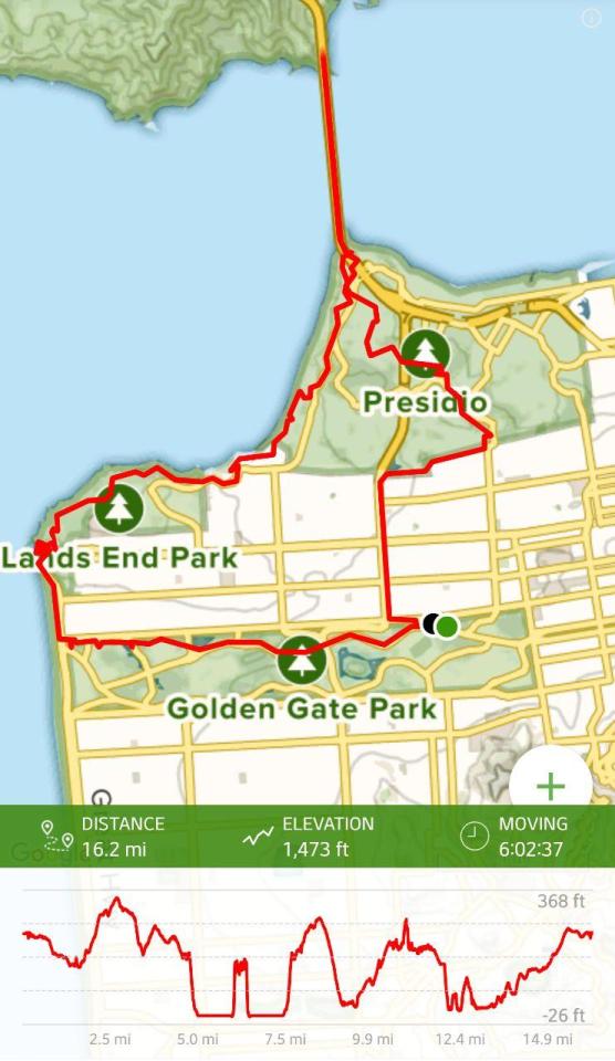
Starting off from Golden Gate Park, I ventured north, determined to get as much of the road walking portion of the hike out of the way, only to be pleasantly surprised when I found a wide green space welcoming me, framed in by trees, providing a forested, and direct path for me to follow as I ventured towards Presidio Park.
The experience proved interesting. The roar of traffic was present on either side of me, but otherwise I was alone, moving through what felt like a forest only to pop out every block or so, and have to cross at a crosswalk to avoid being flattened. It punctuated the hike with a strange staccato, and well illustrated the nature of this hike as a mixed experience early on, for though it felt like I was in the wilds, the city was just beyond my green bubble, ever waiting for me.

That experience was not to last though, as I crossed into the wide expanse of Presidio Park. The location was once a military base and an important pacific fortification for the US Military, and at one time, Spain. It was established in 1776, the very same year that America declared independence from England. The fort maintained a military presence within San Francisco until 1994, ending its 219 years as a fortification. At that time, its sprawling 1,500 acres were deeded to the National Park Service, and remains in its possession to this day. (source: https://en.wikipedia.org/wiki/Presidio_of_San_Francisco)
As a result of its military history, it is full of parade grounds, and is not as densely packed as the rest of the city. Moving up a steep incline, I soon found myself in a well kept parkland. The noises of traffic, so prevalent not fifteen minutes before, fell away. Here people walked dogs, and jogged along, past historical markers and fitness placards, while birds sang and squirrels jostled for bits of food left upon the ground by picnickers.
Diverting past a golf course filled with Lexus, BMW and Porsche a plenty, the trail veered and the population dived as a shaded wood welcomed me. Gaining elevation, quiet surrounded me, save for the pacific wind that blew through the trees granting a cool tinge to the noon time air, all while the Golden Gate Bridge began to peek through the wooded copse.
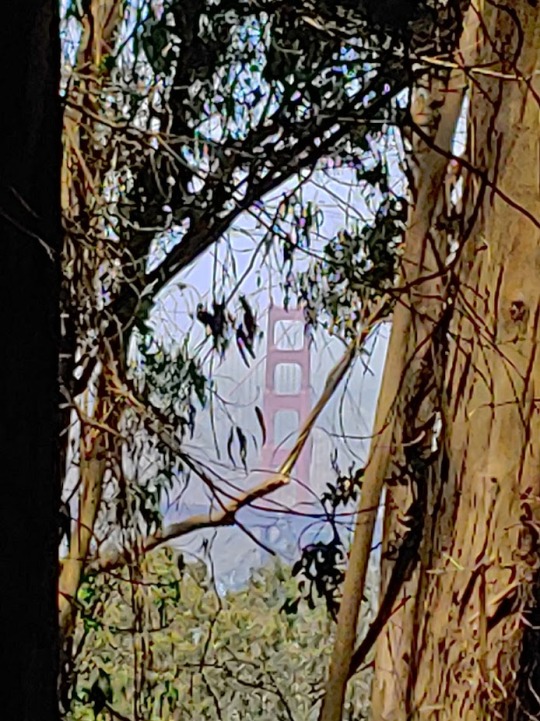
So far, this hike had been full of surprises, and as I stood overlooking the national cemetery, with a stunning view of the Golden Gate Bridge, I could not help but feel that I had found a type of hidden treasure nestled within the city.
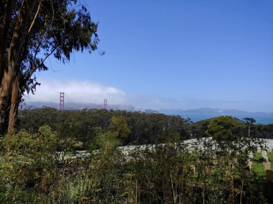
Following the trail, it led me out of the woods, back to sidewalk, and eventually asphalt as I navigated the old military base. Winding ever north, the spires of the Golden Gate became more and more dominant as I moved deeper into the old military base, finally passing a large parade ground set before four identical barracks in a spanish architectural style. It was a curious mash up of architectural beauty and picture perfect reproduction that made them seem both original and mass produced at the same time providing a jarring effect as I followed signs for the coastal trail.
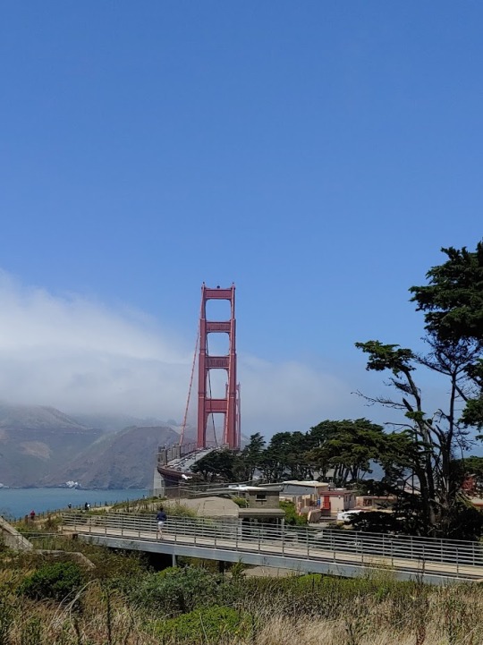
Arriving at Golden Gate plaza, I stopped for lunch and looked towards the bridge, considering my options. Tourists dominated the area, crowding almost every free space, as they milled about from shops, to path, to photo opportunity. Rented bikes whizzed by, with hardly a care for any pedestrians around them, who seemed equally oblivious as they wandered about.
What struck me as interesting was the number of languages I heard, Chinese, Korean, Dutch, English, and others I could not readily identify. While it was a chaotic morass, this area was still a global meeting of various cultures all gathered together to experience a particular American landmark that always ends up destroyed in any blockbuster action movies.
Considering it now, I suppose in that moment I had become a tourist too, because I was about to undertake the same journey, adding a little over three miles to my hike, and walk the bridge.
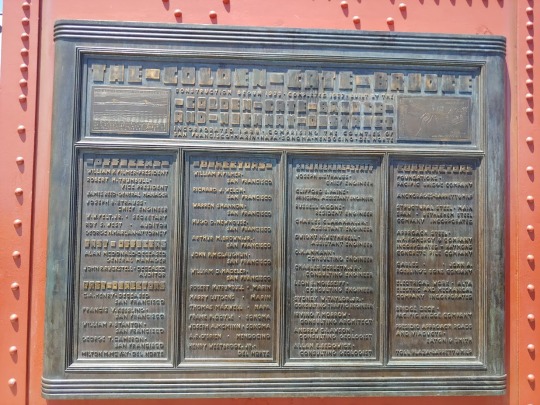
This sounds like a romantic notion. As stated, the Golden Gate is famous, bringing in visitors from around the world to see its iconic red spires. It is the symbol of San Francisco, dominating logos, souvenirs, paintings and films. However, the fact that it is such a venerable symbol does not take away from the fact that it is also a critical traffic artery, and a busy tourist destination.
In short, I had entered into utter chaos and noise. People pressed in around me in a manner that I would associate more with New York City than the bay area, as traffic roared by at highway speeds. Bicyclists continually zoomed by, ringing their bells, giving you only moments to push yourself up against the side, but I wasn’t about to turn around.
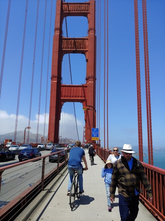
As I wrote last week, perseverance pays, and I had come to hike that damn bridge.
Ushered on by winds, and a prevailing sense of mild panic being surrounded by so many people, the views only got better as I made my way across. There, over an expanse of bright blue water lay Alcatraz, and to my other side was the vastness of the Pacific Ocean. Massive container ships trailed out before my vision, ferrying their goods back and forth, as sail boats raced by distracting me from the chaos that was around me.
Some experiences, some views, make the chaos worth it.
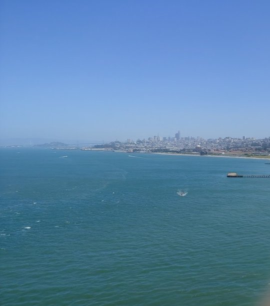
Hooray for type two fun.
A curious rhythm to the hike became apparent as I ventured on, past my halfway point. After another section along a busy road, I again found myself in a forest. This time, clinging to high rocky hills that overlooked the ocean. Waves rolled in as the container ships continued their endless procession in the distance, as the hike again grew more and more wild only for it to dump me suddenly, back into a neighborhood, back into the city, before dropping me off onto the beach.
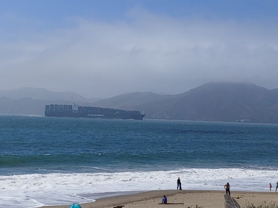
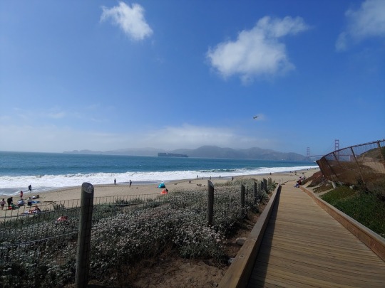
Here among decaying and abandoned bunkers, and cannon emplacements, kites flew, and people luxuriated in the sun enjoying cool seventy degree temperatures, a marked, and beautiful contrast to the sweltering heat wave that was punishing much of the rest of the country at the time. Reporting earlier on the fantastic weather conditions back to our cover artist in Connecticut, they sent a simple one word reply.
“Jealous.”
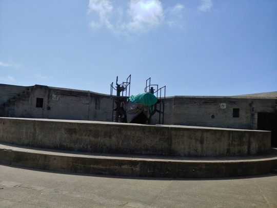
Moving along the shore, past the ruins of the Sutro baths, I was once again on the sidewalk, this time happy for the experience, if for no other reason than that it was keeping sand out of my shoes. Two days after my hike, they still rattle when I put them on, as so much has worked itself between the goretex layers, I wonder if they will ever be free of the gritty material ever again.

Finally, I ended up on the edge of the Golden Gate Park, the very same area I had started. Following a path, through the beautifully kept park, I soon found myself amongst the woods again, as the light of day began fading. As a result of backtracks and diversions, the hike had stretched long, ultimately coming in at 16.1 miles.
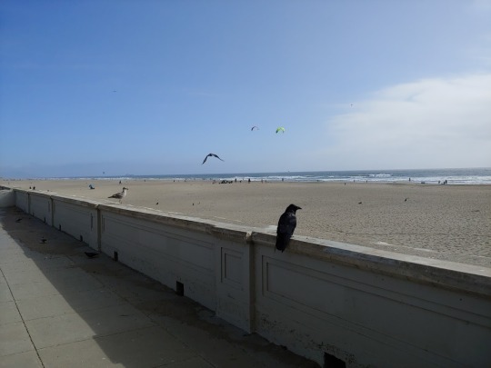
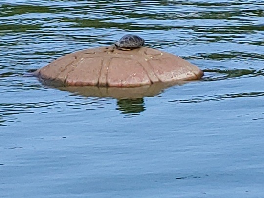
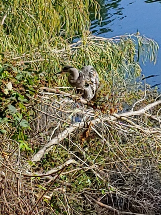
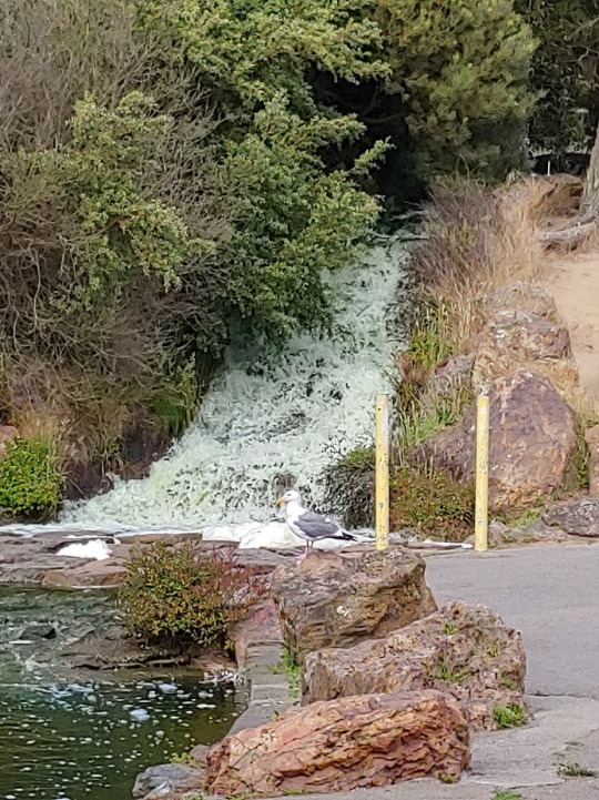
Oftentimes, hiking is seen as a purely rural, or remote activity, however this adventure showed it can be anything but. With a bit of planning and searching, I had found a hidden gem, full of history, stunning natural scenery and ample challenge. Best of all, it was just a short bus ride away in the heart of the City by the Bay.
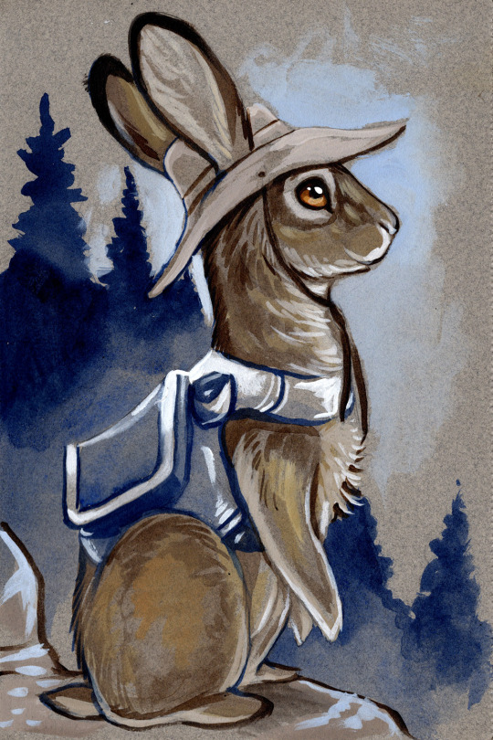
#hiking#urbanhiking#sanfrancisco#goldengatebridge#wanderinghops#studioprey#adventure#travel#adapt#history#scenery#photos#photography
19 notes
·
View notes
Text
Wandering Hops: The Prep Day
Preparation and testing is the key to knowing how your gear will perform while out on the trail; the idea goes without saying… save that I just said it.
Anyway, moving right along, stay with the tour, and hold all questions till the end. Thanks.
Now, preparation can come in many forms, from watching youtube videos about gear and its uses, to setting up your tent in your fitness room because it’s raining outside, and you have to heft it tomorrow.
I’ve done this, dear reader, and as it turns out, an REI Camp Dome 2 fits snugly between the two blue couches perched opposite each other in my den. It’s spacious, roomy, and overall an excellent tent… for everything but backpacking.
If only it didn’t weigh five pounds.
But what about the hefting? What do you do when you’re unsure if the weight you are carrying is too much? What’s the solution, when you want to test your endurance, and ability to work with a heavy pack, and a range of gear when you haven’t before?
For me, that’s what I have Sacajawea Park for.
Nestled centrally in the city of Longview Washington is a 3.3 mile loop over an artificial lake, created out of ancient geography and modern ingenuity. The park itself, is quite bucolic, full of trees, birds, squirrels, and a Japanese garden. The footpath ringing it is wide and only pitches up and down slightly as you go under bridges, or roll with elevation.
In short, it’s perfect for a morning run, a walk with your spouse, or the carrying of 40lbs on your back to see how you can handle it. This is essential, and it’s good training as I prepare for the Pacific Crest Trail, as it gives me time to adapt to heavier pack weights.
Train harder, fight easier, as the saying goes.
Yeah, I’ve gotten some funny looks, maneuvering with full pack, tent strapped to the bottom, and trekking poles out only so I can walk in a circle in the middle of the city, but that’s the price I pay to bring you entertaining and thought provoking anecdotes every week.
It’s a labor of love and quirkiness I tell you.
Longview, Washington is a planned city, founded in 1920 by a Lumber Magnate, the park itself was created four years later, and became so popular with the townsfolk that a public outcry saved it during the depression from being subdivided into residential housing plots. Today, it is known as the “Jewel of Longview” and it only takes a few minutes there to find out why.
There, in the midst of a bustling small city is an utter paradise of curated land, filled with the singing of birds, the antics of squirrels, and, I’m told river otters, though I have never seen one.
I hear they bear grudges.
Moving on..
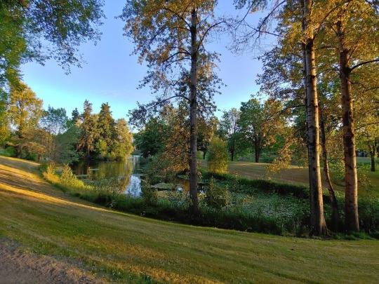
It is one of my favorite easy hikes, and even when I’m not carrying gear and testing weight, I enjoy walking it at least once a week with my beloved. It’s a wonderful place to talk, share and dream while not stressing about falling off a ledge.

Besides the scenery, there’s also the solar system walk, which is a thousand yard model of our planetary system that includes Pluto, as it was dedicated in 2001 before Tyson led the charge to demote her as a planet. It’s quirks like those that make the park especially endearing, along with its history as the heart of the town.
In short, there’s plenty there to keep you interested and moving as you make your circuit around.
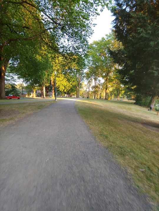
The whole experience is definitely unexpected. Most smaller municipalities don’t go in for the funding it would require to maintain such a large strip of green space. With its winding trails and beautiful scenery, it’s a moment of respite and natural sanity in an otherwise chaotic urban landscape. On either end there are busy roads, with cars whizzing by that only make the longer legs of the journey all the more enjoyable.
It is an escape, without escaping, and an excellent choice to get out there and decompress when you don’t have the ability to go, or hike further.
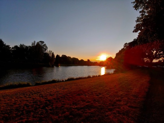
This week, dear reader, has definitely been one of those weeks. As you already know, this post has been delayed a day. That’s because exciting things are happening for Wandering Hops. Soon, I’ll be going further, and bringing you reports from far flung places, including Yellowstone National Park, coming in September.
But I wouldn’t be ready for it without Sacajawea Park. If you’re ever in the area, keep an eye out for me. I’m the unusual one, making a loop with her trekking poles with a full pack on her back, a fitting counterpoint, to the tank top wearing runners, zooming by as they breathe heavily in their fitness pursuits. (sources used www.wta.org/go-hiking/hikes/lake-sacajawea and www.mylongview.com/Facilities/Facility/Details/Lake-Sacajawea-12)
#Wanderinghops#hiking#training#pacificcresttrail#yellowstone#comingsoon#thegreatpnw#longview#Washington#dayhikes#planning#preperation#travelblog#travel#hike#studioprey#Adventure#history
19 notes
·
View notes
Text
Wandering Hops: Epicenters and Fears

Fear makes things bigger in your mind than they are. This is especially true in my case taking that I have an anxiety condition.
For me, there is very little chill, and every issue, even a perceived issue can become a massive crisis in my head in an instant. This is one of the reasons I hike. Conquering miles and rough terrain, helps turn down the volume on all the static surging around and empowers me in my day to day.
At least, that’s how it normally goes…
Loowit Falls, at first, absolutely terrified me. As said in previous blogs, research is the key to a good hike. Before I set out on a trail, I check reports, check what the forest service (State or National depending) has to say. I read reviews on All Trails… and consult guidebooks if I have them.
Knowledge can make the difference between a great hike, and an utter disaster, so it helps to do your homework beforehand.
Cliches seem to be multiplying today, so let’s move on, shall we?
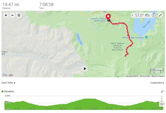
Selecting this hike, I knew it to be a challenge. It’s rated as hard, clocks in at a whopping 14 miles, and is a there-and-back-again hike. Any time spent going downhill in the beginning, means uphill at the end, and vice versa. As you can see from the altitude graph, this was going to make the end especially tough, but as I was reading, it wasn’t the physical challenge stressing me out, but the trail reports warning me of ledges with severe drops, gravelly sandy trails, and grueling up-hills that did.
Still, I’d been feeling strong the last month, making miles, and conquering hikes. Long hikes are my thing (more to come on that later) so a 14 miler seemed a logical next step.
With my chest tingling with excitement and a touch of fear, I told my team… “I’m gonna do it.” Or as Maya would say… YEET.
So now it was time for the research to really begin. I began looking at the topo maps, and followed the trail on google earth. I made my plans, talked to my husband, and began to get the logistics worked out.
Saturday, 0430, I was up and getting ready for my biggest hike to date, and all the while I was doing final gear checks, looking at maps, all that fun stuff, my nervousness beginning to build.
Then the husband woke up, around 630 as he often does before a hike, just to spend some time with me and said, in fearful tones.
“Bun, I’m worried about this one.”
I just smiled and said. “Me too, but I have fallbacks in place, and if it’s something I don’t think I can do, I’ll turn around and reassess.”
Then, he rose, hugged me, and began pricing life insurance policies.
I shit you not… this happened. I’m about to leave on a massive, monster hike, INreach SOS beacon charged, maps printed out, checklist double checked, and I’m looking forward to a nice encouraging talk with my husband, and he leaves to check on life insurance policies.
It’s moments like this that keep a marriage together, I tell you.
Full of confidence, I set out on highway 504 towards Mt. St Helens, the Spirit Lake Highway, only to run into a very unusual type of traffic in Toutle Washington.
Come to find out, there was a bike rally scheduled for the day of my hike, and there were hundreds of them on the side of the road, making their way to Johnston Ridge, the very same place I was going.
Now, I can almost hear you reading this, and shrugging, no big deal right? Well for most people that would be true, but for me, well… driving is something that makes me feel anxious, my mind likes to mess with me, and so for many years I didn’t. It’s only been recently after a lot of work and dedication that I’ve felt safe getting back behind the wheel again and now I had to deal with bikers everywhere, some of whom were so bold as to occupy the car lane, and refuse to yield.
On top of this, the weather turned foggy as I entered what is colloquially known as Big Foot Country, so as the long and windy road took me towards the parking lot, I was feeling more, and more stressed.
The day was beginning to feel cursed, my confidence was getting shakier by the moment, and I hadn’t even set out upon the trail yet.
Finally arriving at Johnston Ridge, the trail head, almost 4000 feet in elevation, the fog was even thicker. I couldn’t see more than 10 feet in front of me at any given time. Still, that was enough to sight the trail, and there were others there, getting ready for their own adventures. It was a motley mix of hikers, tourists and those waiting for the bikers to arrive as they picked their way up the road, but hey, at least there were porta-potties.
After taking a few centering breaths, and strapping on my gear, I set off, hiking towards Boundary Trail, which would eventually take me to Loowit Falls.
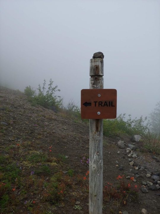
This entire section of Mt. St Helens is filled with history, making this trail an even bigger draw for me than others. Boundary Trail #1, was founded way back in the first decade of the US Forest Service. In 1911, Park Rangers rode horses from ridge to ridge, patrolling what was then the border of two national parks, Ranier and Columbia.
Loowit Falls on the other hand, is of the newer type of history. After months of erupting back in 1980, one morning a 5.1 earthquake struck the already battered region, and an entire wall of Mt. St. Helen’s crater collapsed, and turned into a hellacious landslide, ultimately opping a peak before crashing into the valley below, inundating Spirit Lake.
Loowit Falls was one of the many new features that arose out of the cataclysm shaping the region, up on the mountain itself, directly in the path of the former landslide.
First though, I had to get there, and the hike starts off easily enough. There’s an observation loop that lets out to the Boundary Trail, that’s made more for tourists than hikers, so the first little bit is paved. Soon though, it gives way to gravelly dirt before angling down zig zagging and switchbacking, but I’ve seen all that before. Been there done that.
And there’s another cliche…
After about a mile and a half in, still wondering if I should really attempt to go for the falls, socked in by fog I came across a sign showing the trails in the area along with this picture…
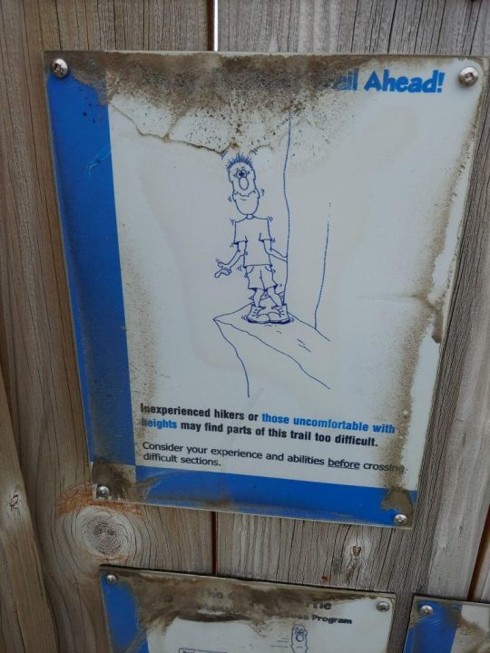
Nervously, I set out from there, heading towards my decision point. I could have gone left, or right. Left had an easier hike, that went up to a peak, ending at around 10 miles covered, with less elevation gain, but to my right, shrouded in fog and mystery, was the hike I came to conquer.
This was the real moment of truth. All I had was my research that said it could be challenging. Some reported the height could be intimidating, others said it was merely tough.
What should I do?
Taking a (figurative) leap of faith, I decided to for it, comforting myself with the idea that it was ok to turn back if things got to intense, and began to descend down the trail, and the mountain, making decent time. The pillowy shroud of fog continued to lay across the trail granting me no wider vista than 5 or 10 feet, but the path was wide, and while I did get closer to edges I still had plenty of room.
Eventually things leveled out and I could tell I was in a valley as the fog slowly began to lift, and I’m thinking is that it? Really?
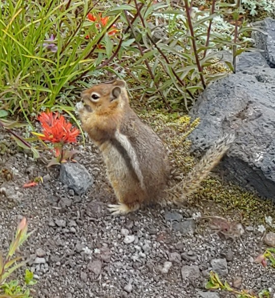
From my perspective there had been nothing to be truly afraid of. The descent wasn’t especially challenging and I had felt safe the entire time. Unlike the husband searching for life insurance, this buoyed my confidence, even though I had eleven miles still to go. With a bounce (hop?) in my step I set out, the fog continuing to lift, revealing more of the stark landscape around me. Black and red lava rocks dotted landscapes that were in some places sandy, other places akin to moonscape, sparkling with volcanic glass and in others, covered with thick shrub like trees, or coated in wildflowers of amazing colors. Chipmunks ran to and fro, eating flowers and wondering if I was going to feed them, while birds flew overhead.
Then it happened. Suddenly the clouds broke and there was a literal mountain in front of me, emerging out of the fog like some giant from the dusty tomes of mythologies. Mt. St. Helens lay before me in all its majestic glory, and off in the distance, a light glinted off a fast moving waterfall surrounded by volcanic sand.
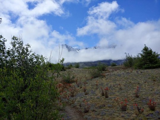
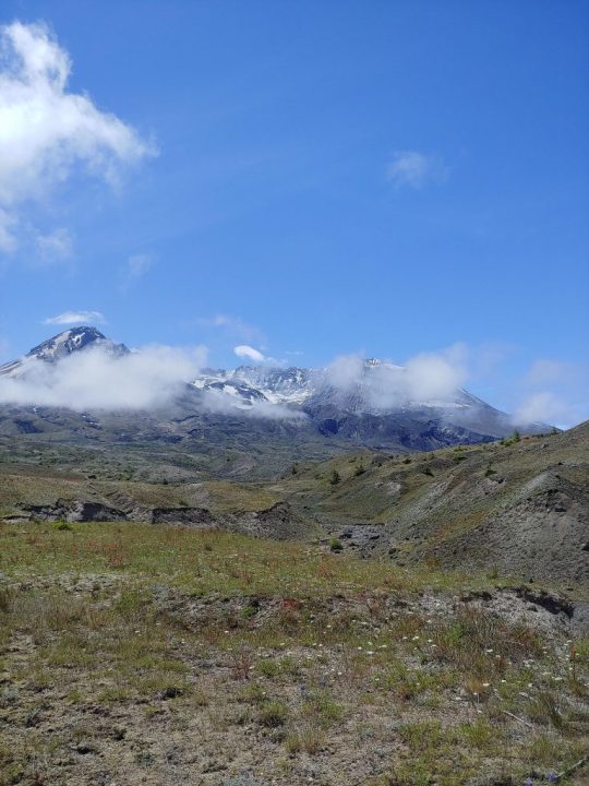
That was my half way point, where I would turn around and come back, Loowit Falls.
I stood there for a moment and took it all in. The vista before me left me awestruck by the power of nature. Then, taking a deep breath, I dug in my trekking poles and began to hike.
And hike….
Then hike some more…
As I went traffic fell away to a few familiar faces, I’d pass them, then they’d pass me as we took alternating breaks, until finally around 2pm, I rounded a switchback, and heard for the first time the roar of a waterfall.

There it was, right in front of me, the moment I had been waiting for. Loowit Falls, in all its splendor, flowed relentless down the mountain as the wind howled off the glaciers above, chilling the air to what felt like the mid to upper 40’s.
Buttoning down my outer layer, I made my way to a flat spot, laid my pack out and had lunch, reveling in my victory only for my open pack to flop over and spill out on the ground, voiding its contents. I went from resting to scrambling as I dove for my glasses and meds, hoping they wouldn’t fall off the edge.
In some ways, it reminded me of the day so far, there was a sensation of “emotional breathing” to the experience, stress followed by periods of ease, akin to the contraction and relaxation of breathing. Up and down, in and out, oh shit to okay…
And this was the halfway point, soon I’d have to go back the way I came, picking my way back up the mountain I had descended to get back to the trailhead. The only difference being, was that now I knew the trail, I knew what to expect, so I hoisted my pack, tightened down my straps, took some water, and got back on the trail.
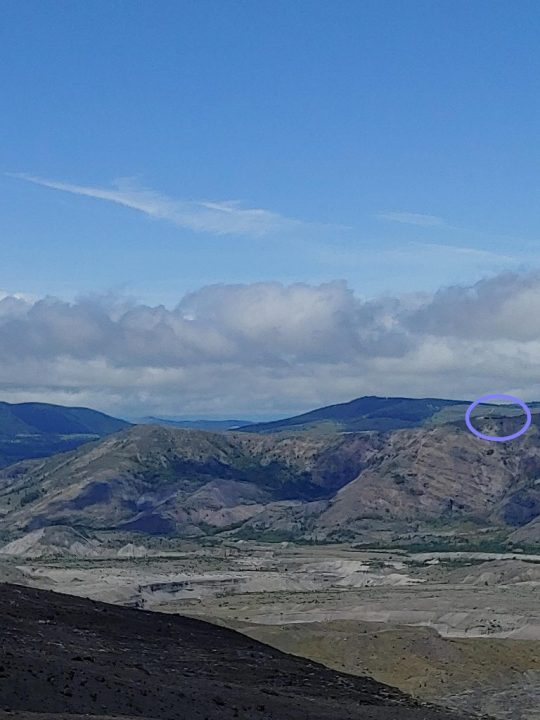
My speed increased, as the air warmed and I left the slopes of St. Helens, making good time across the dramatically stark volcanic plains. Gradually, I began to feel more accomplished than I had in a while and, by the time I had hit ten miles I was riding high. With four miles left to go I charged forward, eager for the challenge.
Then I started to climb. All of the descent from the morning, had to be repeated, this time going up. This is where it got grueling, as if the trail was attempting to punish me for every step I made down upon it just a few hours before, but there was nothing else to do but push through it, keep pace, and enjoy the view as I ascended, granting me new perspective now that the fog was gone.
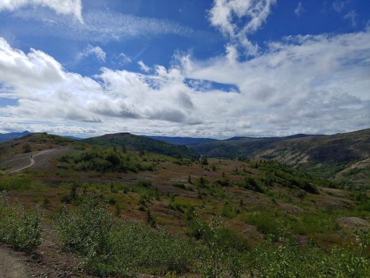
There were places where it was quite steep, and the drops quite far, the morning’s fog had hid all that from me, but there was room, there was space, it was something to respect, but it wasn’t anything to fear.
All of that worry, all of that concern, and if I had let it stop me, I wouldn’t have been there.
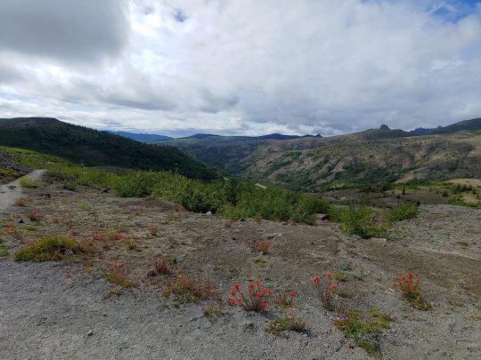
Humbled by that revelation, sore from the elevation I was having to make, and humbled by a day full of experiences, I pushed myself up the trail. Soon there was the last arcing climb, until I set my feet on the pavement of the observation trail yet again, and just beyond was the parking lot.
Setting my gear in the well of the passenger seat, I popped an electrolyte tab into my water and watched it fizz as I nibbled a Clif bar, feeling like the master of my own little universe, resting from the exertion of the day. Once I had some time to recharge, I put the key in the ignition, put the car into drive, and had a major anxiety attack.
The problem with anxiety attacks it that you know, rationally, everything is fine. The problem is your brain isn’t listening to reason. I worked through my coping skills, and tried to get myself centered, but nothing was working. I was exhausted from the hike, and the worries of the day, and it was all crashing in on me at once, amassing as a parade of my biggest fears, and inner demons within my mind.
I made it about three miles before I had to pull over. I stopped in at the Coldwater boat dock, the location of last week's hike, and took a few more deep breaths, walked around the car, and tried to get my mind right. Finally I messaged my husband letting him know what was going on.
Messages travel slower by satellite than text, and so I had some time to sit. I looked out on the parking lot, at the strange bathrooms that looked like forgotten temples, and it reminded me that I had hiked twelve miles last week, and today, I had hiked fourteen…
That caused my brain to stop and pause for a moment, like rays of sunshine penetrating the gloom.
I had excelled through challenges, walked along ridges, and managed my water. I was capable, I was competent, and I was ok.
In the face of this revelation, the anxiety began to let go, and a lightbulb went off in my head. I had a weapon now against it, a reminder, that I was stronger than I thought, and as the messages came back from my husband and other supportive folks, the anxiety withered away.
In spite of all of the difficulties of the day, I had made it, and now, all I had to do was drive home. Turning the car back on, and setting into drive, I carefully made my way out of the parking lot, already thinking of next week's adventure.
#hiking#adventure#mtsthelens#wanderinghops#studioprey#rebeccamickley#pacificnorthwest#trailreport#amblogging#blog#pnw#anxiety#fear
21 notes
·
View notes
Text
Wandering Hops: Black Holes and Blast Zones

Cliches, I feel, are annoying because they are a reminder of simple, near universal truths. No matter how clever, or accurate the wisdom they hold may be, just hearing them reminds me of something I should have never forgotten, and thus, I cringe.
All of this is, of course, natural. None of us are perfect, we all make mistakes, get ahead of ourselves, mislay our car keys, all of that; thus life is full of cliches to remind us that anything that can go wrong, will go wrong.
Shit, there’s another one.
Saturday, that very cliche presented itself and slapped me in the face.
Now, I should have been prepared for it. I woke up, eager, excited and early, ready to take on Black Hole Falls. My hiking checklist was beside my pack and trekking poles, the husband woke up early, and my directions were all loaded in. We even left almost on time.
All of this proved to be ominous portent of the day ahead.
With breakfast done and everything in the car, we left about 930am. Waggs was looking forward to an exciting day in Vancouver, Washington and I was eagerly awaiting my trip to Black Hole Falls. The site is billed as one of the best hidden waterfalls in the Pacific Northwest, perched on the edge of the Gifford Pinchot forest. It had all the makings of a wonderful day.
Heading out towards Amboy, Washington, we followed our directions dutifully. Eventually the two lane highway gave way to a simple paved forest service road that had certainly seen better days. As always in the Pacific Northwest, there were other campers and hikers camped beside conspicuous openings in the forest, portending trail and adventures just beyond.
This is where I start getting excited. The idea of other people on fun adventures reminds me that I’ll soon be on my own as well.
“Keep left at the fork.” Sounded over the speaker, drawing both of our attentions, because the road that awaited us was a steep and graveled dirt road taking us up into the mountains. This was not unexpected. Before I go to any trail, I take a look at things via satellite and try to get the lay of the land. The trail head I was looking for showed to be set off a similar road, and so, all seemed groovy.
Up we went, gaining elevation as the road began to switchback aggressively and an unsettling feeling began to arise that the GPS was leading us on a boondoggle.
Finally, after almost half an hour on gravel roads, covering almost ten miles, it announced we had arrived, there were just a few problems…
No pull out, no trail head, no indication whatsoever of where the trail should be.
Son of a bitch.
Undaunted, I fell back to my InReach navigator, knowing I had synced the maps from my computer the night before. While not designed for vehicle navigation, it should have been able to tell me if I was close, or off in the great beyond relative to the trail location.
That was when the second big surprise of the day hit me. Though I had synced it on my computer, I later found out that only works for software updates, it requires being synced through my phone to push the routes back to the device.

Deep in the pit of my stomach a worried feeling blossomed as I looked up and down the road, it finally coming into clear focus that we were lost, over half an hour from town, one hour out from signal, and no idea where the trail was.
All of my Saturday plans were firmly obliterated at that point. Some careful backtracking followed, as we made our way back to the main road, and off for a day of fun in Portland.
It was actually a pretty good time, save that I didn’t feel I had earned my post hike eat out treat. After all, I hadn’t hiked anywhere.
At the end of the day though, a Bulgogi Bowl from Veggie Grill is a Bulgogi Bowl from Veggie Grill, and as I sat there, talking with my husband I resolved that this weekend would not be shot for Wandering Hops. While he browsed a bookstore, I hung out outside, using my all trails map and then hit upon The Coldwater Lake Loop.
The Coldwater Lake Loop is best described as a franken-trail, a mix of the south coldwater trail and the lake trail, with the last section incorporating elements of the main forest service road to take you back to the trail head. All told, it’s about 11.5 miles, and rated as a Hard/Difficult hike.

This time, dear reader, I wasn’t about to be caught unaware. I synced and resynced my maps, verified in full that the route was on the device, checked permits, passes and hours, as well as my directions.
0630 Sunday rolled around, and as Maya likes to say, it was time to “get this bread.”

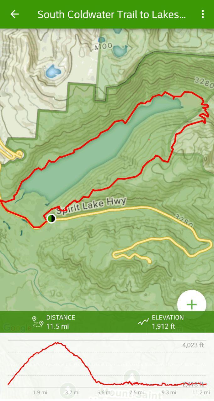
This was my first difficult rated hike since the Hamilton Loop of last year, and as I drove, alone along Highway 504 (letting the husband sleep) I was filled with a degree of trepidation. My chosen route had me going counter clockwise from South Coldwater, which gains a half mile in elevation over the first two or so miles, and then you have to go right back down again.
The challenge though, is part of the fun, you never know what you can do until you do it, after all.
The Coldwater Lake Loop proved amazing from its first moments. For one, Mount St Helens loomed large just behind me. Back in 1980, the region I was hiking was at the very heart of the blast zone, dramatically reshaping the landscape in a moment, wiping away thousands of years of patient erosion and gentle world building. What surprised me was that there was still evidence of the volcanic cataclysm everywhere I looked, from petrified, stony trees to soil mixed with ash.
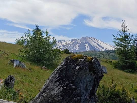
For two, the caterpillars were out by the thousands, massing on the trail, trees and plants in numbers I had never seen before. They made their migrations back and forth, largely oblivious to my movements as I attempted to side step as many as I could. All the while I took in sweeping vistas full of dramatic mountain ranges and colorful wildflowers, until about a mile and a half in, I found some curious bits of metal sculpture.

Back when the volcano blew, the area I was hiking in was being logged. Still buried bulldozers, twisted by the titanic forces of Mother Nature in a full on rage still dotted the trail in two locations, accompanied by an observation tower that was shaped into loops and bends. All of this was found in the first two miles after a punishing round of ever upward arching trail, until it dumped me out on a wide and sandy plain, grey white from volcanic ash, and full of scrubby, stubborn plants and flowers clinging to life.


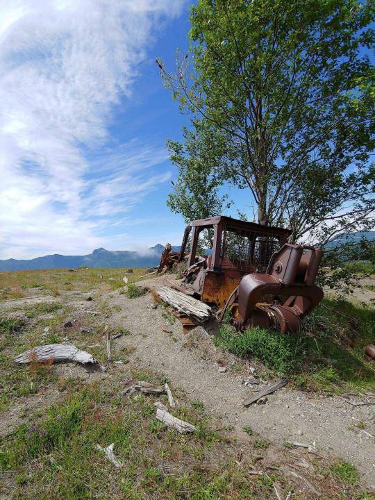
From there, I continued to go up, and up, and… well… up. There were moments when I could hear my heart pounding in my chest as my legs burned from exertion. For my day hikes, I normally move with about 15lbs on my back. It’s good training for backpacking, and besides, I’m not carrying weights. Things like flashlights, extra water, and power bricks can come in useful if anything goes wrong, so up I went, lugging my necessary gear, until I found myself just inches from a ledge, with a heavy drop to my left, and a steep incline to my right as I traced my way up a mountain.
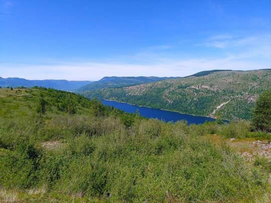
Finally summiting a little over three and a half miles into my trek, a cool breeze began to blow off Coldwater Lake, which was quite refreshing after the hike I had just completed. Originally I had planned to eat lunch there, but I was feeling peppy. Deciding to press on to the halfway point, I began my descent, entering a thick and verdant forest, with the canopy so thick above me, it blocked out much of the sun.
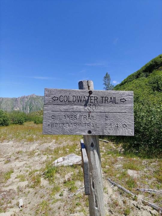
The transition was as quick as what you might see in a movie script. Suddenly, the world goes from open, to close in, the air cools and becomes humid, sticking to your skin, and the heavy scents of earth percolates all around as the world falls to hushed silence, broken only here and there by the chirping of a bird or the rustling of a fern.
It’s peaceful, but also leaves you with a feeling of anticipation. The size and completeness of the silence makes it feel like the world has found a pause, but there’s an expectation at its edge. At any moment it feels like the world around you may lurch forward again, bursting out upon the stage in an unexpected way.
Does that sound like foreshadowing?
As the descent began to level out a roar began to build progressively, until soon, it was deafening. Still, the thick canopy of forest surrounding me offered nothing in terms of view, but I was certain I was coming to a rapids crossing or a waterfall.
Turns out I was right on both accounts; emerging from the wood a sturdy looking bridge revealed itself, spanning the gap over a raging torrent of river and a stair step waterfall, working its way back up into the mountain. The entire scene was breathtaking, and marked about a mile past the halfway mark for the day. It was a perfect time to stop for lunch.
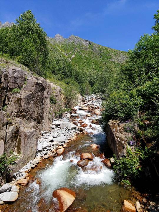

After a few minutes rest and a Probar, my energy surged back, and I hit the trail again. This is where it began to feel long. Especially in the moments where I began to climb. Now, initially, upon my setting out, it was my belief that all the climbing would be done in the beginning, giving me a nice and level trail beside a lake shore to complete my day upon.
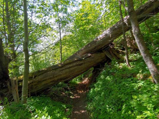
No such luck. Examining my map more closely, I noticed the topographic detail that my trail route vacillated on this second stint a few hundred feet at a time in elevation. This was by no means the same level of challenge as I had started my day with, but it still proved daunting as the hours rolled on. However, the scenery was beautiful, alternating between verdant forests and vast meadows filled with both butterflies and wildflowers, until the sound of people enjoying Father’s Day began to carry on the wind.
That could mean only one thing. I was nearing the boat docks, which marked my return to the highway and trailhead. Roughly 1.5 miles later, and the day was done.
After 11 miles, the sudden stop of forward motion felt strange. My brain had dialed into the idea of me moving forward at a constant steady pace, and as I unloaded my gear into the wagon, I felt a bit lost.
Glorious air conditioning awaited me. Sitting there with the engine idling, preparing to leave after finishing my post trail snack, I began to reflect upon the last few days and realized there was a type of lesson in all of it for me.
To put it in one word, I’d have to call it persistence. I could have quit when my hike was thwarted by bad directions and haywire planning for Black Hole Falls, but I didn’t. I fell back, reassessed and found something that would work.
Still, it wasn’t that easy. Finding the trail is one thing, but hiking it is another entirely. I covered almost 12 miles, up mountains, along ledges, and across bridges. There were times when I was tired, there were times when I even got bored, but the one thing I didn’t do was stop. My perseverance rewarded me with a day full of beautiful memories and moments that I feel I will carry for a long time.
Persistence pays, dear reader. One last cliche to finish the day.

#hiking#adventure#setback#setbacks#mtsthelens#wanderinghops#studioprey#rebeccamickley#pacificnorthwest#trailreport#Volcano#photography
18 notes
·
View notes
Text
Wandering Hops
Hi all!
It was bound to happen sometime. Wandering hops will be a day late this week as I get caught up, well... wandering.
Tune in Wednesday for our next piece on Sacagewea Park!
-Rebecca Mickley
7 notes
·
View notes
Text
July Livestrean
Catch up with Becca and the Dragon team tomorrow, July 26th at 4pm EST on the Studio Prey YouTube channel, as we talk about the upcoming release of Nightmare Gods on Amazon, new Patreon perks coming soon, and the expansion of Wandering Hops!
#livestream announcement#livestream#live stream#studioprey#studio prey#july livestream#ghosts of the nightmare gods#wanderinghops
5 notes
·
View notes
Text
Monthly Livestream
Join us Monday June 24th at 4 pm Eastern Standard Time, as we discuss our new series Ghosts of the Nightmare Gods, Wandering Hops, and further upcoming adventures!
#Monthly Livestream#wanderinghops#Ghosts of the Nightmare Gods#livestream announcement#announcements
6 notes
·
View notes