#pointe du Hoc
Explore tagged Tumblr posts
Text

On June 8, 1944, German prisoners are marched past an American flag as it lies as a marker on a destroyed bunker, two days after Pointe du Hoc was captured by U.S. Army Rangers.
(U.S. National Archives/Reuters)
118 notes
·
View notes
Text

2 notes
·
View notes
Video
WWII by Linh Yoshimura Via Flickr: USAF’s Douglas A-20 Havoc bombers make a return visit to the Pointe Du Hoc coastal battery on 22 May 1944, and ready for a bombing mission. (U.S. National Archives). Notice, on June 6, 1944, the famous D-Day, US Rangers launched an assault on the Pointe du Hoc ; Normandy, Calvados, France
17 notes
·
View notes
Text

11 notes
·
View notes
Text
NORMANDIË | POINTE DU HOC
Donderdag, 18 augustus 2011 | De volgende en tevens laatste bestemming van deze vakantie gaat naar Pointe du Hoc dat zo’n 10 km van Colleville-sur-Mer ligt. Pointe du Hoc is een historische locatie aan de Normandische kust van Frankrijk, beroemd vanwege zijn rol in de D-Day invasie op 6 juni 1944. Deze strategische klif, ongeveer 30 meter hoog, werd zwaar versterkt door de Duitsers en huisvestte…

View On WordPress
0 notes
Text
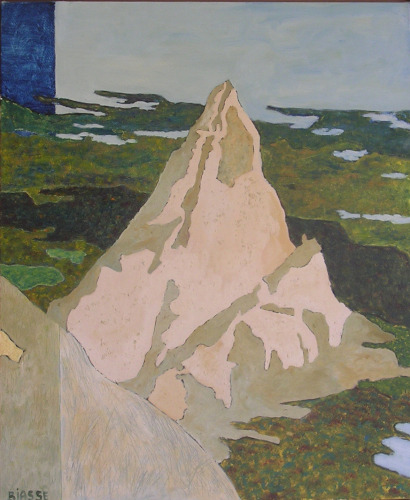
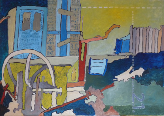
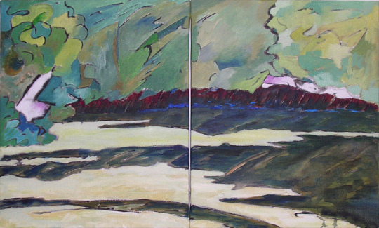
Paysages - peintures à l'huiles - tailles diverses
Paysages




0 notes
Text

1 note
·
View note
Text

Photo prise à J+2 sur la pointe du Hoc après l'arrivée des secours et de la relève du 2e Bataillon de Rangers – Opération Overlord – 8 juin 1944
Le drapeau américain a été déployé pour prévenir des tirs amis tandis que certains prisonniers allemands sont transférés.
#WWII#opération overlord#overlord#opération neptune#operation neptune#2e bataillon de rangers#2nd ranger battalion#la pointe du hoc#calvados#normandie#normandy#france#08/06/1944#06/1944#1944
8 notes
·
View notes
Text
Call of Duty 2 - D-Day: The Battle of Pointe du Hoc
Cabo Bill Taylor
Normandia, França - 1944
Captura feita a partir do XBox 360 utilizando a placa de captura EZCAP 333 Gamelink Raw
youtube
#Gameplay#Call of Duty 2#Activision#Infinity Ward#XBox 360#XBox#Microsoft#D-Day#The Battle of Pointe du Hoc#Bill Taylor#Youtube
0 notes
Text
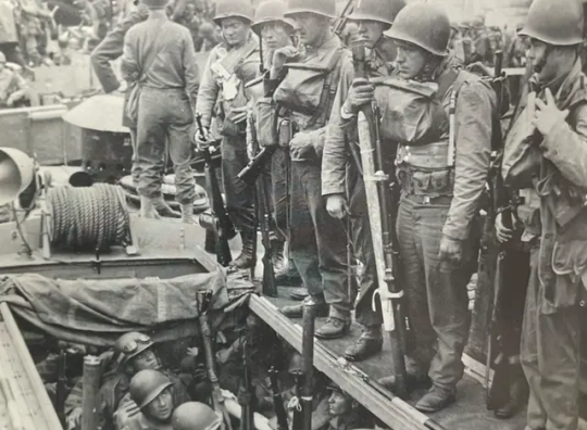
6 June 1944: Grim-faced Rangers of the 2nd Battalion prepare to assault Pointe Du Hoc. 60% of them will be dead or wounded in the next 48 hours.
56 notes
·
View notes
Photo

The USS Texas fired on Pointe du Hoc with its 14 in/356 mm guns on DDay. Today, some of the craters made by the Texas' shells are still visible.
107 notes
·
View notes
Photo

The Texas Quote of the Day: |"I wish somebody could tell me how we did that." ----- D-Day hero (and Texan) James Earl Rudder, upon revisiting the cliffs at Pointe du Hoc in Normandy, France that he and his men had scaled 20 years before at the start of the D-Day invasion. Today marks the 79th anniversary of D-Day. Rudder had returned with Walter Cronkite for a TV interview for a "20 years after D-Day" type of thing when he made this comment. He was looking at the cliffs and you could tell that, returning to the place, he was humbled and amazed by what he'd done in 1944. May he RIP. This photo of him during WW II comes courtesy Texas A&M Press and was taken by the U.S. Army.
320 notes
·
View notes
Text
Commemorations Marking The 80th Anniversary of D-Day Take Place In Normandy
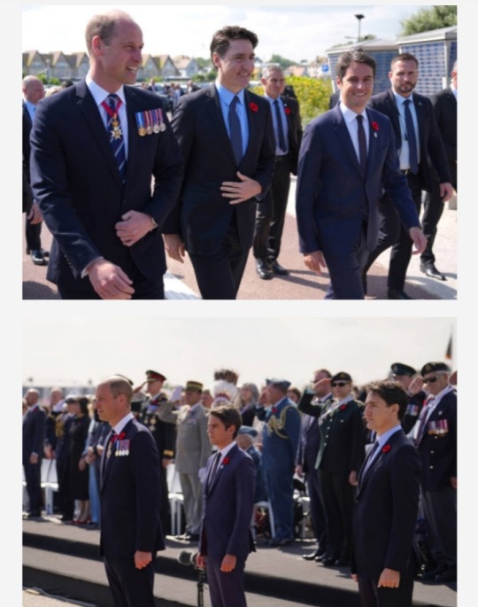
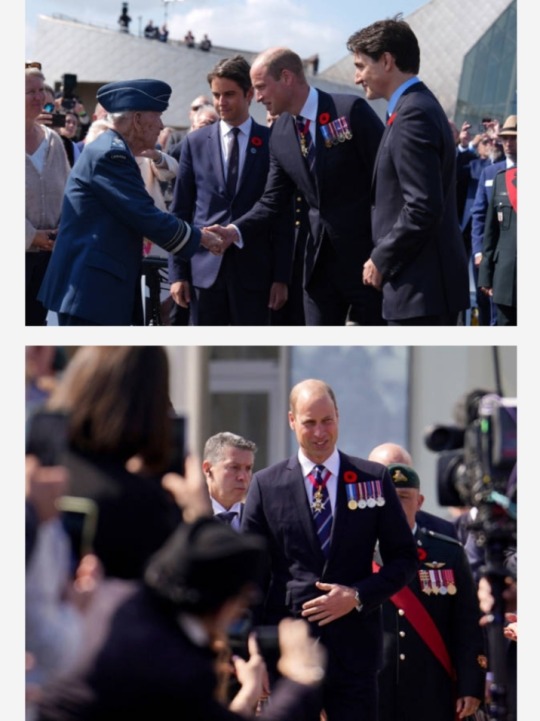
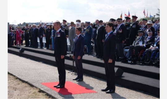
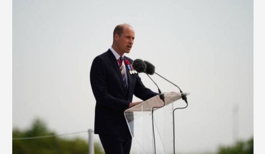
Prince William, French Prime Minister Gabriel Attal, and Canadian Prime Minister Justin Trudeau during the Government of Canada ceremony to mark the 80th anniversary of D-Day at Juno Beach on 6 June 2024 in Courseulles-sur-Mer, France.
Normandy is hosting a variety of events across significant sites such as Pegasus Bridge, Sainte-Mère-Église, and Pointe du Hoc, leading up to the official commemoration of the 80th anniversary of the D-Day landing on June 6.
📸: Jordan Pettitt - Pool / Getty Images
#Prince William#French Prime Minister Gabriel Attal#Canadian Prime Minister Justin Trudeau#Juno Beach#D-Day#D-Day 1944#D-Day80#Normandy#France#Canada#UK#British Royal Family#war heroes#war veterans#military operations#history#World War II#Allied Forces
37 notes
·
View notes
Photo

Thunderbirds off the coast of Pointe du Hoc, Normandy, France
193 notes
·
View notes
Text
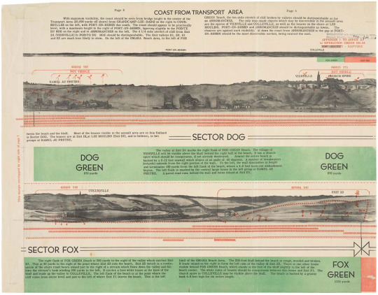
Panoramic Sketch of the D-Day Beaches
Record Group 331: Records of Allied Operational and Occupation Headquarters, World War IISeries: Geographic Intelligence Maps
large, centered on top]: COAST FROM TRANSPORT AREA [top left, column]: Page 6 [continue column, top left]: "With maximum visibility, the coast should be seen from bridge height in the center of the Transport Area (20,000 yards off shore) from GRANDCAMP-LES-BAINS on the right to COURSEULLES on the left, with PORT-EN-BESSIN due south. The coast should appear to be practically level, with a maximum height to the right of PORT-EN-BESSIN, tapering slightly to the POINTE DU HOE on the right and to ARROMANCHES on the left. The 4 1/4 mile stretch of cliff from Exit D1 (VIERVILLE) to POINTE DU HOE should be distinguishable. The Exit valleys D1, D3, E1 and E3 are much less likely to show. On the left of the OMAHA Beach Area, to the left of FOX" [misspelling? should be POINTE DU HOC and not 'POINTE DU HOE'?] [top of column on top right, Page 5] [column, top right, continuation of left column]: "GREEN Beach, the ten-mile stretch of cliff broken by valleys should be distinguishable as far as ARROMANCHES. The only man-made objects which may be discernible in the assault area are the spires of VIERVILLE and COLLEVILLE, as well as the houses on the shore at LES MOULINS, PORT-EN-BESSIN and ARROMANCHES should be distinguishable as towns. The chances are against such visibility. At dawn the coast form ARROMANCHES to the gap at PORT-EN-BESSIN should be the most discernible section, being nearest the east." [two stamps bottom right of top right column: first stamp "DECLASSIFIED per authorities in [illegible other than "C"]. Project 84-(either "515" or "010"). Date [handwritten on line, illegible] by [handwritten initials on line, "JAD"?, followed by another illegible word]; second stamp, in red, just below the first: "APPENDIX 1 TO ANNEX A to OPERATION ORDER BB-44 (crossed out by hand, "TOP-SECRET") - NEPTUNE] [the coastline as described above is depicted horizontally across the page, with two places labeled above their location, "PORT-EN-BESSIN" and "COLLEVILLE"; underneath the coastline depiction "FOX GREEN" and "EASY RED" are labeled and highlighted in their respective colors of green and red] [full transcription at link]
36 notes
·
View notes
Text
The real story behind the lean by Tom Scott

"Like a case of herpes, exaggerated versions of TEXAS 'flooding herself' to 'lean the ship' and extend range of her guns pops up from time to time. It is hard to think of an action that has been more exaggerated or misstated than this one. The following is based upon the ship's war diary, daily deck log entries and study of a flooding effects chart for the ship.

Flooding torpedo blisters to create list wasn't some last minute stroke of genius by TEXAS' captain and crew. The act had not only been performed numerous times on British monitors in the 1920's, it was understood by the U.S. Naval War College and likely taught there. This was documented in a letter written in 1925 from the college's superintendent to the Chief of Naval Operations. It requested information on the ability to flood the blisters being added to TEXAS and how long it would take to flood them. The request specified that it be done with the intent of creating list that would extend the range of her 14" guns.

The fire mission given to TEXAS on June 15 was apparently sent to the ship during the early morning while she was at her overnight anchorage 1.5 miles off of Point du Hoc. The assigned target was a German troop and truck concentration located more than 20,000 yards from the assigned bombardment point. This placed the target at or just beyond the extreme range of the ship's 14" guns While we do not know precisely which sections were flooded, a flooding effects table on a damage control plate, shows that they could obtain the needed list perfectly by flooding a specific 4 of the 18 floodable sections in the starboard blister. This would have given 2.2 degrees of starboard list while maintaining the ship's trim. Maintaining trim was critical since any change would have created trunnion tilt error on the guns that would degrade their accuracy.
TEXAS raised anchor at 05:30 and sailed to the bombardment point 5.8 miles away that was about 2 miles offshore. While underway, she opened flooding valves on some starboard blister compartments to create the 2 degree list. That was complete by the time she dropped anchor and fired her first rounds at 6:30.
An entry in the daily deck log states that 24 rounds were fired in single and two gun salvos over the next hour, and that the target area was covered and eliminated. Nothing was stated in the logs, but it is assumed that the blisters were immediately drained, using the ship's big steam operated bilge pumps, after completing the mission to restore proper list.

All of this is to say that Captain Baker and crew were well read, well educated and fully understood their ship's capabilities. While they didn't invent the technique, they were certainly aware of it and understood it well enough to immediately use to solve a problem that would otherwise result in failure to complete the mission."
Posted on the Battleship Texas Foundation Group Facebook page by Tom Scott: link
#USS TEXAS (BB-35)#USS TEXAS#New York Class#battleship Texas#Dreadnought#Battleship#Warship#Ship#United States Navy#U.S. Navy#US Navy#USN#Navy#World War II#World War 2#WWII#WW2#WWII History#History#Military History#Operation Overlord#Battle of Normandy#Normandy Invasion#Normandy#France#Europe Theater#June#1944#my post
85 notes
·
View notes