#photomap
Explore tagged Tumblr posts
Visit Tumblr Blog
Explore Tumblr blogs with no restrictions, modern design and the best experience.
Last Seen Tumblr Blogs


Fun Fact
Tumblr has 16.74 million mobile monthly users in the US.
Photo
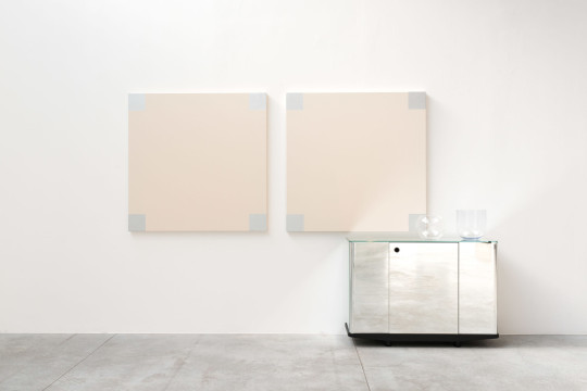
Check out John M. Armleder, Photomap (furniture sculpture) (2019), From Almine Rech
1 note
·
View note


Text
City of Vancouver marks Black History Month with interactive photomap, Give Them Their Flowers
City of Vancouver marks Black History Month with interactive photomap, Give Them Their Flowers
Today the City of Vancouver launched an interactive photomap to mark Black History Month. According to a press release the web-based project, called Give Them Their Flowers, “centres the experiences, hopes, and wishes of 10 Black residents who have made impactful contributions to life in Vancouver.” “This February will mark the 25th anniversary of the acknowledgement of Black History Month…

View On WordPress
#arts#Black#Canada#City#dining#entertainment#events#fashion#Flowers#Give#history#INTERACTIVE#marks#month#movies#music#news#nightlife#photomap#shopping#Vancouver
0 notes
Photo
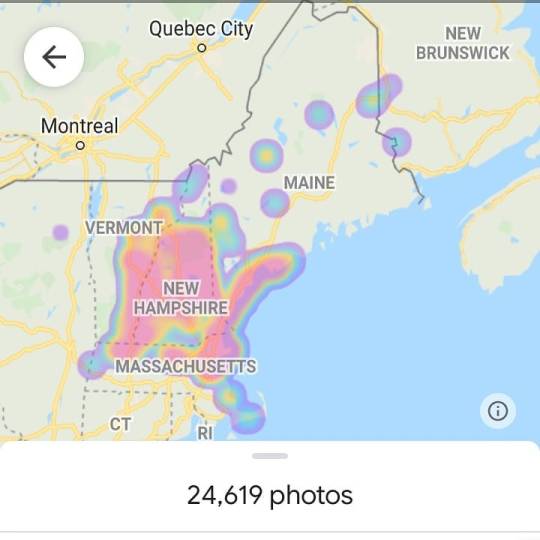
My photo map. . . . #photography #photooftheday #photoshoot #photographer #photomap #newengland (at New England) https://www.instagram.com/p/CHGU4T4F16r/?igshid=15pgghttw27d3
0 notes
Photo

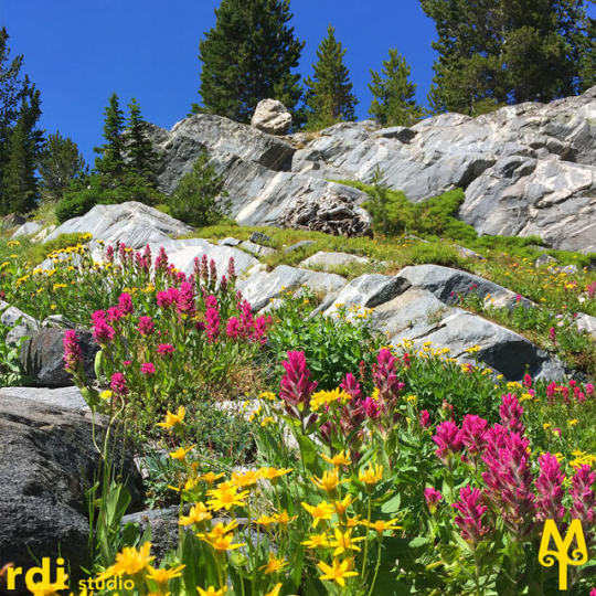
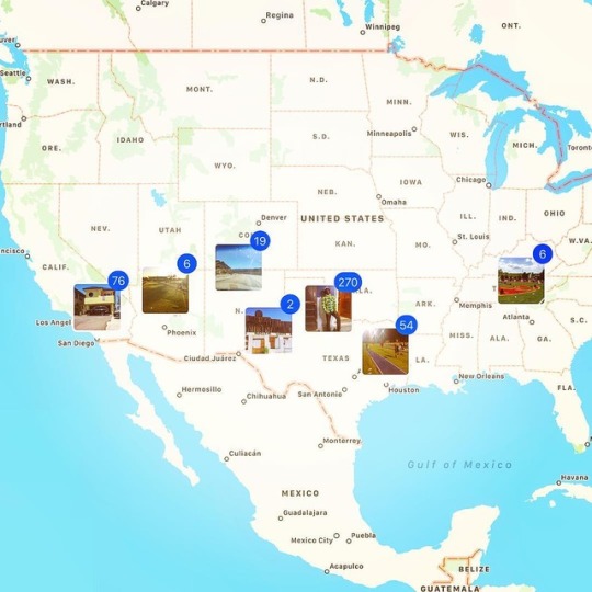
Hike Montana Photo Map
Have you ever seen a photo of a Montana hiking destination; but, you wondered where in Montana it was taken? Well, now you can locate Montana hiking destination photos and videos on a Google Map.
For mobile users, use the following link: https://goo.gl/fciGjL
#montanasummer#montanaoutdoors#montanaphotographer#escapeandexplore#neverstopexploring#bozeman#montana#getoutside#explore#staywild#hike#hikingtrail#hikingadventures#montanatreasures#lastbestplace#hikemontana#photomap
2 notes
·
View notes
Photo
This is my #2016 #photomap...You might #run into me any where in a calendar season. #setbacks have kept me #grounded in 2017 but I'm determined to fill a world map with photos, when it all said and done.... #photomap #tracknation #jumpnation #worldmap #states #usa #unitedstates #photography #wanderlust #traveler
#photography#worldmap#grounded#wanderlust#usa#traveler#2016#setbacks#states#unitedstates#run#jumpnation#photomap#tracknation
1 note
·
View note
Text
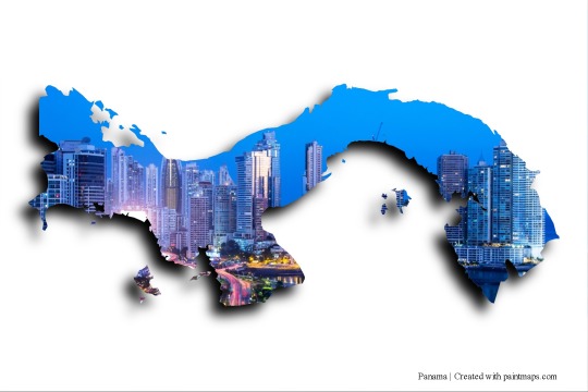
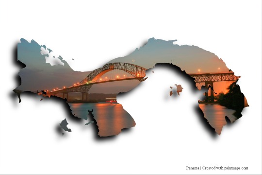
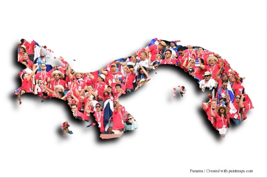
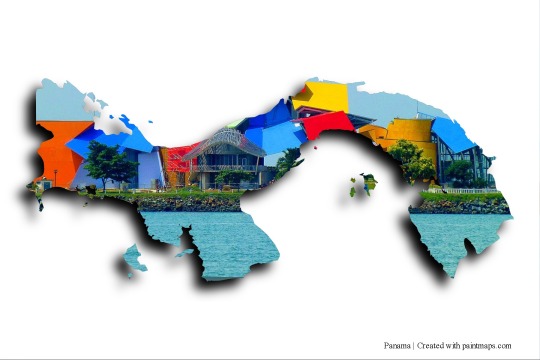
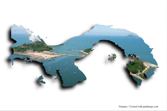
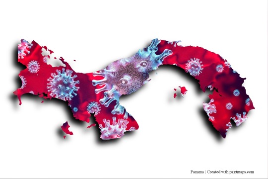
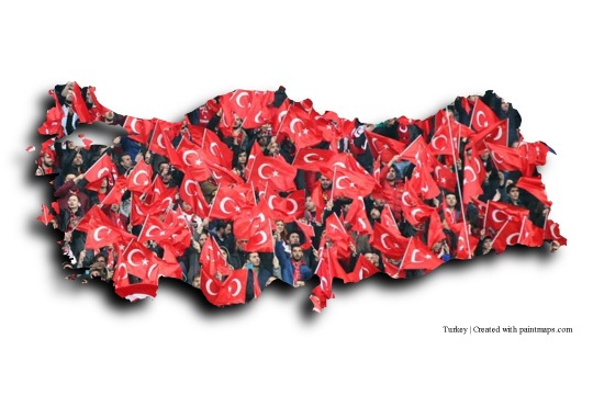
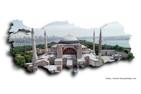
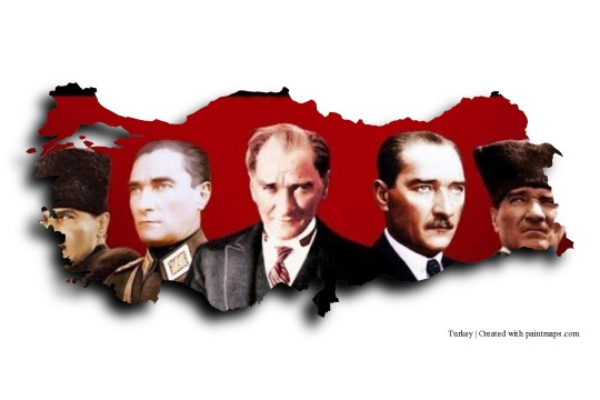
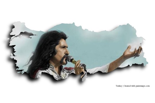
Images on Panama map generated with https://paintmaps.com/photo-maps


2 notes
·
View notes
Photo

PhotoMap Gallery Photos, Videos and Trips 9.1.9 APK Ultimate #Apps #Photography https://t.co/XG07Ouc6dw http://twitter.com/iandroideu1/status/1242277738326581250
PhotoMap Gallery Photos, Videos and Trips 9.1.9 APK Ultimate #Apps #Photography https://t.co/XG07Ouc6dw
— iAndroid.eu (@iandroideu1) March 24, 2020
0 notes
Video
Mapillary 🚶 #mapillary #mapillaryexplore #hiking #hike #trekking #madeiraislands #Madeira #portugal #visitmadeira #landscape #outdoors #outdoorslife #photography #streetview #openstreetmap #OpenData #photomapping #mapping #crowdsourced #osm (em Madeira)
#photomapping#visitmadeira#mapillaryexplore#landscape#streetview#mapping#photography#outdoorslife#openstreetmap#opendata#osm#hike#crowdsourced#outdoors#madeiraislands#trekking#mapillary#madeira#portugal#hiking
1 note
·
View note
Text
Inside Media | Residential aerial photography services Edmonton
Outfitting elevated information through drone study and planning is capable, pocket-accommodating, and precise. It permits organizations to settle on careful choices more expense viably and effectively in regards to critical assets.Endeavoring to convey inventive information cycles and content conveyance, our Residential Photography services in Calgary gives aeronautical arrangements by conveying excellent Geo-Spatial arrangements supported with improved speed and exactness for both the general population and private areas. We offer profoundly precise and point by point GIS Surveying, drone review, mining administrations, flood Assessment, crop wellbeing observing, geographical overview, UAV information handling, 3D planning, and ethereal photography and qualified faculty, for example, wind turbine specialists. Residential 3d virtual tour services in Edmonton Provide particular Drone administration for projects across Canada and have acquired the information and ability to achieve them through experience, collaboration, and solid equipment.We furnish your business with the significant information it needs to advance activities, face less challenge and accomplish savvy useful work. Residential Drone services in Edmonton give a product set-up of utilizations according to your industry along these lines taking you jumps ahead in getting basic data needed to settle on more intelligent business choices. At some point catching and recording your recollections according to normal perspective isn't sufficient, How about an Ariel see? Stunning isnt it? How small you would glance in a higher perspective when you are in the middle of the nature.We offers Residential Rms services in Calgary. Never miss to catch those, Our expert robot photographic artists will record the photos in most ideal casing in an Ariel see. At the point when you are in a best area for a pre wedding shoot it should require a robot shoot. We will stay up with the latest with your development project with normal photograph and video refreshes. Residential Measurements services in Edmonton can accomplish costly glancing airborne video in your film or TV creation for a portion of the cost.We can accomplish centimeter-precise review information quicker than conventional study methods, taking into account studies of regions that are troublesome and additionally hazardous for people. Self-ruling robot assessors make "photomaps" from overhead photos; eliminating bending and presenting exact estimations through ground testing distances permit human administrators to order exact advanced height models, shapes, volume estimations, and more.Using camera-prepared robots, Residential Floor plan services in Calgary can perform quick, precise, and amazingly productive structure and land investigations, making three-dimensional "geomaps" utilizing geological and orthomosaic imaging. Assessors can wear First Person View glasses and find progressively what the robot sees in great HD. Structures and resources can be immediately assessed without the requirement for expensive shut downs or placing laborers in conceivably risky areas.
#photographers on tumblr#photography#portrait photography#film photography#film photography photography skills#photography studio#photograph#photography services examples#shooting#dronelife#dronefly#architecture#aerial photgraphy for agriculture intelligence#aerial photography#drone photography#drone pilot#rms services#commercial photography#residential photography#virtual staging#3d virtual tour#3d animator#3ddesign#3d video#3d visualization#3d product rendering#drone videography#drone video services#drone videos of mines and quarries#drone view
1 note
·
View note
Text
PhotoMap PRO Gallery - Photos, Videos and Trips Mod 8.6 Apk [Unlocked]
New Post has been published on https://allmoddedapk.com/photomap-pro-gallery-full-apk/
PhotoMap PRO Gallery - Photos, Videos and Trips Mod 8.6 Apk [Unlocked]
PhotoMap PRO Gallery – Photos, Videos and Trips Mod 8.6 Apk [Unlocked]
If you’re careful, all the published galleries for Android devices have the same functionality, and their work is managing and categorizing images; among them, there are some cool developers who come up with special initiatives! Photo Map PRO Photo Gallery is a unique gallery with unique features by Dr. Ludger Bischofs on Google’s Android Market It has been published. Enjoy your photography and complete your photos by placing your photos on Google Maps! The Google Maps Maps app helps users to take photos of their different moments and capture the images recorded on their original location on the map to complete a full description of their memoirs and detailed details of them. Save. Take photos of your trips regularly and create a great diary by using your photos. Different categories are included in this app, so you can easily get the most out of each one. There are also different frames for building collages that multiply the pleasure of managing images!
Some Features and Features of the Photo Map PRO Photo Gallery Android:
Sharing recorded images via the link
View images on cloud servers
View photos on a network drive or shared directory via RESP FTP / FTPS. CIFS / SMB
Quickly put images on your original location on Google Maps
Zoom on maps and use them in 3D
Different display modes of maps
Add your notes and memos to the pictures
Create geo-collages!
Track your trips with geo tracker
Change the location of your photos by dragging and dropping
Professional photo editor before storing them
0 notes
Text

Some pictures from the photomapping workshop. The second photo shows some of my images made in photoshop. I hope to use more of these in the future using photomosh.
9 notes
·
View notes
Text
PhotoMap PRO Gallery - Photos, Videos and Trips v8.0.2 [Paid]
PhotoMap PRO Gallery – Photos, Videos and Trips v8.0.2 [Paid]
PhotoMap PRO Gallery – Photos, Videos and Trips v8.0.2 [Paid]Requirements: 4.0.3+Overview: Enjoy your photos being placed on a world map in a fascinating way. PhotoMap helps you finding and visiting great or important places again. It enables you to describe beautiful moments by adding photo captions or writing in a diary. Relive your trips by jumping virtually from location to location. PhotoMap…
View On WordPress
0 notes
Photo
はろーわーるど
どうも初めましてtomorrow0127と申します。
趣味で写真を撮っていて、どこか何かしらの形でまとめて公開していきたいと思い、tumblrにたどり着きました。
写真SNSといえばinstagramで、そちらの方も日々精力的に更新しているのですが、アップデートでフォトマップが削除されてしまい、自分の密かな楽しみが無くなってしまいました。。。
そこでいろいろ調べて、googleマイマップとtumblrを組み合わせ、自分だけのフォトマップを作成しようというのがこのブログのテーマです。
htmlなんぞ触ったことなく、苦戦は必死ですが、なんとか作成の糸口は掴んだと感じていますので、今日から少しずつ作成していければと思います。
よろしくお願いします。
0 notes
Photo
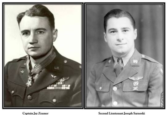
Medal of Honor Monday: A B-17 crew fends off Japanese fighter planes
On this day in 1943, a B-17 crew fends off nearly two dozen Japanese fighter planes. Captain Jay Zeamer and Second Lieutenant Joseph Sarnoski would later receive the Medal of Honor for their actions. It remains one of the few times that two members of a single crew were so honored for separate acts of heroism during the same combat.
Allied forces were then preparing for an invasion in the Solomon Islands: They needed the area photomapped! Any attempt to get that intelligence would be dangerous, of course. The mission required a plane to make a 1,200 mile round trip, solo, in hostile territory.
Zeamer and his crew volunteered anyway.
“The notice was put on the bulletin board asking for volunteers to photomap Bougainville Island,” Zeamer later explained. “All my fellows volunteered for it . . . . We’d fly anything that needed to be done.”
The mission began on June 16. The crew first stopped at Buka for a quick recon of an airstrip. Twenty-two Japanese fighter planes were there. THAT was a lot! Zeamer had to decide: Would they really continue to work on photomapping, with so many enemy fighters nearby?
Yes, they would. In fact, Zeamer’s crew had mostly completed their task when they suddenly came under attack.
The story continues at the link in the comments.
#Medal of Honor#Medal of Honor Monday#Medal Monday#today i learned#heroes#US air force#aviators#world war 2#world war ii#ShareTheHistory
2 notes
·
View notes
Text


Put your images on the maps with paintmaps.com photo map maker.
5 notes
·
View notes