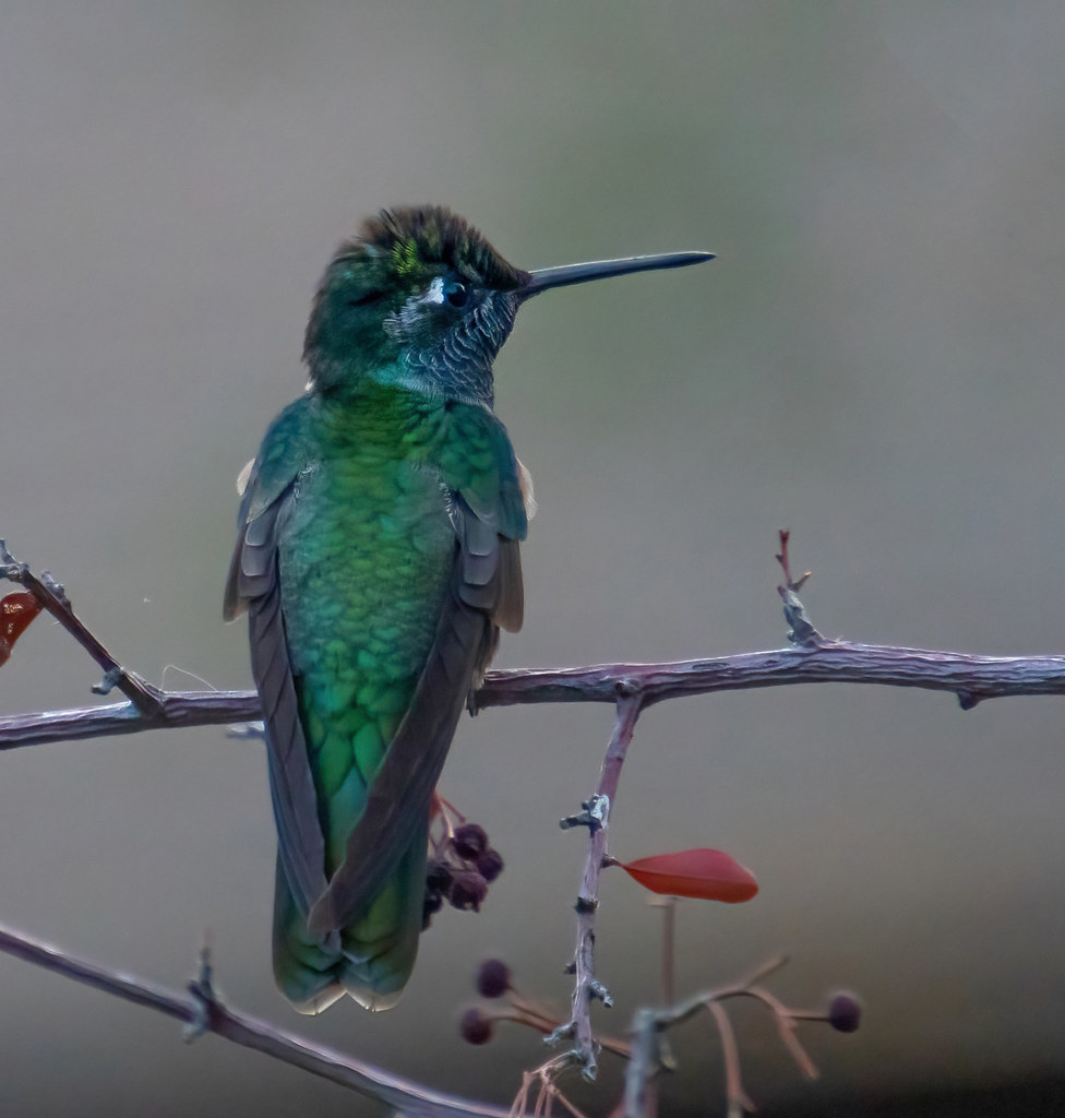
#madera canyon
Explore tagged Tumblr posts
Text
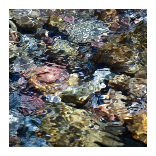
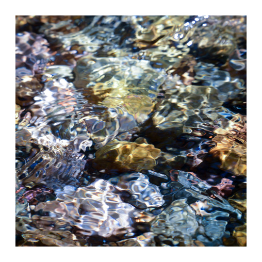

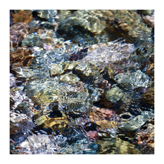
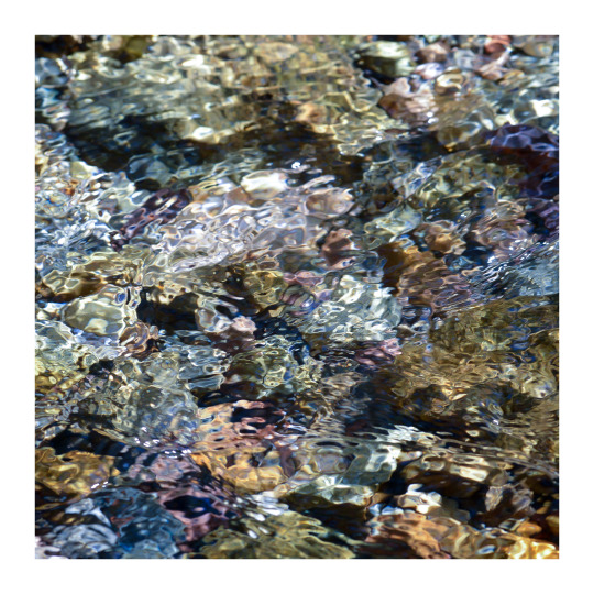
Cool clear water.
Flows in the canyon at a sunny stretch of Madera Creek.
#photographers on tumblr#water in motion#abstraction in nature#Madera Creek#Madera Canyon#Coronado National Forest#Santa Cruz County#Arizona
5K notes
·
View notes
Video
broad billed hummingbird madera canyon az 4-24-2018-3 by Thomas Johnson
6 notes
·
View notes
Text
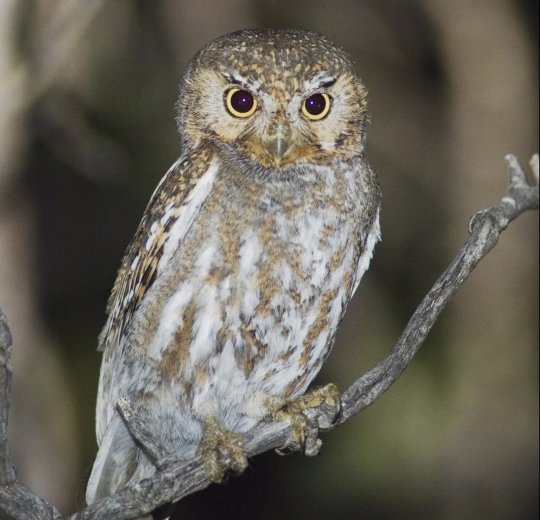
Elf Owl and Ferruginous Pygmy-Owl
Elf owl in Madera Canyon, Santa Rita Mountains, Tucson, Arizona
ROLF NUSSBAUMER/GETTY IMAGES
#rolf nussbaumer#photographer#getty images#elf owl#ferruginous pygmy-owl#bird photographer#madera canyon#santa rita mountains#tucson#arizona#nature
17 notes
·
View notes
Text

Cupressus arizonica, Arizona Cypress. Madera Canyon, Arizona. March 2023.
1 note
·
View note
Text

Townsend’s Warbler (Setophaga townsendi), Madera Canyon, Santa Rita Mountains, Arizona.
170 notes
·
View notes
Text

Arizona Woodpecker (Leuconotopicus arizonae), male, family Picidae, order Piciformes, Madera Canyon, AZ, USA
photograph by Mick Thompson
177 notes
·
View notes
Text

Brenda Mummert, photographer
Western Bluebirds, feeding in a pyracantha bush Madera Canyon.
97 notes
·
View notes
Text

Take a few minutes to click the links (click on the room name) + read the new room descriptions on Cliq. We look forward to seeing more activity there as you make yourselves familiar with the additions. Please reach out if you need ideas on how to make the most of them.
Equinox Fitness Club
STK Steakhouse
Casa Madera
Simply Wholesome
Georgia (due to a lot of citizens being from this state)
Erewhon Market Organic Grocer and Café
Greek Theater (this technically inside of Griffith park per our research. So the Griffith park room can be used for this.)
Bel-Air Country Club
New York (unless none of the citizens want a room for this, we can remove it)
Silicon Valley (this is where social media and tech headquarters will be located. Places such as Google, Apple, Tidal, Snapchat, Meta; formally known as Facebook, Twitter; now known as X, and Instagram)
Egg Slut
Harolds Chicken & Bar
A Beautiful Life Jamaican
Verve Coffee Roasters
L.A. Farmers Market at 3rd & Fairfax
Post and Beam Soul Food
Fixins Soul kitchen
Yardbird
Nevada (for Las Vegas)
Urban Air California
The Escape Revolution
The Grove Shopping Center
Aquarium of the Pacific
Dragonfly Hollywood
Napa Valley Wine Country
Xtreme Xperience Racing
Bottega Louie
Rooms that are already at the rp per suggestion:
Staples Center or Crypto.com Arena
Florida
Outside of California (this room should be used as any State that was not given an individual room)
Room name changes.
Club Paradise will become Dragonfly Hollywood
BXR Gym will become Equinox Fitness Club
The Dolly Llama will become Jeni Splendid Ice Cream
Katana Sushi will become Jinya Ramen Bar
Bossa Nova will become Bottega Louie
Roscoes will become Harolds Chicken and Bar
Breakfast bitch will become Egg Slut
Sky Zone will become Urban Air Revolution
Oceans Aquarium will become Aquarium of the Pacific
Rooms that are being removed:
Gizmos Cereal Bar
Boa Steakhouse
Ocean Prime
Star Hookah Lounge
Firefly
Johnny Rockets
Providence
7Eleven
Target
Border Grill
Oasis of the Seas
Big Bear Cabins
Mildred E. Mathis Botanical Garden
Delta Phi Zeta Sorority House
Omega Psi Beta Fraternity House
Runyon Canyon
Walmart
Hollywood Sign & Boulevard
9 notes
·
View notes
Text

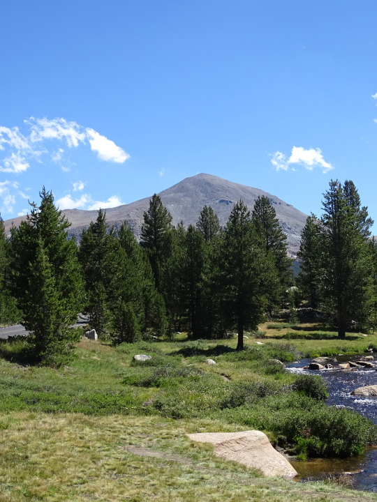


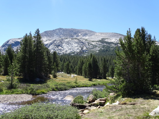
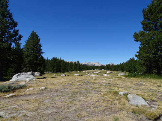

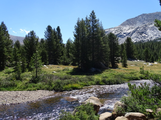

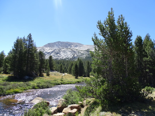
Yosemite National Park, CA (No. 2)
Yosemite National Park is a national park in California. It is bordered on the southeast by Sierra National Forest and on the northwest by Stanislaus National Forest. The park is managed by the National Park Service and covers 759,620 acres (1,187 sq mi; 3,074 km2) in four counties – centered in Tuolumne and Mariposa, extending north and east to Mono and south to Madera. Designated a World Heritage Site in 1984, Yosemite is internationally recognized for its granite cliffs, waterfalls, clear streams, giant sequoia groves, lakes, mountains, meadows, glaciers, and biological diversity. Almost 95 percent of the park is designated wilderness. Yosemite is one of the largest and least fragmented habitat blocks in the Sierra Nevada.
Its geology is characterized by granite and remnants of older rock. About 10 million years ago, the Sierra Nevada was uplifted and tilted to form its unique slopes, which increased the steepness of stream and river beds, forming deep, narrow canyons. About one million years ago glaciers formed at higher elevations. They moved downslope, cutting and sculpting the U-shaped Yosemite Valley.
Source: Wikipedia
#Dana Lake#Mount Dana#Mount Gibbs#Yosemite National Park#Sierra Nevada#Mono County#geology#flora#California#summer 2022#tourist attraction#landmark#landscape#countryside#USA#nature#forest#woods#fir#pine#rocks#travel#original photography#vacation#alpine meadow#creek
10 notes
·
View notes
Photo

Weather: Pacific Northwest
Report generated at 2024-12-06 20:00:07.175413-08:00 using satellite imagery and alert data provided by the National Weather Service.
Winter Weather Advisory
WA:
Central Chelan County
Kittitas Valley
Lower Slopes of the Eastern Washington Cascades Crest
Moses Lake Area
Northeast Mountains
Northern Blue Mountains of Oregon
Northern Panhandle
Northwest Blue Mountains
Okanogan Highlands
Okanogan Valley
Spokane Area
Upper Columbia Basin
Upper Slopes of the Eastern Washington Cascades Crest
Waterville Plateau
Wenatchee Area
West Slopes South Central Cascades and Passes
Western Okanogan County
OR:
Lower Treasure Valley
Malheur County
Northern Blue Mountains of Oregon
Northwest Blue Mountains
Oregon Lower Treasure Valley
ID:
Bitterroot/Sapphire Mountains
Lower Hells Canyon/Salmon River Region
Lower Treasure Valley
Malheur County
Northeast Mountains
Northern Clearwater Mountains
Northern Panhandle
Oregon Lower Treasure Valley
Orofino/Grangeville Region
Southern Clearwater Mountains
Winter Storm Warning
WA:
West Slopes North Cascades and Passes
West Slopes North Central Cascades and Passes
Western Chelan County
Flood Watch
WA:
Mason
Air Stagnation Advisory
WA:
Cascade Foothills of Marion and Linn Counties
Central Oregon Coast Range Lowlands
Clackamas County Cascade Foothills
Cowlitz County Lowlands
East Central Willamette Valley
Inner Vancouver Metro
Lane County Cascade Foothills
Lower Columbia River
North Clark County Lowlands
North Oregon Coast Range Lowlands
Outer Southeast Portland Metro
South Washington Cascade Foothills
Tualatin Valley
West Central Willamette Valley
Willapa and Wahkiakum Lowlands
OR:
Baker County
Benton County Lowlands
Boise Mountains
Camas Prairie
Cascade Foothills of Marion and Linn Counties
Central Douglas County
Central Oregon Coast Range Lowlands
Central and Eastern Lake County
Clackamas County Cascade Foothills
Cowlitz County Lowlands
East Central Willamette Valley
Eastern Curry County and Josephine County
Harney County
Jackson County
Klamath Basin
Lane County Cascade Foothills
Lane County Lowlands
Linn County Lowlands
Lower Columbia River
Lower Treasure Valley
Malheur County
North Clark County Lowlands
North Oregon Coast Range Lowlands
Northern and Eastern Klamath County and Western Lake County
Oregon Lower Treasure Valley
Outer Southeast Portland Metro
South Washington Cascade Foothills
Tualatin Valley
Upper Treasure Valley
Upper Weiser River
West Central Mountains
West Central Willamette Valley
Western Magic Valley
Willapa and Wahkiakum Lowlands
ID:
Baker County
Boise Mountains
Camas Prairie
Harney County
Lower Treasure Valley
Malheur County
Oregon Lower Treasure Valley
Upper Treasure Valley
Upper Weiser River
West Central Mountains
Western Magic Valley
Freezing Fog Advisory
OR:
North Central Oregon
CA:
Lassen-Eastern Plumas-Eastern Sierra Counties
Northern Washoe County
NV:
Lassen-Eastern Plumas-Eastern Sierra Counties
Northern Washoe County
Wind Advisory
OR:
Grande Ronde Valley
CA:
Santa Susana Mountains
Dense Fog Advisory
OR:
Lower Treasure Valley
Oregon Lower Treasure Valley
Upper Treasure Valley
Upper Weiser River
ID:
Bear Lake Valley
Lower Treasure Valley
Oregon Lower Treasure Valley
Upper Treasure Valley
Upper Weiser River
CA:
Bakersfield
Buttonwillow - Lost Hills - I5
Caruthers - San Joaquin - Selma
Delano-Wasco-Shafter
Fresno-Clovis
Hanford - Corcoran - Lemoore
Los Banos - Dos Palos
Merced - Madera - Mendota
South End San Joaquin Valley
Southeast San Joaquin Valley
Visalia - Porterville - Reedley
West Side of Fresno and Kings Counties
Air Quality Alert
OR:
Lake
CA:
Calabasas and Agoura Hills
Catalina and Santa Barbara Islands
Eastern San Fernando Valley
Eastern Santa Monica Mountains Recreational Area
Los Angeles County Beaches
Los Angeles County Inland Coast including Downtown Los Angeles
Los Angeles County San Gabriel Valley
Malibu Coast
Palos Verdes Hills
Santa Clarita Valley
Santa Susana Mountains
Western San Fernando Valley
Western Santa Monica Mountains Recreational Area
Fire Weather Watch
CA:
Calabasas and Agoura Hills
Central Ventura County Valleys
Eastern San Fernando Valley
Eastern San Gabriel Mountains
Eastern Santa Monica Mountains Recreational Area
Interstate 5 Corridor
Los Angeles County San Gabriel Valley
Malibu Coast
Northern Ventura County Mountains
Riverside County Mountains-Including The San Jacinto Ranger District Of The San Bernardino National Forest
San Bernardino County Mountains-Including The Mountain Top And Front Country Ranger Districts Of The San Bernardino National Forest
San Bernardino and Riverside County Valleys - The Inland Empire
San Diego County Inland Valleys
San Diego County Mountains-Including The Palomar And Descanso Ranger Districts of the Cleveland National Forest
San Gorgonio Pass Near Banning
Santa Ana Mountains-Including The Trabuco Ranger District of the Cleveland National Forest
Santa Clarita Valley
Santa Susana Mountains
Southeastern Ventura County Valleys
Southern Ventura County Mountains
Ventura County Beaches
Ventura County Inland Coast
Western San Fernando Valley
Western San Gabriel Mountains and Highway 14 Corridor
Western Santa Monica Mountains Recreational Area
2 notes
·
View notes
Text






Plumas brillantes.
Iridescent plumage on Gould’s turkeys / guajolote norteño (Meleagris gallopavo mexicana) at Santa Rita Lodge. In Madera Canyon, Santa Cruz County, Arizona.
#photographers on tumblr#Gould's turkey#Meleagris gallopavo mexicana#abstraction in nature#turkey feathers#iridescence#Santa Rita Lodge#Madera Canyon#Santa Cruz County#Arizona
1K notes
·
View notes
Video
Broad-Billed Hummingbird by Ruby 2417 Via Flickr: Madera Canyon, Green Valley, Arizona. Sept. 2024.
#hummingbird#bird#wild#wildlife#nature#colorful#green#blue#male#madera#canyon#arizona#birding#flickr
9 notes
·
View notes
Text
Unveiling the Secrets of Coronado National Forest: From History to Wilderness
Nestled in the southeastern reaches of Arizona and southwestern New Mexico, the Coronado National Forest spans approximately 1.78 million acres (7,200 km²) across the diverse mountain ranges of Cochise, Graham, Santa Cruz, Pima, and Pinal Counties in Arizona, and Hidalgo County in New Mexico.


A Brief History
Established in 1908, the Coronado National Forest evolved from the Santa Rita Forest Reserve, which was part of the U.S. Forest Service's early conservation efforts. One notable event in its recent history was the Sawmill Fire of 2017, which ravaged around 47,000 acres (19,000 ha) and was caused by an off-duty Border Patrol agent. The fire underscored the delicate balance of managing such vast lands.
In more recent developments, tensions arose in 2022 when the Arizona Department of Emergency and Military Affairs constructed a border wall on federal and tribal lands near Yuma without proper authorization. This led to a legal dispute with federal agencies, and Governor Doug Ducey’s administration sought to challenge the removal orders. As of January 2023, the State has agreed to dismantle the controversial barrier.
Administration and Ranger Districts
Coronado National Forest is divided into five ranger districts, each encompassing unique sky island mountain ranges:
Santa Catalina Ranger District: This area includes the Santa Catalina and Rincon Mountains, featuring Mount Lemmon, the Pusch Ridge Wilderness, and Sabino Canyon. Previously part of the Santa Catalina National Forest, it’s a popular spot for outdoor enthusiasts.
Safford Ranger District: Surrounding Safford, Arizona, this district covers the Pinaleño, Galiuro, Santa Teresa, Winchester, and Greasewood Mountains. It includes Mount Graham, once part of the Mount Graham National Forest, which merged into Coronado in 1953.
Nogales Ranger District: North and west of Nogales, this district includes the Santa Rita, Tumacacori, Pajarito, and San Luis Mountains. Key sites include Mount Hopkins and Madera Canyon. It absorbed the Santa Rita and Tumacacori National Forests early in the 20th century.
Douglas Ranger District: Located north and east of Douglas, Arizona, this district encompasses the Chiricahua, Dragoon, and Peloncillo Mountains, with part extending into New Mexico. It includes the Chiricahua, Dragoon, and Peloncillo National Forests.
Sierra Vista Ranger District: West of Sierra Vista, this district covers the Huachuca, Patagonia, and Whetstone Mountains, including Miller Peak and the Canelo Hills. It absorbed the Huachuca National Forest.
Wilderness Areas
Coronado National Forest is home to eight designated wilderness areas spread across each ranger district. These protected spaces offer a refuge for outdoor activities such as hiking, horseback riding, camping, hunting, and fishing. However, mechanized and motorized equipment, including bicycles and chain saws, are strictly prohibited to preserve the natural integrity of these areas.
Discover the beauty and diversity of Coronado National Forest, where nature’s grandeur and historical depth converge to offer an unparalleled experience in the American Southwest.
2 notes
·
View notes
Text
Madera Canyon
5 April 2023

This was the first of two rides near Tucson today and was a simple 14-mile (each way) out and back (or an up and down?). I started at La Posada in Green Valley near I-19 and rode to the trailhead at the end of the road.


Much of the ride is a gradual climb across the broad alluvial fan (or pediment). 8 miles up, the road turns south, crosses a couple of dry washes, and steepens toward the bottom of the valley. It gradually becomes more vegetated once you pass the entrance station and enter the canyon, but from there it’s only another 2 1/2 miles to the turnaround. This is certainly the most interesting part of the ride with curves, steep grades, forest (and shade), and a few small resorts, but ultimately I suspect the prettiest and lushest part of Madera Canyon is further upstream of the trailhead.

Madera Creek flows northward out of the Santa Rita Mountains. Mount Wrightson (9500’ and still with some snow) rises to the southeast and Mount Hopkins (topped with an observatory) lies to the southwest. I knew that friends might be hiking in the canyon today and we ended up crossing paths just as I approached the top and they were driving out.

3 notes
·
View notes
Text
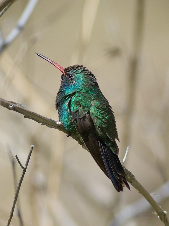
Broad-billed Hummingbird (Cynanthus latirostris), Madera Canyon, Santa Rita Mountains, Arizona.
886 notes
·
View notes
Text


A wood ear mushroom, mosses and lichen on Feb 20, 2023 in Madera Canyon.
6 notes
·
View notes
