#entiat mountains
Explore tagged Tumblr posts
Text


Earthquake Point/Broken Mountain, WA
Take a step back in time to December 14, 1872 in what was at that time Washington Territory. Ulysses S. Grant had just been elected president for his second term, and Boston was still recovering from the Great Fire that destroyed much of the city in November of that year. You had to draw water from a well, light your cabin with oil lamps, and typically folks would retire for the night shortly after sundown, when the evening chores were completed, and supper dishes were cleaned.
On that night, at almost 10pm, folks across the region were awakened by a massive earthquake. Contemporary accounts describe the earth rolling from North to South, no jolting bumps, just the feeling like walking on the deck of a ship in rough seas.
The earthquake impacted an area of the Pacific Northwest over 625,000 miles – from Salem Oregon in the South, to Victoria, BC in the North, across Idaho into Montana and much damage was sustained in the populated areas west of the Cascades. In Seattle buildings rocked, trees shook, items and fell off shelves. Pendulum clocks were stopped by the offsetting rocking, or started up again, if they had been stopped. Plaster walls cracked and lamps tipped over.
Prior to the event, Lake Union had been flat calm, but the quake caused a tidal wave several feet high. In Olympia there were reports of fireplaces crumbling.
Jack Splawn (also known as Moses Splawn) was a cowboy and resident of Yakima City at that time. He explained that he and the other cowboys on the ranch had just completed the year’s branding and were celebrating at the Sagebrush Saloon, when the building began rocking and they ran outside to see what hoodlums were trying to tip the house over.
While some folks dealt with milk sloshed out of the pail, and knickknacks falling off the shelf, the residents of North Central Washington, especially indigenous tribes who lived along the Columbia river near Chelan witnessed a far more catastrophic event. It is known locally as “the night the mountain fell.”
As you drive along Highway 97A just past Entiat on your way to Chelan, there is a roadside pullout and marker explaining “Earthquake Point.” Here you can view what the native people named “Ribbon Cliffs”. A giant portion of the hillside of Broken Mountain fell into the Columbia river that night. Of course, the river was not as high then as it is now, as the hydroelectric projects along the river have raised it, however, the amount of earth and granite that fell blocked the river and flooded the lands behind it, including the ranch of the Wapato family. You might recognize that tribal name from the peninsula of land at Lake Chelan, called Wapato Point.
At some point the following day the water broke through the earthen dam, the flood receded, and the river began to flow again. It must have been a sight to behold if you lived in Wenatchee to wake up to a dry riverbed! Witnesses to the event reported that it took several days for the earthen dam to break up and the river to return to its previous level.
While there was no seismologic equipment in place seventeen years before Washington became a state, experts studying the damage and geologic features believe the quake was between 6.5 and 7.5 in magnitude. That makes it one of the largest on record in the state.
For 143 years it was a mystery where the epicenter of this earthquake could be found. In 2015 geologist Brian Sherrod painstakingly surveyed a canyon between Chelan and Entiat, where he found a fault and was able to definitively prove it to be the source of the quake.
Source
#Earthquake Point#Broken Mountain#Ribbon Cliff#white volcanic ash#Chelan County#travel#original photography#vacation#tourist attraction#landmark#landscape#contryside#summer 2023#USA#Pacific Northwest#Washington#flora#nature#Columbia River#tree#geology#US history
2 notes
·
View notes
Text
0 notes
Photo

"Box Canyon H" is available as prints, canvas and more. See LINK IN BIO (linktr.ee/tonyadoughty) or tonyadoughty.net > purchasing. #art #landscape #mountains #entiat https://www.instagram.com/p/CC4GbmyjJTE/?igshid=1rhwzpn156q9i
0 notes
Photo

"From the time you take your first breath, you become eligible to die. You also become eligible to find your greatness. And become the one warrior (in a hundred). But it is up to you to equip yourself for the battle ahead. Only you can master your mind, which is what it takes to live a bold life filled with accomplishments that most people consider beyond their capability." -@davidgoggins ° 📸 May 2019 📍 Entiat River Valley ° ° ° #northCascades #FindYourPark #PublicLands #PNW #PNWonderland #PacificNorthwest #NFS #Mountaineering #PNWPeakbaggers @pnwpeakbaggers #optputside #rei1440project #WildernessCulture #HikingCulture #igPacificNorthwest #IGnorthwest #Entiat #Chelan #forest #nature #phonephotography #Samsung #GalaxyS10 #ChooseMountains (at Entiat River) https://www.instagram.com/p/BxvaJ1bDY_x/?igshid=sqnxx4f6olar
#northcascades#findyourpark#publiclands#pnw#pnwonderland#pacificnorthwest#nfs#mountaineering#pnwpeakbaggers#optputside#rei1440project#wildernessculture#hikingculture#igpacificnorthwest#ignorthwest#entiat#chelan#forest#nature#phonephotography#samsung#galaxys10#choosemountains
0 notes
Photo

The best work days are the ones in the mountains. / / / / #todaysoffice #vsco #vscocam #mountains #photography #nature #travel (at Entiat, Washington) https://www.instagram.com/p/B7wdmrVAA_x/?igshid=pfp03rbzttgf
2 notes
·
View notes
Text
Leroy-Carne Loop and Ice Lakes, Entiat Mountains
October 4-7, 2017
Seven-Fingered Jack (9100′) North Spectacle Butte (8080′) South Spectacle Butte attempt
For our annual Golden Larch Trip this year, Doug, Fay, Lisa, Steve, Deb, Brian, and Eileen joined me on the very popular Leroy-Carne Loop in the Entiat Mountains. We included a side trip to beautiful Ice Lakes and managed to tuck in some nice peaks along the way. The larch trees were close to being at their peak of golden color, and the weather started out pleasantly autumnal. But all of that was overshadowed by the incredible blizzard most of us experienced while camped at Upper Ice Lake on Friday night. It was a storm of near-biblical proportions that none of us survivors will ever forget.
DAY 1: We drove up the Chiwawa River Road to the Phelps Creek Trailhead on Wednesday morning. There were numerous cars in the parking lot, and we immediately bumped into our friends Dave and Milda, who were headed into Ice Lakes via Carne Mountain. Our group was headed to the same place, but we were entering from the north via Leroy Basin. We donned backpacks and hiked the 6 miles into the basin under sunny skies, arriving in mid-afternoon (4.2 hours from TH). There was time to do some exploration of the basin and check out the larch color. It appeared that we were about a week early for prime color; some trees were bright gold, whereas others were only green-gold.

From our camp in Leroy Basin, we could gaze directly up at the summit crags of Seven-Fingered Jack our objective for tomorrow morning.
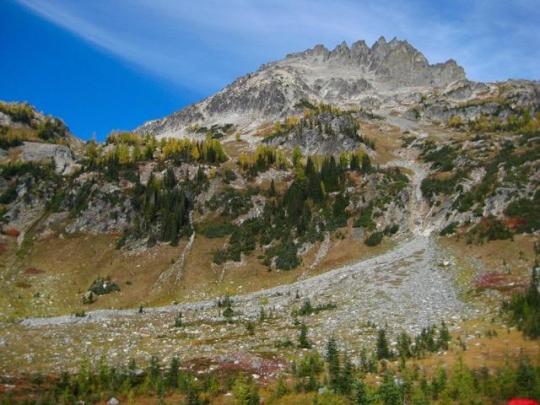
DAY 2: We awoke at 5:30am and were on the move with summit packs just after sunrise. Our plan was to climb the northwest ridge of Seven-Fingered Jack, so we headed north to the 7700-foot col separating Leroy Creek and Big Creek. Views of Buck Mountain and other peaks to the west were excellent in the clear October air.
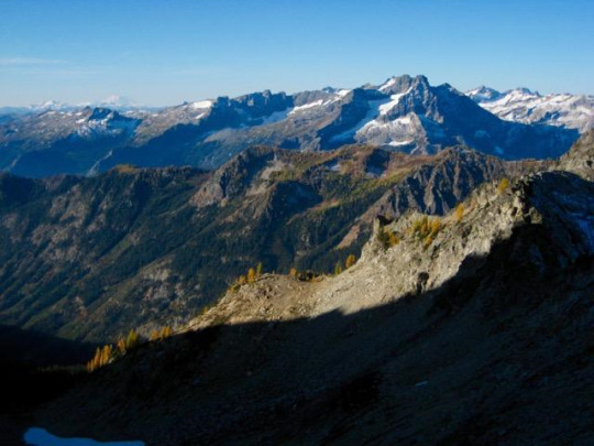
We soon reached the Big-Leroy Col (1.5 hours from camp), which marks the bottom of the northwest ridge. Steve and I had previously climbed this route in past decades but somehow managed to forget that it starts at a steep face of rotten volcanic breccia or tuff. Whatever the rock type, it was enough to make Lisa, Deb, Doug, Steve, and Eileen retreat back to the more-standard west slope route. Meanwhile, Fay and Brian and I decided to take our chances with the steep face. It began with an exposed Class 3 ledge system but soon eased off to Class 2-3 scrambling with only moderate exposure.

The upper part of the west ridge served up some very interesting Class 3 scrambling around numerous horns and pinnacles, but Brian decided to turn around near the midpoint. Eventually, Fay and I rejoined our west slope comrades and continued upward together.

We topped out in late morning (4.6 hours from camp) and enjoyed the calm summit for nearly an hour. Eileen had carried up Ed Miller’s memorial traveling register to leave for future parties.

Views included the incredible north face of Mt. Maude to the south...
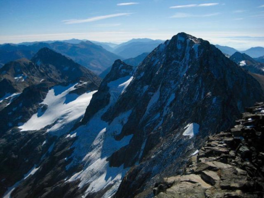
... Stuart Range farther to the south ...

... and Entiat Meadows directly below.

We headed back down to Leroy Basin by way of the expansive southwest slope.
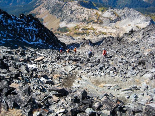
Once back at camp, we packed up and headed south on the Carne Mountain High Route, following the old sheepherder’s trail up to 6900-foot Leroy Pass.

The pass offered us one last look back at Seven-Fingered Jack and Leroy Basin before we turned east and left the trail.

Faint footpaths led up heather, talus, and scree to 7600-foot Ice Lakes Pass. Late-afternoon shadows were stretching across Upper Ice Lake just as we arrived at the pass. We hurried down to the lake and set up camp on some conveniently flat but very exposed pumice terraces (2.9 hours from Leroy Basin).

DAY 3: After a comfortable night of being lightly buffeted by mountain breezes, we awoke to a gorgeous sunrise over Spectacle Buttes. Or should I call them “Spectacular Buttes”?

Upper Ice Lake is strikingly beautiful in an austere, lunar-esque fashion. I think that if the moon had lakes and larch trees, it would look very similar to this.

Pink clouds streaked across the western sky ...
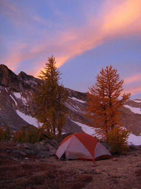
... and alpenglow lit up Mt. Maude.

During breakfast, Steve, Deb, and Brian announced that they would break camp and head out today, adding a climb of Mt. Maude along the way. Lisa, Doug, Fay, Eileen, and I, on the other hand, decided to make a day trip over to Spectacle Buttes. We began with a traverse around the shore of Upper Ice Lake.
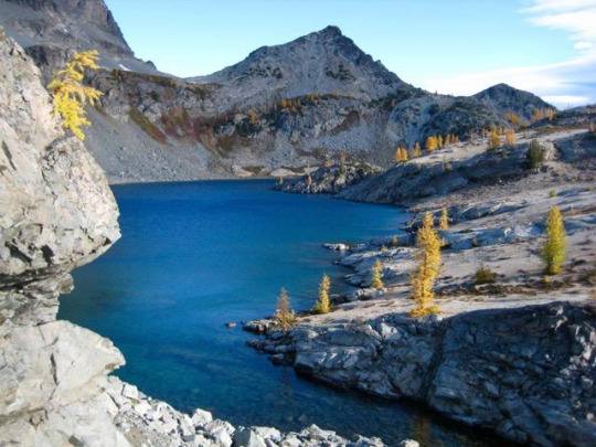
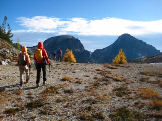

We then dropped down to Lower Ice Lake, which has a user-friendly shoreline and an inviting larch-studded island.

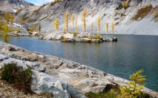
At the lower lake, Lisa and Doug veered off to climb North Spectacle Butte, whereas Fay, Eileen, and I proceeded in the direction of South Spectacle Butte. This involved a short descent into the Ice Creek valley, then a traverse below the north butte. We crossed over the top of a huge erosion gully along the way.
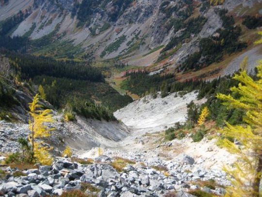
An ascent through a high larch basin ended at 7300-foot Spectacle Col, between the two buttes.

Beckey’s original Cascade Alpine Guide indicates that South Spectacle Butte can be readily climbed from this col, so we were game to give it a whirl. The first 600 feet was straightforward and enjoyable, but we soon encountered an impassable notch at 7900 feet. After several attempts to get beyond the notch, we reluctantly decided to retreat and traverse over to North Spectacle Butte.

We contoured around the eastern side of the north butte, then scrambled up the northeast ridge, arriving on the summit in late afternoon (7.0 hours from camp).

The skies had been growing dark and ominous throughout the afternoon, and a light snow started to fall just as we left the summit.
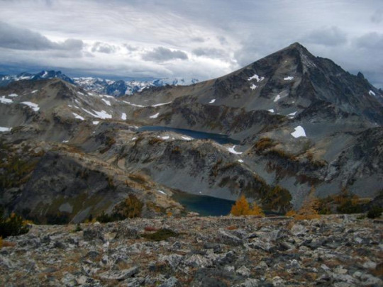
We raced down the peak’s west ridge, dropped into Lower Ice Lake, then hiked back up to our camp at Upper Ice Lake. Gusty winds spit graupel pellets in our faces as we made the final traverse to camp (1.7 hours from summit). Doug and Lisa had arrived an hour before us, having tucked in North Spectacle Butte earlier in the day.
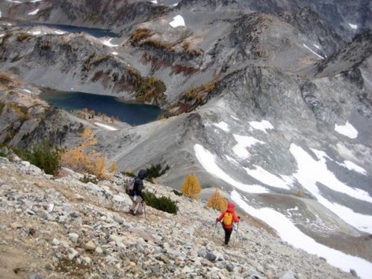
NIGHT 3: After eating a hasty dinner in the brewing storm, we all retreated to our respective tents around 7:00pm. The winds continued to grow in intensity throughout the evening, and the snowfall increased. Before long, it became a full-blown blizzard. Somewhere around 10:00pm, I got out to re-stake our wind-battered tent with rock anchors, and then I stumbled off to check on the others. Doug’s single-wall Megamid tent had suffered a blow-out at the apex and collapsed on top of him; he had no choice but to lie under it like a tarp. Fay’s lightweight double-wall tent was still standing, but it deformed badly under the wind loading and was filling with spindrift; she and Lisa were doing their best to hold it up from within.
I scurried back to our tent and jumped inside. For the next 2 hours, the winds became even more ferocious. To make things worse, the gusts continually changed direction; one gust would roar in from the west, circle around Ice Lake, then roar back in from the east. We later estimated that they reached speeds in the range of 60 to 80 mph at their peak. I spent most of that time with my feet pushed up against the corners of the tent ceiling, trying to keep it from folding over under the tremendous load. Eileen got out at midnight to replace anchor rocks that had been moved and stakes that had pulled out. Around 1:00am, the gusts abated slightly, and we both dozed off. This rest was short-lived, however, because we were awoken at 2:00am when our tent partially collapsed due to a broken pole. With no means to repair a tent pole during a blizzard, our only option was to huddle inside and accept the incoming spindrift. It was a long night.
DAY 4: At 5:20am, I announced to Eileen that it was time to move. I emptied the spindrift out of my boots and got dressed in my full battle armor, then crawled out the rally the others. Doug was more than happy to get out from under his flattened pyramid. Likewise, Fay and Lisa were very ready to escape their snow-filled cocoon. We all packed up in the still-howling wind, being careful to keep a grasp on each item lest it be whipped off to the Entiat Valley. As we ate breakfast behind a windbreak, the eastern sky gradually lightened and began to splash dawn colors across the frozen landscape. It was a visually stunning aftermath to a wild night.
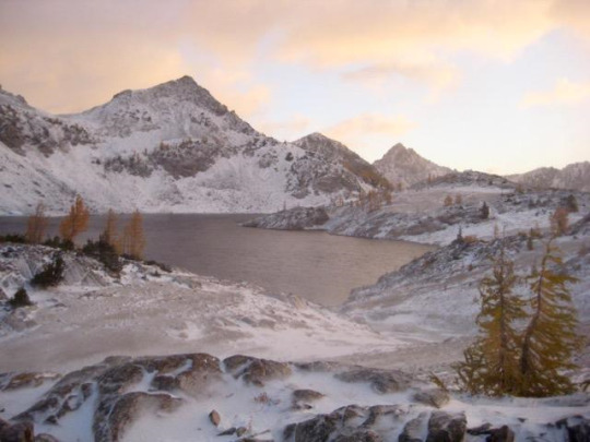


We trudged up to Ice Lakes Pass and took a short break to soak in one last view of Upper Ice Lake to the east.
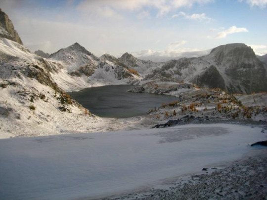
To the west, dark storm clouds battled with patches of deep-blue sky.

We spent the rest of our day hiking through a snowy wonderland along the Carne-Leroy High Route and down to the trailhead.
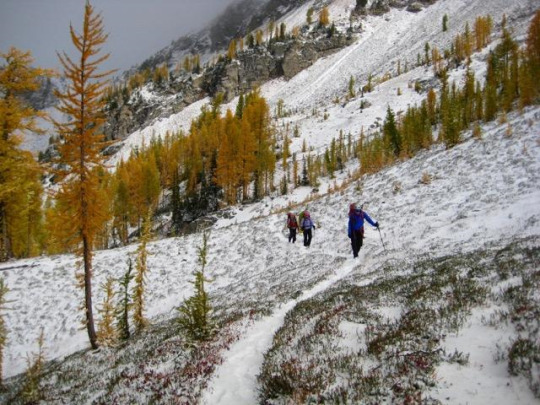
Around midday, we encountered Dave and Milda, who had also been camped at Upper Ice Lake the night before. We shared survivor tales with them, and laughed at the helplessness of our respective situations. For all of us, we felt that we’d lived through MOAB: the Mother Of All Blizzards! Fay later summed it up perfectly by saying, “We had a once in a lifetime experience; one not to missed but one not to ever be repeated.” Amen.
Approximate Total Stats: 28 miles traveled; 13,700 feet gained & lost; 3 tents damaged.
#ice lakes#seven-fingered jack#7fj#spectacle buttes#carne basin#Leroy basin#entiat mountains#Cascade Mountains#golden larch
0 notes
Text
Watch High School Football 2019 Live Stream
Live On : http://bit.ly/HS-Football-Live

Wauneta-Palisade Broncos vs Medicine Valley Raiders Nebraska High School Football LIVE 7:00 PM Welsh Greyhounds vs Iota Bulldogs Louisiana High School Football LIVE 7:00 PM Wewoka Tigers vs Ada Cougars Oklahoma High School Football LIVE 7:00 PM Wilbur-Creston Wildcats vs Entiat Tigers Washington High School Football LIVE 7:00 PM Wilson Wildcats vs La Puente Warriors California High School Football LIVE 7:00 PM Woodside Wildcats vs Leigh Longhorns California High School Football LIVE 7:00 PM Wray Eagles vs Sheridan Rams Colorado High School Football LIVE 7:00 PM Wyalusing Valley Rams vs Athens Wildcats Pennsylvania High School Football LIVE 7:00 PM Wynne Yellowjackets vs Arkadelphia Badgers Arkansas High School Football LIVE 7:00 PM Xavier Prep Saints vs Aquinas Falcons California High School Football LIVE 7:00 PM Xavier Saints vs Assumption Knights Iowa High School Football LIVE 7:00 PM Yelm Tornados vs Tumwater Thunderbirds Washington High School Football LIVE 7:00 PM Miami Country Day Spartans vs Pompano Beach Golden Tornadoes Florida High School Football LIVE 7:15 PM Monsignor Pace Spartans vs Treasure Coast Florida High School Football LIVE 7:15 PM Northwestern Bulls vs Killian Cougars Florida High School Football LIVE 7:15 PM Beatrice Orangemen vs Ralston Rams Nebraska High School Football LIVE 7:30 PM Central Cobras vs Boca Raton Bobcats Florida High School Football LIVE 7:30 PM Christian Brothers Cadets vs Chaminade Red Devils Missouri High School Football LIVE 7:30 PM Eaglecrest Raptors vs Rocky Mountain Lobos Colorado High School Football LIVE 7:30 PM Fairmont Senior Polar Bears vs North Marion Huskies West Virginia High School Football LIVE 7:30 PM Frontenac Raiders vs St. Mary's-Colgan Panthers Kansas High School Football LIVE 7:30 PM Klein Bearkats vs Klein Oak Panthers Texas High School Football LIVE 7:30 PM Lanier Vikings vs Eastside Memorial Texas High School Football LIVE 7:30 PM Loyal Greyhounds vs Assumption Royals Wisconsin High School Football LIVE 7:30 PM McLain Science & Tech Titans vs Central Braves Oklahoma High School Football LIVE 7:30 PM MCSTNJMSL (CO-OP) vs Riverside University/Meir Wisconsin High School Football LIVE 7:30 PM North Branford Thunderbirds vs SMSAUSECM (CO-OP) Connecticut High School Football LIVE 7:30 PM North Crowley Panthers vs Guyer Wildcats Texas High School Football LIVE 7:30 PM Northview Vikings vs Don Lugo Conquistadores California High School Football LIVE 7:30 PM Spanaway Lake Sentinels vs Decatur Golden Gators Washington High School Football LIVE 7:30 PM Strake Jesuit Fighting Crusaders vs Eisenhower Eagles Texas High School Football LIVE 7:30 PM TMI-Episcopal Panthers vs Center Point Pirates Texas High School Football LIVE 7:30 PM Turner Lions vs Western Hills Cougars Texas High School Football LIVE 7:30 PM V.R. Eaton Eagles vs Naaman Forest Rangers Texas High School Football LIVE 7:30 PM Waterbury Career Academy Spartans vs Ansonia Chargers Connecticut High School Football LIVE 7:30 PM Yukon Millers vs Moore Lions Oklahoma High School Football LIVE 7:30 PM
#HighSchoolFootball #HSFootball #CollegeFootball #NCAAFootball #VarsityFootball #AmericanFootball #NFL #HSFootballLiveStream #HighSchoolFootballLiveStream
2 notes
·
View notes
Text
Sometimes I really miss living on the east side of the Cascades in Washington.
I lived in a small town just north of Wenatchee. Ardenviour is a tiny outpost a few miles up a valley along the Entiat river. In the summer it has dry grassy hills intersperced by ponderosa, with fir on the shady slopes and vine maple along stream beds and seeps.
To the east across the Columbia river lay the scablands, a volcanic landscape of hills and terraced basalt pillars. A barren landscape, in parts mesas and canyons are reminiscent of the southwest, but lack the drama of oxidized sandstone.
West was the Wilderness, the heart of the Cascades. Rugged mountains, not huge but big enough. Glaciers and jagged ridgelines, intersperced by alpine lakes, high meadows and thick forests.
Summer could be hot, especially to the east, but the smell of warm grass and sagebrush is subtle and wonderful.
There is so much more....
#me#words#writing#outdoors#pnw#WA#cascades#wilderness ranger#wish i could again.#those were the days.
10 notes
·
View notes
Text

near the entiat mountains, WASH.
1 note
·
View note
Photo

[OC] Entiat Mountains, Plain WA [3024 x 4032] via /r/EarthPorn https://ift.tt/3cS0ioF
0 notes
Text
The #Filter That Makes Pacific Lamprey Pretty (in the Eyes of Biologists)
It’s not just tubers and paddleboarders out there on our local rivers. Biologists are at work, trying out a new sampling system to reveal the presence of fish species. Low cost, simple, and long-lasting: this is the attraction of a new technique for revealing the presence of lamprey and other hard-to-find fish in our rivers. Katy Pfannenstein of the Mid-Columbia Fish & Wildlife Conservation Office (MCFWCO) described how collecting eDNA works.

Photo: Americorps contractor Andrew Thai helped MCFWCO staff with collecting eDNA samples. Credit: Katy Pfannenstein
One person holds the end of a hose in the river where the sample is being taken. A portable pump draws water up and into a five liter collection container. The water is run through a round filter a little smaller than the size of the mouth of a coffee mug. The filter paper is put into a baggie with dessicant and shipped to the National Genomics Center for Wildlife and Fish Conservation, run by the U.S. Department of Agriculture, where it is frozen. The lab amplifies the DNA in the sample, tests to see if DNA from the species of interest is present, and sends the results back. The cost is just $85.
DNA is deoxyribonucleic acid, the code that programs living cells to grow, reproduce, and behave in certain ways. DNA is the blueprint of our selves. And DNA is distinctive from one species to another. We all shed cells containing our DNA every day: loose hair and bits of skin, for example. This material is called environmental DNA (eDNA). Filtering river water captures the shed cells from fish, allowing researchers to see whether certain species are present.

Photo: Emily Dick, a biotechnician with MCFWCO, collecting eDNA samples. Credit: Ann Grote
“Aquatic eDNA sampling is a relatively new technique. Depending on your questions, it works really well,” said Ann Grote of MCFWCO. eDNA sampling is accurate, and time- and cost-effective for looking at species presence. One field crew can collect up to ten samples in one day. The samples can be archived and re-sampled at later dates. And the filters collect everything: while one study might be looking for Pacific lamprey, another researcher might want to check for bull trout; and the same sample can serve both. The data are very shareable, which reduces duplicate effort. A person can check to see if any samples were taken from Icicle Creek, for instance, before going out to collect new samples.
But there are real limitations. eDNA sampling is very powerful at detecting DNA, but it doesn’t tell you about the source of that DNA. Is the DNA produced by live fish or dead fish? Did it originate in the study system, or did it come from another water source and “hitchhike” over on a dirty boat or a pair of angler’s waders?

Photo: Biologist Ralph Lampman inserts PIT tags into each lamprey before release. Credit: Jarod Hutcherson/Bureau of Reclamation
eDNA also can’t distinguish between abundance and biomass. “Is the sample from three really big fish, or from 10,000 tiny ones? We can’t tell,” Ann said. To answer these kinds of questions, it helps to pair eDNA sampling with more traditional fish survey methods, like snorkeling (swimming in the river to identify and count the fish) or using seines or nets to capture them.
But, wait—lamprey? If an image of a bloodsucking parasite comes to mind, you’re not wrong. But local lamprey don’t feed on blood in our rivers. Young lamprey are like earthworms, rooting through river sediment and consuming bacteria. They may prove valuable in removing excess phosphorous from streams. And they’re so hard to see, most people have no idea they’re even there.

Photo: Katy Pfannenstein of MCFWCO reaches sampling sites via inflatable kayak. Credit: Andrew Thai/USFWS-AmeriCorps
Lamprey typically spend seven years in river sediment. Then, like salmon, they are triggered to migrate to the ocean. They spend a few more years out there, living up to their bloodsucking reputation and getting large and fat. They need the fat to make the return migration, because (again like salmon) they don’t eat once they return to freshwater. Since lamprey are poor swimmers, it can take them a year to get back upstream to where they want to spawn. And once more like salmon, once they spawn, they die.
Pacific lamprey have disappeared from much of their historic range. This may be a result of dams blocking or delaying the adult spawning migrations. Pacific lamprey are poor swimmers: because they don’t have jaws, they use their mouths, or “oral disks,” to anchor themselves when swimming in swift currents. Their swimming and attachment style means that Pacific lamprey cannot easily make their way up many fish ladders that were designed for salmon.

Photo: A Pacific lamprey adjusts to its new surroundings after translocation by the Yakama Nation. Credit: Ralph Lampman/Yakama Nation
What we don’t know about lampreys outweighs what we do. It was thought only one species of lamprey (Pacific lamprey or Entosphenus tridentatus) was found in the Mid-Columbia region. But juvenile lamprey recently collected by Ralph in the Methow, Entiat, and Wenatchee rivers revealed the presence of Lampetra, a different genus of lamprey. The MCFWCO is currently partnering with the National Genomics Center for Wildlife and Fish Conservation to develop an eDNA test for Lampetra species.
None of these lampreys are closely related to the sea lamprey, Petromyzon marinus, that has invaded the Great Lakes. This is the lamprey most Americans know, and they are often aware of its negative impact on fish and fishing in that area. But the lampreys found in Washington State belong here, and in many cases, are beneficial. And adult Pacific lamprey are a highly valued food for many Native Americans.

Photo: Ralph Lampman, lamprey research biologist with Yakama Nation Fisheries (YNF) and Ann Grote translocating lamprey, Credit: Barb Kelly Ringel/USFWS.
There’s not much money available for lamprey research. Lamprey are not as charismatic or as economically significant as salmon. But for the Native Americans of the region, they are culturally vital, as well as being an integral part of a fully functional ecosystem.
The MCFWCO first started using eDNA in its research in June 2016, in conjunction with the release of lamprey into the Wenatchee River earlier that spring by Ralph Lampman to restore lamprey to their native range. Historically, lamprey were found all the way up the Wenatchee River to Lake Wenatchee. However in recent years, Pacific lamprey have been absent from the upper Wenatchee River. Electrofishing surveys by the MCFWCO in 2010, 2012, and 2015 detected no lamprey between Tumwater Dam and Lake Wenatchee.

Photo: Young of the year lamprey are tiny! Photo credit: Ralph Lampman/Yakama Nation
MCFWCO eDNA surveys in June 2016 did, in fact, detect Pacific lamprey DNA following the YNF releases months earlier. But later results from September after another release in August 2016 were less clear. Perhaps, said Ann, the best samples are obtained after spawning, which is typically a summer event. At that time, lamprey are expelling eggs and sperm, and dying after spawning. Lots of genetic material is released. This fall, the MCFWCO will compare electrofishing and eDNA from the same sites to see if the results corroborate one another. Check out their work so far here: https://www.fws.gov/leavenworthfisheriescomplex/MidColumbiaFWCO/reports.html#lamprey.
What is completely clear is that eDNA is a useful tool that will increasingly help answer questions about lampreys and many other species. The MCFWCO is using eDNA in a collaborative study of bull trout, led by the Rocky Mountain Research Station under the Department of Agriculture. Learn more about that study here: https://www.fs.fed.us/rmrs/science-spotlights/detection-and-range-delineation-bull-trout-using-environmental-dna.
12 notes
·
View notes
Text
Duncan Hill + Anthem Peak via Duncan Ridge and Entiat Valley / 鄧肯丘
Duncan Hill + Anthem Peak via Duncan Ridge and Entiat Valley / 鄧肯丘
Duncan Hill and Anthem Peak rise above North Fork Entiat River Valley. Both peaks also share a long ridge with Gopher Mountain. Meanwhile, the ridgeline extends upward through to Saska Peak, Emerald Peak, and Bearcat Ridge. One final look at Duncan Hill See more trip photos here. Duncan Hill + Anthem Peak at a Glance Access: Duncan Hill Trailhead Round Trip: 14.8 milesElevation Range:…

View On WordPress
#anthem peak#duncan hill#Entiat River Road#Entiat River Valley#Highway 97#I-90#labrador#mountaineering
2 notes
·
View notes
Photo
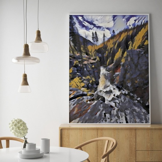
"Box Canyon V" is available as prints, canvas and more. See LINK IN BIO (linktr.ee/tonyadoughty) or tonyadoughty.net > purchasing. #art #landscape #mountains (at Entiat, Washington) https://www.instagram.com/p/CBS0krcjQST/?igshid=hhojh1b3wgld
0 notes
Photo

buy Polygon Entiat TR8 - 27.5+ Trail Mountain Bike ® https://ebay.to/36IimwZ
0 notes
Photo

I got it again today... "Do you ever stop smiling?" ° In short, no, I do not. 😁 Tangentially... I frequently pass others in the wild and I almost always say "hello" or some other cordial greeting because I'm happy; to be out in the wild means much to me. Yet others seldom seem as ecstatic. More often than not, they're exasperated...nearly to the point of despair. Even when I've been going up for hours, I smile or at the least enjoy what I'm doing (unless it's unkempt, loose sidehilling, eff that). ° These images are two different views of the same range (the Entiat Range). The first is from the south (South Spectacle Butte summit, August '19) and the second is from Greenwood Mountain, June' 19). Mt. Maude is seen in the first but not the second image. The remainder are Copper, Fernow, and Seven Fingered Jack. ° 📸 August/June 2019 📍 Glacier Peak Wilderness ° ° ° #northCascades #FindYourPark #PublicLands #PNW #PNWonderland #PacificNorthwest #NPS #NFS #samsung #phonephotography #optputside #rei1440project #WildernessCulture #HikingCulture #igPacificNorthwest #IGnorthwest #BulgerList #WashingtonTop100 #WashingtonState #CascadiaExplored #GetHigh #GlacierPeakWilderness #ChooseMountains #AdventureAwaits #PNWPeakbaggers @pnwpeakbaggers (at Glacier Peak Wilderness) https://www.instagram.com/p/B2UZziyjdcW/?igshid=k0odmm1cv76h
#northcascades#findyourpark#publiclands#pnw#pnwonderland#pacificnorthwest#nps#nfs#samsung#phonephotography#optputside#rei1440project#wildernessculture#hikingculture#igpacificnorthwest#ignorthwest#bulgerlist#washingtontop100#washingtonstate#cascadiaexplored#gethigh#glacierpeakwilderness#choosemountains#adventureawaits#pnwpeakbaggers
0 notes
Photo


SELEUSS - On top of Seven Fingered Jack
SELEUSS, SEATTLE, JULY 23, 2019: Much appreciation and gratitude to Scot, Christiane and Hadley for taking our chocolates to a higher plane! ;) on top of SevenFingeredJack at the north end of Entiat.
https://en.wikipedia.org/wiki/Seven_Fingered_Jack
https://www.wta.org/go-hiking/hikes/seven-fingered-jack
Seven Fingered Jack is a mountain in the North Cascades in the U.S. state of Washington. It is located at the north end of the Entiat Mountains, a sub-range of the Cascade Range. It is part of a three-peak group called the Entiat Cirque which includes Mount Maude and Mount Fernow. Seven Fingered Jack is about 4 miles (6.4 km) south of Holden.[2] The peak is in the Glacier Peak Wilderness of Wenatchee National Forest.
Sources differ over the height of Seven Fingered Jack. Peakbagger.com says it is 9,100 feet (2,800 m),[1] peakware.com says 9,077 feet (2,767 m),[3] and the United States Geological Survey cites 9,022 feet (2,750 m) in its Geographic Names Information System database.[2] Its rank also differs by source. Seven Fingered Jack is the twelfth-highest peak in Washington, according to peakbagger.com[4] and fourteenth-highest, according to peakware.com.[3]
Seven Fingered Jack is the second-highest and middle of the three peaks of the Entiat Cirque, the other two being Mount Maude and Mount Fernow. All three are over 9,000 feet (2,700 m).[5] Together they form a high, curved ridge from which the headwaters of the Entiat River flow eastward. There are a number of glaciers on Seven Fingered Jack and its neighbors, including Entiat Glacier. Streams flowing down the east and south sides of the mountain enter Spider Meadows, through which flows Phelps Creek, a tributary of the Chiwawa River, which flows south to the Wenatchee River. Thus Seven Fingered Jack sits on the boundary between the drainage basins of the Entiat and Wenatchee rivers. Both rivers are tributaries of the Columbia River.[6]
SELEUSS Chocolates is located at the Thompson Hotel Seattle complex in downtown Seattle right above the Pike Place Market on the corner of 1st Ave and Stewart street.
1910 1st Ave, Seattle, WA 98101 www.SELEUSS.com www.SELEUSSChocolates.com
https://www.facebook.com/seleuss
https://www.instagram.com/seleuss
https://twitter.com/SELEUSS
{Purveyors of Haute Chocolate}™
https://www.yelp.com/biz/seleuss-chocolates-seattle
https://eatseattletours.com/chocolate-coffee-tours/
0 notes