#bdtravelbug
Explore tagged Tumblr posts
Video
. #stmartin #saintmartin . . . . . . . . . ... .. .. . . . #travelianz #travelbangla #travelbagladesh #bangladesh #bangladeshtravel #bangladeshi #igtravel #travelbd #bdtravelbug #travelblogger #photography #travelstories #traveltheworld #bangladeshtravels #bdtour #tourbd #tour #journey #world_travel #travellers #travelgram #travelguide #traveller #traveling #tourist #travelawesome #travelling (at St. Martin's Island । সেন্ট মার্টিন্স দ্বীপ) https://www.instagram.com/p/Bsx-UoZDtym/?utm_source=ig_tumblr_share&igshid=t1160ba032q4
#stmartin#saintmartin#travelianz#travelbangla#travelbagladesh#bangladesh#bangladeshtravel#bangladeshi#igtravel#travelbd#bdtravelbug#travelblogger#photography#travelstories#traveltheworld#bangladeshtravels#bdtour#tourbd#tour#journey#world_travel#travellers#travelgram#travelguide#traveller#traveling#tourist#travelawesome#travelling
1 note
·
View note
Photo

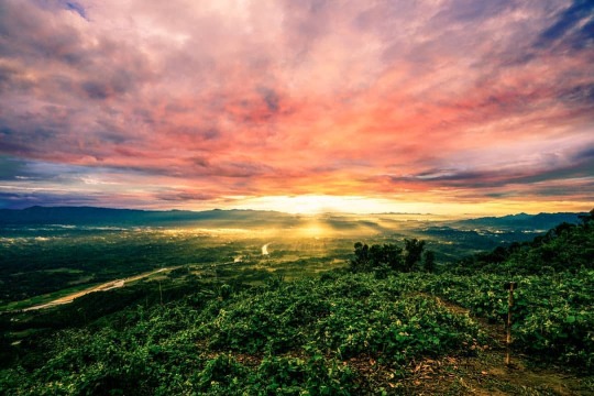
Top of the MARAYAN THONG. Marayan Thong /Jadi — The desire to experience standing on this mountain is not only thrilling; Rather, the challenge is the main one there. The height of this hill is 1660 feet from the sea level. The upper part of the hill is flat. As far as the view from here is just mountains and hills. The settlements are peeking through the gaps. The river Matamuhuri is flowing like a snake below. Crop fields can be seen on its two shores. This hill is inhabited by various small ethnic groups. Tripura, Marma and Murang are among them. #travelbug #bdtravelbug #bdwalkman #Bandarban #alikadam #natgeo #nationalgeographic #YourShotPhotographer #natgeotravel #natgeoyourshot #Sonyalphabd #Sonyalpha #bealpha (at Marayan Thong Hill, Bandarban) https://www.instagram.com/p/CIvgA-oh0uW/?igshid=zjgh14f42h9s
#travelbug#bdtravelbug#bdwalkman#bandarban#alikadam#natgeo#nationalgeographic#yourshotphotographer#natgeotravel#natgeoyourshot#sonyalphabd#sonyalpha#bealpha
0 notes
Photo

This is where architecture is known as the frozen music ����🎵. Man made bridge, surrounding with nature and tea plantation and the occasional symphony of the train passing through them. Roaring and making it’s own place. . . . . . . . . . . . . . . . . . . . . . . #srilanka🇱🇰 #ella #ninearchbridge #srilankatrip #srilankatourism #srilankatours #srilankadaily #travelsrilanka #naturephotography #instatravel #exploremore #travel #shotz_delight #travelblogger #travelgram #travelphotography #bdtravelbug #welivetoexplore #shewhowanders #theimaged #travelholic #aroundtheworld #moodygrams #srilankatravel #girlslovetravel #agameoftones #eclectic_shotz #nakedplanet #wanderfolk #neverstopexploring (at Nine Arch Bridge, Sri Lanka) https://www.instagram.com/p/BtL5XnIBZlY/?utm_source=ig_tumblr_share&igshid=11j1nnksa3obp
#srilanka🇱🇰#ella#ninearchbridge#srilankatrip#srilankatourism#srilankatours#srilankadaily#travelsrilanka#naturephotography#instatravel#exploremore#travel#shotz_delight#travelblogger#travelgram#travelphotography#bdtravelbug#welivetoexplore#shewhowanders#theimaged#travelholic#aroundtheworld#moodygrams#srilankatravel#girlslovetravel#agameoftones#eclectic_shotz#nakedplanet#wanderfolk#neverstopexploring
0 notes
Video
#france #lafrance #france🇫🇷 #europe #unitedkingdom #england #london #alps #paris #niceville #mountain #londonbridge #bashundhara #bangladesh🇧🇩 #banani #chittagong #coxsbazar #mirpur #dhanmondi #dhakagram #sylhet #sylheti #moulvibazar #dhakauniversity #dhaka #mymensingh #bdtravelbug #sylhety #rajshahi (at France) https://www.instagram.com/p/Bogd0Tan-TN/?utm_source=ig_tumblr_share&igshid=aq11scvfefnn
#france#lafrance#france🇫🇷#europe#unitedkingdom#england#london#alps#paris#niceville#mountain#londonbridge#bashundhara#bangladesh🇧🇩#banani#chittagong#coxsbazar#mirpur#dhanmondi#dhakagram#sylhet#sylheti#moulvibazar#dhakauniversity#dhaka#mymensingh#bdtravelbug#sylhety#rajshahi
0 notes
Video
মেঘের রাজ্য সাজেকে মেঘের খেলা। . #sajek #sajekvalley #sajektour . . . . . . . . . ... .. .. . . . #travelianz #travelbangla #travelbagladesh #bangladesh #bangladeshtravel #bangladeshi #igtravel #travelbd #bdtravelbug #travelblogger #photography #travelstories #traveltheworld #bangladeshtravels #bdtour #tourbd #tour #journey #world_travel #travellers #travelgram #travelguide #traveller #traveling #tourist #travelawesome #travelling (at Sajek Valley - সাজেক ভ্যালি) https://www.instagram.com/p/BsxW3LtDsgG/?utm_source=ig_tumblr_share&igshid=x8codothyauf
#sajek#sajekvalley#sajektour#travelianz#travelbangla#travelbagladesh#bangladesh#bangladeshtravel#bangladeshi#igtravel#travelbd#bdtravelbug#travelblogger#photography#travelstories#traveltheworld#bangladeshtravels#bdtour#tourbd#tour#journey#world_travel#travellers#travelgram#travelguide#traveller#traveling#tourist#travelawesome#travelling
1 note
·
View note
Photo

Top of the MARAYAN THONG. Marayan Thong /Jadi — The desire to experience standing on this mountain is not only thrilling; Rather, the challenge is the main one there. The height of this hill is 1660 feet from the sea level. The upper part of the hill is flat. As far as the view from here is just mountains and hills. The settlements are peeking through the gaps. The river Matamuhuri is flowing like a snake below. Crop fields can be seen on its two shores. This hill is inhabited by various small ethnic groups. Tripura, Marma and Murang are among them. #travelbug #bdtravelbug #bdwalkman #Bandarban #alikadam #natgeo #nationalgeographic #YourShotPhotographer #natgeotravel #natgeoyourshot #Sonyalphabd #Sonyalpha #bealpha (at Marayan Thong Hill, Bandarban) https://www.instagram.com/p/CIvgA-oh0uW/?igshid=zjgh14f42h9s
#travelbug#bdtravelbug#bdwalkman#bandarban#alikadam#natgeo#nationalgeographic#yourshotphotographer#natgeotravel#natgeoyourshot#sonyalphabd#sonyalpha#bealpha
0 notes
Photo

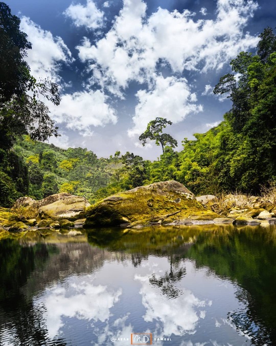
Beauty of Lakeview 🌳 It is the most mysterious beauty of Hill Tracts areas in Bangladesh. somewhere it is fallow to fall of water somewhere it is like to magical lake view. Sangu River is a river in Myanmar and Bangladesh. Its source is in the North Arakan Hills of Myanmar. Many of the waterfalls of bandarban directly fall into sangu . over the seasons, sangu changes its nature and climate. whole bandarban make a natural paradise in the Bangladesh. If you like adventure in the deep of natural trails then you go the Bandarbans trek. Over the pain & gain finally you have to feel & find of pure natural life. @natgeo @bbcearth @bbc_travel #bandarban #sanguriver #lakeview #wonderland #bdtravelbug #trekroute #paradiseview #insanebandarban #Bangladesh #bdwalkman #awesomedreamplaces #ourplanetdaily #Sonyimages (at Bandarban) https://www.instagram.com/p/CAdLS3ShYLv/?igshid=1uc26mulaa8u5
#bandarban#sanguriver#lakeview#wonderland#bdtravelbug#trekroute#paradiseview#insanebandarban#bangladesh#bdwalkman#awesomedreamplaces#ourplanetdaily#sonyimages
0 notes
Photo

Bangladesh | 🇧🇩 The flag house of Bangladesh, which may see the keokradong trails.Keokradong is a peak located in Bandarban, Bangladesh, with an elevation of 986 metres. it was once considered the highest mountain in the country, but according to the modern method, it is currently the fifth largest mountain. #bdwonderland #bdtravelbug #keokradong #bandarban #bbcearth @natgeo @thisbangladesh @ourplanetdaily @sonyalpha (at Bangladesh) https://www.instagram.com/p/CAVc_wwB3f7/?igshid=q7d4cf5l0hj2
0 notes
Photo

Back to work everyday🚶 Every day at sunrise, many people run away in search of work, many people run back to a specific workplace. There are many stories of non-cooperation in the midst of their daily running which may be unknown to many. Many may run aimlessly in search of work. Many such stories are unknown and unexplained. (Picture taken on the west embankment of Kuakata beach.) #incrediblebangladesh #bdwonderland #bdtravelbug #kuakata #patuakhali #embankment #evergreen #gotoworkplace #daylife #risewithfindworkplace @bbcearth @bbc_travel @natgeotravel (at Patuakhali- পটুয়াখালী) https://www.instagram.com/p/CALIhr2Bv39/?igshid=u3dv161m5qsl
#incrediblebangladesh#bdwonderland#bdtravelbug#kuakata#patuakhali#embankment#evergreen#gotoworkplace#daylife#risewithfindworkplace
0 notes
Photo

Patuakhali is a district in South-central Bangladesh in the Barisal Division. This district is the main entrance for the beach of Kuakata. It is adjacent to the Bay of Bengal. The area of the district is 3220.15 km2 Patuakhali city is surrounded on three sides by rivers. The two major rivers are Laukathi and Lohalia, which are directly connected with the Bay of Bengal. The city has an inland airport used for transport and private travel across the country. Source : Wikipedia. Patuakhali is mainly looking for Kuakata sea beach, locally it's called "The Daughter of Sea." #incrediblebangladesh #bdtravelbug #bdwonderland #kuakata #patuakhali #daughterofocean #daughterofsea #embankment #seaembankment #joyoflife #earthpic #earth_pix #awesomeplace #Sonyimages #Sonyalpha (at Patuakhali- পটুয়াখালী) https://www.instagram.com/p/CAA1HTehFE0/?igshid=1xbriqhjj82jb
#incrediblebangladesh#bdtravelbug#bdwonderland#kuakata#patuakhali#daughterofocean#daughterofsea#embankment#seaembankment#joyoflife#earthpic#earth_pix#awesomeplace#sonyimages#sonyalpha
0 notes
Photo

Tanguar haor, located in the Dharmapasha and Tahirpur upazilas of Sunamganj District in Bangladesh. Tanguar haor is the second largest freshwater wetland in Bangladesh. The haor covers an area of about 100 sq km. Tanguar haor plays an important role in fish production as it functions as a 'mother fishery' for the country. Every winter the haor is home to about 200 types of migratory birds. The haor is an important source of fish. Tanguar haor One of the largest waterlands in the country and one of the most spectacular places to visit... #incrediblebangladesh #incrediblesylhet #bdwonderland #bdtravelbug #wetlake #sunamganj #tanguarhaor #insanesylhet #insanebangladesh #insaneworld #forestland #lakeview #bluewetland #Landscapephotos #travelphotos #natgeoyourshot #natgeo #natgeofineart #ourplanetdaily #nationaldestination #awesome_earthpix #Sonyimages #Sonyalpha (at Tanguar Haor - টাঙ্গুয়ার হাওড়, সুনামগঞ্জ) https://www.instagram.com/p/B_xWa7khgQY/?igshid=1ftek7liutuku
#incrediblebangladesh#incrediblesylhet#bdwonderland#bdtravelbug#wetlake#sunamganj#tanguarhaor#insanesylhet#insanebangladesh#insaneworld#forestland#lakeview#bluewetland#landscapephotos#travelphotos#natgeoyourshot#natgeo#natgeofineart#ourplanetdaily#nationaldestination#awesome_earthpix#sonyimages#sonyalpha
0 notes
Photo

The mysterious beauty of Sangu river. Sangu river. Sangu river is the main river of Bandarban district. Locally it is called conch river or hill river. The Sangu River is one of the rivers flowing to enhance the beauty of Bandarban. This river flowing in the lap of the mountains is the reason for the beauty and mystery of Bandarban. The Sangu River source is in the North Arakan Hills of Myanmar, located at 21°13´N 92°37´E. The Arakan Hills form the boundary between Arakan and the Chittagong Hill Tracts. The river originated in the hills of Madak area of Thanchi upazila of Bangladesh bordering Myanmar. The length of this river from its source to the Bay of Bengal is 170 km. #incrediblebangladesh #walkinbangladesh #bdwonderland #bdtravelbug #bdtrekkingtour #sanguriver #bandarban #rawbeauty #mysterybeautyBangladesh #riverlane #bayofbengal #journeybyboat #natgeoyourshot #natgeotraveler #natgeofineart #ourplanetdaily #awesomeearth #Sonyimages #sonyalpha #BeAlpha (at Bank of Sangu River) https://www.instagram.com/p/B_porvmhX_6/?igshid=1almdemspdtdy
#incrediblebangladesh#walkinbangladesh#bdwonderland#bdtravelbug#bdtrekkingtour#sanguriver#bandarban#rawbeauty#mysterybeautybangladesh#riverlane#bayofbengal#journeybyboat#natgeoyourshot#natgeotraveler#natgeofineart#ourplanetdaily#awesomeearth#sonyimages#sonyalpha#bealpha
0 notes
Photo

Thanchi-Alikadam road is known as the highest road in Bangladesh. These roads and Dim hills have gained a lot of popularity among adventure-loving travelers. The boundaries of Alikadam and Thanchi police stations have been demarcated with Dim Pahar, which is full of natural beauty and diverse tribal lifestyle. The construction of 33 km long Alikadam-Thanchi road under the supervision of Bangladesh Army has made it easier to reach Dim Pahar. It is difficult to describe in words the form of nature that can be seen walking along this hilly path, which stretches from Alikadam to a height of about 2500 feet. To get the full satisfaction of Thanchi - Alikadam Road, you need to travel by bike. And then you can see all the views around. #incrediblebangladesh #bdtravelbug #bdwonderland #Bandarban #thanchitoalikadam #highestroadinbangladeah #hillwalking #longestroad #bikeride #Rideroad #scenery #natgeotraveler #natgeofineart #ourplanetdaily #natural #sonyalpha #Sonyimages #bealpha (at Alikadam Bandarban) https://www.instagram.com/p/B_cyIvGh8iq/?igshid=1dtunkv74og8z
#incrediblebangladesh#bdtravelbug#bdwonderland#bandarban#thanchitoalikadam#highestroadinbangladeah#hillwalking#longestroad#bikeride#rideroad#scenery#natgeotraveler#natgeofineart#ourplanetdaily#natural#sonyalpha#sonyimages#bealpha
0 notes
Photo

campsite⛺ One of the best ways to stay in Keokradong is through camping. Those who come here single or double can camp here if they wish. The feeling of coming to the mountains and staying in a tent is different, especially at night. If you want to go camping, you must inform your guide in advance. Because available camping is not allowed in Keokradong. So if you are private or professional travel or adventure you can conditionally set up a tent with the help of a guide. One of the reasons for not camping at Keokradong is that it is still privately owned. Lala manages all the activities of Keokadong Peak with his intervention.. So whatever you do there, you can talk to the guide and Lala😊 #incrediblebangladesh #traveltreeking #bdwonderland #bdtravelbug #keokradong #campsite #bdtrekkingsite #bandarban #bdwalkman #mountainscape #mountainofbangladesh #natgeoyourshot #natgeo #ourplanetdaily #sonyalpha #sonyalphaclub (at Keokradong peak) https://www.instagram.com/p/B_XX293BlIa/?igshid=zf7c91wgro5z
#incrediblebangladesh#traveltreeking#bdwonderland#bdtravelbug#keokradong#campsite#bdtrekkingsite#bandarban#bdwalkman#mountainscape#mountainofbangladesh#natgeoyourshot#natgeo#ourplanetdaily#sonyalpha#sonyalphaclub
0 notes
Photo

Nafakhum Waterfall Nafakhum is a waterfall whose beauty amazes any traveler. Nafakhum Falls is a natural waterfall located in Bandarban district. It is the largest waterfall in Bangladesh. The road to reach here is inaccessible but the beautiful Nafakhum falls. The path is as beautiful as it is difficult. The beauty of this unprecedented waterfall and mountain path will fascinate anyone. Must be remembered throughout life. It is difficult to believe that such a beautiful country can exist. Mountains, rivers and rocky canals will look as if I am walking on the page in one of the pictures. Extraordinarily beautiful, The sound of the storm bursting with water. During the monsoon, the size of the fountain increases. And in winter it becomes weak. However, the true beauty of Nafakhum is seen in September-October. #incrediblebangladesh #bdwonderland #bdtravelbug #bdwaterfall #waterfall #nafakhumfalls #nafakhum #bandarban #thanchi #naturalfalls #bluefalls #trekpath #bdnatural #bdphotos #ourplanetdaily #travelphotos #nationaldestination #earthawesome #natgeoyourshot #natgeo #natgeofineart #earthdaynetwork #Sonyalpha #Bealpha (at Nafakhum - নাফাখুম জলপ্রপাত) https://www.instagram.com/p/B_ScDnThop0/?igshid=kq4jnzgw9wru
#incrediblebangladesh#bdwonderland#bdtravelbug#bdwaterfall#waterfall#nafakhumfalls#nafakhum#bandarban#thanchi#naturalfalls#bluefalls#trekpath#bdnatural#bdphotos#ourplanetdaily#travelphotos#nationaldestination#earthawesome#natgeoyourshot#natgeo#natgeofineart#earthdaynetwork#sonyalpha#bealpha
0 notes
Photo

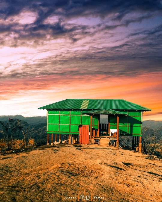
Mountain dwelling 🏠 Keokradong is the third highest mountain in Bangladesh. This peak located in Bandarban, Bangladesh, with an elevation of 986 metres. Some sources claim it as the highest point of Bangladesh. There are several small tinset houses for staying in Keokradong, with wonderful places to stay for the night. Recently, a local owner, Lala, has been building a house at the last corner of Keokradong, this house name was greenhouse 😊 From where you can enjoy the haven view of Keokradong.. #incrediblebangladesh #bdwonderland #bdtravelbug #keokradong #highattitude #highestpeak #greenhouse #bandarban #mountainofbangladesh #highelevation #trekking #trekroute #expeditionbandarban #bbcearth #ourplanetdaily #natgeotraveler #Sonyalpha (at Keokradong peak) https://www.instagram.com/p/B_C-SnPh6Df/?igshid=jhjmkewlpmqc
#incrediblebangladesh#bdwonderland#bdtravelbug#keokradong#highattitude#highestpeak#greenhouse#bandarban#mountainofbangladesh#highelevation#trekking#trekroute#expeditionbandarban#bbcearth#ourplanetdaily#natgeotraveler#sonyalpha
0 notes