#alaska highway
Explore tagged Tumblr posts
Visit Tumblr Blog
Explore Tumblr blogs with no restrictions, modern design and the best experience.
Last Seen Tumblr Blogs


Fun Fact
Tumblr.com is the 103rd most visited website in the world.
Video
youtube
Alaskan Highways: A Tourist's Experience. Discover What It's Like to Drive on Alaskan Highways
In this video, I will go over the major Alaskan highways and describe the tourist experience. We will cover:
Seward Highway, which runs between Anchorage and Seward.
Glenn Highway, which runs between Anchorage and Glennallen, where it connects with the Richardson Highway, allowing drivers to head toward either Fairbanks or Valdez.
Richardson Highway, which runs between Fairbanks and Valdez.
George Parks Highway, which runs between Anchorage and Fairbanks.
The Denali National Park Drive, which allows travelers to drive 15 miles within Denali National Park.
Denali Highway, which connects the Richardson Highway and George Parks Highway.
This video reflects my experience driving these highways during the summer. While the roads are generally well-maintained, I strongly recommend checking and following current road advisories, rules, and restrictions before planning your drive.
135 notes
·
View notes
Text

Alaska Highway in Yukon. Camera: Canon EOS 5D Mark IV.
#iso 100#adventure#adventure life#explore the world#pick of the day#mountains#in the mountains#outdoors#summer#beautiful world#photography#go out and explore#nature#yukon#road trip#canon#canada#landscape photography#nature photography#travel#landscape#higway#alaska highway#canon 5d mark iv#digital#color#canon eos 5d mark iv
27 notes
·
View notes
Text


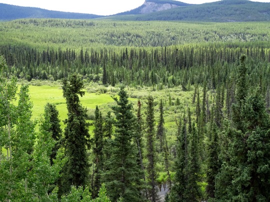


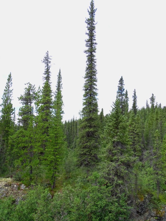
Forest (No. 17)
Alaska Highway, YT
#Alaska Highway#mountains#tourist attraction#travel#original photography#vacation#landmark#landscape#Canada#summer 2023#forest#woods#flora#nature#countryside#clouds#the North#street scene#pine#fir#sub-alpine fir#fireweed#wildflower#Yukon
26 notes
·
View notes
Text

The Northern Lights hover eerily over the Alaska Highway in B.C.
#aurora borealis#northern lights#Fort St John#Alaska Highway#boreal forest#Canadian North#northern sky#British Columbia
208 notes
·
View notes
Text
Last night I stayed in Pemberton, driving from camping spot to public library and back in order to get wifi access. It took several hours for the van to cool down and for me to fall asleep, sprawled on the back bed listening to the wind snap at the cover of the exhaust fan. Images of the cover breaking off kept me up for a while -- when I drove the food truck that happened -- and eventually I got up and closed the cover, sacrificing air flow for peace of mind.
Right choice, as it turned out. I woke up a few hours later to pitch darkness -- the gravel lot next to the soccer fields where I and half a dozen other cars were boondocking had no lights -- and the sound of hard rain clattering on the van. The rain and the dark and the sips of cool air finally coming in through the open windows sent me back to a contented sleep, finally comfortable enough to pull the duvet over me.
In the morning I failed to figure out how to work the microwave and reheated the remains of yesterday's coffee with hot water from the kettle instead, eventually making a fresh thermos with the Aeropress. After loitering outside the library again to let my family know how I was, and stopping by the supermarket for Febreze and Aleve, I got on the road.
The junction to 99 North iin Pemberton looks more like a back road than a highway, so I almost missed the turn. I made it, though, and spent the next several hours climbing in my first real mountain driving of the trip. I stopped several times to get pictures, even though they'll never do it justice. My favorite views are always from spots where there aren't any pull-outs, spots where you come around a curve and are presented with crags and canyons and water.
I've stopped for lunch in Lillooet, using the wifi from a Tim Hortons to write this. Tonight should see me in Williams Lake, making today about 127 miles covered. See you there!
8 notes
·
View notes
Text

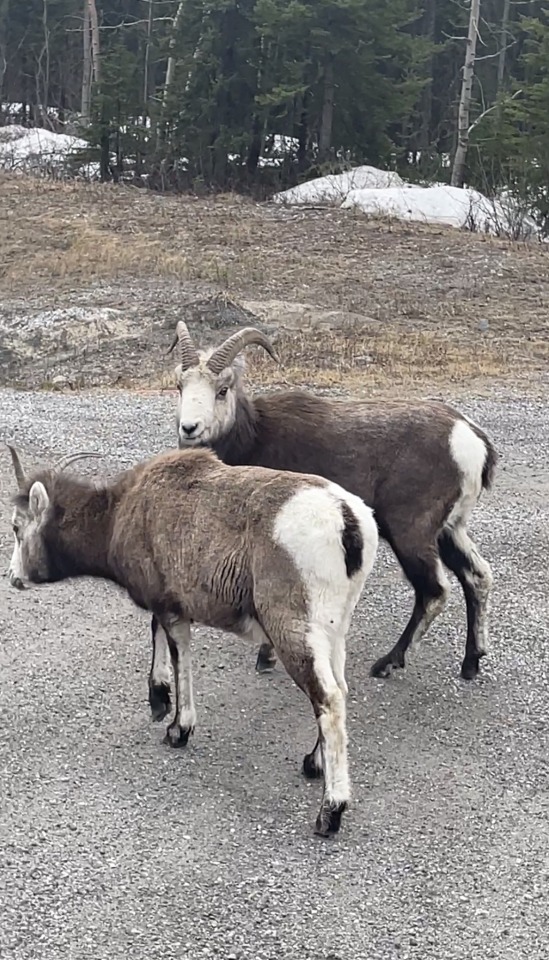
stone sheep hanging out along the alaska highway. stone mountain provincial park, british columbia, july 2018.
#the lil baby :')#photography#my photography#british columbia#wildlife#animals#stone sheep#alaska highway#naturecore
3 notes
·
View notes
Text
Meanwhile, with the ursine mating season antics of the Hair Bear Bunch ...
imagine their annual mating season road trip in this respect taking them along the Alaska Highway into the Yukon and Alaska proper, replete with a number of fascinating off-the-road escapades to certain wilderness-type lakes to satisfy their ursine desires ... and under the storied midnight sun of Alaska as well, what with near-daylight conditions existing at such high latitudes through the ursine mating season!
#hanna barbera#headcannons#fanfic ideas#hair bear bunch#bear mating season#ursine love#ursine romance#ursine sexuality#up north#off the beaten track#alaska highway#midnight sun#twilight all night#hannabarberaforever
0 notes
Text
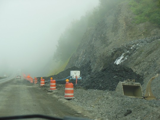
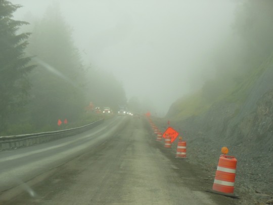
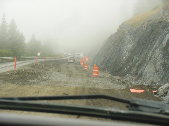
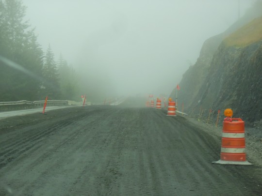
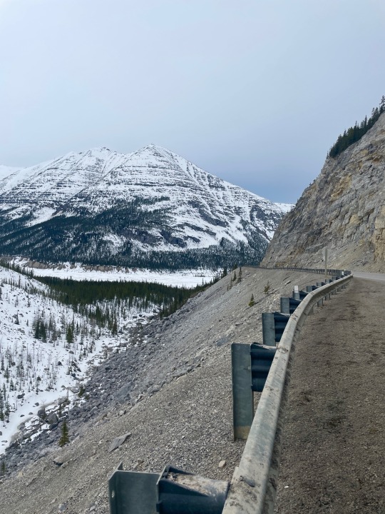
Detour in Place - August 2023 There is a problem with construction on the Alaska Highway. There is nowhere to go but where the highway was dug through the hills and mountains. That means that occasionally, you end up driving through the construction area. This three mile long nightmare was between Seward and Anchorage. They close the road for two hours to blast at night and then spend the rest of the time picking up the rock and gravel they have dislodged. Needless to say, you drive very slowly through these construction zones. MWM
1 note
·
View note
Text

"Roadbuilders Forge On to Alaska," Ottawa Citizen. October 8, 1942. Page 3. --- Workers on the new "Alcan" military road across Canada to connect the U.S. with Alaska are making rapid progress as they equalize topography by cutting through hilltops such as that shown above.
#alaska highway#highway construction#road construction#alcan highway#pacific war#world war ii#canada during world war 2#military road
0 notes

Text
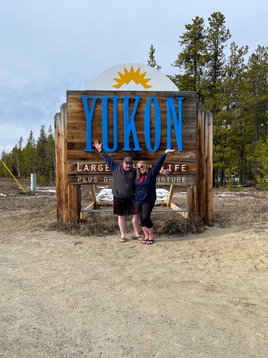


Trip to Yukon
1 note
·
View note
Text

Matanuska Glacier, Alaska
#alaskatrip#matanuskaglacier#matanuska#travelblogger#travel destinations#alaska highway#original photography
0 notes
Text
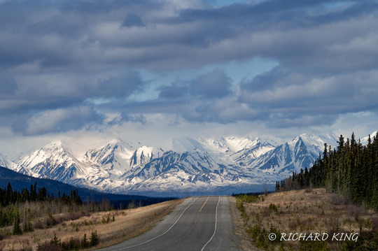
Arriving in Alaska, 2023
View On WordPress
#Alaska#Alaska Highway#Kluane Mountain Range#Nik 6 Silver Efex#Nikkor Z 100-400mm f/4.5-5.6 VR S#Nikon Mirrorless Camera#Nikon Z 6 II#Nikon Z6 ii#Photoshop 2023#Richard King Photography#Snow capped mountains#Sony Digital Film#www.richardkingphoto.com#YT#Yukon Territory
0 notes
Text


Forest (No. 18)
Rancheria Falls Recreation Site, YT
#Rancheria Falls#Alaska Highway#mountains#tourist attraction#travel#original photography#vacation#landmark#landscape#Canada#summer 2023#forest#woods#flora#nature#countryside#clouds#the North#street scene#pine#fir#sub-alpine fir#fireweed#wildflower#Yukon#Rancheria Falls Recreation Site#boardwalk#waterfall
25 notes
·
View notes
Photo
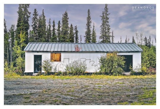
Above: Alaska Highway Roadhouse 3, Yukon Territory, Canada.
A THIRD RARE GLIMPSE OF A BYGONE ERA.
Welcome back. IN AN EARLIER POST, I presented the first photograph of a bygone era: the ALASKA HIGHWAY ROADHOUSE.
These roadhouse photographs are from a series showcasing the remote northern beauty of YUKON TERRITORY along the ALASKA HIGHWAY.
HISTORY: THE ALASKA HIGHWAY ROADHOUSE.
Many Alaska Highway roadhouses evolved from American military camps built during the construction of the 2,700 kilometre highway completed in 1942.
It may not look like much, however a roadhouse offered respite from harsh weather conditions with a place to sleep, meals and gasoline, and were spaced no more than a day's drive apart.
THE YUKON TERRITORY SERIES.
Originally photographed in 2015, it’s incredibly interesting to revisit these photographs almost 8 years later, and have the opportunity to perform more work on them. One of the details I’m taken with are the snow-capped mountain peaks. Though it was summer, snow is visible year-round.
ALASKA ROADHOUSE 3: SHOP FINE ART PRINTS.
One version of ALASKA HIGHWAY ROADHOUSE 3 is available.
ALASKA HIGHWAY ROADHOUSE 3 FULL FRAME
Choose traditional silver-halide, archival giclée or gallery-wrapped canvas prints. Order via my online gallery or CONTACT ME. I’ll ensure you’re ordering exactly what you want.
Thank you for visiting. See you next time.
SEE MORE DEAN OROS FINE ART PHOTOGRAPHY.
Curated collections of my photographs are available to enjoy in your home, office or retail space.
Virtual Gallery: DEANOROSPHOTO.COM
Social: INSTAGRAM | FACEBOOK | TWITTER
artistry + documentary
#Alaska Highway#roadhouse#haines junction#dawson city#yukon territory#landscape photography#whitehorse#photoart
0 notes
Text
Today felt like a hugely long day, even though it ended up only being about five hours of driving. I started out from Teslin, where I overnighted at a pullout by Teslin Lake. In the morning I took my coffee down to the lakeside, walking past piles of driftwood. Even just a few yards from the highway, with a screen of trees between it and me, it was suddenly so quiet I didn't want to talk. How did the driftwood get there, up on the shore behind me? Imagining waves on this lake was incomprehensible.


Towns with services are fewer and farther between, in this part of the Yukon. Though I've still never been more than a couple hours' drive from gas, communities where I can hop onto an open wifi network or fill up on potable water get farther apart. I drove from Teslin to Whitehorse in no small part so I could go into a Tim Hortons and get wifi fast enough to update my offline maps.


I then proceeded to spend a long time at the Integra station trying to deal with a plumbing problem. Let us be discreet about this. If that hadn't taken so long, I might have made it to Beaver Creek tonight, which would have put me back on schedule after taking an extra day in Watson Lake -- or maybe not. With the border crossing looming tomorrow, and Anchorage the day after that, and the drive taking me further and further into territory where there's nothing but spruce forest for hundreds of miles, I find myself clinging to the wilderness.


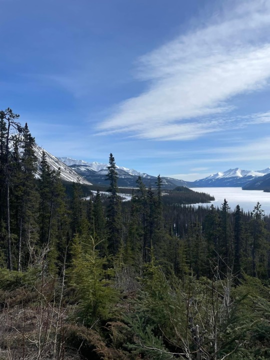
The amount of nothing out here is breathtaking. Leaving Haines Junction, the highway winds along lakes and rivers, but the topography is fairly flat, especially compared to the switchbacks along the mountains of British Columbia, or the Kenai Peninsula. Mountains jut up in the near distance, but they're aloof, untouched.
Breathtaking, and in some ways boring, I won't lie. It's not entirely unlike driving through parts of the American midwest, except instead of corn and soy and canola making the rolling hills look same-y, it's evergreens. I've barely seen any non-bird animals since a couple days ago when I crossed into the Yukon Territory (I spotted some kind of furry scampering thing today that I only managed to identify as "not a squirrel or a rabbit"). Plenty of ravens, their mouths open in unheard yelling, and one falcon of some sort.


Interestingly, though, this part of the trip has made up for the lack of animal wildlife with another kind: other tourists. I chatted with a guy from Florida in a huge rig while I was filling up water jugs in Whitehorse. I stopped off at a small hike called Soldier Summit outside Burwash Landing, and took the pictures of a German couple who'd taken the ferry from Bellingham to Haines and were now driving around the Yukon. And tonight I'm boondocking beside a couple from South Carolina, Bill and Joyce. (Joyce is the more voluble, showing me pictures of a black bear she saw while fishing near Valdez, pictures of fireweed, a weather map of Anchorage; Bill smoked a couple of cigarettes over by their trailer, occasionally throwing in commentary to her stories, before finally announcing "I'm gonna go hide." I liked them both.) The farther from civilization I am, the more people I meet.
I would like to say, though, that if I had one note for this whole trip, it would be: I have not met hardly ANY traveling dogs. I see them around! I just haven't met them! This is a real disappointment and I'll be complaining to the Milepost editors about it.
7 notes
·
View notes