#Xingu National Park
Explore tagged Tumblr posts
Visit Tumblr Blog
Explore Tumblr blogs with no restrictions, modern design and the best experience.
Last Seen Tumblr Blogs


Fun Fact
Tumblr was attacked by a cross-site scripting worm deployed by the Internet troll group GNAA on Dec 3, 2012.
Note
(sorry this is from a week ago but) Wait, what's going on right now that's complicated with Amazonian farmers' land rights?
Not farmers, indigenous people
See, recently they put a new law through congress that severely reduces indigenous land to the borders established during the late dictatorship, or immediately post-dictatorship, in 1988. An absolute joke of a border that was dreamed up by some military assholes. People in america may recognize this type of society from the times of westward expansion and think this is a thing of the past because for you guys it is. But here it is a reality. Murder is rampant. The reach of the law is incredibly limited. Government is just too weak and landowners basically run things. THAT'S WHY it's so important to donate directly to the native peoples instead of random NGOs because native people are fucking there and the more power they hold in the land the safer the land will be from agroindustrial expansion.
Well the law was vetoed by the the president and the Supremo Tribunal Federal, aka supreme federal court, labeled it as unconstitutional. Which it is, because our 1988 constitution describes native american land rights in some of its first articles. We thought this would be it for the law
But then the senate (that already overrepresents landowners in rural states) just went along and approved it anyway. I had no idea they could approve something unconstitutional. The progressives and particularly the socialists are fighting this in court. But it happens that for now the legal border is the severely reduced version.
Doesn't mean they'll just give up, because as it happens we don't have any stand your ground laws so even if you own a piece of land, you cannot legally speaking just shoot everyone there. Or attack or threaten them in any way. They'll just have long legal battles individually for the rights to occupy land based on use. Also the Xingu national park, the largest preserved land of the Amazon described as 'larger than Belgium', is being encroached by huge farms that are poisoning their water supply. The border is Visible. I'll try to find video of it but essentially you have a forest and a desert separated by a strict line.
Just last week in the south of Bahia (not the Amazon, let me explain more about the Amazon situation in a bit) Hãhãhãe leadership Nega Muniz Pataxó was shot and killed by an armed militia group that invaded and occupied the Caramuru territory.
instagram
The situation in the Amazon, specifically the yanomami territory in Roraima our northernmost state, aka deep forest, is more dire than average given difficulty of access, sheer size, and government abandonment. It's a place that depends on government aid for medicine. It's land that is being systematically invaded by gold miners, pandemic, toxins from nearby farmlands, wood extraction etc. (wood extration is rampant everywhere tho). Early 2023 saw a massive federal government operation by now president Lula to empty the mines and try to look for where funding comes from. Yanomami land is still being invaded to this day, the struggle is ongoing.
The yanomamis need support right now more than any other. Last year saw a massive heat wave that (well, one, caused a girl named Ana Clara Machado to die during the Taylor Swift concert. This is unrelated but I feel like not enough foreign media covered this, Taylor even lied about it as well.) dried up a lot of rivers, killed a LOT of fresh water animals including an unprecedented amount of pink dolphins. Access that was already hard became damn near impossible without boats. I cannot overstate how many pink dolphins were found dead.
Another technique that landowners use to clear space for farms is to just set things on fire and then occupy the empty land, which they legally can do to land that was naturally burned in a forest fire. It happened that Pantanal, another national park of swampland, was massively devastated by fires last year too
this article is from 2020, the year that the worst fire happened, but in 2023 there was another one. It's been happening yearly now due to a) deliberate action and b) climate change aggravation.
And this is not nearly all. Just off the top of my head. If you speak portuguese I recommend following the APIB or the COIAB on instagram to keep up with the news. The FUNAI is the government branch of indigenous organization, but it's not generally that well liked. Still.
806 notes
·
View notes
Text
Crime more than climate is to blame for record fires in the Amazon
An investigation by SUMAÚMA suggests land grabbers and ranchers are committing arson for commercial and political objectives, safe in the knowledge that investigations are few and punishments weak
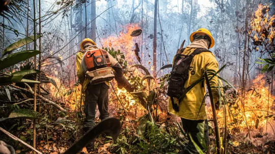
The area burned in the Brazilian Amazon in the first ten months of this year would cover a space equal to 100 times the size of São Paulo, Latin America’s most populous city. From January to October, over 120,000 fires destroyed 15 million hectares in the biome, according to Brazil’s National Institute for Space Research. Despite a record number of blazes and certainty that human action is what caused them, only a few dozen people have been arrested, as found in a SUMAÚMA survey of federal and state police departments. There are cases like São Félix do Xingu, Pará. In this municipality, which holds the country’s largest herd of cattle and the record for most area burned in 2024, nobody has been punished for a single fire thus far.
The numbers illustrate how weak the laws are and how difficult and insufficient the investigations are in the Amazon, leading crime to continue rising. This year, the area lost to fire in the Amazon grew by at least 114% compared to 2023, according to the MapBiomas organization’s Fire Monitor. Police, the Federal Public Prosecutor’s Office, and environmental authorities have a hard time obtaining evidence that would lead to a criminal prosecution of the people behind the fires. And when this happens, forest arsonists receive a slap on the wrist: their entire sentence can be served with work release or in home confinement.
According to the Fire Monitor, most of what burned in the Amazon from January to October 2024 was forest. Yet over half (55%) of fires started in areas where cattle are farmed – the vast majority (86%) of which were cleared after 2015. This means that most of the fires began in regions where there are agricultural activities, but they spread to native vegetation areas. At this point, 14% of the Amazon’s forests have been replaced with pasture.
That is why it is no surprise that the few suspects arrested and charged with causing these fires are ranchers and land-grabbers who use fire as a tool to remove native vegetation and clear space for their cattle. That is what investigations by the Federal Police and Civil Police in Mato Grosso and Pará have found.
According to the Federal Police, 112 investigations were opened to look into fires that happened in 2024 in every region of the country (there is no Amazon-specific data). Seven people were arrested and ten were formally charged after sufficient evidence was found to file a criminal complaint. Some of these investigations led to operations like Dracarys, which is targeting those responsible for the deforestation of 1,672 hectares and for setting fire to 2,368 hectares of forest located on public land in the municipalities of Boca do Acre and Pauini, in the southeast of the state of Amazonas – burning an area equal to 15 Ibirapuera Parks, the city of São Paulo’s largest urban green area. According to the Federal Police, “the leader of the criminal scheme” and the “main financial backer and articulator of illegal operations in the two cities in Amazonas resides in an upscale condominium in Campinas [in the interior of the state of São Paulo].” His name was not disclosed.
“In various cases [as with Dracarys] we have signs of planned and coordinated criminal activities, aimed at a subsequent crime, the theft of public lands for livestock farming,” Humberto Freire, a chief of police and the Federal Police’s director of the Amazon and Environment, told SUMAÚMA. Another two police operations in the state targeted public forest arsonists. One of them is looking into fires that ravaged 5,000 hectares of forest to create pastures. Although the crime was committed in Apuí, in southeastern Amazonas, one of the suspects lives in Novo Progresso, in the state of Pará. Two sources in the city told SUMAÚMA the Federal Police were looking at a rancher involved with illegal mining and deforestation in the Jamanxim National Forest, where 17% of the plant cover has already been illegally cleared by land-grabbers in the region.
Continue reading.
#brazil#brazilian politics#politics#environmentalism#amazon rainforest#brazil forest fires 2024#image description in alt#mod nise da silveira
25 notes
·
View notes
Text
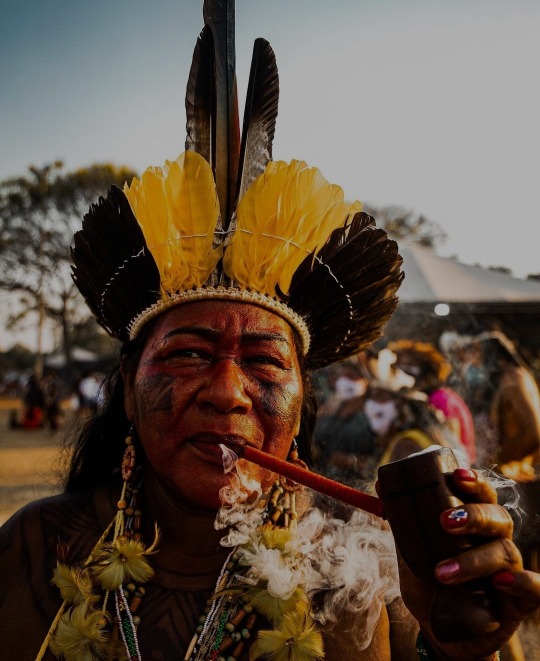
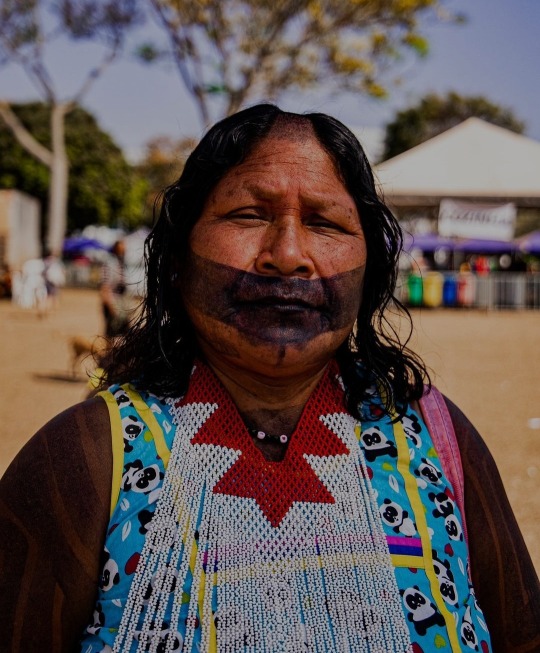
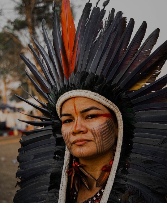
March of Indigenous Women, Brasília, 2021 (Portuguese to english) Text above
Indigenous peoples in Brazil

Indigenous peoples once comprised an estimated 2000 tribes and nations inhabiting what is now the country of Brazil, before European contact around 1500.
What happened to the indigenous people in Brazil?
Between 1900 and 1967, an estimated 98 indigenous tribes were wiped out. Mostly due to the efforts of the Villas-Bôas brothers, Brazil's first Indian reserve, the Xingu National Park, was established by the Federal Government in 1961.
Indigenous peoples in Brazil - Wikipedia
Brazil’s Indigenous women march again for the rights of their people and lives
Trying to consolidate their leading role in the fight for territory and political prominence, around 8,000 Indigenous women occupied Brasília during the III March of Indigenous Women.
Aware of the role of Indigenous peoples in preserving biodiversity, the meeting was scheduled to discuss climate emergencies and the importance of Indigenous women’s participation in the U.N. Climate Conference, to be held in Belém, in northern Brazil, in 2025.
Amid debates in Brazil’s Federal Supreme Court, the demarcation of Indigenous territories was brought to the top of the list of urgent issues at this year’s march.

First March of Indigenous Women, held in Brasília in 2019. Image by Inaê Guion.

Solemn session in the Chamber of Deputies in honor of the III March of Indigenous Women on Sept. 11, 2023. Image courtesy of Lula Marques/Agência Brasil.
‘The fight for mother Earth is the mother of all fights’
For Joenia Wapichana, the first Indigenous woman in the Brazilian Parliament (elected congresswoman in 2018) and current president of the National Foundation of Indigenous Peoples (Funai), the motto of the first March of Indigenous Women ��� “Territory: our body, our spirit” — was very strong, as it represented the true feeling of the Indigenous people in relation to the land.

Protesters at the III March of Indigenous Women in Brasília, September 2023. Image courtesy of Fabio Rodrigues Pozzebom/Agência Brasil.

Protester at the III March of Indigenous Women in Brasília, September 2023. Image courtesy of Fabio Rodrigues Pozzebom/Agência Brasil.
Brazil’s Indigenous women march again for the rights of their people and lives (mongabay.com)


Marcha das Mulheres Indígenas, Brasília, 2021 🏹
9K notes
·
View notes
Text
Txucarramãe was a Brazilian indigenous leader of the Caiapó ethnic group, he was the first indigenous person to assume the position of indigenous director of the Xingu Indigenous Park, in 1984.
He was also at the forefront of achievements for his people, such as the construction of a school and teacher training. “These workshops must continue, there must be more. Because there is still a lot for teachers to write in the language”, says Megaron Txucarramãe
Txucarramãe, his name means "Monkey's Foot". He was an important figure in indigenous resistance during the period of aggressive expansion of the agricultural frontier and mining in the Brazilian Amazon in the 1970s and 1980s.
Txucarramãe became known for his firm stance in defending the territorial and cultural rights of his people. He led the resistance against the construction of the Transamazônica highway and the advance of illegal miners into Kayapo territory, mobilizing his people and seeking international support for his cause.
His work gained prominence on a national and international level, and he was a prominent voice in the fight for indigenous rights and the preservation of the Amazon. His story is an example of indigenous peoples' confrontation with threats to their land, culture and traditional way of life.
images: Megaron Txucarramãe Photos: Laura Rachid and Juliana Pesqueira
edisonmariotti @edison
.br
Txucarramãe foi um líder indígena brasileiro da etnia Caiapó, foi primeiro indígena a assumir o cargo de diretor indígena do Parque Indígena do Xingu, em 1984.
Também esteve à frente de conquistas para o seu povo, como a construção de escola e formação de professor. “Essas oficinas têm que continuar, tem que ter mais. Porque ainda há muita coisa para os professores escreverem na língua”, avalia Megaron Txucarramãe
Txucarramãe, seu nome significa "Pé de Macaco". Ele foi uma figura importante na resistência indígena durante o período de expansão agressiva da fronteira agrícola e do garimpo na Amazônia brasileira nas décadas de 1970 e 1980.
Txucarramãe ficou conhecido por sua postura firme na defesa dos direitos territoriais e culturais de seu povo. Ele liderou a resistência contra a construção da rodovia Transamazônica e o avanço dos garimpeiros ilegais em território Caiapó, mobilizando seu povo e buscando apoio internacional para sua causa.
Sua atuação ganhou destaque em nível nacional e internacional, e ele foi uma voz proeminente na luta pelos direitos indígenas e pela preservação da Amazônia. Sua história é um exemplo do enfrentamento dos povos indígenas diante das ameaças à sua terra, cultura e modo de vida tradicional.
imagens: Megaron Txucarramãe Fotos: Laura Rachid e Juliana Pesqueira - @edisonblog
0 notes
Link
6 min read NASA-ISRO Radar Mission to Provide Dynamic View of Forests, Wetlands NISAR will use radar to study changes in ecosystems around the world, such as this forest in Tikal National Park in northern Guatemala, to understand how these areas are affected by climate change and human activity, and the role they play in the global carbon cycle.Credit: USAID NISAR will help researchers explore how changes in Earth’s forest and wetland ecosystems are affecting the global carbon cycle and influencing climate change. Once it launches in early 2024, the NISAR radar satellite mission will offer detailed insights into two types of ecosystems – forests and wetlands – vital to naturally regulating the greenhouses gases in the atmosphere that are driving global climate change. NISAR is a joint mission by NASA and ISRO (Indian Space Research Organisation), and when in orbit, its sophisticated radar systems will scan nearly all of Earth’s land and ice surfaces twice every 12 days. The data it collects will help researchers understand two key functions of both ecosystem types: the capture and the release of carbon. Pictured in this artist’s concept, NISAR, short for NASA-ISRO Synthetic Aperture Radar, marks the first time the U.S. and Indian space agencies have cooperated on hardware development for an Earth-observing mission. Its two radar systems will monitor change in nearly all of Earth’s land and ice surfaces twice every 12 days.Credit: NASA/JPL-Caltech Forests hold carbon in the wood of their trees; wetlands store it in their layers of organic soil. Disruption of either system, whether gradual or sudden, can accelerate the release of carbon dioxide and methane into the atmosphere. Tracking these land-cover changes on a global scale will help researchers study the impacts on the carbon cycle – the processes by which carbon moves between the atmosphere, land, ocean, and living things. “The radar technology on NISAR will allow us to get a sweeping perspective of the planet in space and time,” said Paul Rosen, the NISAR project scientist at NASA’s Jet Propulsion Laboratory in Southern California. “It can give us a really reliable view of exactly how Earth’s land and ice are changing.” Tracking Deforestation Forestry and other land-use changes account for about 11% of net human-caused greenhouse gas emissions. NISAR’s data will improve our understanding of how the loss of forests around the world influences the carbon cycle and contributes to global warming. “Globally, we do not understand well the carbon sources and sinks from terrestrial ecosystems, particularly from forests,” said Anup Das, an ecosystems scientist and co-lead of the ISRO NISAR science team. “So we expect that NISAR will greatly help address that, especially in less dense forests, which are more vulnerable to deforestation and degradation.” To show the kind of imagery NISAR will produce, researchers pointed to this composite that uses data from two Japanese L-band SAR missions to reveal land-cover change in Brazil’s Xingu River basin between 1996 and 2007. Black shows forest areas converted to farmland before 1996, and red shows additional areas cleared by 2007.Credit: Woodwell Climate Research Center/Earth Big Data LLC. Data courtesy of METI and JAXA. The signal from NISAR’s L-band radar will penetrate the leaves and branches of forest canopies, bouncing off the tree trunks and the ground below. By analyzing the signal that reflects back, researchers will be able to estimate the density of forest cover in an area as small as a soccer field. With successive orbital passes, it will be able to track whether a section of forest has been thinned or cleared over time. The data – which will be collected in early morning and evening and in any weather – could also offer clues as to what caused the change, such as disease, human activity, or fire. It’s an important set of capabilities for studying vast, often cloud-covered rainforests such as those in the Congo and Amazon basins, which lose millions of wooded acres every year. Fire releases carbon into the air directly, while the deterioration of forests reduces the absorption of atmospheric carbon dioxide. The data could also help improve accounting of deforestation and forest degradation – as well as forest growth – as countries that rely on logging try to shift toward more sustainable practices, said Josef Kellndorfer, a member of the NISAR science team and founder of Earth Big Data LLC, a provider of large data sets and analytic tools for research and decisions support. “Reducing deforestation and degradation is low-hanging fruit to address a substantial part of the global carbon emission problem,” he added. Monitoring Wetland Flooding Wetlands present another carbon puzzle: Swamps, bogs, peatlands, inundated forests, marshes, and other wetlands hold 20 to 30% of the carbon in Earth’s soil, despite constituting only 5 to 8% of the land surface. When wetlands flood, bacteria go to work digesting organic matter (mostly dead plants) in the soil. Through this natural process, wetlands are the planet’s largest natural source of the potent greenhouse gas methane, which bubbles to the water’s surface and travels into the atmosphere. Meanwhile, when wetlands dry out, the carbon they store is exposed to oxygen, releasing carbon dioxide. NISAR will track wetland flooding to study how these carbon-rich ecosystems are reacting to climate change. It will generate images like this one from an airborne radar that flew over Peru in 2013. Black indicates water, gray is rainforest, green is low vegetation, and red and pink are flooded plants.Credit: NASA/JPL-Caltech “These are huge reservoirs of carbon that can be released in a relatively short time frame,” said Erika Podest, a NISAR science team member and a carbon cycle and ecosystems researcher at JPL. Less well understood is how changing temperature and precipitation patterns due to climate change – along with human activities such as development and agriculture – are affecting the extent, frequency, and duration of flooding in wetlands. NISAR will be able to monitor flooding, and with repeated passes, researchers will be able to track seasonal and annual variations in wetlands inundation, as well as long-term trends. By coupling NISAR’s wetlands observations with separate data on the release of greenhouse gases, researchers should gain insights that inform the management of wetland ecosystems, said Bruce Chapman, a NISAR science team member and JPL wetlands researcher. “We have to be careful to reduce our impact on wetland areas so that we don’t worsen the situation with the climate,” he added. NISAR is set to launch in early 2024 from southern India. In addition to tracking ecosystem changes, it will collect information on the motion of the land, helping researchers understand the dynamics of earthquakes, volcanic eruptions, landslides, and subsidence and uplift (when the surface sinks and rises). It will also track the movements and melting of both glaciers and sea ice. More About the Mission NISAR is an equal collaboration between NASA and ISRO and marks the first time the two agencies have cooperated on hardware development for an Earth-observing mission. JPL, which is managed for NASA by Caltech in Pasadena, leads the U.S. component of the project and is providing the mission’s L-band SAR. NASA is also providing the radar reflector antenna, the deployable boom, a high-rate communication subsystem for science data, GPS receivers, a solid-state recorder, and payload data subsystem. ISRO’s U R Rao Satellite Centre in Bengaluru, which is leading the ISRO component of the mission, is providing the spacecraft bus, the S-band SAR electronics, the launch vehicle, and associated launch services and satellite mission operations. To learn more about NISAR, visit:https://nisar.jpl.nasa.gov/ See the NISAR spacecraft in 3D in NASA's interactive Eyes on the Earth News Media Contacts Andrew Wang / Jane J. LeeJet Propulsion Laboratory, Pasadena, Calif.626-379-6874 / [email protected] / [email protected] 2023-151 Share Details Last Updated Oct 27, 2023 Related Terms EarthEarth ScienceEarth Science DivisionEarth System Observatory (ESO)NISAR (NASA-ISRO Synthetic Aperture Radar) Explore More 5 min read NASA, Pacific Disaster Center Increase Landslide Hazard Awareness Article 23 hours ago 5 min read AWE Launching to Space Station to Study Atmospheric Waves via Airglow NASA’s Atmospheric Waves Experiment, or AWE, mission is scheduled to launch to the International Space… Article 2 days ago 4 min read New Software Enables Atmospheric Modeling with Greater Resolution Next-generation software is making it easier for researchers, policy makers, and citizen scientists to model… Article 3 days ago Keep Exploring Discover Related Topics Missions Humans in Space Climate Change Solar System
0 notes
Text
I'm still laughing at the idea of the emperor of Rome in gladiator giving away pamphlets that just say SWORD FIGHT on them and nothing else
movies often make signs that make no sense in-universe and are just there for an audience to understand and that's one of my favourite things to spot specially in period pieces
in ep 1 of merlin where he goes inside a medieval castle and there's a little sign saying "<- COURT PHYSICIAN" like this was some kind of toilet sign
or I was watching a movie about the guy who created the xingu national park and he dramatically drew a bunch of native houses on his sketchbook, circled them and then wrote 'ISOLATE' to indicate that he came up with the idea of... making a reservation?
Idk. I just love those.
2 notes
·
View notes
Photo

The Yawalapiti tribe live deep in the Brazilian heartland, where the upper reaches of the Amazon Basin dissolve into the central plateau.
Yawalapiti warriors hold wrestling matches in qualifying rounds to select the best team to confront warriors from other tribes.
8 MAY 2012. XINGU NATIONAL PARK, BRAZIL. REUTERS/UESLEI MARCELINO
#culture#wrestling#match#tribes#tribal life#indigenous peoples#warriors#Amazon Basin#Brazil#Yawalapiti
6 notes
·
View notes
Photo

Kawakanih Yawalapatani, 9, from Brazil traveled 31 hours by boat, bus, and car to get to photographer Gregg Segal’s studio in Brasilia to take part in his project exploring the diets of kids around the world. Yawalapatani mainly eats fish, cassava, porridge, fruit, and nuts — a local diet that is steeped in history and rich in nutrients. “It takes five minutes to catch dinner,” Kawakanih told Segal. “When you’re hungry, you just go to the river with your net.” She’s one of the last Indigenous speakers of the Arawaki language where she lives in Xingu National Park, a protected Indigenous zone in the Amazon Rainforest that has come under threat since the election of President Jair Bolsonaro. “When she was born, her mother was determined to keep her language from going extinct, so [Yawalapatani] didn’t interact with anyone except a handful of people who were native speakers of the language,” Segal told Global Citizen. “She also speaks her father’s native language and Portuguese.” For his new book, “Daily Bread,” Segal traveled to nine countries and asked families to help their kids record their eating habits over the course of a week. His team then invited the families to a studio, bought all the food that was described in the food journals, and arranged a photo shoot. Read our interview with Segal at this link to learn more more about "Daily Bread.”⠀ ⠀ (📷: Gregg Segal)
144 notes
·
View notes
Link
Indigenous groups across South America are blockading their villages and retreating into their traditional forest and mountain homes in an effort to escape the potentially cataclysmic threat of coronavirus.
In recent days, as the number of cases in South America has risen to almost 8,000 – with many more cases likely to be unreported – indigenous groups in Brazil, Colombia, Ecuador and Peru have all started taking steps to protect themselves from what they call a historic danger.
“Coronavirus could wipe us out,” warned Ianucula Kaiabi, an indigenous leader in Brazil’s Xingu national park, a sprawling sanctuary on the southern fringes of the Amazon that is home to about 6,000 people from 16 different tribes.
[...]
“These communities have taken the decision to isolate themselves,” said Kelly Peña, who works for the national parks service in Guaviare, the province where the Nükak live.
“But many don’t have phone signal or food supplies, so they are coordinating when they can with local government to organize deliveries.
“Some are still waiting for supplies before they go into isolation,” Peña added.
Mendonça, who works at São Paulo’s Federal University, said taking flight at a time of epidemic was a longstanding practice for South American indigenous communities, a survival technique passed down from generation to generation or acquired from personal suffering. “This is part of their ancestral memory,” she said.
But such tactics – which were employed during 2016’s H1N1 epidemic – also brought risks.
If those flocking back to remote villages from towns outside reserves were not properly quarantined or tested before returning it was possible they could carry coronavirus back home with them – with catastrophic effects.
“People are panicking. They are worried – and they want to go back,” Mendonça said. “But it is very important for there to be an isolation or quarantine process so you can [safely] return to your village, to your home. And this will require different strategies in each place.”
Mendonça said authorities also needed to act swiftly to expel outsiders such as thousands of wildcat goldminers from reserves like the Yanomami territory, straddling Brazil’s border with Venezuela.
“If we don’t get these people out of the [indigenous] areas the chance of contagion is much greater,” she said.
2 notes
·
View notes
Text
This is the ongoing situation of deforestation in Brazil under the government of the far right president Jair Bolsonaro, that he and his ministers don't believe in climate change, and just this year the Brazilian government approved 211 new agrotoxics to be used in the country where one third is prohibited in North America and Europe because it causes death of the soil, water, cancer and more.

This is the progression with him the deforestation increased 278% from May to July 2019 data from Inpe (instituto nacional de pesquisas espacionais) compared to the same time of 2018, it's held by miners invading indigenous territory killing the people and killing the forest to extract gold, wood and to set agriculture and camps to raise bovine, this pic is from National Xingu Park in the heart of the Amazon rainforest

We are running out the time with all this negation of climate change and people continuing to destroy the earth.
We and people that will come after us are the generation of renegated future.
6 notes
·
View notes
Photo


Kalapalo people, Brazil
The Kalapalo are an indigenous people of Brazil. They are one of seventeen peoples who inhabit the Xingu National Park in the Upper Xingu River region of the state of Mato Grosso. They speak the Amonap language, a Cariban language, and are one of four peoples speaking languages in this family in the area. They have a population of 569 as of 2010.
Before the creation of the Xingu National Park in 1961, the Kalapalos lived at the confluence of the Tanguro and Kuluene, which are tributaries of the river Xingu. Since then, the Brazilian government has convinced them to settle near the Leonardo station, where medical treatment was made available. However, they frequently return to their former villages where they can grow cassava and cotton and where they can gather shellfish for art and craft-making purposes.
The Kalapalos have a strict code of ethics established by them that distinguish them from other peoples inhabiting the Upper Xingu. They all collectively share their culture as their fishing. Any public quarrels and fights are a serious violation of their code and are punished. They refrain from hunting land animals for fur by simply eating aquatic animals including fish.
402 notes
·
View notes
Text
Following visit from Angelina Jolie, Brazilian Kayapó Chief Raoni meets Lula, warns against oil drilling

On the heels of hosting American actress and activist Angelina Jolie just days before, Chief Raoni Metuktire, one of the most prominent Indigenous leaders in Brazil, met with President Luiz Inácio Lula da Silva, who bestowed the nation’s highest civilian honor upon the chief.
On Friday President Lula visited the Piaraçu village, located in the Capoto-Jarina Indigenous Territory within the Xingu National Park. The territory is in the far north of the Mato Grosso state — a region that lies in the southern reaches of the Brazilian Amazon.
The visit was marked by a symbolic and long-awaited meeting with Chief Raoni Metuktire, a prominent leader of the Kayapó people who is widely regarded as the most influential Indigenous figure in Brazil.
Chief Raoni, who has long been recognized internationally for his tireless advocacy to protect the Amazon rainforest, remains sharp-minded and active at the age of 93. During the ceremony, Lula awarded him the Grand Cross of the National Order of Merit — Brazil’s highest civilian honor — in recognition of a lifetime dedicated to defending the environment and Indigenous rights.
Continue reading.
#brazil#brazilian politics#politics#environmentalism#indigenous rights#luiz inacio lula da silva#Raoni Metuktire#image description in alt#mod nise da silveira
8 notes
·
View notes
Photo

A PORTRAIT OF THE AMAZON ON THE BRINK OF CATASTROPHIC CHANGE Miss Rosen for Feature Shoot
The mouth of the mighty Amazon River lies in the state of Pará, Brazil, which has been home to the people of the rainforest for over 5,000 years. During the 1960s, the government created the nation’s very first Indigenous Park, which was, at that time, the largest preserve in the world.
Home to 14 tribes that survive off the land, Xingu Indigenous Park became the site of controversy when the government began to develop plans for the Belo Monte Dam Complex on the Xingu River in 1975. In 1989, the Kayapo, a warrior tribe, mounted a massive campaign in opposition to the construction. International financers pulled out, and the project was shelved until 2007, when President Luiz Inácio Lula da Silva announced the Accelerated Growth Program.
Positioned at the forefront of construction of more than 60 major hydroelectric project in the Amazon over the next 15 years, Belo Monte is poised to become the fourth largest dam in the world — displacing up to 40,000 people living in the park while destroying the complex ecosystems in order to fuel continued mining of the rainforest.
In his series, Where the River Runs Through, which was chosen for the Critical Mass Top 50, photographer Aaron Vincent Elkaim presents Where the River Runs Through, a profound portrait of the people and the landscape at the precipice of a massive change whose impact on the indigenous communities and the environment are devastating. Elkaim shares his insights into the impact of industry on the earth.
Read the Full Story at Feature Shoot
Photo: March 29, 2014. A group of boys climb a tree on the Xingu River by the city of Altamira, Para State, Brazil. Major areas of the city have been permanently flooded by the construction of the nearby Belo Monte Dam Complex displacing over 20,000 people while impacting numerous indigenous and riverine communities in the region. © Aaron Vincent Elkaim
1 note
·
View note
Text
Joy and worry of IPO of led enterprises: one will have a meeting and one will terminate
On December 29, according to the information on the website of Shanghai Stock Exchange, China micro semiconductor (Shenzhen) Co., Ltd. (hereinafter referred to as China micro semiconductor) was approved in the initial launch of science and innovation board. Founded in 2001, China micro semiconductor is a chip design company. It mainly focuses on the technical layout of chips and underlying algorithms required by intelligent controllers, continuously expands its independent design capability, and has accumulated more than 1000 independent IPS. In this IPO, China micro semiconductors plans to raise 729 million yuan, of which 193 million yuan is used for the R & D and industrialization projects of power grid and industrial control MCU chips, 133 million yuan is used for the R & D and industrialization projects of Internet of things SOC and analog chips, 283 million yuan is used for the R & D projects of vehicle specification chips, and 120 million yuan is used to supplement working capital. The worry is that on January 4, China chart semiconductor was terminated from the IPO application of the science and innovation board, less than a year from the application for IPO. Zhongtu semiconductor is a professional substrate material supplier for gallium nitride semiconductor technology on sapphire. Develop suitable substrate materials according to different LED chip application fields and epitaxial technical characteristics, and provide comprehensive substrate material solutions for GaN LED chips through graphical structure design, application of different material combinations, process realization, etc. At present, the main products of China figure semiconductor include 2-6-inch patterned sapphire substrate (PSS) and patterned composite substrate (MMS), which are mainly used in deep UV LED, mini / microled and other fields. Company dynamics Overview of internal and external changes of enterprises 1. Recently, sunshine lighting and Xiaodu will jointly launch more intelligent life scenes, more open cooperation platforms, more ecological products, healthier lighting environment, more convenient voice control and so on. 2. On December 27, Guoxing optoelectronics won the honorary title of "2021 Chinese proud Foshan brand enterprise" with its good brand image, leading innovation level and strong market competitiveness. 3. On January 6, Sanxiong Aurora stood out among many brands and won the honor of "well-known brand in Guangdong" with its years of deep industry cultivation and good reputation. 4. Recently, Zhongke San'an biological plant factory located in Anxi sub Park of Xingu, Quanzhou, Fujian Province is fully promoting the construction of Zhongke San'an plant factory project, and has built 10000 square meters of all artificial light vegetable production workshop and several 10000 square meters of Clematis medicinal material production workshops. 5. Recently, Shenzhen Municipal Bureau of housing and construction and Shenzhen Municipal Bureau of urban management and comprehensive law enforcement jointly issued the local standard for engineering construction in Shenzhen (technical standard for urban landscape lighting engineering). 6. Recently, the annual list of China's top 500 listed companies was freshly released. Among them, it covers LED related enterprises such as Dongshan precision, North Huachuang, San'an optoelectronics, Zhongwei company, Shilan micro, Xingyu Co., Ltd., Han nationality laser, Jingsheng electromechanical and so on. 7. On December 31, after receiving the notice from the controlling shareholder Qinshang group, Qinshang group decided to terminate the planning of matters related to the change of control. On January 4, Qinshang shares resumed trading. (click to view details) 8. On January 6, OPP lighting official micro announced that the company had reached a strategic cooperation with Songzan group to jointly build a new benchmark for the development of high-end hotel industry, and launched joint product development at the same time. 9. On January 5, jinlaite announced that Guohai Construction Co., Ltd., a wholly-owned subsidiary, won the bid of "Jinke Jiangxi Nanchang Jimei Tianchen project phase II civil installation EPC project", with a bid amount of 165 million yuan. Forward direct attack Capture industry technology direction 1. Recently, a research team composed of the University of science and technology of Munich, the Department of infectious diseases and tropical medicine of the hospital affiliated to the University of Munich and the new entrepreneur smart United GmbH announced the development of covid-19 UV protective wall. According to foreign media reports, this virus protection wall composed of uvc-led can kill pathogens drifting with airborne particles and prevent them from entering the indoor environment. At an air velocity of 10 cm per second, it can reach an inactivation rate of more than 99%. 2. On January 7, the official wechat of Jingke Electronics announced that after a whole year of research and strict selection, the list of the second "Zhejiang lighting Award" was released, and Jingke electronics's high luminous efficiency and color adjustable cob was rated as the second prize of the "innovative product award". Urban starlight Latest trends in lighting applications 1. G60 science and technology innovation corridor is located in Songjiang Science and Technology City, Lingang, Shanghai. It is designed by Raphael vinori, a world-famous architectural designer. The cloud corridor reticulated shell structure is composed of 7449 node plates in different directions. Each reticulated shell is deployed by three different lamps in three layers, so as to make the ground perspective more detailed. In addition, 8000 monochrome point light sources, 107000 RGB point light sources and 107000 RGB wall washing lamps are used on the outer top of the building. Through the intelligent lighting control platform and combined with the lighting creative design, the perfect combination of technology and art is truly realized. 2. The Beijing Winter Olympics is about to open. In Harbin, the newly opened 2022 4th Harbin Songhuajiang ice and snow Carnival focuses on the theme of "happy ice and snow, embrace the Winter Olympics". Taking the Winter Olympics as an opportunity, it is paved with nearly 3000 huge ice bodies weighing about 40-50 kg, interspersed with color light bands, and various colors flicker and change under the night, Present a colorful "Olympic rings lighting show".
0 notes
Photo


1961
The cold war continued to worsen with the USSR exploding some very large bombs during testing and then masterminding the building of the Berlin Wall, separating East from West Berlin. America sent a battle group to Germany, and Americans and Russians glared at each other across the border — due to this uncertainty, many Americans built backyard fallout shelters in case of nuclear war. To make matters worse, the Americans financed anti-Castro Cubans for an invasion at the Bay of Pigs, which was an unmitigated disaster. The Soviets put the first man in space, Yuri Gagarin, on April 12, followed by the U.S. in May, with Alan Shepard. Popular music included Chubby Checker’s “Pony Time” and the Shirelles’ “Will You Love Me Tomorrow”, and top movies included West Side Story and The Parent Trap.
Major events
• John F. Kennedy is sworn in by Chief Justice Earl Warren as the 35th President of the United States, in January.
• Yuri Gagarin becomes the first human in space.
• The Peace Corps is established by President John F. Kennedy.
• Cuban exiles and the CIA mount an unsuccessful attempt to overthrow Fidel Castro.
• The USSR tests the “Tsar Bomba,” the largest nuclear bomb ever.
• East German authorities close the border between East and West Berlin, and construction of the Berlin Wall begins.
• NASA launches the Mercury-Atlas 5 (MA-5) mission during November.
• Disney releases their first live-action musical film, Babes in Toyland.
• The World Wide Fund for Nature (WWF) is created.
• The Soviet Union launches the Venera 1 space probe.
• Britain applies for membership of the European Economic Community.
• Segregation on railways in Southern U.S. ends.
• The Xingu National Park is created in Brazil.
• Somalia suffers a widespread flooding after the two main rivers overflowed their banks and merged in a vast flood plain, leaving hundreds of thousands homeless.
• Texas sales tax introduced.
• General Assembly of the United Nations condemns apartheid.
• President John F. Kennedy advises American families to build bomb shelters.
• South Africa becomes an independent republic.
• Last journey of the Orient Express.
• First direct U.S. military involvement in Vietnam.
• The Six Flags Over Texas opens in Arlington, Texas.
• Amnesty International starts in the United Kingdom.
• The Antarctic Treaty System comes into force on June 23 to regulate international relations, ensuring that Antarctica shall continue forever to be used exclusively for peaceful purposes.
• Pampers, the first disposable diaper, is introduced.
• Members of the Portuguese leftist movement hijack the luxury cruise liner Santa Maria.
• Members of the UK Portland Spy Ring are found guilty of selling plans of the HMS Dreadnought, Britain’s first nuclear submarine, to the Russians.
• Estimate of the world’s population reaches 4 billion.
• The 23rd Amendment to the Constitution is ratified, which permits electors in the district of Columbia to choose electors for President and Vice President.
• During the Italian Grand Prix race, Wolfgang von Trip’s Ferrari crashes off the track onto the embankment filled with spectators, killing 14 plus the driver.
• “Freedom Riders” test the United States Supreme Court decision (Boynton v. Virginia) by riding racially integrated interstate buses into the South. Some are attacked and beaten by white supremacist supporters of racial segregation.
• The farthing coin, used since the 13th century, ceases to be legal tender in the United Kingdom.
• British satirical magazine Private Eye is published for the first time.
• “The Pony” becomes a popular dance.
Top 10 highest-grossing films in the U.S.
1. West Side Story (dir. Robert Wise and Jerome Robbins)
2. The Guns of Navarone (dir. J. Lee Thompson)
3. El Cid (dir. Anthony Mann)
4. The Absent-Minded Professor (dir. Robert Stevenson)
5. The Parent Trap (dir. David Swift)
6. La Dolce Vita (dir. Federico Fellini)
7. Lover Come Back (dir. Delbert Mann)
8. King of Kings (dir. Nicholas Ray)
9. One Hundred and One Dalmatians (dir. Wolfgang Reitherman, Hamilton Luske and Clyde Geronimi)
10. Splendor in the Grass (dir. Elia Kazan)
Billboard’s number-one music albums (in chronological order)
1. “G.I. Blues” by Elvis Presley
2. “Nice ‘N’ Easy” by Frank Sinatra
3. “The Button-Down Mind Strikes Back!” by Bob Newhart
4. “Wonderland by Night” by Bert Kaempfert
5. “Exodus” by Ernest Gold
6. “Calcutta!” by Lawrence Welk
7. “Camelot” by Camelot Original Broadway Cast
8. “Carnival!” by Carnival! Original Broadway Cast
9. “Stars for a Summer Night” by various artists
10. “Something for Everybody” by Elvis Presley
11. “Judy at Carnegie Hall” by Judy Garland
12. “Blue Hawaii” by Elvis Presley
Source: [x]
72 notes
·
View notes
Photo

Kuikuro According to the indigenous Kuikuro people in Brazil, artists are “itseke” powerful spirits of invisible knowledge. The Kuikúro are a community of around 500 people who live in the upper reaches of the Xingu River, Amazon Region. The Xingu Indigenous Park is a protected territory of more than 2.6 million hectares and home to 16 indigenous peoples, including the Kuikuro. The area was designated as a protected national park in 1961 to protect the lives and culture of its indigenous villages and to preserve the local environment. A ‘maloca’ is an ancestral long house used by indigenous people of the Amazon, notably in Colombia and Brazil. Each community has a ‘maloca’ with its own unique characteristics. Several families with patrilineal relations live together in a ‘maloca’, distributed around the long house in different compartments. In general, the chief of the local descent group lives in the compartment nearest to the back wall of the long house. Each family has its own furnace. During festivals and in formal ceremonies, which involve dances for males, the long house space is rearranged; the centre of the long house is the most important area where the dance takes place. Each ‘maloca’ has two entrances, for men and for women. Married men and women sleep together, and unmarried men sleep separately, as do unmarried women. A ‘maloca’ is traditionally surrounded with two gardens: the inner called the kitchen gardens (growing plants such as bananas, papaya, mango and pineapple) and the manioc gardens growing manioc (yuca). For the indigenous peoples of the Colombian Amazon the ‘maloca’ is an abode in the broadest sense of the word, it is a temple, a model of the cosmos, a physical expression of knowledge to allow the community to live in harmony with nature. For them the cosmic responsibility of humanity is to take care of the world and ensure that it does not deteriorate - so the ‘maloca’ is a primary tool in the development of this task. #neonurchin #neonurchinblog #dedicatedtothethingswelove #suzyurchin #ollyurchin #art #music #photography #fashion #film #words #pictures #neon #urchin #longhouse #xingu #xingusociety #cosmos #rituals #harmony #community (at Xingu, Amazonas, Brazil) https://www.instagram.com/p/CIX2-mllSY7/?igshid=9kal8r1wwo4l
#neonurchin#neonurchinblog#dedicatedtothethingswelove#suzyurchin#ollyurchin#art#music#photography#fashion#film#words#pictures#neon#urchin#longhouse#xingu#xingusociety#cosmos#rituals#harmony#community
0 notes